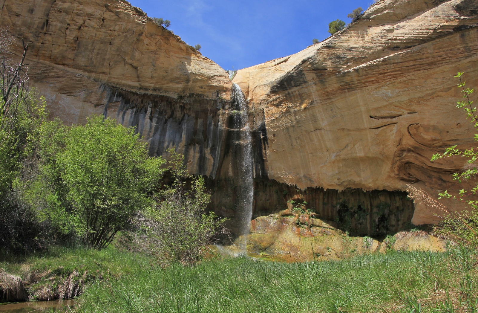
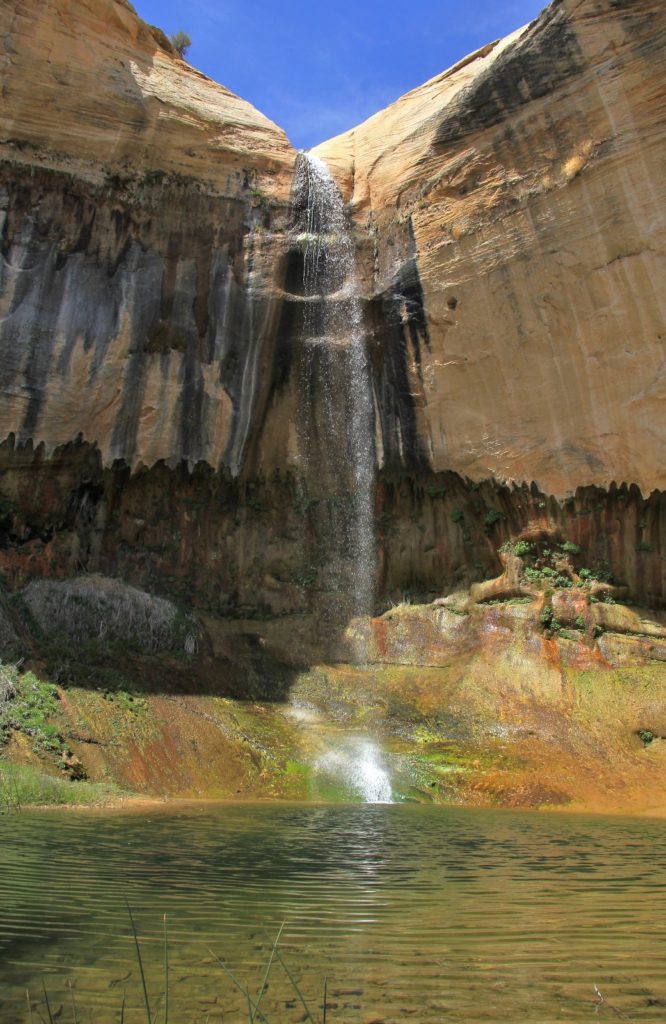
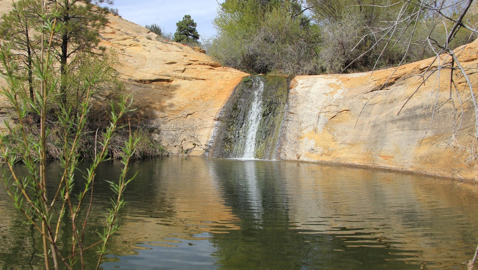
Beautiful desert waterfall, cascades and pools on this short hike in Utah’s Grand Staircase-Escalante National Monument
Distance: 2.3 miles round trip
Type: Y shape
Difficulty: moderate due to 657’ elevation loss/gain, most of this in the first half mile
Best season: spring and fall
Note: you’ll want shoes with good traction for the steep descent over slickrock
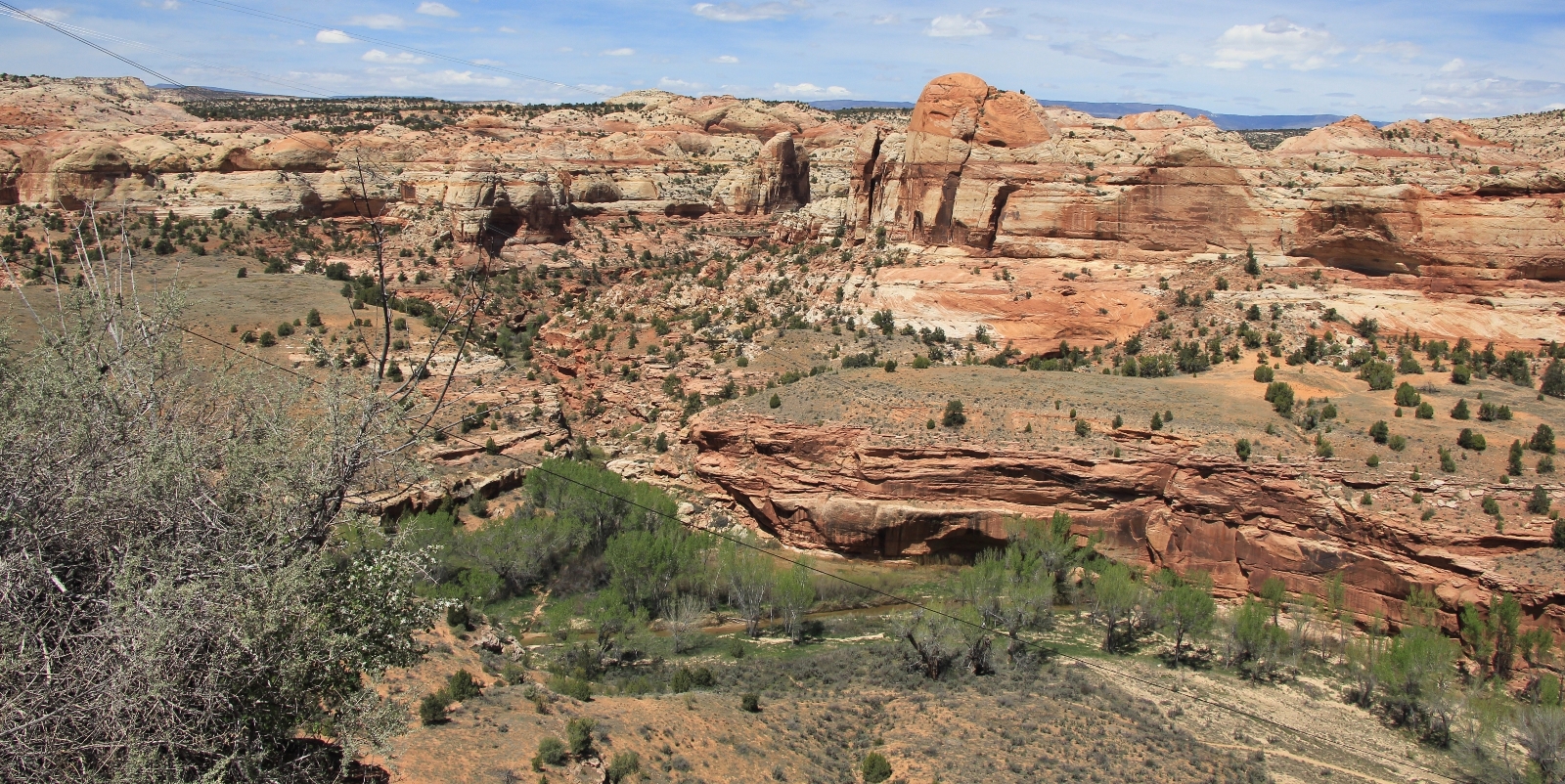
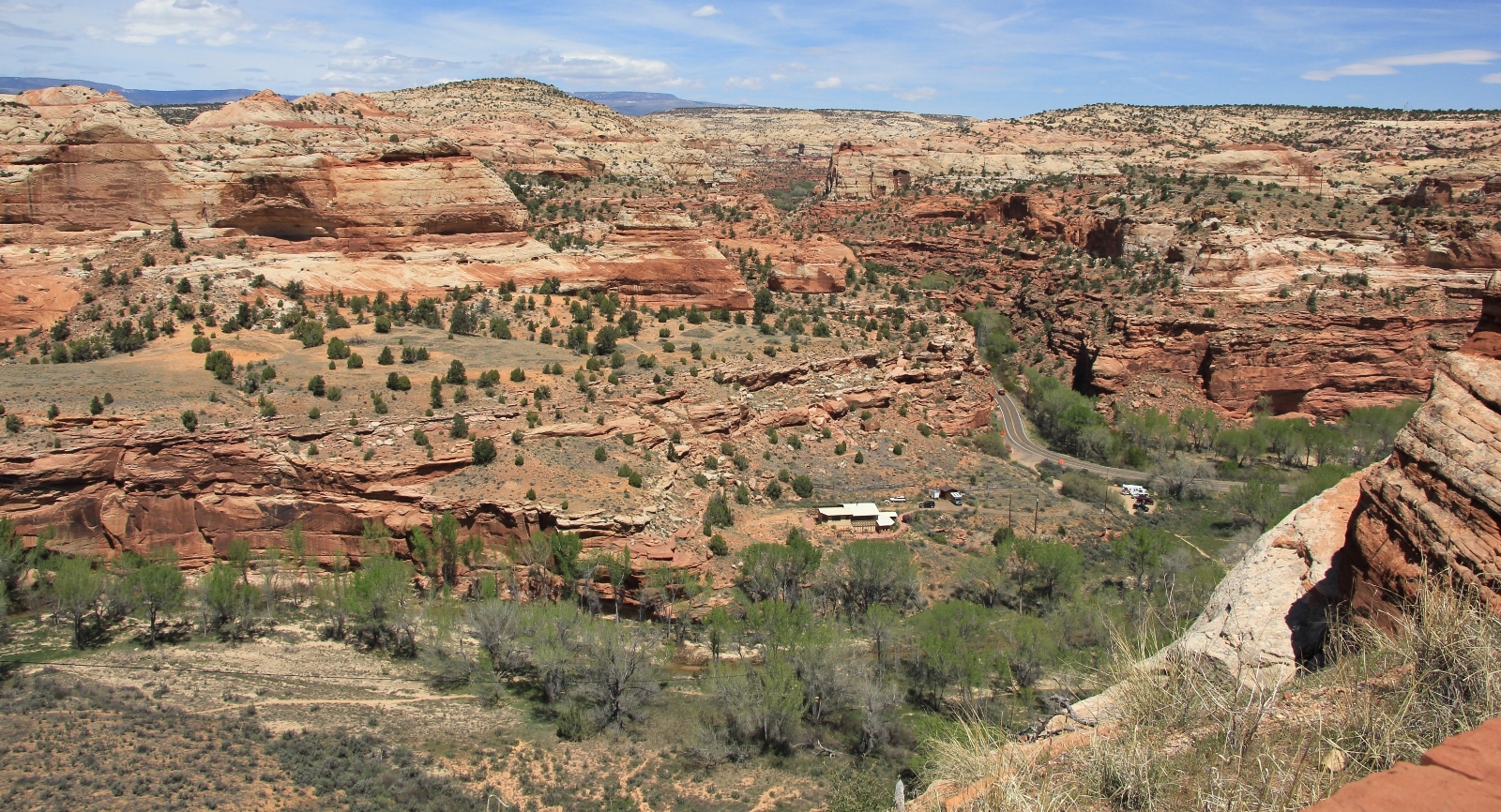
Most destinations in Grand Staircase-Escalante National Monument require access via rough roads and/or a long hike—Upper Calf Creek Falls is one of the rare exceptions. A short hike down a steep slickrock trail leads visitors to a riparian area with a beautiful waterfall. To the casual observer driving across Utah’s Scenic Byway 12, a waterfall like this might seem out of place. But to those who know the Escalante, this is but one of many such jewels.
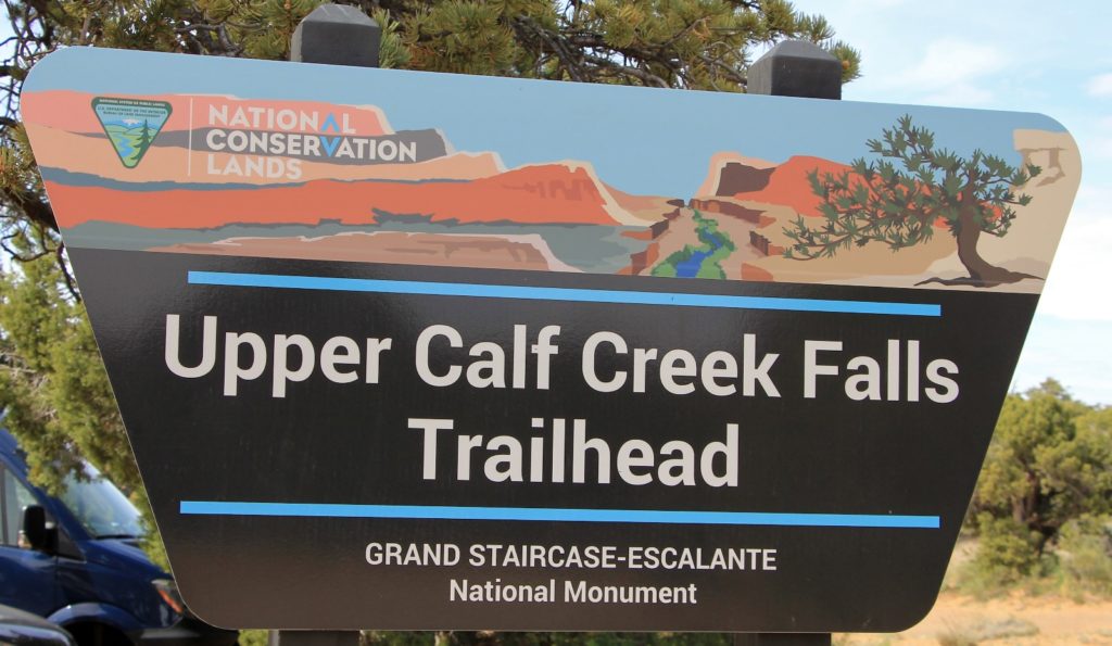
We first visited Upper Calf Creek Falls in April 2013. Back then, I don’t remember a sign at the empty trailhead (perhaps there was) and we didn’t see anyone else on the trail. This year when we arrived, we were greeted by a huge trailhead sign and about a dozen vehicles. The monument’s popularity is certainly growing and the few easily accessible trails are becoming busier. Still, Upper Calf Creek offers more solitude than nearby Lower Calf Creek Falls where the parking lot is packed by noon on any given day (don’t let the crowds deter you, Lower Calf is a must see location).
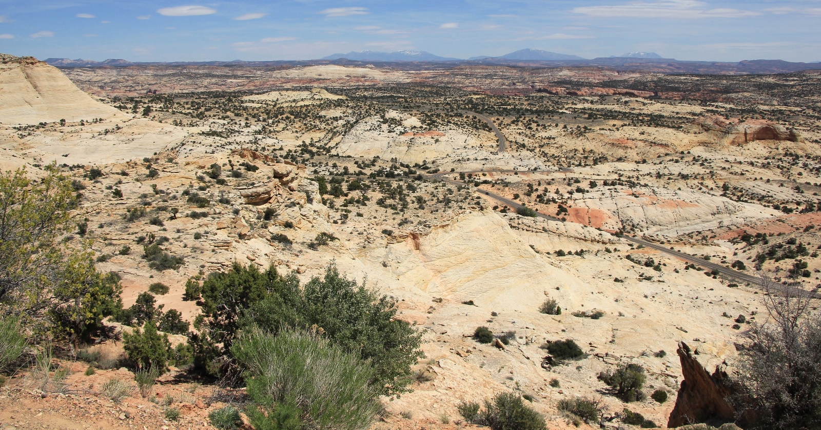
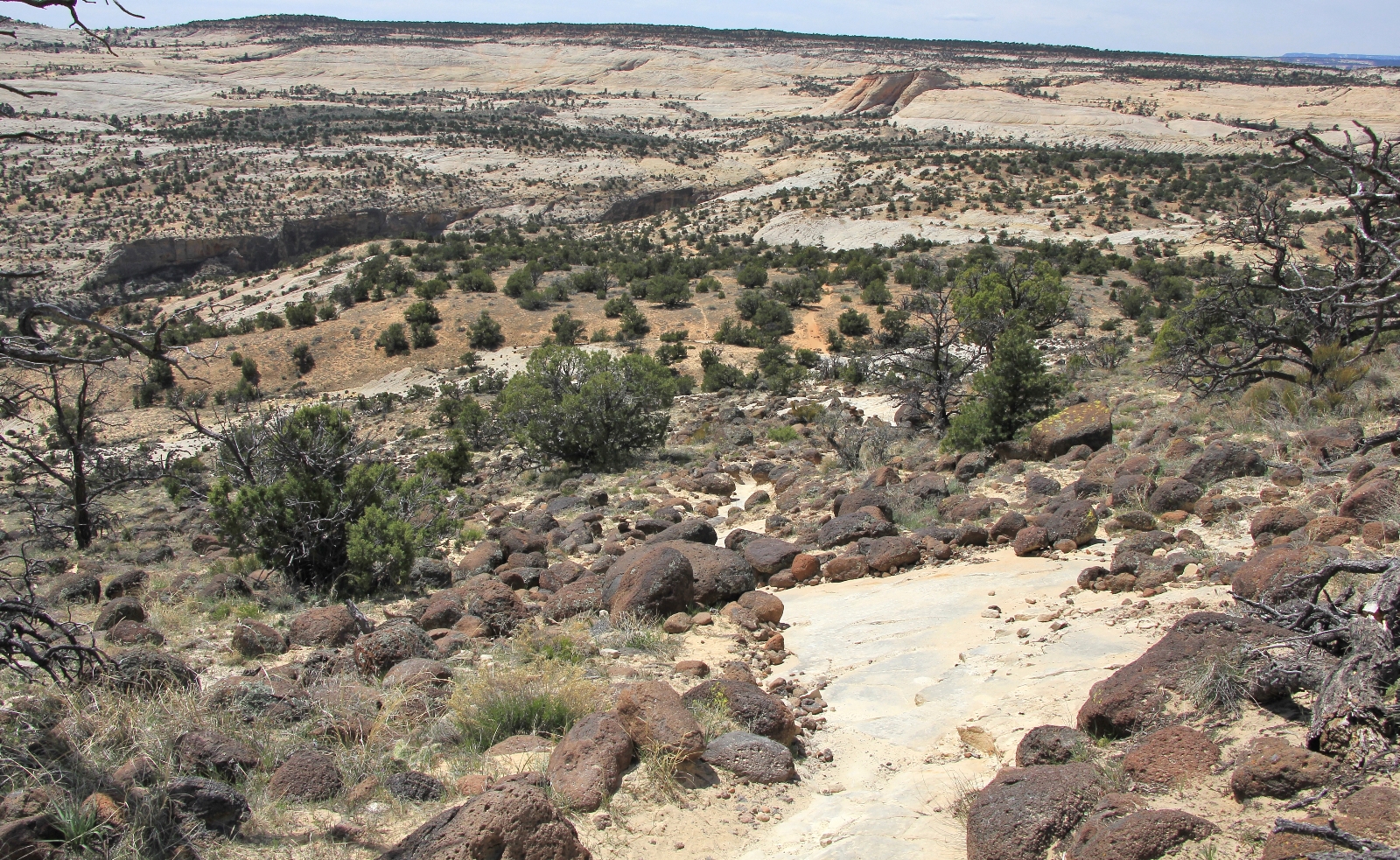
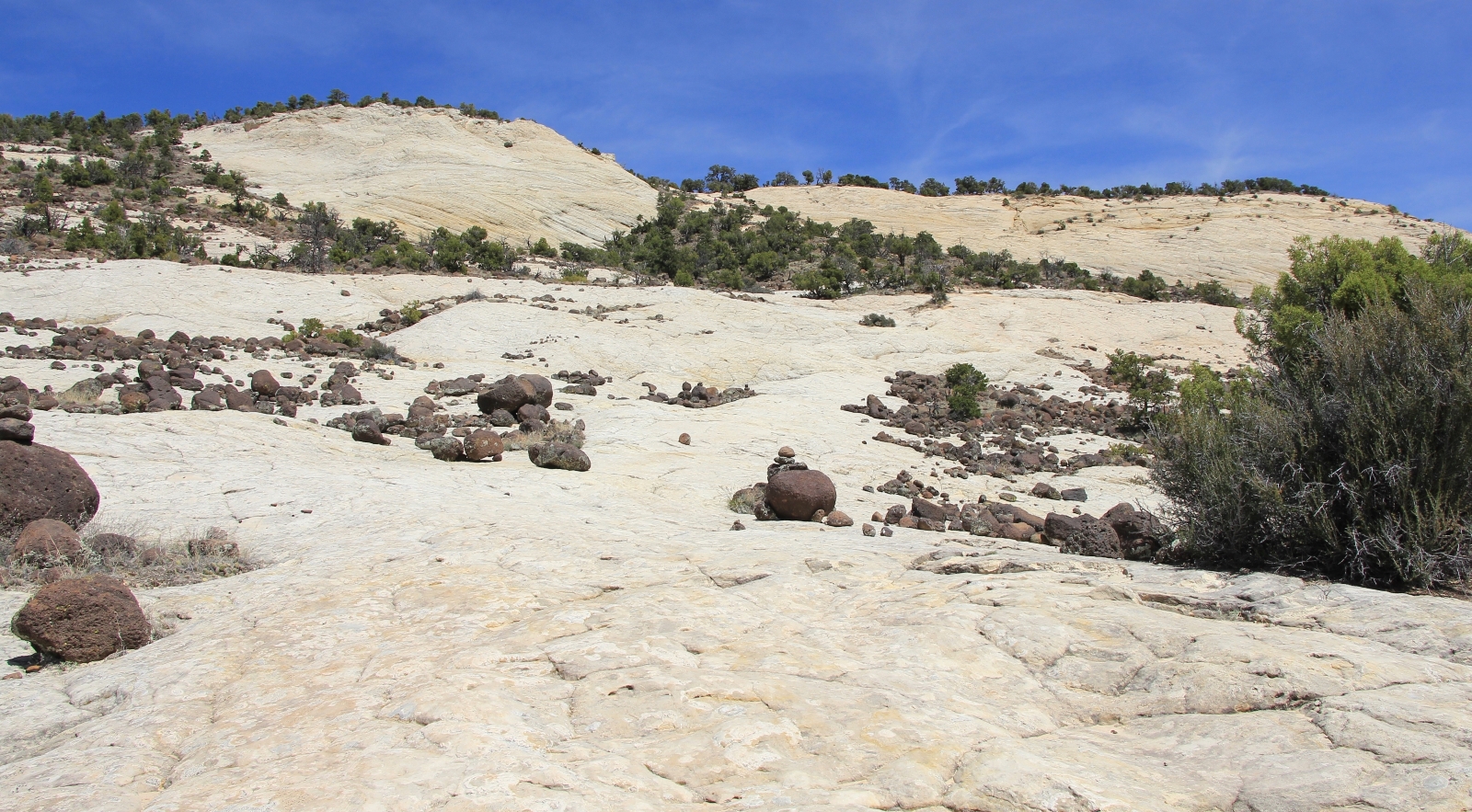
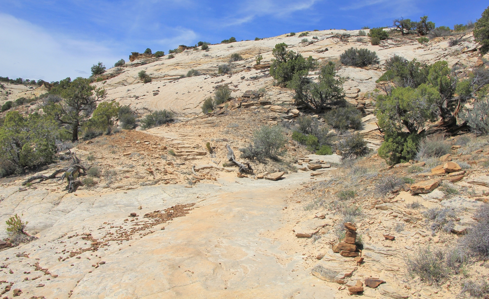
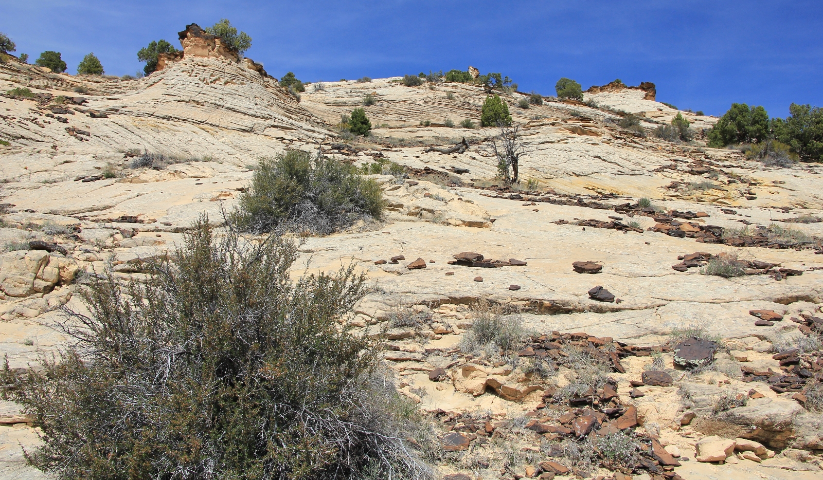
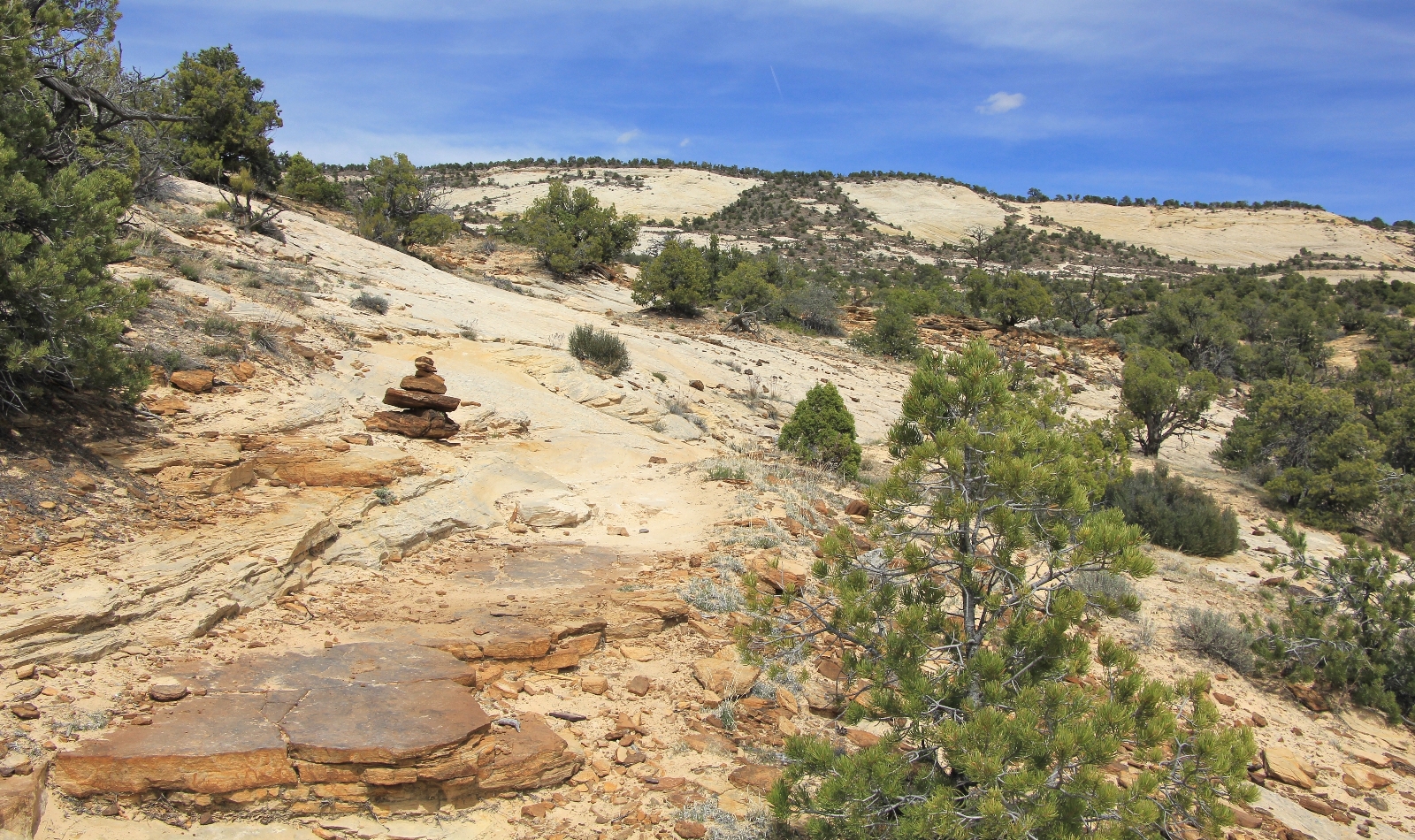
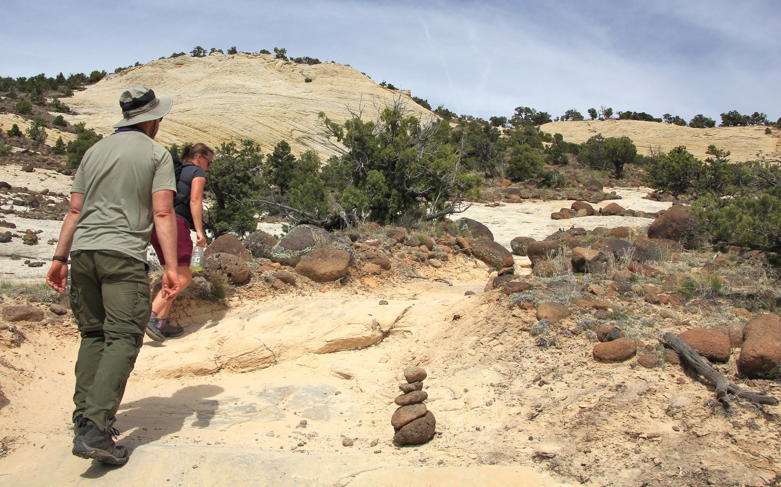
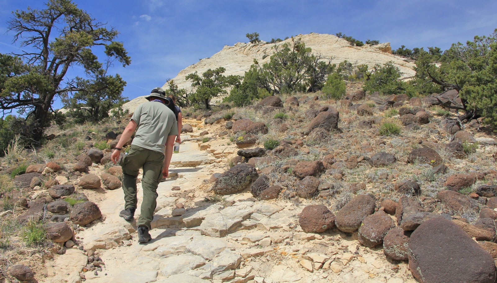
Immediately after leaving the trailhead (elevation 6,520′), the trail dropped over the canyon rim descending steeply into Upper Calf Creek Canyon. The trail was primarily over slickrock with intermittent patches of packed dirt and sand. Alongside much of the trail we saw boulders of reddish black basalt which were deposited here by volcanic eruptions. During the descent, we enjoyed views of the vast sea of sandstone that surrounds the Calf Creek drainage.
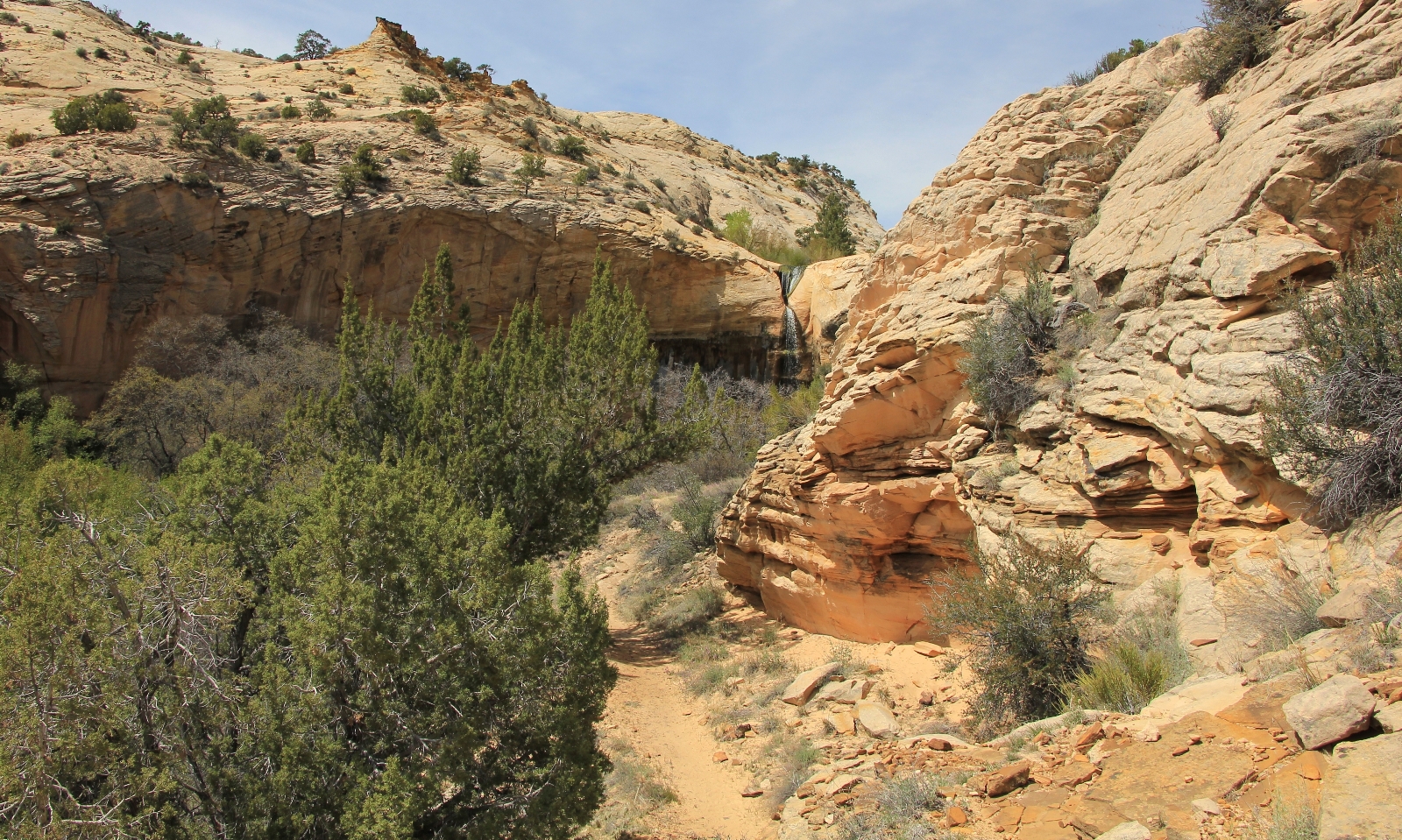
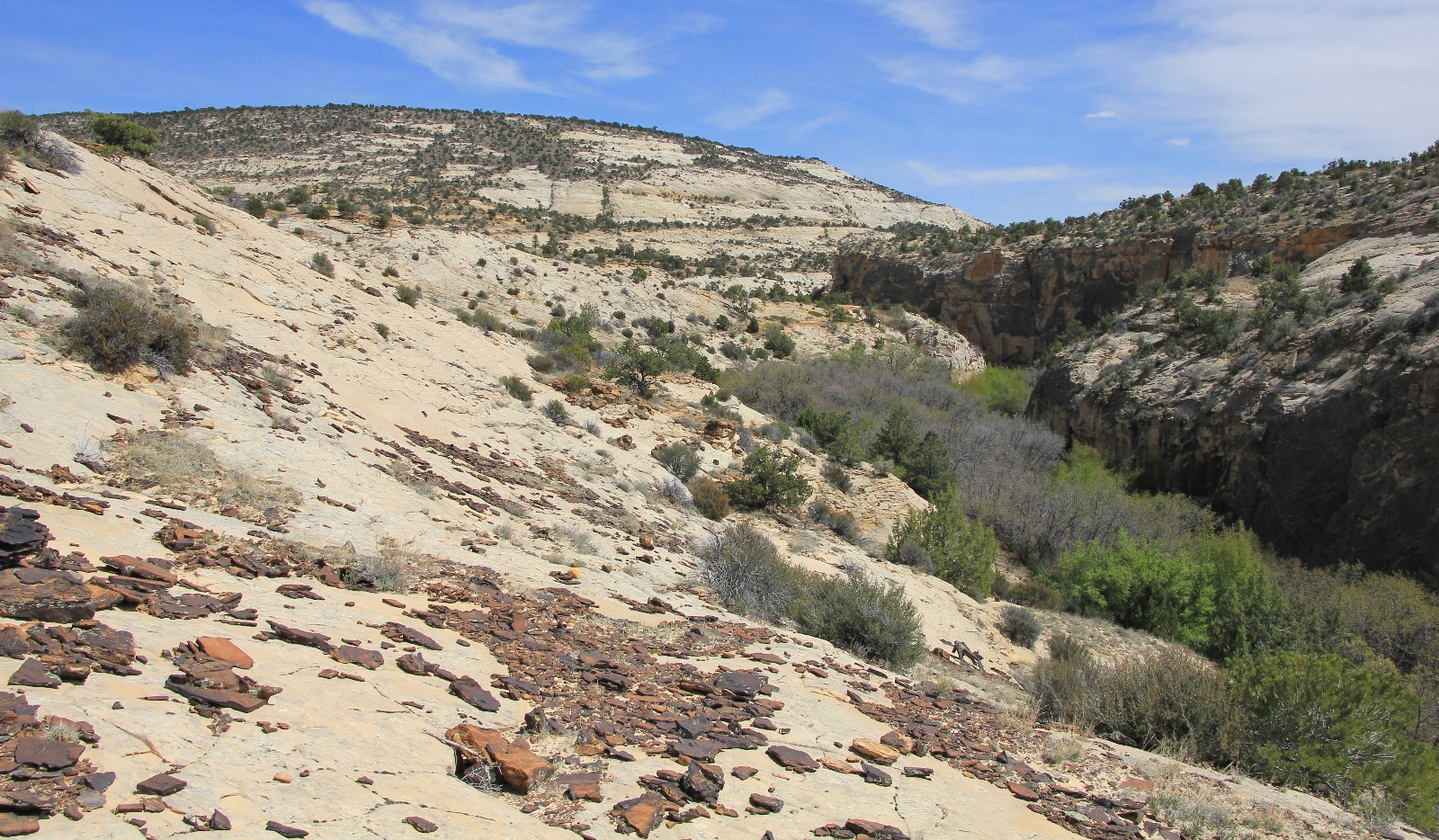
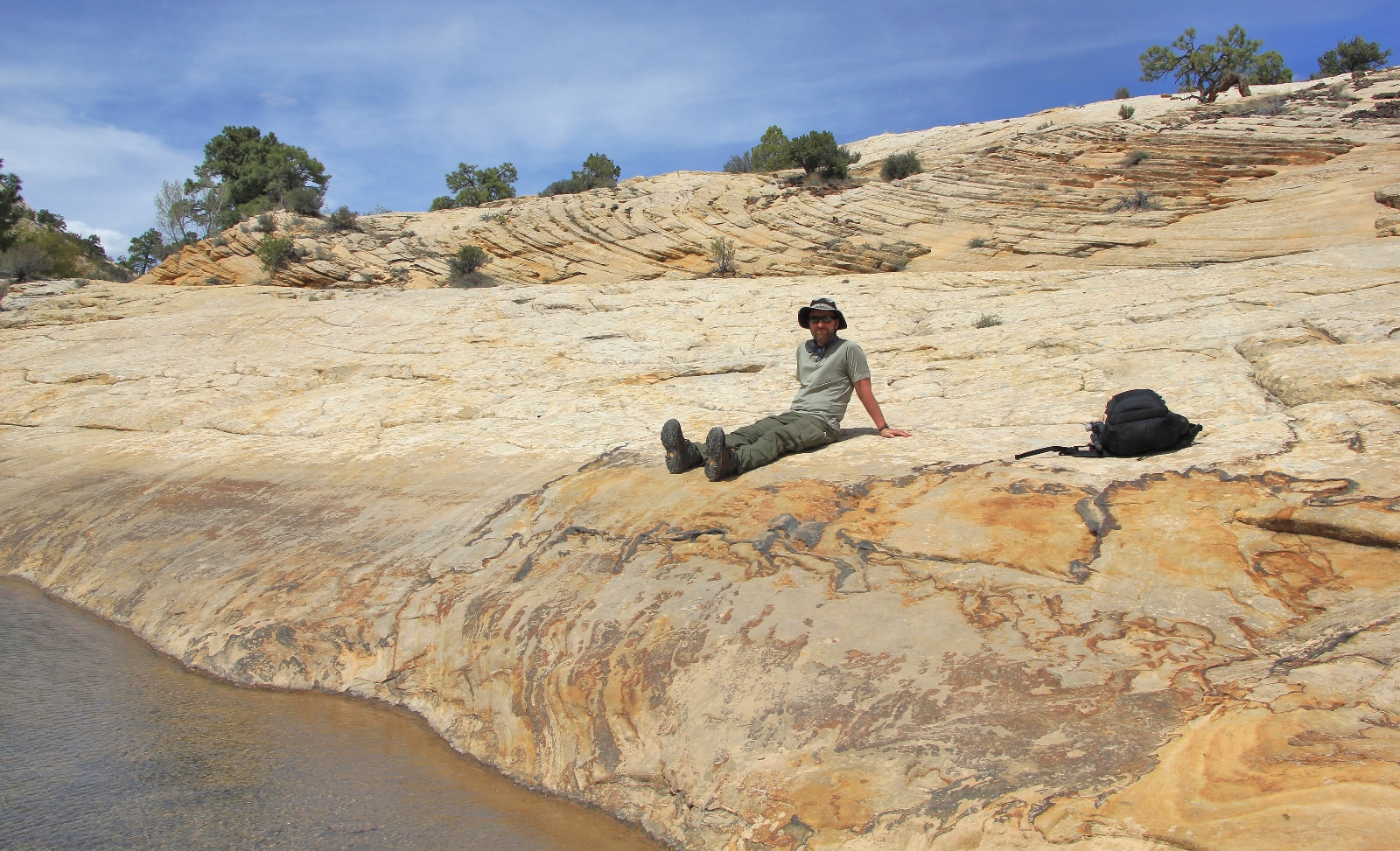
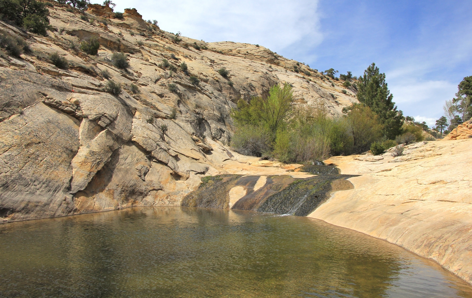
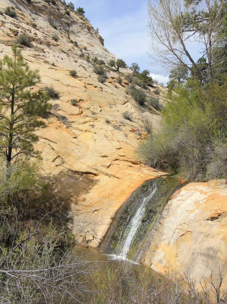
 Nearing the bottom of the canyon, we came to a faint trail split—the left branch leading to the main falls while the right branch lead to a series of cascades and pools that feed Lower Calf Creek Falls.
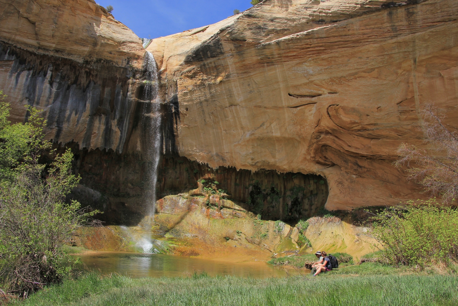
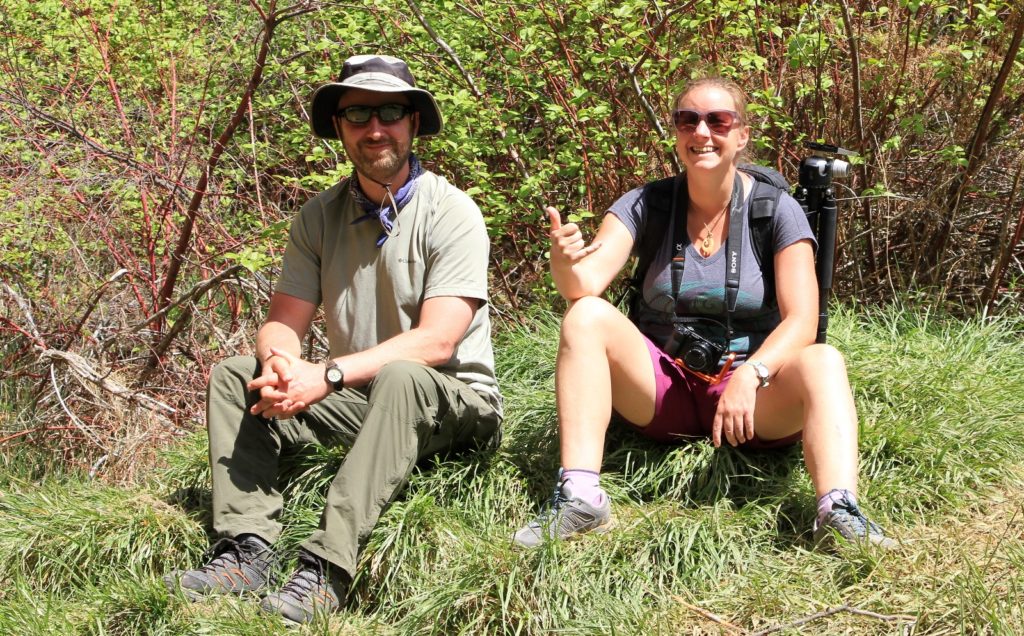
We decided to hike to the falls first and then check out the upper pools. As we approached the massive alcove behind the falls, there was our friend Yvonne. What a wonderful surprise!! She had already photographed the falls and the upper pools, but she joined us for the rest of our hike. She seemed glad for the company and we were glad for hers.
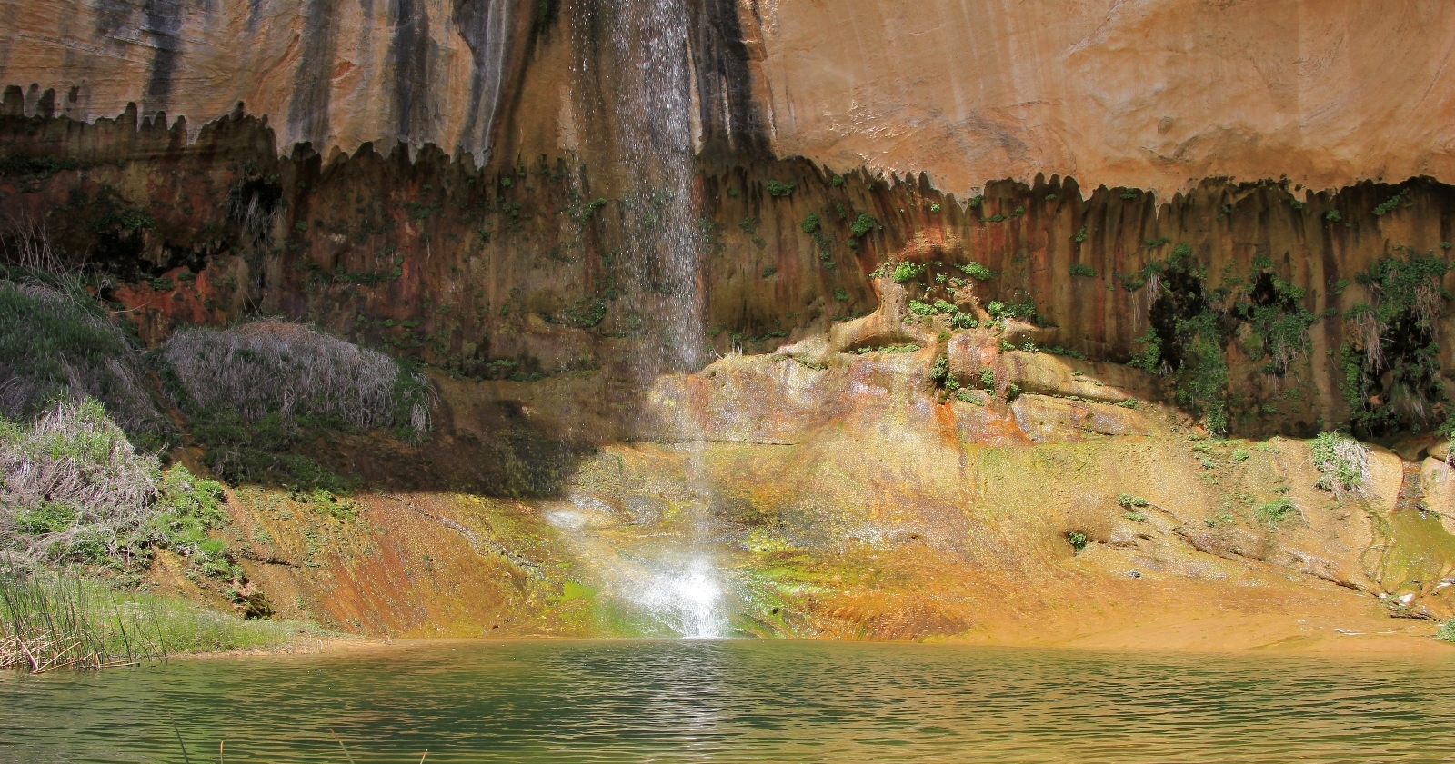
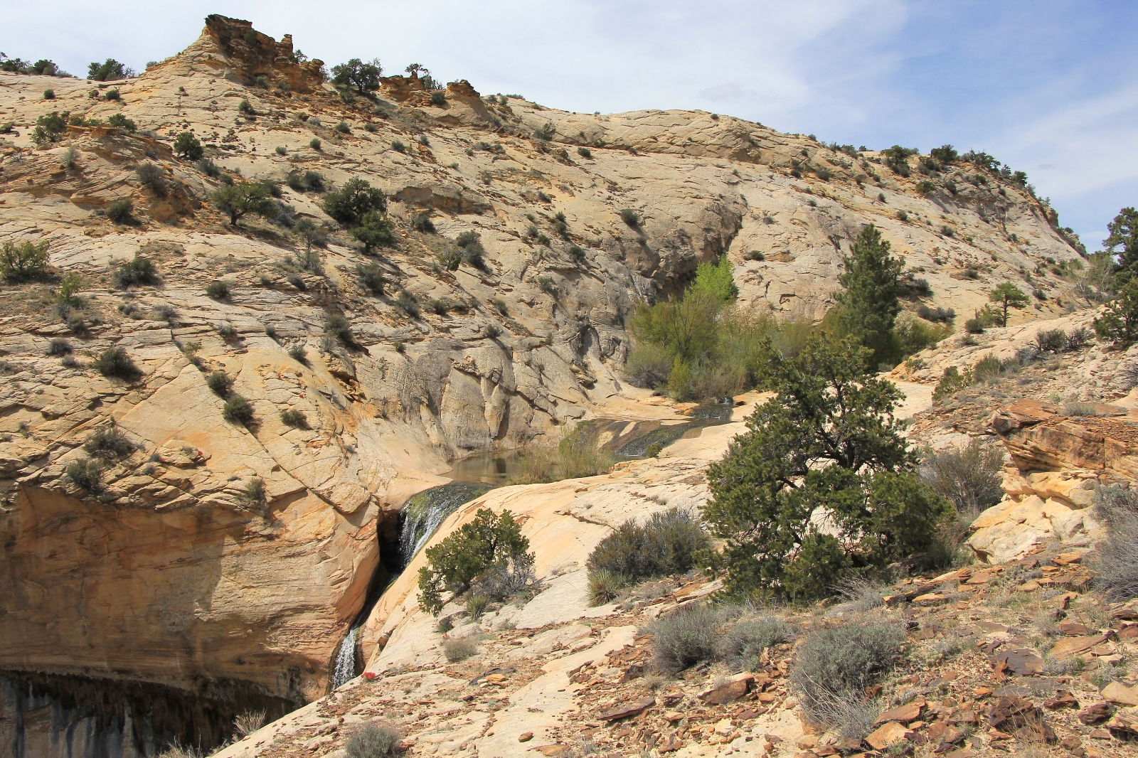
Upper Calf Creek Falls (elevation 5,920′) is located approximately one mile from the trailhead. It is approximately 110 feet high with a little less volume that Lower Calf Creek Falls three miles downstream. Like Lower Calf, these falls are contrast against a beautiful orange cliff wall and alcove with lush foliage—a literal desert oasis. Be sure to watch out for the poison ivy which was taller than me.
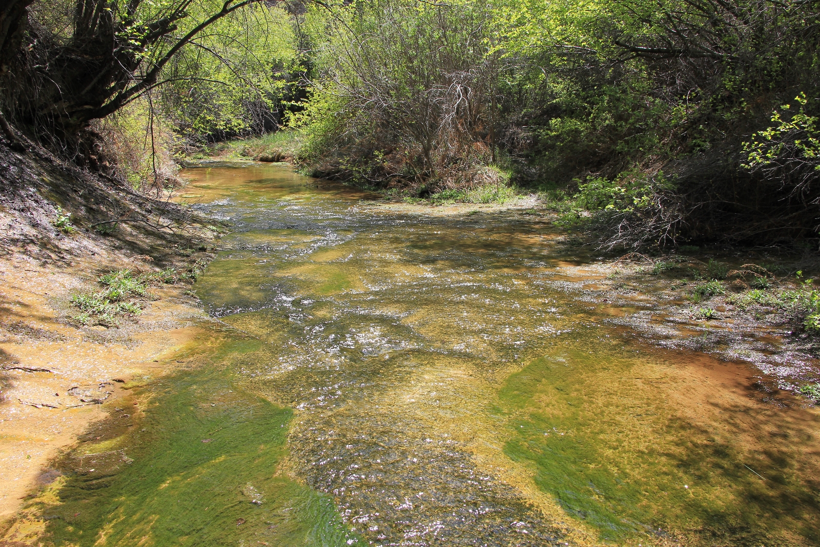
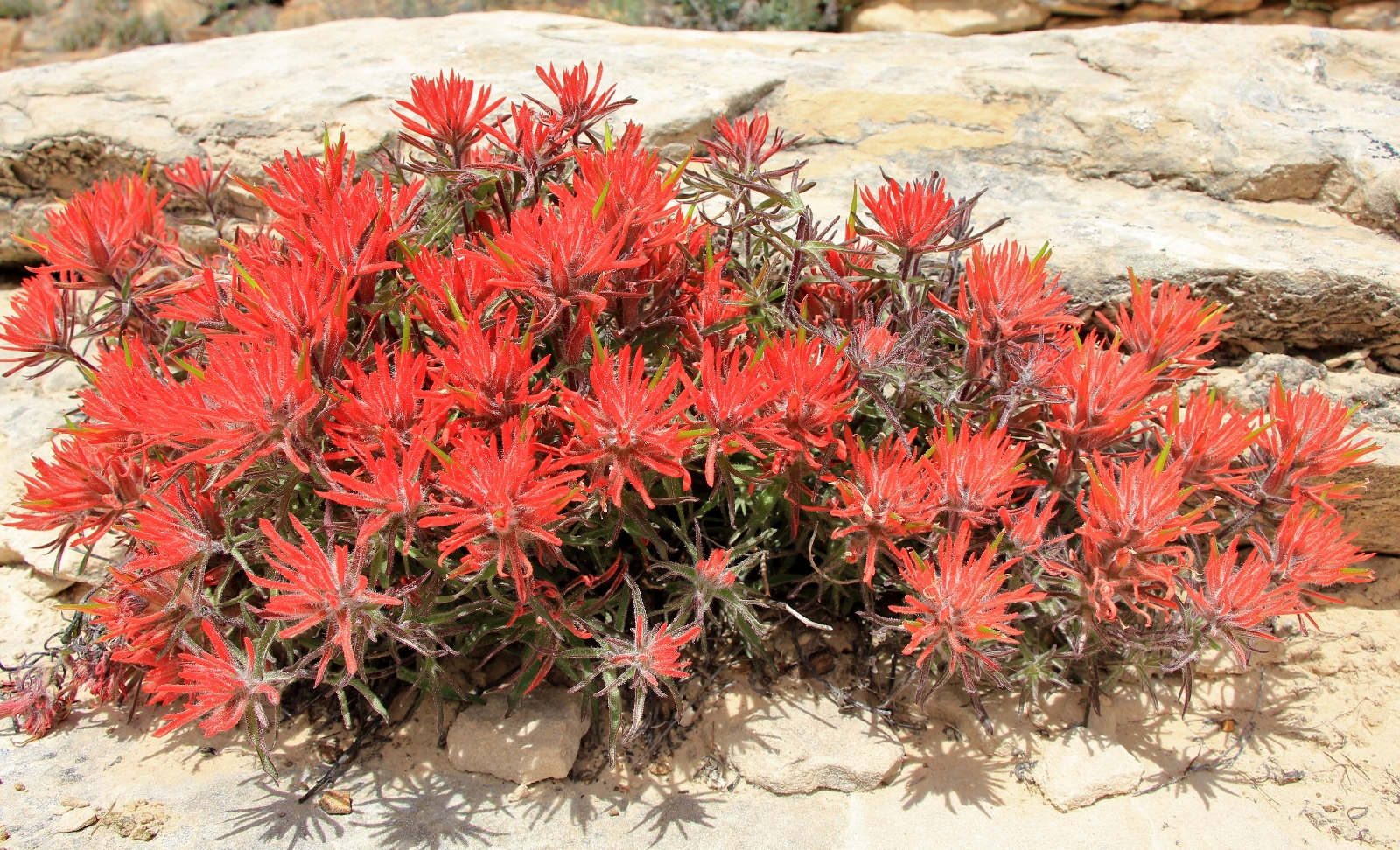
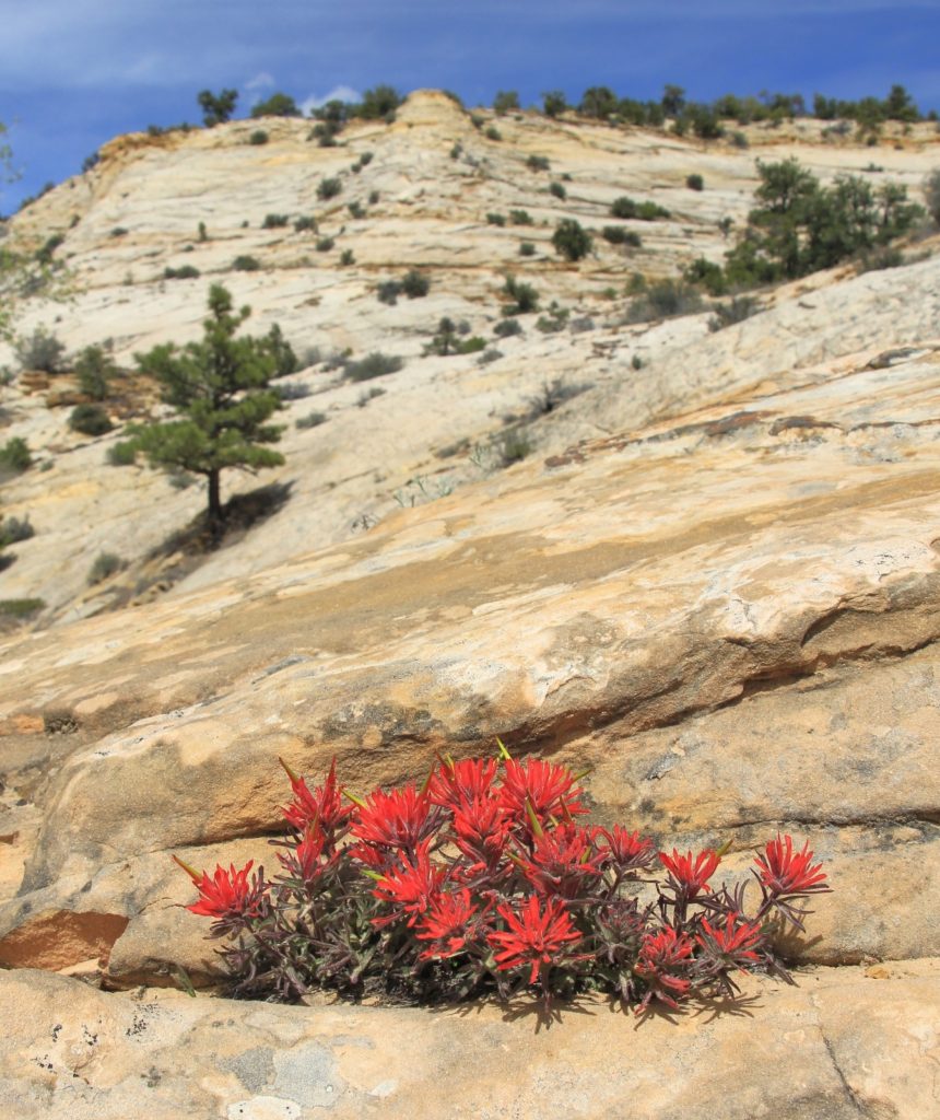
 After visiting Upper Calf Creek Falls, we backtracked to the trail split and climbed the short side trail to the pools and cascades above the falls. This area is well worth the small amount of extra effort expended. Indian paintbrush grows out of the slickrock providing a colorful contrast to the yellow and white sandstone surrounding the lovely cascades and pools. Splashing the cool water on our faces was a refreshing treat in the warm April sun.
It was a short, but stiff climb back up to the trailhead. The last half mile will especially cause you to pause for a couple extra photos (otherwise known as opportunities to catch your breath). The climb is a small price to pay for such a beautiful hike in canyon country.
Directions to Upper Calf Creek Falls Trailhead: from the town of Escalante, Utah, travel east on highway 12 for roughly 16 miles to the Calf Creek Campground. Travel another 6.0 miles and turn left onto an unmarked dirt road. The trailhead is a short distance down this road.