Hike to towering basalt cliffs, several lakes, and the site of a former waterfall that was four times the size of Niagra Falls.
Distance: 3.0 miles round trip
Type: loop
Difficulty: easy
Best season: spring
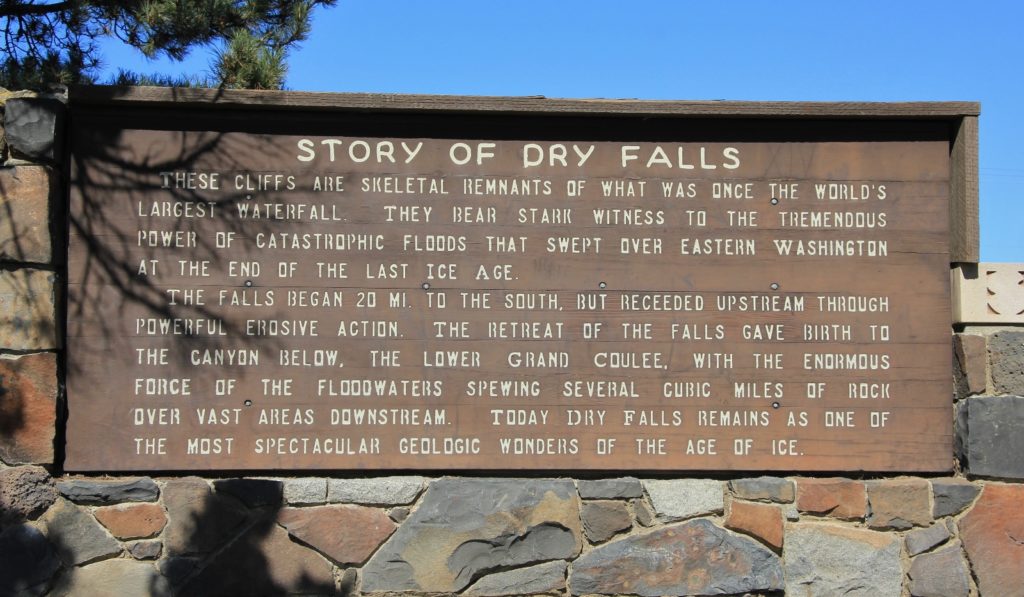
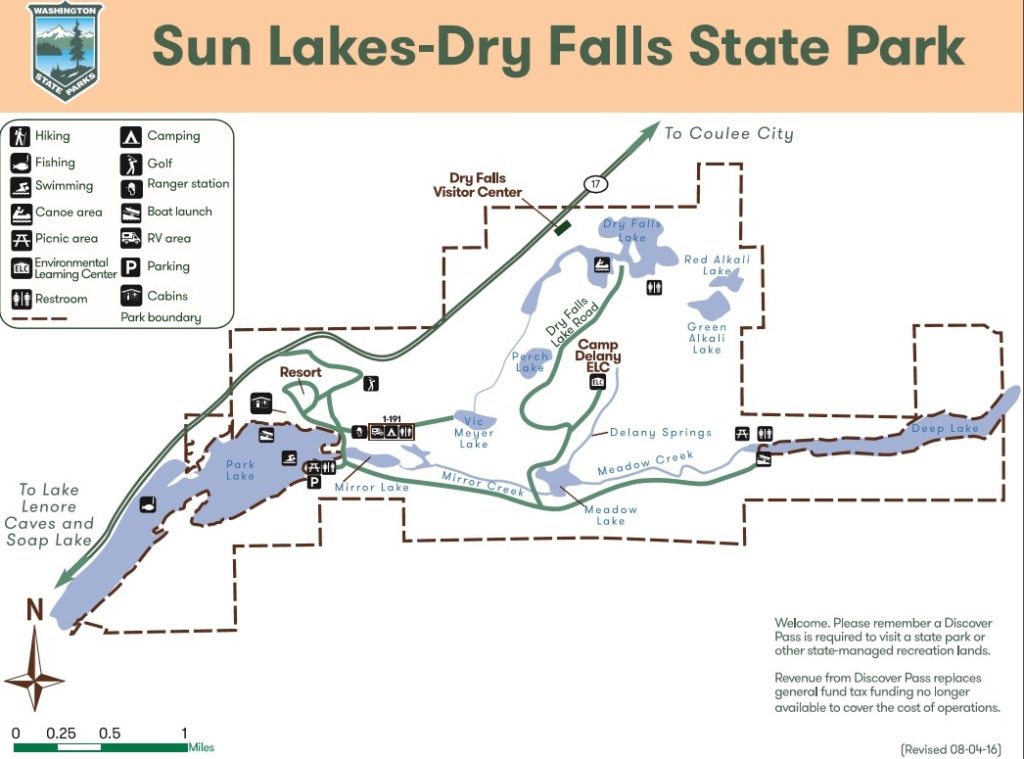
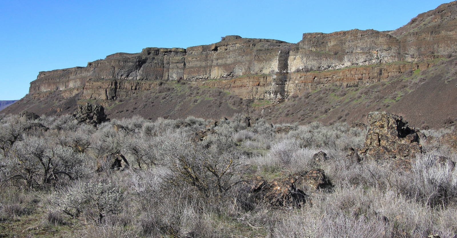
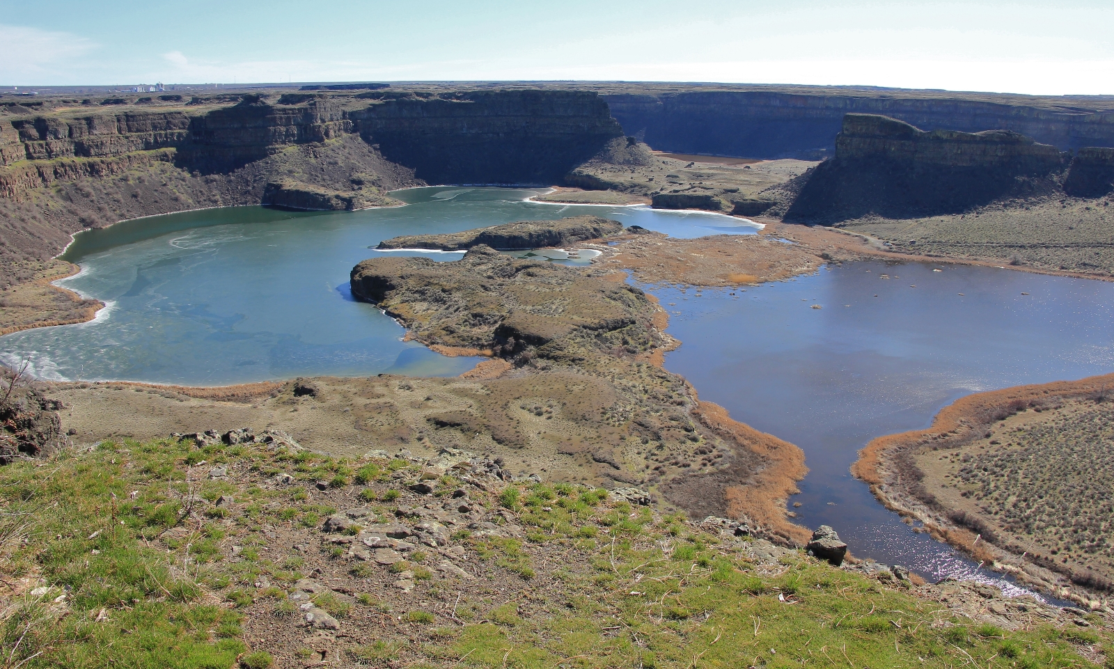
Located in the heart of central Washington’s Grand Coulee, Sun Lakes – Dry Falls State Park offers something for everyone. Boating, fishing, swimming, hiking, camping, and golfing—this park has it all. If you are a geology enthusiast, look no further in satisfying your wonder. During the last ice age, the Great Missoula Floods scoured across the region creating Washington’s channeled scablands and Dry Falls. 15,000 years ago, Dry Falls was the world’s largest waterfall. Today the massive basalt cliffs are dry, but the coulee below is dotted with numerous small lakes and towering Umatilla Rock.
The first weekend of spring 2017 found us heading to central Washington for a couple new hikes. Saturday, we visited Frechman Coulee near George, Washington. We had blustery conditions, but enjoyed seeing the impressive waterfall as it poured over massive basalt cliffs.
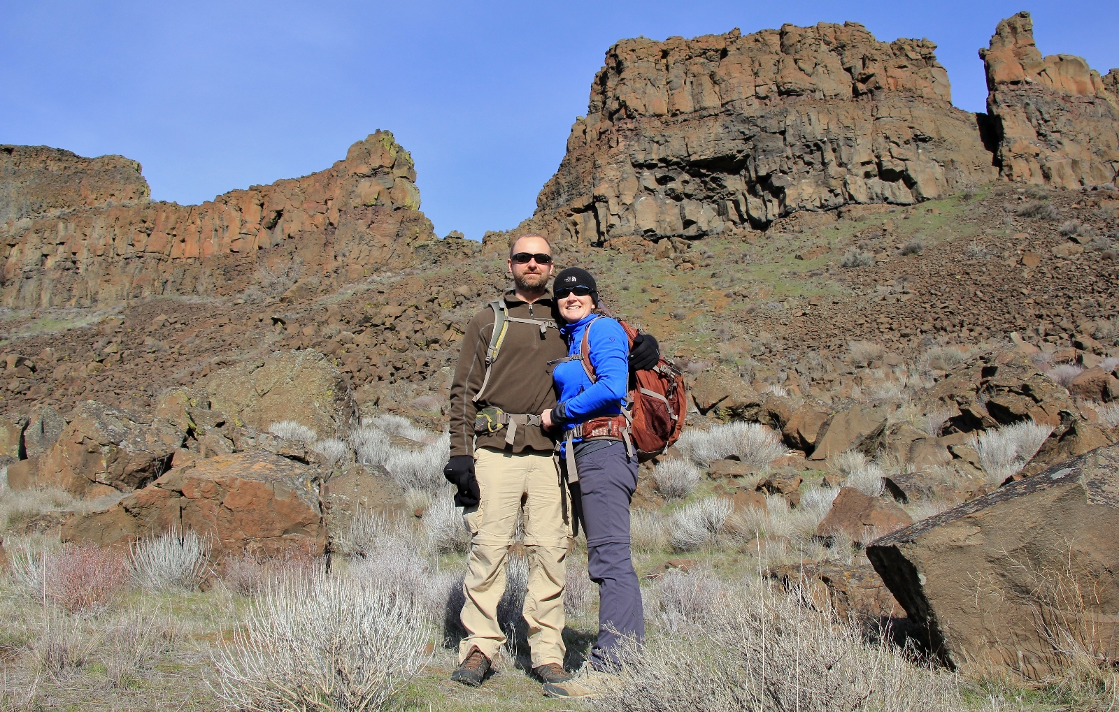
Sunday morning we made our way north to Sun Lakes – Dry Falls State Park for a loop hike around Umatilla Rock to Dry Falls Lake. The trailhead parking lot in the shadow of Umatilla Rock was small with room for just about half a dozen vehicles. No problem, we were the only car. Conditions were still a little overcast, but the temperature was slowly warming and it was supposed to be a sunny morning. We hit the trail with temperatures around 40 degrees.
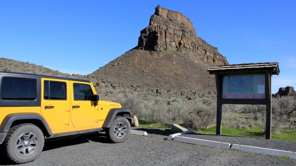
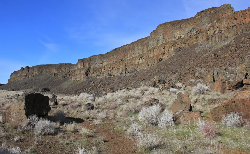
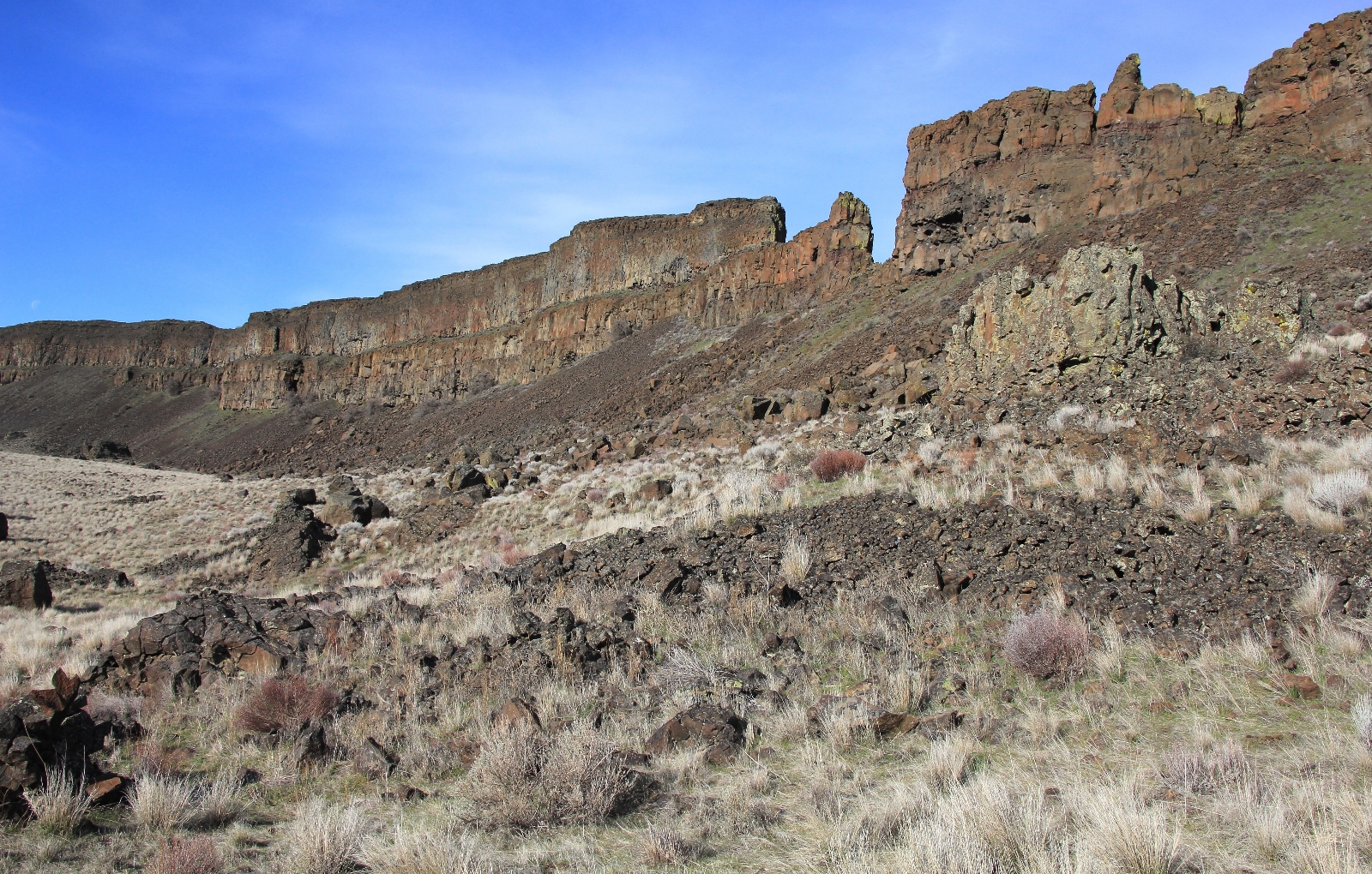
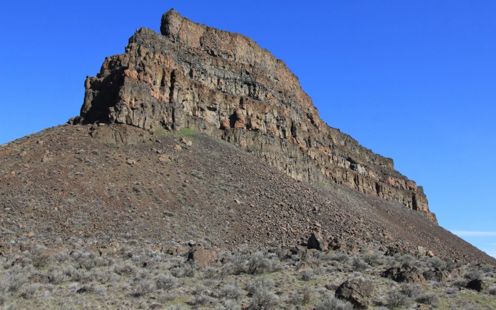
A short distance out of the parking lot we came to a trail split. The trail forms a loop around Umatilla Rock so it doesn’t matter which direction you go. We hiked the trail counterclockwise (to the right) to take advantage of the morning sun. The trail is well marked with red tipped posts every so often. There are a few places where things aren’t perfectly clear, but as long as you keep huge Umatilla Rock in sight, you can’t get lost.
The first part of trail was interesting as we made our way through a large area of basalt boulders at the base of Umatilla. We even saw our first yellow wildflowers of the year! YAY!!
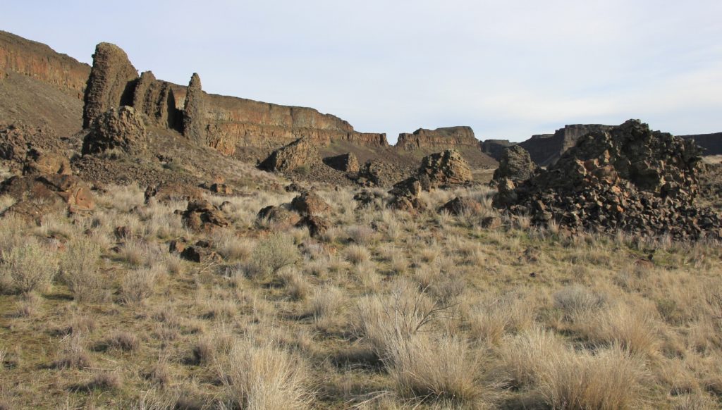
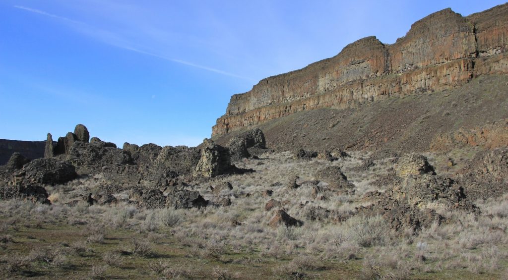
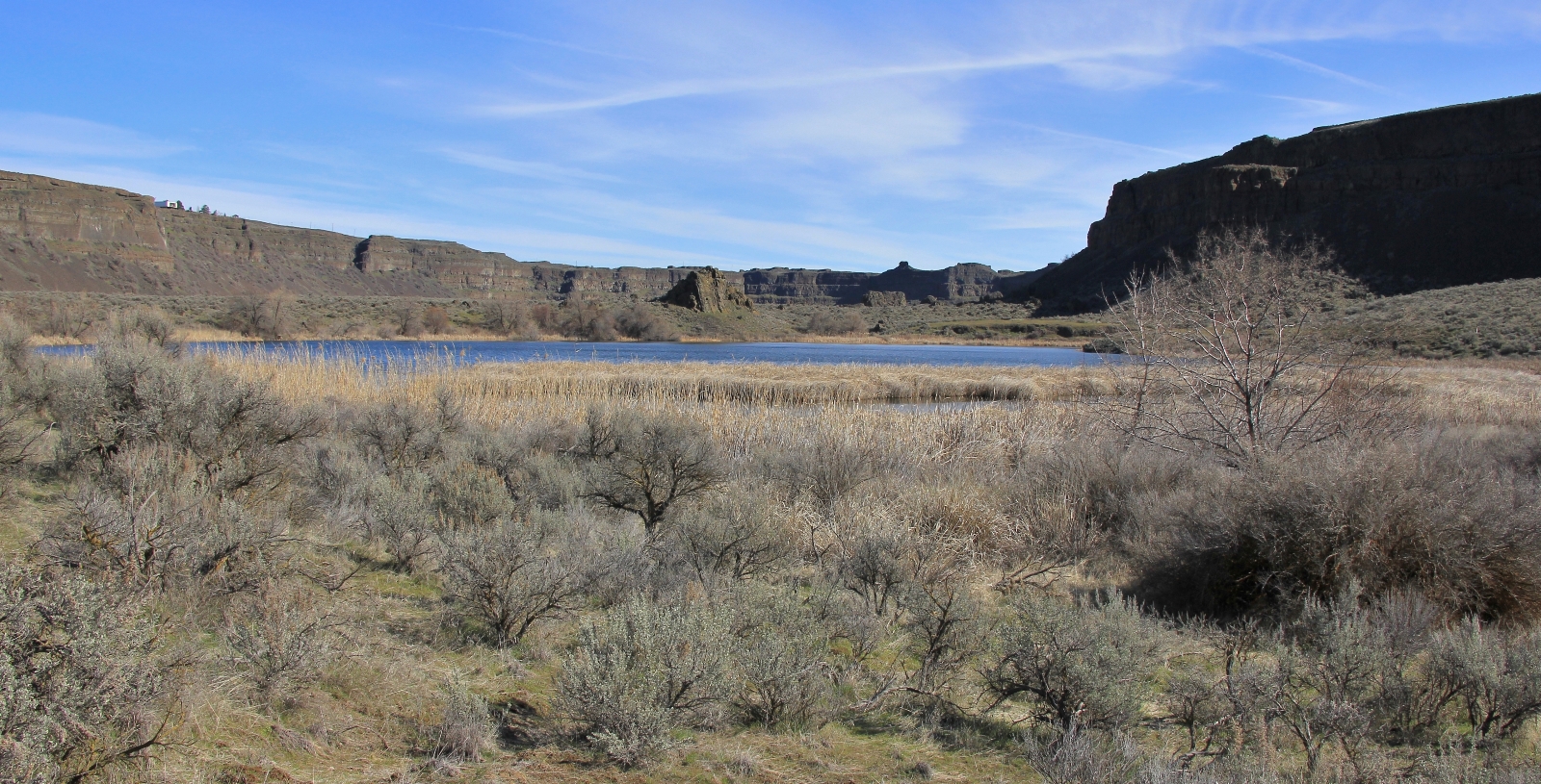
As we worked our way along the base of Umatilla Rock, the sun broke through the clouds and we enjoyed a beautiful early spring day. With a record setting winter finally behind us, it was the nicest day we’d seen for months. As we rounded the north end of Umatilla Rock, the winds picked up and it was quite cool for a few minutes as we worked our way down a slope toward Dry Falls Lake. The trail was a little faint in places here, but we were dropping down into a small parking lot, so it was easy to find our way.
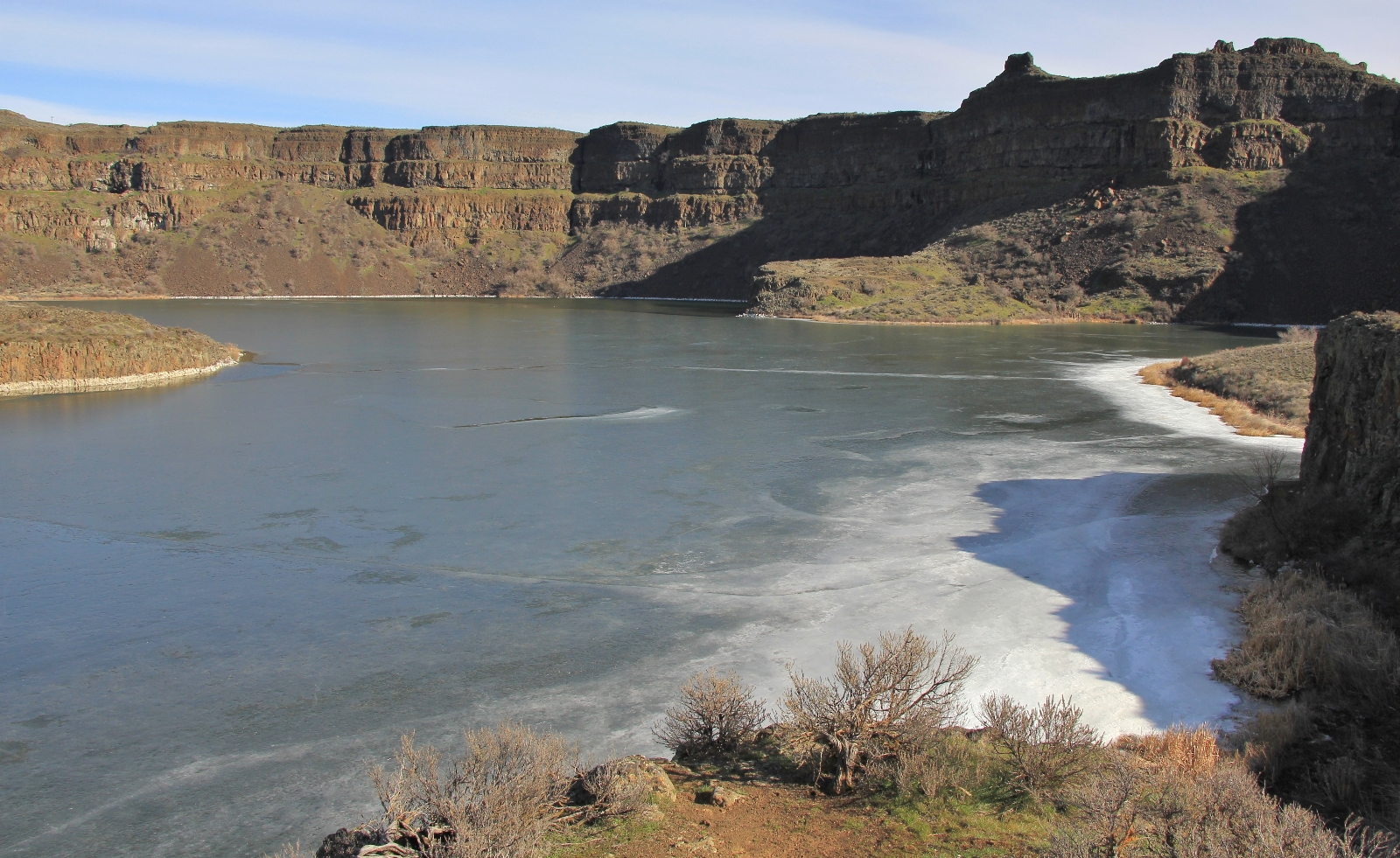
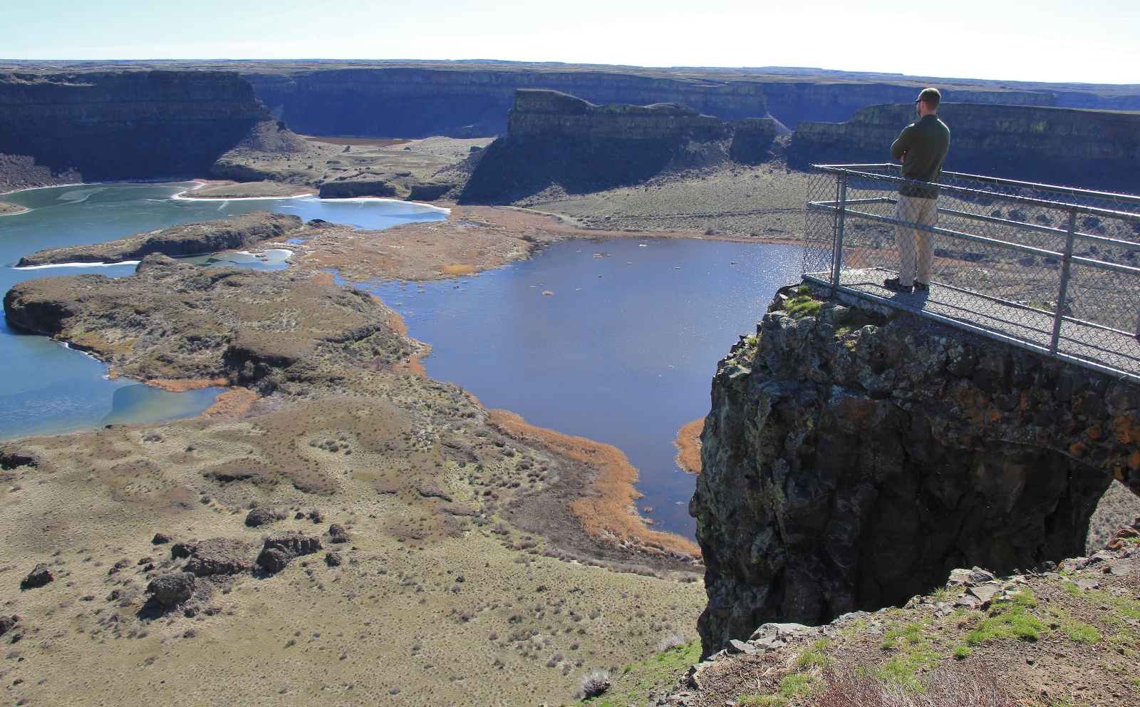
We found ourselves along the shore of Dry Falls Lake surrounded by towering cliffs and water fowl happy with song. There was a gravel parking lot with pit toilet and a place to launch non-motorized boats.
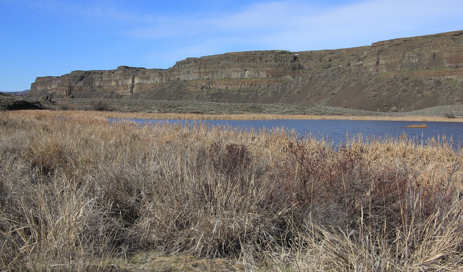
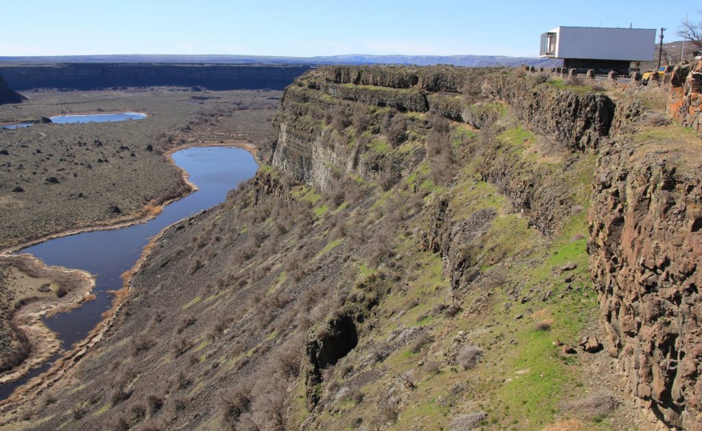
From the parking lot, the trail paralleled the road for a bit. We were now on the west side of Umatilla Rock following above the shore of Dry Falls Lake. We could see the visitor center high above at the far end of the lake
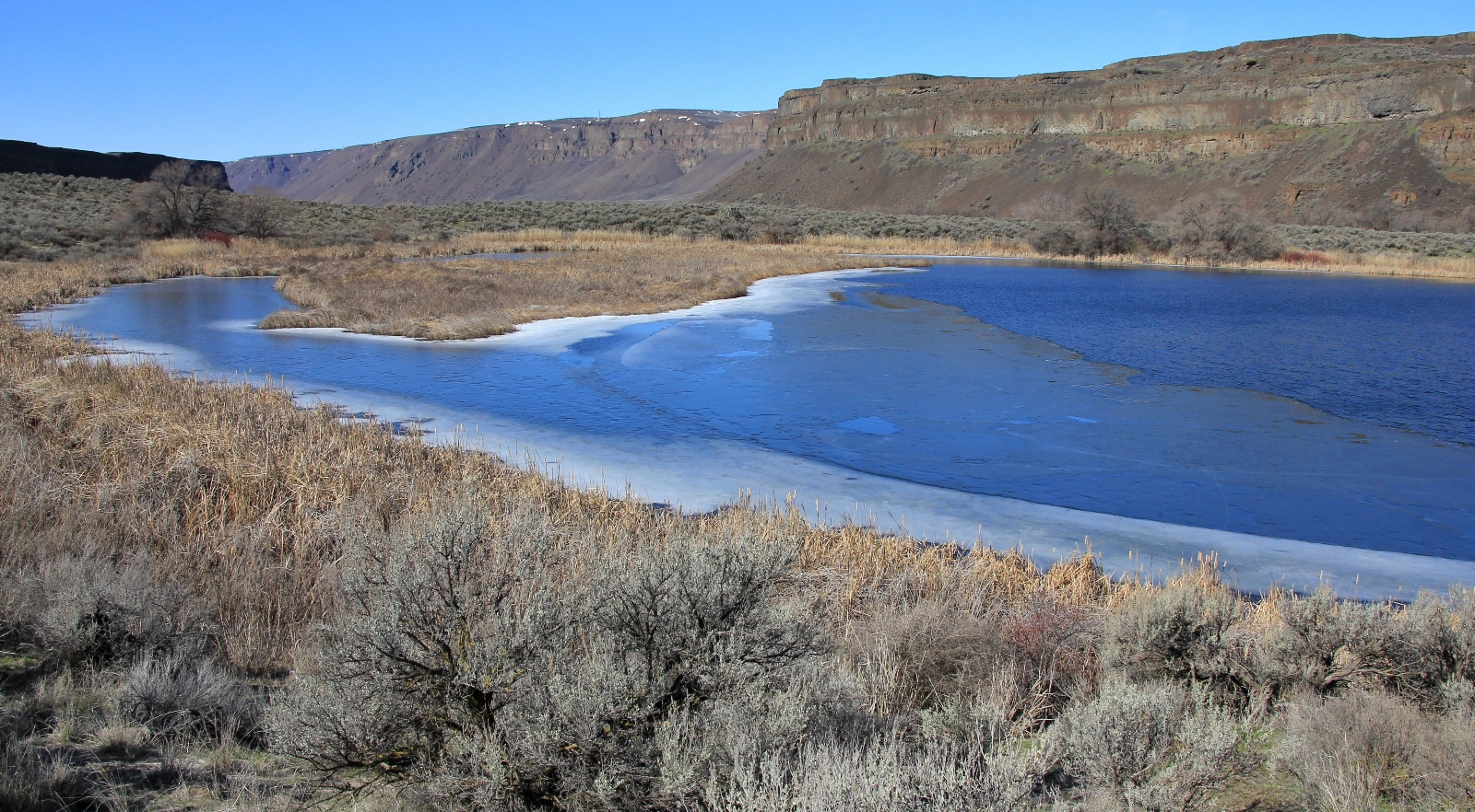
We continued through sage brush, enjoying the sun and the cliff views ahead. Soon we came to Perch Lake. Our initial views were limited, but the trail worked its way around most of the lake providing for nice angles. After that, it was a short distance back to the trailhead.
This loop is a great early season hike. I would love to do again about the middle of April when the area is more lush and dotted with colorful wildflowers. The hiking is easy with very minimal elevation change and a well marked trail.
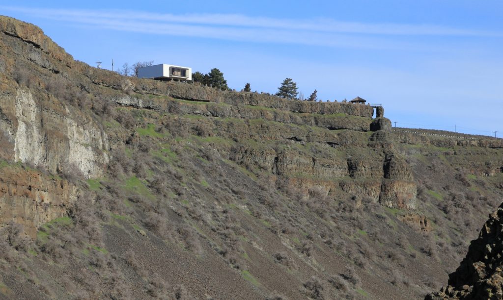
After our hike we retraced the drive through the park and up the highway a short distance to the Dry Falls Visitor Center. Here we enjoyed the interpretive displays and impressive views down into the coulee where we had just hiked.
Directions: Sun Lakes – Dry Falls State Park is located just south of Coulee City, Washington along state route 17. From the park entrance, drive 1.2 miles and turn left toward Deep Lake. After 0.9 miles, turn left onto the unpaved road leading to Perch and Dry Falls Lakes. The well-signed trailhead with kiosk is just 0.4 miles up this road. A Discover Pass is required.