A narrow and rugged river canyon to the deepest gorge in North America with stunning scenery and mining ruins.
Distance: 9.0 miles round trip to confluence with Snake River, add another couple miles to explore the ruins at Eureka Bar.
Type: out and back (dayhike or makes a great backpack)
Difficulty: easy with minimal elevation gain/loss and good dirt tread most of the trail. Watch for poison ivy and rattlesnakes.
Best Season: spring and fall
I had wanted to hike the Imnaha River down to Eureka Bar in Hells Canyon ever since I missed backpacking it with Jason and family back in 2012. Jason returned with tales of the river’s rugged beauty, but also of its jungles of poison ivy. He agreed to take me one day, but only if we went early or late season to improve our chances with the poison ivy.
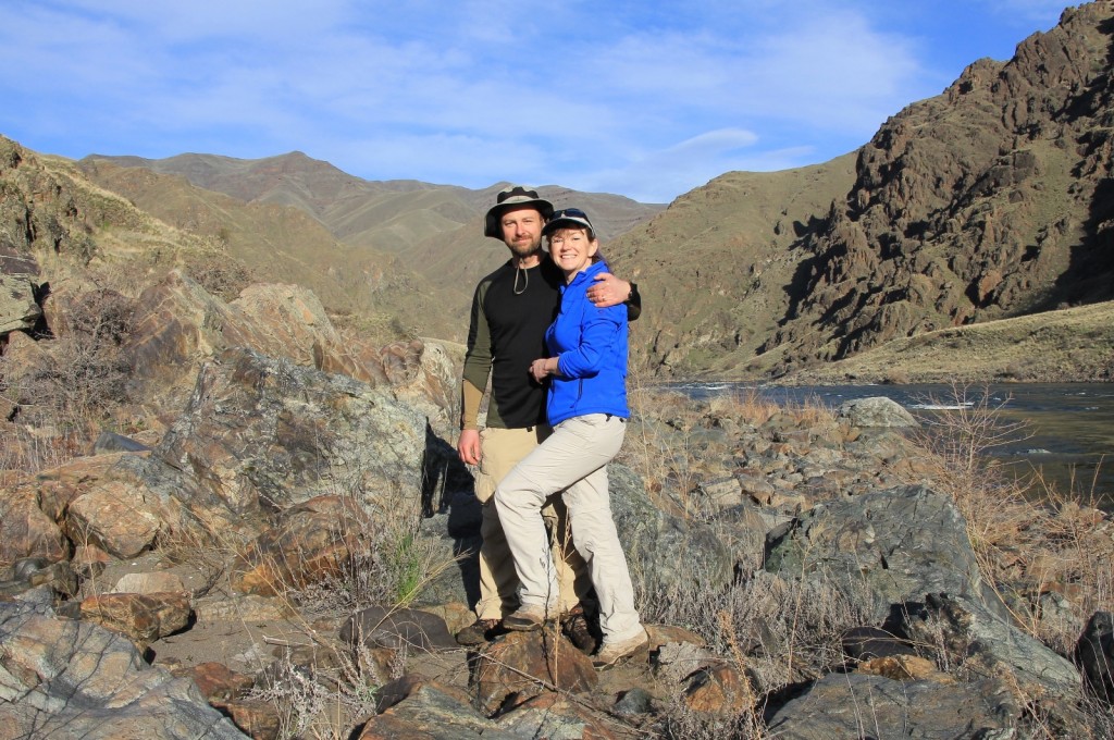
We tentatively set our 24th anniversary, also first day of spring, as our weekend of choice. We watched the weather and waited. A week out it looked great- but would it hold? We hadn’t had a great weather weekend yet and even had snow and ice for much of the week leading up to the pack. Friday we made the final call. The forecast for Imnaha was mostly sunny and 65 Saturday, 38 and clear overnight, and 67 and partly cloudy Sunday. We were on!
We traveled from our home in SE Washington to the beautiful community of Joseph, Oregon where we topped off on gas. The clear weather provided good views of the Wallowa Mountains which were still buried in snow. El Nino had brought us a wet winter—hopefully 2016 will be a much better fire season for the Northwest! From Joseph it was a 30 mile drive to the tiny town of Imnaha.
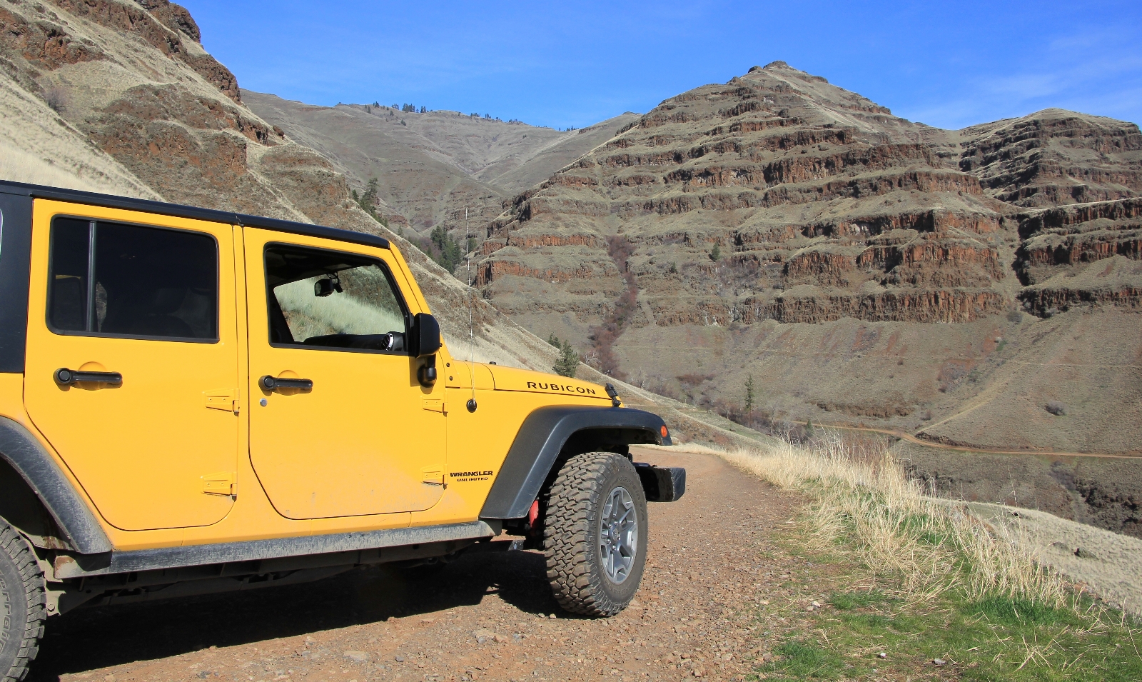
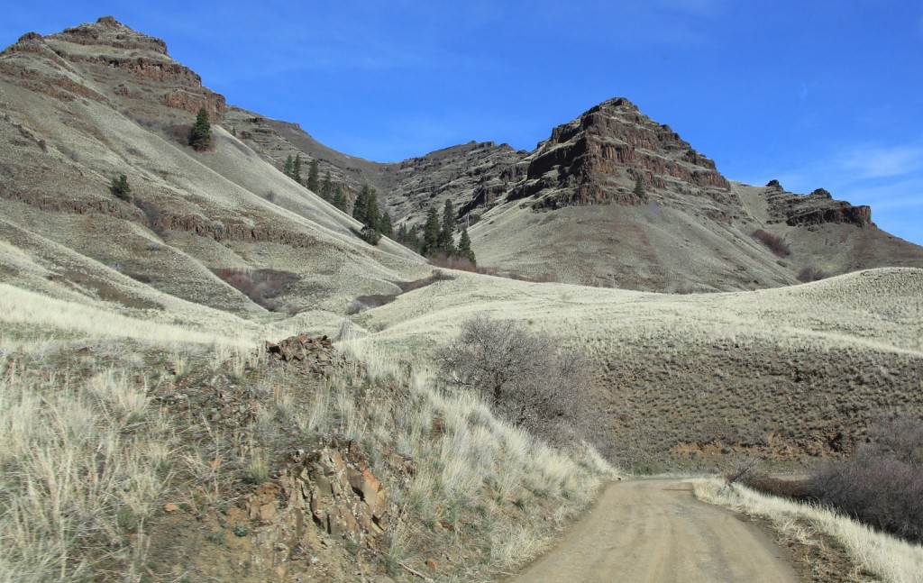
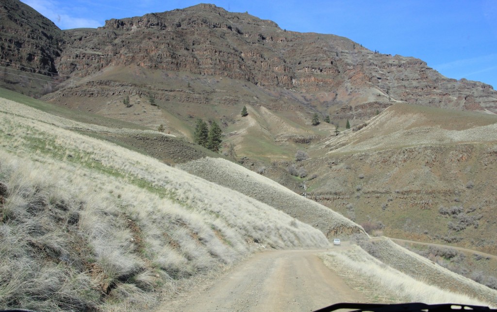
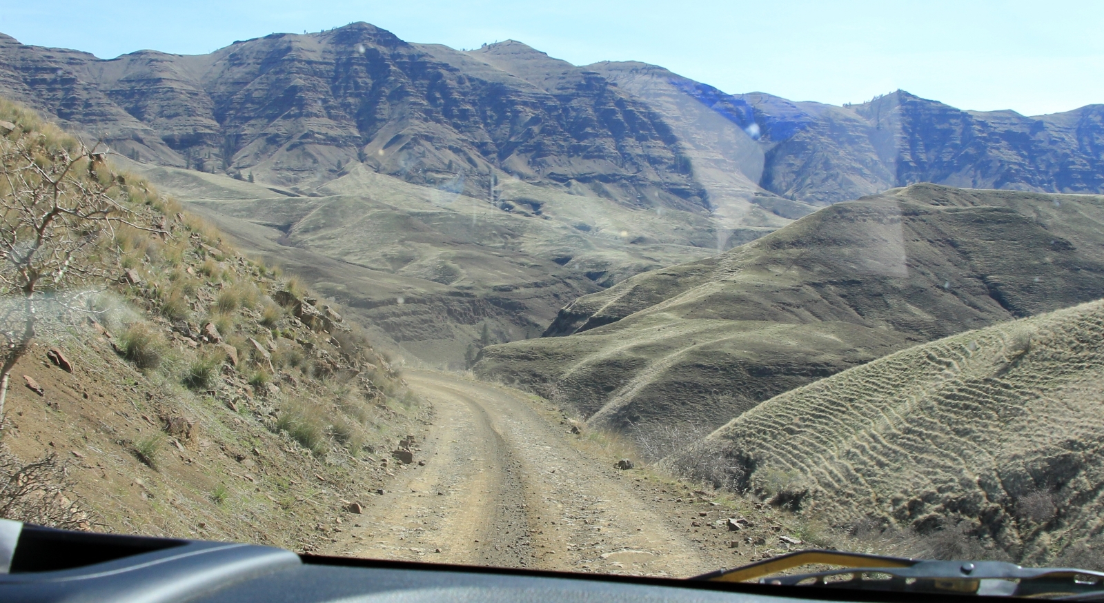
At Imnaha we turned left onto paved Lower Imnaha Road and followed it six miles. This was a pretty stretch along the Imnaha River through a mix of rural residential and cattle ranches. After six miles the pavement suddenly ended and we were immediately climbing steep, rocky, rutted and narrow Dug Bar Road #4260. I knew this was a rough road, but I was a little surprised by how steep and narrow it was and how impressive the drop offs were at times. The new Jeep handled it like a dream and the scenery was absolutely stunning. This stretch was only 13.5 miles, but it took an hour to drive. Getting there is truly half the adventure.
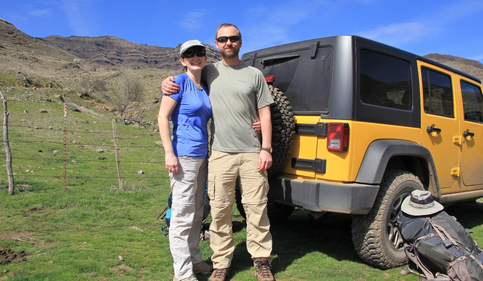
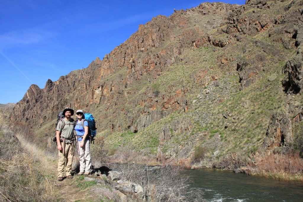
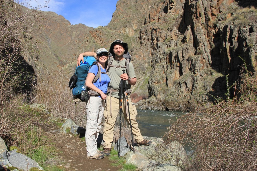
We finally arrived at the Cow Creek Bridge Campground and Trailhead (elevation 1,250′) at 12:30. There area was quite busy with steelhead fisherman, but we squeezed in at the end of the hiker’s parking lot. We put the last touches on our hiking gear and hit the trail with temperatures in the upper 50s and full sun.
We passed several groups of fisherman along the trail within the first half mile. After that, we enjoyed quiet and solitude. We’d see a father-son coming back from fishing Eureka Bar and two different couples day hiking to Eureka Bar.
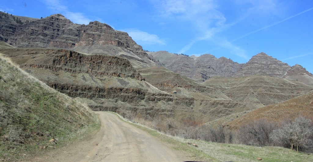
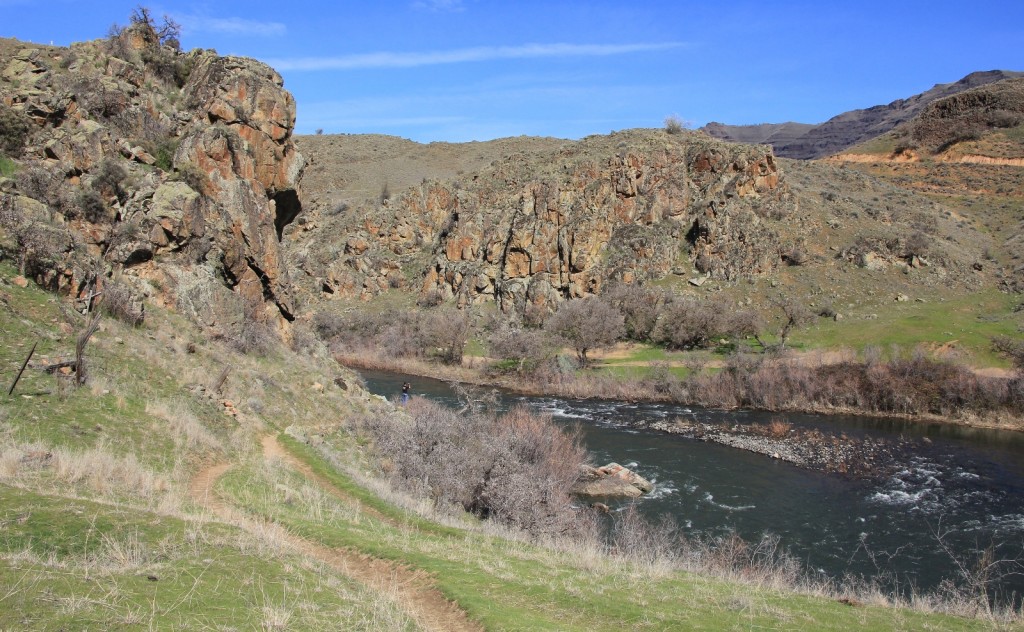
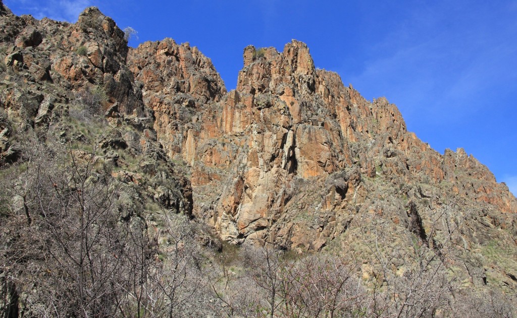
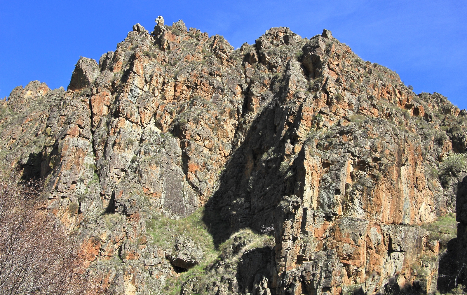
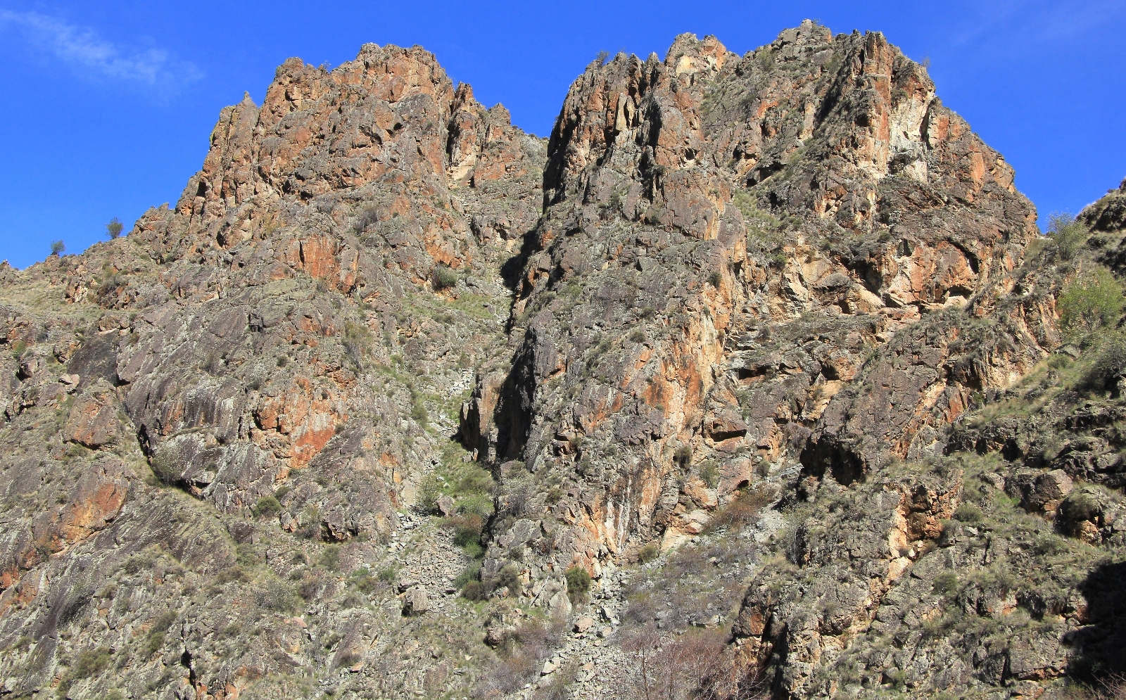
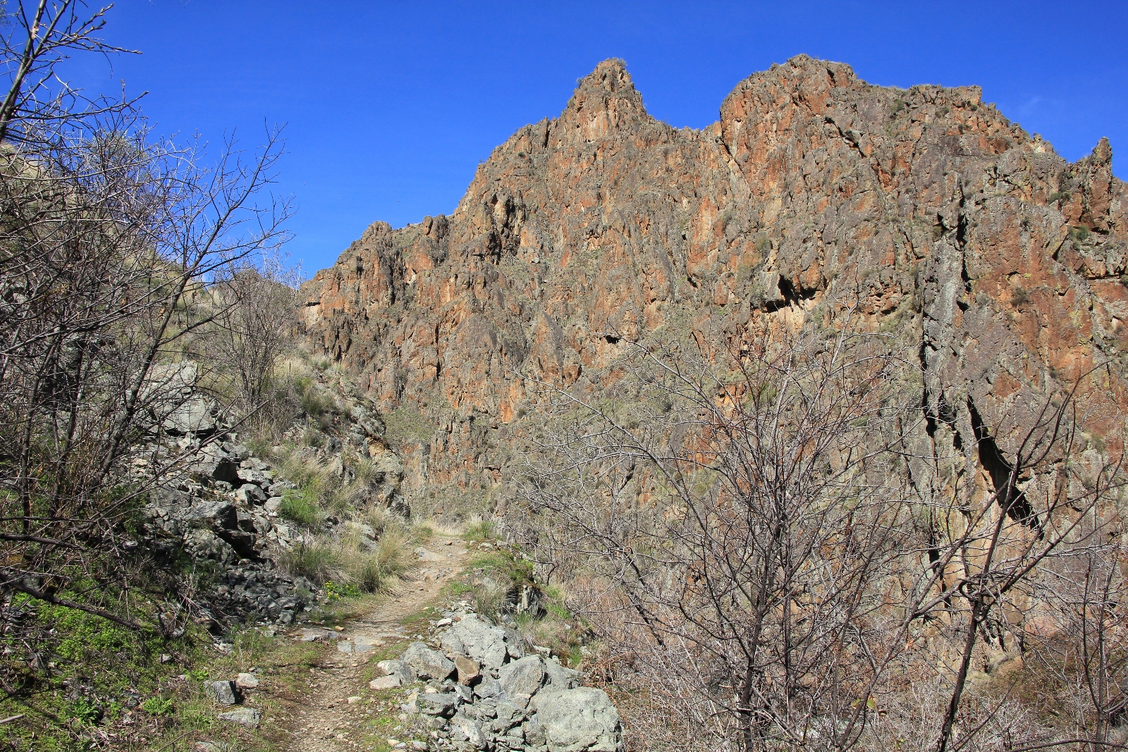
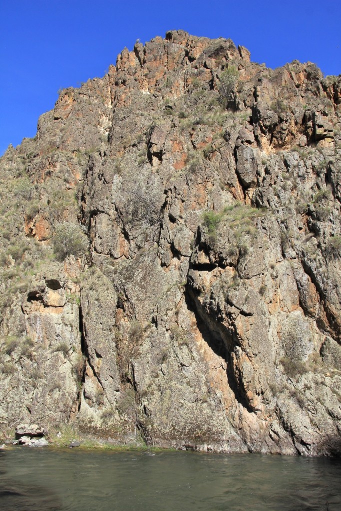
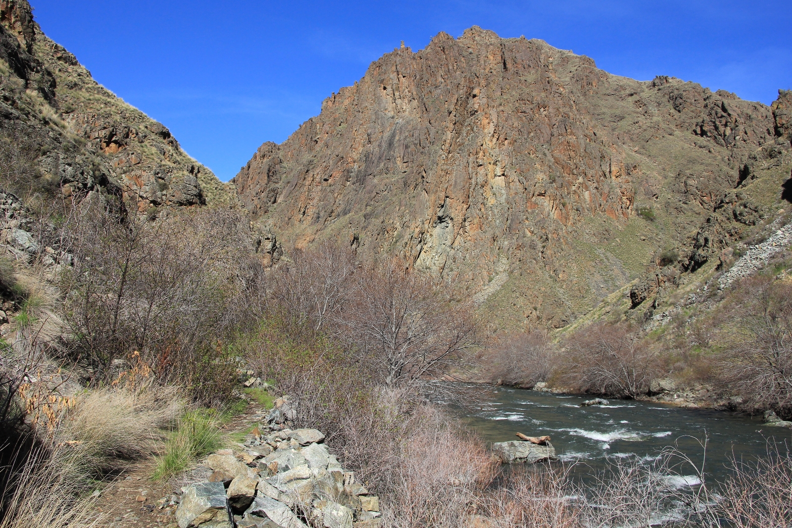
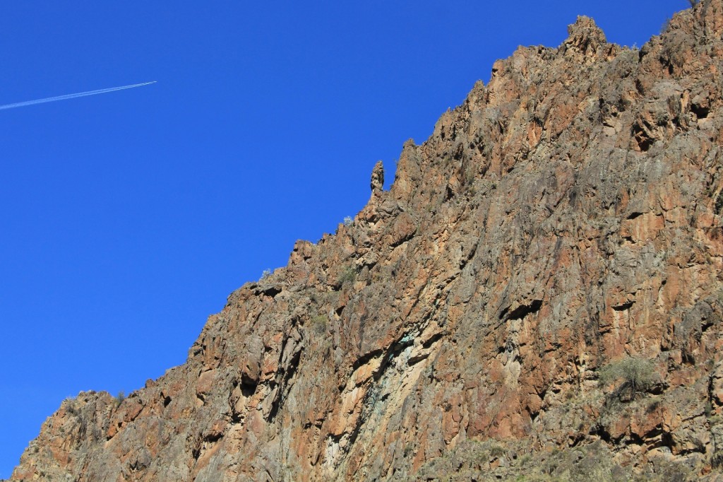
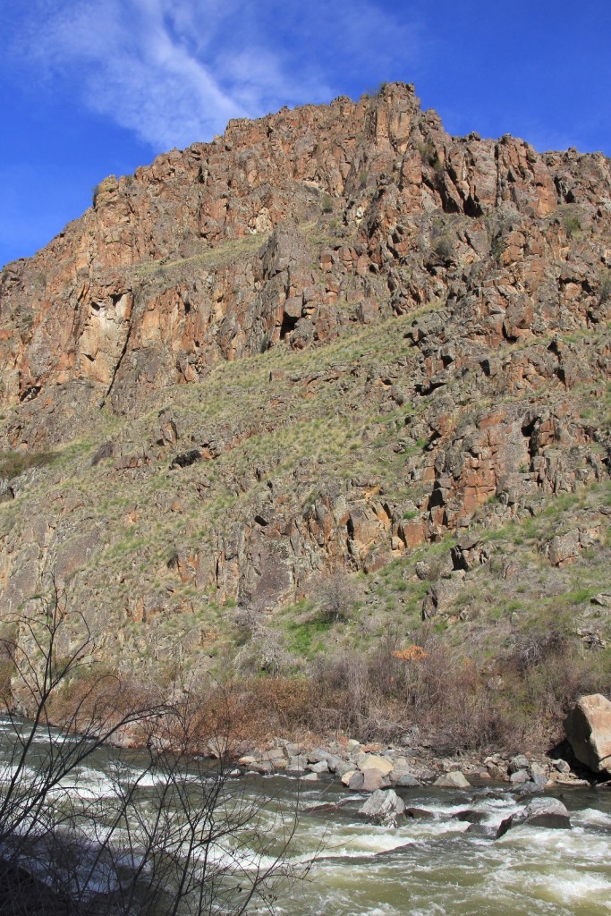
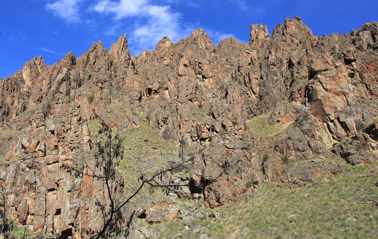
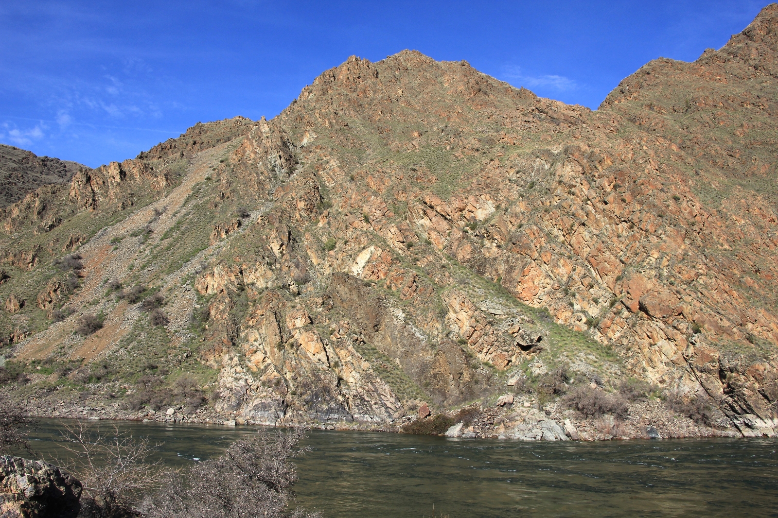
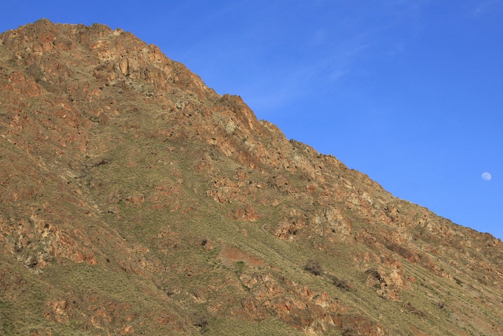
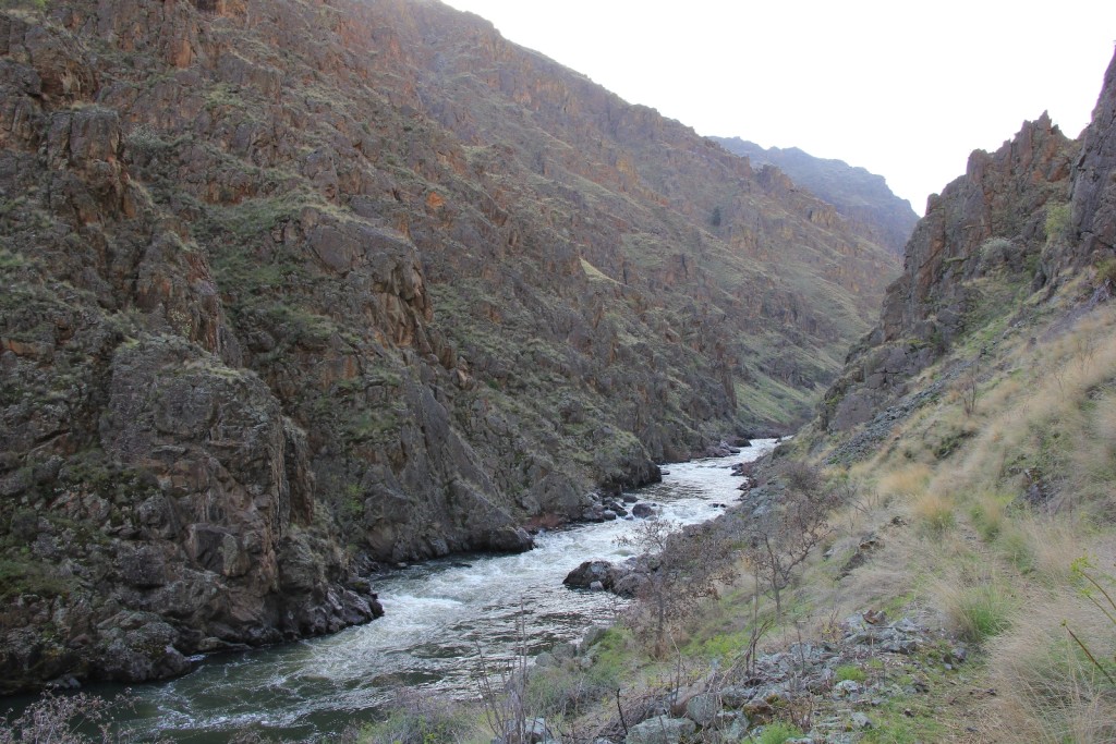
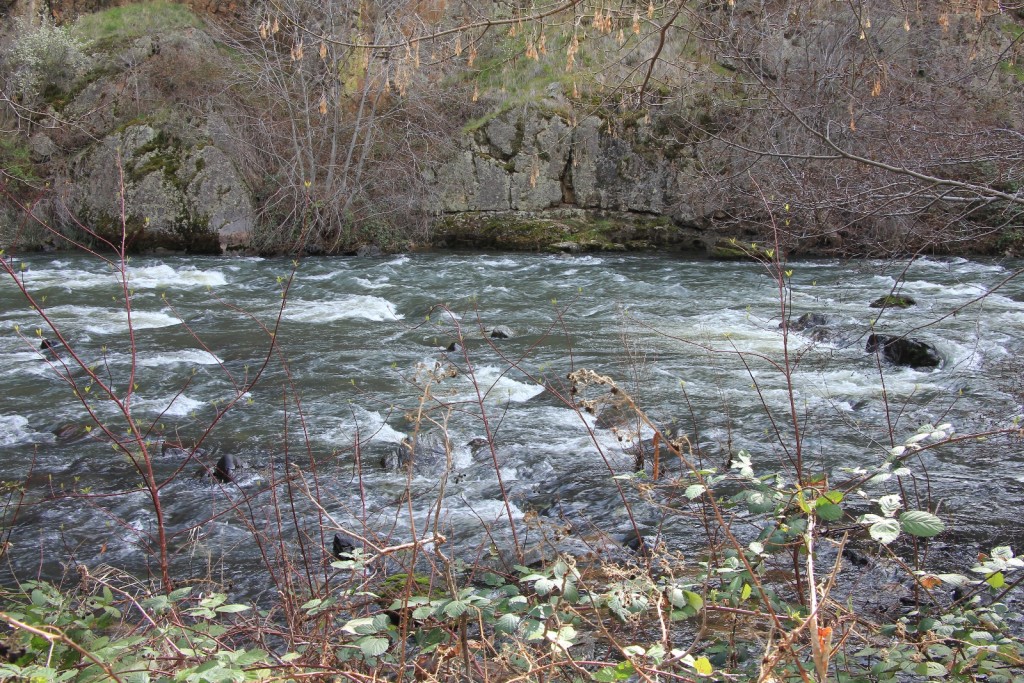
The first mile or so was scenic and lacking in poison ivy. After that, the canyon becomes more rugged, narrow, and beautiful. I was expecting a scenic trail, but this exceeded all my expectations. The rock walls were gorgeous and more colorful than I expected. The trail remained nearly flat up until the very end where there is a short climb before dropping us into Hells Canyon.
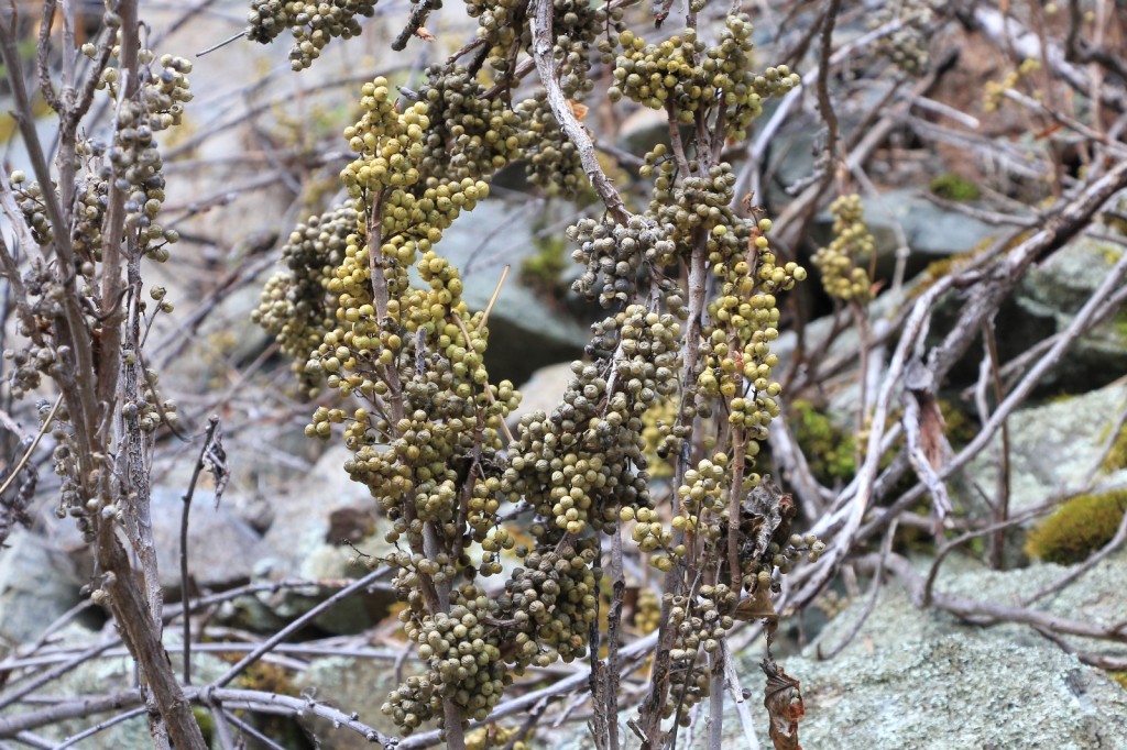
As the scenery improved, we got into the poison ivy— lots of it. It was everywhere alongside the trail. Fortunately it had not leafed out yet. We still needed to be careful since the urushiol oils are found in the stems as well as the leaves, but at least we weren’t fighting full bushes over the trail. It was at the perfect stage to differentiate it from the other bushes which were leafing out. We very carefully made our way down canyon.
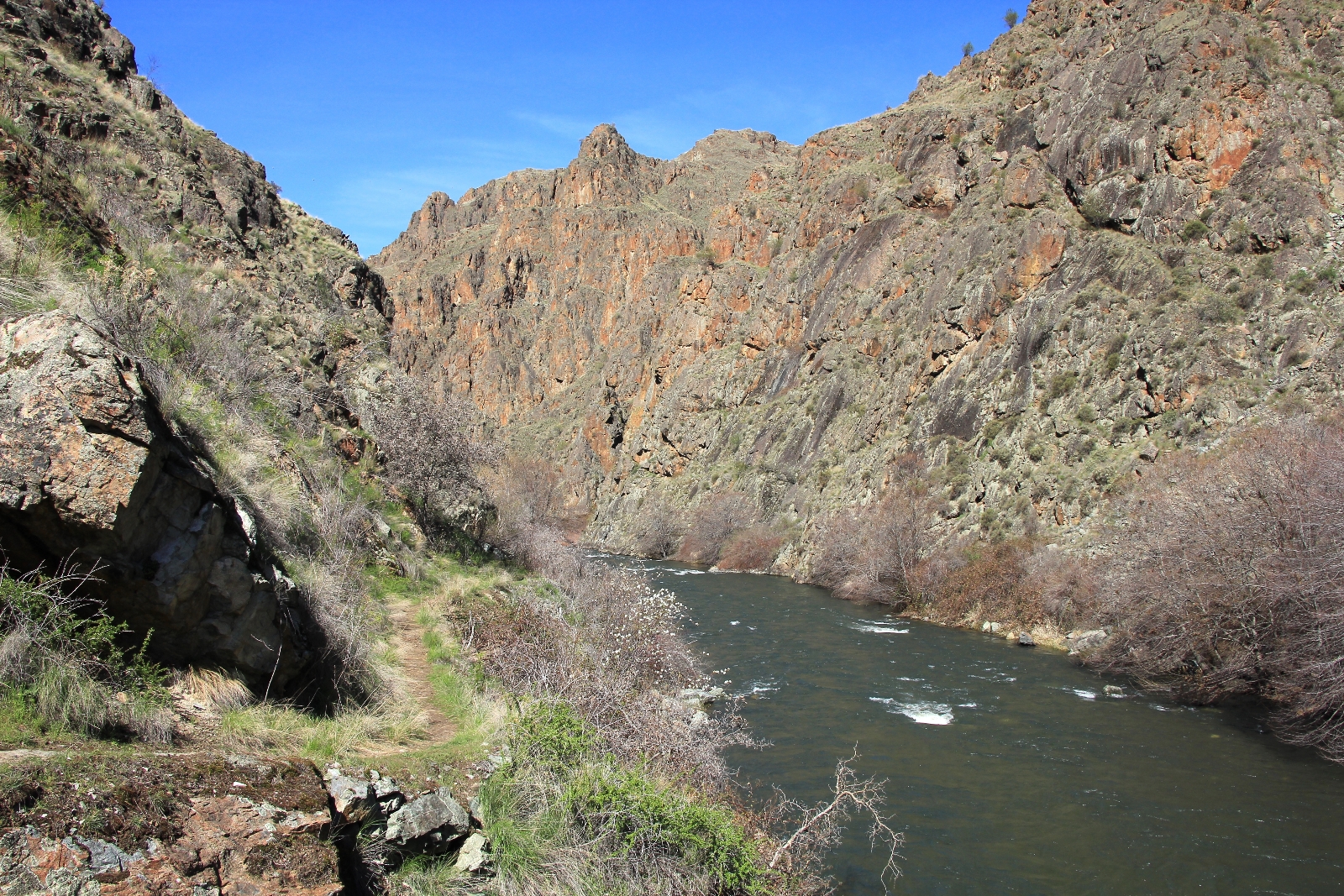
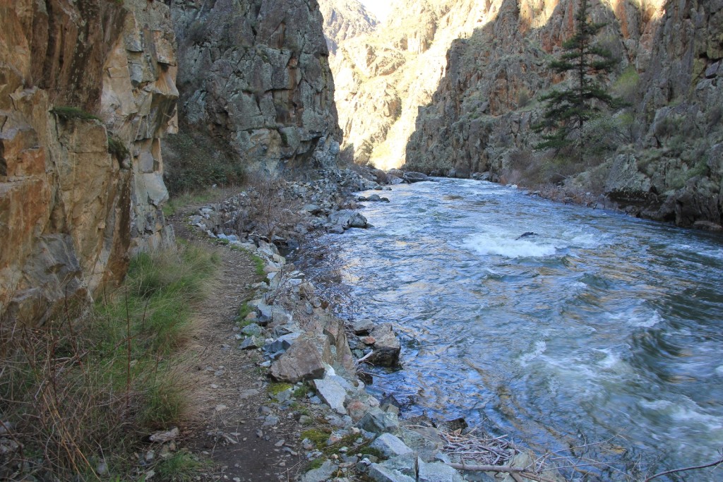
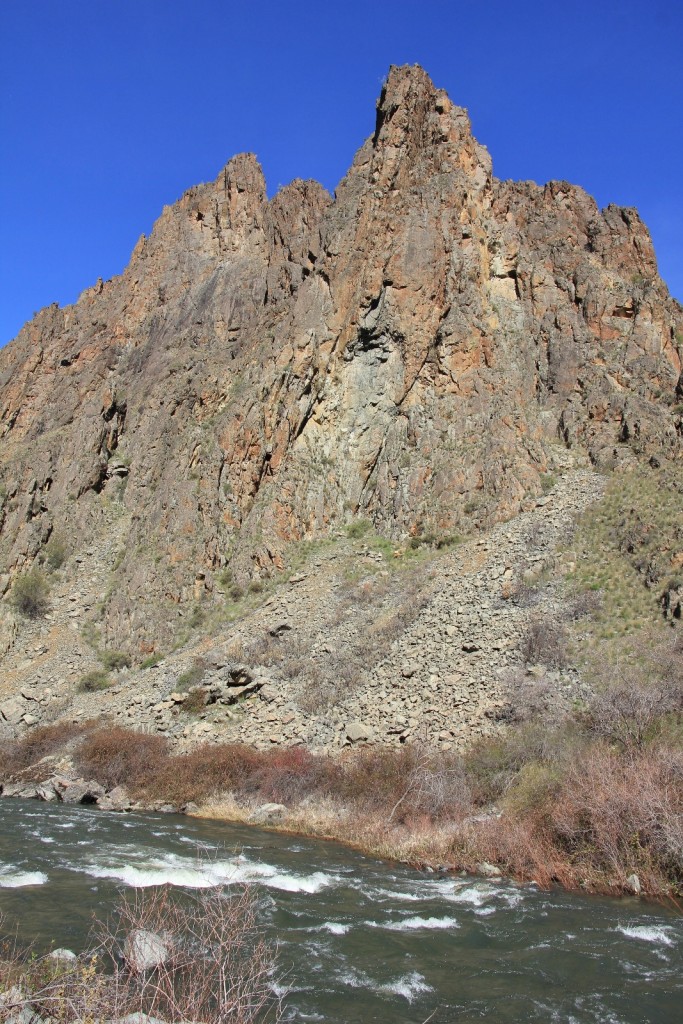
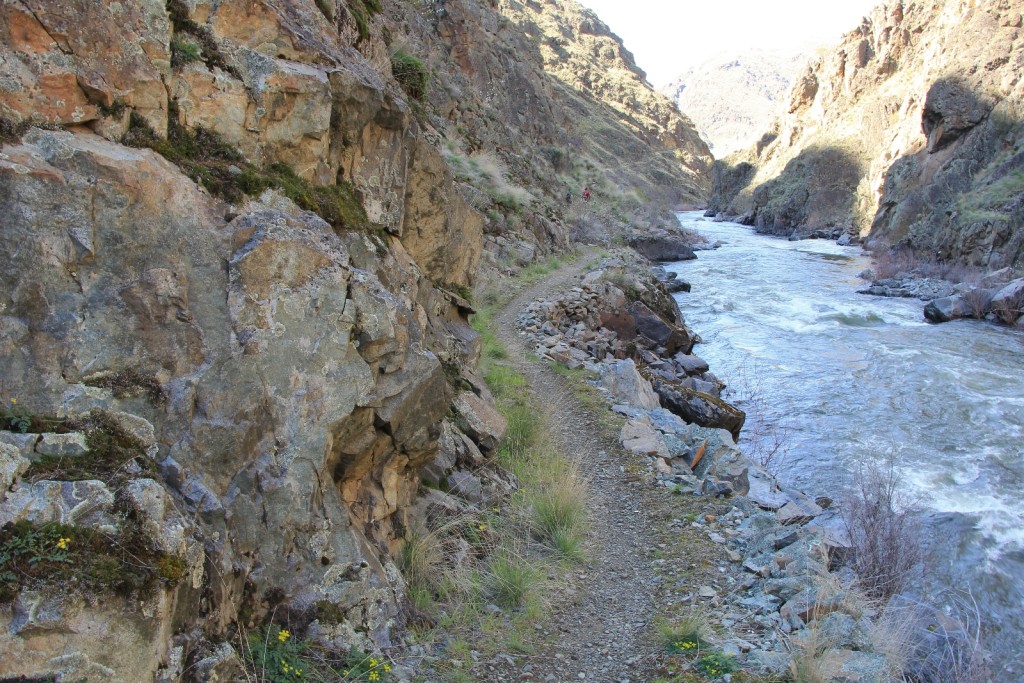
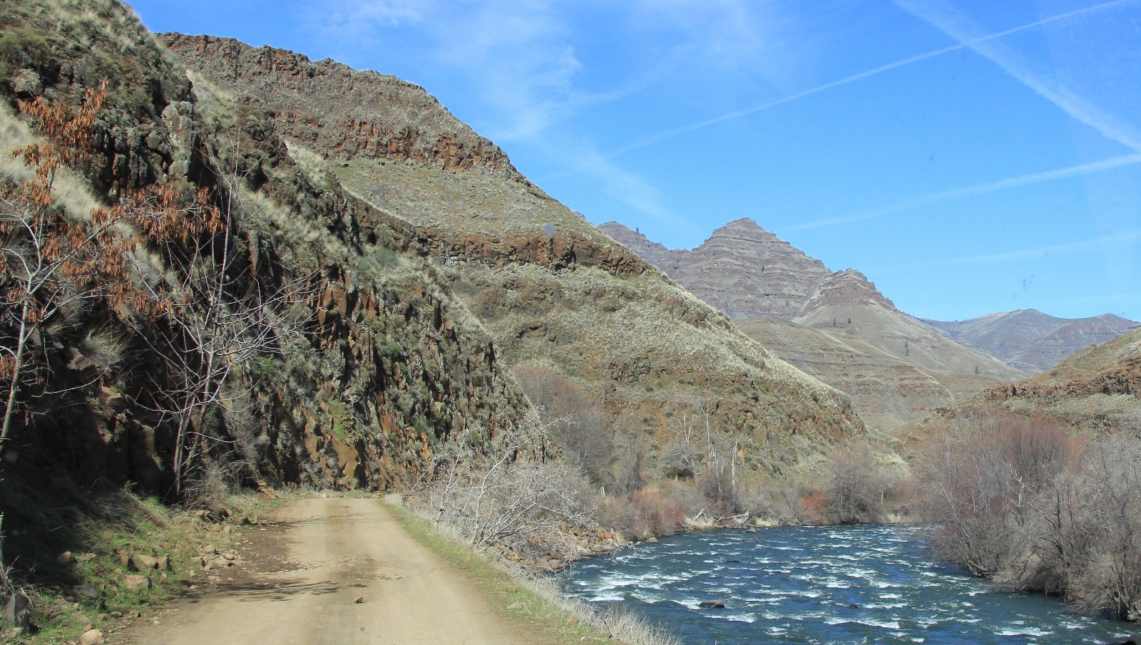
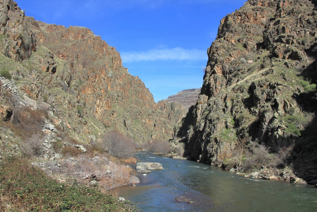
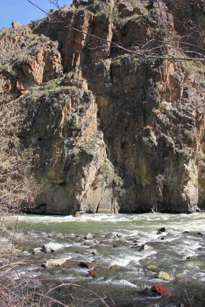
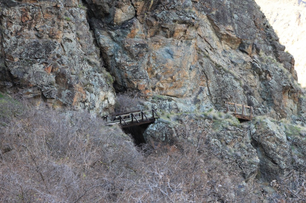
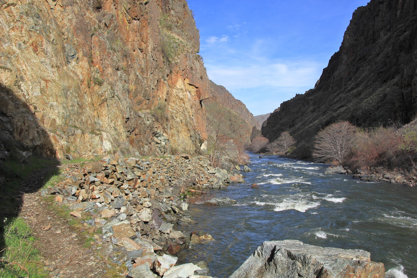
We made good progress considering my frequent stops for photos. The trail was flat with a mostly dirt surface which made for easy hiking. The CCC built this trail back in the 1930s and they did a really nice job. Large portions of the trail were built up on rock walls- a CCC trademark. Near the confluence with the Snake, we passed over three short foot bridges that were built to cross open cliff walls. Across the river we could see the opening to the Mountain Chief Mine which tunnels 740 feet through the mountain to an opening on the Snake River side.
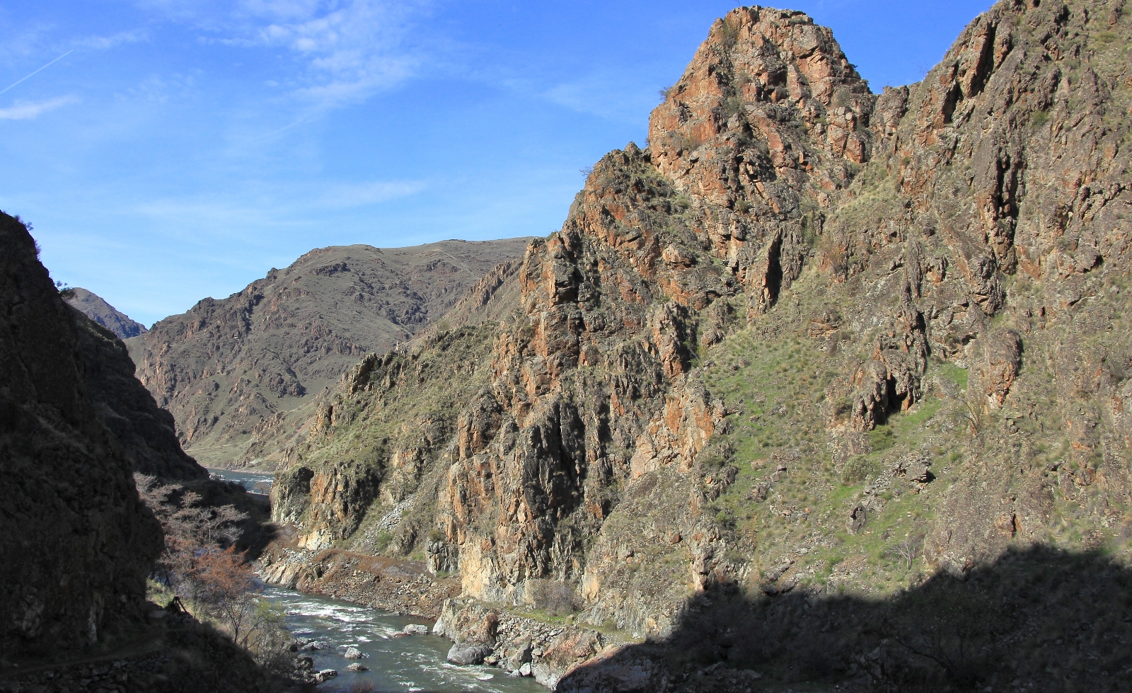
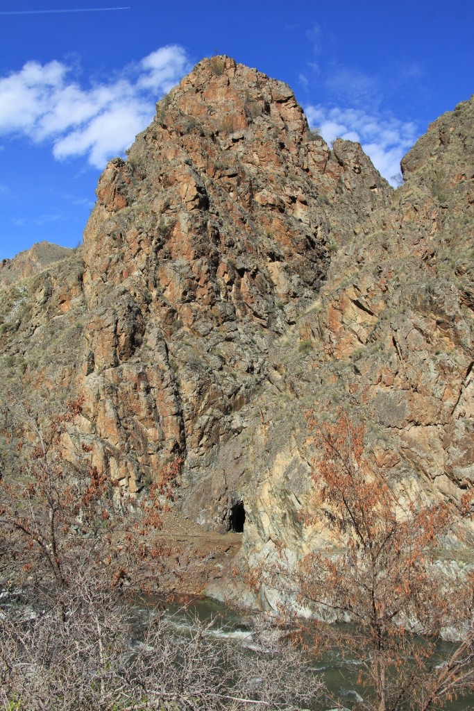
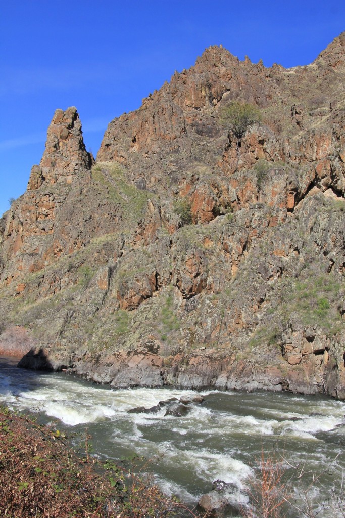
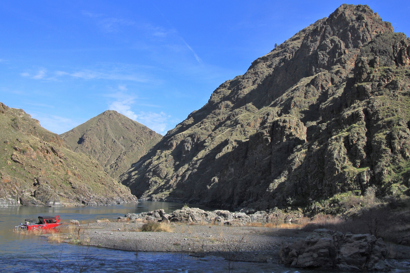
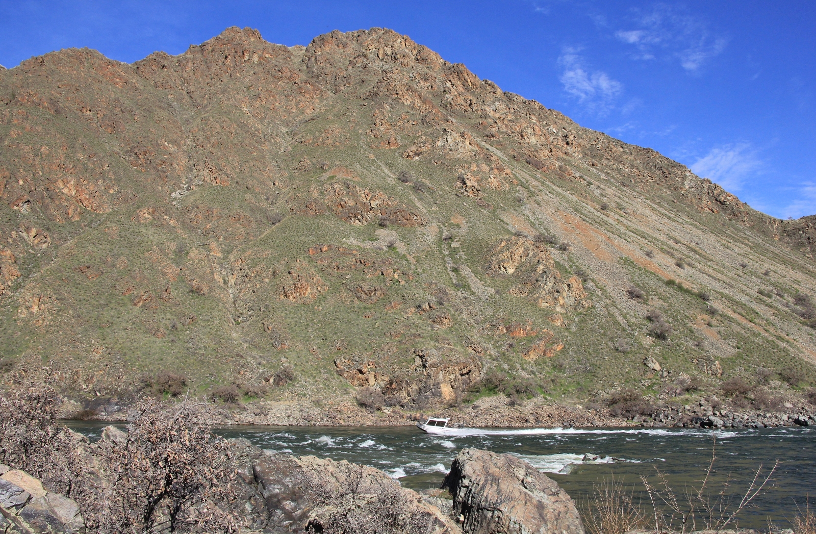
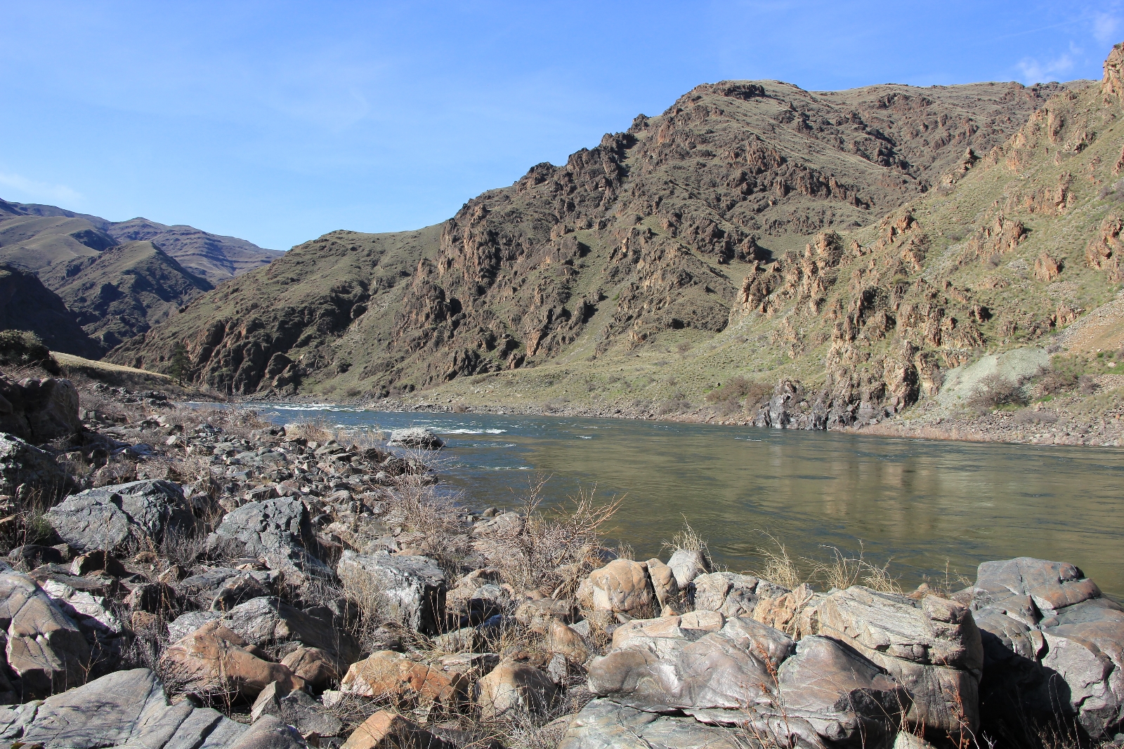
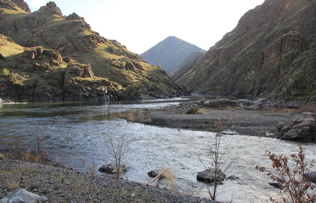
At 4.5 miles we dropped down onto the confluence of the Imnaha and Snake Rivers where we officially entered Hells Canyon. It was such a different experience arriving in this fashion compared to the three jet boat trips we had taken past here.
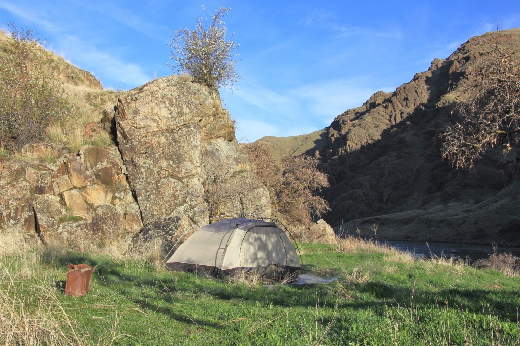
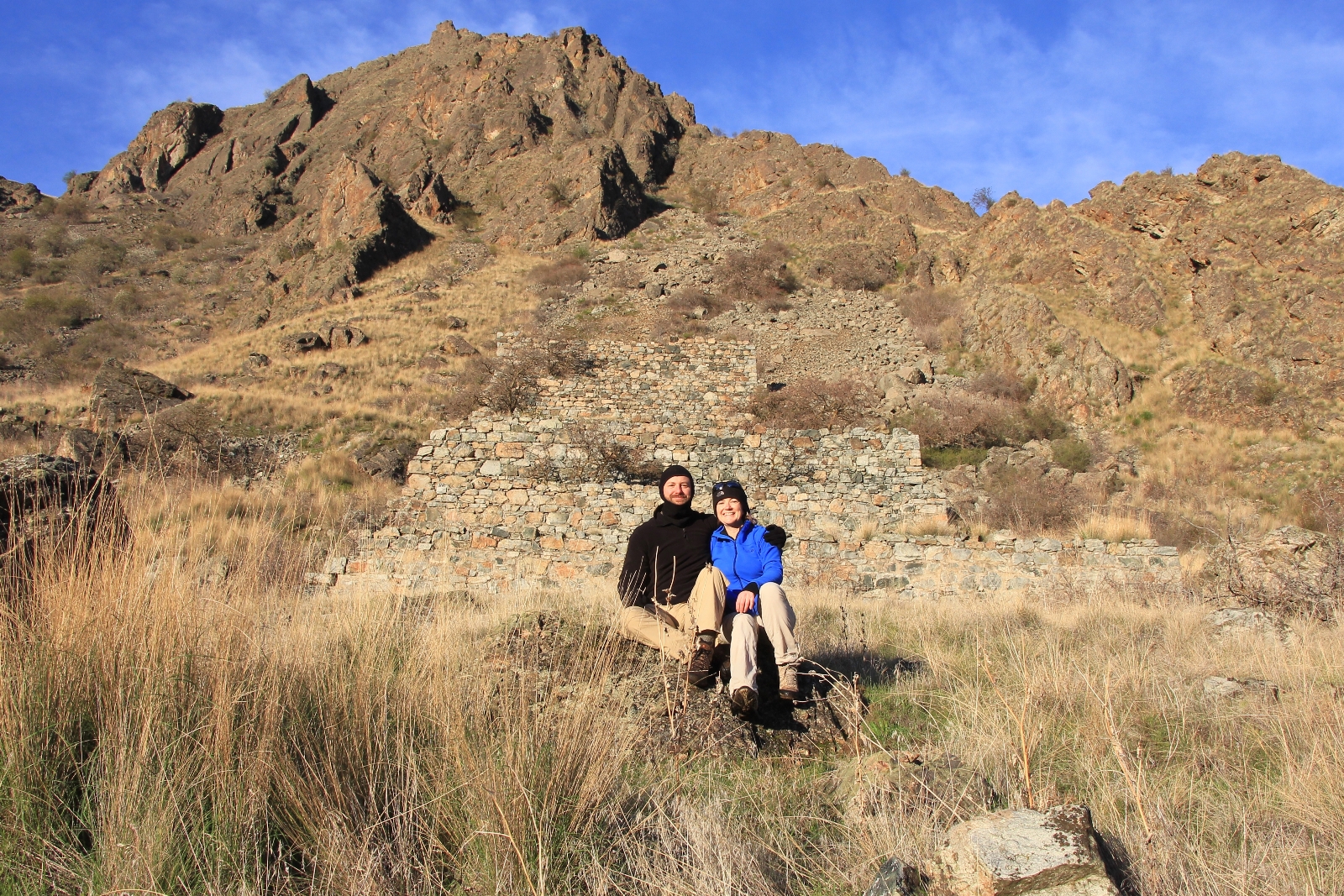
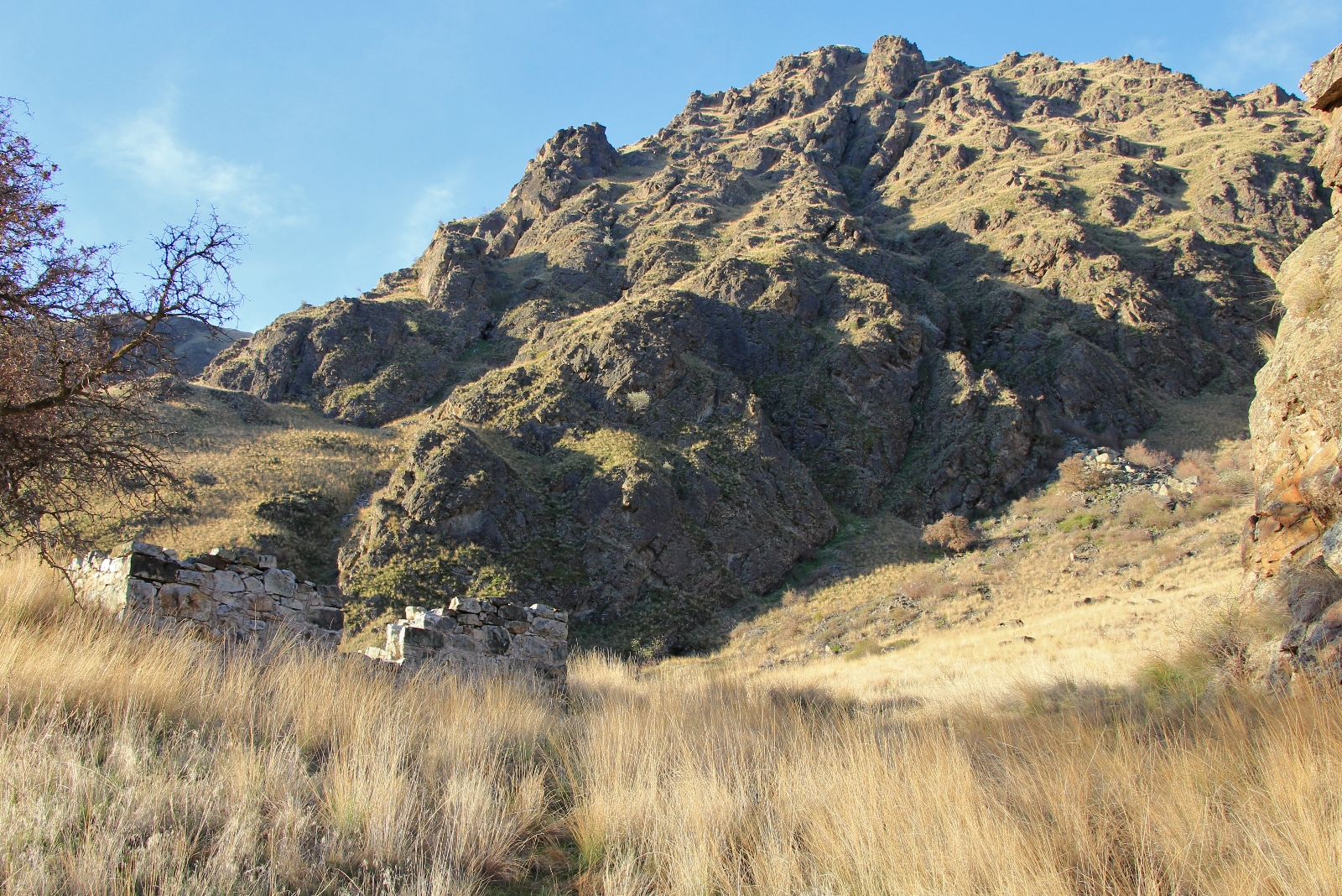
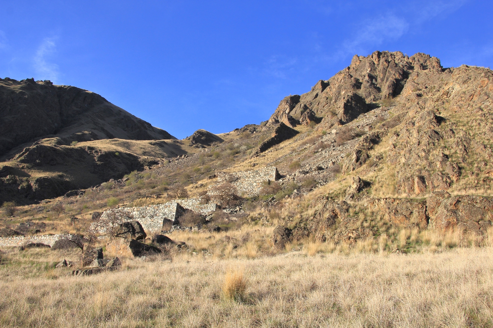
At the confluence we curved to the left onto Eureka Bar (elevation 972′) and made our way down the Snake River. We passed one group of 5-6 backpackers at the first campsite. We continued down river toward the Eureka Bar Mine foundations that tower up the hillside. We dropped our packs at a partial beach. This would make a fine campsite, but we continued a short distance to see if we could find a better spot. Just downriver we found the perfect spot on a bench above the river with a lush grassy area for the tent. Best of all, it felt very private.
By 3:45 we were setting up camp. Despite the remaining hours of daylight (sunset at 7:00), the sun had already set behind the steep canyon walls. With the added distance from scouting out a campsite we had hiked 6.25 miles. It had been an easy pack in and now we could settle in for a relaxing afternoon around camp.
Eureka Bar was a busy place at the turn of the twentieth century. Copper ore was discovered here in 1898 and a mining claim established. Access to the bar was difficult with the turbulent Snake River to navigate and no roads in. Despite the lack of accessibility, a settlement built up along the bar to support the copper mine. A wagon road was put in from Buckhorn Springs 10 miles and over 4,000 feet in elevation down Eureka Creek (then Deer Creek) to the town site allowing travel up to Enterprise, Oregon. A sawmill was established at Buckhorn which provided 350,000 board feet of lumber for the mine and camp buildings including a two story hotel, grocery store, and post office.
Meanwhile, the stern wheeler Imnaha was constructed to transport goods the 53 river miles from Lewiston, Idaho. Her inaugural voyage was June 30, 1903. It was quickly discovered that the ship would need to be pulled up through Mountain Sheep and Wild Goose Rapids via cables run through rings anchored into the cliffs along the shore. On November 9 of the same year, on just her fourteenth voyage, the Imnaha sank in Wild Goose Rapids. The stern wheeler Mountain Gem made a couple of trips, but activities in the area were already on the decline.
A mile and a half down Hells Canyon, HMPNP can be seen painted on the Oregon side. The High Mountain Sheep Dam was proposed at this site in 1958. The concrete barrier would have been 670 feet high and would have backed water up 58 miles, nearly to Hells Canyon Dam. The beautiful and wild Imnaha River Canyon that we had just hiked would have been underwater—an arm of yet another man made reservoir with a marina at the upper end. I believe the Pacific Northwest has enough of those. I’m glad we were left with a few wild and untamed rivers to explore.
We made ourselves comfortable at camp and read our Kindles for a while. We had purchased those around Christmas in anticipation of the 2016 backpacking season.
Dinner was a dehydrated meal of chicken and rice, a new flavor for us. It was of decent flavor and very filling. I also experimented with some mac and cheese. The previous fall I had tried the Mountain House dehydrated mac and cheese and thought it was disgusting. This trip’s experiment was to make good old Kraft mac and cheese using powdered milk and butter. It needed to be cooked a little longer and have a little more water left in, but it was a good start.
After dinner we read some more, enjoying the sounds and sights of the Snake River running just 10-15 yards in front of our campsite. We had two jet boats pass by shortly after we reached camp. Otherwise, the canyon was silent except for the sound of the river and birds.
Fading daylight and dropping temperatures chased us into our tent where we added our fleece layers and settled into our down bags. We had a nearly full moon which lit the canyon up until about 4:00 in the morning.
Sunday, our 24th anniversary and the first day of spring. We awoke early to cold, but moderate temperatures considering it was March. We stayed in bed until about 5:00. It was still pitch black when we crawled out of the tent, but we were ready to stretch and get some coffee. It was 36 degrees and everything was wet with dew. The moon had set and the sky was full of stars. We each enjoyed two cups of coffee while stargazing. Breakfast was an experimental instant oatmeal packet I had made with cran-strawberries and almond slivers.
We packed up most of camp and then decided to go explore a little before heading out. The morning light was hitting the mine foundations and I wanted to get an anniversary photo with those. Next we headed down the trail and found the cellar foundations for the old hotel. We continued a little further and noticed one other group camped down river.
We finished packing up and hit the trail at 9:00. For the first mile or so we hiked in the morning shade of the canyon. Temperatures were very comfortable and it was fine hiking conditions. Then we started transitioning into sun and it didn’t take long to strip down to our t-shirts. We had sunny conditions for the rest of the hike.
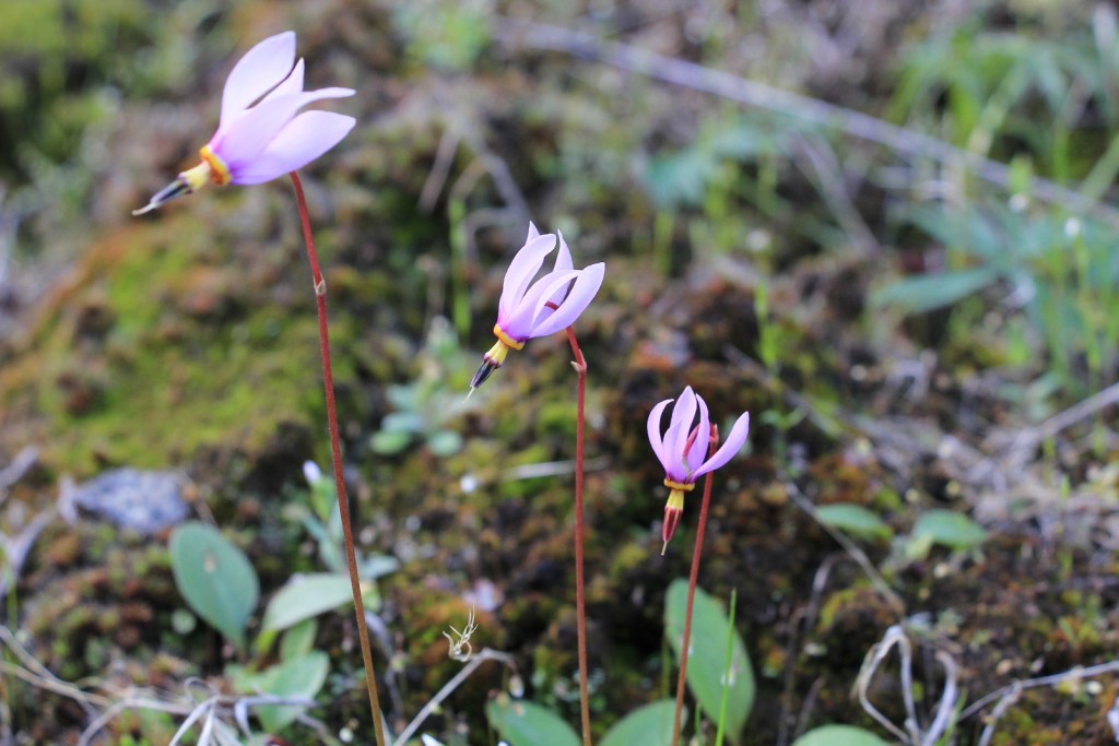
One of the highlights of the trip was seeing 3 river otters making their way downstream in the swift current. I also enjoyed seeing my first shooting stars and bleeding hearts of the year.
We had the trail to ourselves until roughly the last mile. Then we passed a couple groups of day hikers- one set of three middle aged women who inquired about the trail and another large group that appeared to be a big family.
We finished our hike at 11:30 with a temperature of 65 degrees and conditions just starting to cloud up. Including all our side explorations we had logged 12.75 miles. We couldn’t have asked for better weather on the pack or a better way to celebrate our anniversary.
We hit the road at noon and made the trip back to the town of Imnaha where we made a beeline for the Imnaha Tavern which has been in business since 1904. We had a good burger here and enjoyed a nice conversation with the owners. We’re hoping to make it back in June to drive our ATV up to Hat Point.
Directions to trailhead: Enter Joseph, Oregon on OR-82. At mid-town, following signs for Imnaha, turn east (left) onto Imnaha Highway. Drive 30 miles NE on good highway to the tiny town of Imnaha. Immediately after passing the Imnaha Tavern on the right, turn left onto Lower Imnaha Road. Follow this paved road 6 miles. The road will turn to dirt surface and will immediately being a steep climb- this is the beginning of Dug Bar Road #4260. Follow this single lane road for 13.5 miles. Portions of the road are switchback, steep, drop off, rutted, rocky, and/or full of large potholes. There are numerous pullouts, but you may need to back up if you encounter an oncoming vehicle. Arrive at the Cow Creek Bridge Campground and Trailhead where a bridge crosses the Imnaha River. We parked in the moderate sized lot to the left immediately before crossing the bridge. A spur trail here will lead you down the hill and to the main trail. At this time, no parking passes are required.
Got Gear?
Click here to see some of our tried and true gear. By accessing Amazon through the links on this page, you get the same GREAT Amazon pricing and they share a little with us. This helps us maintain evansoutdooradventures and is much appreciated! Thank you to our supporters!
Nice post. Good writing and photographs. Use “cattle ranches” instead of “cattle farms”. (Farms raise plants – ranches raise meat).
Thanks for stopping by Rob. And point well taken on ranch vs farm!
Thanks for this detailed report. We are thinking to hike this one day.
Patrick, I hope you do. It is a wonderful hike! Thanks for visiting.
We made this hike a few years ago on memorial weekend. The poison Ivy was intense but otherwise it was a great hike. We were surprised when we reached the trail head to find a Toyota Prius had made the gnarly trip there as well. Last year we finally made it to hat point lookout and it is worth the trip! Thanks for the post and pics, I hope it encourages others to hike this trail.
Hello Erin,
Thank you for sharing about your trip. I think your term “intense” to describe the poison ivy is quite accurate! Jason had hiked the trail with his brother and nephew over Memorial Day a few years earlier and they described it as “a jungle” of poison ivy. That made me intimidated to go, but I was determined because of the few photos they brought back. It helped going so early in the season- the ivy was still there, but at least it wasn’t leafed out yet. We could easily identify the stems and berries- which were everywhere in some stretches! So glad I went though. The canyon is way more impressive than the Grand Canyon (in my humble opinion) and without thousands of tourists!
As for the Prius, I’m always amazed by the vehicles we see on roads like this. Frankly, I’m impressed a Prius had the power and clearance…kudos to the driver if they actually made it in and out without destroying their car. I was amazed at the pull trailers we saw down along the river before arriving at the TH (I think we were there during peak spring steelhead season). How anyone navigated those hair pin corners and steep descents with a full sized travel trailer is beyond my comprehension!
Happy trails,
Lusha
Lusha, I absolutely love your writing, and I really enjoyed the photography. Thank you for taking the effort to tell us about your (you and Jason) adventures. I hope you never stop for I predict many more adventures in your future.
Thank you Tom. The Imnaha is a hidden gem in our area. Not many people know about it other than seeing its confluence with the Snake on the jet boat tours. The lower Imnaha Canyon is more beautiful than anything we’ve seen in Hells Canyon- shhh, don’t tell! 🙂
Lusha