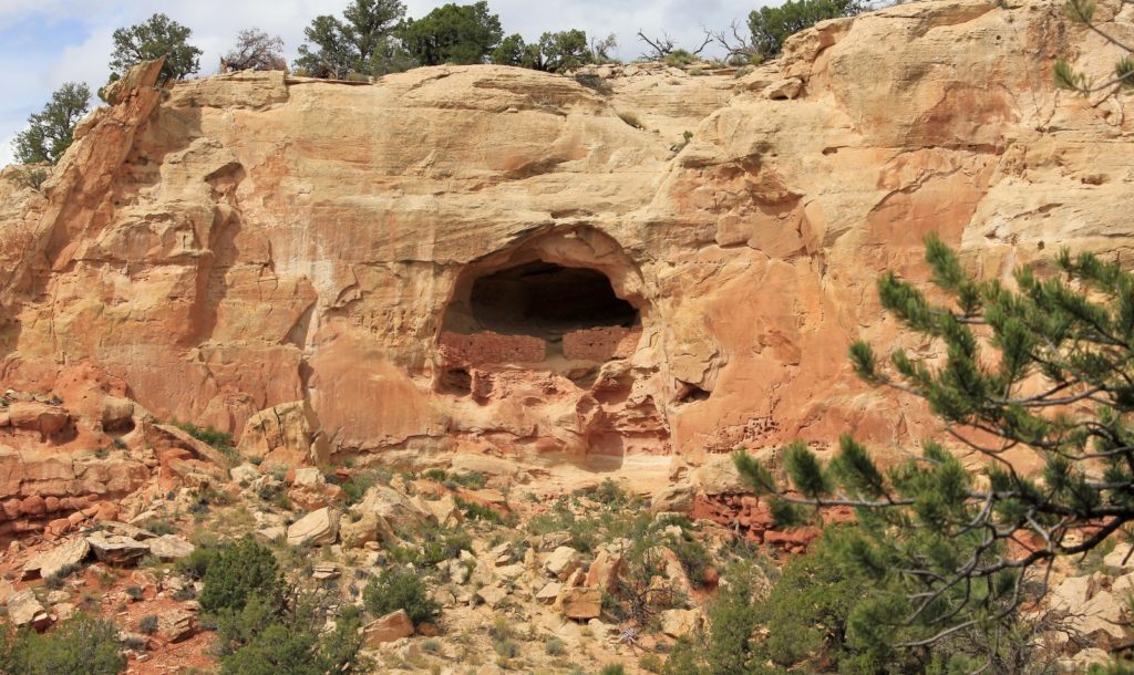
Scenic trail to numerous Anasazi ruins dating back to the 1200s
Distance: 7.75 miles round trip
Type: loop
Difficulty: moderate
Best season: spring and fall
Despite all the obstacles we’d encountered while planning our fall 2013 vacation (see previous posts), our “hiking around the government shutdown” vacation had been going splendidly. We had already enjoyed four days of beautiful weather and great hikes in SE Utah. Two days were spent hiking the Amasa Back trail and a loop hike around Dead Horse Point State Park near Moab, followed by a day hiking down into Grand Gulch, followed by a day exploring some lesser known ruins on Cedar Mesa.
Wednesday morning we checked out of our Bluff, UT hotel and headed east on highway 162 following the San Juan River. We passed through the tiny community of Montezuma Creek and then turned onto McElmo Road at Aneth. McElmo wound and bounced us through 27 miles of pretty desolate looking area. Somewhere near the UT-CO border, the scenery began to change. We started seeing hay fields and things were pretty green. Small farms and more traffic started to appear, a stark contrast to the desolate Utah side.
We pulled into the well-marked Canyons of the Ancients National Monument Sand Canyon Trailhead on the left. The parking area which was really just a big slab of slickrock. There was only one other car there and the information board said nothing about the TH being closed due to the government shutdown (likely it was, but no one had bothered to sign it since it is in such a remote area) so we grabbed our gear and set off.
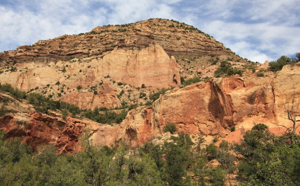
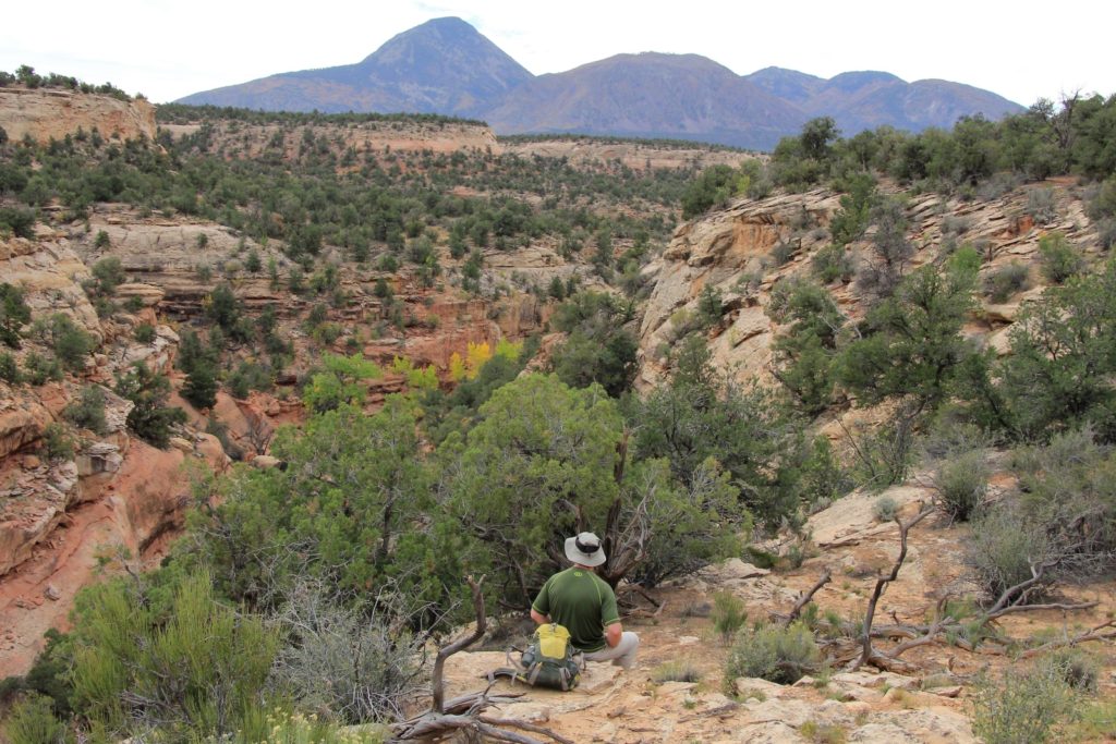
We had woken up to sun in Bluff, but this was forecast to be a transition day. By now the clouds were moving in and we had mostly overcast conditions as we set off. We would end up with some nice sun breaks during the second half of the hike, but overall I was disappointed with the lighting for most of my photos that day.
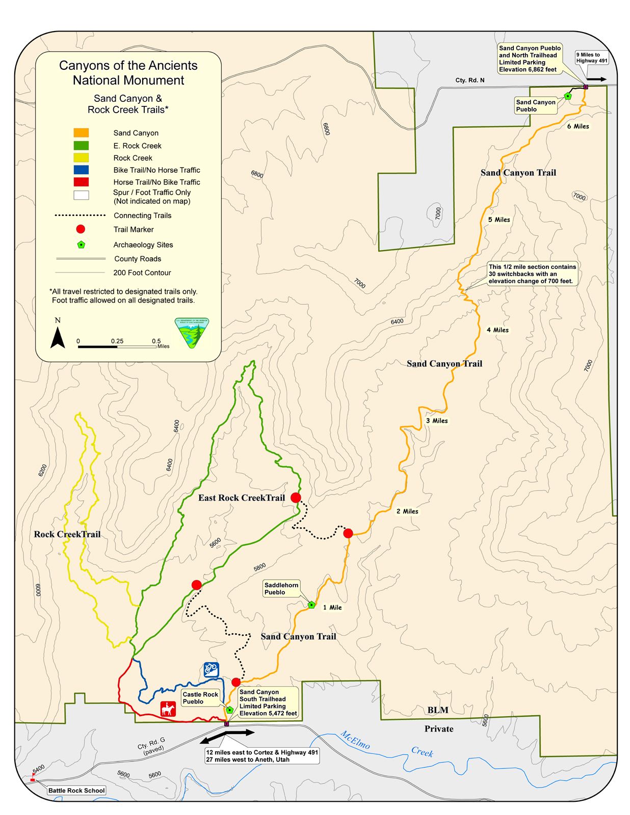
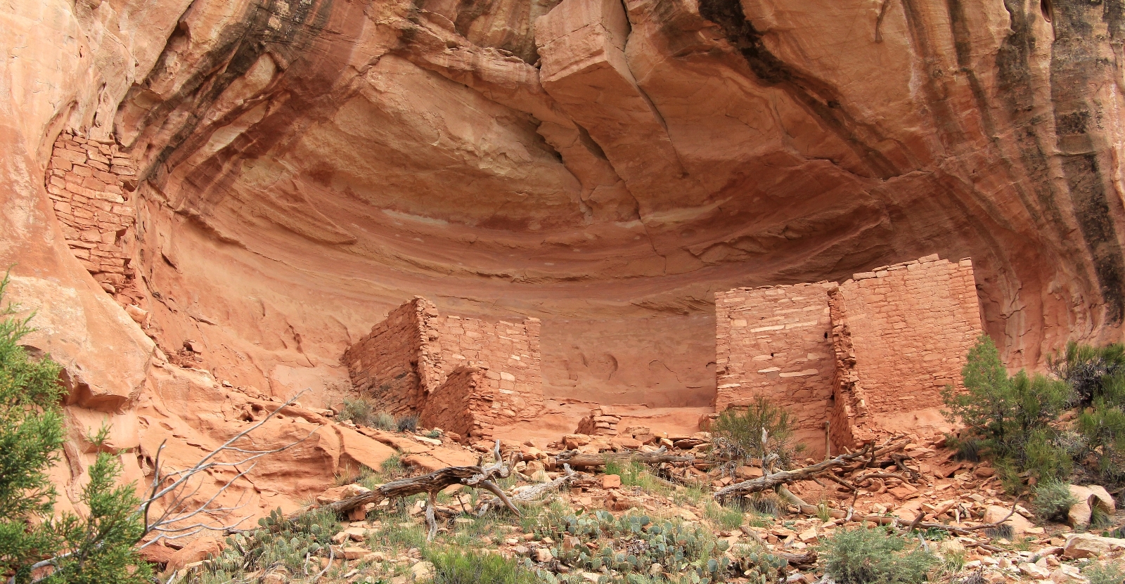
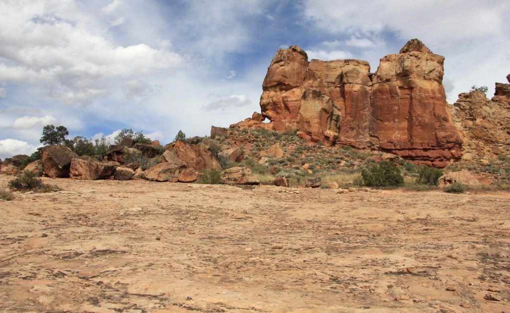
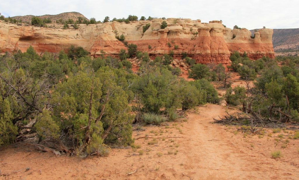
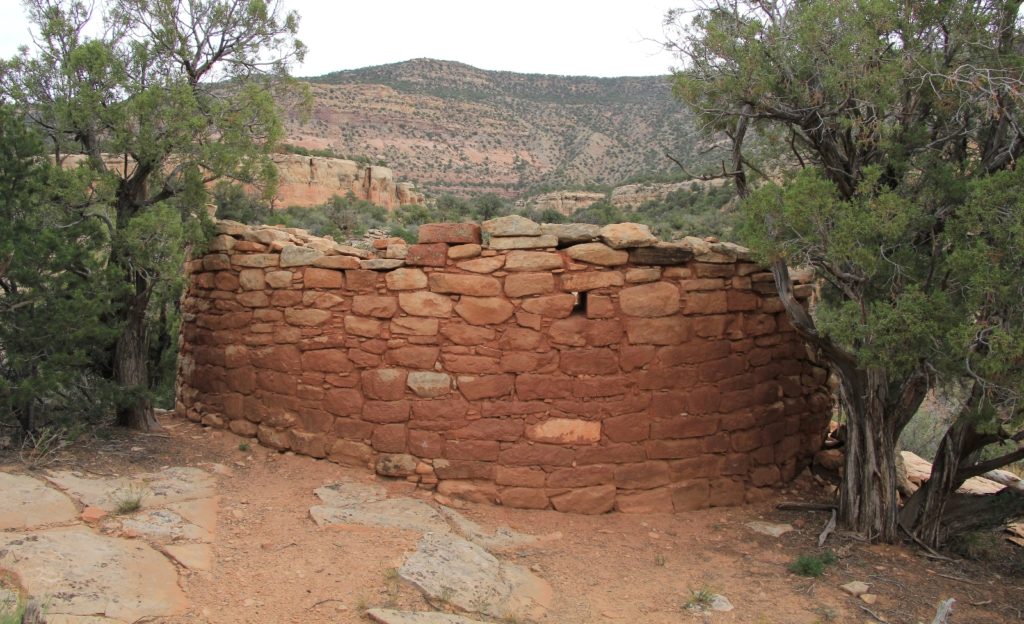
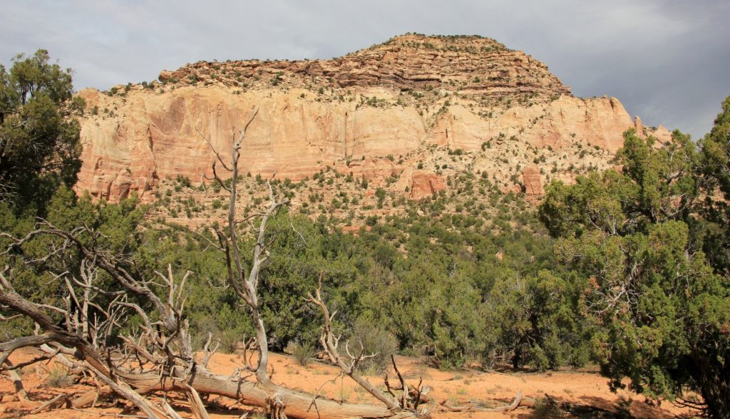
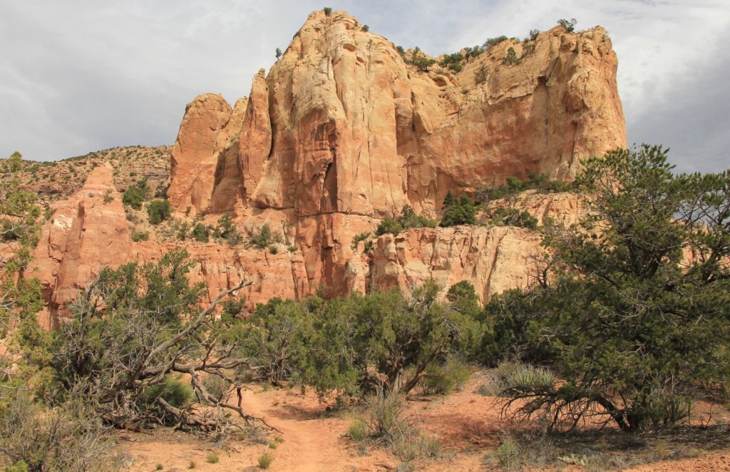
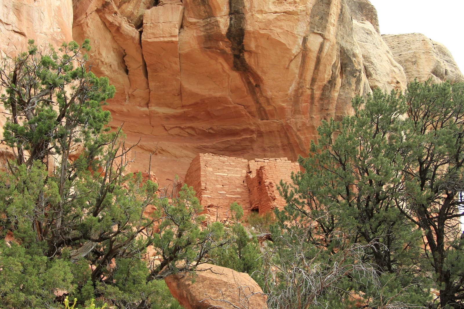
The trail climbed up over a gentle grade of slick rock and made a split. We took the split to the right which took us up Sand Canyon. Sand Canyon was amazing with eight ruins in the first 4 miles. Behind us were nice views of Sleeping Ute Mountain. We hiked until we reached the last set of ruins, then turned around and retraced our steps 2 miles until we reached the well-signed cut off trail to the right that would take us over to the East Rock Creek Trail.
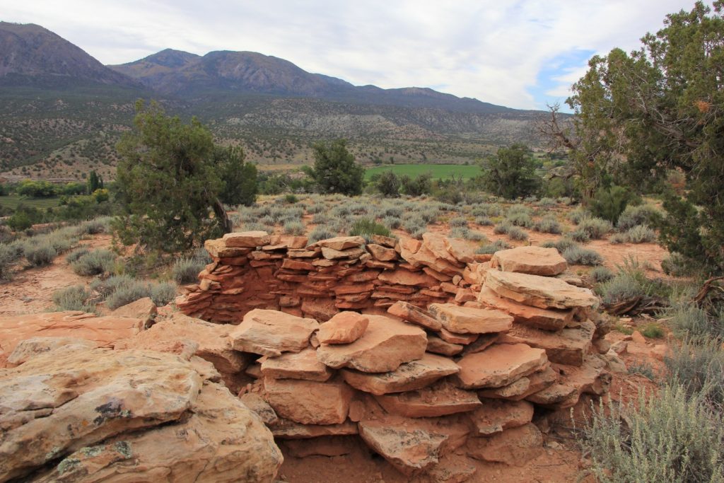
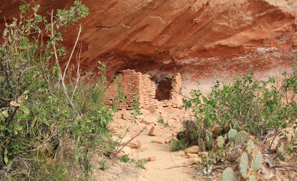
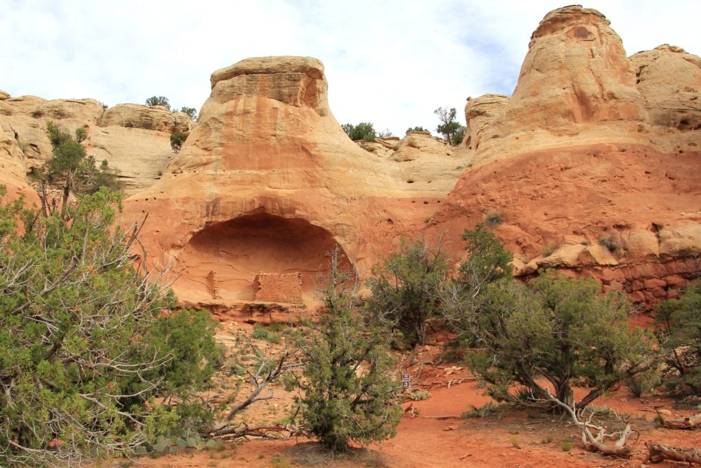
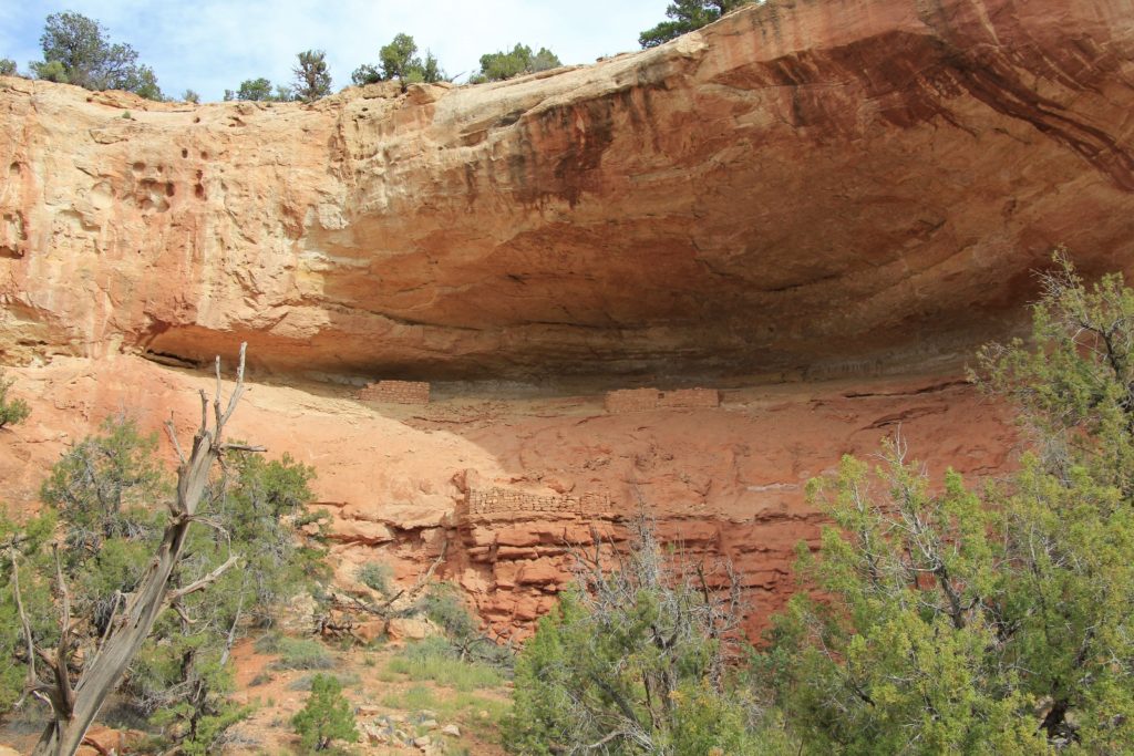
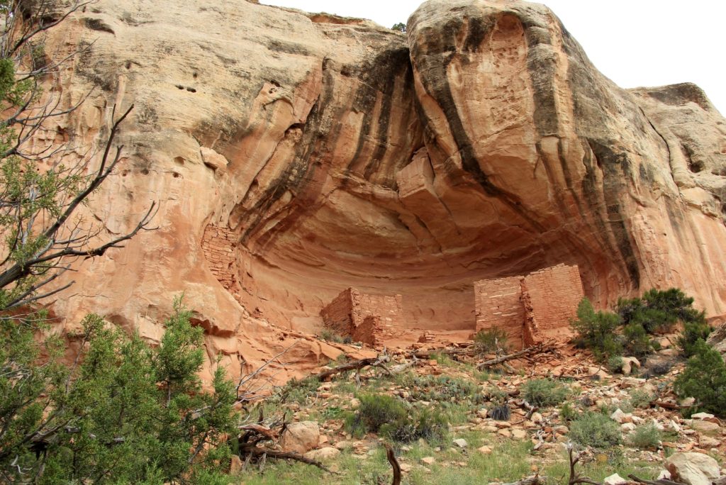
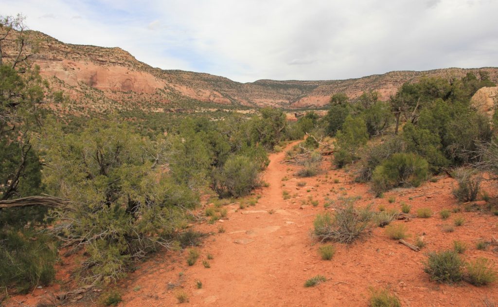
We began with a climb up and out of Sand Canyon followed by a descent down into East Rock Creek. This stretch was unexciting until we came around a bend and passed four more ruins in lovely alcoves before returning to the trailhead. We didn’t see any other hikers until we were over half way through the hike. We then passed a handful of hikers and mountain bikers within a few minutes and then didn’t see anyone the rest of the hike.
After the hike, we made the 12 mile drive east to Cortez. It was a pretty drive and Cortez seemed like a nice little busting town. We checked in at the Best Western and asked the front desk woman if she had any good recommendations for dinner. She highly recommended The Pepperhead if southwestern food sounded good—always!!
What a great recommendation Pepperhead was! The flavors were very different than anything we have here in SE Washington. We both had the carnitas. The plates were generously sized with a small scoop each of rice and beans, a generous scoop of sour cream, guacamole, fried onions and peppers, and about half a plate worth of meat. I couldn’t believe how much meat they gave us for the price. Jason barely finished his and I couldn’t eat all of mine. With tip and drinks our dinner was only $35. If you are near Cortez, Colorado, I highly recommend you give this gem a try.

As the evening progressed, the weather system that we were expecting hit. By bedtime it was pouring rain, wind, thunder, and lightning.
Directions to trailhead: Head south of Cortez on Highway 491. Turn right (west) on County Road G at the signs for the airport and/or Hovenweep National Monument. Go 12 miles on this paved road. Trailhead parking is on slickrock surface on the north (right) side of the road.
I especially enjoyed this.
I’ve been thinking of spending the first summer of retirement in south west Colorado.
Your beautiful photos peaked my interest.
wow!
Thank you Tom. We have many places in SW Colorado we’d like to visit. Such a beautiful area! When you go, be sure to have dinner at Pepperhead in Cortez. Fantastic food!