Lovely forest hike that visits two waterfalls in the greater Spokane metropolis
Distance: 7.5-8.5 miles round depending on where you park
Type: lollipop
Difficulty: moderate with 1,350′ elevation gain
Best season: spring to fall (I recommend May when the wildflowers are in bloom)
By May, temperatures are starting to warm up and we’re itching to get into the mountains of the Inland Northwest. One little problem—our mountains are typically buried in snow until June or July. Until then, the Liberty Lake Loop on the outskirts of Spokane, Washington provides a nice forest ramble. Hikers pass two waterfalls and climb just enough in elevation to feel like they’ve earned a good cheeseburger afterward.
The trail starts near the campground at Liberty Lake County Park at 2,062’ elevation (click here for trail map). The lower stretch of trail follows an old single track road and leads through a marshy area with a lot of beaver activity. At 0.3 miles the trail splits, starting the loop portion which can be hiked in either direction. We passed the trail to the right and continued straight, hiking the loop in a clockwise direction.
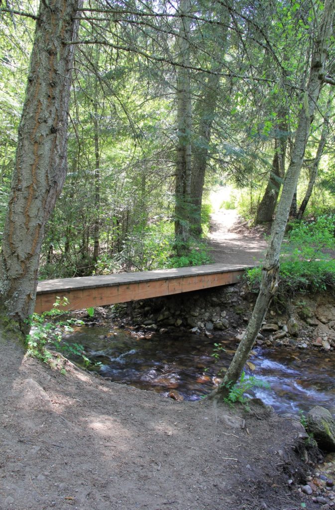
At about a mile in, the trail splits again. The trail to the left is Split Creek and to the right is Liberty Creek (see map). The trails join back together after almost a mile, so follow whichever trail looks more appealing. Either way, the hiking is easy and any stream crossings will be over nice footbridges. The trail climbs gently as it travels along Liberty Creek. By now the forest is thick with pine, fir, hemlock, and cedar.
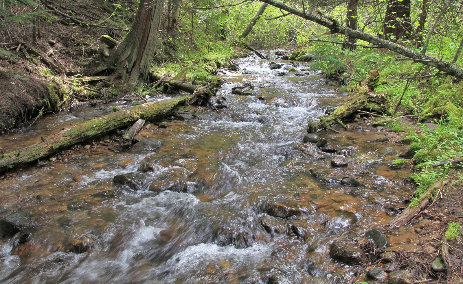
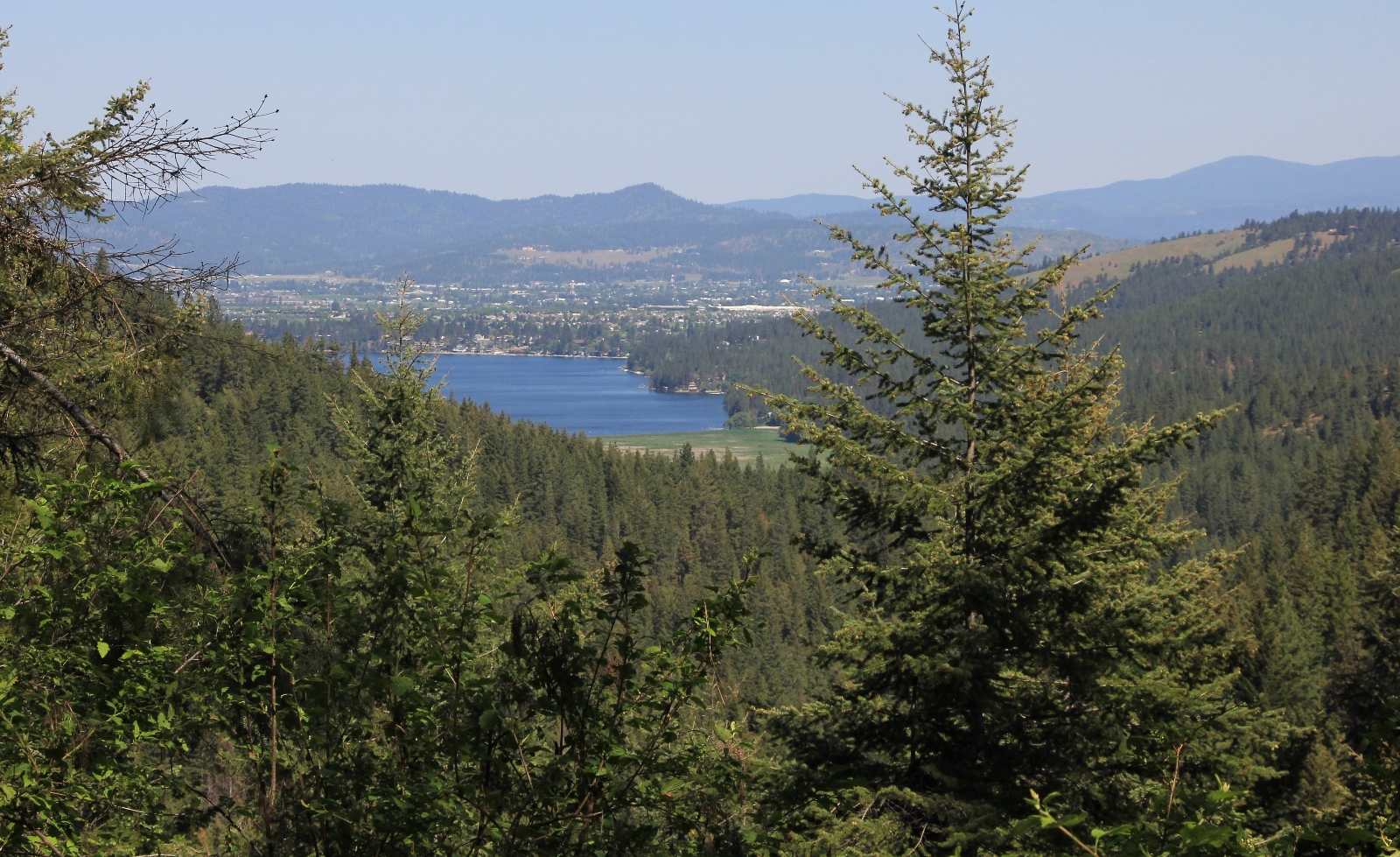
You will likely meet a lot of traffic along this lower stretch of trail due to the close proximity to a popular county park and the easy walking. This changes at a little over two miles in when the trail passes by a cedar grove, crosses a footbridge, and immediately begins a stiff ascent. As you climb eleven switchbacks up the hillside, a nice view of Liberty Lake comes into sight. The climb moderates after about a third of a mile and it is easier hiking for about half a mile before making a final climb to the first waterfall.
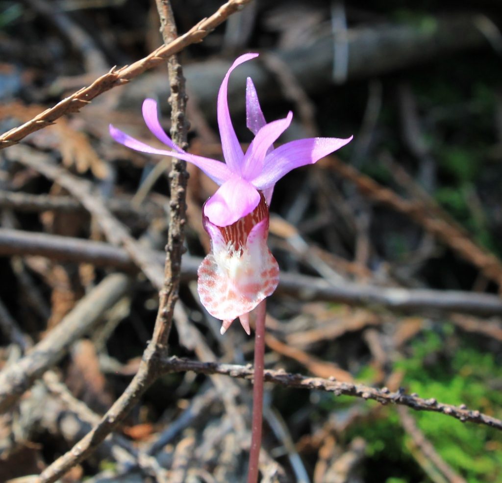
The first waterfall is located at about three miles from the trailhead after a roughly 800 foot climb. This is a nice little cascade and I found some fairy slippers here. In our experience, most who make it this far will now turn around, making this a 6.2 mile out and back hike. I highly recommend continuing on.
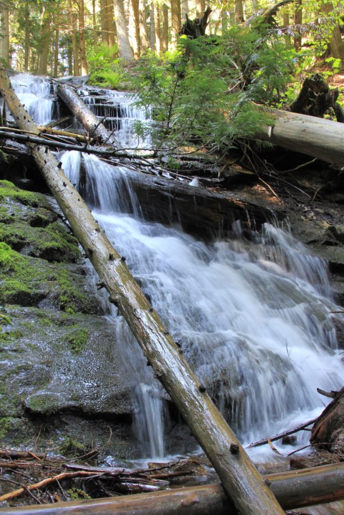
From the first waterfall, the trail climbs another 400’ over the next half mile. Keep an eye out to the right for glimpses of another waterfall. Above these falls, the trail passes over the stream on a nice little footbridge and then climbs a bit more before crossing an old roadbed and topping out at Camp Hughes Cabin, elevation 3,250’.
![]()
Camp Hughes Cabin is a small structure used by local Boy Scout troops. At 3.7 miles from the trailhead, it makes a great spot for a snack break. There is an outhouse nearby, but it was in such foul condition that I elected to water a nearby tree.
From the cabin, it is an easy return hike. Standing with your back to the front of the cabin, you will turn left down the Edith Hanson Riding Trail which quickly joins an old road bed (go left here). From here it is a mostly gentle descent along good trail. There is an unsigned trail and then unsigned road that both come in from the left, continue straight ahead at both of these intersections.
At 3.2 miles from Camp Hughes Cabin, the trail bottoms out and comes to a junction. Turn right here along the Edith Hanson Cut-off Trail. You might have a difficult time keeping dry feet along the cut-off trail as this area can be quite marshy. We had a wet crossing here in 2013, but dry in 2016. After a couple tenths of a mile you will join back up with the trail that you started on, completing the loop portion of the hike. From here is it just 0.3 miles back to the trailhead parking lot near the campground.
![]()
Directions to trailhead: from Spokane, WA, head eastbound on I-90. Take Exit 296 -Turn right (south) onto N. Liberty Lake Rd -Turn left (east) onto Sprague Avenue for 1.1 miles -Continue onto Neyland Ave for 0.8 of a mile -Keep right and continue on Neyland -Turn right onto Lakeside Road for 0.7 of a mile To Main Parking Lot: -Turn right onto Zephyr Road and continue into the park. There will be a large parking lot to your right, this is for the swimming beach. You can park here, but it will add to your mileage total. Instead, continue straight ahead following signs for the campground. Soon you will see the trailhead parking lot to your right. Drop down the hillside and then turn left onto the trail.