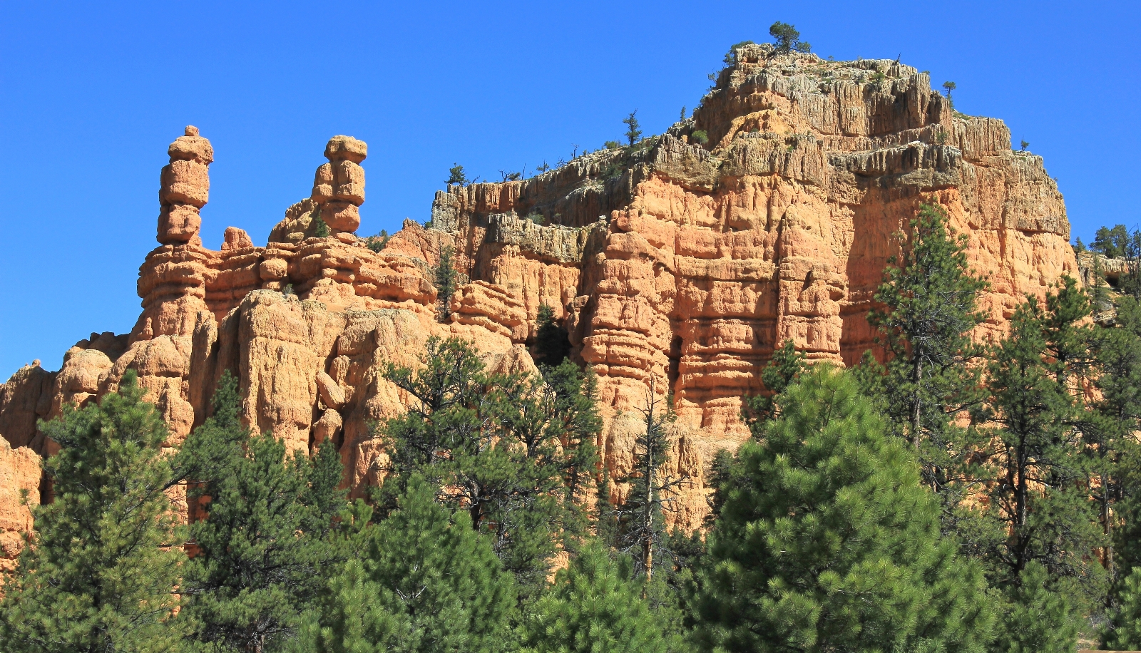
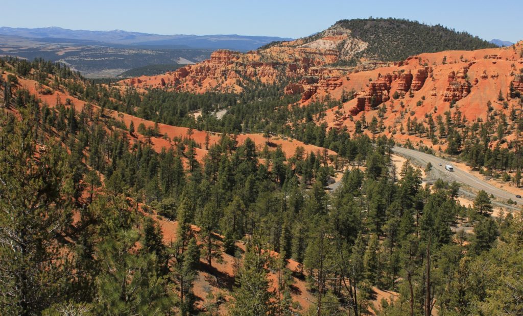
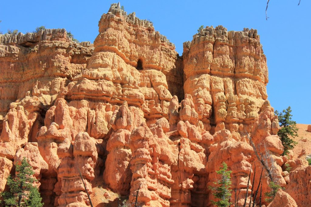
Colorful hoodoos every bit as impressive as Bryce Canyon National Park but without the crowds.
Distance: 5.25 round trip
Type: loop
Difficulty: moderate with an estimated 1,000 foot elevation gain
Best season: spring and fall
Roughly thirty years ago, my family made a quick stop at Bryce Canyon National Park and nearby Red Canyon on our way to Texas. The brilliant red colors and fantastical shaped hoodoos captured my imagination. The following day we visited the Grand Canyon and I couldn’t help but be disappointed—it didn’t seem very grand compared to the red rock country of Utah. In 2010 Jason and I visited Escalante, Moab, and Cedar Mesa and so fell in love with the area that by April 2017 we were making our ninth trip.
We hadn’t planned a spring trip to Utah, but after a record wet winter and early spring in the Inland Northwest we were ready for some warmth and sun. Thirteen hours into our drive we passed through Red Canyon on our way to Escalante. Our legs were needing a good stretch and we had a few hours for a short hike. Red Canyon was a logical choice since we were driving right past the visitor center. We decided on the Golden Wall-Castle Bridge- Buckhorn trails loop which we had hiked in 2012. It was just the right distance for our allotted time, is highly scenic, and we likely wouldn’t see anyone else. I still have some Red Canyon trails on my bucket list and my policy is generally against re-hikes in Utah until that list gets smaller; however, the loop was the perfect fit for the afternoon.
Back in 2012, we were hiking Red Canyon for the first time. I inquired at the visitor center to see if combining the Golden Wall, Castle Bridge, and Buckhorn trails would make a nice loop trail. The friendly volunteers told us this was their favorite in the area and that we likely wouldn’t see anyone else. They were right. The scenery and solitude were superb. My trail journal from that visit states, “a spectacular hike that would be well worth repeating”.

We arrived at the Red Canyon Visitor Center (elevation 7,150’) around 1:30. It was the Thursday before Easter weekend and the pullouts were packed with tourists snapping photos. It never ceases to amaze me how many people stop for a few photos and then continue on without spending more than ten minutes in the canyon. I guess it shouldn’t surprise me considering Bryce Canyon National Park is just up the road, but Red Canyon is worthy of so much more.
The sun was out and the temperature was in the upper 60s—absolute heaven after one of the worst winters we’ve experienced. There are a couple places to begin this hike. We parked at the visitor center, crossed highway 12, and then turned right onto the paved bike path.
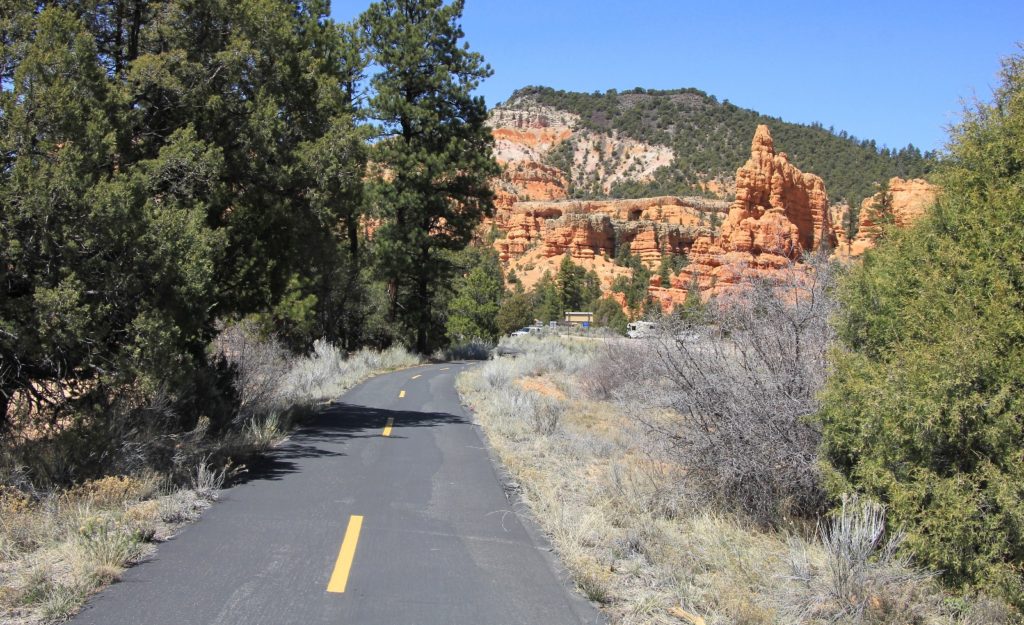
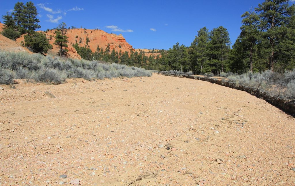
After walking a short distance along the paved path, we turned left onto the well signed Golden Wall Trail. There is a pullout and some parking here if you’d like to use this as your trailhead. We immediately crossed a wash and continued up the trail (warning: this wash will flood in heavy rains). Almost immediately we passed a couple families and then we had the rest of the trail to ourselves.
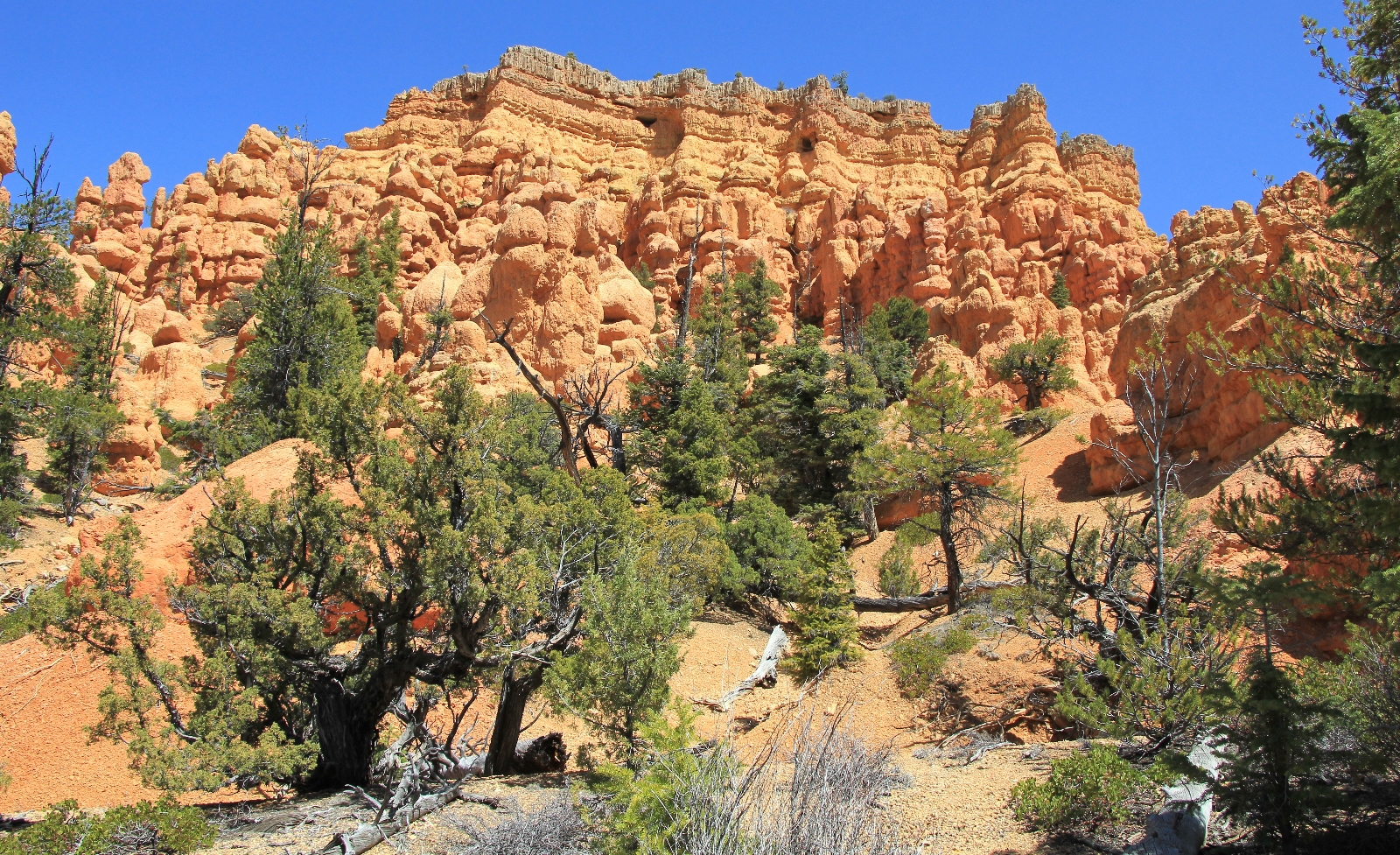
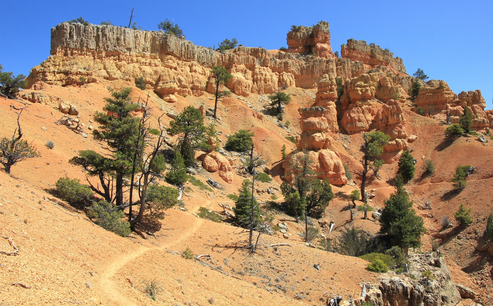
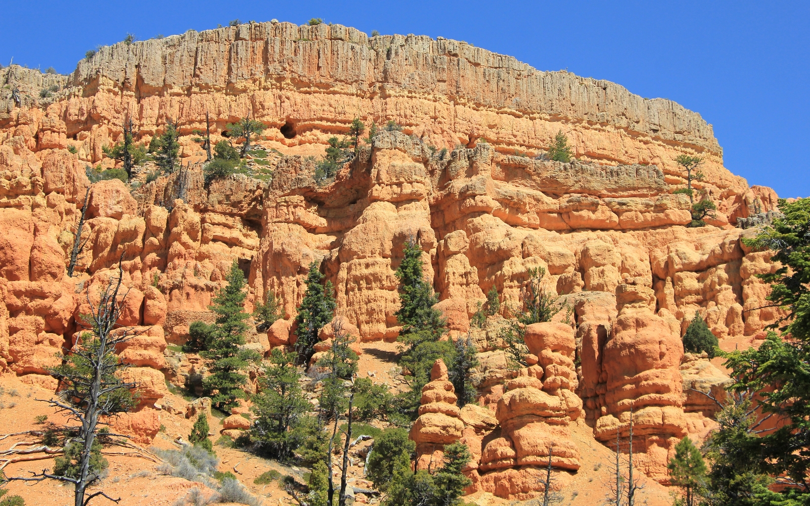
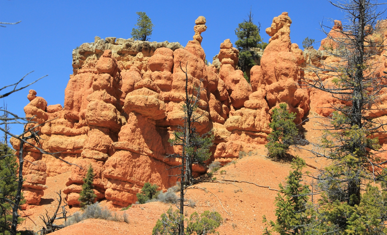
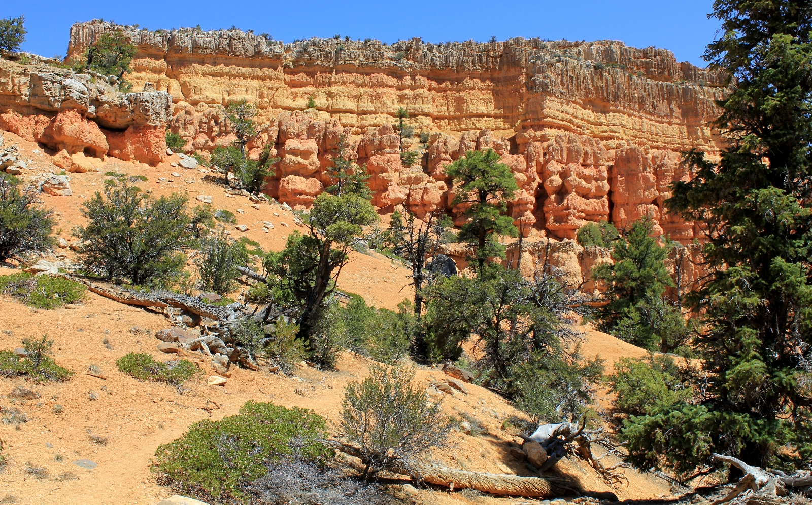
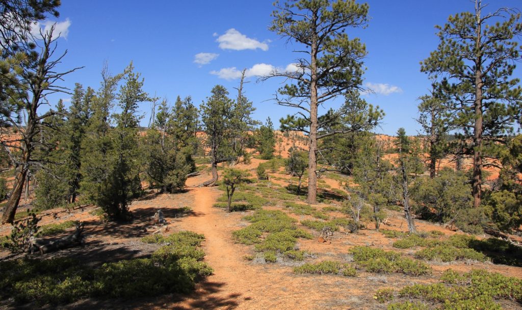
The first stretch Golden Wall follows alongside a wash. The scenery is pretty pedestrian here and I think a lot of people turn around thinking it isn’t worth the effort. This is a mistake as the scenery rapidly improves. Within about a quarter mile hoodoos begin to appear alongside the trail and the mixed conifer forest is quite lovely.
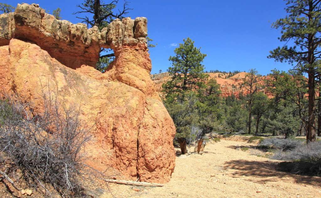
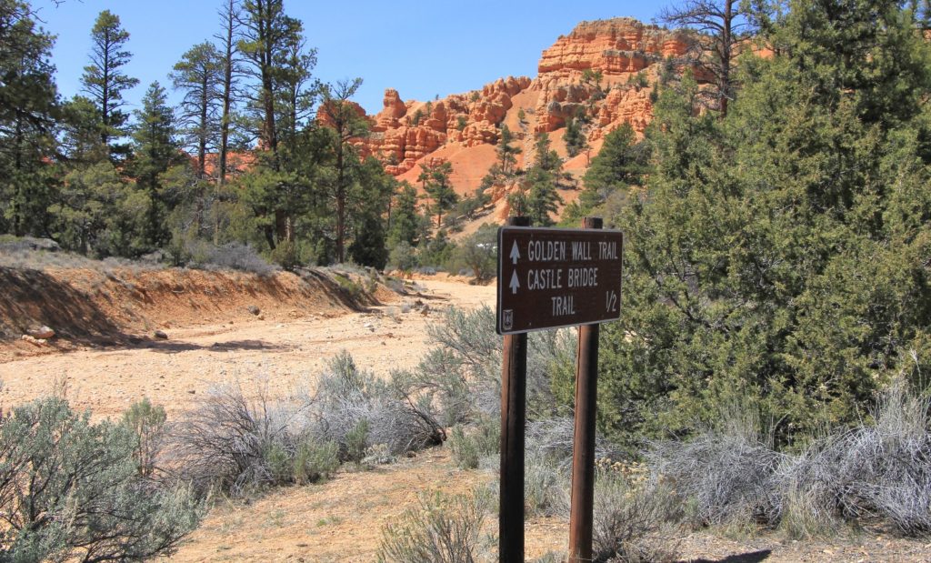
Half a mile from the paved path we arrived at the Golden Wall-Castle Bridge trail junction. The two trails merge back together later on, so you can take whichever route you’d like. We’ve never continued up Golden Wall, but my guess is it’s an easier trail (although I can’t imagine its scenery could compare to that on Castle Bridge).
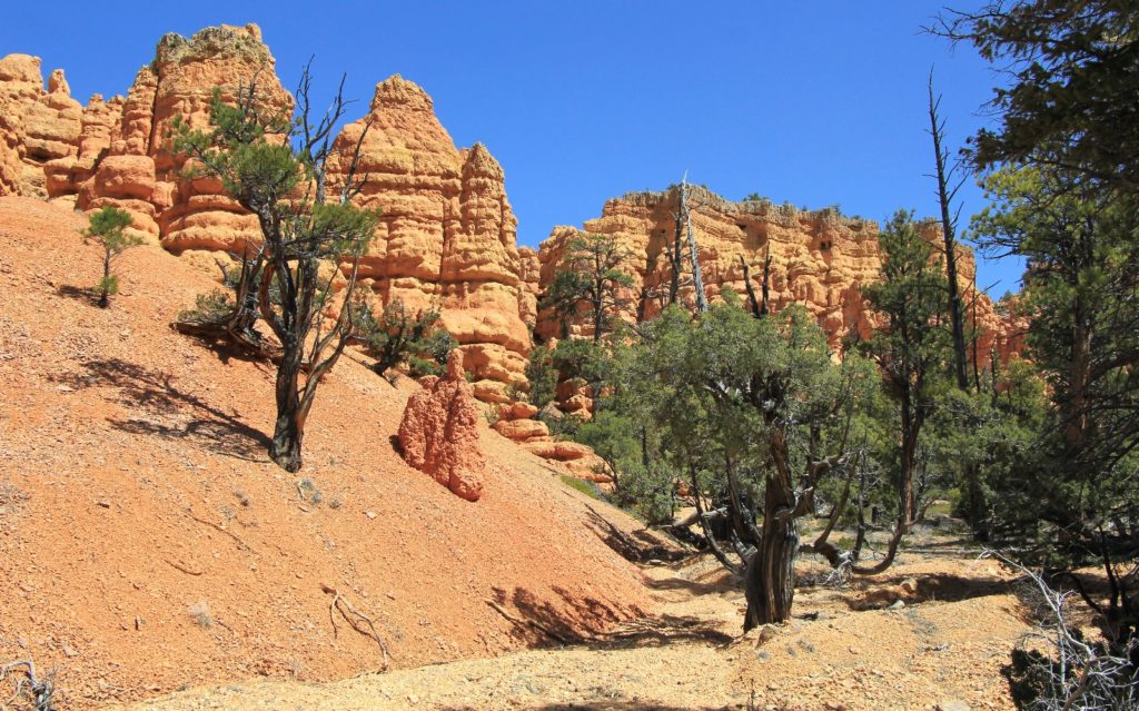
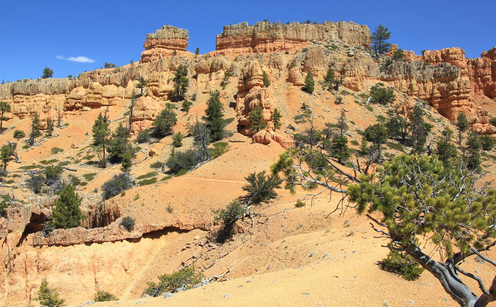
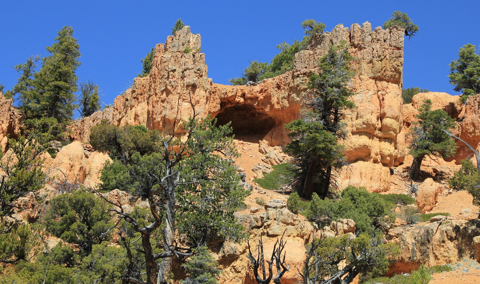
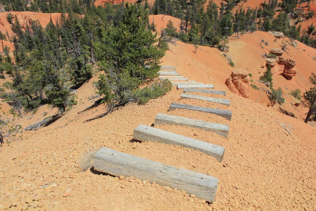
We turned left onto Castle Bridge and started to climb. At over 7,000 feet elevation, Red Canyon is significantly higher than our home elevation of 2,500 feet. It didn’t take long before I was breathing heavy. The good news is this trail has bountiful photo opportunities which double as chances to stop and catch your breath! The views improve dramatically with each progressive step up the trail.
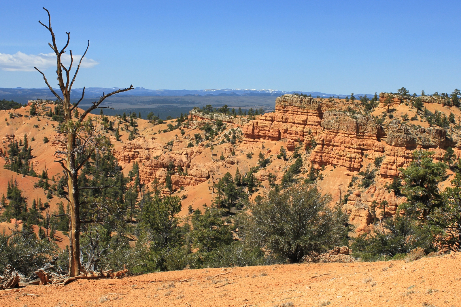
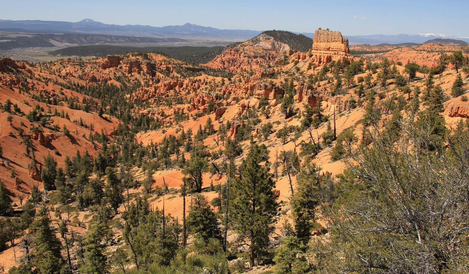
At the first top out, we stopped for a snack break and to admire the view. We could see down into the Sevier River Valley and over toward Zion.

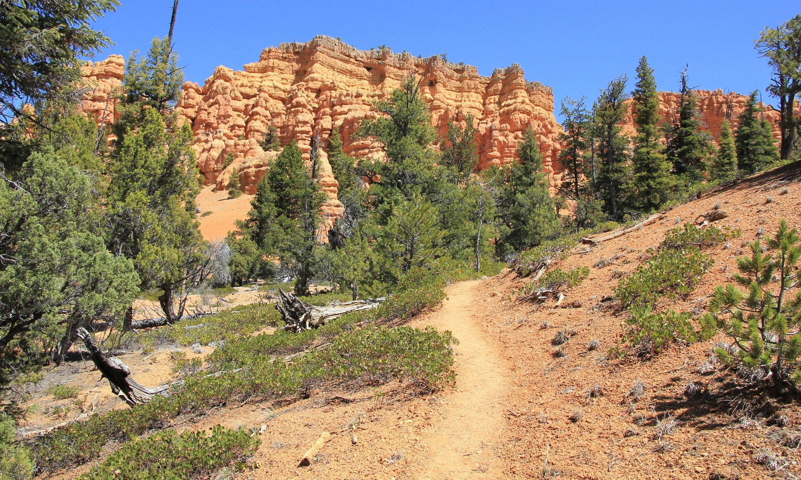
We continued along Castle Bridge which rolled up and down more than I had remembered. We had some skinny stretches of trail, but generally the tread was very good. The views were just as amazing as I remembered.

We looped back in with the Golden Wall Trail where we continued to make relatively short climbs and descents.

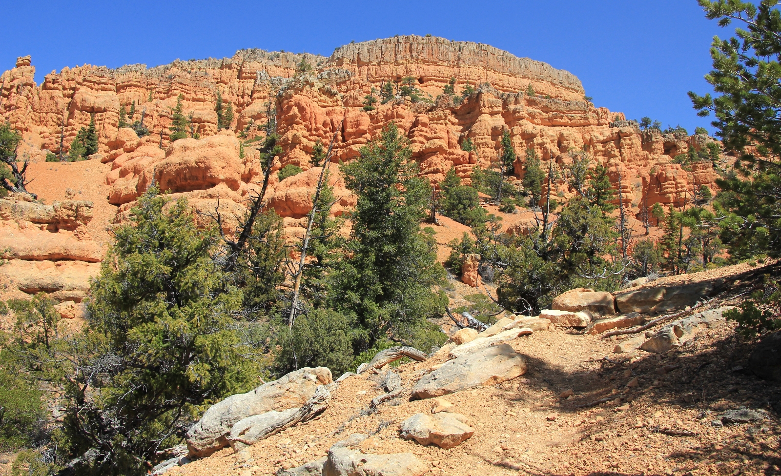
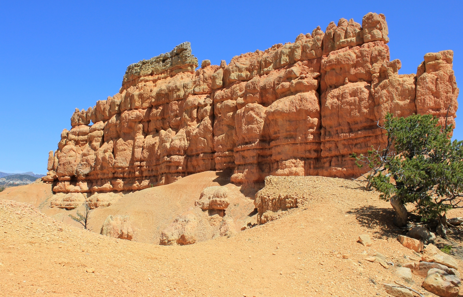
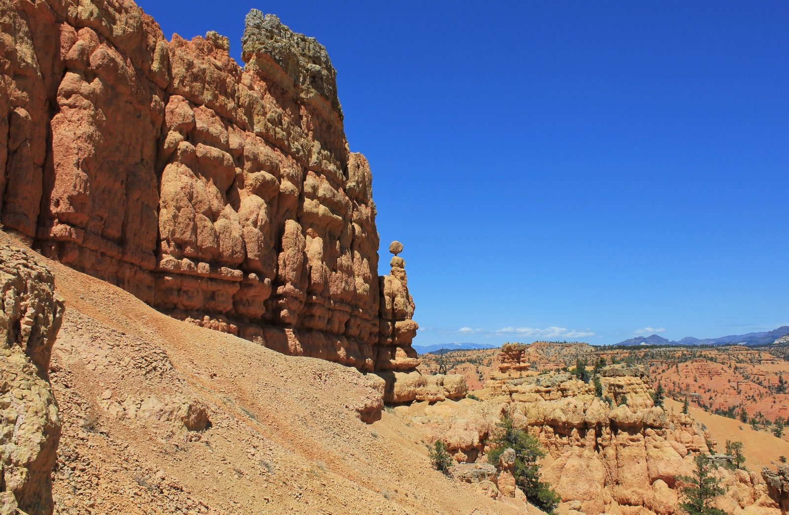
We occasionally had some nice long views back toward the Castle Bridge section of trail.
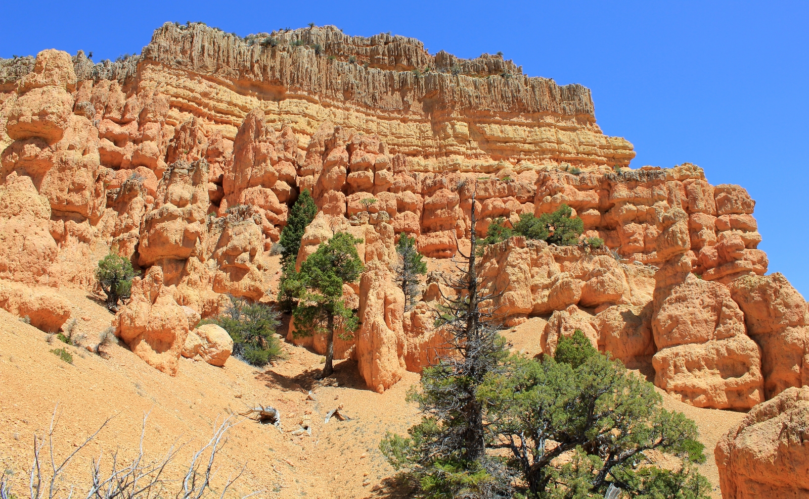
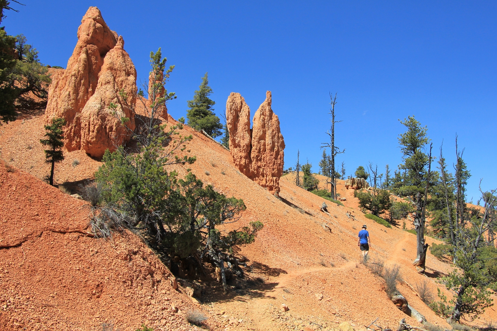
One stretch climbs to an impressive wall of hoodoos and great views to the north. A short but steep descent follows.

At roughly three miles we reached the junction with Buckhorn Trail. As before, we did not take the extra little spur trail out to the end of Buckhorn. I’m guessing this spur trail is about ¼ long each direction. I’ve read that the upper stretch is pretty steep and exposed.

We turned right at the junction and began our descent down into Red Canyon campground. A few sections were pretty steep, but overall the trail descended on well graded switchbacks. The trail bottoms out between sites 24 and 25 in the campground. From there, we turned left and walked the wash back to the visitor center parking lot (you can also follow the paved bike path back).
Directions to trailhead: From Panguitch,Utah travel south on Highway 89 approximately 7 miles then turn east onto Highway 12. Travel roughly 3.5 miles to the Visitor Center on the left.
Wow Lusha that deep blue sky against the red rocks is amazing….may have to join you for that hike one day! Thanks for the great post!