Beat the crowds on the eastern side of Oregon’s Eagle Cap Wilderness by visiting lesser known Swamp and Steamboat Lakes
Distance: 27 miles round trip
Type: out and back
Difficulty: moderate with approximately 4,350′ total elevation gain
Best Season: July – September
Mid-august in the Inland Northwest typically brings oppressive heat and wildfires. August 2018 was no exception. One of the best ways to beat the heat is to get high in the mountains—provided they aren’t on fire. If you’re familiar with our blog then you know, Oregon’s Eagle Cap Wilderness is one of our favorite dog days of summer destinations. It’s scenic alpine lakes typically see 70 degree days when our hometown is topping out over 110 degrees.
Over the years, we’ve made multiple trips into the Eagle Cap, but we still have many destinations on the bucket list thanks to a well-maintained trail network and a high concentration of beautiful alpine lakes. Our route for this pack was one I’d been eyeing up for a few years, Swamp and Steamboat lakes. These two lakes are on the popular east side of the wilderness and even share a trailhead with Mirror Lake and Lakes Basin, the most popular destinations in the Eagle Cap; however, from everything I read, we could expect significantly fewer people on this route. My first choice was to do this as a loop hike going in at Two Pan TH and returning via Bowman TH, but that route was a little longer than we could comfortably do in four days and would end with a hot and dusty road walk of about 3.5 miles. Instead, we decided to hike this as an out and back to Steamboat Lake.
On Saturday August 11, I awoke at 2:30 a.m., half an hour before my alarm was set to go off. I laid in bed for a few minutes, but couldn’t stand the excitement, it was time for another four day Eagle Cap backpack! We left the house at 3:40 and arrived at the popular Two Pan Trailhead outside of Lostine, Oregon (elevation 5,600’) three hours later. I expected a lot of cars at the trailhead, but what we found was ridiculous. I counted 88 cars plus about ½ dozen trucks with horse trailers. We circled the small parking lot and ended up parking about a third of a mile down the road. My guess was that most of those people were up in the popular Lakes Basin to the south of our destination.
It was already 60 degrees when we started hiking. Conditions were moderately smoky from all the Northwest fires and it was fairly muggy which is atypical for the Eagle Cap in August. After a short walk up the road, we made it to the trailhead where we filled out our free wilderness permit. For anyone considering skipping the permit, please don’t. First, it helps the Forest Service manage the area and second, rangers will check your pack (we had a very friendly volunteer check ours a couple years ago).
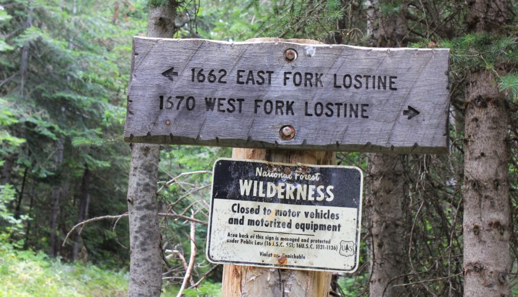
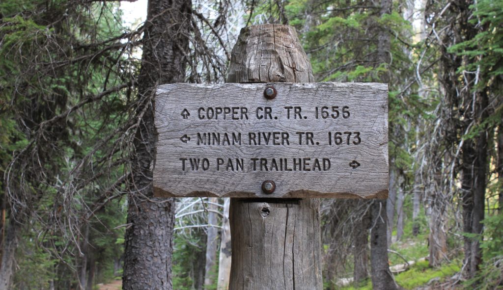
From the trailhead, we hiked a short distance to a well-marked junction. To the left was the East Fork Lostine Trail (#1662) which leads to popular Mirror Lake and the heart of the area referred to as Lakes Basin. This area is by far the busiest of the Eagle Cap. To the right was the West Fork Lostine Trail (#1670) which leads to Minam Lake and Copper Creek Meadows, our destination for the day.
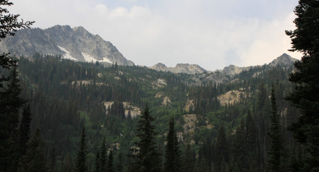
After taking a right at the junction, we continued 2.8 miles along the West Fork Lostine River. We climbed 820′ elevation over the stretch and were happy for an abundance of shade to offset the humid morning. The trail here was mostly in the trees with little for views, including only a few good views of the river. The few mountain peak views we had were moderately obscured from the layer of wildfire smoke we were under.
We reached a second junction (elevation 6,463′) at 3.0 miles from the trailhead. To the left was the Minam River Trail (#1673) which leads to Minam Lake. Despite the crowds, I highly recommend the Minam to Mirror Lake loop if you’ve never done it. We hiked the loop in 2015 and it was wonderful. There’s good reason why it is one of the most popular routes in the Eagle Cap. For this trip, we took the Copper Creek Trail (#1656) to the right. If my trail intel was correct, this junction marked the point at which we would separate from the worst of the crowds—from all the owners of those cars back at the trailhead.
Starting along the Copper Creek Trail, we passed several nice campsites to the left along the edge of a small meadow bordering the West Fork Lostine River. Despite the busy weekend, all the sites were empty. If you are looking for a short, easy pack, these campsites would make a very nice river front destination. For us, one of the shaded campsites made a nice break spot.
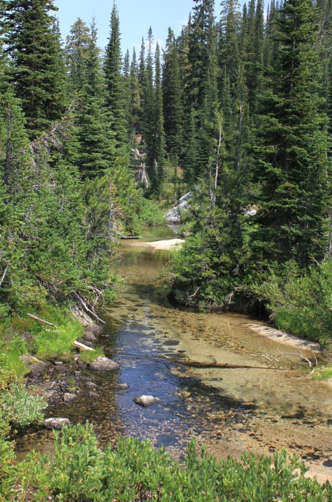
It was an easy mid-calf crossing across the Lostine. The cold water, snow melt even in the August, felt great.
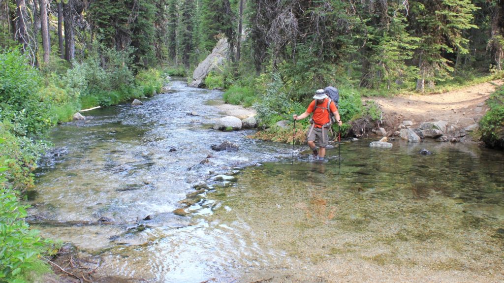
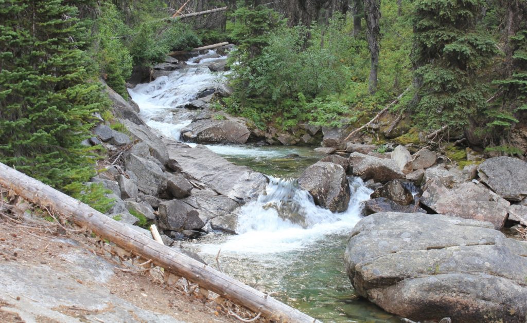
From there the trail climbed nearly 500′ over the next 1.7 miles to a crossing of lovely Copper Creek. The creek was about mid-calf deep. With a little effort, we probably could have rock hopped this crossing, but our feet were already wet and we figured why bother. Just before the crossing, there was a nice campsite to the left of the trail.
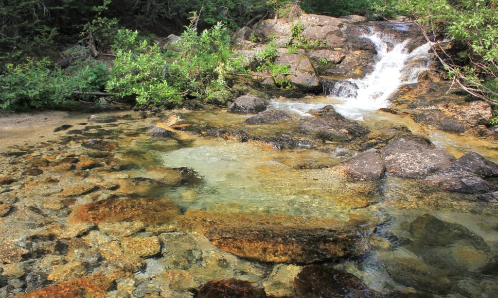
Immediately after crossing Copper Creek, we stopped for a short break in the shade. About that time, two young men with two dogs and a handful of horses came down the trail. They had camped at Swamp Lake and gave us some good information about the area. They had tried to get down into Long Lake, a side trip we were considering, but a massive downfall blocked their passage.
After our first crossing of Copper Creek, we continued climbing. The forest began to thin and we started getting nice views to some magnificent peaks. We climbed another 400′ over the next half mile to another crossing of Copper Creek. This stretch was our most strenuous climb of the day and the trail was rockier over all, but it was also the best views of the day. During this climb, we passed two nice young men from Portland. This was their first time in the Eagle Cap and from the looks of their gear it may have been their first backpack. They thought they were at a junction that was still about four miles ahead. They were visibly disappointed when I showed them where we were at on the map. Later, we’d see them turn around and begin hiking back toward the trailhead.
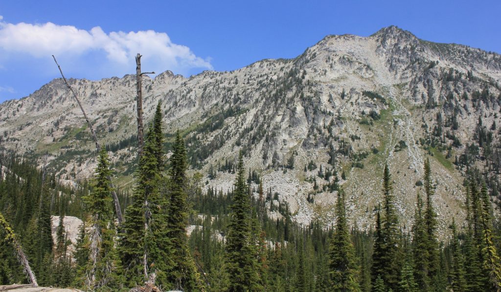
Our second crossing of Copper was easy. Immediately before the crossing there was a nice large campsite to the right in the trees. We considered camping there, but it lacked any kind of view and was too close to the trail. A short distance after the crossing, we opened up into massive views of Copper Creek Meadows. We were about five miles from the Jeep.
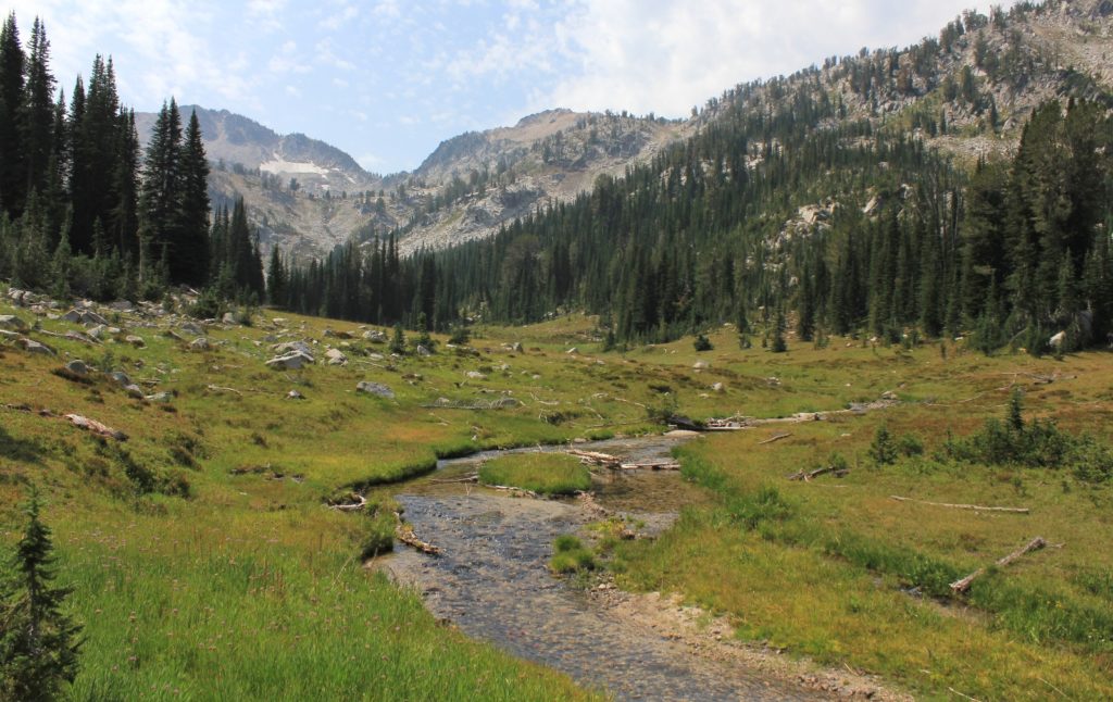
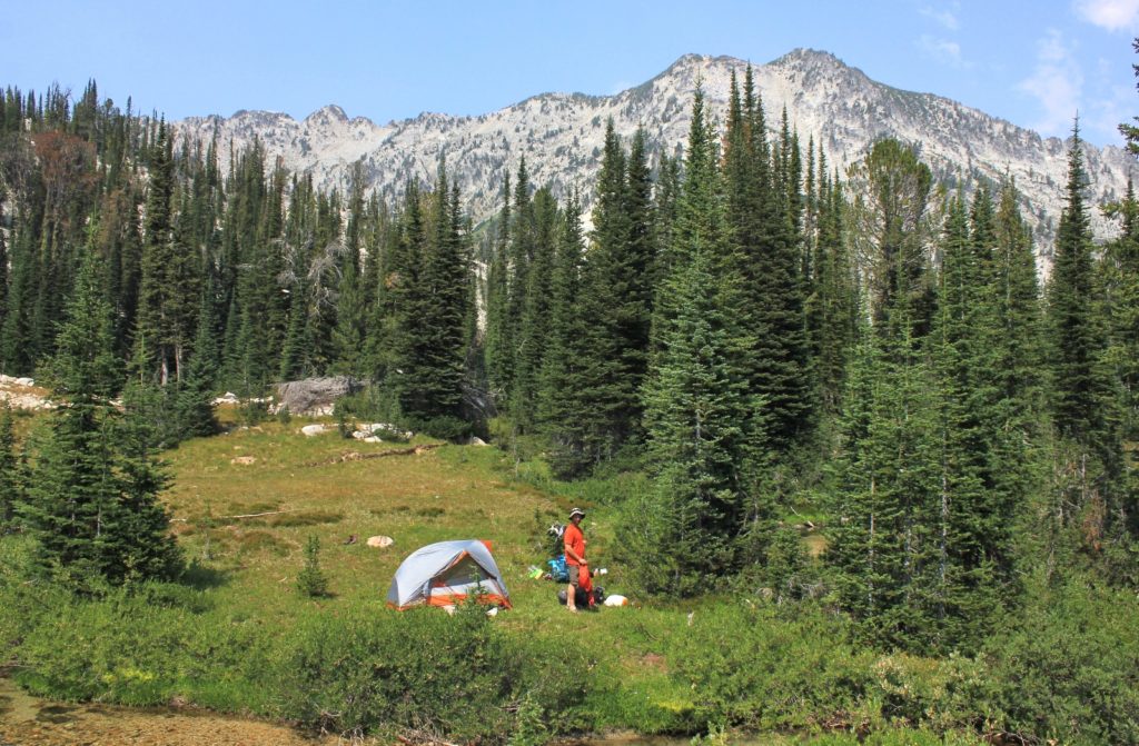
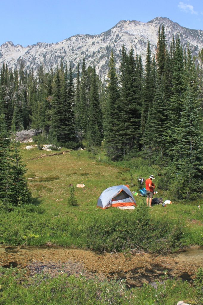
We explored all over Copper Creek Meadows and found two very nice tent sites, but they were both taken. There were a few other sites that we could have made work, but none seemed better than where we had dropped our packs. We returned and set camp up along Copper Creek (elevation 7,381’). With searching for a campsite and exploring Copper Creek Meadows, we had hiked 6.81 miles with an elevation gain of 1,781′ (this includes the road walk to get to the trailhead).
We set up camp on a grassy flat spot just up from the creek. We could hear the quiet gurgle of the stream and we agreed this would be a pleasant location for the evening. We had views up to a couple nice peaks and a little bit of shade. Jason went for a dip in the creek while I started my new Kindle book Dear Bob and Sue: Season 2. It was a partly cloudy afternoon with a moderate breeze that blew the wildfire smoke out of the basin. The temperature was just in the lower 70s—what a relieve from the nonstop triple digit heat we’d been having back home.
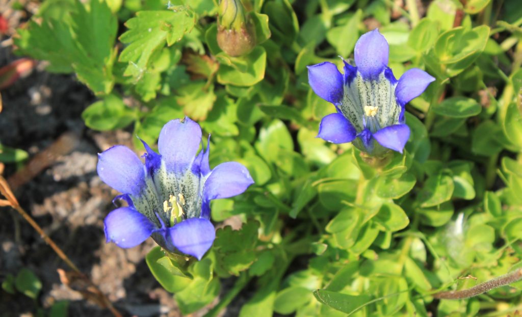
It was a quiet Saturday afternoon at our Copper Creek campsite with only five parties passing by. That was no doubt a stark contrast to conditions over in the Lakes Basin. We had an early dinner on a flat bench alongside the creek where we were entertained by fat bumble bees crawling into beautiful blue wilder flowers as well as a spunky dipper who worked his way up and downstream.
The sun dropped behind the mountain around 6:00 and temperatures started dropping immediately. It isn’t unusual for us to see lows drop into the 30s in the Eagle Cap, even during the hottest summer months. It wasn’t long before we turned into bed and read our Kindles from the warmth of our down sleeping bags. I started drifting off by 7:30. It had been a long day and it was very peaceful with the sound of our little babbling stream.
Directions to Two Pan Trailhead: from the small town of Lostine, Oregon, turn off Highway 82 onto Lostine River Road (#8210) following signs for Lostine Campgrounds. Continue 18 miles to Two Pan Trailhead. There is a separate parking lot for stock vehicles to the left. Pit toilet available. A Northwest Forest Pass is required to park at the trailhead. A free, self issued wilderness permit is also required and available at the trailhead.
Related Posts
Oregon’s Eagle Cap Wilderness: Swamp and Steamboat Lakes Backpack day 2 (Swamp Lake)
Oregon’s Eagle Cap Wilderness: Swamp and Steamboat Lakes Backpack day 3 (Steamboat Lake)
Oregon’s Eagle Cap Wilderness: Swamp and Steamboat Lake Backpack day 4 (return to civilization)
Resources Used
Hiking Oregon’s Eagle Cap Wilderness
100 Hikes / Travel Guide: Eastern Oregon
Got Gear?
Click here to see some of our tried and true gear. By accessing Amazon through the links on this page, you get the same GREAT Amazon pricing and they share a little with us. You don’t even have to purchase one of the linked items, simply access Amazon through our site and purchase anything! This helps us maintain Evans Outdoor Adventures and is much appreciated! Thank you to our supporters!
The Eagle cap is such a great place with so many choices for backpack hiking . Great photos and glad you missed the smoke .
Rich