Day hike or backpack along one of Idaho’s wildest and most beautiful rivers
Distance: 13.5 miles round trip for our two day backpack
Type: out and back (a long shuttle makes a 50 mile backpack possible—on our bucket list!)
Difficulty: easy to moderate depending on distance (good tread and minimal elevation gain make this a good hike for all)
Best season: spring, but the trail is accessible most of the year
Warning: rattlesnakes are common on this trail, especially during the warm summer months
I couldn’t believe our luck—we were heading into our fifth nice weather weekend in a row. We agreed that we should stay home and get some chores done… but that we couldn’t stand the thought of wasting a good weather weekend. Typically April is a real crap shoot in the Inland Northwest for weather. It isn’t at all unusual to get really nice days during the week and then wet and soggy weekends. Spring 2016 was really outdoing itself for weather and we were determined to ride the nice weekends as long as they would last.
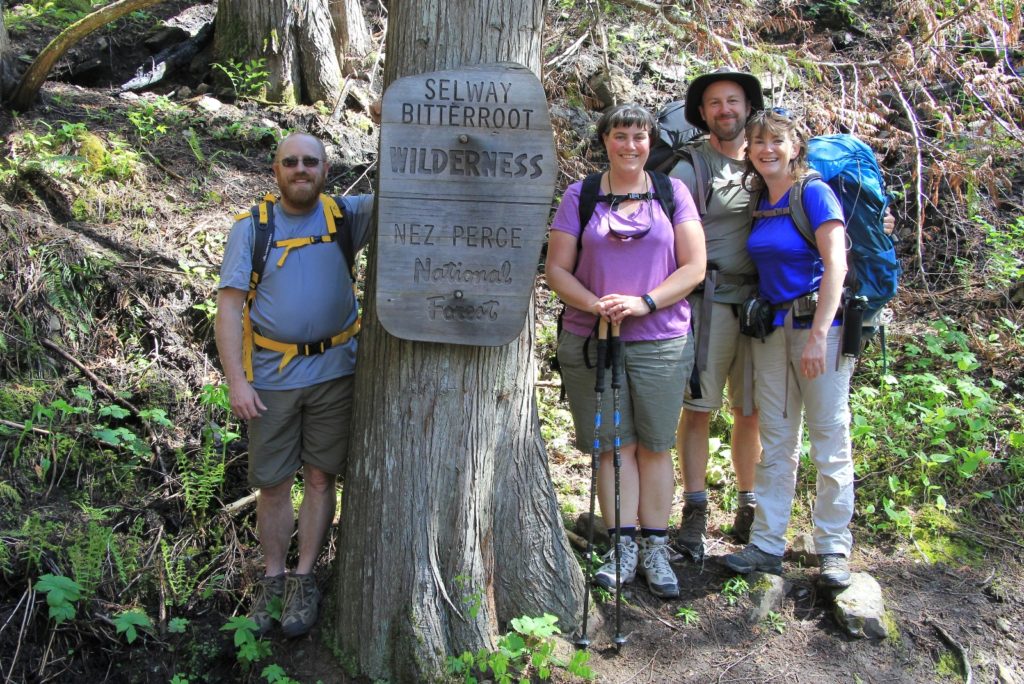
We originally set our sights on backpacking Rapid River near Riggins, Idaho, but late in the week I found out they were planning controlled burns in the area. I called the Nez Perce-Clearwater National Forest office to inquire about the Selway River trail in the wake of last year’s historic forest fires. The ranger confirmed the fires did burn areas of the trail, but that he still recommended going. He had hiked the first 3 miles of trail the previous weekend and thought it was beautiful. Sold!
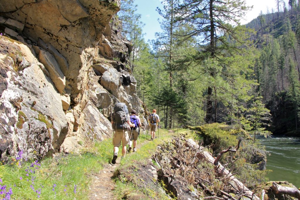
Early in the week, I mentioned our plan to Torrey and Scott, married coworkers of mine. They had hiked with us the previous weekend and had a fabulous time. I sensed they were ready for another adventure. When I told Torrey we’d be backpacking she quickly asked, “is that the type of thing where we could day hike in part way with you?” What a great idea!
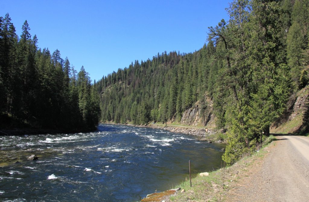
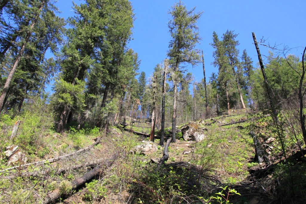
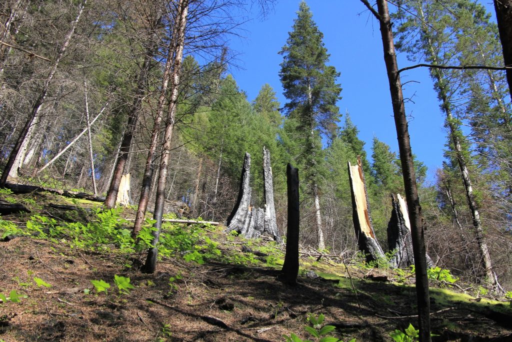
On Saturday April 16, we made the 3 hour drive from our home in SE Washington to the Race Creek Trailhead at the end of the road on the Selway River. We saw a fair amount of burn along the Selway River Road, but not nearly as bad as I expected and most of it was in the lower stretches just off highway 12.
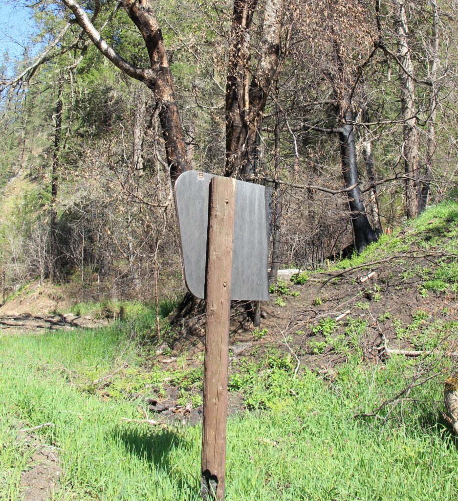
At the Race Creek Trailhead we found some evidence of burn. A few trees were blackened and the trailhead sign was burned in half, but otherwise it looked unscathed. After some final packing and adjustments to our gear, we hit the trail around 10:30 with sunny skies and temperatures near 60 degrees.
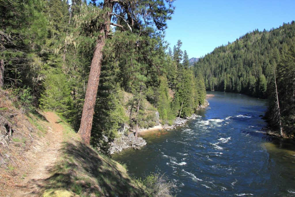
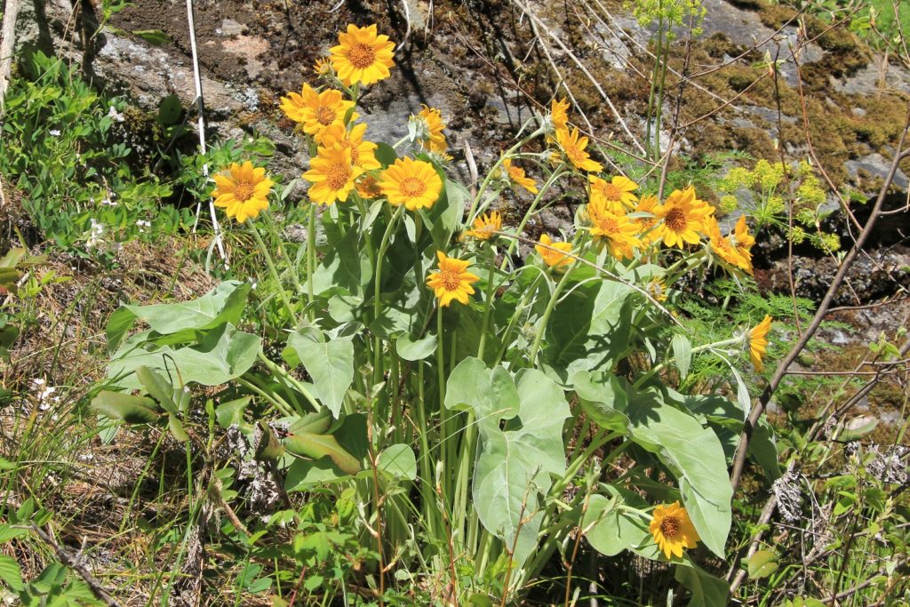
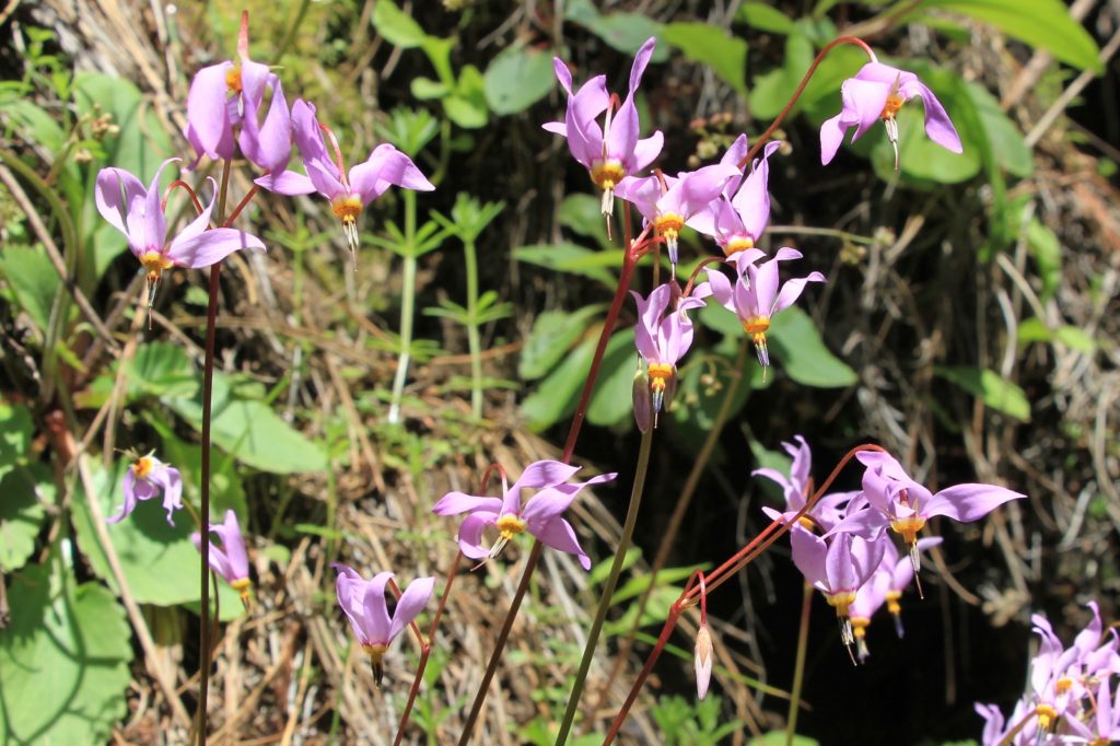
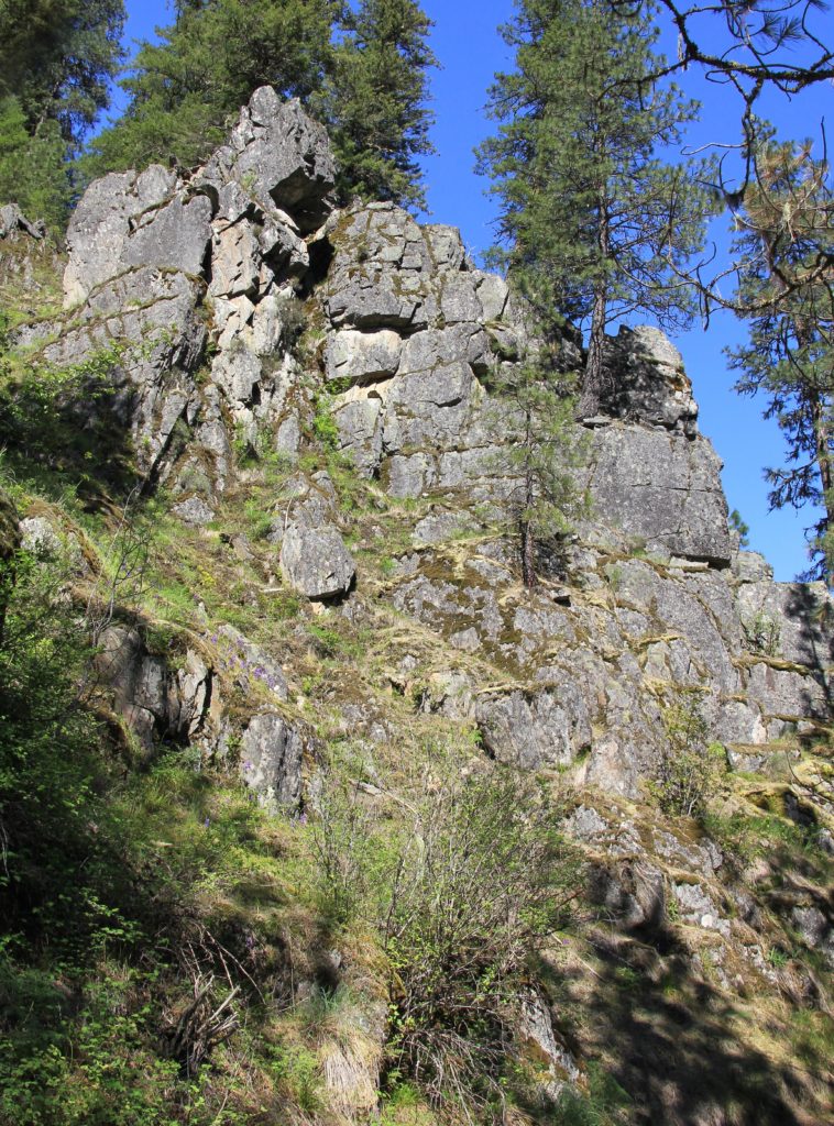
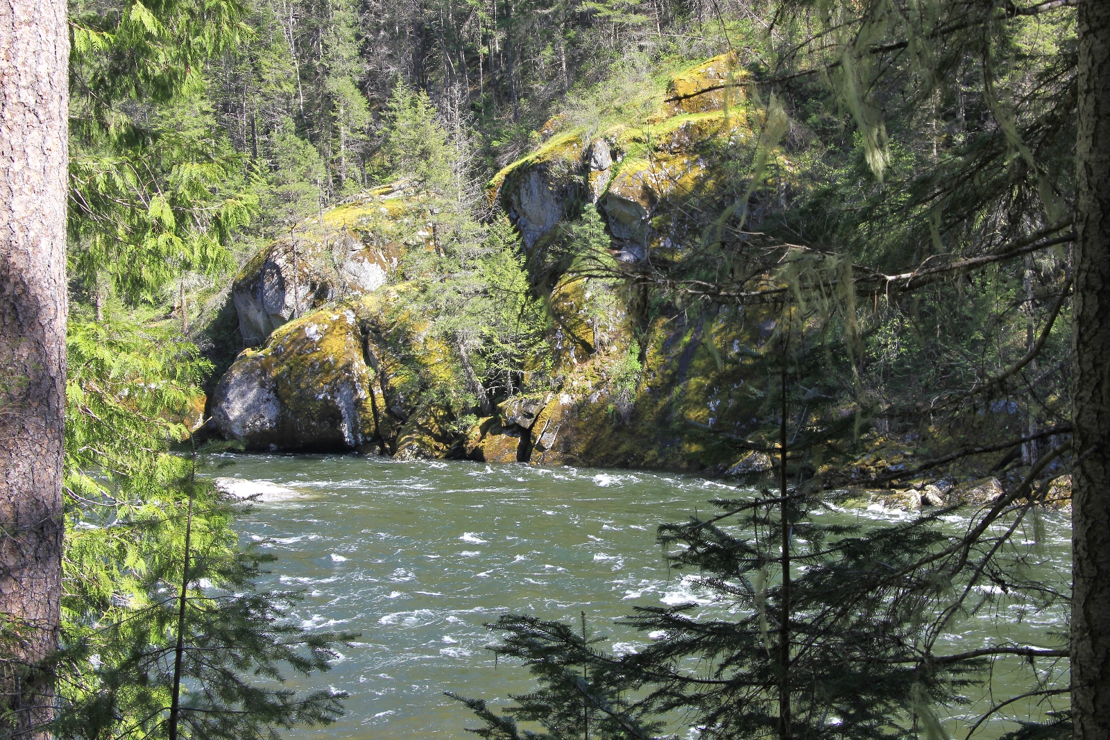
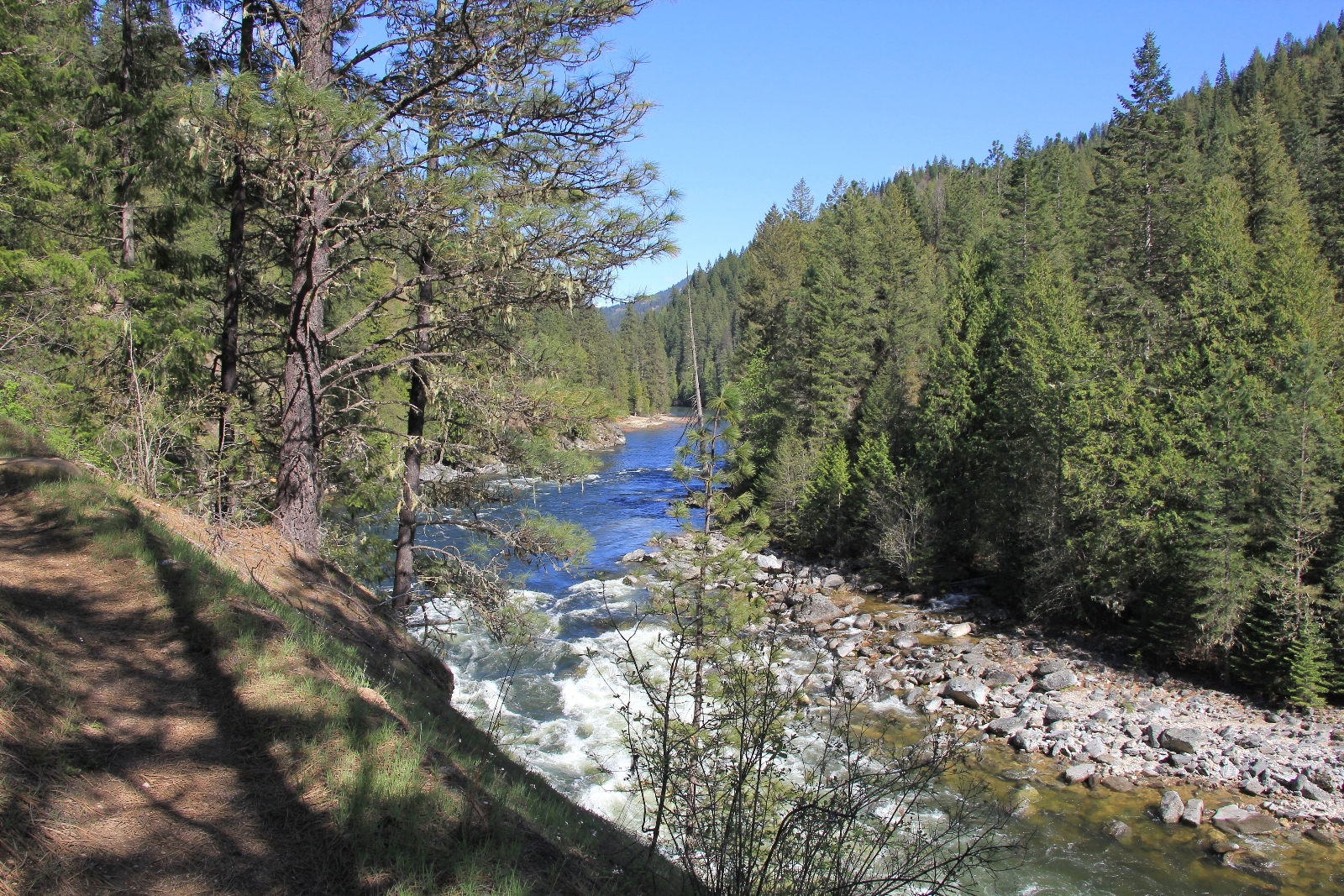
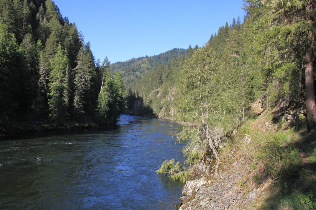
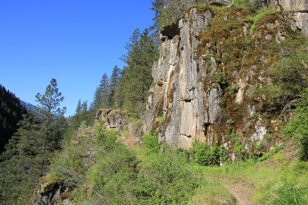
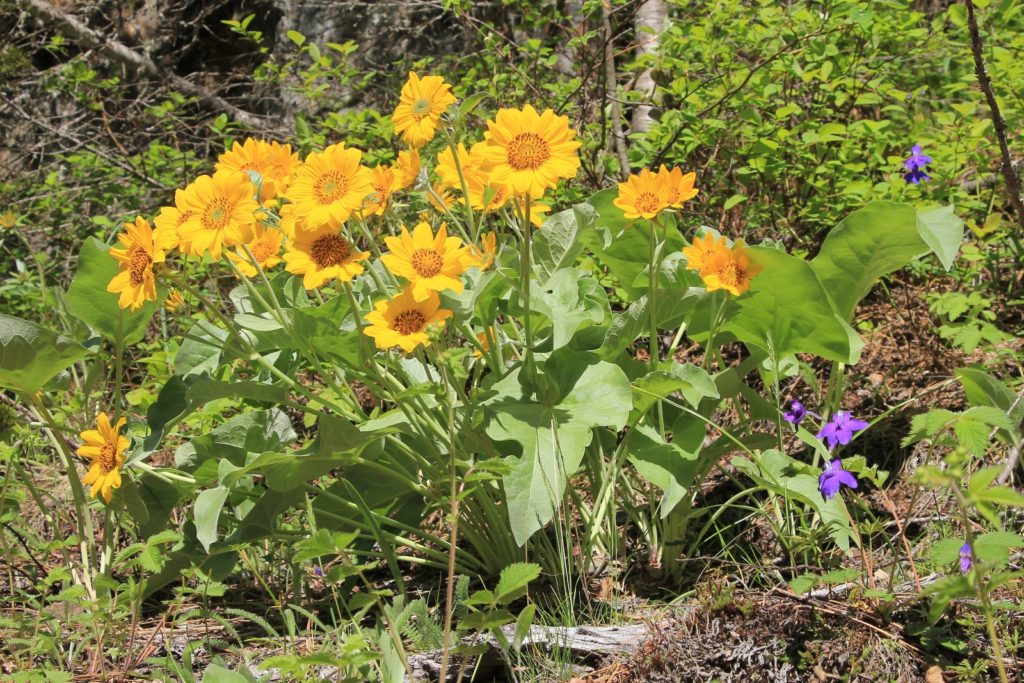
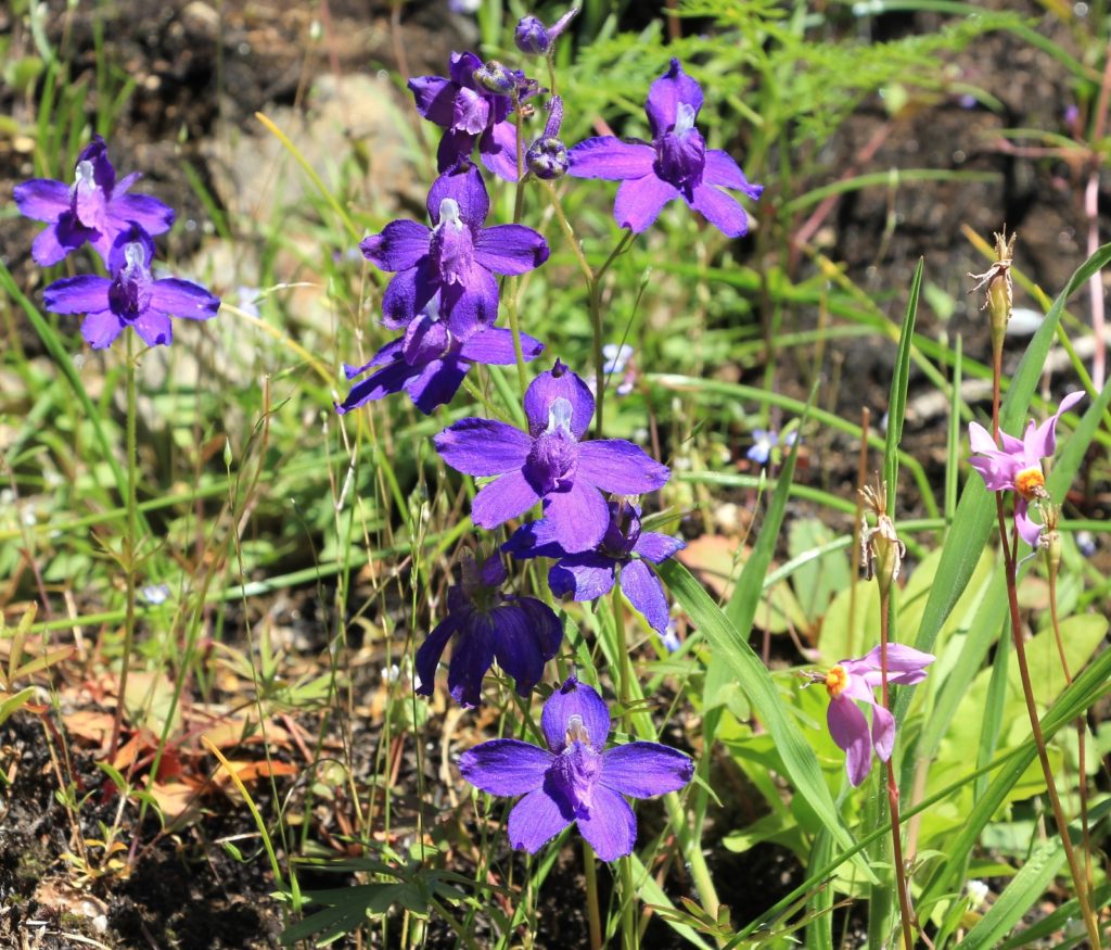
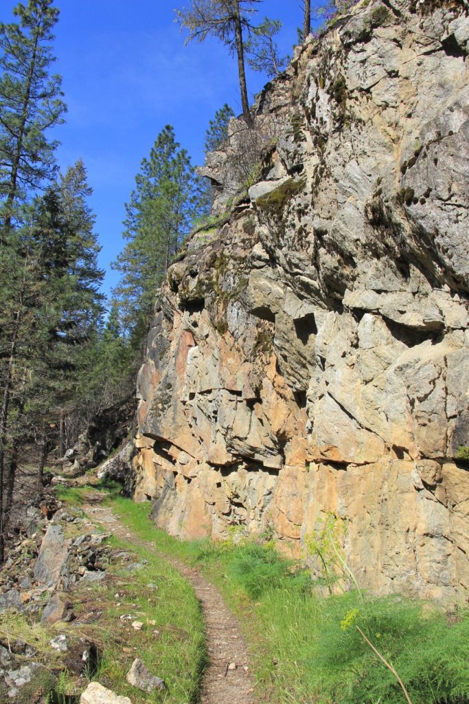
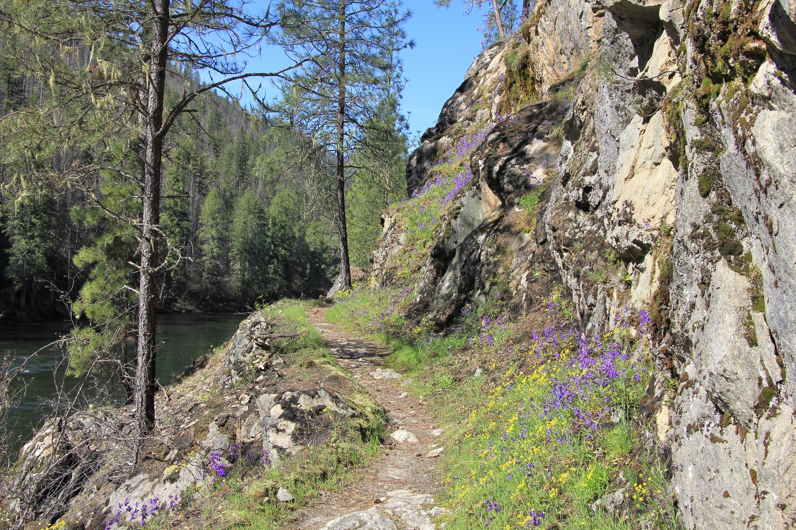
Most of the burn areas we would see were in the first couple of miles between the TH and wilderness boundary. We’d see a few black trees, but they were surrounded by green healthy trees. We never felt like we were going through a major burn. The wildflowers were in peak bloom—shooting star, arrowleaf balsamroot, what I believe are larkspur, and many others carpeted the side of the trail. The river was flowing above normal at around 8,500 cubic feet per second and the trail was in excellent condition. It was a great day to be on the trail!
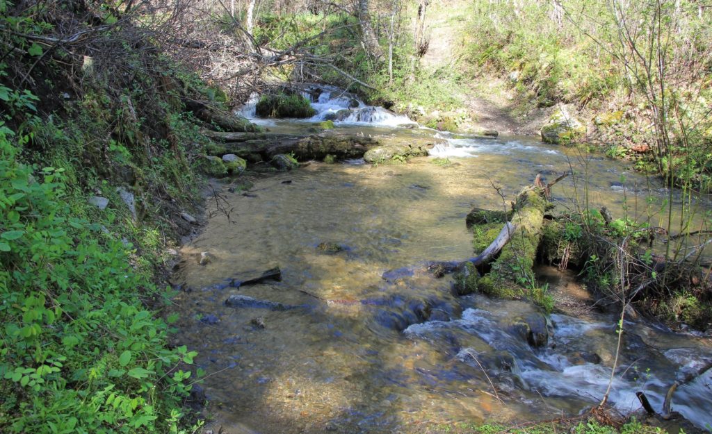
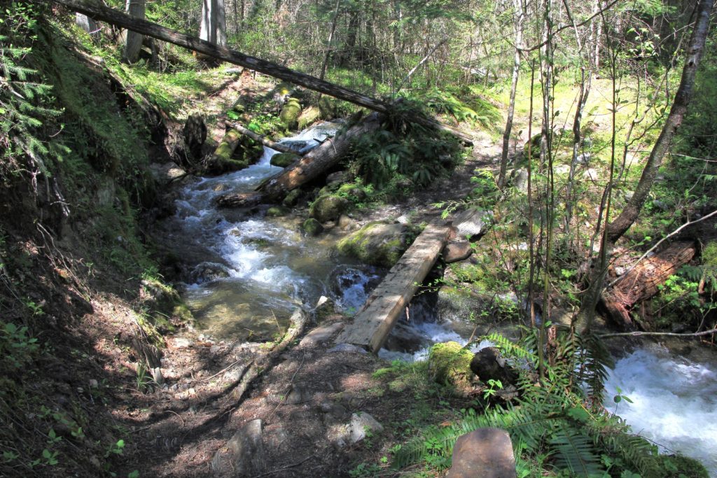
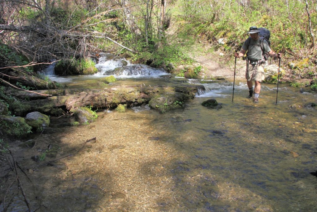
At two miles in, we came to the big stream crossing just before the wilderness boundary. The level was too high for rock hopping. Jason managed to bushwhack his way off the trail and jump across, but he didn’t recommend it. Torrey, Scott, and I all changed into our Keens and crossed the frigid stream.
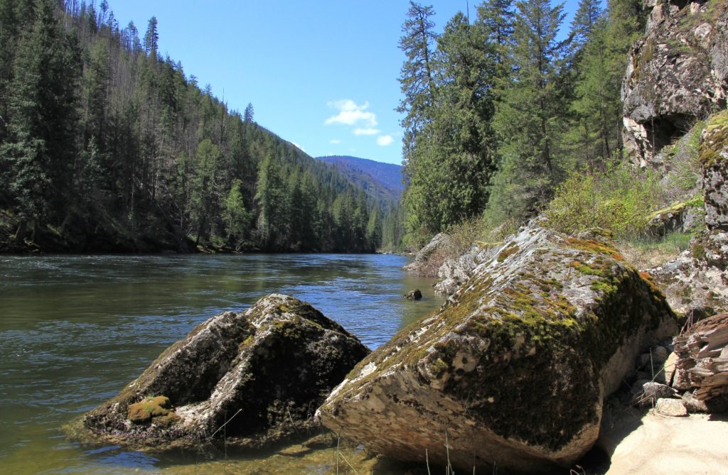
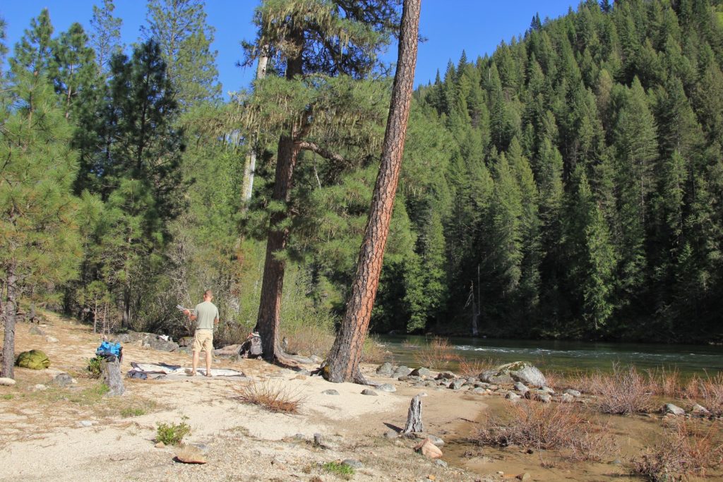
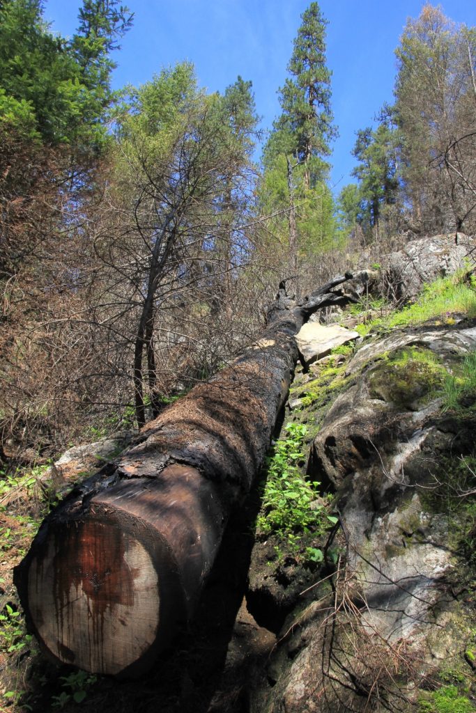
At about 4 miles in, Torrey and Scott decided it would be a good time for them to turn around. I spied what I thought might be a good beach up around the bend and proposed that we all take a nice break there before going our separate ways. We walked a short distance and found a great break spot with a lovely beach and a side stream flowing into the main river. There was a perfect tent site here and it was very tempting to set up camp and spend a lazy afternoon on our own private beach, but we hadn’t gone nearly far enough. This was the last place we’d see any evidence of burn from the previous year’s fire.
We said our goodbyes to Scott and Torrey. They would make the return hike out alone and then spend the night in Orofino. For us, we resisted the temptation to make camp on that lovely little beach. We climbed back up to the trail and continued on.
At just shy of 6.0 miles we reached what had been our previous high water mark. We had made it this far back in November 2012 when we took my Uncle Don on a post Thanksgiving hike. We were now in new territory.
At around 6.5 miles we reached the Cupboard Creek Bridge. There were some very nice looking camp sites here, but we decided to push on.
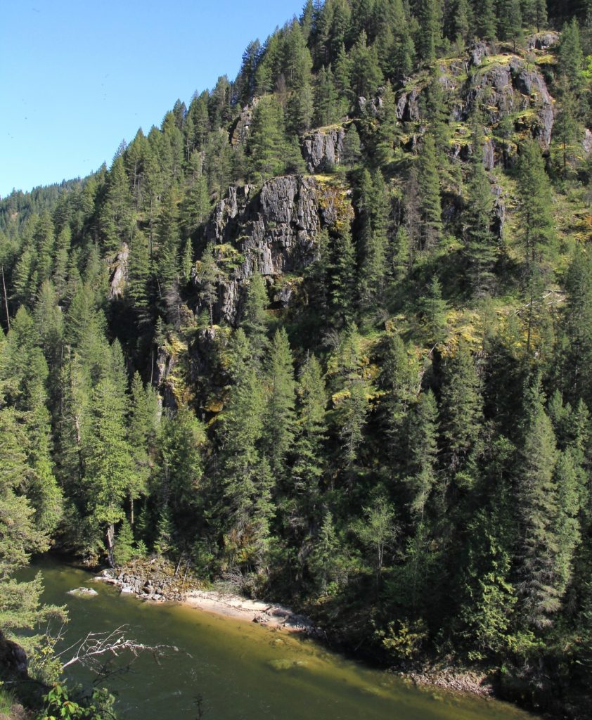
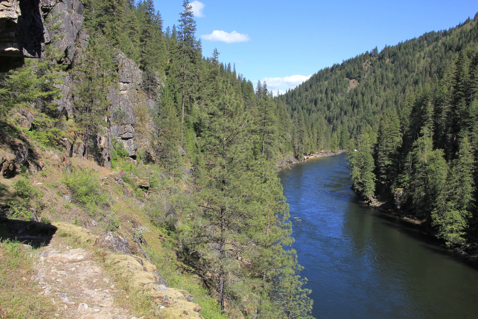
After Cupboard creek, we were on a bit of a roller coaster for the next two miles. The trail would climb and drop, providing us with excellent views at times. The few potential campsites that we passed were when the trail was up high and access would have been very difficult. By now, temperatures were in the upper 60s and this stretch of trail didn’t provide much shade.
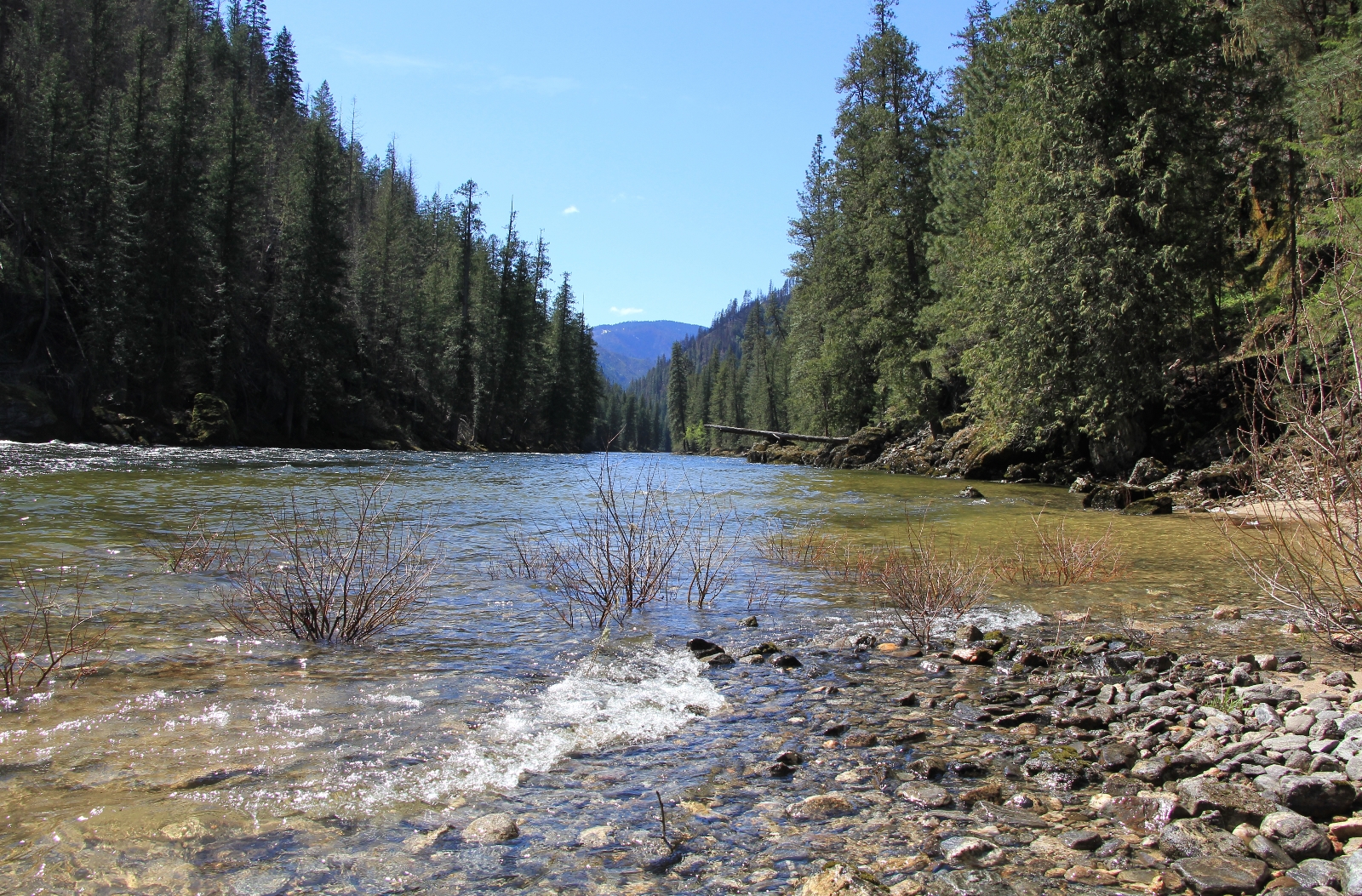
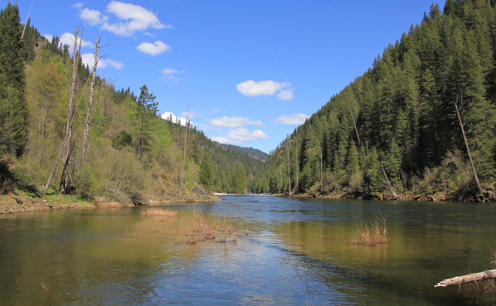
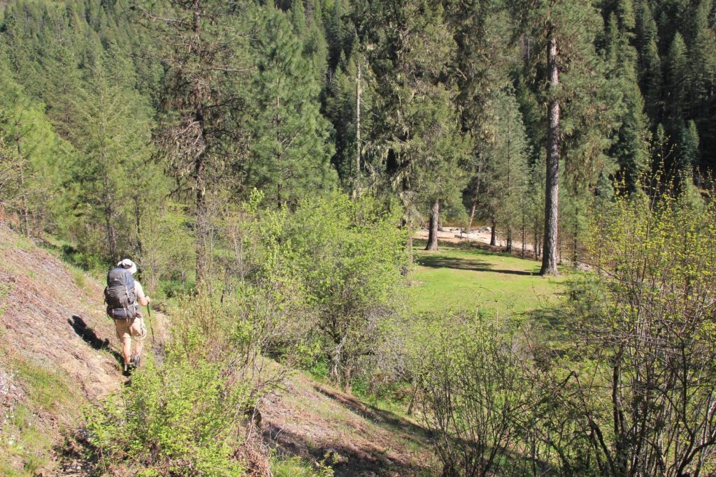
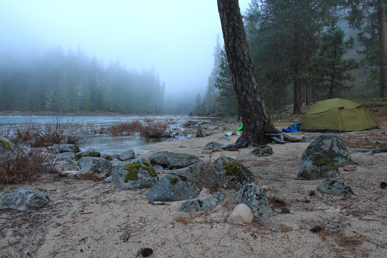
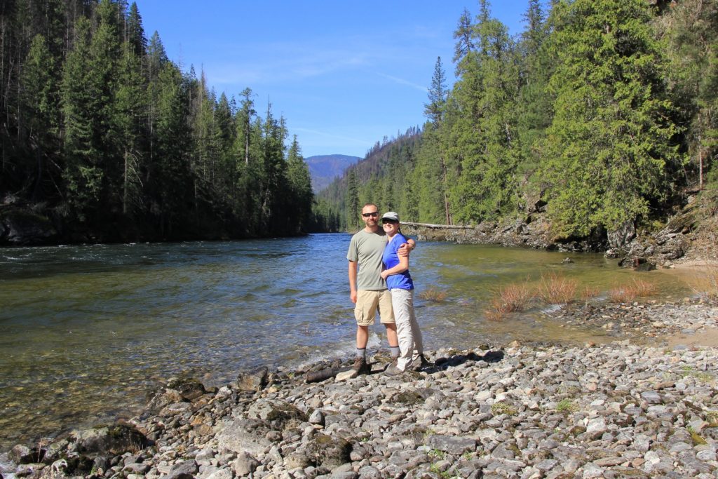
Finally, at 8.3 miles, we dropped down onto a lovely grass flat. We initially eyed up a grassy spot for our tent, but then I noticed a small sandy section down on the water. It was perfect for just the two of us and our little tent. We had a beautiful spot right along the river with snow covered mountains out our tent door.

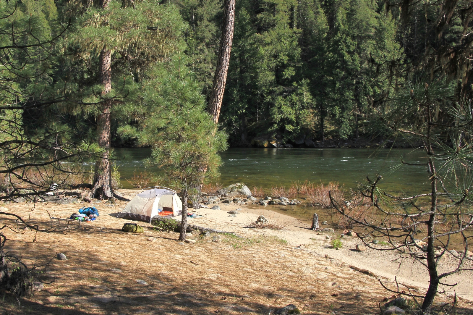
By the time we set up camp and did our chores it was 4:30. We took a short break to enjoy the river views and our neighbors (osprey, kingfishers, and a group of 3 mergansers). One of my favorite moments of the trip came when an osprey let out a loud cry and a kingfisher chattered over the top of it. They were good neighbors indeed.
Dinner for the evening was a dehydrated meal of beef stroganoff, a package of Scott’s homemade pork jerky, and a box of mac and cheese. I was still working on perfecting my field mac and cheese. I used the beef stroganoff bag after it was empty, placed the noodles in with about 18-20 oz boiling water, sit 5 min, stir, sit 10 min. The noodles were perfectly done. I thought the left over water was about perfect so I dumped in the powered cheese, butter, and milk. I had judged wrong and we ended up with a somewhat soupy version. At least the noodles were perfect. Now I just need to perfect compensating for powdered milk and butter.
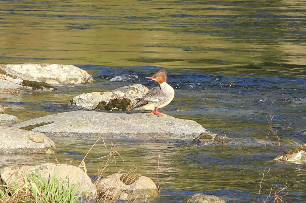
After dinner we heard a loud splashing in the water. It turned out to be a common merganser who was causing quite a ruckus as she splashed around for her evening bath. After, she stood on top of a rock preening herself until another female and male came and joined her. The male was quite striking with his stark white body, black back, dark green head, and orange bill. Together the three spent the rest of the evening in the waters near camp.
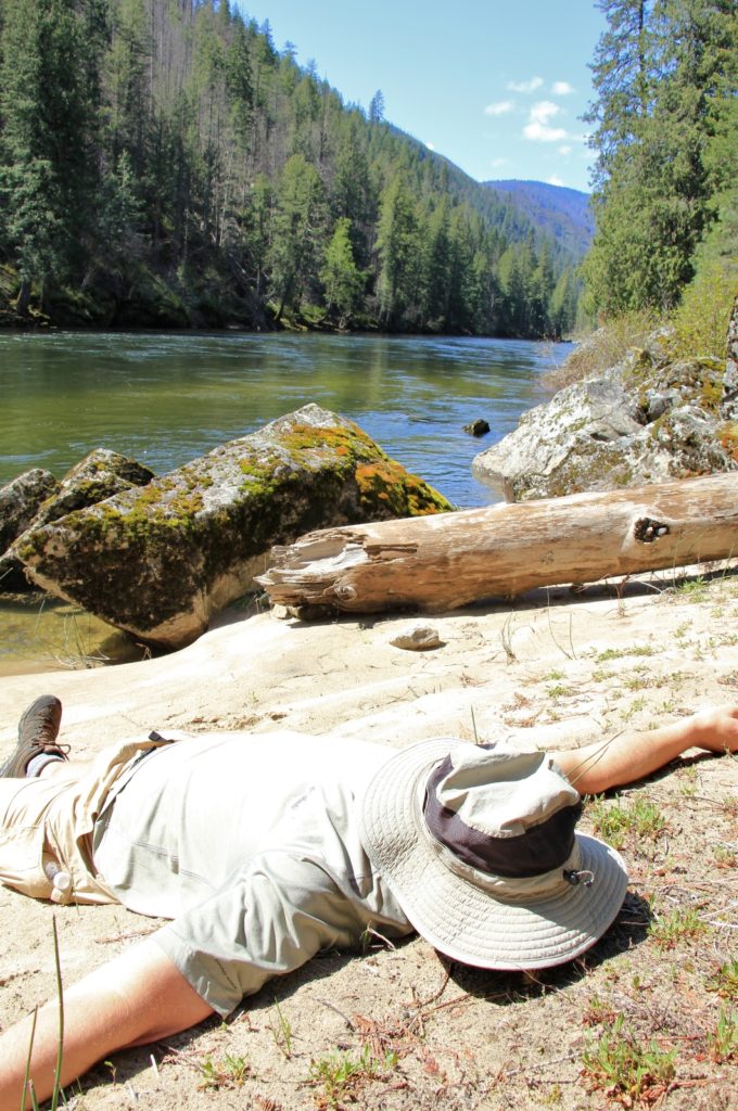
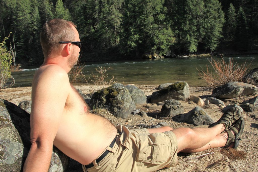
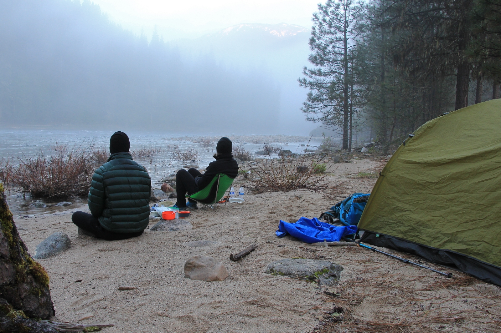
After dinner, we sat on the beach for a couple hours to enjoy the scenery and wildlife. Temperatures dropped quickly as soon as the sun dipped behind the mountain so we headed into the tent around 7:30 to cuddle in our warm sleeping bags and read our Kindles. Jason was working on Bill Bryson’s At Home and I was reading Lost on the Appalachian Trail by Kyle Rohrig. The fading daylight was replaced by the bright glow of a ¾ moon which provided natural light well into the morning hours.
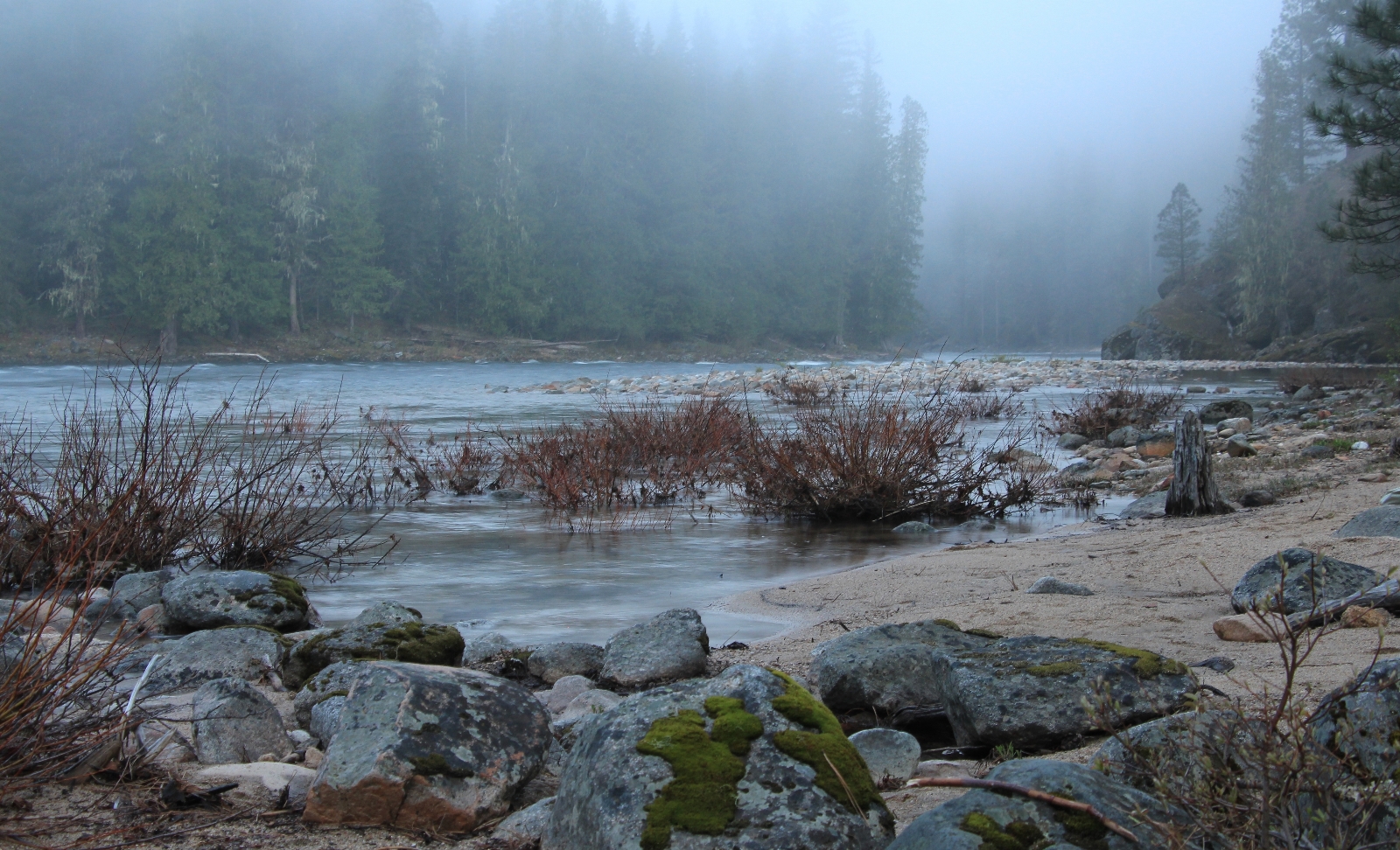
We were up and out of the tent by 4:00 Sunday morning. The temperature was 31 degrees and conditions felt fairly damp. I was glad for my multiple layers of fleece and stocking cap. The stars were still out and there wasn’t a cloud in the sky. We each enjoyed two cups of Starbucks Avia coffee and watched the stars fade into a new day. As the sun slowly started to rise, a layer of mist and fog rolled in obscuring all our views except down low on the river, creating a cozy mood and a feeling of closeness with the wild river.
For breakfast we tried a dehydrated meal of biscuits and gravy which exceeded my expectations. We supplemented that with a double serving of my homemade oatmeal with almond slivers and cran-strawberries. By 7:30 all of the fog had burned off, the sun was shining, and we were hitting the trail.
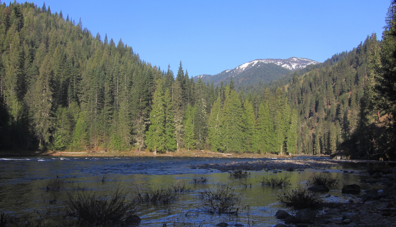
We both enjoyed hiking in the cool morning temperatures. Temperatures would be in the upper 60s by the end of our hike, but for now it was a cool and lovely morning on the trail.
At Cupboard Creek, we saw one tent and a couple along the shoreline at the prime camping spot we saw on the way in. We also saw a kayaker and 2 rafts floating by the same location. Aside from Scott and Torrey, these were the first people we had seen all weekend. Numerous kingfishers and mergansers kept us company along the river trail.
We took a short snack break at 4 mile beach where we had said goodbye to Scott and Torrey the previous day.
At the wilderness boundary stream crossing, we both plowed thru the stream unconcerned with wet feet at that point—it felt good and we only had a couple miles to go. About half a mile later, we saw two men day hiking and a moderately large group of rafters coming downstream.
We reached the Jeep at noon with 16.5 miles logged for the two days. We took off our wet shoes and socks and slipped into our cool and comfy Keens. We grabbed cold drinks from our cooler and made the 45 minute drive back to the confluence of the Selway and Lochsa Rivers at Lowell, Idaho where we enjoyed big juicy burgers at Ryan’s Wilderness Inn.
Directions to Race Creek Trailhead: From Lewiston, Idaho, follow US-12 east 96 miles to Lowell, Idaho where the Lochsa and Selway Rivers join to form the Clearwater River (this area is known as Three Rivers by many locals). Turn right onto the Selway River Road 223, immediately crossing a bridge over the Clearwater River. The first 7 miles of the Selway River Road are paved as you pass homes and historic Fenn Ranger Station. The road then transitions to single lane with dirt/gravel surface. This road is notoriously full of large potholes, but can be negotiated by passenger cars. It is approximately 13 miles from the end of the pavement to Race Creek.
Roadside attraction: Just shy of the trailhead you will pass magnificent Selway Falls. The views here change dramatically with the river levels. It is well worth a stop here anytime of year. In June you might get lucky and see salmon jumping the falls on their return trip to their native waters.
When I was 16 years old my Half Uncle and a friend of his hiked the Selway River full trail. All 60 miles went though Moose Creek Lodge. Some of those photos brought on the website up some good memories. I’m 72 now!!
What wonderful memories! We have talked about backpacking the full trail. We have a friend who is willing to shuttle us and have steaks waiting for us at the end- hard to refuse that offer! Thank you for sharing your memories with us Steven.
Lusha
The 60 mile Selway Trail was a 6 day hike with 60 pound backpacks. Everything is needed tents sleeping bags including weather report for the trip. Back when I hiked there was parking at the end of the trail. I remember a sign about entering rattlesnake country at the start of the trail!! Plus in the last day of the hike I was fishing for rainbow trout. I fell in the creek and was eye level with a large rainbow trout.