December 30 – January 5, 2020
After a relatively cool and wet (for Vegas) Christmas week, the weather conditions improved as we prepared to celebrate the end of one decade and the beginning of another. With abundant sun and perfect hiking temperatures, it was a great week to continue our Lake Mead National Recreation Area explorations.
Last Hike of the Decade: Liberty Bell Arch
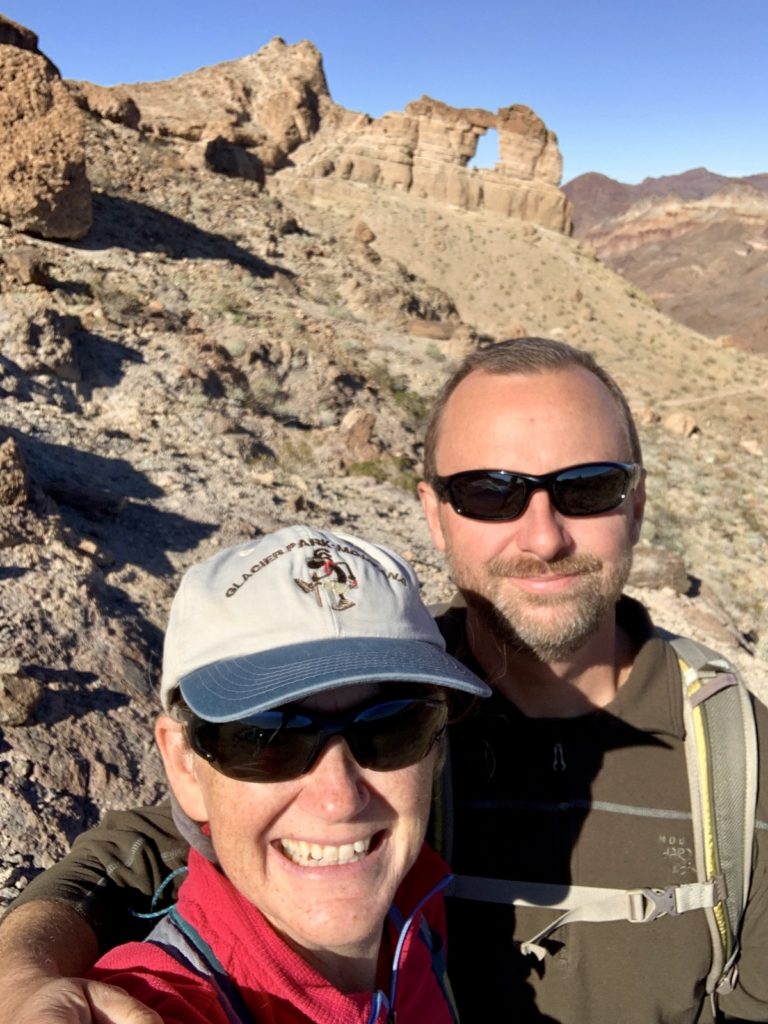
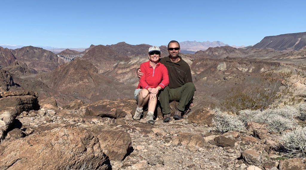
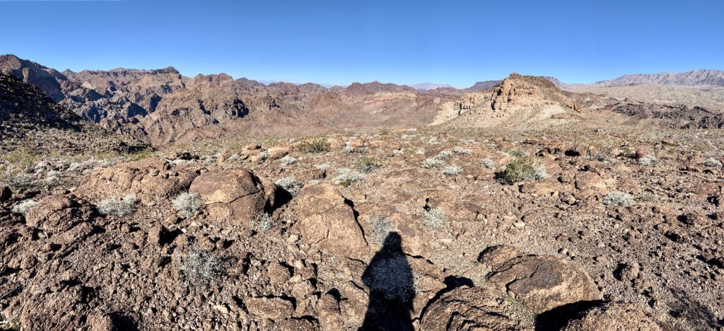
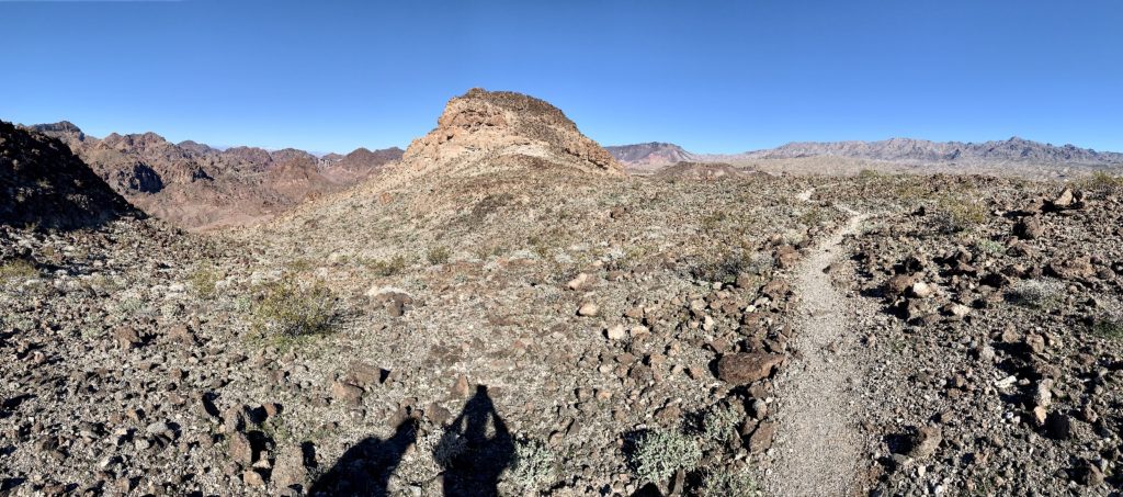
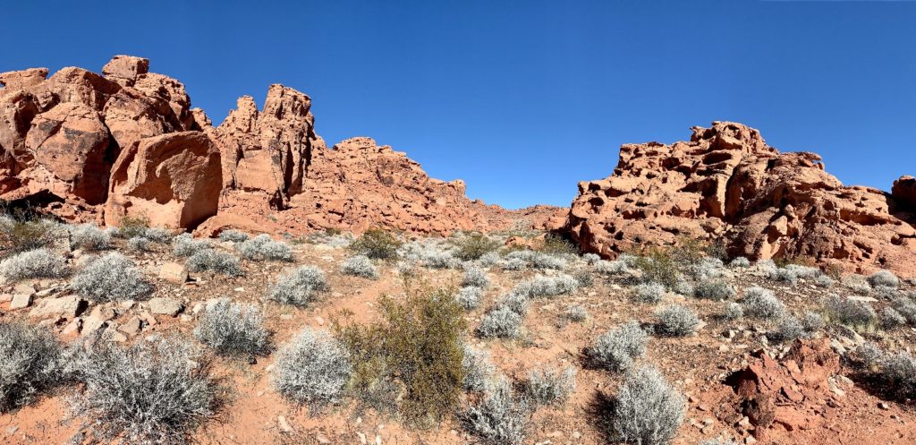
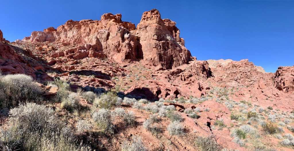
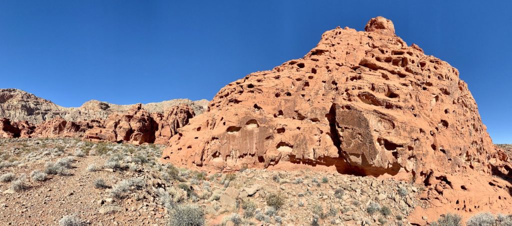
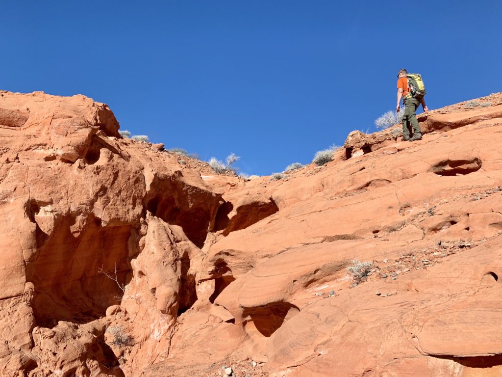
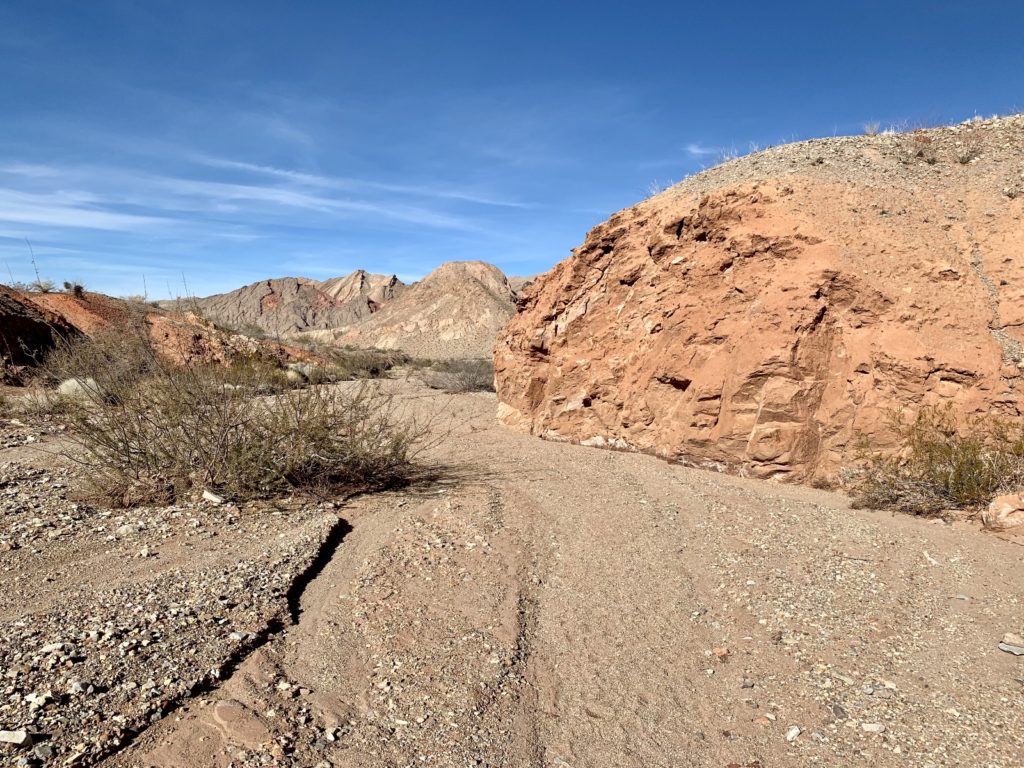
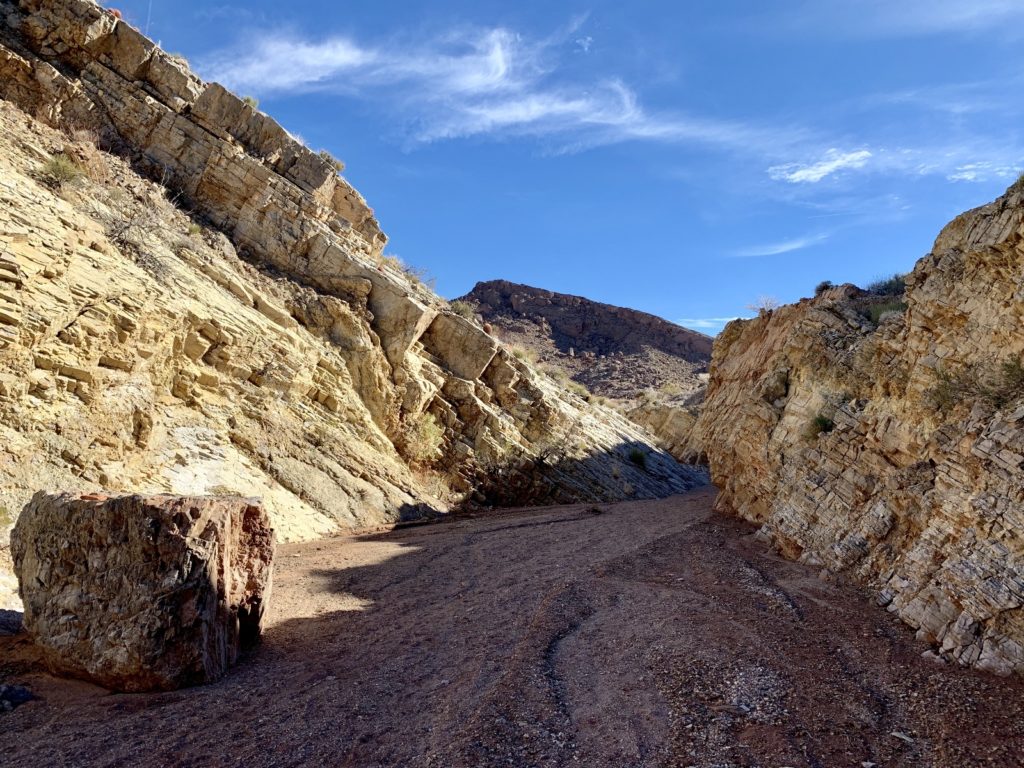
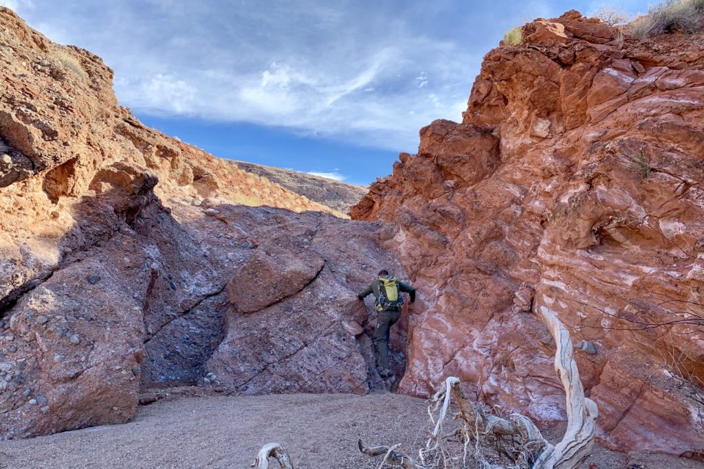
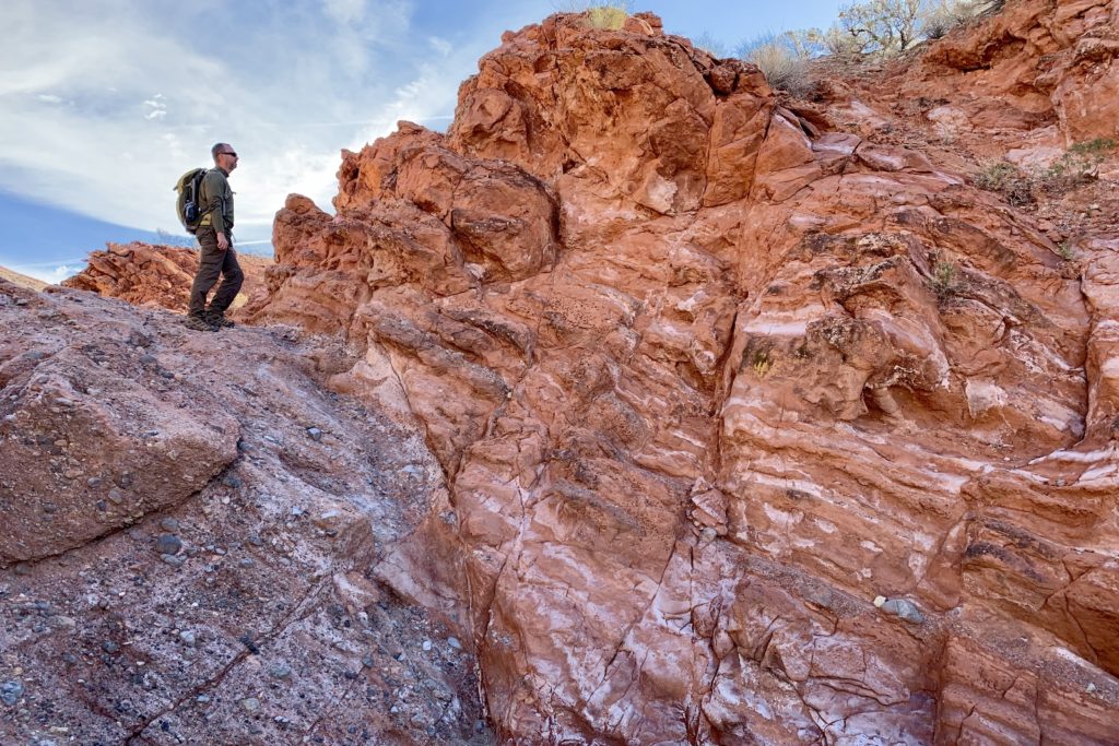
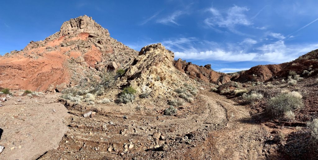
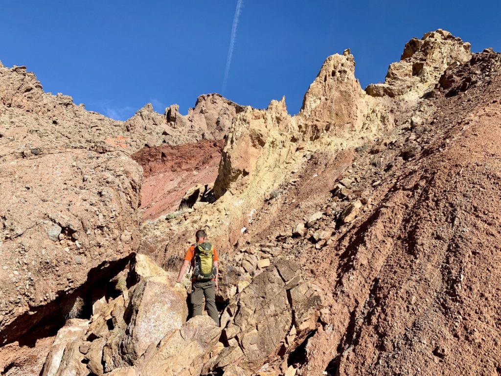
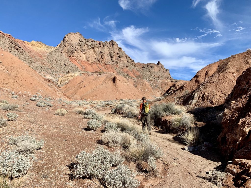
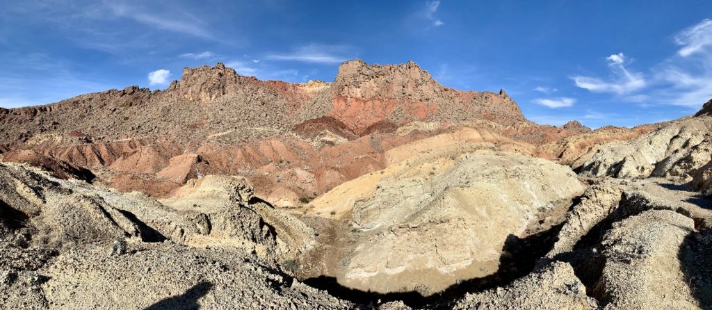
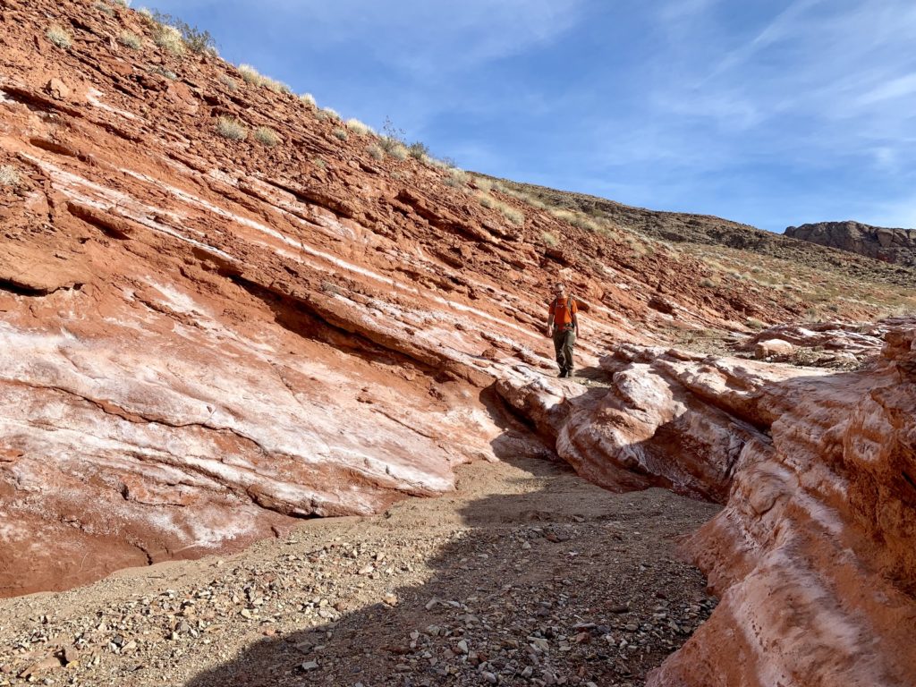
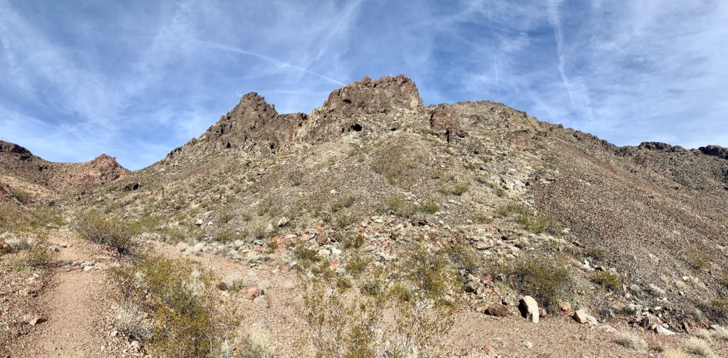
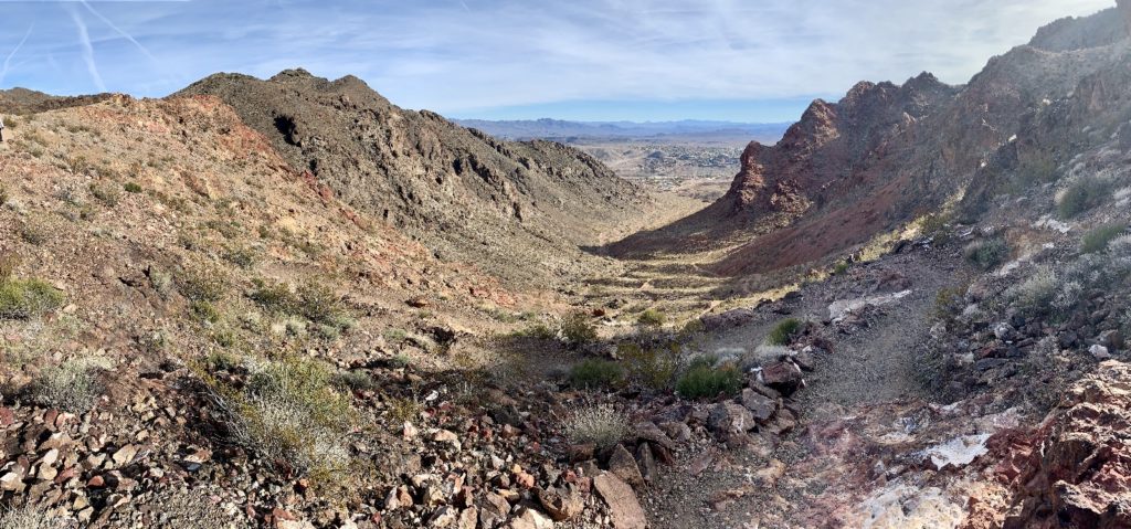
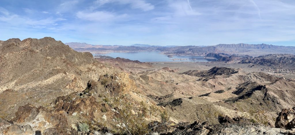
What better way to end the decade than with a fantastic hike. Lake Mead offers a plethora of great hiking opportunities making it difficult to choose, but we picked Liberty Bell Arch. This is a 5.5 mile out-and-back hike across a beautiful Arizona landscape to an arch that looks like, you guessed it, the Liberty Bell. Once at the arch, those willing to make one last climb are treated to a stunning overlook of Black Canyon of the Colorado River just below Hoover Dam.

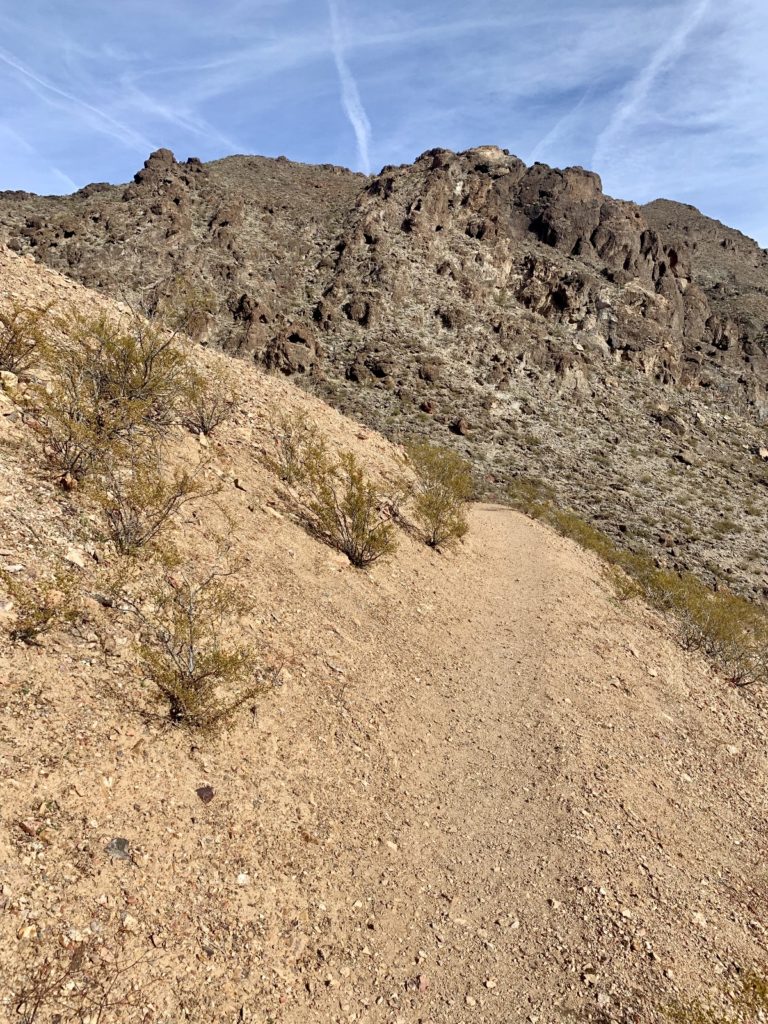
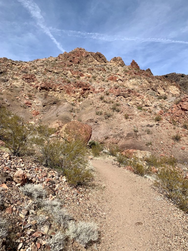
This hike is within Lake Mead National Recreation Area along the Nevada-Arizona border. The trail begins at the White Rock Canyon Trailhead located just off U.S. Highway 93 south of Hoover Dam on the Arizona side of the Colorado River. The National Park Service rates this as a strenuous hike. They state there is a 275′ elevation change, but I don’t know where they came up with that number. My AllTrails app states the change this is 974′ and that seemed spot on to us.
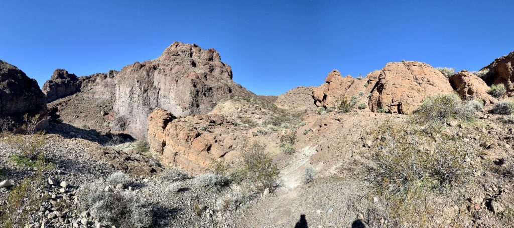
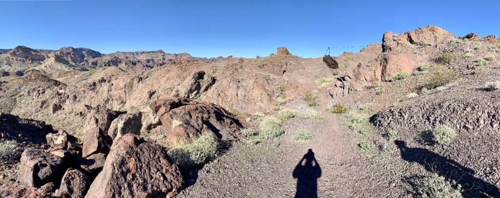
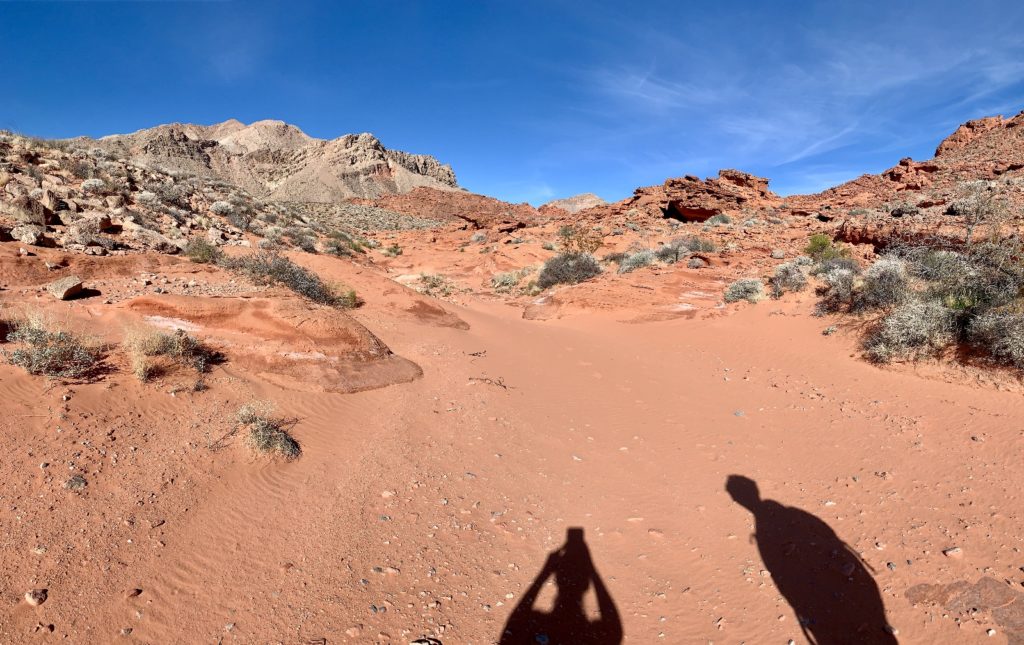
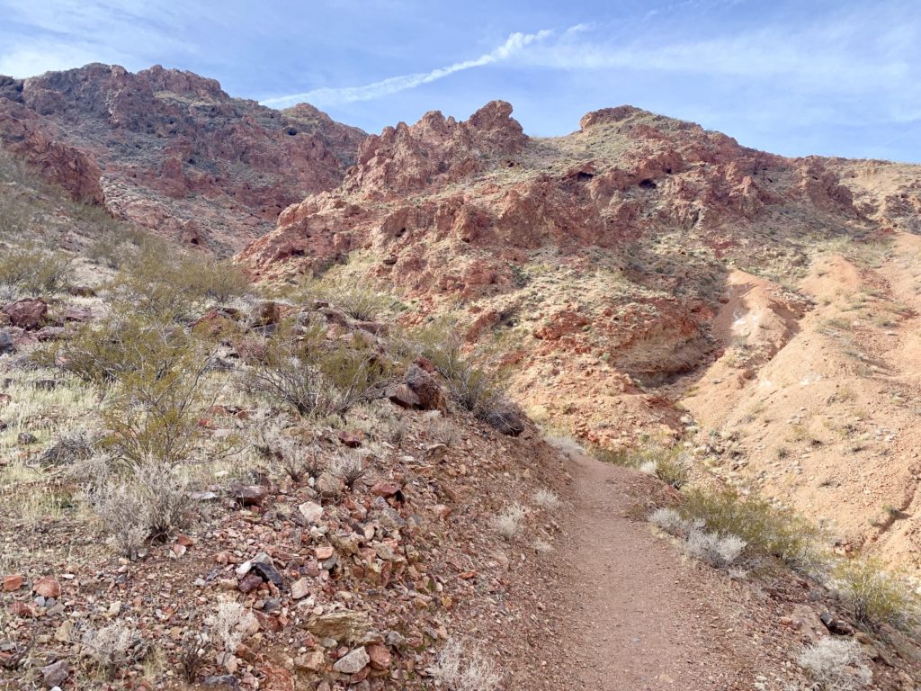
Liberty Bell Arch, White Rock Canyon, and Arizona Hot Spring Canyon trails all begin at the same trailhead. Trail junctions are well marked, but there are no trail markers or signs once you are on the Liberty Bell Trail. The trail is relatively easy to follow, but there are a few places where you might need to hunt for trail and/or backtrack to the right spot. Be sure to note major landmarks just in case. There is a fair amount of hiking through loose sand and over rocky slopes.
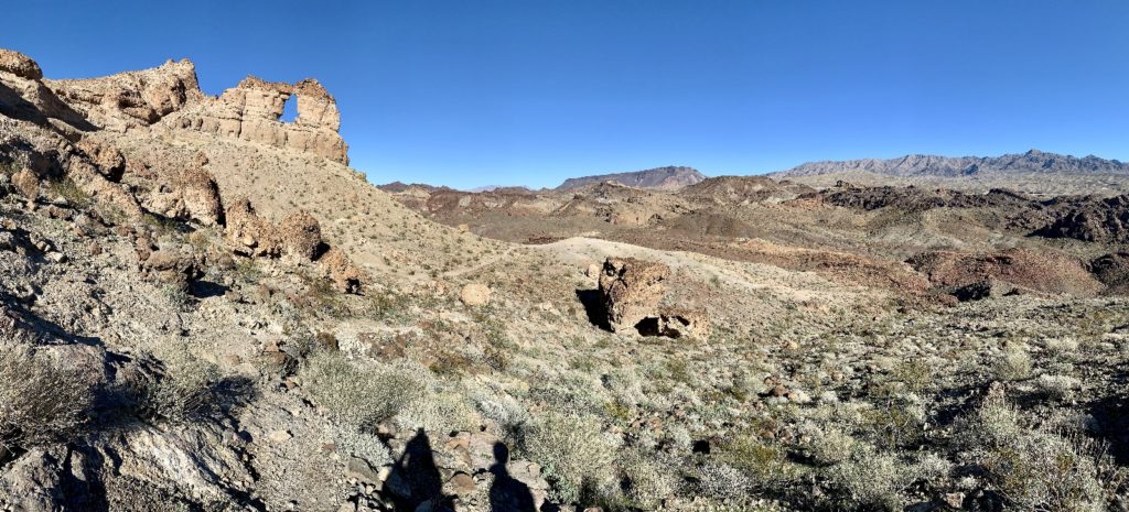
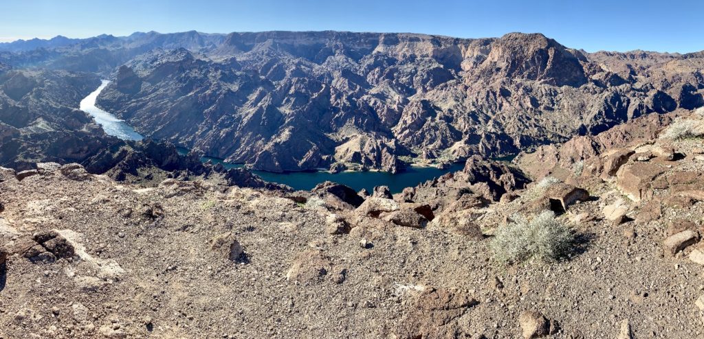
This was a spectacular hike, certainly worth the designation of “last hike of the decade”. We didn’t see anyone on our hike in and just a few parties on the hike out. Liberty Bell Arch lived up to its name and was a lovely geological formation with nice colors. Past the arch, the overlook of Black Canyon of the Colorado River was spectacular. Standing on the edge of the canyon rim staring down at the mighty Colorado River as it snaked its way along the Arizona-Nevada border, we couldn’t help but reminded of Hells Canyon back home.
The Beginning of a New Decade
Happy 2020! We wish you health, happiness, and adventure. What will your adventures be this year? We all have different ideas of what constitutes adventure. We hope that you will have new experiences that challenge you in some way and make you feel a sense of satisfaction. It is good to push your comfort zone a bit. We’ve done that over the past year. It has been terrifying at times, but it has also been incredibly rewarding.
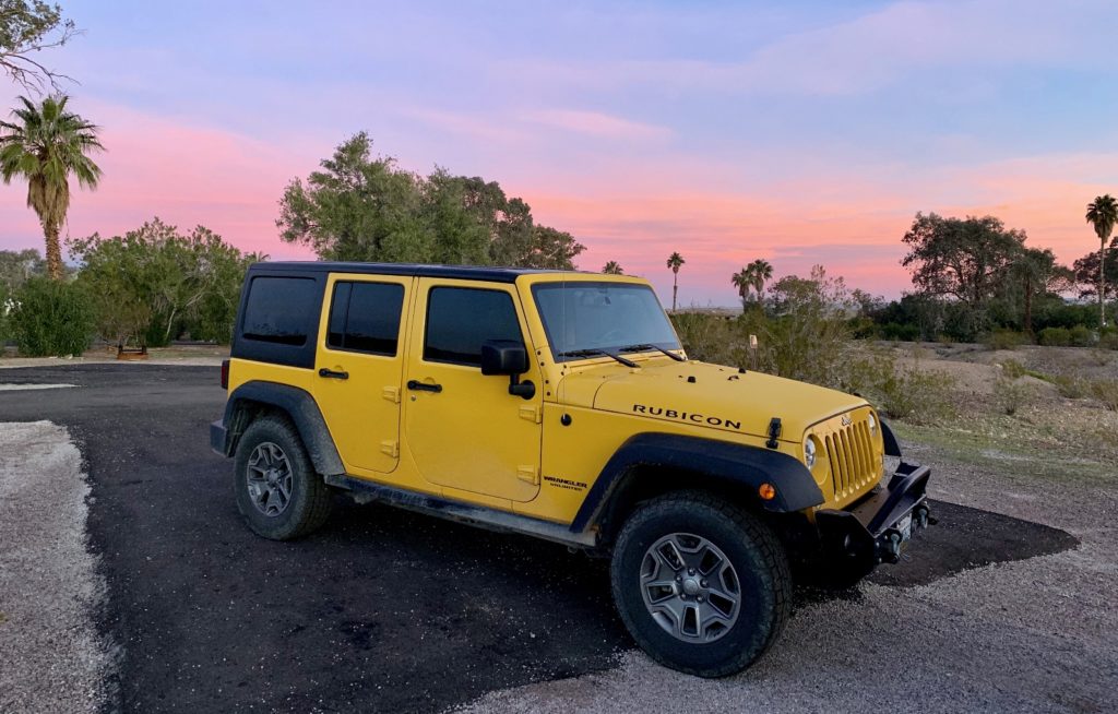
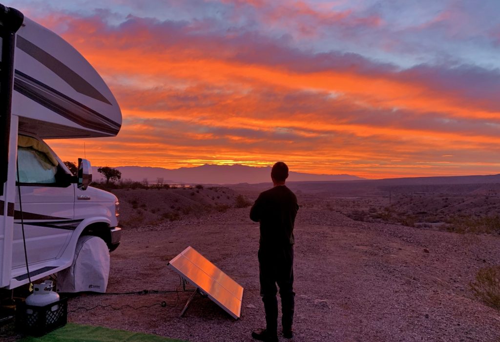
We began the new decade with one of the most beautiful sunrises we’ve ever experienced. It began as a hint of pink over Lake Mead. The light and colors evolved until they filled every inch of the sky. It was awe inspiring.
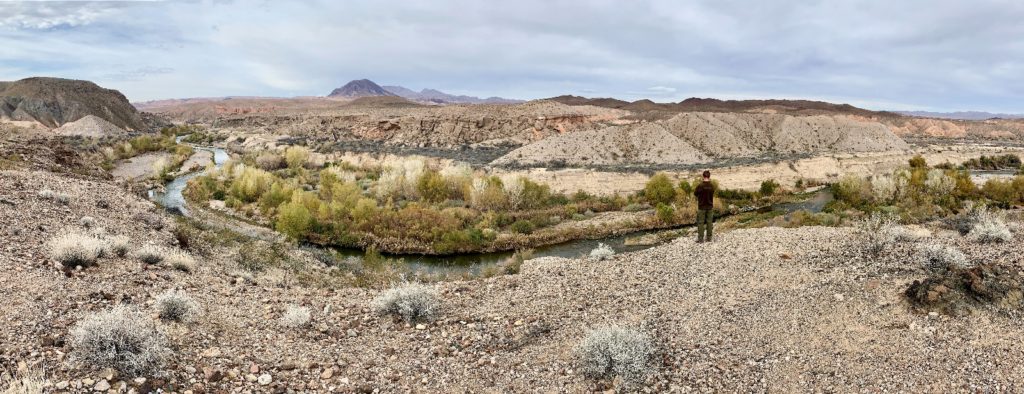
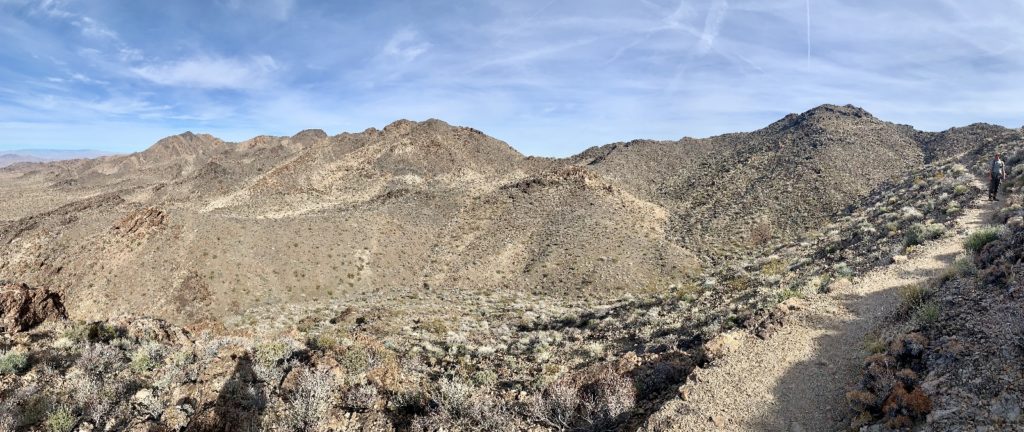
We spent the morning hiking the short and easy Lake Mead Bluff Trail. This 2.6 mile round trip hike departs from the Las Vegas Bay Campground and offers nice views down onto Las Vegas Creek shortly before its confluence at Lake Mead. This was a nice enough little hike, but really it was just a good opportunity to rest my knees after the rocky trail to Liberty Bell Arch the day before.
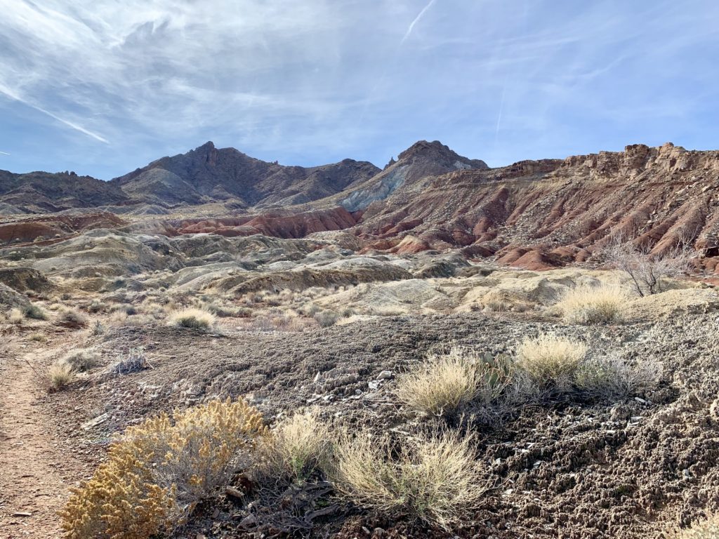
Muddy Mountains Wilderness: Bowl of Fire South
Nevada is full of designated wilderness areas. The Wilderness Act of 1964 defined wilderness as an area where the earth and its community of life are untrammeled by man, where man himself is a visitor who does not remain. That’s our kind of place. Seeing a wilderness area on a map is like seeing a National Park—my first thought is, I bet there’s great hiking there.
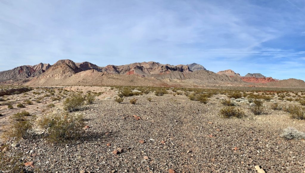
Congress designated Nevada’s Muddy Mountains Wilderness in 2002 and it now has a total of 48,154 acres. The area first caught my attention on a day trip from our camp near Overton to Boulder City. I glanced over to its towering grey mountains and spied an area of dark red rocks. And my first thought was, I bet there’s great hiking there.
After a little research, I learned that this area of red rock is known as Bowl of Fire. A couple different route options, but no official trails, lead hikers to the area. We parked at mile marker 18.2. There are no trail signs there, just a pull out with parking for about half a dozen cars and a sliver of Bowl of Fire peaking over the hills to the north. We followed an obvious social path with occasional cairns north to the southern end of Bowl of Fire.
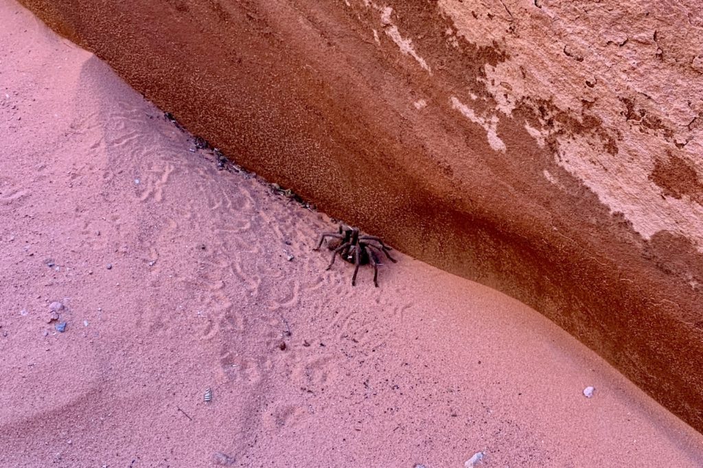
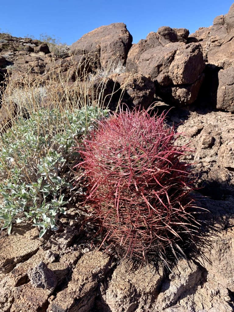
Once at Bowl of Fire, we explored up washes, slots, and desert hillsides. We found a colorful Mojave Desert habitat of waist-high creosote bush, yucca, beavertail cactus, and catclaw acacia. The region is inhabited by bighorn sheep, kit fox, jack rabbits, coyotes, desert tortoise, and chuckwalla, but our only wildlife sighting was a tarantula who was guarding a slot canyon we were passing through. We gave him as wide a berth as possible, but we had to pass within a couple feet of him. This was our first tarantula sighting on trail and it caused a lot of excitement!
Pinto Valley Wilderness
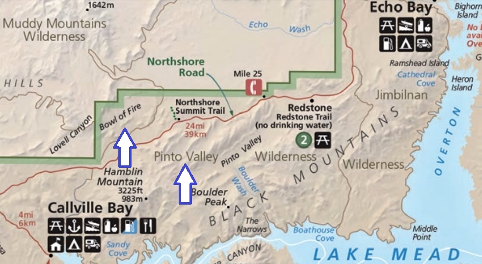
Across Lake Mead’s Northshore Road from Muddy Mountain Wilderness is another wilderness area, Pinto Valley. The 39,173 acre wilderness protects rugged hills and scenic valleys between Northshore Road and the western shore of Lake Mead. You won’t find anything for official trails here, but there are a few routes that only the locals seem to know about.
Once again, the AllTrails app tipped us off to an interesting looking route. Ironically, it started at the same trailhead as the Bowl of Fire route. We parked at mile marker 18.2, crossed Northshore Road, and followed obvious user trail to a wash. From there, we navigated through Pinto Valley using the AllTrails app and by following footprints in the sand. There was no real destination for this hike—just a Mojave Desert ramble through interesting washes and around colorful hills until we felt we had gone far enough.
River Mountain Trail, Boulder City
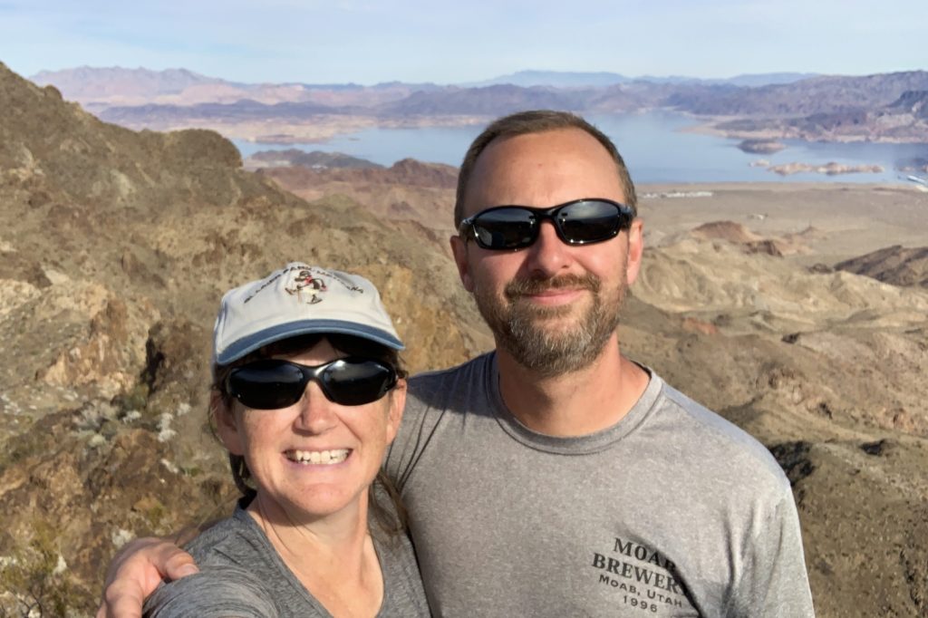
When we are in an area ripe with hiking opportunities and we discover a little known trail where the locals hang out, we know we’ve scored. The River Mountain Trail was just that. I hadn’t read about it during any of my area research, but we passed the trailhead one day on our way into Boulder City for supplies. The trailhead was located in a fancy subdivision, but we could see some interesting rocks and impressive mountains in the distance. Since we have nothing but time, it seemed worth a try.
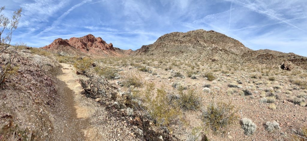
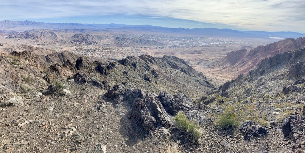
The River Mountain Trailhead is located on the north side of highway 93 just as you are entering Boulder City from the Hoover Dam and Lake Mead side. There is a large paved lot with information kiosk, but no restroom. River Mountain was constructed by the CCC in 1935-1937 and displays extensive rock work that was their signature trademark. The trail climbs 3 miles (one way) to Black Mountain Mountain Overlook where hikers are treated to 360 degree views of Boulder City, Las Vegas, and Lake Mead. There is over 1,000′ elevation gain on the climb to Black Mountain, but the trail is well graded and never too steep.
The first thing that impressed me about this trail is that it’s “hiker only”. Boulder City has done an exceptional job of developing and maintaining a network of trails in the area and there is something for everyone here. Most trails are mixed use, but this one is only for those willing to beat feet.
We made our way up a canyon with impressive rock cliffs on either side. We spotted a desert bighorn ewe and lamb up high as we made our way up a series of well-graded switchbacks.
At the top of the switchbacks, we came to a trail split. To the left is Red Mountain, to the right Black Mountain Overlook. Thanks to a tip from a Boulder City local who we met on the trail, we turned onto the Black Mountain Overlook Trail. We made a final climb and then enjoyed a long break to take in the phenomenal views.
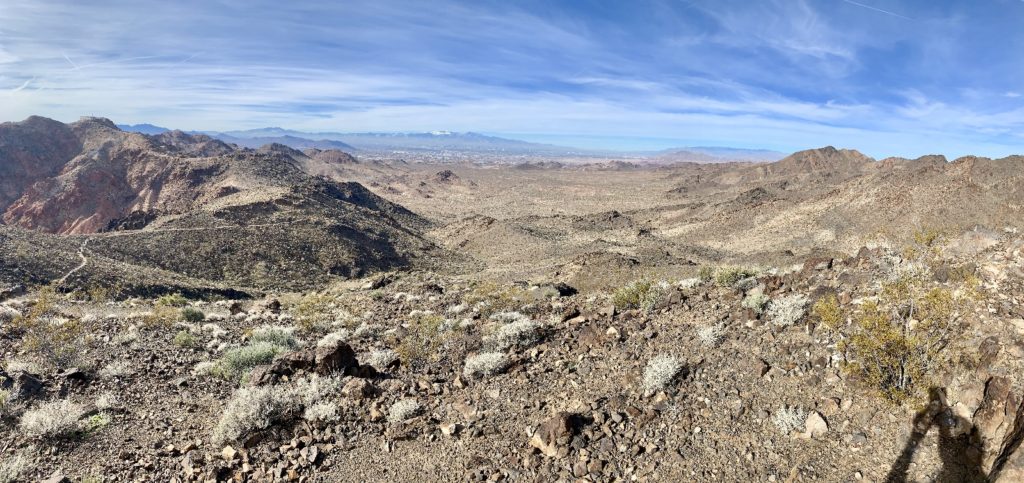
River Mountain Trail was a great find! The trail was exceptionally well built and maintained and the views were much more impressive than my photos show. The best part of the day was meeting several local hikers and trail runners, especially Kasie and April. These young women run the trail several times every week. They passed us on their way up and down the trail, but stopped both times to talk with us. They gave us great information on the greater Las Vegas area and were both warm and lovely people. When we got back to the Jeep, Kasie had left a note on our windshield saying how nice it was to meet us with a heart drawn in the corner. I wonder if she realized how much that made our day?
The Adventure Continues
Join us next week as we visit Red Rock Canyon and continue our Lake Mead National Recreation Area adventures.
Your Support Helps!
Are you enjoying being part of our adventure? Do you like what you see here? If so, please consider supporting this site by doing some of your online shopping here. We only post links to products that we use and that meet the Evans Outdoor Adventures seal of approval! Not interested in any of these items? No problem! By accessing Amazon through the links below and making any purchase, you get Amazon’s every day low pricing and they share a little with us. This helps us maintain Evans Outdoor Adventures and is much appreciated!
How in the heck do we find all these fun places? I do extensive research using a variety of online resources. I also go old school and use maps. Yeah, maps. Remember those things that we used before iPhones and navigation programs? I’m a big fan of the Benchmark Road and Recreation Atlas series for the American West. They show incredible details including parks, tourist attractions, bodies of water, campgrounds, rest areas, etc.
Your photos are so spectacular. Such deep, rich blue skies. And that Lake Mead sunrise? Just magnificent, as those pesky Shadow People would agree! I’m drooling over the arid scenery as I brace for near record setting snowfalls on the Palouse. Please keep the Adventure Logs coming, it’s going to be a long winter!!
Thank you friend! We remember those Palouse winters well and we do NOT miss them! I am just so happy you don’t have to commute in that anymore. Hang in there- all that mountain snow will bring us some spectacular summer fishing on our favorite “tributaries of the Snake River”. We’ve been enjoying some walks along Las Vegas Creek which flows into Lake Mead. Jason keeps thinking there might be some good fishing there, but access is horrible. Makes us long for our special home streams.
Lusha
I’m so glad you enjoyed your Southern Nevada adventures!! I still think my little corner of the world is the best… but I bet you guys have far more comparison! Happy Trails to you both! I was so happy to meet another trail friend!
Love Kasie!!!!
Hi Kasie, so great to hear from you!! Yes, your little corner of the world is definitely a special place. We really enjoyed all our time there. I’m behind on my posts, but we ended up staying along Lake Mead until the end of January… and we still didn’t get to see everything we wanted! We’ve been telling everyone that “Boulder City is full of the nicest people!” and you’re at the top of that list 🙂 Remember to look us up if you come to Eastern Washington!
Lusha