December 14-22, 2019
Exploring Lake Mead
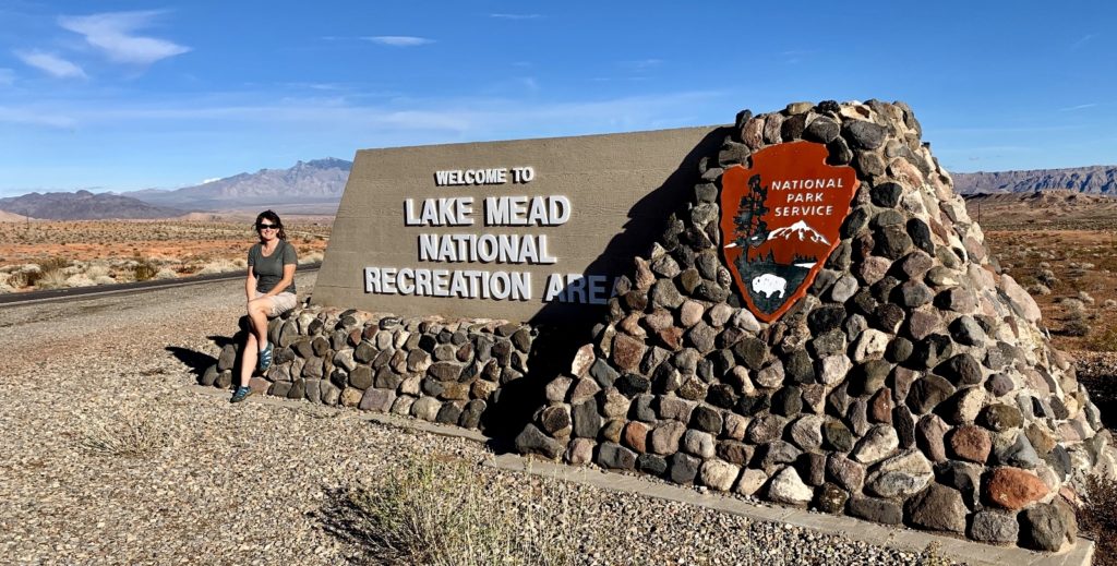
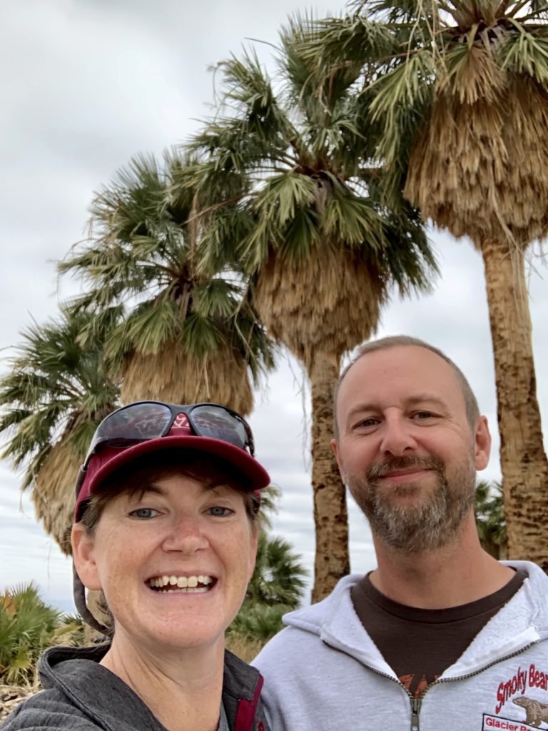
We were excited—one of the highlights of our 2019-2020 snowbird travels was coming up. After three months away from home, we’d be seeing family soon! But first, we took a break from our Valley of Fire adventures to explore the west side of Lake Mead National Recreation Area. We’d be moving closer to Las Vegas in a few days and we wanted to check out the numerous options available for RVing along the lake.
Lake Mead is the nation’s first and largest recreation area covering 1.5 million acres with nearly 7.9 million visitors in 2017. At just half an hour from the Vegas Strip, Lake Mead is no doubt a refreshing relief from the triple digit temperatures of summer. In the winter, Lake Mead is pleasantly quiet with numerous camping options for northern snowbirds such as ourselves.
We drove from our RV site just south of Overton, Nevada south along the Northshore Road. We visited two popular boondocking locations (Stewart’s Point and Government Wash), one private RV park (Lake Mead RV Village), and four National Park campgrounds (Echo Bay, Calville Bay, Las Vegas Bay, and Boulder Beach). All were nice options, but we especially liked Boulder Beach for our upcoming stay with our nephew. I’ll be doing a blog post soon that will cover all the options in more detail.
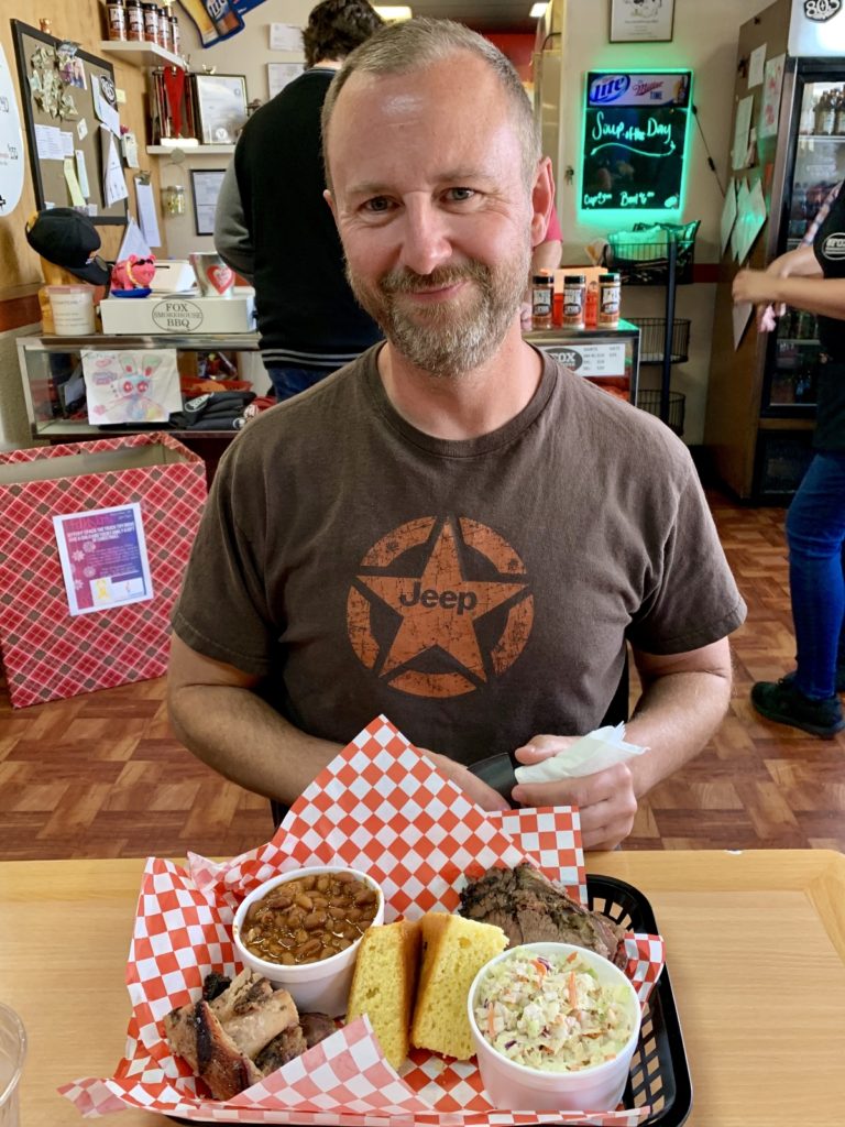
Ending our explorations at Boulder Beach, we realized we were just a few miles from Boulder City, “the city that built Hoover Dam”. We hadn’t had a meal out since Hurricane, so we decided to give a local establishment a try. A quick Google search revealed Fox’s Smokehouse BBQ as one of the highest rated options. And wow, were we impressed—food and service were exceptional! We even had the owner visit our table and ask how everything was. I told him we’d be traveling for three months and this was by far the best meal we’d had. Everything was fantastic and he should keep doing what he was doing. He seemed grateful for the rave reviews and was happy to hear we planned on coming back (which we did).
Max Arrives!
Before leaving home in September, our nephew Max asked, “where do you think you’ll be in December?” I wasn’t sure, but figured somewhere Vegas area or south. I inquired why and he said he’d love to come visit us for his Christmas break. I was a little surprised, but then again, not really. This kid loves to explore and have new adventures. I still refer to Max as “a kid” out of habit, but that isn’t very fair. He has grown into an exceptional young man who will graduate with an engineering degree from Washington State University in just a few months and has been a successful small businessman for years.
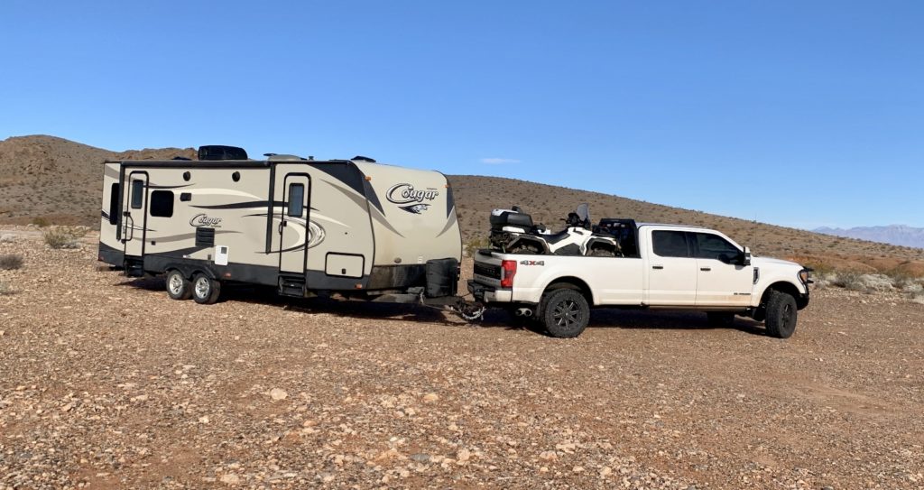
The roads between home and Vegas can be pretty bad in December, but Max made it with travel trailer and ATV in tow. The plan was to spend the first few days at our boondocking spot near Valley of Fire and then move down to Boulder Beach on Lake Mead. Max had been to Las Vegas before, but he’d never been to any of the areas around Vegas. He set an aggressive agenda for his week, one that was reminiscent of our vacations during our working days.
Valley of Fire
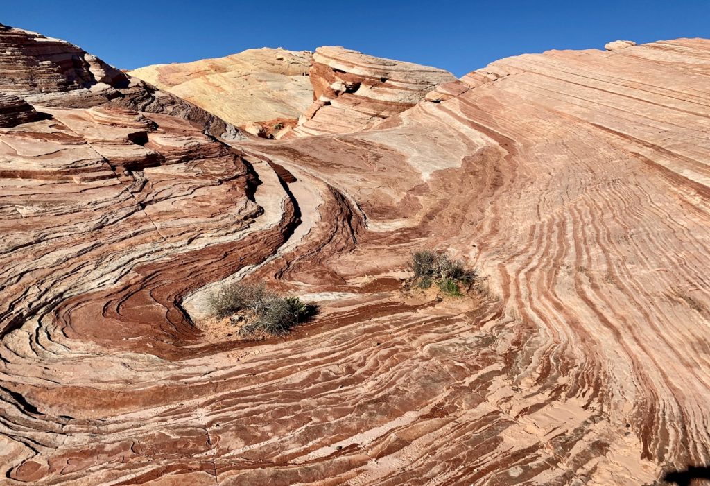
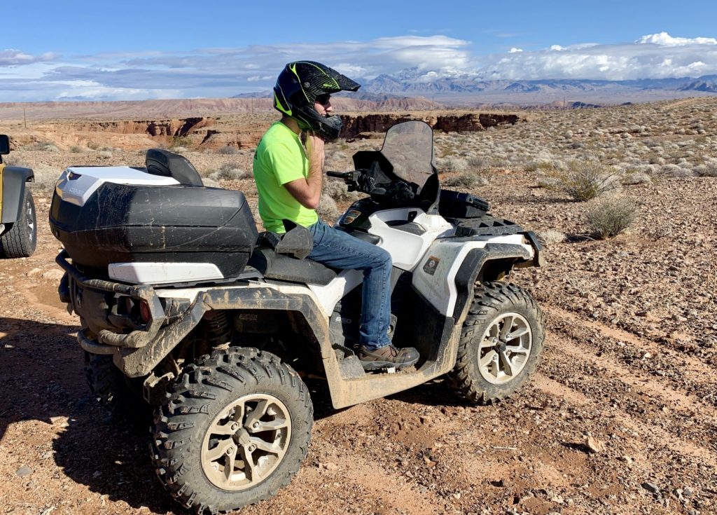
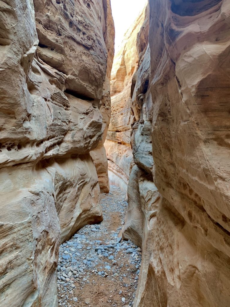
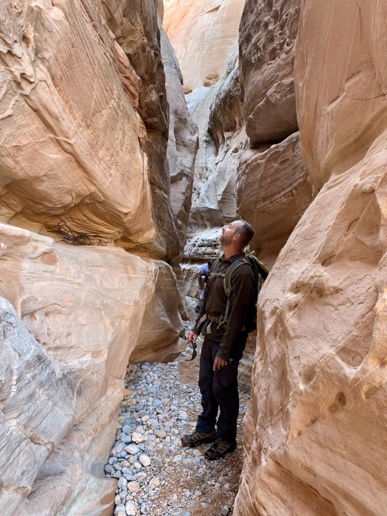
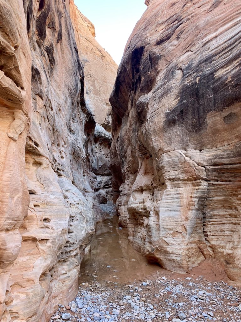
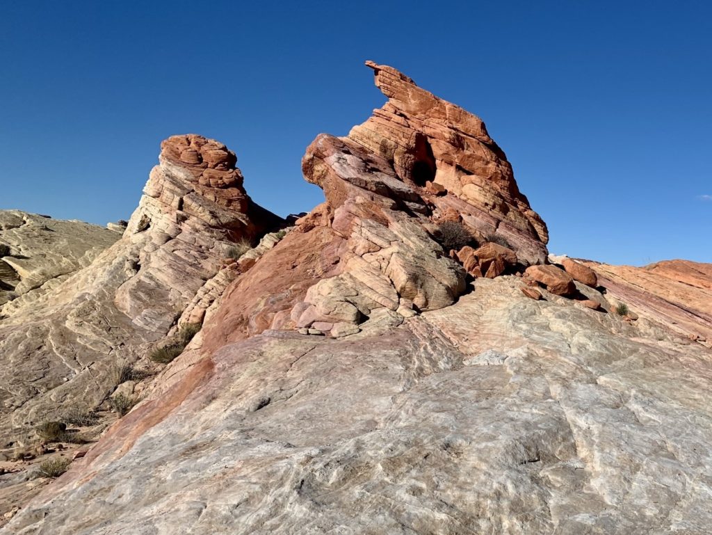
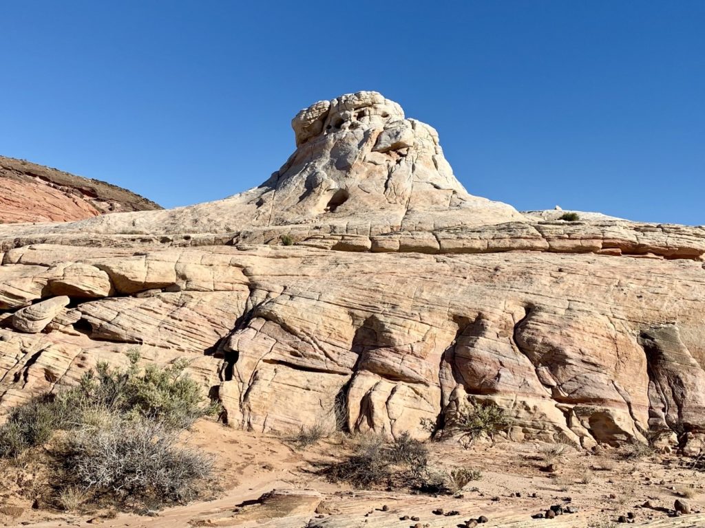
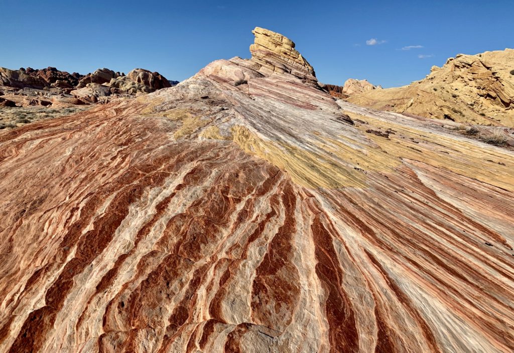
First up, we took Max to Valley of Fire State Park. We had gotten to know the park well the previous week and I had a route in mind that would give Max a good introduction to desert hiking including slickrock routes, slot canyons, rock art, and colorfully sculpted sandstone. Hiking in the desert Southwest is very different from what we experience in the mountains of the Pacific Northwest and I wanted Max to get a good taste of what this area has to offer.
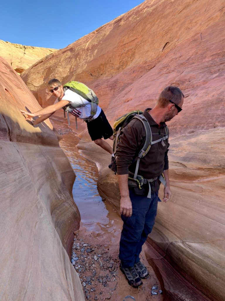
We started out by retracing the route Jason and I had hiked through Fire Wave and Pastel Canyon the week before. Then, using the AllTrails app on my phone, we navigated from Pastel through a beautiful slot canyon and connected in with the Prospect Trail. We hiked that for a while and then retraced our steps back and caught the White Domes Trail to the end of the White Domes Road and back to the Jeep via a short cross country route. Some of the connections that made this 5.0 mile loop possible are not found on the official park map. Once again, the AllTrails app paid for itself!
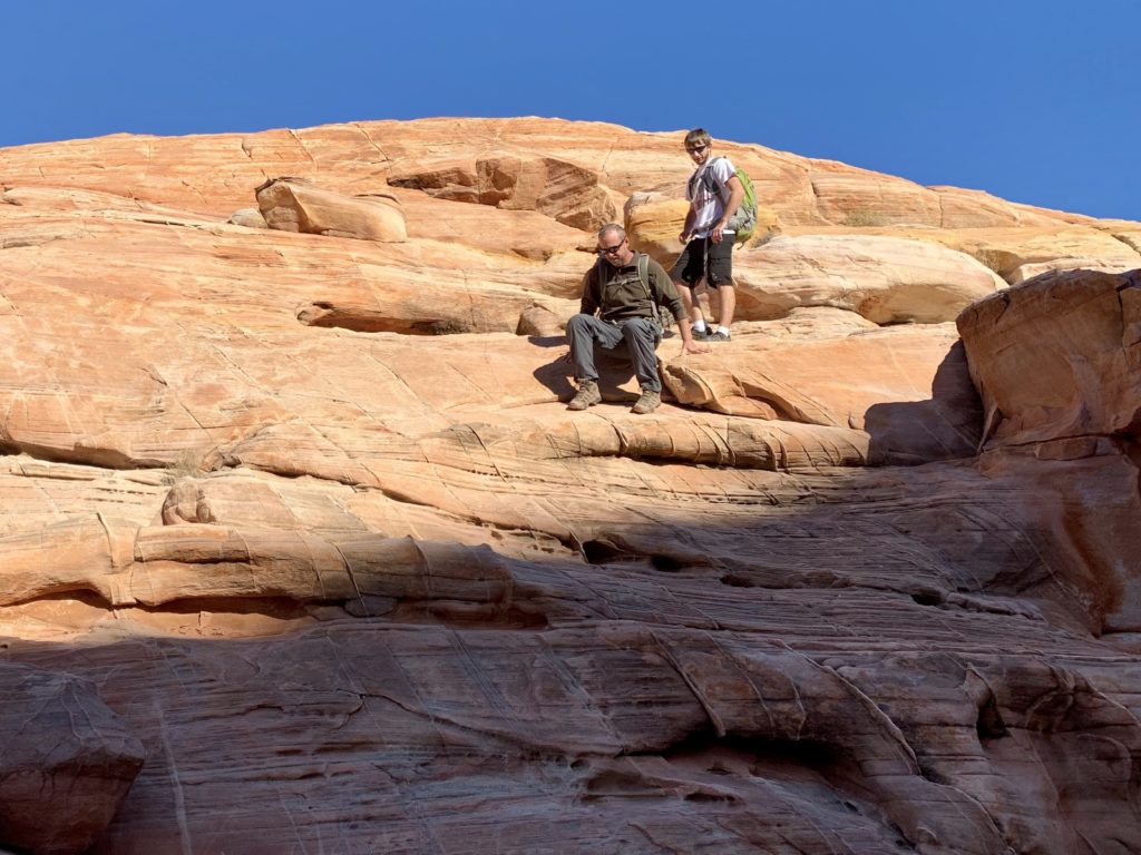
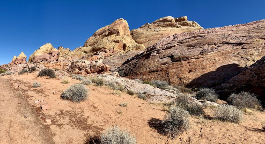
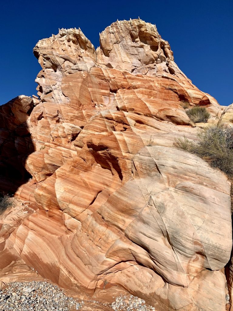
We then drove back to Parking Area #2. Jason and I had been eyeing up some interesting rock formations off to the east. There was no official trail there, but we found a social trail out to some beautifully sculpted and colored rocks.
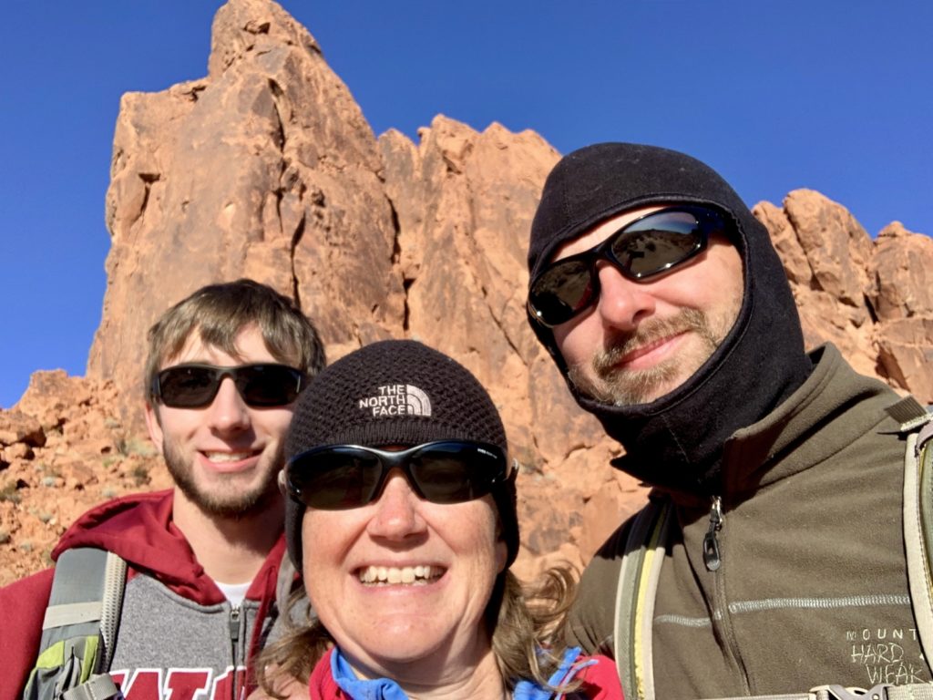
Zion National Park
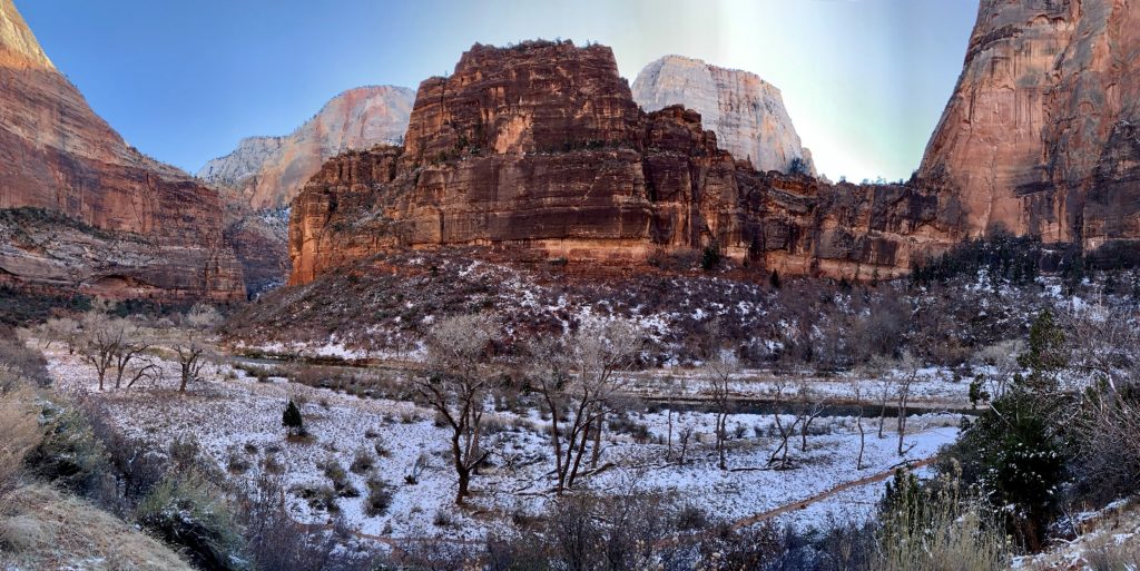
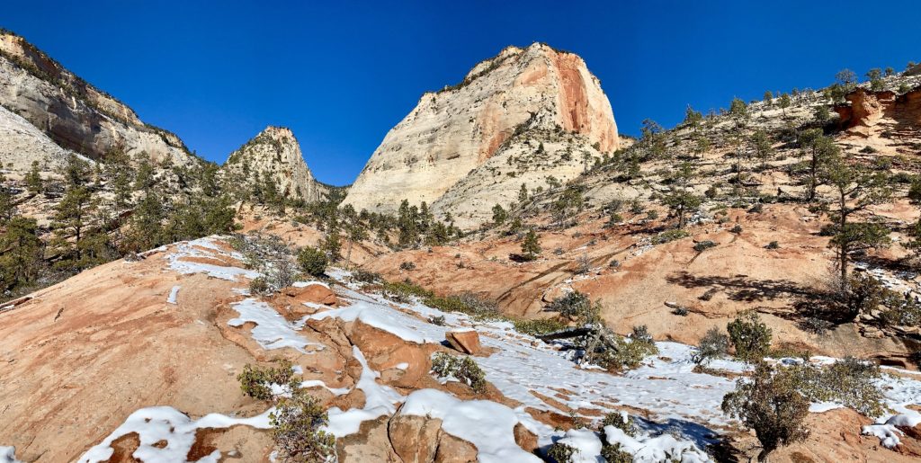
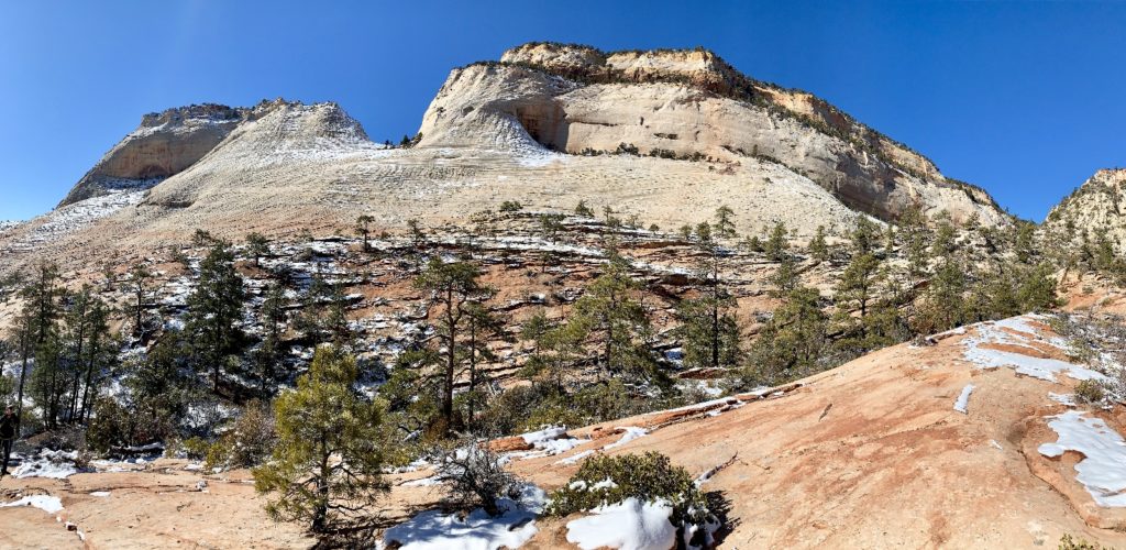
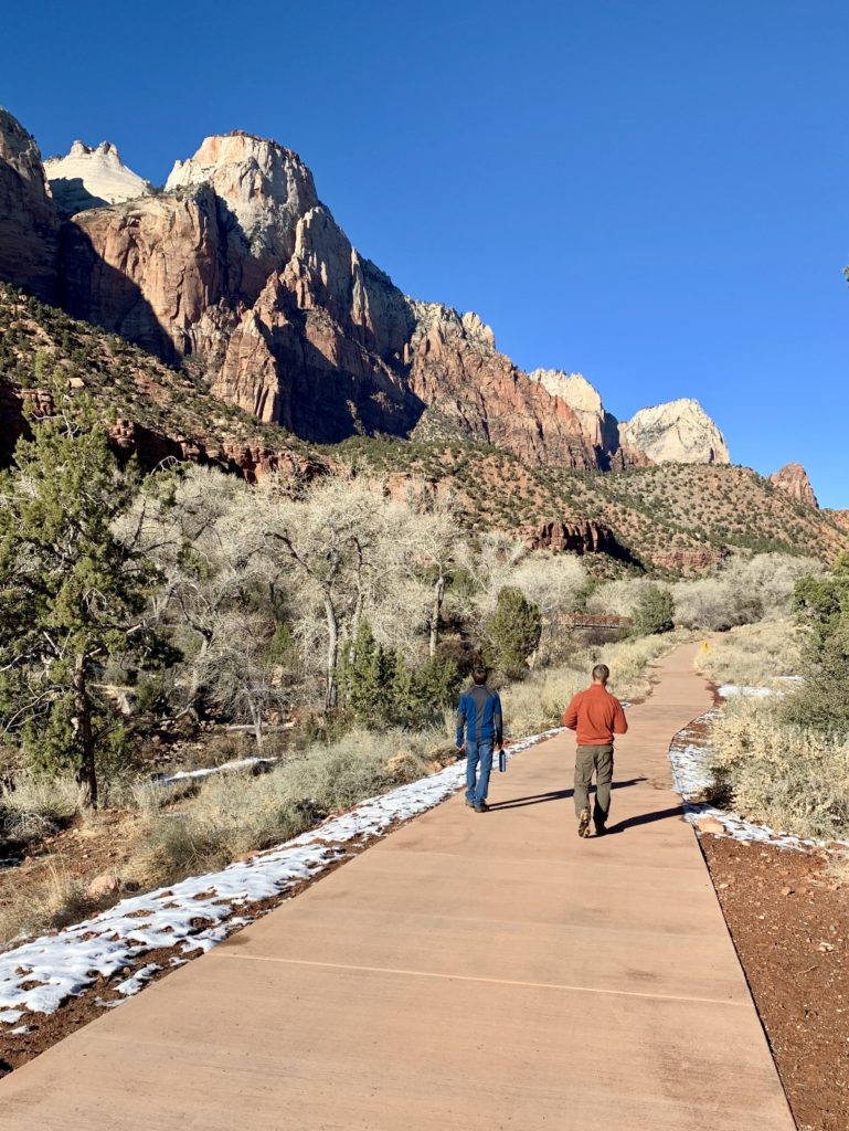
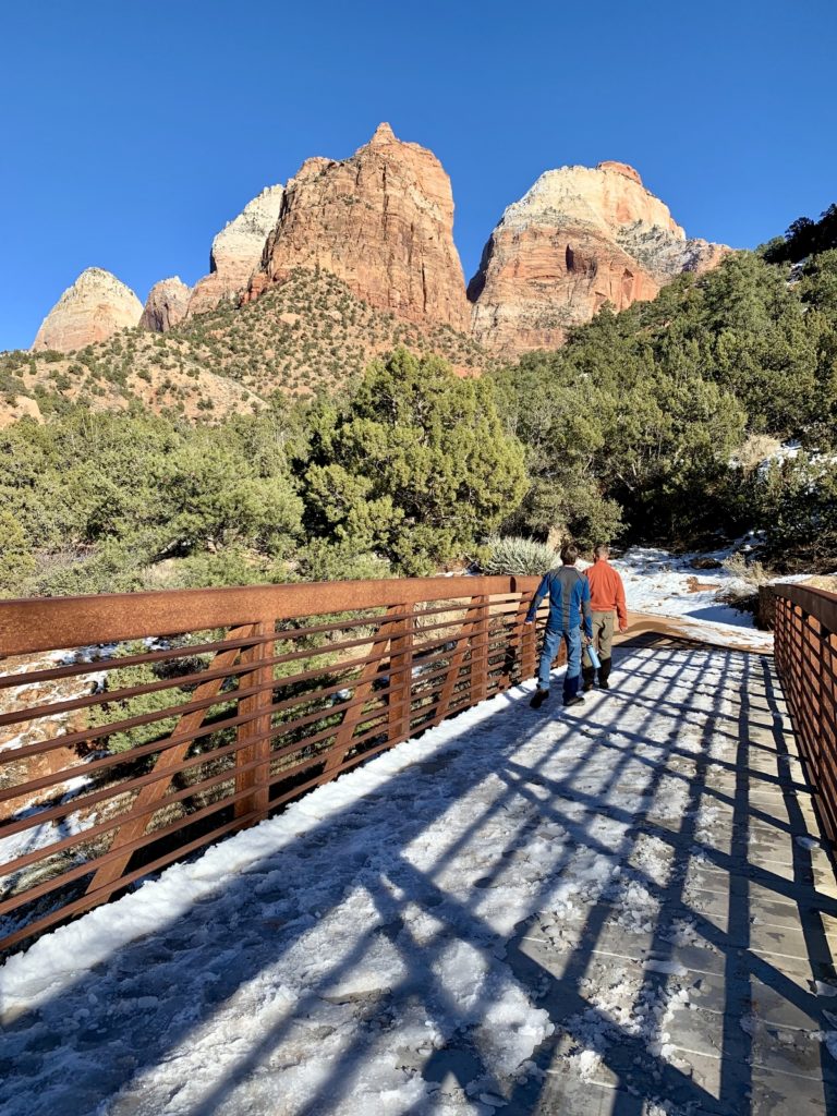
When we left Hurricane a couple weeks earlier, we didn’t think we’d be back so soon. But Max had never been to Zion and it was high on his bucket list for this trip…and it really didn’t take much arm twisting to get us to go back. The park had received snow since our visit and while our policy is to avoid snow (too many years of commuting in it), I was a excited to see the contrast of white against Zion’s red rocks.
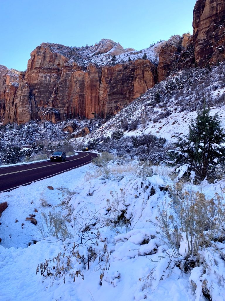
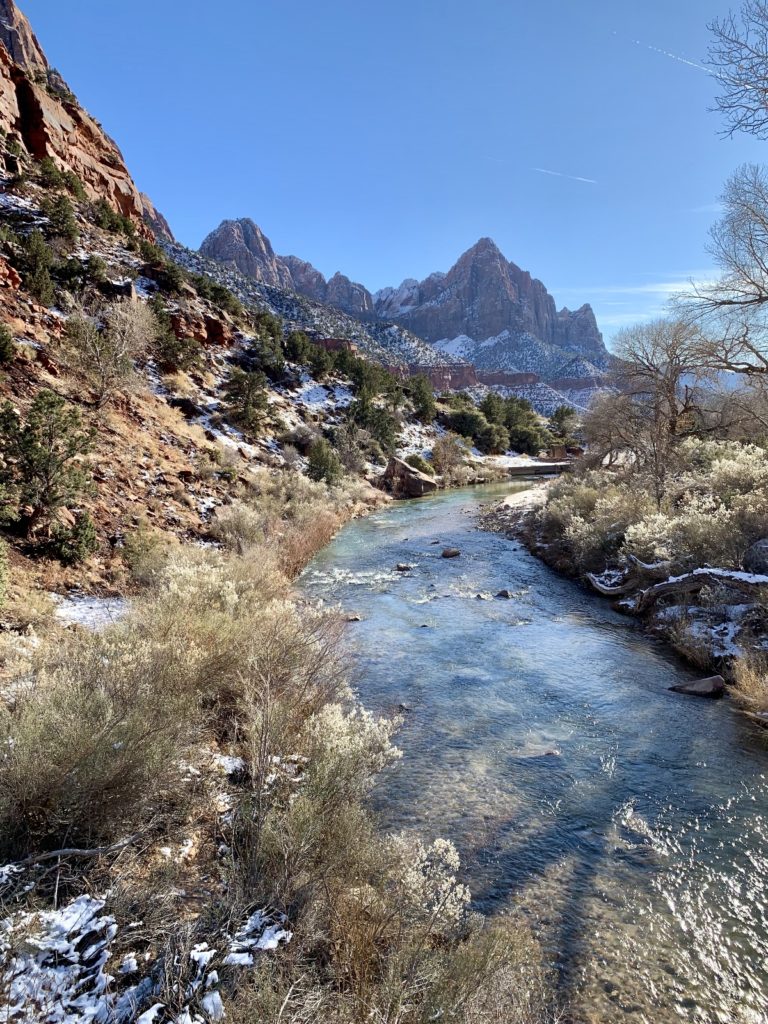
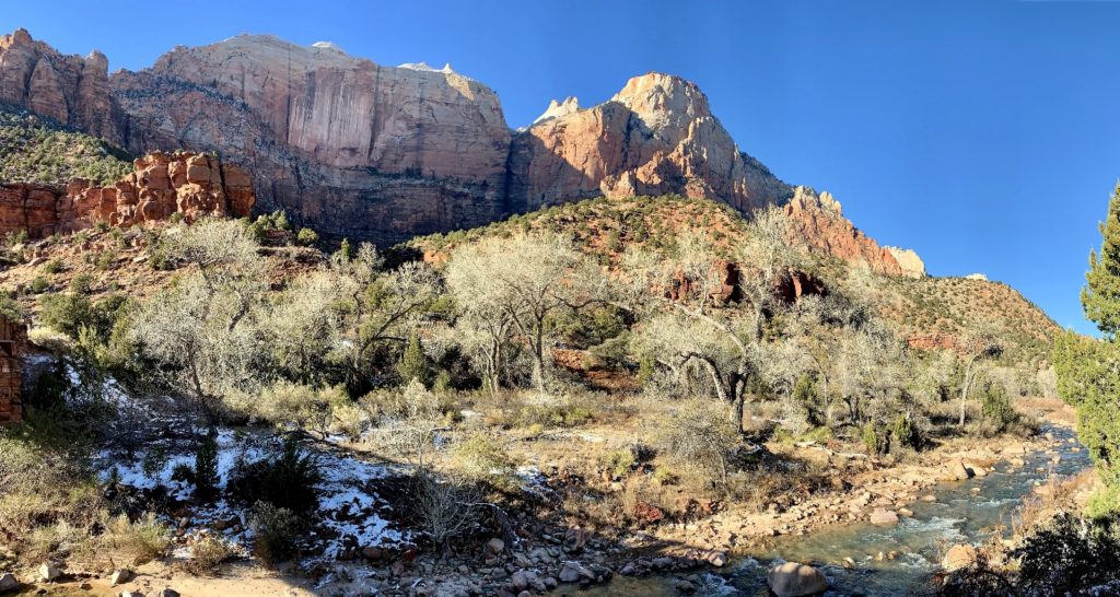
We started the day by driving along the Virgin River up Zion’s main canyon and stopping at all the major viewpoints. For most of the year, visitors have to ride a mandatory shuttle bus to see the sights in the main canyon, but we visited during one of the few months of the year that the shuttle is not in operation.
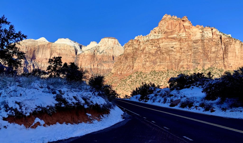
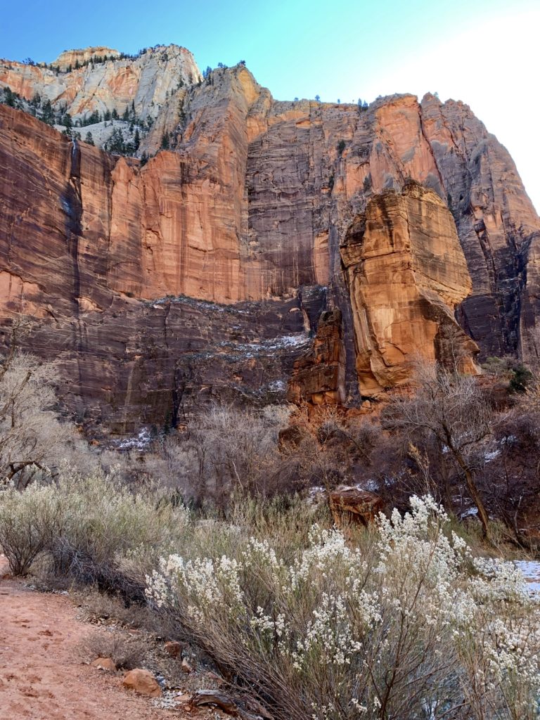
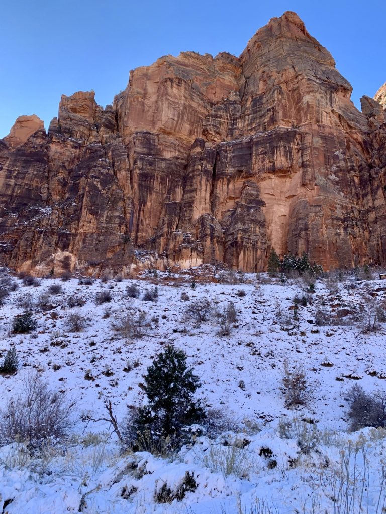
Finding most of the trails in the main canyon covered in ice, we made our way up to the park’s east side to see if we could get out of the shaded canyon and into some sun. Conditions looked promising at the route to Many Pools so we strapped on our packs and hit the trail.
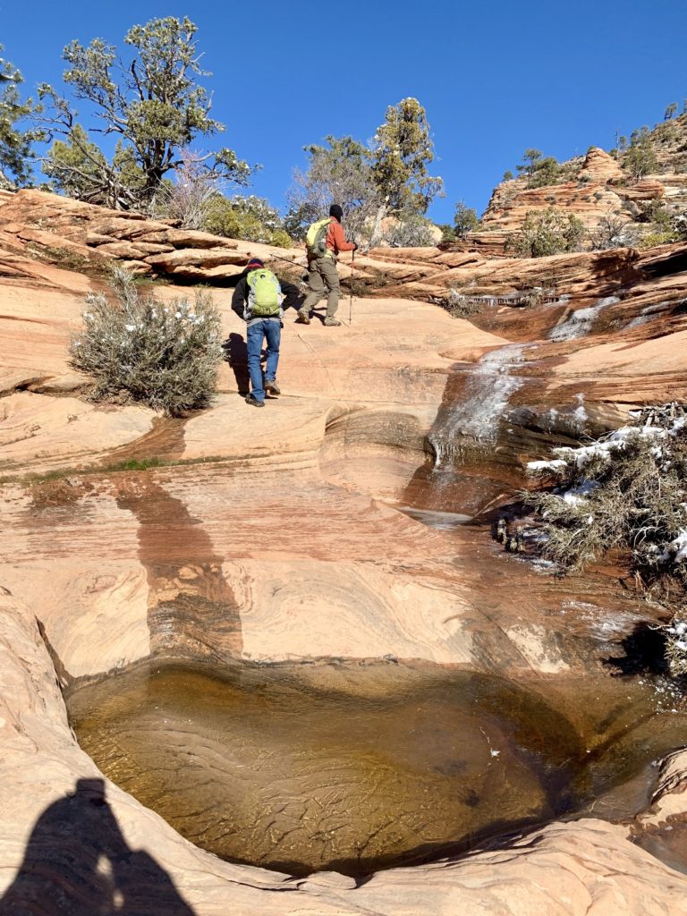
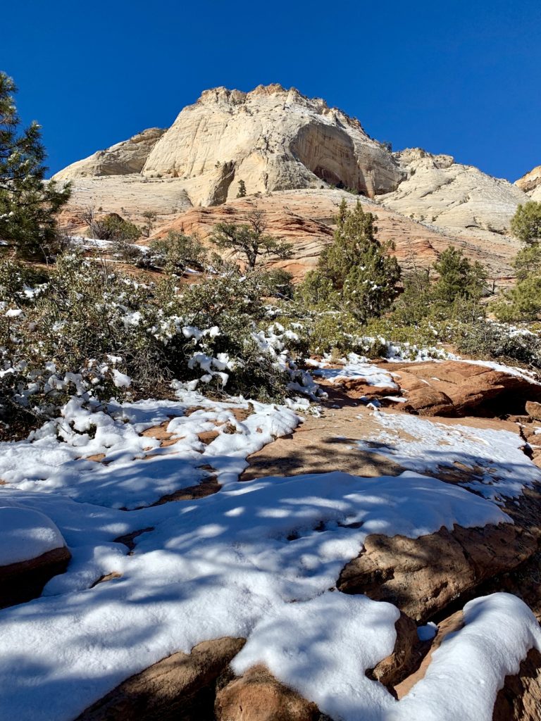
Many Pools is not an official Zion National Park trail, but it has become a relatively well known route. We first hiked the pools back in 2013 and didn’t see anyone. Now, the unmarked trailhead has portable toilets and garbage cans, a sign of its increasing popularity. We hiked the trail a few weeks earlier after heavy rains. The pools were beautiful, but it was a grey and dreary day to be on the trail. Now, we’d get to see it with blue sky, water, ice, and snow!
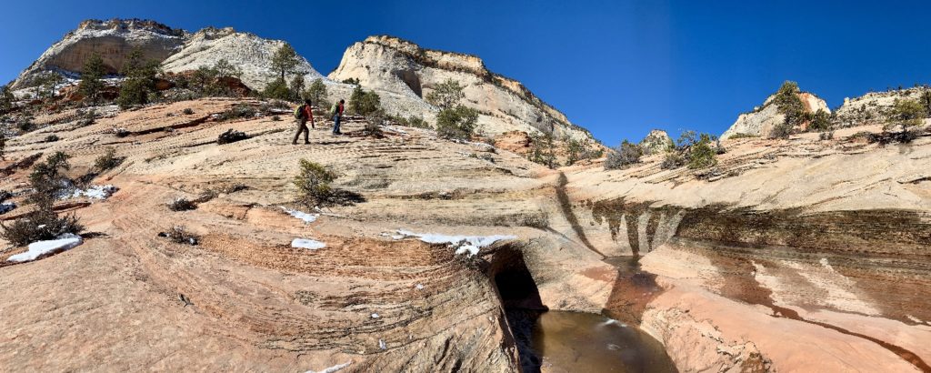
Many Pools gets its name from the potholes that have been eroded into the sandstone. Water collects in these potholes after a rain creating a beautiful series of pools. There is no trail to follow and you simply make your way up the slickrock following the path of least resistance.
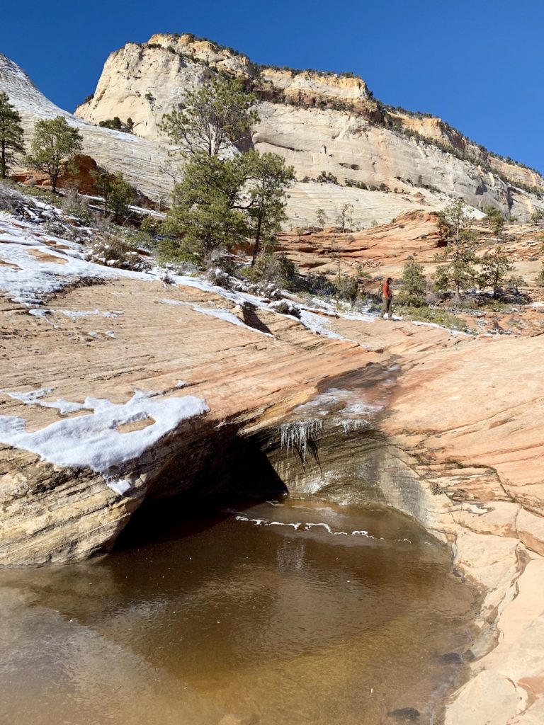
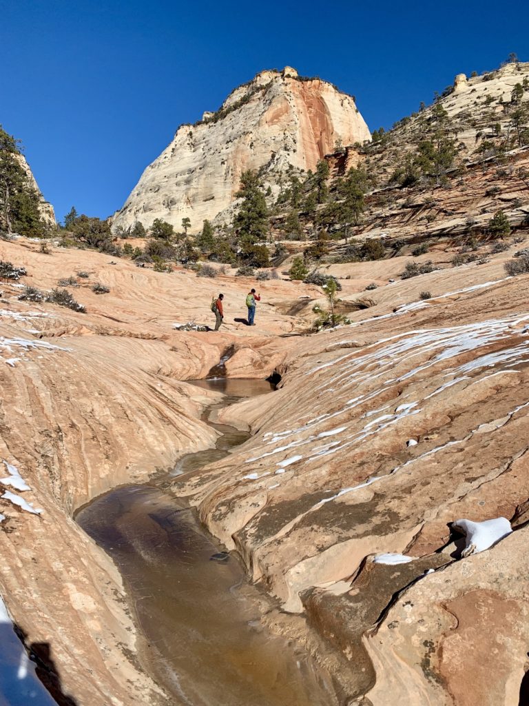
The pools were iced over when we arrived and we enjoyed a beautiful hike up the slickrock. Icicles had formed along some of the cliffs and we enjoyed hearing the sound of them crashing onto the slickrock as the sun’s warm rays melted them away.
To reach Many Pools, travel highway 9 east out the two tunnels to the East Canyon. At about .9 miles east of the small tunnel, park in the pull-off on the south side of the road. Carefully walk along the road (in the direction away from the tunnels) and look a path off the left side of the road.
After Many Pools, we dropped back down to near the Visitor Center and hiked the Pa’rus Trail from the Human History Museum to Canyon Junction. This paved trail is an easy stroll that yields spectacular views of the Virgin River and surrounding peaks. Pa’rus is one of the few wheel chair accessible trails in the park and it is the only trail open to pets and bicycles.
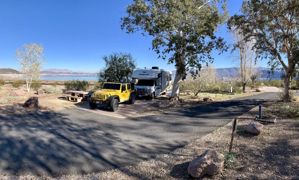
Move to Boulder Beach Campground
Midway through Max’s visit, we relocated from near Overton south to Boulder Beach Campground on Lake Mead, not far from Boulder City. This is a National Park campground with dump and water available, but no hookups at the sites. We had a beautiful lake view site with abundant wildlife. I’ll describe this location in more detail in my future blog post covering Lake Mead camping options .
Max was in need of full hookups so he checked into Lake Mead RV Village next door. He had a similar view to us, but he enjoyed electric, water, and sewer hookups.
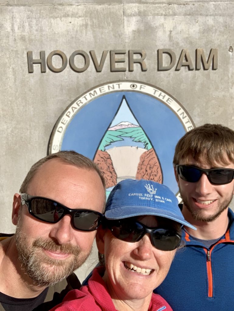
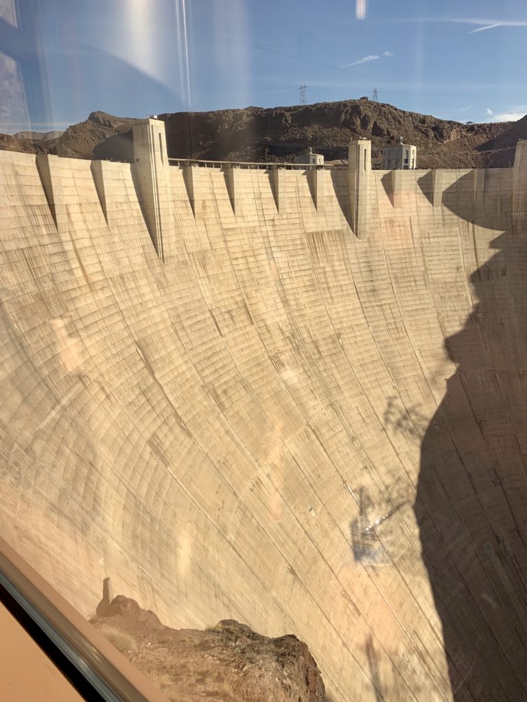
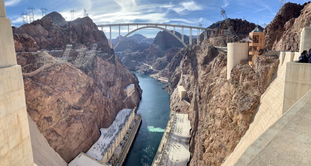
The “Dam” Tour & Historic Railroad Trail
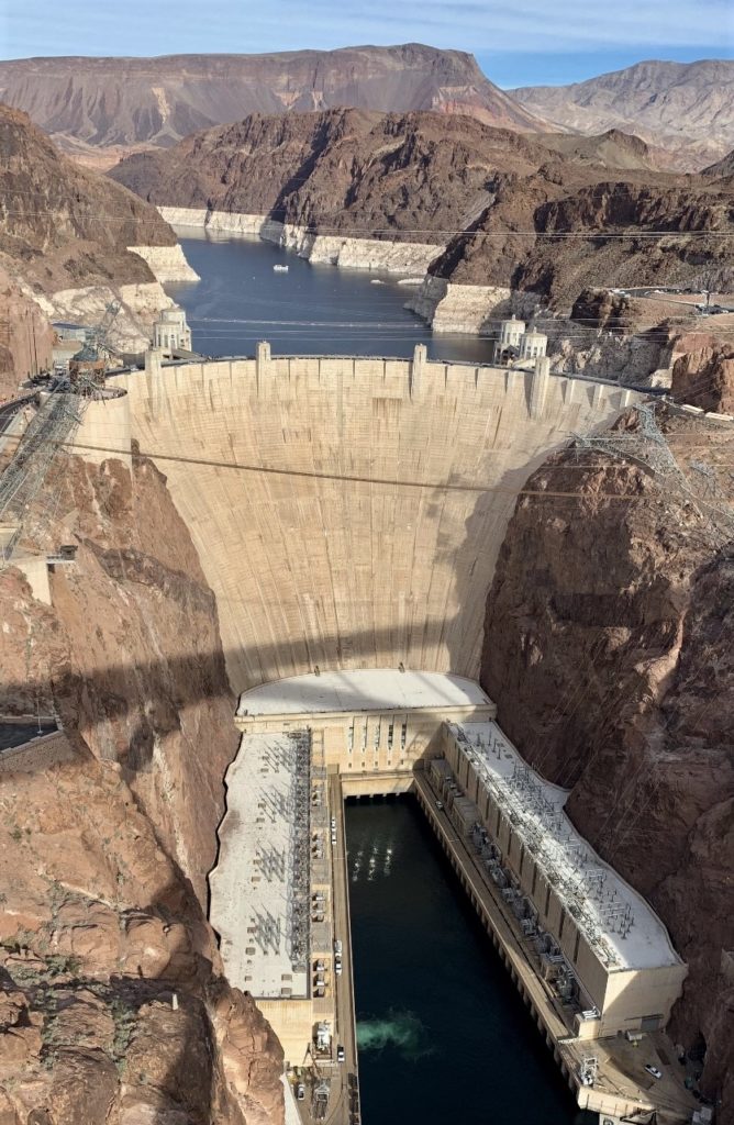
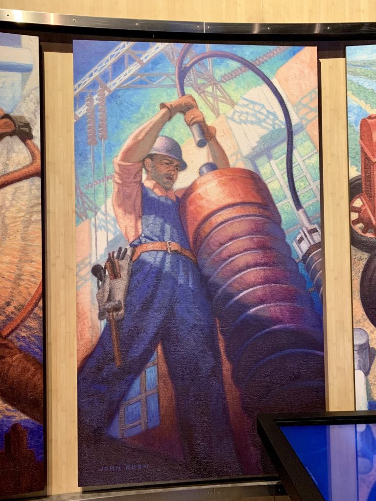
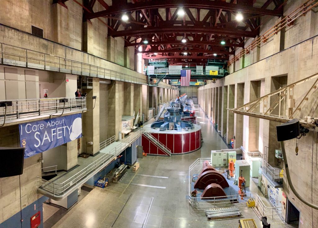
A bucket list item for all of us was touring Hoover Dam. We were all anxious to take the “dam” tour (yes, we made lots of dam jokes all damn day). There was something interesting for all of us at Hoover. A builder and soon-to-be civil engineer, Max was fascinated with the construction process. Jason spent his career as a software engineer for a company that provides power system protection for utilities and industries worldwide. He was excited to see a wall of Schweitzer Engineering Laboratories relays in the powerplant. I’m a history buff, so I really geeked out over the visitor center’s photos and historical displays.

There are various options for seeing Hoover Dam:
*Dam View: There is a stunning view of Hoover from the Mike O’Callaghan – Pat Tillman Memorial Bridge. Cost = free!
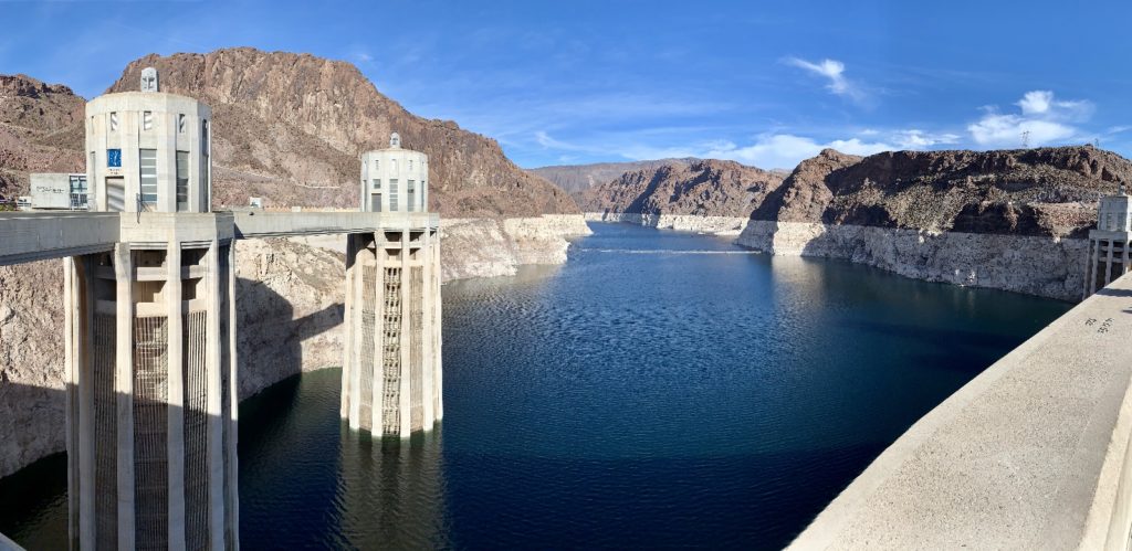
*Self-Guided Visitor Center Tour: visit the Original Exhibit Building with narrated 3D model of the region’s dams and power systems, enjoy a 360 degree view of the Dam, Colorado River, Lake Mead and Hoover Bypass Bridge from the Observation Deck, and immerse yourself in the history of Hoover Dam as you walk through the narrated exhibits. Cost = $10 + $10 parking
*Guided Powerplant Tour: all of the Self-Guided Tour activities plus walk through original construction tunnels and tour the Powerplant. Cost = $15 + $10 parking
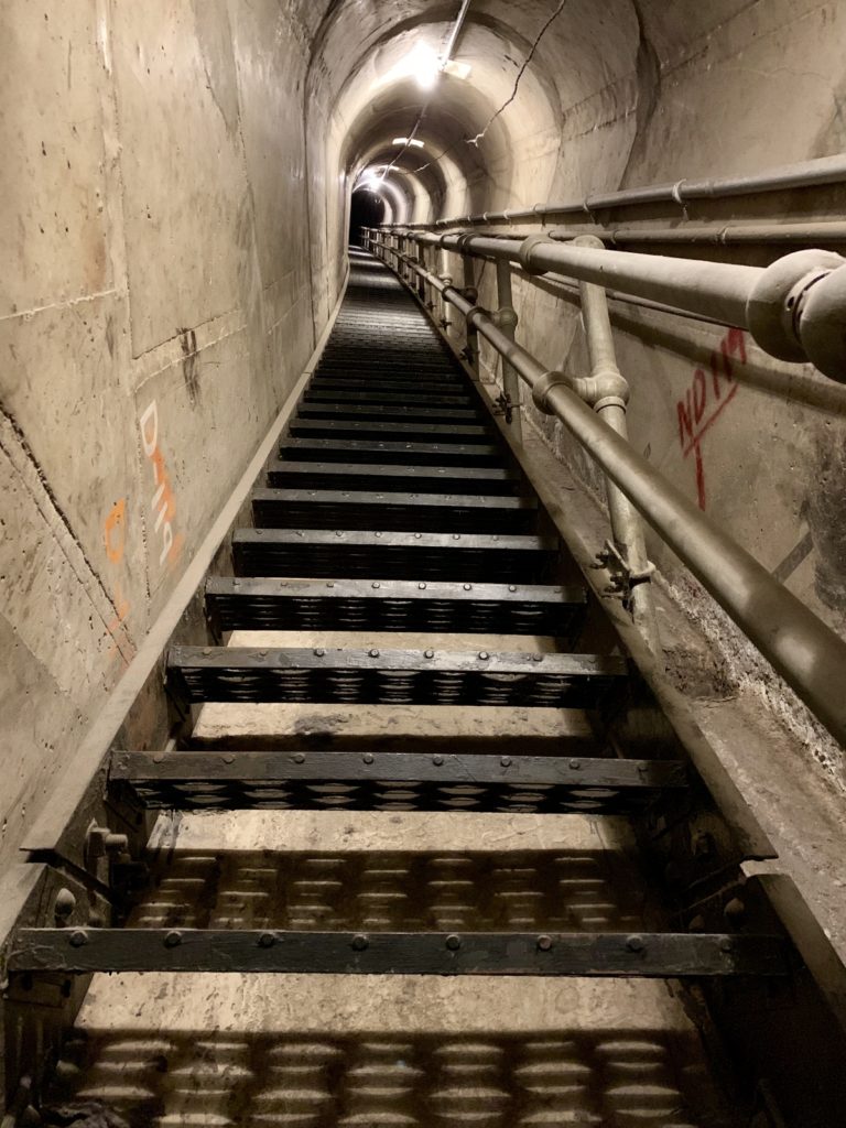
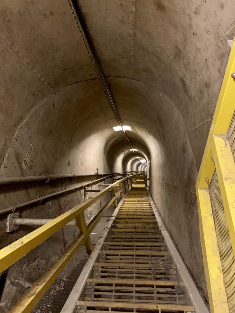
*Guided Dam Tour: All of the Self-Guided Tour and Guided Powerplant Tour activities plus walk through the inspection tunnels at the center of the dam view the Colorado River through the inspection ventilation shaft, and visit historic tour tunnels and ride original elevator to the top of Hoover Dam. Cost = $30 + $10 parking
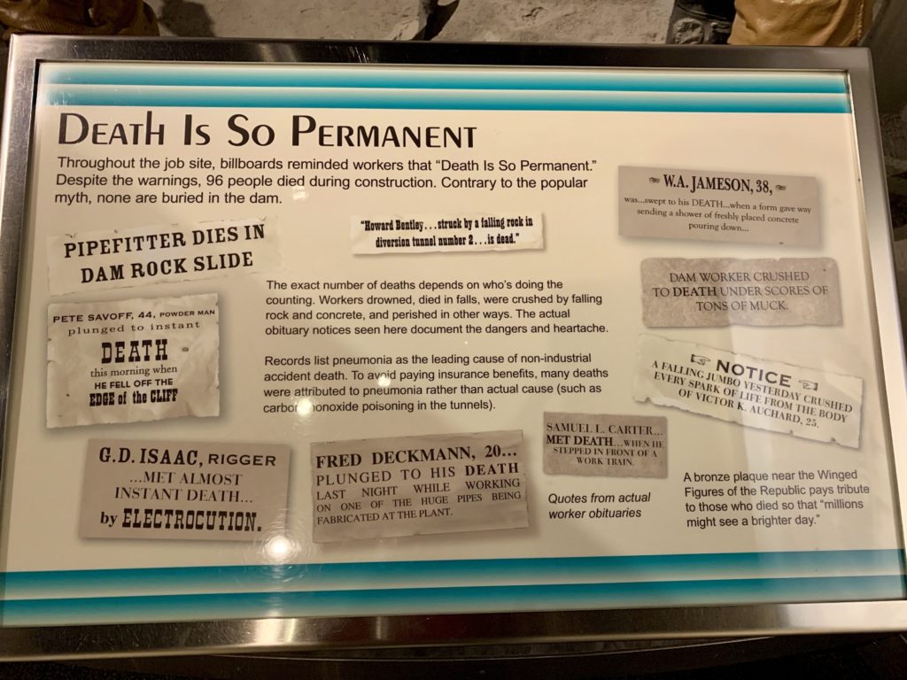
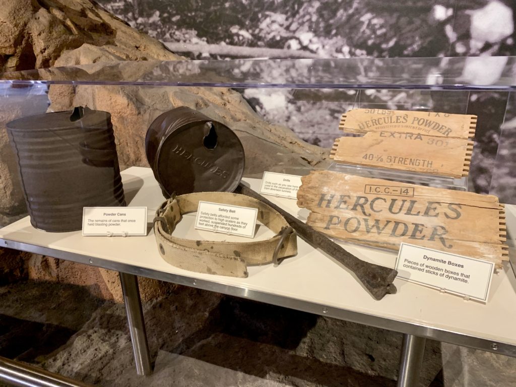
We did the Guided Dam Tour which included everything available to the public. We all enjoyed it and were glad we did the full tour, but agreed that you don’t see much from inside a dam other than “dam” concrete walls. Still, our recommendation is to do the full tour.
A few interesting dam facts:
- Hoover Dam is 724.6 feet high and weighs 6,600,000 tons.
- There is enough concrete in Hoover Dam to build a two lane highway from Seattle, Washington to Miami, Florida or a four foot wide sidewalk around the Earth at the equator.
- The water pressure at the base of the dam is 45,000 pounds per square foot.
- For those interested in more dam facts, check out the excellent FAQ page on the Bureau of Reclamation website.
- A good map of Hoover Dam can be accessed here.
Hoover Dam was constructed and is operated by the Bureau of Reclamation which is the nation’s largest wholesale water provider and second-largest producer of hydroelectricity. Reclamation oversees more than 600 projects in 17 western states providing water to 31 million Americans, irrigation to 10 million acres of farmland which produce 60% of the nation’s vegetables, flood protection, 40 billion kilowatt hours of electricity a year (enough to supply about 6 million homes), and recreation for about 92 million visitors a year.
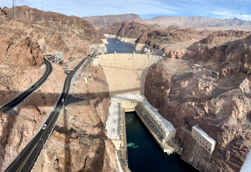
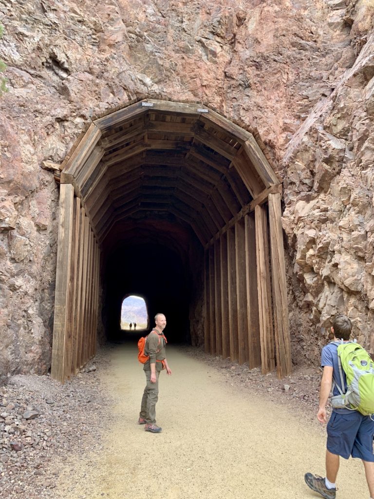
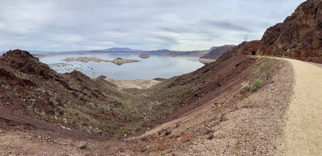
After the dam tour, we hiked the nearby Historic Railroad Trail. This follows one segment of a 30-mile network of railroads built in 1931 to haul materials to construct Hoover Dam. This line ran from Boulder City to a concrete mixing plant on the rim of Black Canyon. Trains ran 24 hours a day carrying gravel, supplies, and machinery to the dam construction site.
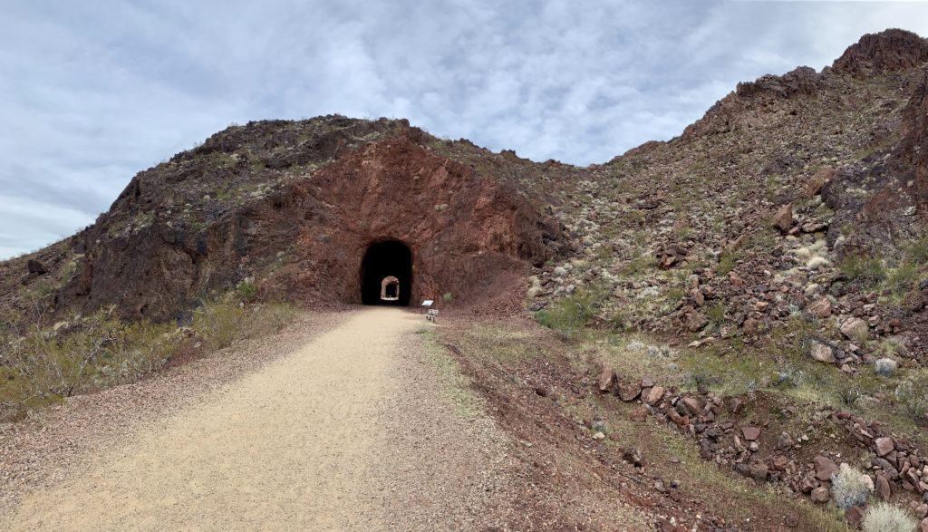
Today the railroad tracks are gone, but pedestrians and hikers can still pass through the five tunnels that crews blasted out of the cliffs. The trailhead is located near Lake Mead Visitor Center just outside Boulder City. It leads 3.5 miles (one way) to just above Hoover Dam providing fantastic views of the Lake Mead Marina Complex and Boulder Beach area.
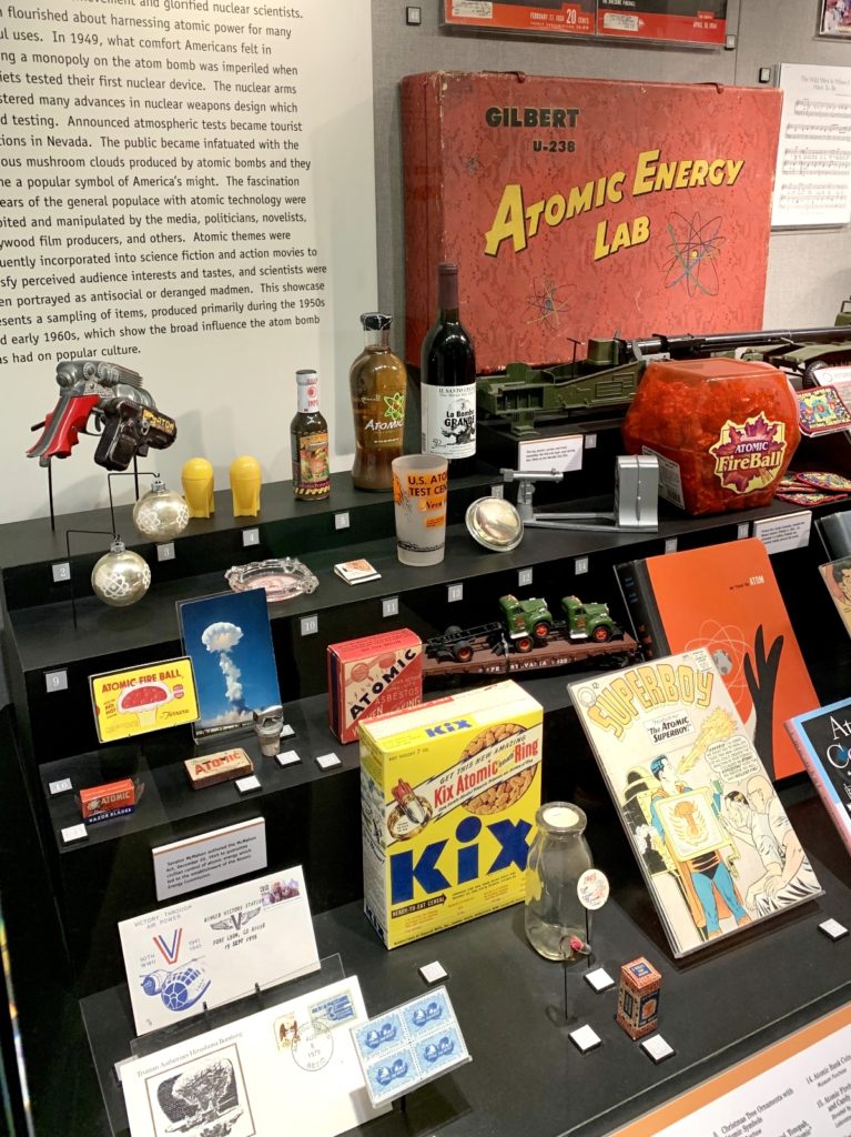
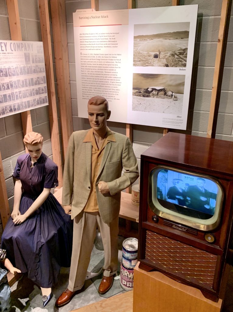
Atomic Testing Museum, Las Vegas
On Max’s last day, we visited the Atomic Testing Museum in downtown Las Vegas. From 1951-1992, 928 nuclear weapons tests were conducted at the Nevada Test Site just outside Las Vegas. The Nevada Test Site played a vital role in the Cold War and thousands of workers supported the effort. The Atomic Testing Museum tells their stories and recounts this dark period in our nation’s history through exhibits, photos, artifacts, and a simulated nuclear bomb test. Cost is $22 for adults, although we purchased discounted tickets through Groupon. ATM is open 7 days a week and they suggest allowing 2-4 hours for your visit.
Here’s a little of the history we learned:
After three years of groundbreaking work, the world’s first atomic bomb was made using plutonium produced at the Hanford Engineer Works in south-eastern Washington. On July 16, 1945, the Army detonated the bomb at the Trinity site in south-central New Mexico. The flash from the explosion was seen 250 miles away; the heat produced was four times hotter than the surface of the sun; and the blast equaled 21 kilotons of conventional explosives.
On July 26, 1945, the Allied Forces broadcast the Potsdam Declaration to Japan which demanded unconditional surrender. Japan rejected it. A belief that an allied invasion of the Japanese mainland would be very bloody grew (with estimates of up to one million American casualties alone). Policy makers unanimously concluded the atomic bomb would end the war with the least bloodshed and should be used without warning against military targets. An untested uranium bomb, named Little Boy, was detonated over Hiroshima, Japan on August 6, 1945. When Japan did not surrender, a second bomb, named Fat Man, was detonated over Nagasaki, Japan on August 9, 1945, with devastating results. Japan surrendered five days later.
Although World War II had ended and no further military use was anticipated for the atom bomb, American military officials were anxious to learn much more about the new newest weapon in their arsenal. The experience gained from the Trinity test and the bombing of Hiroshima and Nagasaki made it clear that nuclear explosions should be conducted far from any population centers to minimize the dangers of exposure to radioactive fallout.
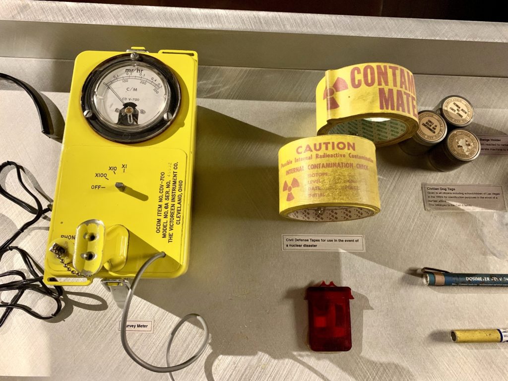
On December 18, 1950, President Truman approved the establishment of a continental test site recognizing the need for a secure and readily accessible location. Land at the proposed Nevada Test Site was already owned by the federal government and was under military control. The Test Site possessed favorable conditions for year-round testing and mountainous barriers that would prevent close observation. It also had large valleys and dry lakebeds for constructing facilities and conducting tests. Truman authorized the use of 680 miles of the Las Vegas Bombing and Gunnery Range with the first test conducted in January 1951.
In spite of early attempts to keep detonation times hush-hush, the atmospheric tests quickly became must-see attractions for Las Vegas residents and visitors. The predawn spectacles made the desert bloom with dazzling fireballs brighter than the sun. Soon mushroom clouds appeared on souvenirs and atomic cocktails became popular drinks. Instead of keeping people away, as earlier feared, the tests boosted tourism.
The Vegas Strip
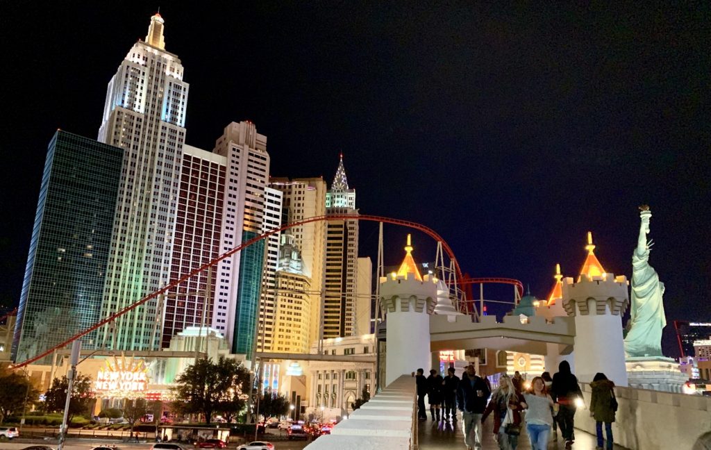
I’ll confess, I did not expect to like anything about the Las Vegas Strip. I really dislike crowds and have no appreciation for such gross displays of conspicuous consumption (I mean no offense to those who enjoy such things, it just isn’t my bag). Still, Jason and I both enjoy experiencing new things and so we agreed to visit the Vegas Strip with Max on his last day. He graciously offered to drive and serve as tour guide since he had been there before.
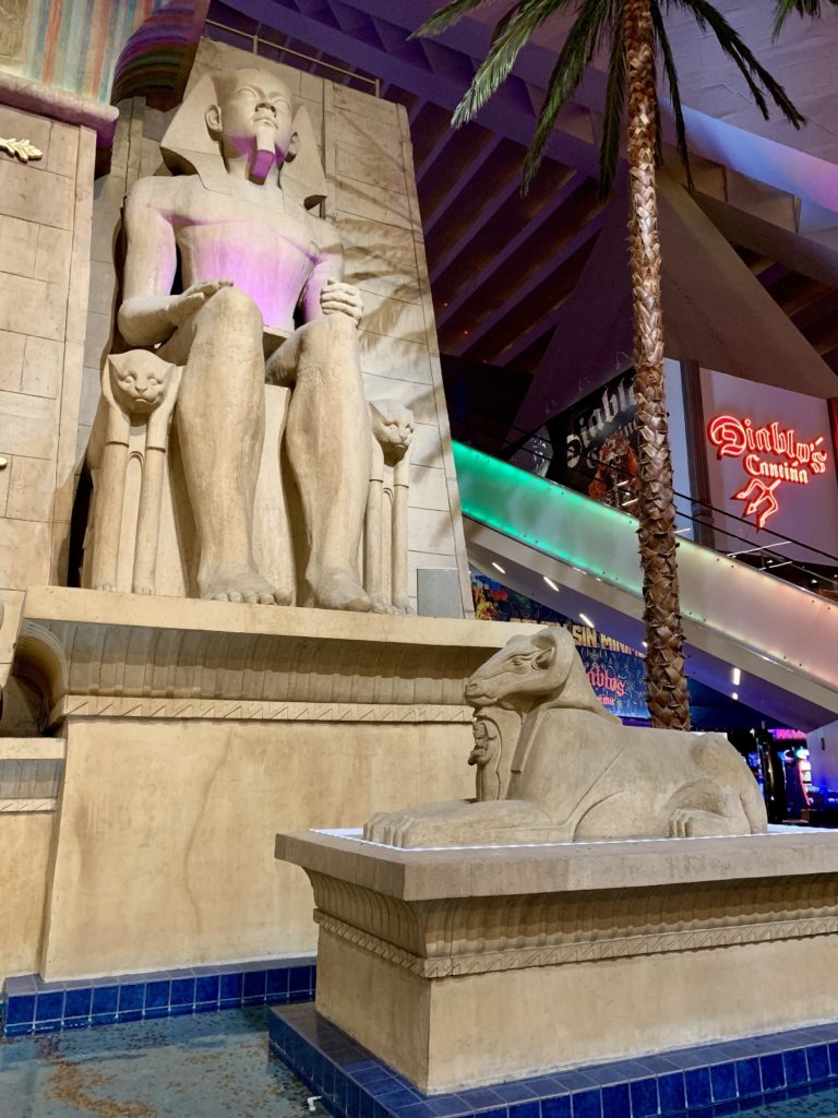
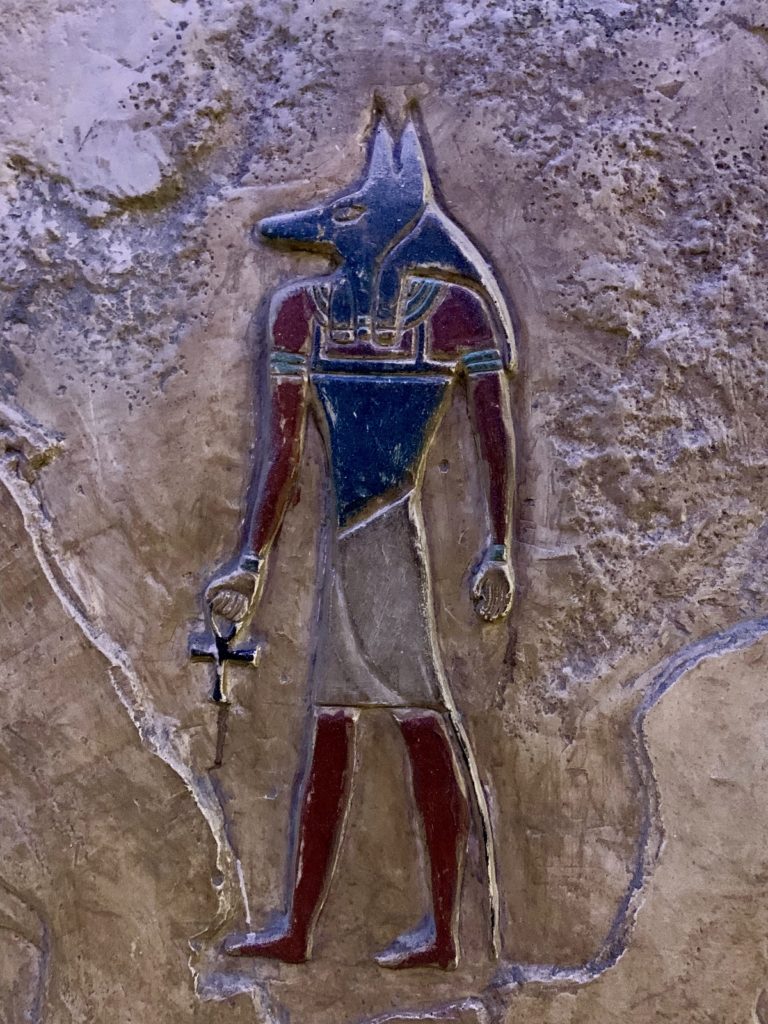
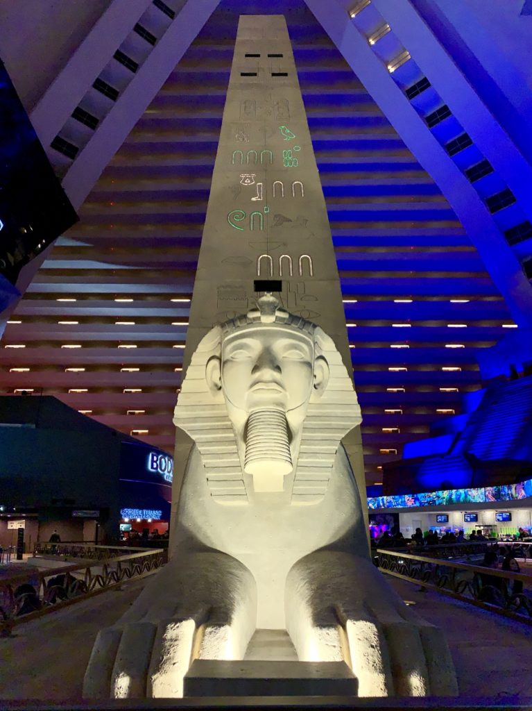
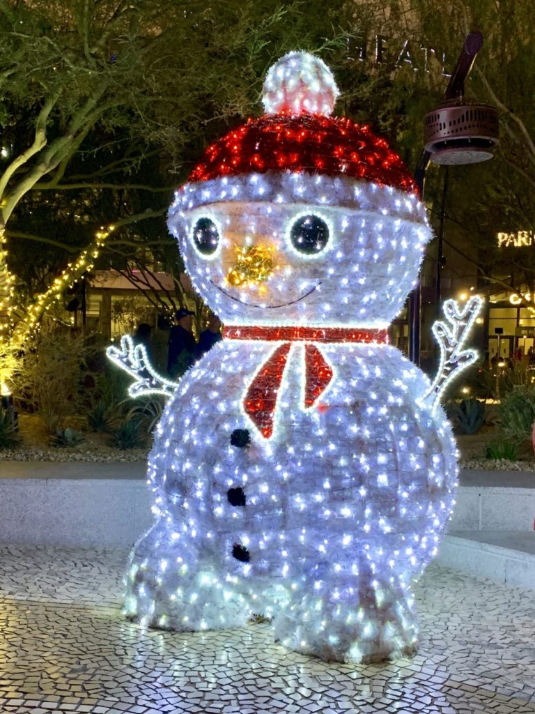
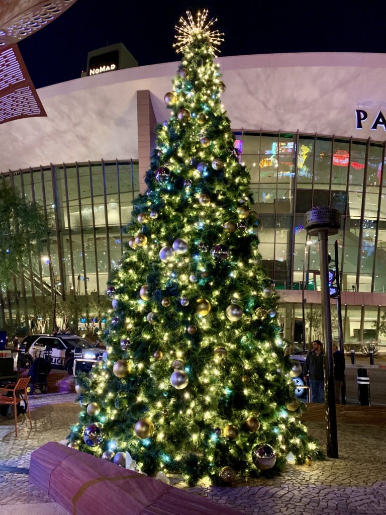
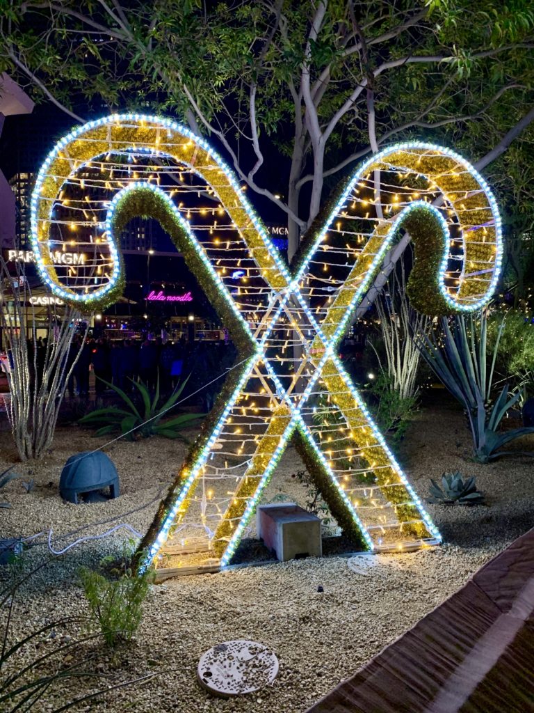
Ours was a fast and furious introduction to be sure. In just one afternoon and evening, we walked the entire strip, had a couple meals, visited inside ten hotel/casinos, and enjoyed part of a southern rock band performance. We were exhausted by the end of the night, but we both found several things that we’d like to go back and enjoy at a slower pace. I especially enjoyed all of the Christmas decorations. It hadn’t been feeling much like Christmas being so far away from home and family, but all the decorations helped put me in the spirit.
The Adventure Continues
Join us next week as we explore Lake Mead National Recreation Area and celebrate Christmas in the most unlikely and unholy of locations, the Vegas Strip.
Your Support Helps!
Are you enjoying being part of our adventure? Do you like what you see here? If so, please consider supporting this site by doing some of your online shopping here. We only post links to products that we use and that meet the Evans Outdoor Adventures seal of approval! Not interested in any of these items? No problem! By accessing Amazon through the links below and making any purchase, you get Amazon’s every day low pricing and they share a little with us. This helps us maintain Evans Outdoor Adventures and is much appreciated!
How in the heck do we find all these fun places? I do extensive research using a variety of online resources. I also go old school and use maps. Yeah, maps. Remember those things that we used before iPhones and navigation programs? I’m a big fan of the Benchmark Road and Recreation Atlas series for the American West. They show incredible details including parks, tourist attractions, bodies of water, campgrounds, rest areas, etc.
How fun! Thank you for your write ups!