Mountain hike to two lakes snuggled under the Selkirk Crest near the Idaho-Canadian border.
Distance: 9.0 miles round trip
Type: out and back
Difficulty: moderate with 2,000′ elevation gain
Best season: summer and early fall
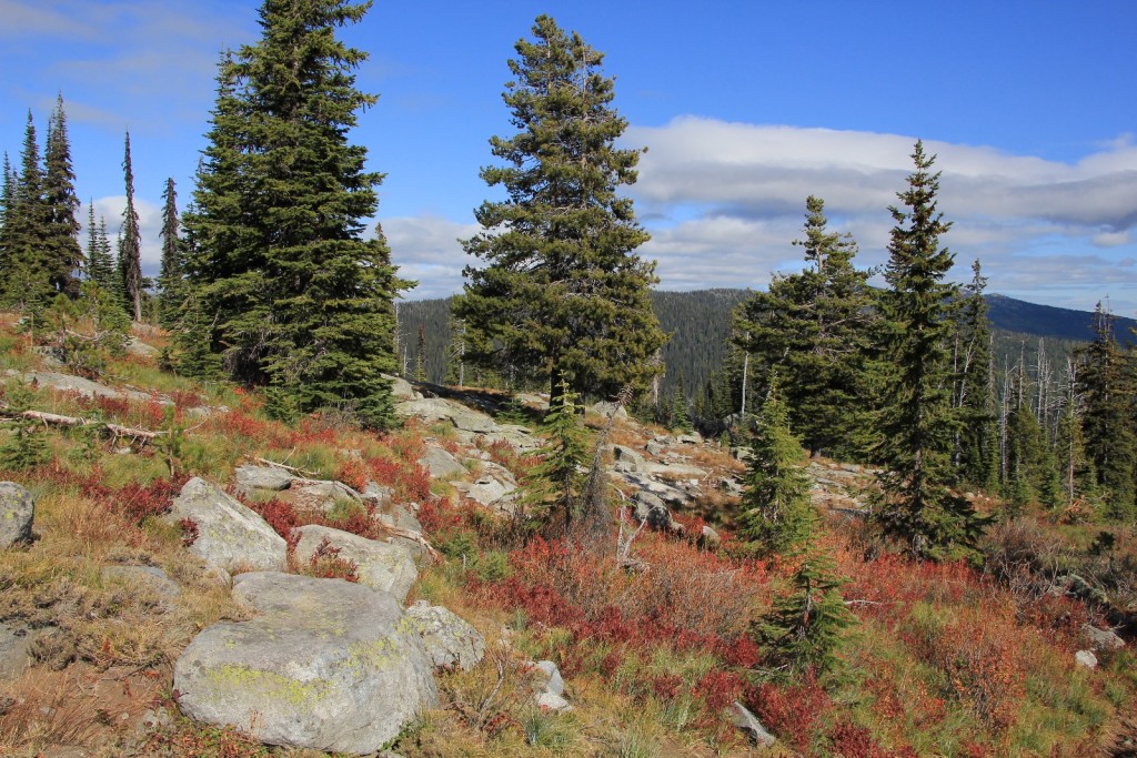
The Selkirk Mountains of northern Idaho are one of our favorite late summer and early fall hiking destinations. Snuggled up against the Canadian border, these mountains are so rugged and remote that endangered species like grizzly bear and caribou still roam their lonely shadows. We especially enjoy the high mountain lakes backed by towering granite cliffs as well as the plump huckleberries that line the trails around Labor Day.
Early in the first week of October 2014, I started watching the weather forecast for all of our favorite local areas. The forecast was looking great all over and we debated several options before deciding on a weekend in the Selkirks. My bucket list for the area was still long and the forecast for Bonner’s Ferry looked perfect with highs in the 60’s and mostly sunny.
Saturday morning we headed north up US 95 through Coeur d’Alene and Sandpoint to Bonner’s Ferry. From there we drove to the Kootenai National Wildlife Refuge and turned up Myrtle Creek Rd 633. The single lane gravel road quickly climbed in elevation and was quite washboard the first mile. The road surface improved after the steep climb and visibility was better for spotting oncoming cars. Overall, it was a pretty decent road.
We followed our guidebook directions and found ourselves at what we thought was the trailhead to Two Mouth Lakes. We were expecting to park at a gated off road. The road we found wasn’t gated, but it was at the exact mileage we were expecting and it had a hiking sign pointing up the road. A short ways up the road, conditions deteriorated to the point that Jason said we better stop and hike the rest of the way. Since we were convinced we were at the beginning of the trail, we parked the truck and hiked from there.
Almost immediately, I had a feeling we weren’t on the right trail. I expected to be on a distinct trail by now, but the road continued. After 2.5 miles, the road finally turned to trail with a marker for trail 286. Well, that sounded right. But it still didn’t seem right. It was a narrow and lightly used path—I had expected Two Mouth to be more heavily traveled. And now that you mention it, we hadn’t seen a single soul.
I finally pulled out the GPS and used it to find Two Mouth Lakes compared to our position. That confirmed it, we were on definitely on the wrong trail. By now I suspected that we were on the trail to Myrtle Peak. After about 3.5 miles of hiking (with nearly 2,000’ elevation gain), I told Jason I thought we should turn around and save what was left of our legs for the following day. I was disappointed that we weren’t on the right trail and that we were just seeing mediocre Selkirk views- it isn’t very often I navigate us off course. But at least we weren’t lost and the weather was perfect.
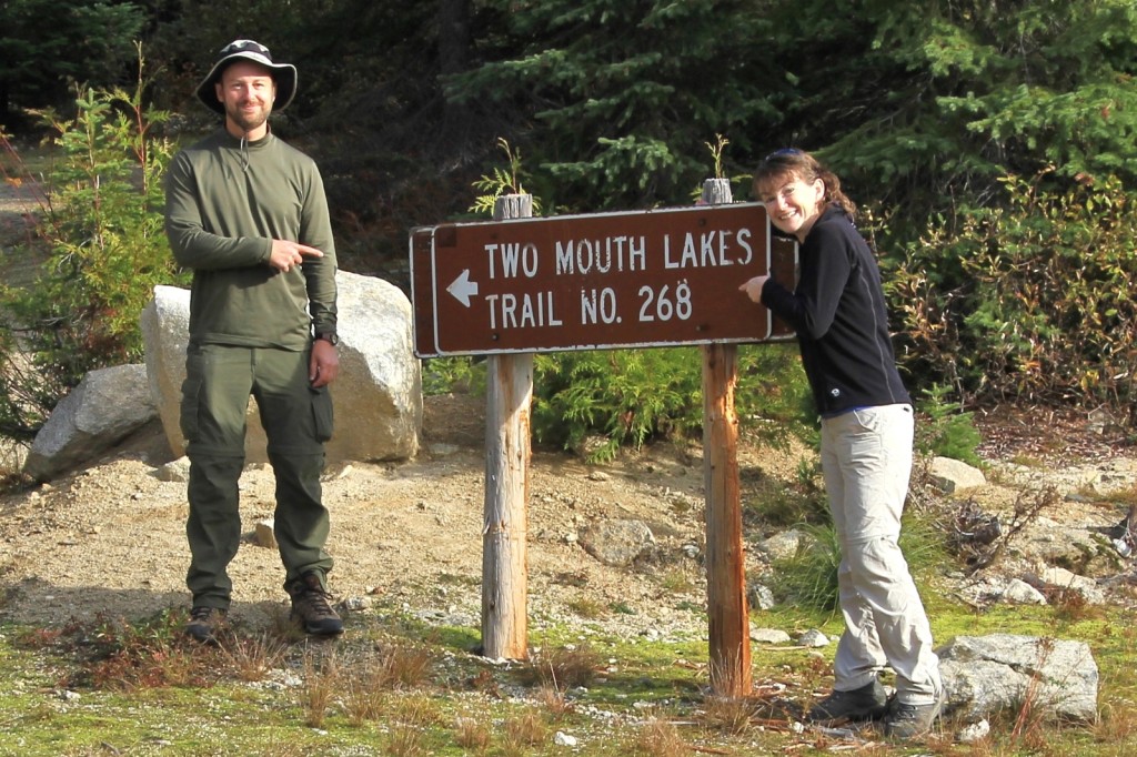
In all, we wandered 7.25 miles. Back at the truck, I grabbed a map and confirmed that we were on the Myrtle Peak trail #286 instead of Two Mouth Lakes trail #268 which was a couple miles further up the road. We drove the short distance up the road and found the correct trailhead which was well marked with half a dozen rigs. Oh well, at least we got some good exercise and complete solitude.
Disappointed, but determined to return the next day, we made the trip back to Bonner’s Ferry. We had dinner at the Kootenai Brewing Company where we both enjoyed a guacamole bacon burger.
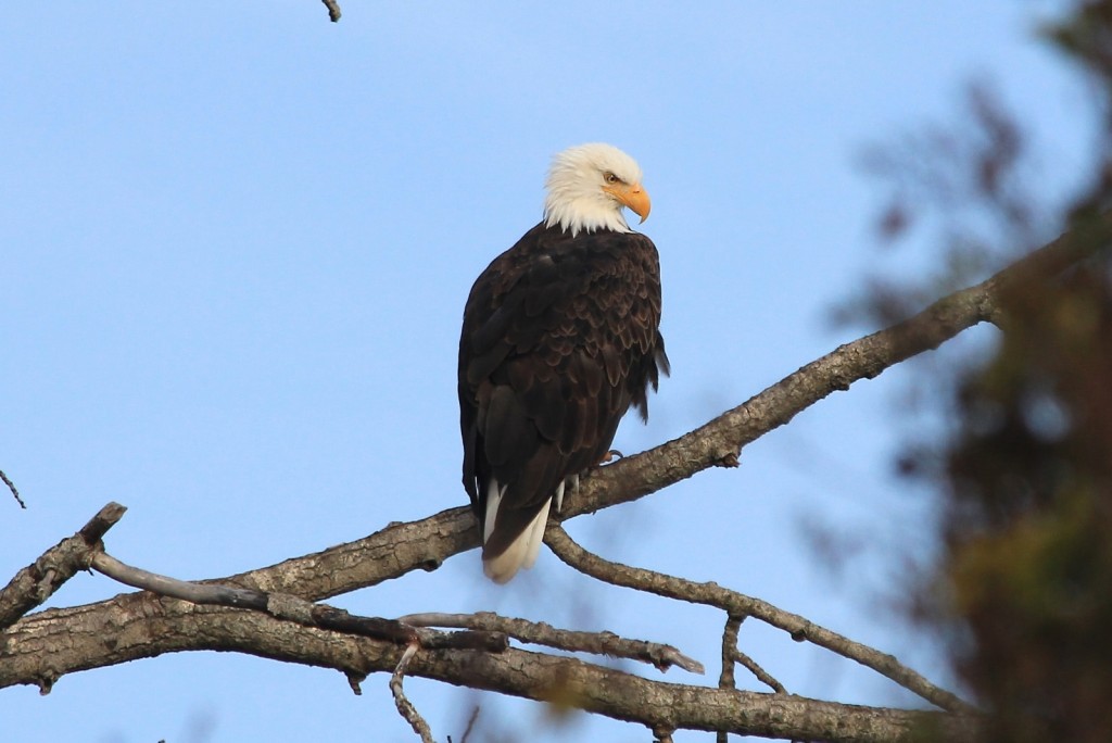
Sunday morning we headed back out toward the wildlife refuge. We had seen several bald eagles along the river the day before and we saw several more in the early morning light. We made our way up to the trailhead to find it empty. Score! I thought for sure people would have been backpacked in with the weather so nice.
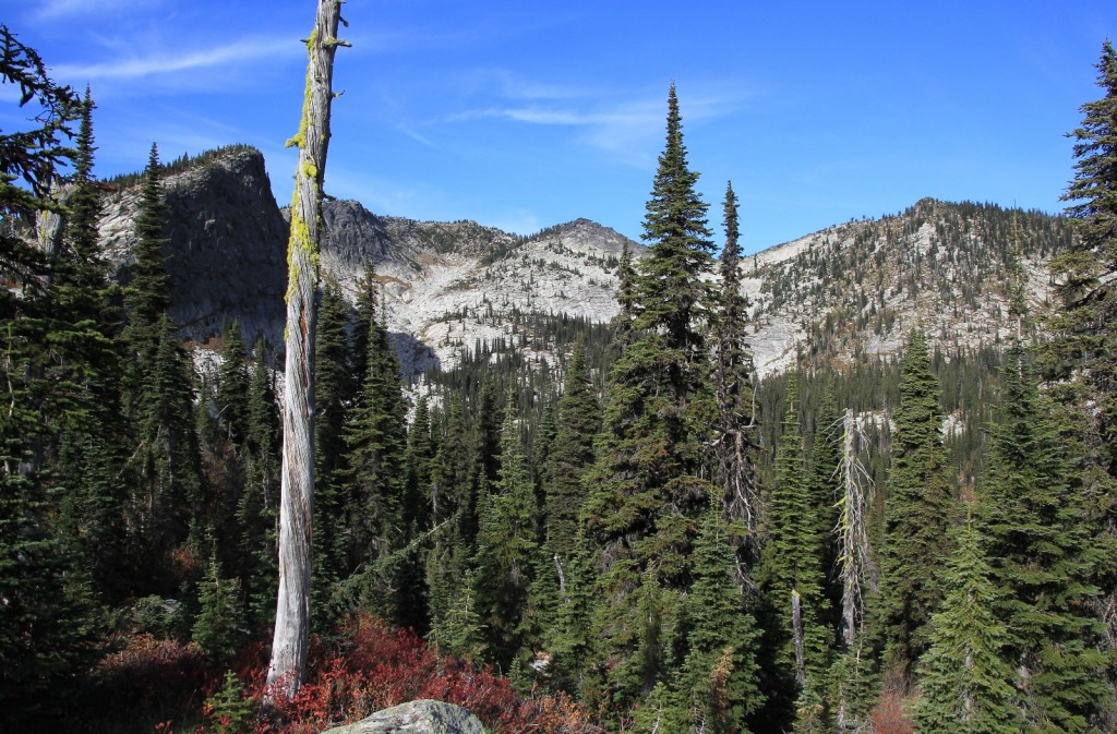
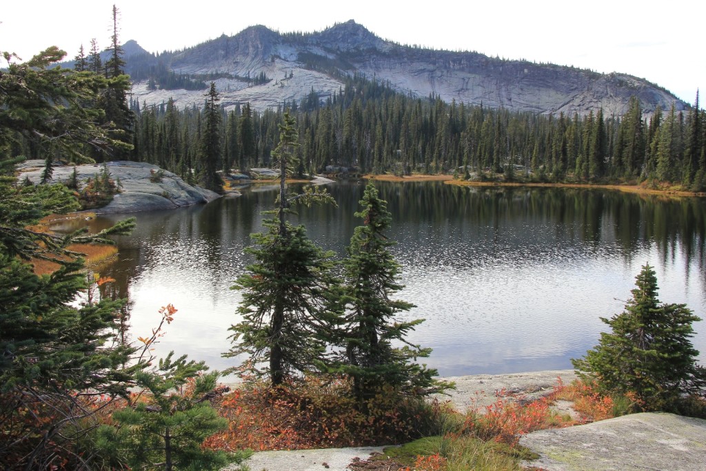
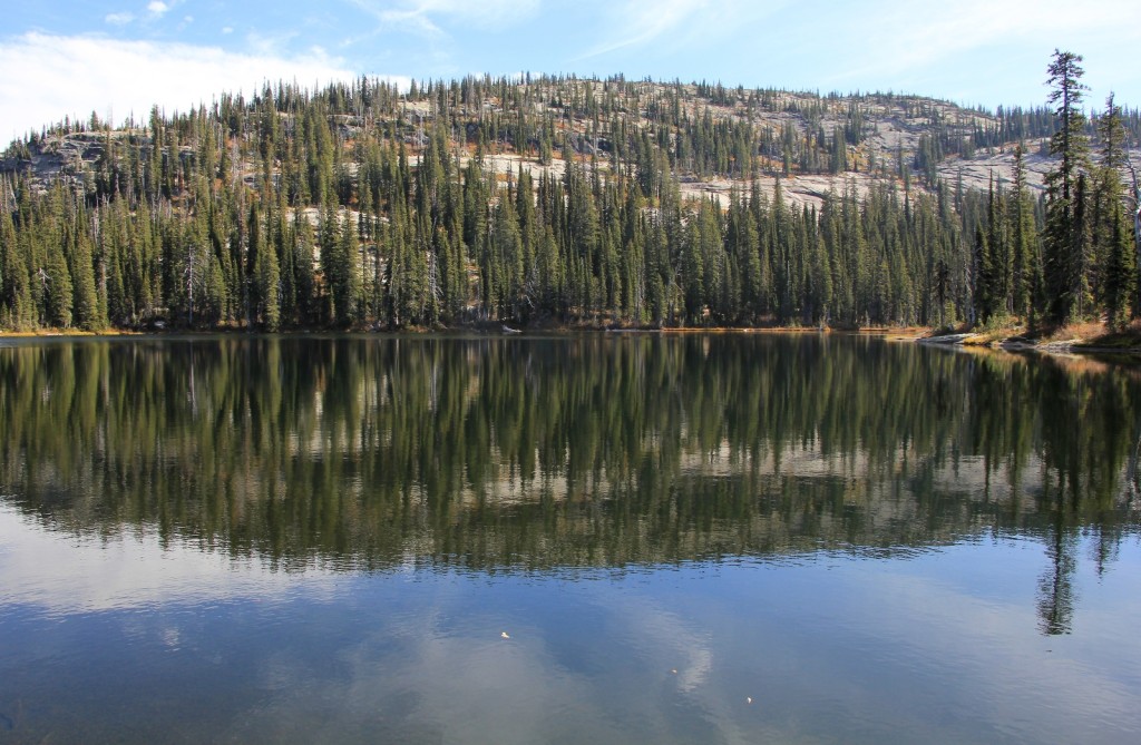
The trail to Two Mouth Lakes begins on old road 658 (elevation 4,360′) which is barricaded at the trailhead. We hiked roughly 0.5 miles to a sign marking an old skid road that headed uphill to the left. This skid road soon turned into trail 268. The trail continued a gentle climb through the forest on good tread then up and over a pass. We didn’t have much for views until we began the climb up the pass, but the stretch through the forest was pleasant. After the pass we dropped down into the duo of lakes located at 5,845′.
Both of the lakes were pretty, but the lower lake was by far more interesting with nicer views and a couple nice campsites. Overall, these lakes were not nearly as stunning as the other Selkirk lakes we had hiked too, but the trail was much more private. We’d only see one other person, a lone woman near the trailhead, the entire day. Add perfect weather and some pretty fall colors and we had a lovely hike.
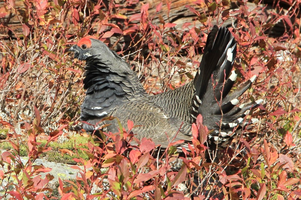
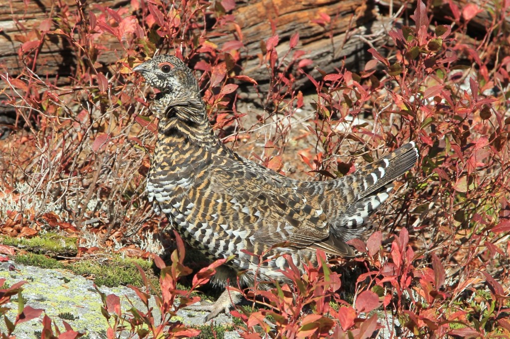
Shortly after leaving the second lake, we came across a grouse hen next to the trail. I grabbed a couple quick pictures expecting her to take off at any second, but she stayed there. I heard something on the other side of the trail and saw a male grouse fly up and roost on top of a small tree. The thin branch swung from side to side as he tried to catch his balance. I grabbed a couple shots, took a few steps closer, grabbed a couple more shots, and took a few steps closer. He checked me out but seemed to find me of little threat—or at least not nearly as interesting as the three hens surrounding me. He flew down out of the tree, walked within a few feet of me, and started strutting with his tail feathers fluffed out. It was unclear if the females were impressed with his mating dance, but we were quite entertained.
The rest of the hike back was uneventful. It may have taken us two tries to find Two Mouth Lakes, but we enjoyed a beautiful fall day out in God’s country.
Directions to the trailhead: Enter Bonner’s Ferry, Idaho on US 95. Take the City Center exit and drive west on Riverside Street along the Kootenai River roughly 5 miles to the Kootenai National Wildlife Refuge. After passing the refuge headquarters on the right, drive 1.5 miles and turn left on Myrtle Creek Road 633. This is a single lane gravel road which was quite washboard at the time of our visit, but passable by most passenger vehicles. Drive approximately 11 miles up this road to the well signed trailhead.