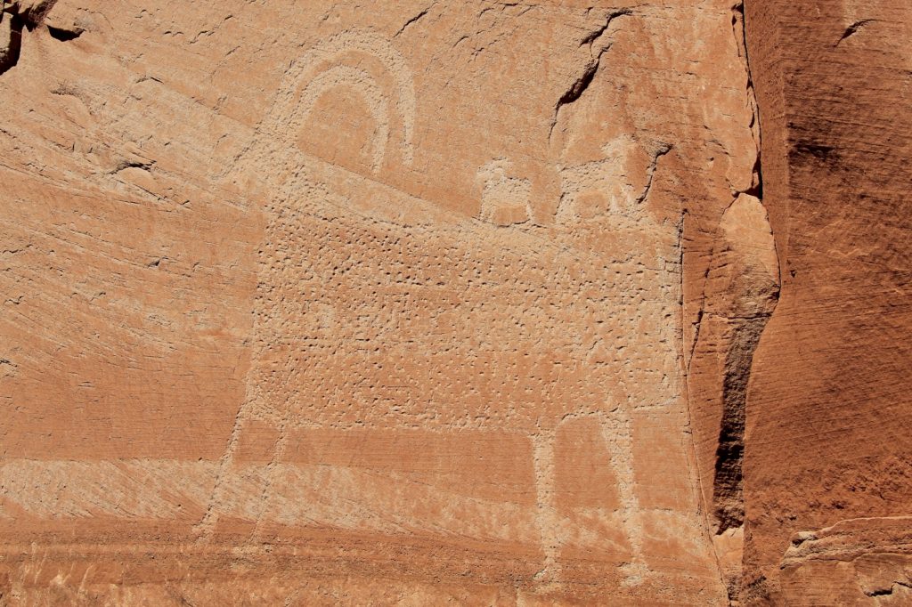
This SE Utah desert multi-use trail makes a great hike with stunning views and an impressive bighorn petroglyph panel
Distance: 9.6 miles round trip
Type: out and back
Difficulty: moderate due to climb of around 1,500′
Best Season: year around, but hot in summer
Sometimes even us type A ultra-planers have to fly by the seat of our pants. Our October 2013 vacation was not at all as I had originally planned. Plan A was to hike the Canadian Rockies the first of September, but I had a new hire coming on board at work and really couldn’t get away. Plan B was Yosemite the middle of September, but one of the largest wildfires in California state history hit in mid-August. Plan C was Rocky Mountain National Park, but in mid-September the area received 26″ of rain in just two days—they were calling it a “1,000 year flood event”. Roads were washed away and much of the park shut down.
Plan D became hiking several National Parks/Monuments in SW Colorado. Our vacation was set for October 4-13…then on October 1st, three days before departure, the United States federal government entered a 16 day long shutdown closing all National Parks/Monuments.
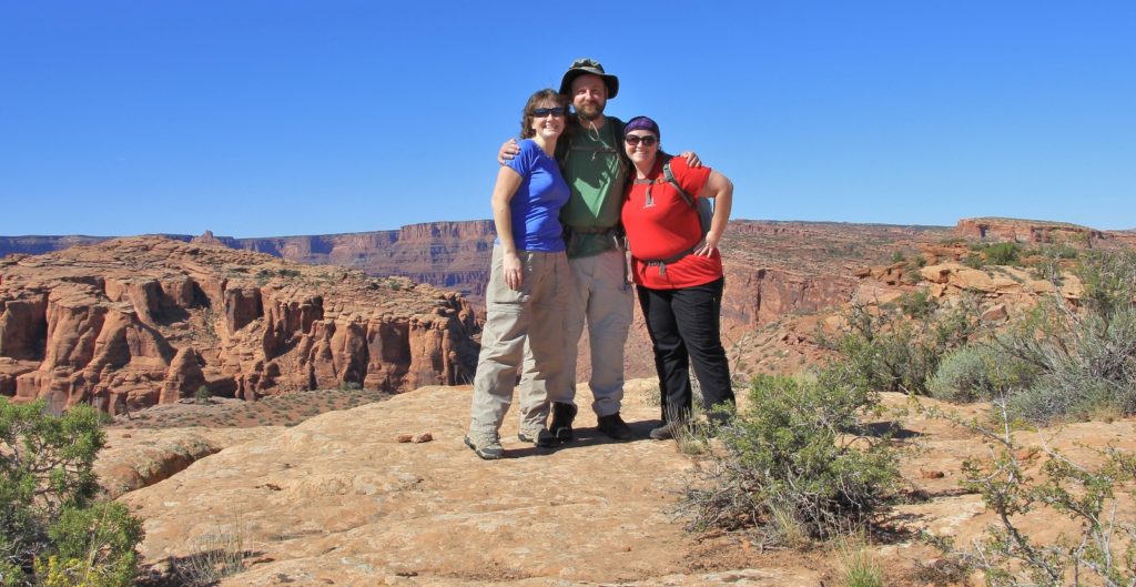
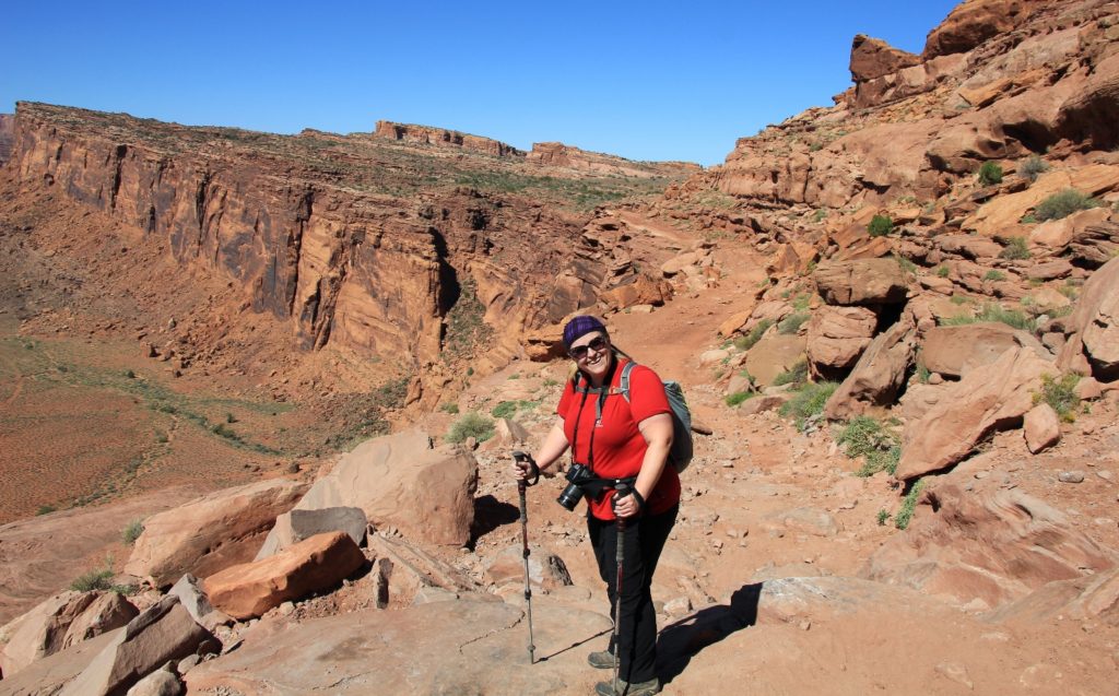
With a bit more scrambling and last minute planning, plan E came together. All state parks and BLM land in Utah were open (BLM facilities were shut down, but they left the land open to hikers). We planned to head for the area between Moab and Bluff in SE Utah where we would hike Amasa Back, Dead Horse Point State Park, Grand Gulch (Kane Ranger Station to Junction Ruins), Cedar Mesa (Fallen Roof and Citadel Ruins), Sand Canyon (SW Colorado), Tower Ruins, and what ended up being an early sneak into Capitol Reef National Park as the governor of Utah was cutting a deal with the feds. Best of all, our friend Lisa would be joining us for the first two days. And we didn’t know it yet, but we would meet a couple on the Citadel trail who would end up being dear friends. We were set!
On Friday October 4th, we made the long drive from our home in SE Washington to Price, Utah. Saturday morning it was just a two hour drive down to Moab where we met up with Lisa and made the drive out Kane Creek Road to the large Amasa Back trailhead parking lot (elevation 4,000′) where we found close to 30 vehicles. This was not surprising—it was a beautiful fall weekend and nearby Arches National Park was closed due to a bunch of politicians having a temper tantrum.
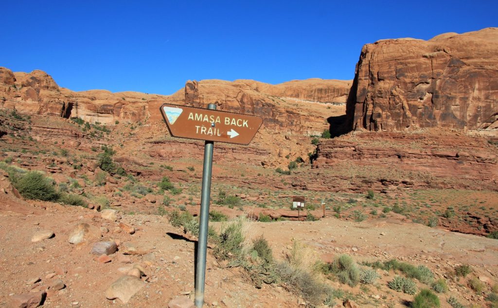
The Amasa Back trailhead (elevation 4,200′) was about half a mile up the road from the parking lot. We grabbed our gear and hiked along the road as 4 wheel drive rigs zipped past us on their way up Kane Road. We hit the trail and began a great day of hiking.
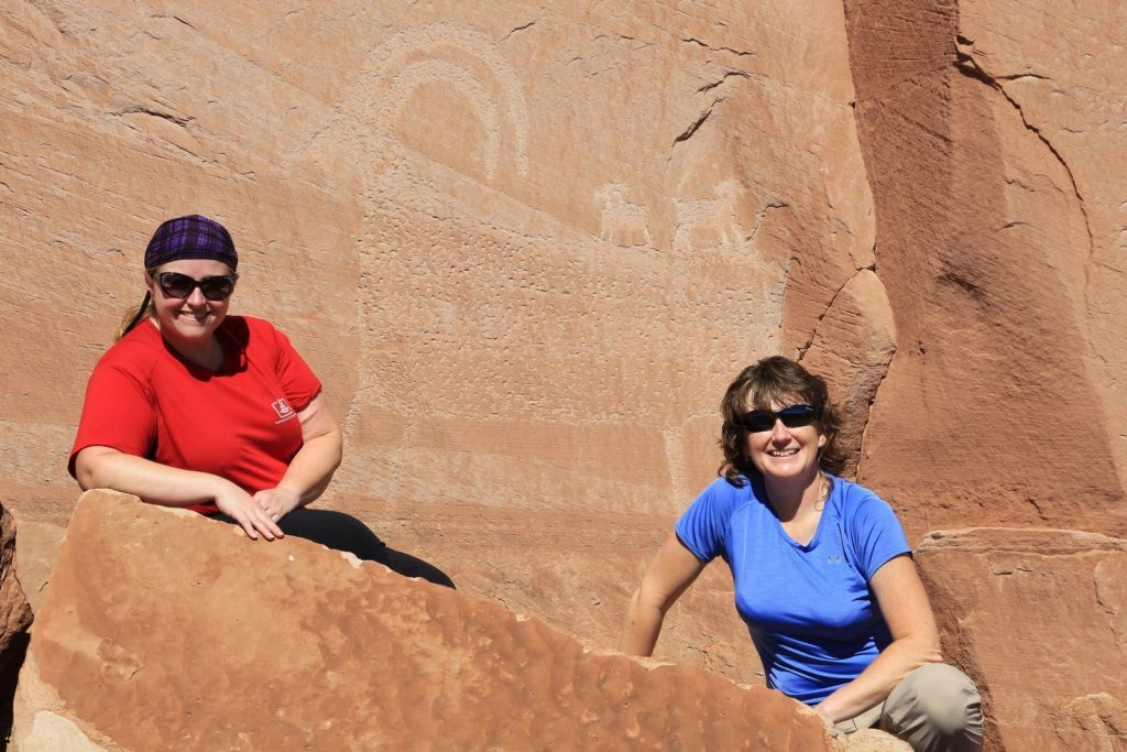
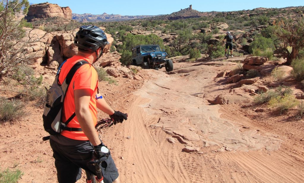
Amasa Back is a multi-use trail that is especially popular with mountain bikers and that is the vast majority of the traffic we saw; however, we also saw several dirt bikes and a few groups of several hardcore OHVs, full size and small. The trail is also popular with hikers who know how to find the impressive bighorn panel at the top. I was amazed and impressed how well all of the groups got along. Everyone was courteous and made way for each other.
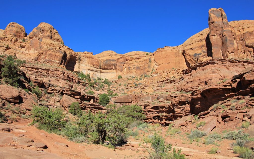
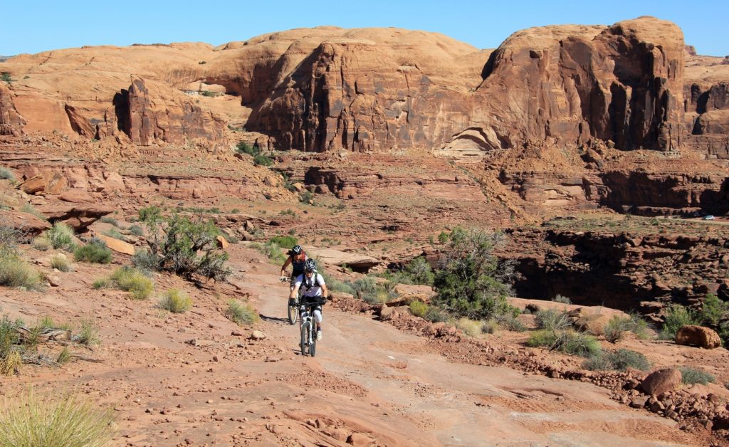
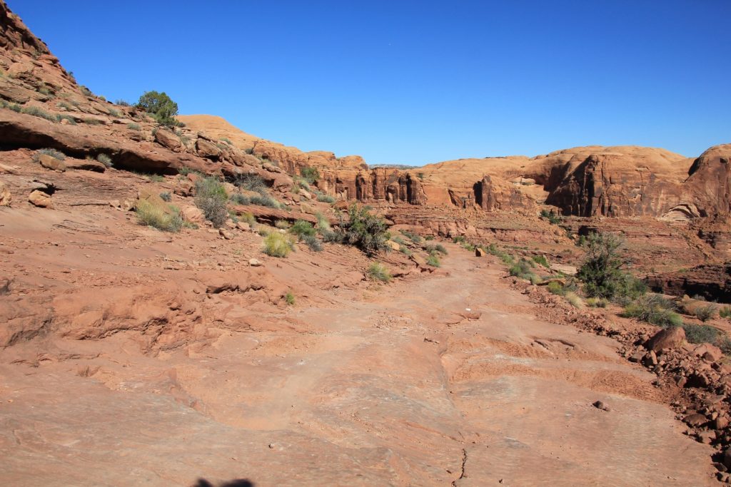
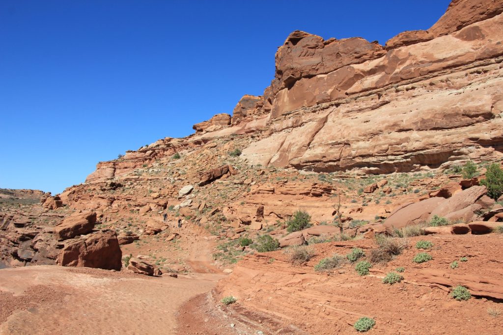
The trail immediately dropped 250′ down to Kane Creek where we were easily able to rock hop across with dry feet. We then began the long, but fairly gradual climb, up the trail. It was easy to navigate the trail—just stick to the only surface that a bike could stay vertical on!
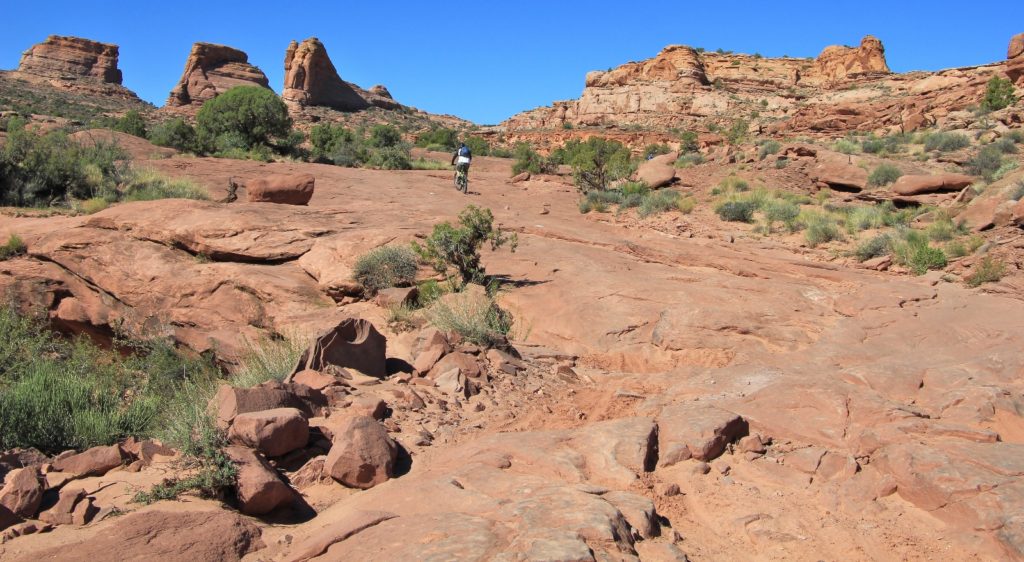
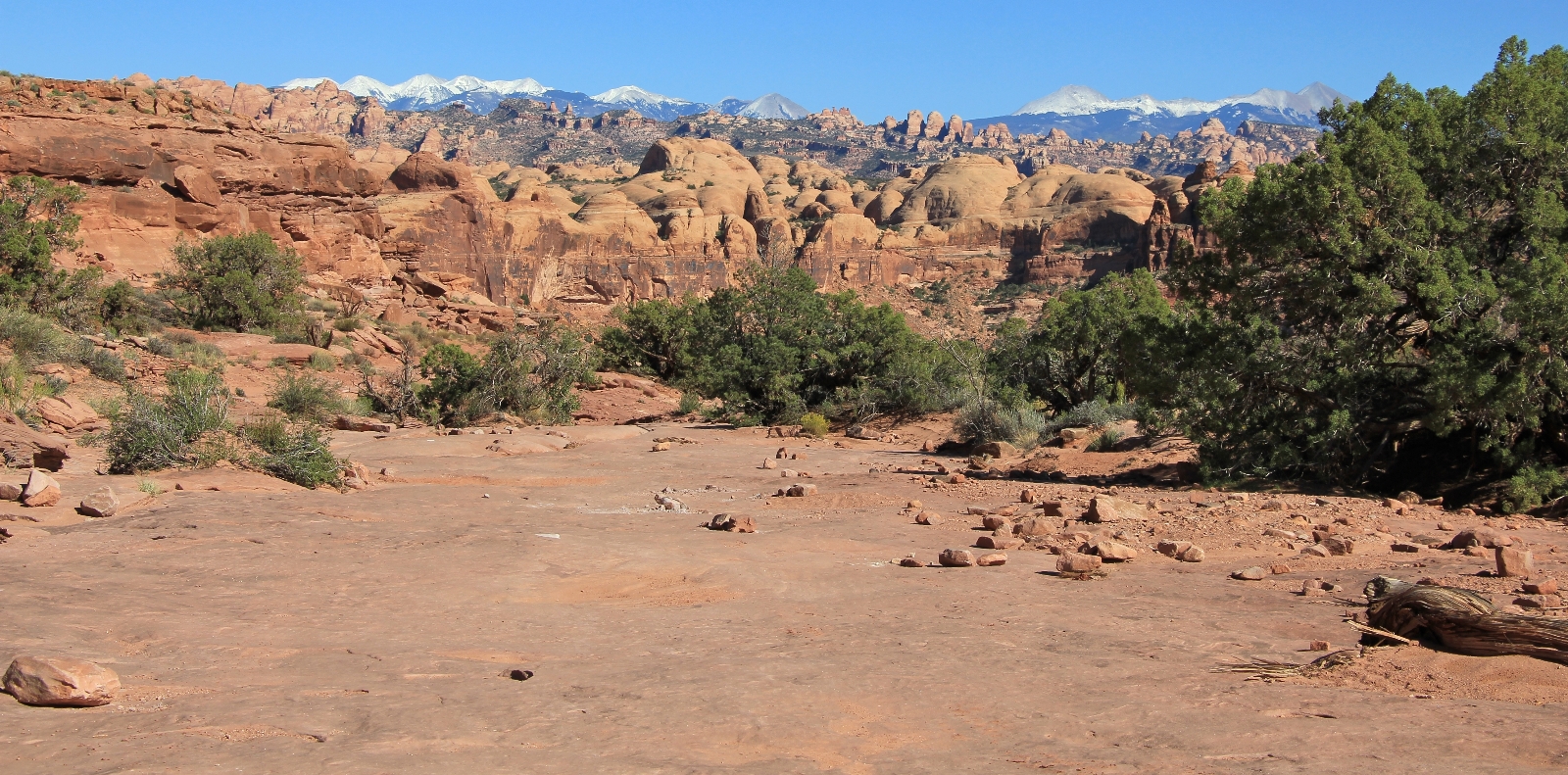
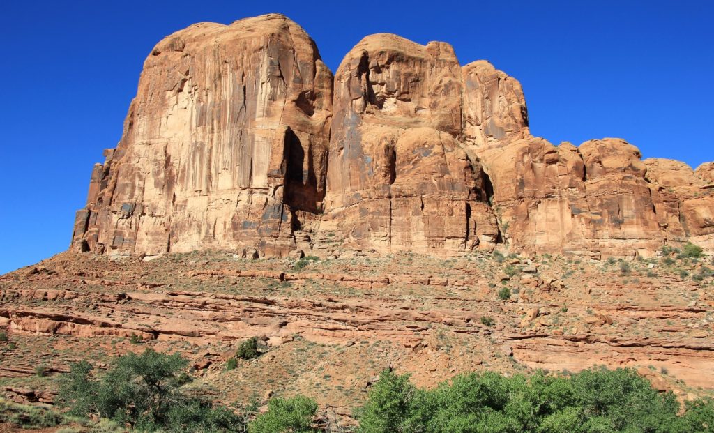
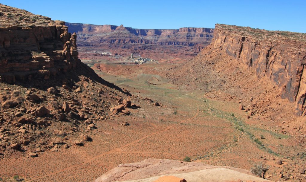
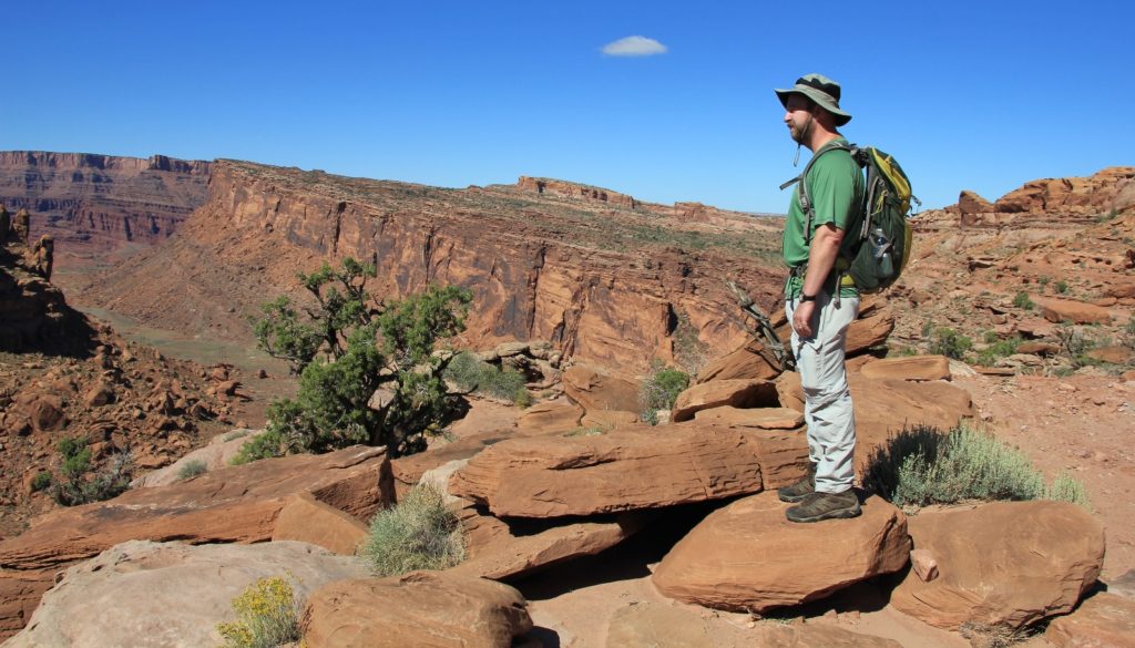
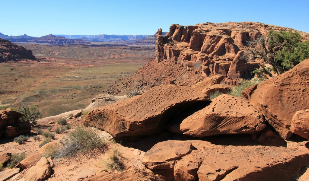
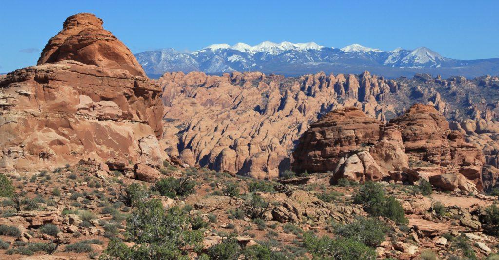
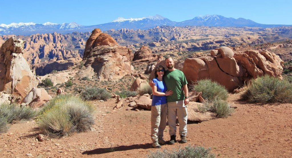
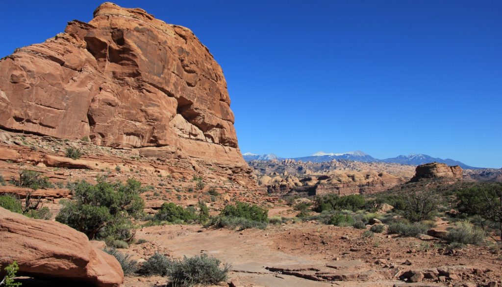
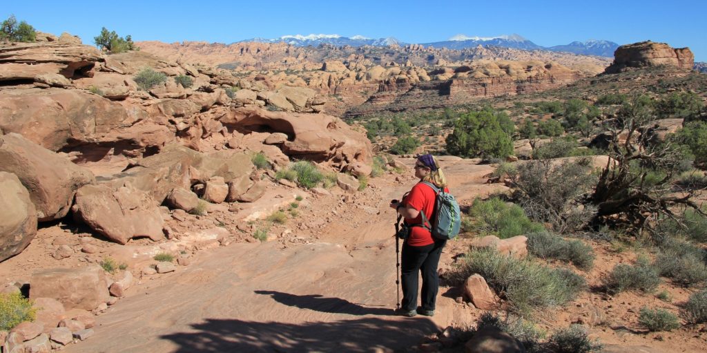
Views were stunning for the entire hike, but were especially so after we climbed about a mile. We had great views behind us of Behind the Rocks and the La Sal Mountains, the later sporting a gorgeous layer of fresh snow. In front of us, red rock cliffs rose to the heavens.
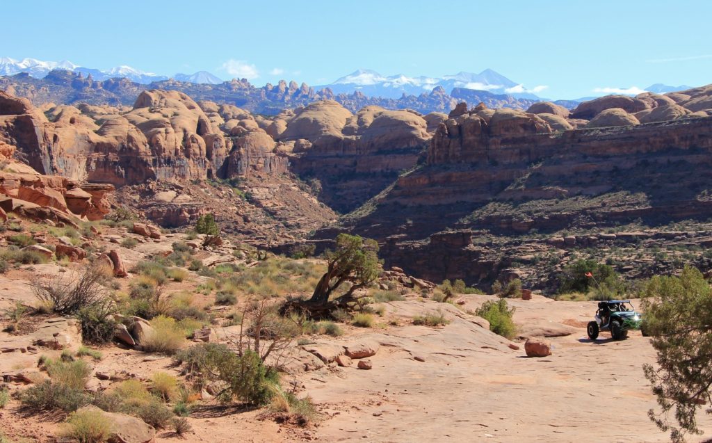
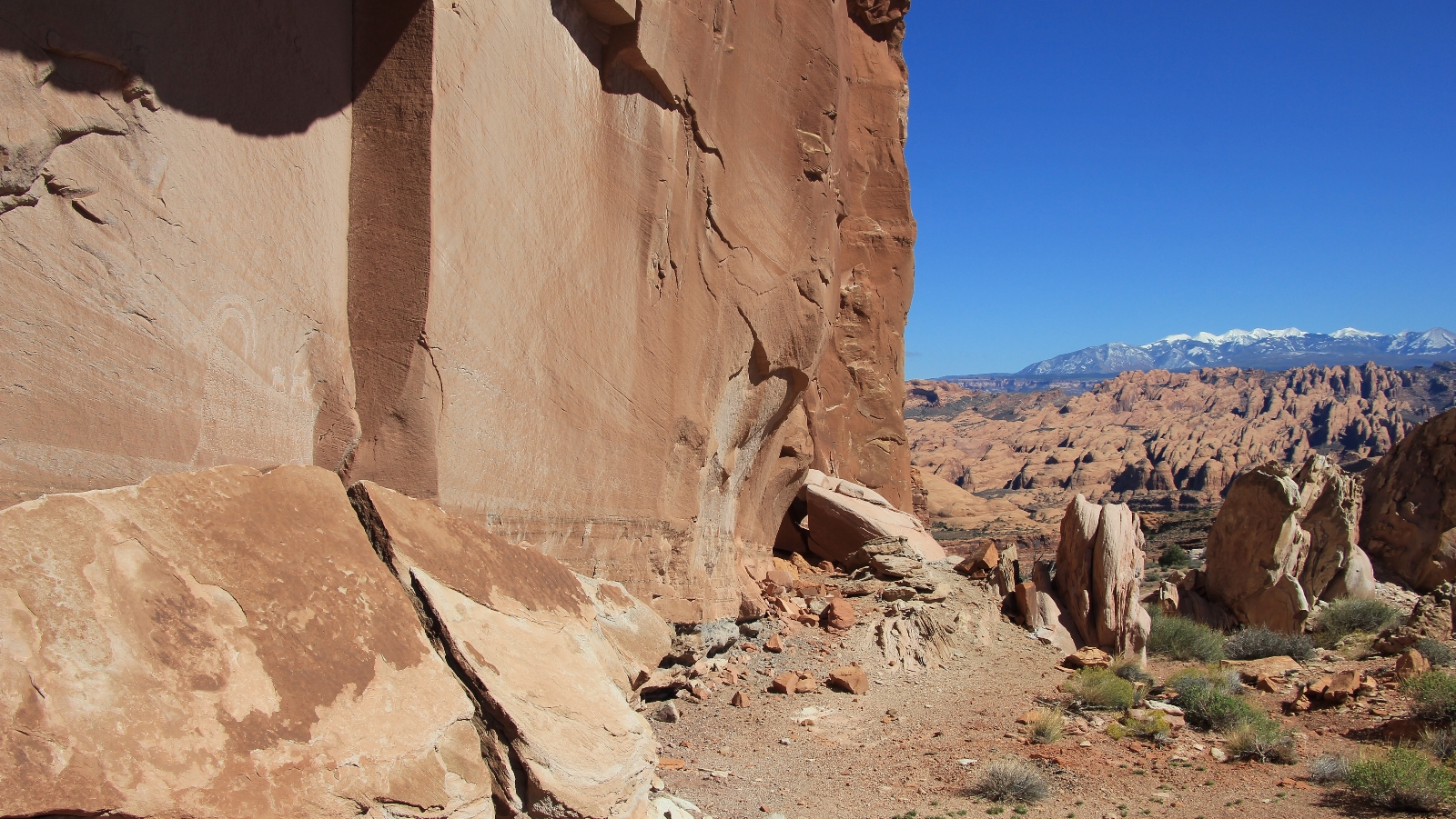
After climbing, the trail topped out and we had stunning views all around. We could still see Behind the Rocks and the La Sals, but now we could also see north to the Potash area and Dead Horse State Park. We followed the rim and enjoyed the views before beginning our final search for the bighorn petroglyph panel that we were in search of.
Our directions to the panel were a little vague and we had to do some searching, but we finally found it. This petroglyph panel is roughly 5′ long and 3′ tall and depicts two smaller bighorns on the back of a large bighorn ram. We had the panel all to ourselves—it was just far enough off the main trail that I don’t think anyone noticed us. We enjoyed a long break there for lots of photos and some lunch.
On our hike back, we continued to encounter many mountain bikers, a couple dirt bikes, and two groups of OHVs. The first group of OHVs that we met came near the beginning of our descent. We were nearing a corner when we heard them. We got off to the side of the trail. A group of mountain bikers coming down behind us stopped, listened, and one near me said “something is coming”, so they got over too. The group was a string of about 7 Jeep style rigs. The first appeared slowly as it negotiated the steep and boulder strewn curve. It was fun watching them creep their way up the trail. Friendly greetings were exchanged by all groups.
Our total hiked for the day was 9.65 miles. This was a first class trail that I would gladly hike again, although I think it would be much preferred on a week day with less traffic. The views were superb and the multi-use nature was interesting. While I’m glad we don’t hike trails like that all the time, it was fun seeing everyone play well together. The weather had been absolutely perfect with beautiful sunny skies and temperatures in the mid-60s. Best of all, we had enjoyed a day on the trail with a great friend. We got back to the rig shortly after 4:00 and made our way to The Moab Brewery—all of our favorite.
Directions to trailhead: Entering Moab, Utah from the north, turn right at McDonald’s onto Kane Creek Blvd. At 1.4 miles bear to the left and drive another 4.4 miles to the Amasa Back trailhead parking area (note: Kane Creek Blvd becomes Kane Creek Road. All but the last 0.6 miles is paved.)