Beat the crowds at Bryce Canyon National Park—hike in solitude with the pines and hoodoos at nearby Red Canyon
Distance: 7 miles round trip (longer and shorter options available)
Type: loop
Difficulty: moderately difficult with 1,000′ elevation gain (elevation ranges from 7,000-8,000′)
Best season: spring and fall
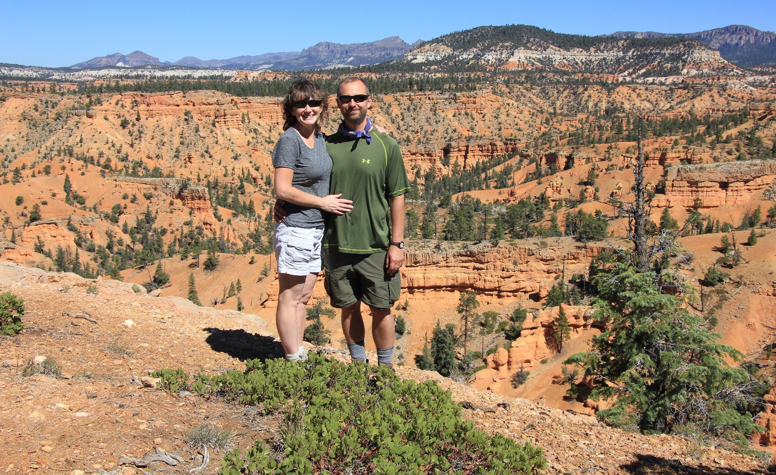
Roughly thirty years ago, my family made a quick stop at Bryce Canyon National Park and nearby Red Canyon on a trip south to Texas. The brilliant red colors and fantastical shaped hoodoos thrilled me and captured my imagination. The following day we visited the Grand Canyon and I couldn’t help but be disappointed—it didn’t seem very grand compared to the red rock country of Utah. For over twenty years I longed to return to southern Utah. In 2010 Jason and I made a quick tour of Escalante, Moab, and Cedar Mesa and so fell in love with the area that by September 2016 we were making our eighth trip.
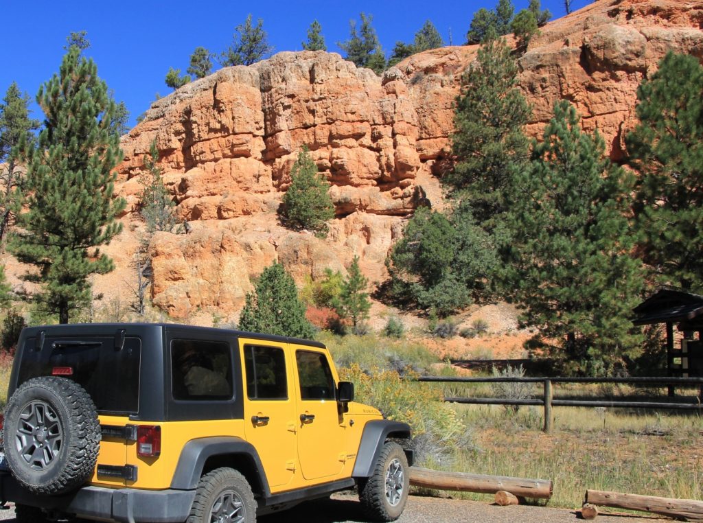
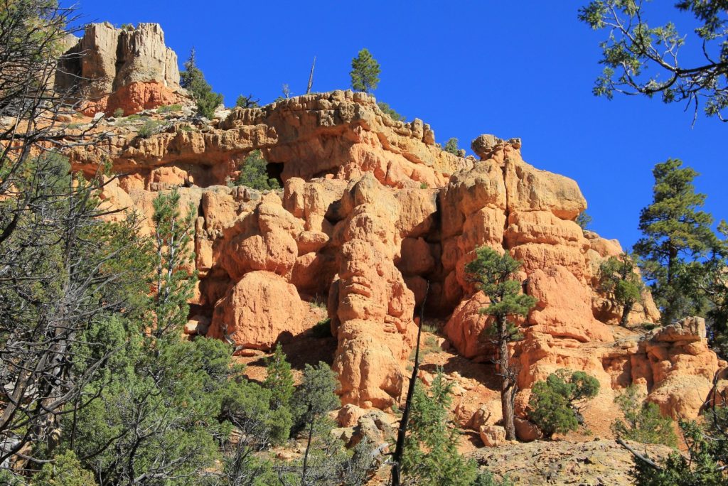
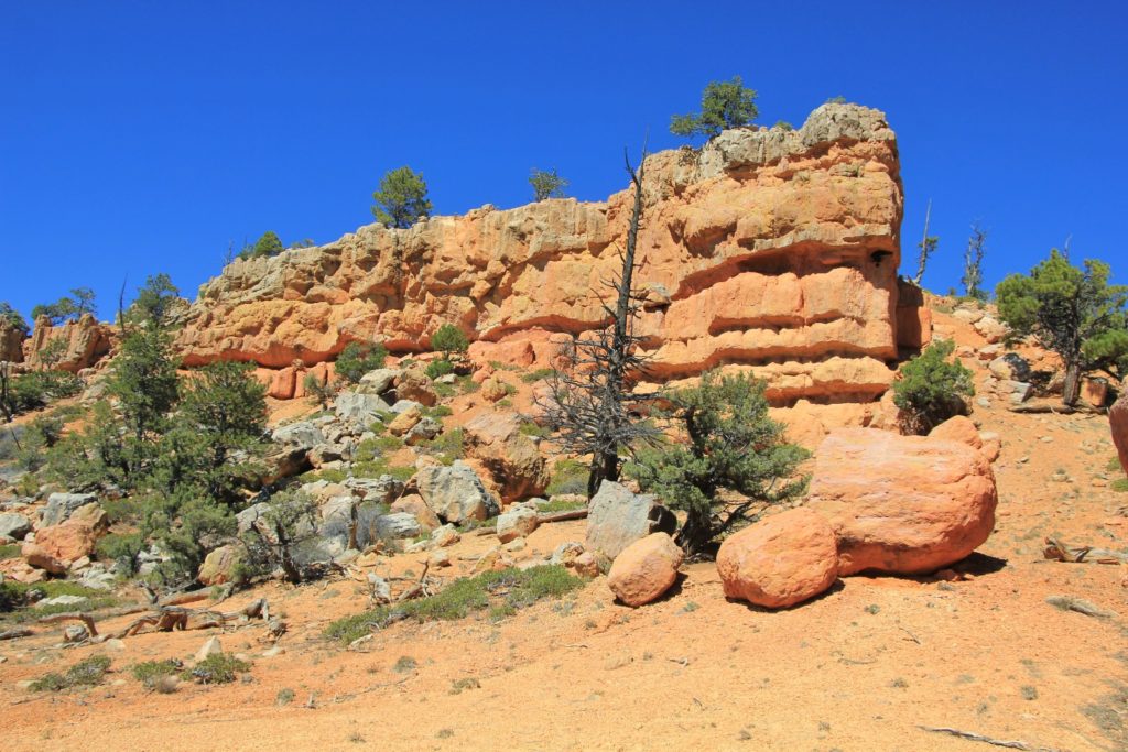
Despite my love of driving and travel, the trek from our home in Washington to Utah is always a grind. I dread it each and every time, but the payoff of desert hiking is more than ample reward. After a full day of driving on Saturday and a three hour drive Sunday morning, we found ourselves at the Red Canyon Visitor Center on Scenic Byway 12. Red Canyon has the red rock hoodoos of nearby Bryce Canyon without the national park crowds. At best, most visitors stop at a couple viewpoints, snap a few photos, and continue on to Bryce. Not the Evanses. We learned years ago that Red Canyon offers some of the finest and most secluded hiking around.
We arrived to find the scenic pullouts and visitor center were quite busy—not surprising considering it was a beautiful late September weekend with temperatures in the upper 60s. We pulled into the Red Canyon Trailhead (elevation 7,310’) and found it completely empty. You can’t beat that!
Our route for the day would combine the Cassidy, Rich, and Ledge Point trails to form a seven mile round trip loop. The Forest Service description sounded superb,
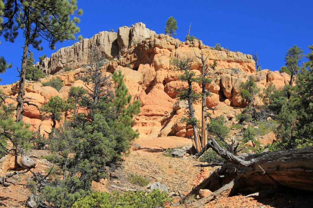
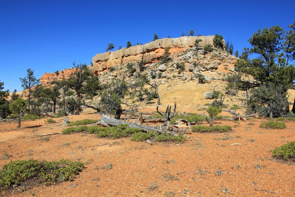
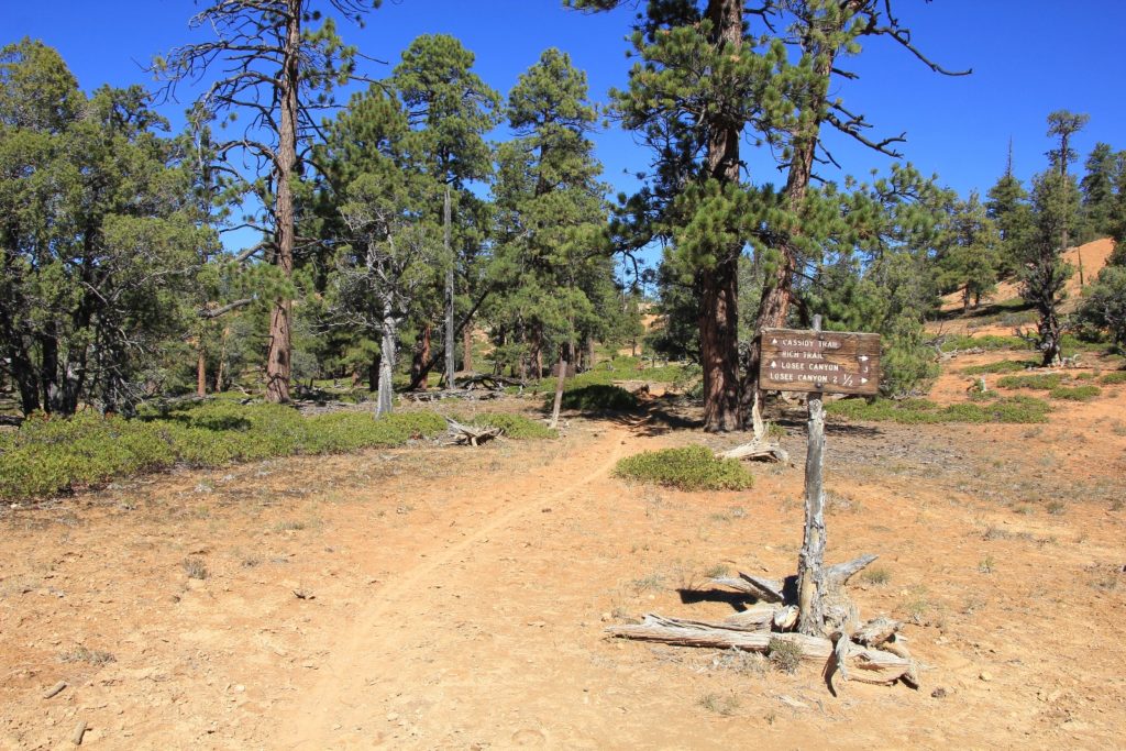
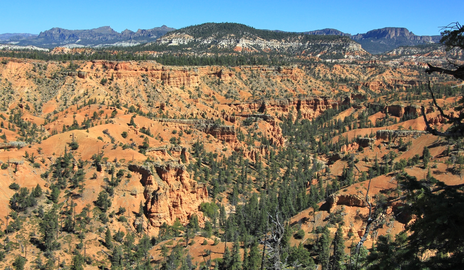
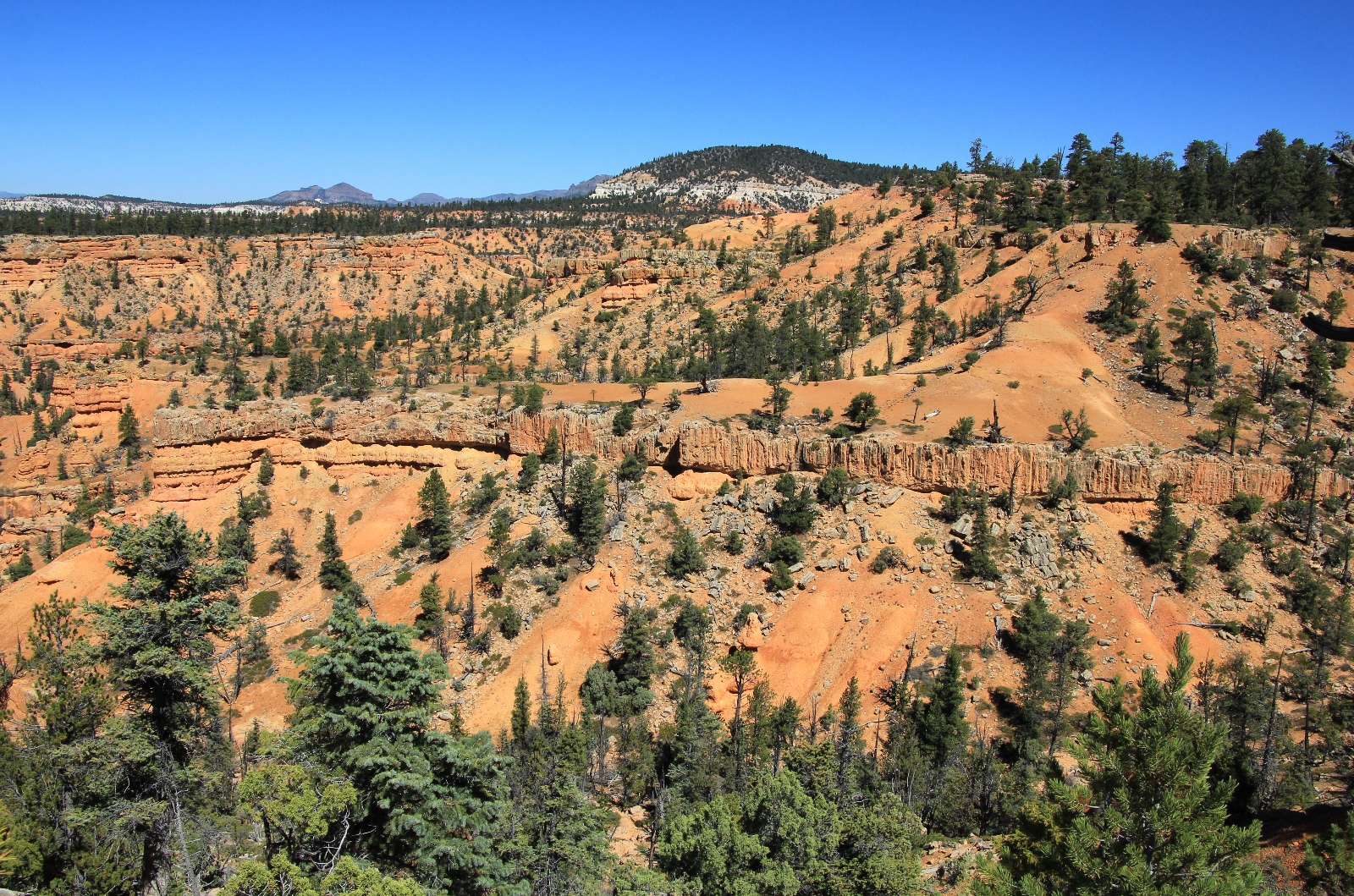
This single track trail extends northerly to the ridge between Red Canyon and Losee Canyon; then northerly to the Casto Canyon Trail in Casto Canyon. The trail travels through spectacular red rock terrain and a variety of vegetation types including stands of old growth ponderosa pine. Special sites along the trail include Brayton Point offering an overview of Losee Canyon. The trail is well marked with trail blazes on trees and directional signs at trail junctions. Sections of the Cassidy Trail are believed to have been used by Butch Cassidy, the notorious outlaw.
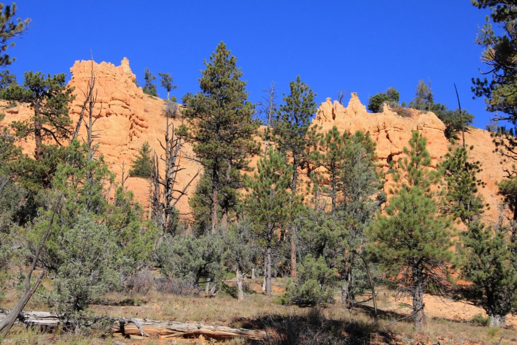
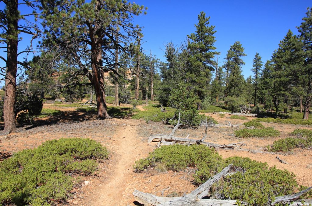
The first mile or so of the Cassidy Trail crisscrossed its way in and out of a wash with some nice red rock views and impressive ponderosa pines. While this was a nice enough stretch of trail, it paled in comparison to what was ahead. At the first junction, we turned left onto the Rich Trail where we began climbing, the views improving with each step.


Soon we reached a sign pointing to the Ledge Point Trail on the left. I didn’t have any information about this trail, but knew it was short and looked like it would be worth the time and effort. We ended up on a loop trail that took us south for great views down onto highway 12 and toward the town of Panguitch.
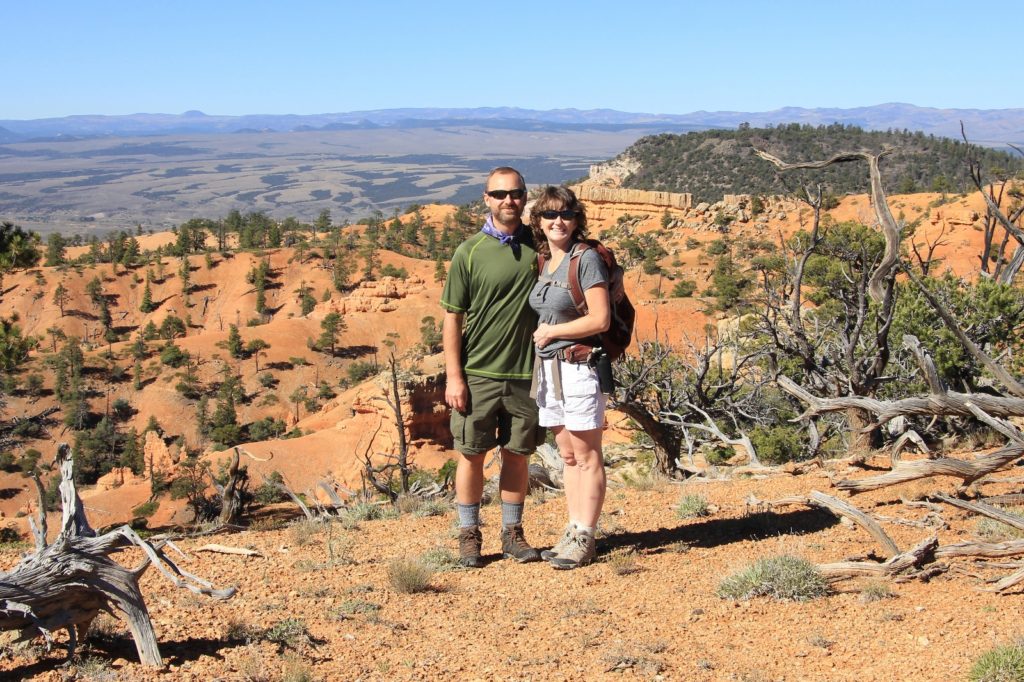
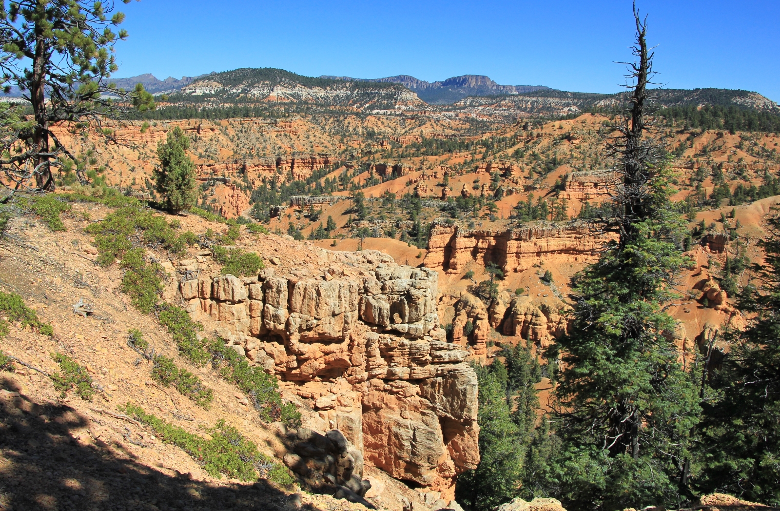
Rejoining the Rich Trail, we continued working our way north. The trail did some rollercoaster climbs and drops for the next couple of miles, adding to the hike’s total elevation gain. Soon we came to another split. We took the trail to the left which put us back on Cassidy and lead us north to Brayton Point.
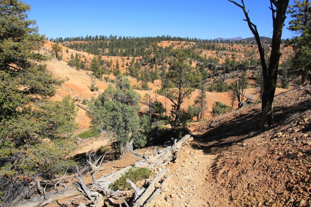
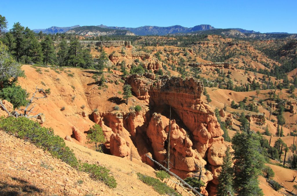
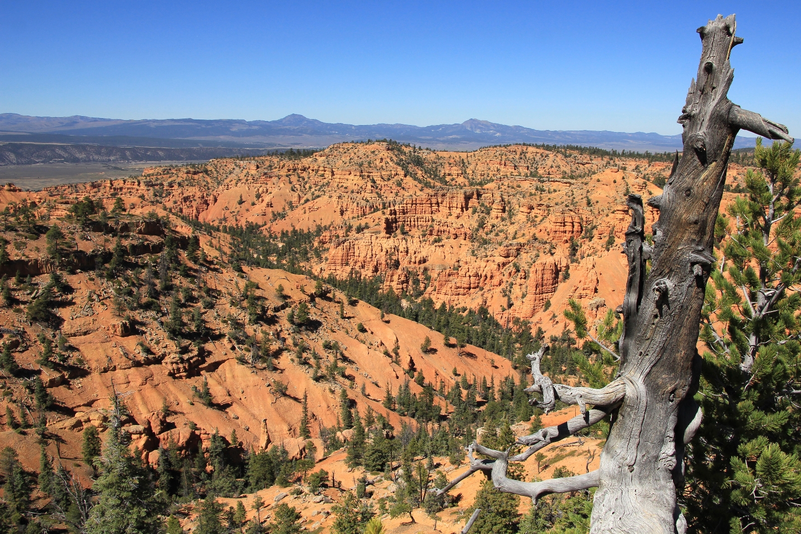
Brayton Point and the section of trail just to the east were the highlight of the hike. The far reaching views to the west and north were spectacular. Hundreds of feet below, Losee Canyon looked like a mini-Bryce. While enjoying Brayton’s views, we had an equally enjoyable conversation with a British gentleman on a mountain bike. He appeared to be in his 60s and spends his time traveling the American West in a motorhome with his wife. We also saw a young woman who had just mountain biked up from the Losee Trail. These were the only people we saw on the trails of Red Canyon this day.
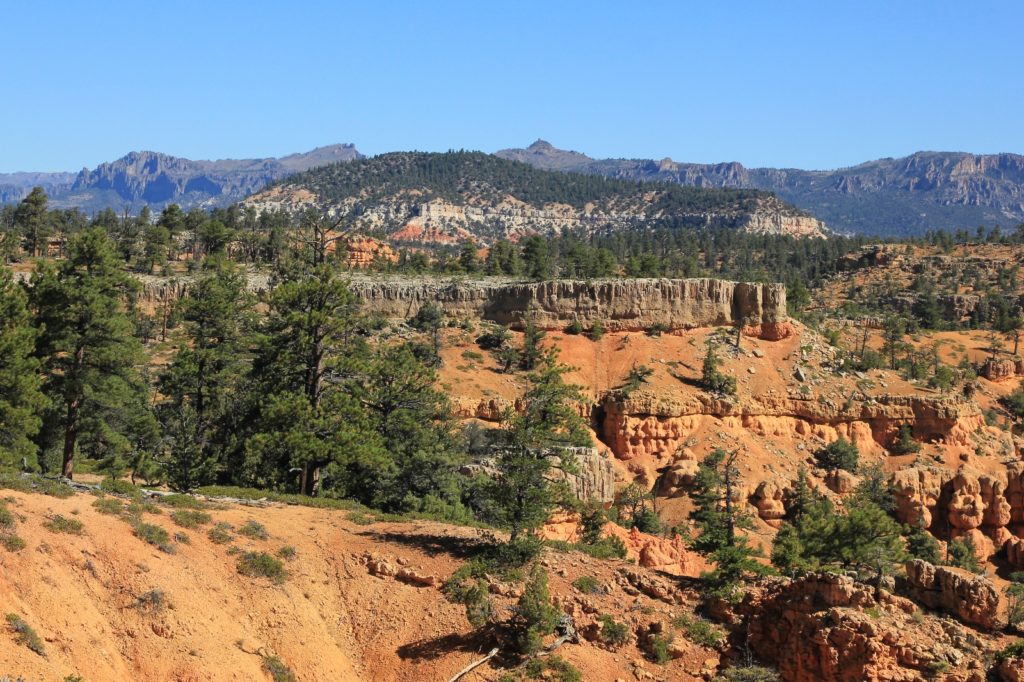
The Cassidy Trail continued east to yet another junction with the Rich Trail. We took a left here and continued our climb with fine views to the north. The trail topped out in this area at around 7,930’ elevation. Soon there was another junction with the Cassidy Trail. This was our turnaround point for the day. We took a right to rejoin Cassidy.
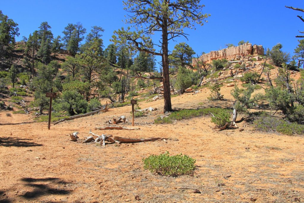
Like the hike in, the return hike alternated between Rich and Cassidy trails. Each junction was clearly signed and we took the left branch each time. While there were a lot of trail junctions, it would be hard to get lost with the exceptional signage.
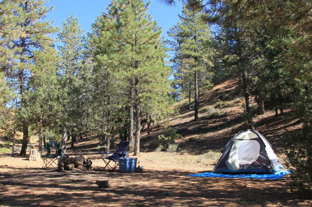
We ended the day with a yummy bacon cheeseburger at nearby Bryce Canyon Pines (a favorite of ours) followed by finding a secluded campsite off an area side road. We were just a few miles from a busy national park, but we didn’t have a single car drive by during our stay. After setting up camp, we went to work getting our backpacking gear ready for a three day pack into Coyote Gulch. It was a clear night, so I had Jason leave the rain fly off the tent for some star gazing. I’d regret that decision the following morning when we awoke to 28 degrees and a light frost covering our sleeping bags, but it was wonderful that evening!
Directions to the trailhead: from the Red Canyon Visitor Center (Dixie National Forest), travel east along scenic byway 12. After passing through the tunnels, turn into the first parking lot on the left. This is the Red Canyon Trailhead. You will find ample parking and a well kept privy.
Given our summer plans for Utah, it occurred to me that I should look at what you’ve written about Utah. Wow! We might have to do more than one summer in the state.
I wish to compliment you on your writing skills.
And your photography is beautiful.
Thank you for sharing
And note, below there is an edit box for “Website”. Weird, but I can’t seem to paste into this field.
Thank you for the compliments Tom. It is taking me a while to find my writing ‘voice’ (saying enough to put a story to the photos, but not so much as to be boring). Hopefully I’m improving with each post. Compliments such as yours provide good motivation.
This post you’ve commented on is from Red Canyon, which is one of the places I told you and Claudia about last night. A mini-Bryce without as many people and several nice, short trails of high scenic value. There are great dry camp options in the area if you know where to look. And it is high elevation, so a good summer option… and there is a place down the road with really good pie! We’ve done more hikes in Utah than the blog reflects- I have so many old trips I’d like to blog about if only I could find more time… as you know- someday. Be sure to keep in touch and let us know as you plan new areas of Utah, I’m bound to have a tip or two. 🙂
Thanks for the note on the “website” field. I tried it out and seems users can type a website in, but cannot copy and paste. The WordPress format allows for lots of customization… if only I can figure out where that might be.
Happy trails!
Lusha
Are mountain bikes allowed on these trails?
Hi Natalie,
Many of the Red Canyon trails do allow bikes. Cassidy, Rich, & Ledge Point (discussed in this blog post) allow bikes- or at least they did when we were there and we saw a couple mountain bikers during our hike. I recommend double checking with the Red Canyon Visitor Center. The staff is very helpful and they have a free brochure that includes a map as well as trail descriptions and what type of travel is allowed on each trail.
Happy trails!
Lusha