The Southeast corner of Utah is home to three incredible National Monuments: Hovenweep, Bears Ears, and Natural Bridges. A drive of just 78 miles will take visitors to all three monuments and the ambitious could hit all three in one day—but that would be a travesty. These monuments beg for deeper exploration, particularly Bears Ears with its 1.35 million acres of land. We’ve made many trips to the area over the years and have barely scratched the surface of what it has to offer.
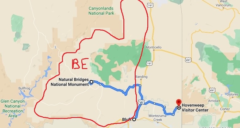
After leaving Canyonlands Needles District, we relocated to Coral Sands RV Park in Bluff, Utah for 6 nights. After nearly a month of boondocking, it was nice to have full hookups for a few nights. This was especially true on warm afternoons when the winds picked up and sandstorms blew in. Getting to close the RV up and run the air conditioner was a welcome luxury. If you are traveling through the area, we recommend Blanding for grocery resupply (just don’t expect to find beer in this dry town), White Mesa for gas (great prices on the Ute Mountain Reservation) and Bluff for your basecamp. Bluff is a charming Mormon pioneer town that has hosted us many times over the years. Desert Rose Inn is a great choice for those wanting a plush hotel experience while Coral Sands was a wonderful RV park. Be sure to visit Cottonwood Steakhouse or Comb Ridge Eat and Drink to satisfy your hunger after a fun day adventuring.
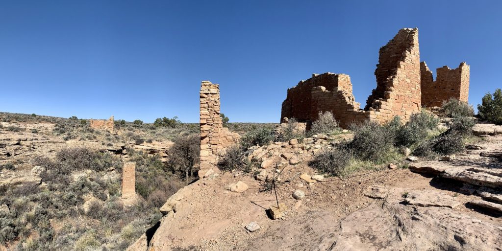
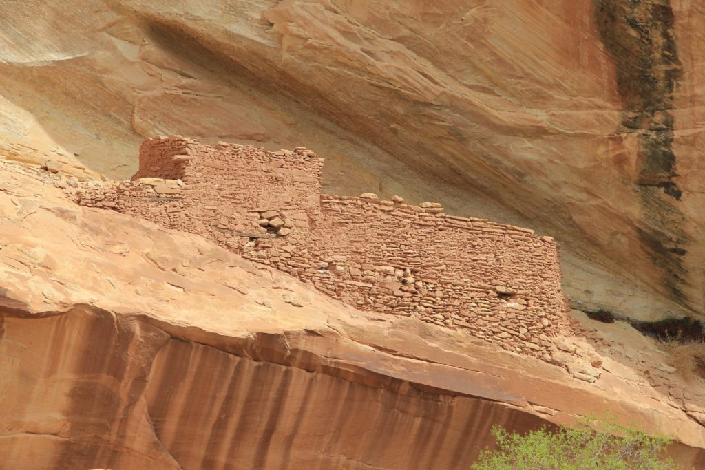
Hovenweep National Monument
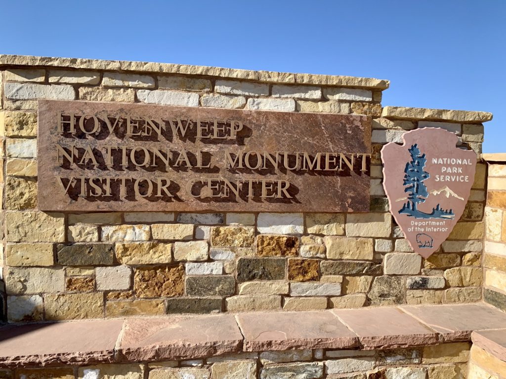
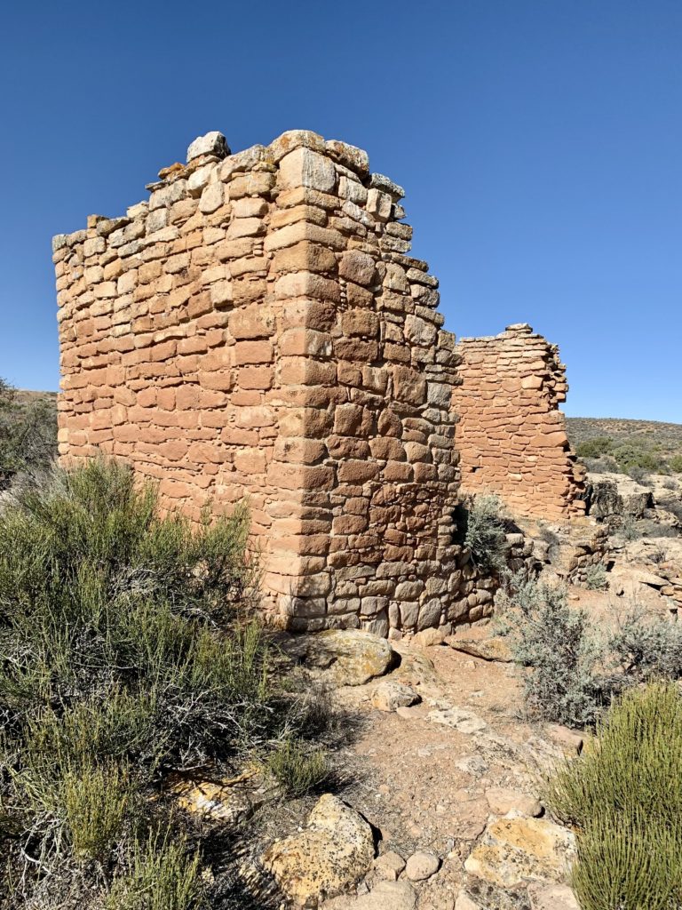
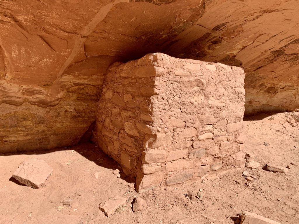
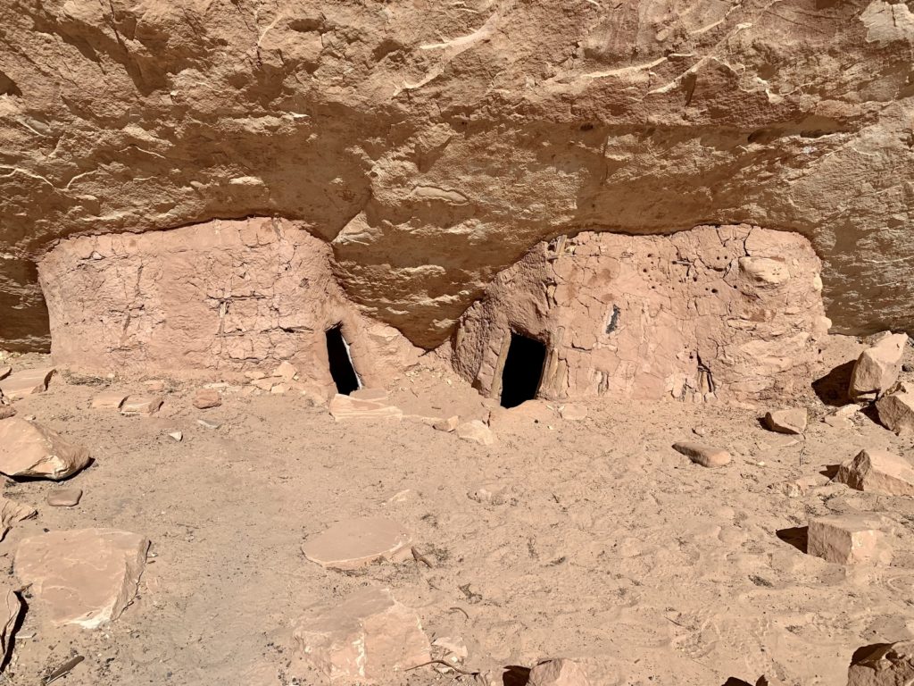
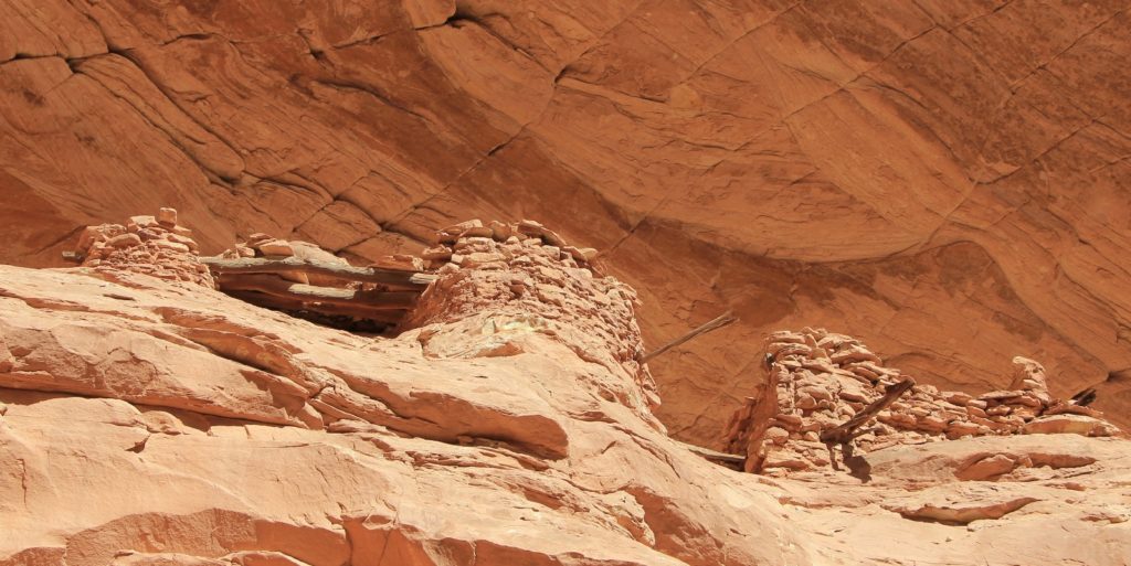
Hovenweep National Monument, established by President Harding in 1923, protects six prehistoric ancestral Puebloan villages along a 20 mile long stretch of mesa tops and canyons along the Utah-Colorado border. The remains here represent what archeologists consider to be the finest examples of ancestral Puebloan masonry anywhere. “Hovenweep” is a Paiute and Ute word meaning “deserted valley”.
Human presence in this area can be traced to 6,000 – 8,000 BC. Nomadic hunter-gatherers camped near the springs located in the area. Eventually, lifestyles became more agricultural based and people began settling this region around 900 AD. In the late 1100s to early 1200s, dispersed habitations began consolidating into communities around water sources and at canyon heads. Tree ring dating at Hovenweep shows most of the structures dating to 1230 to 1275, about the same time as the massive cliff dwellings at nearby Mesa Verde National Park. These communities were short lived—by 1300 the Puebloan people departed the area. Their impressive structures were discovered by a Mormon expedition in the mid-1850s.
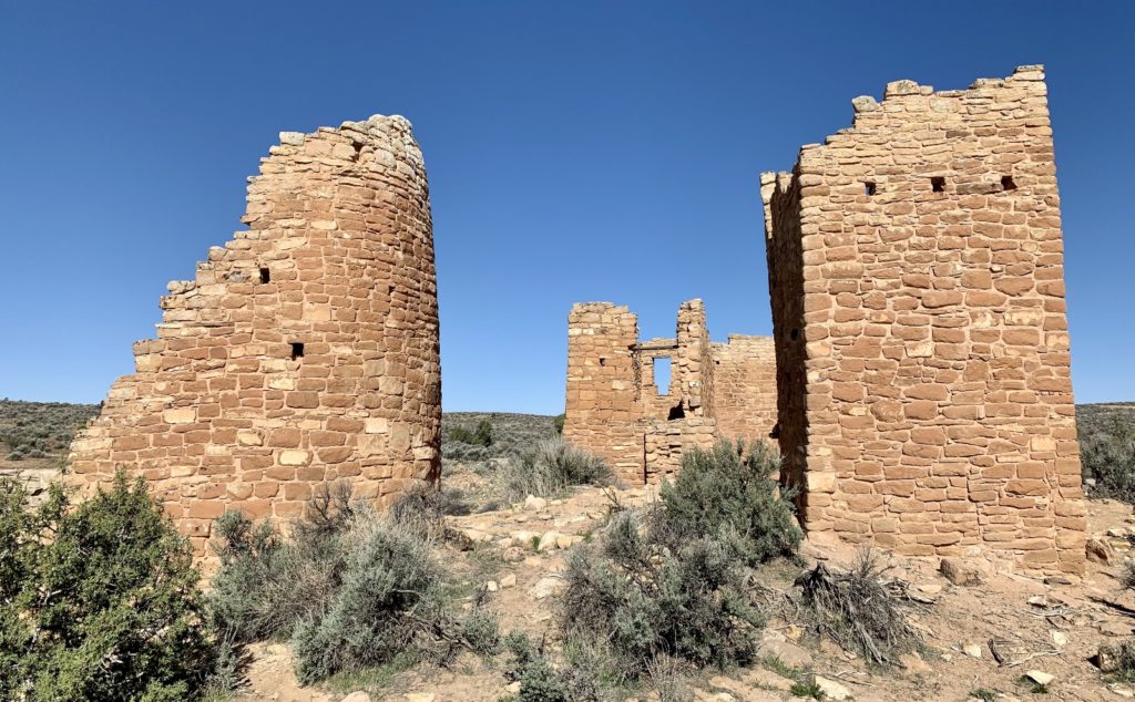
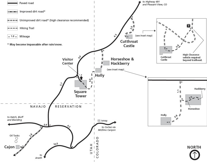
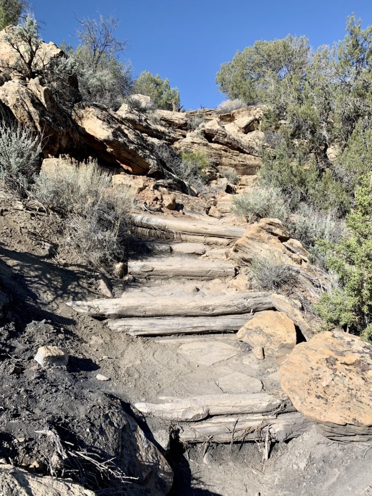
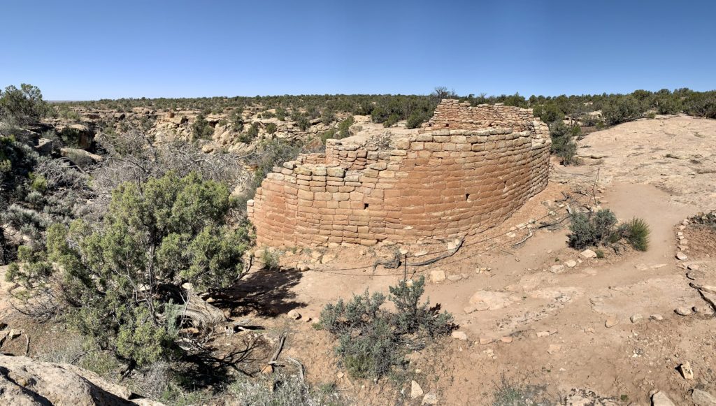
Square Tower Unit is the largest and most visited unit in the monument. It has a visitor center, campground, the densest concentration of ruins and the most popular trails. The visitor center was closed during our visit (due to COVID restrictions), but a very nice and informative ranger came out to speak with us. We hiked the 1.5 mile Rim Trail Loop and added on the 0.5 mile Tower Point Loop. Hiking is generally easy, but the trail does climb in and out of a canyon over uneven terrain west of Stronghold House. For those uncomfortable with that type of hike and/or distance, I recommend heading east along the loop and going as far as Hovenweep Castle which is the most impressive set of ruins in the monument.
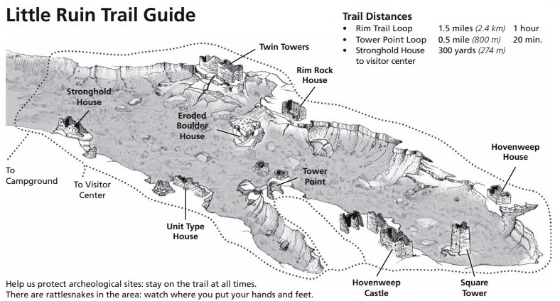
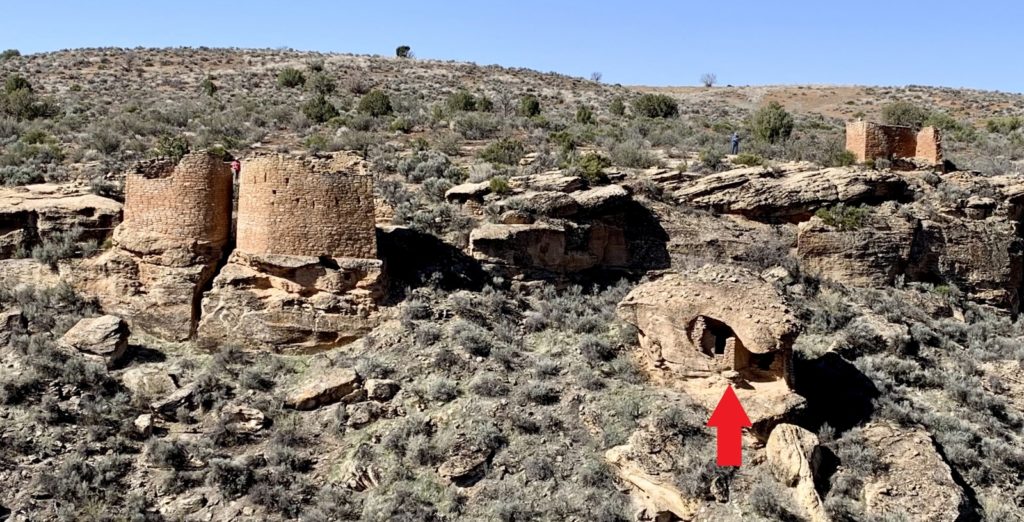
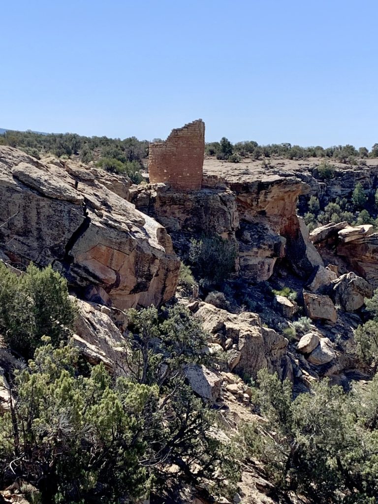
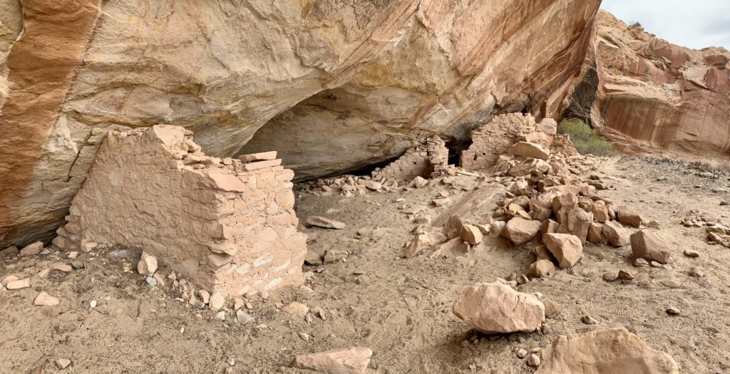
The monument also has five outlying units: Holly, Horseshoe, Hackberry, Cutthroat Castle, and Cajon. While the Square Tower Unit is accessed via paved roads (albeit some of the most poorly paved roads we’ve seen), the outlying units are all off unmaintained dirt and gravel roads. Rangers recommend high-clearance vehicles to access these sites. We visited the Horseshoe and Hackberry units which were a relatively short drive from the visitor center and just across the Colorado border.
In all our trips to the area, this was our first visit to Hovenweep and it was long overdue. If you are driving through the area and have half a day, be sure to stop by and at least visit Square Tower Unit. The remote nature of the monument means it received very light visitation and we saw few people despite being a beautiful spring weekend. While places like Arches and Canyonlands had been busier than we’d ever seen, Hovenweep was very quiet, especially at the outlying units. The highlight of our day came as we were leaving Hovenweep via Navajo Nation roads. We saw several groups of wild horses including a dam with a newborn foal (likely born that day based off how wobbly its legs still were).
Bears Ears National Monument
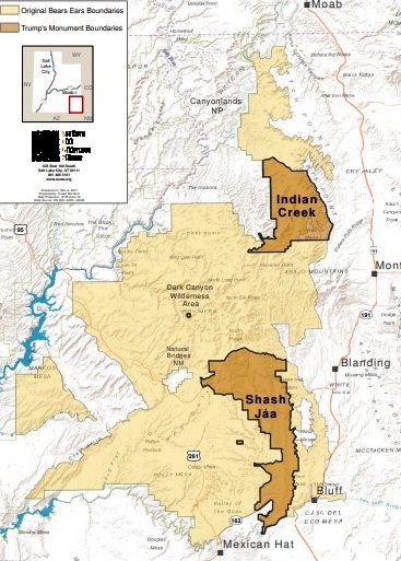
Our first visit to Bears Ears National Monument was in spring of 2010. The area wasn’t a monument back then, but it was obvious that its wild lands and numerous archeological sites deserved protection. On December 28, 2016, President Obama created the 1,351,849 acre Bears Ears National Monument using his authority under the Antiquities Act. As a National Monument, lands in Bears Ears were withdrawn from new mining, energy development, and grazing (existing rights were honored). Additionally, the Bears Ears Commission was created consisting of officers from the Hopi Nation, Navajo Nation, Ute Mountain Ute Tribe, Ute Indian Tribe of the Uintah Ouray, and Zuni Tribe. The expertise of the intertribal Commission would help provide access to members of Indian tribes to traditional and cultural use of the land.
Less than one year after the creation of Bears Ears, President Trump took an ax to the monument, an overreach of powers under the Antiquities Act. Bears Ears was reduced 83% to just 229,000 acres. Included on the chopping block were beautiful and archaeologically rich Cedar Mesa, Comb Ridge, and Grand Gulch—amazing areas that we have visited many times. The action revoked much needed protections and opened the area back up to new mining and energy development. These are highly sensitive areas that need the protections afforded under National Monument designation. Like many, I recognize the original boundaries of the monument and believe the current administration will fully restore them.
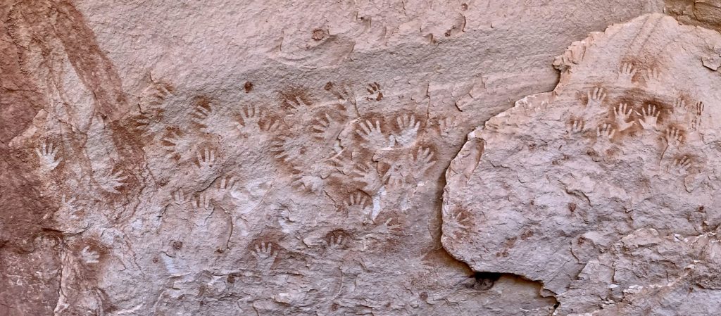
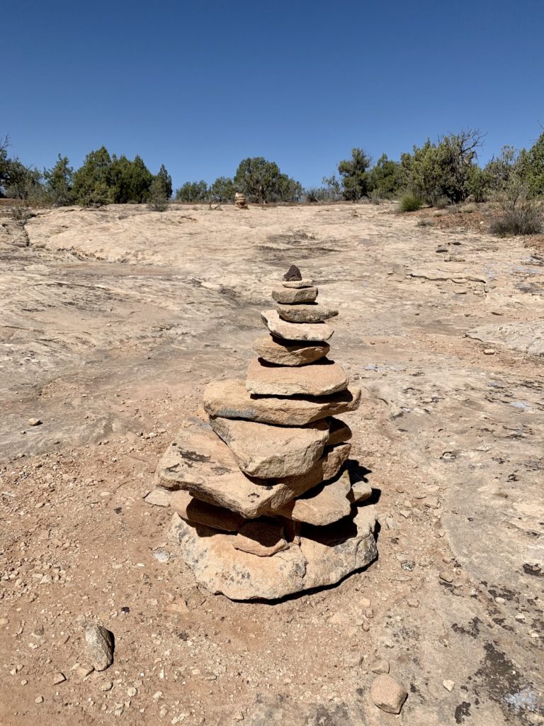
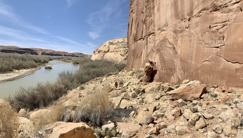
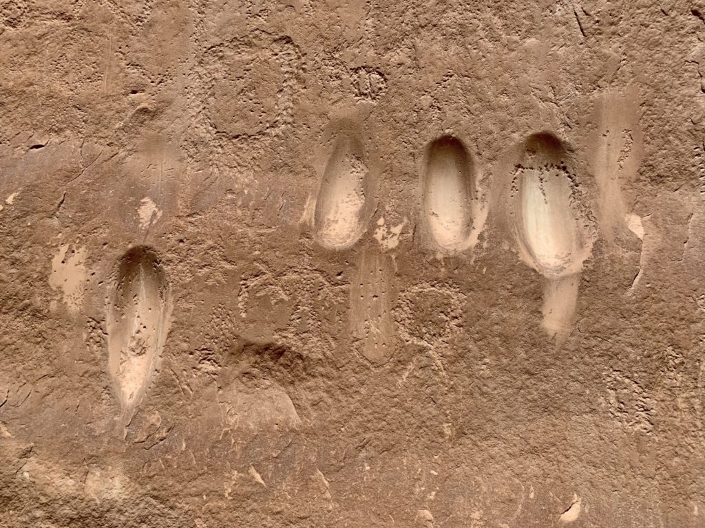
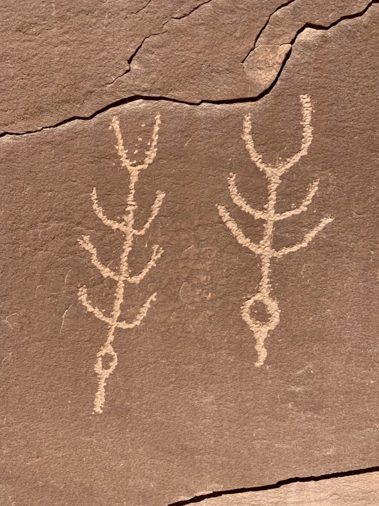
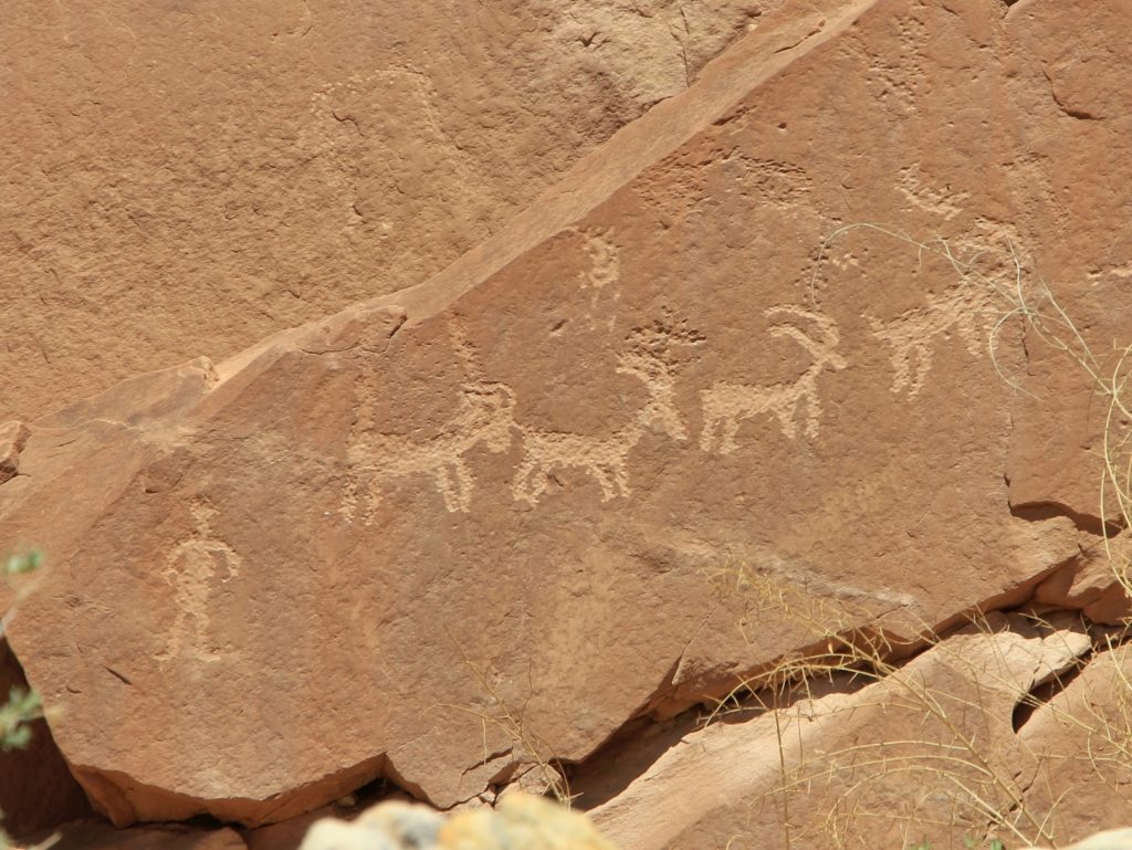
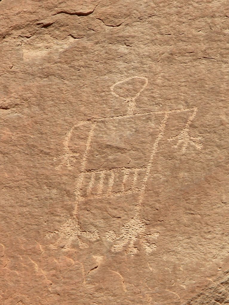
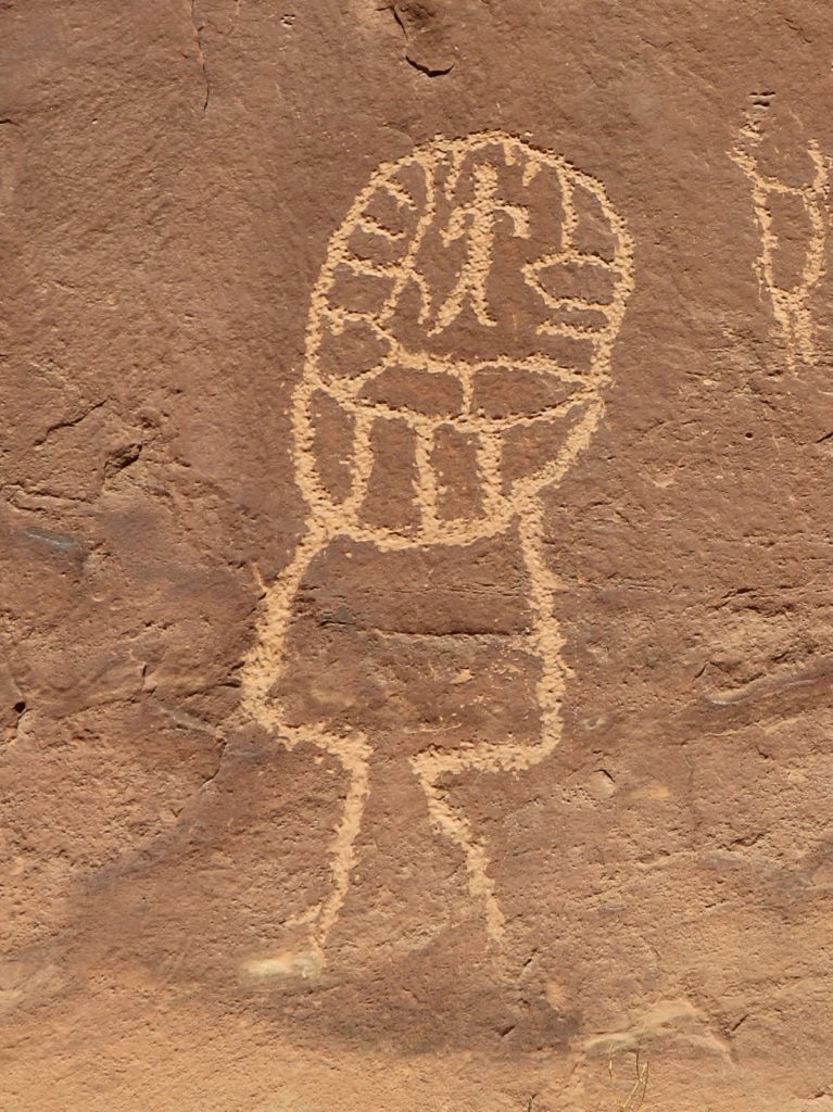
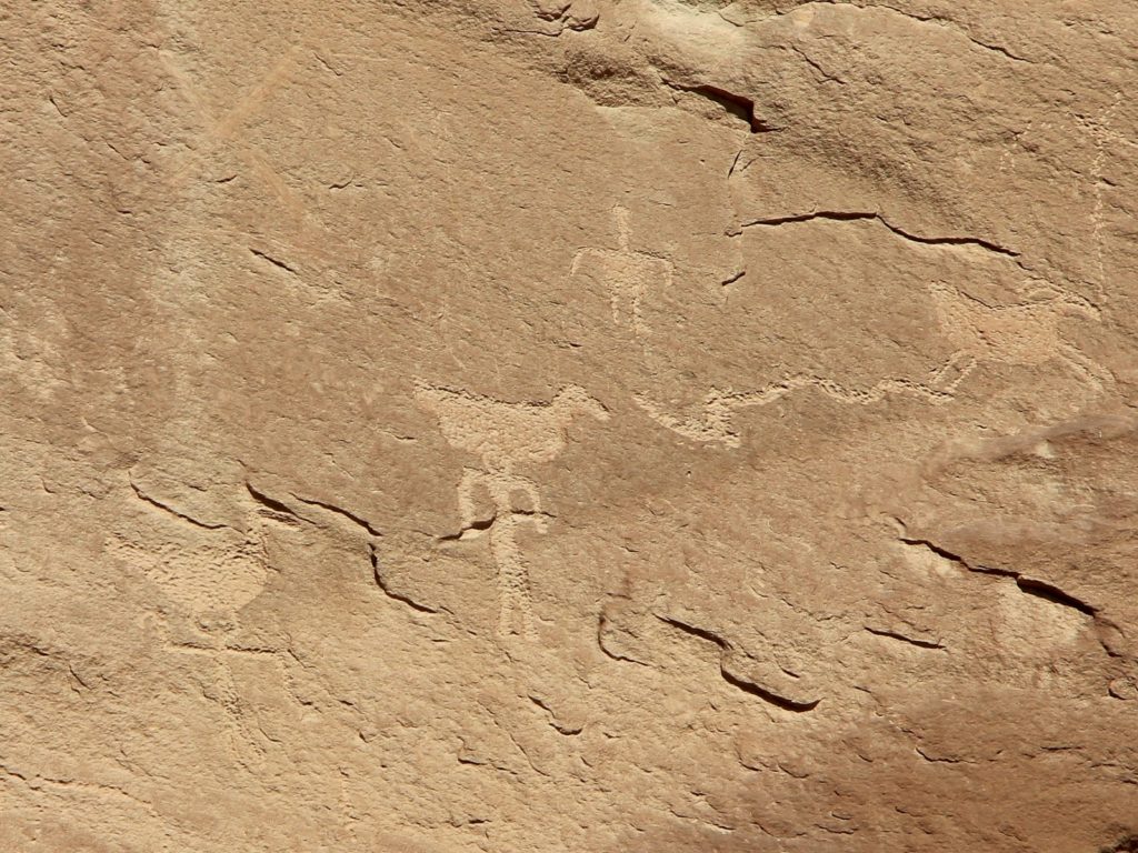
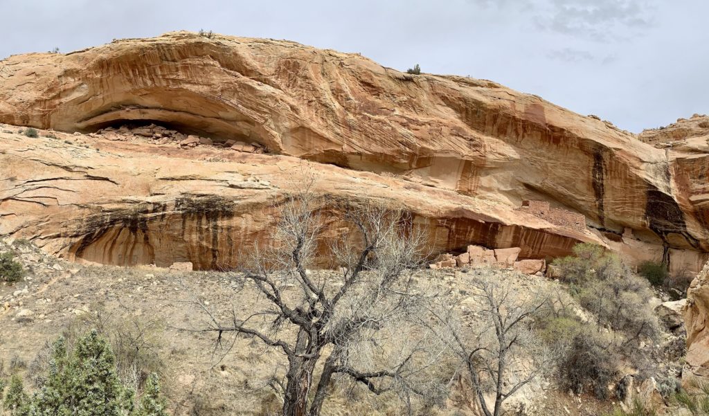
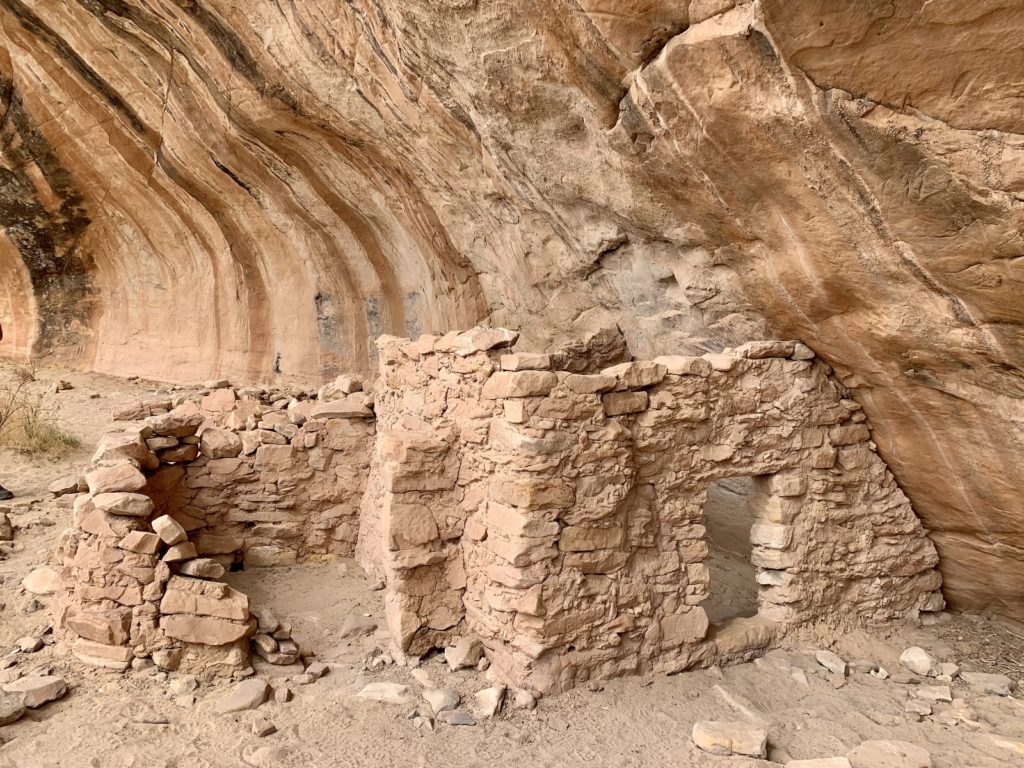
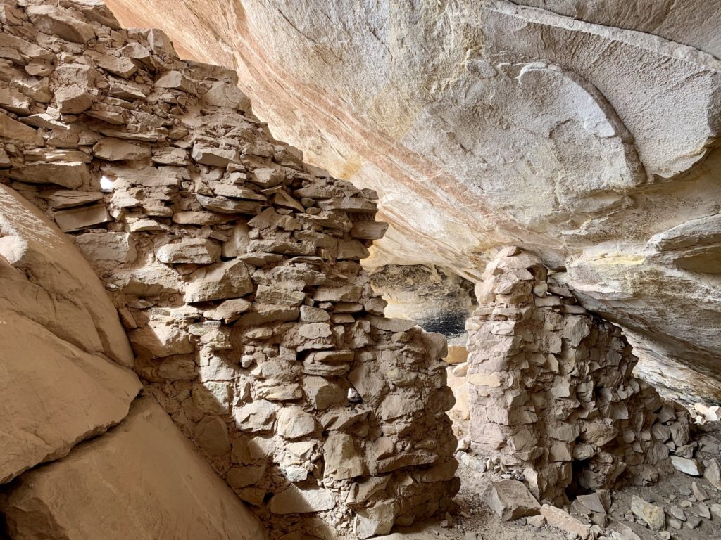
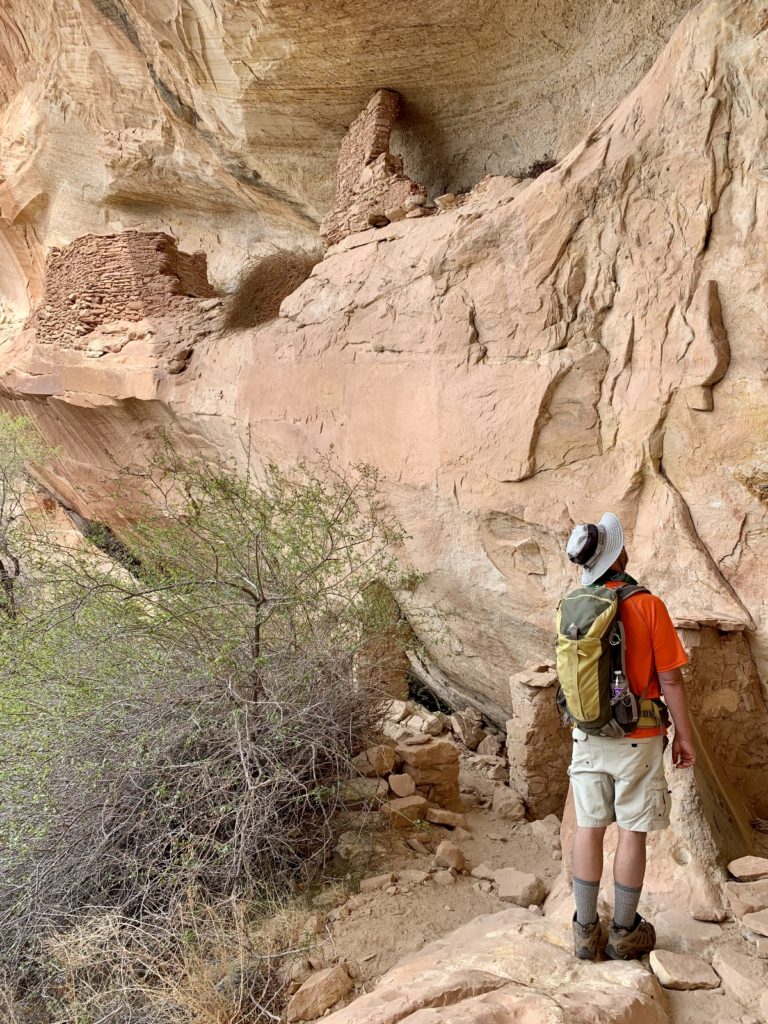
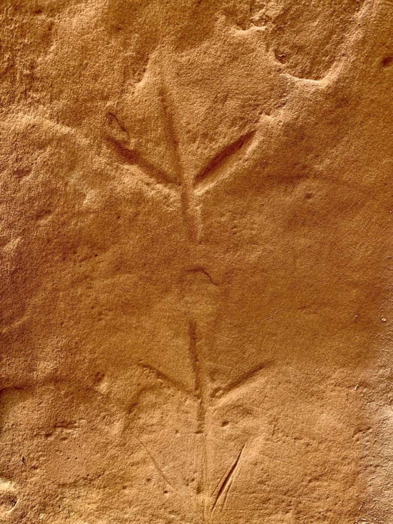
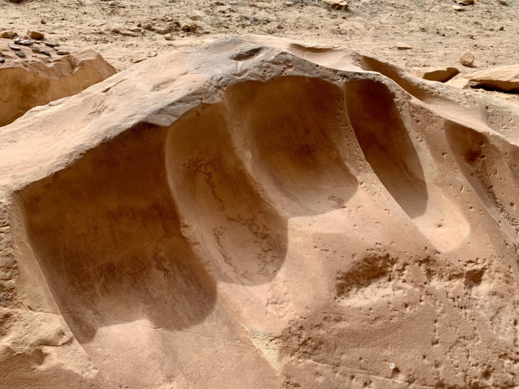
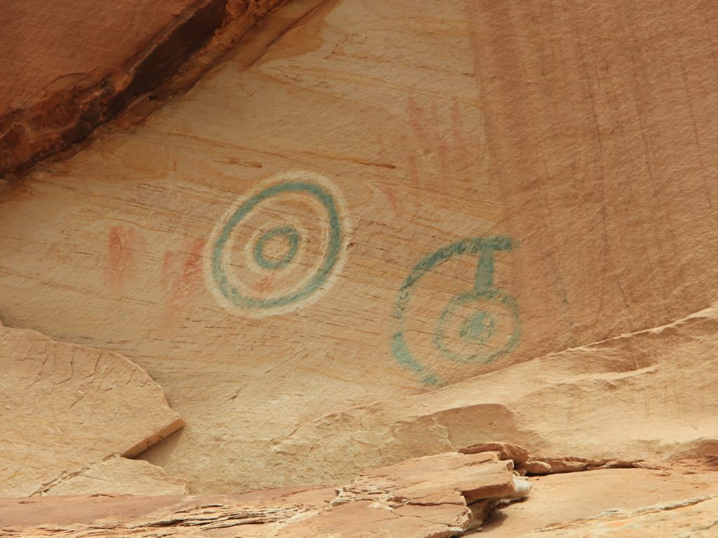
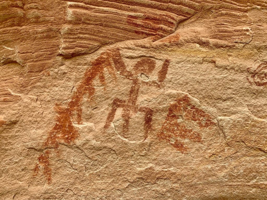
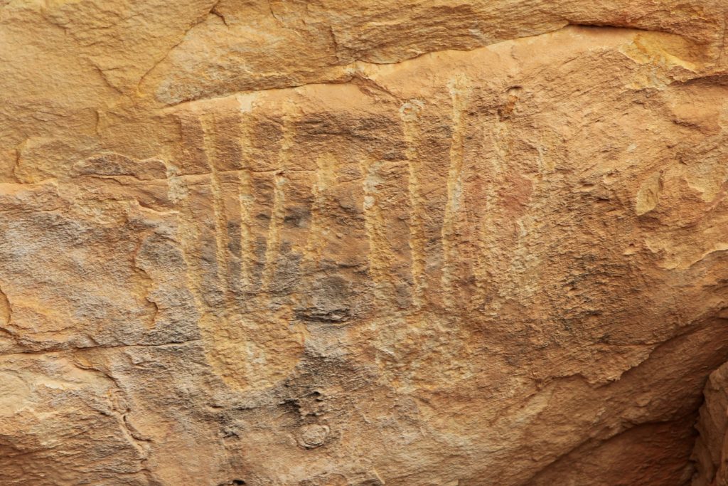
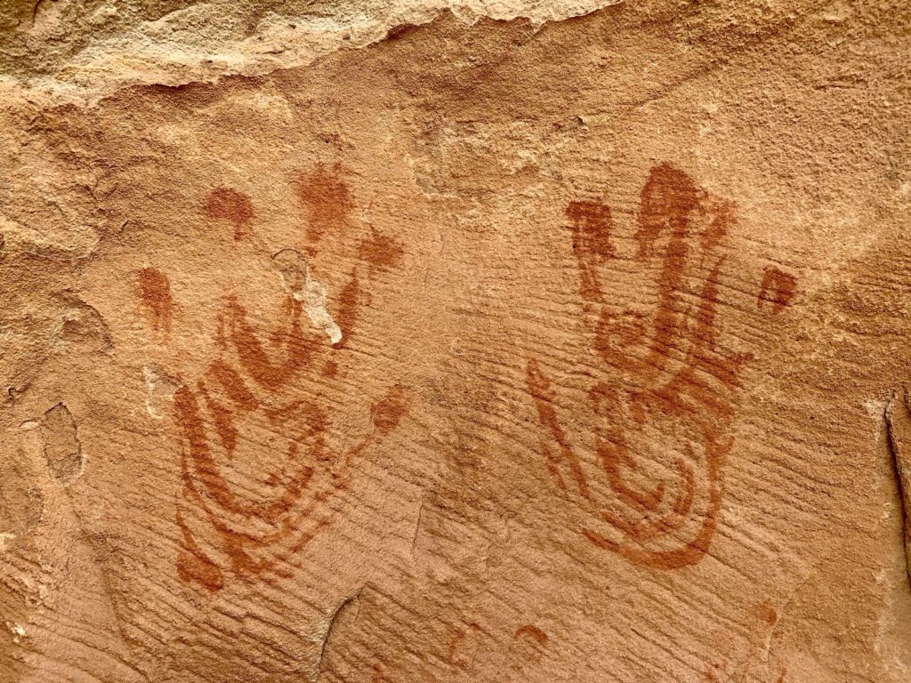
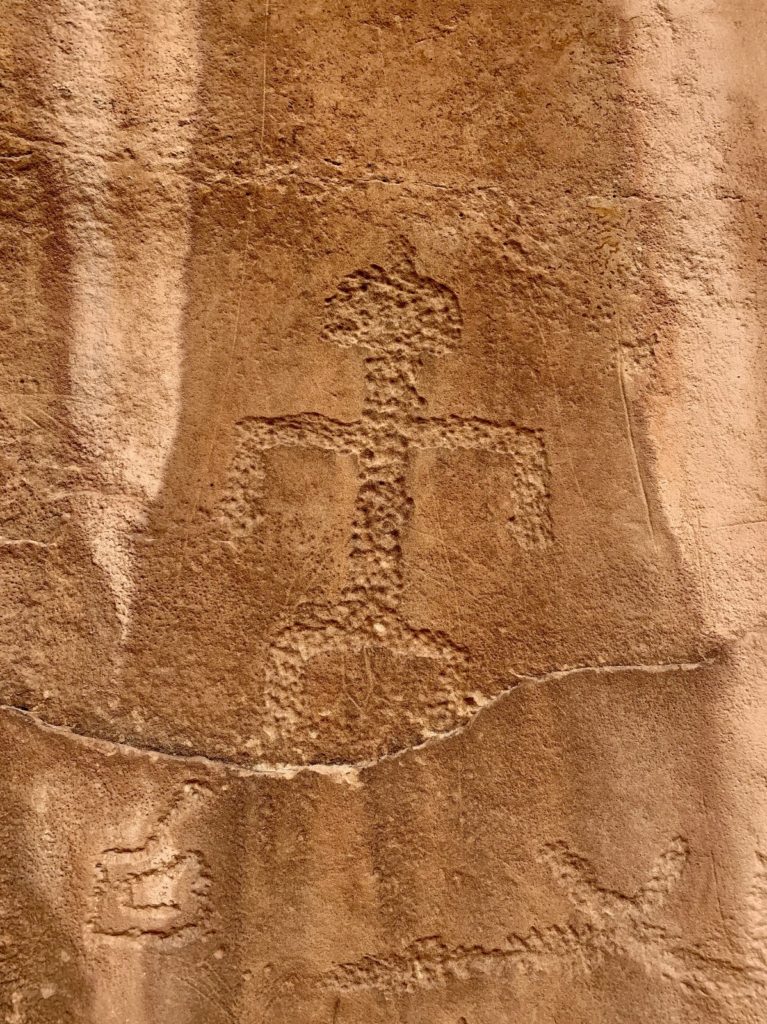
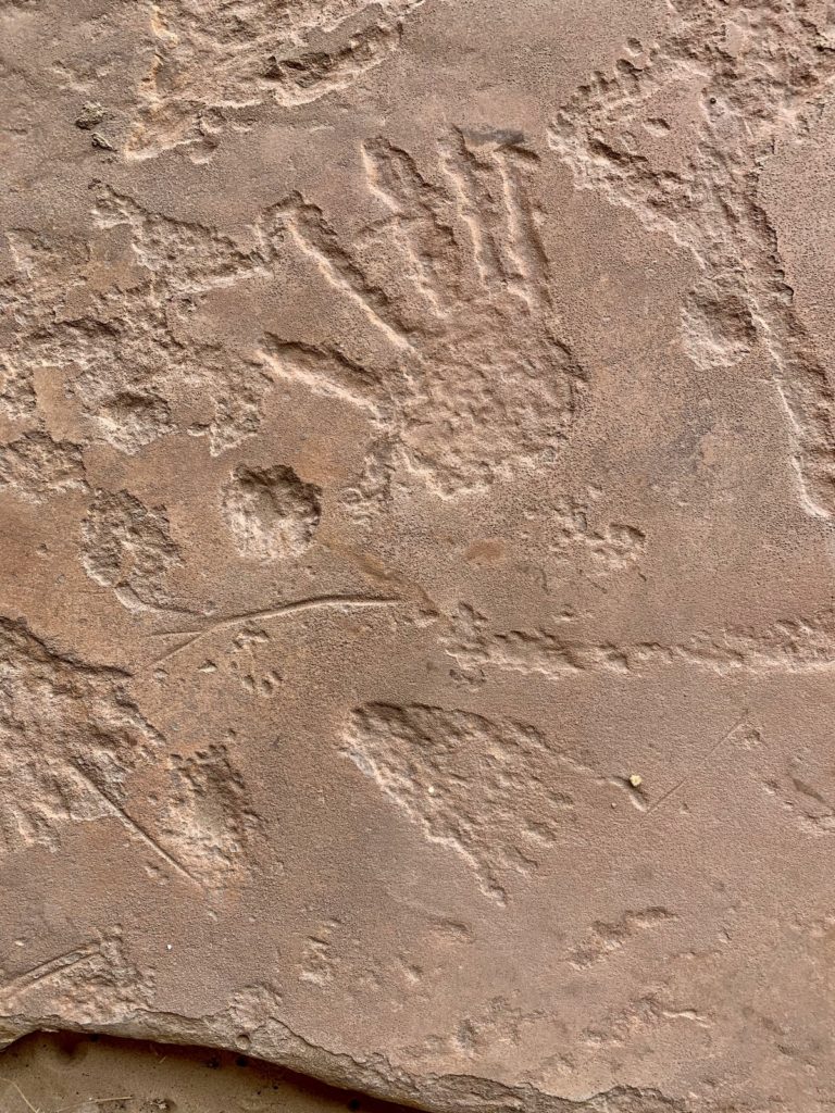
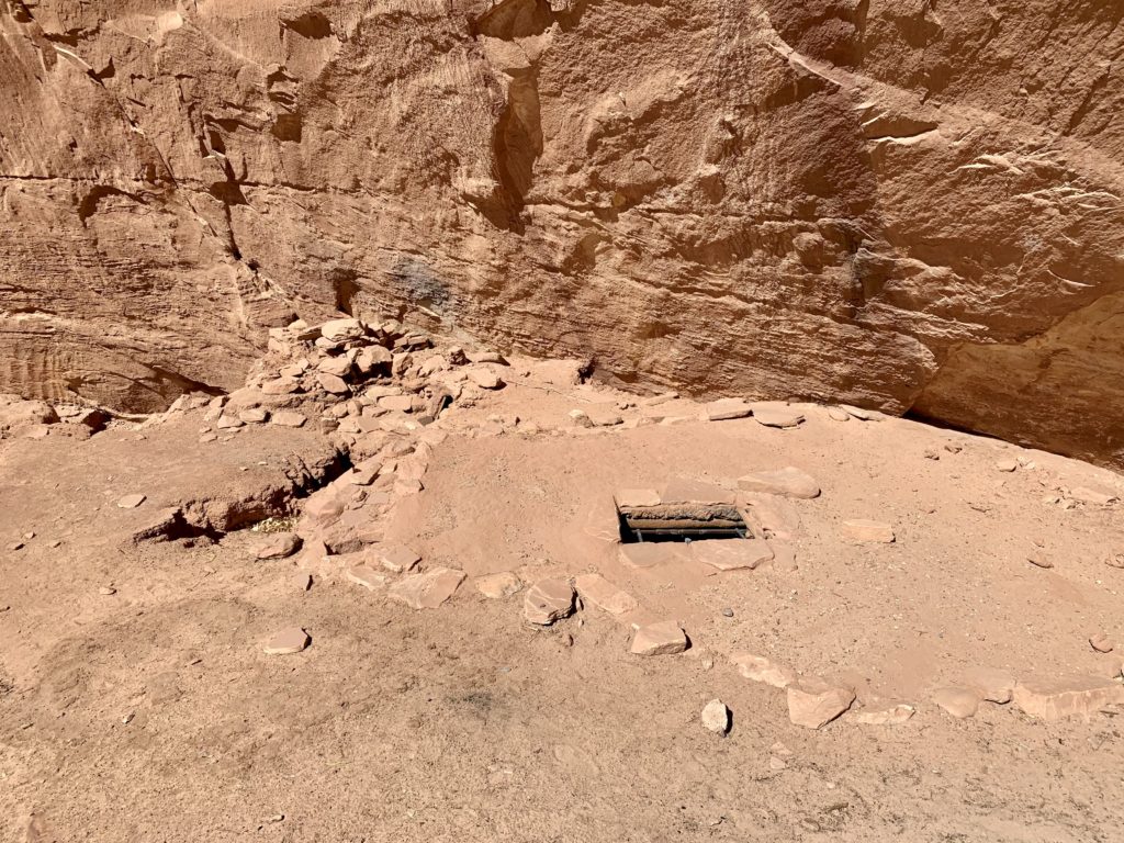
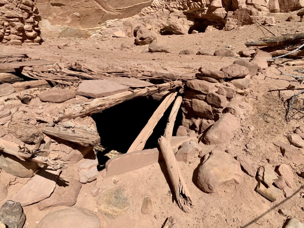
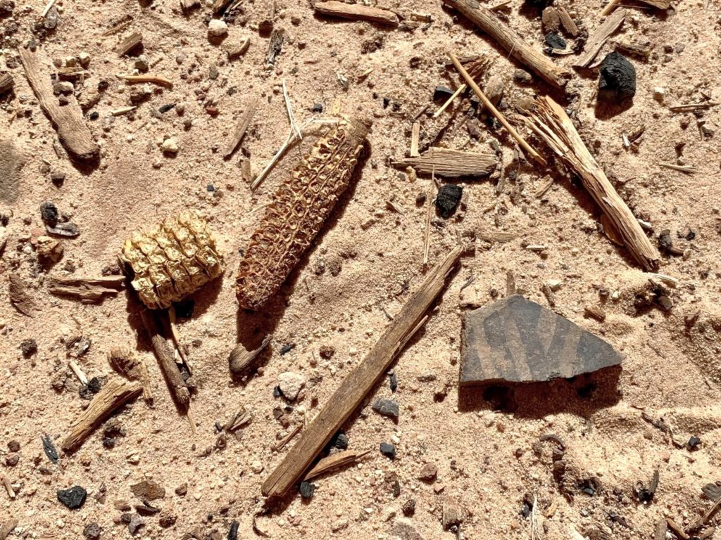
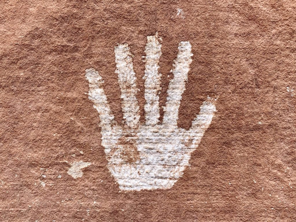
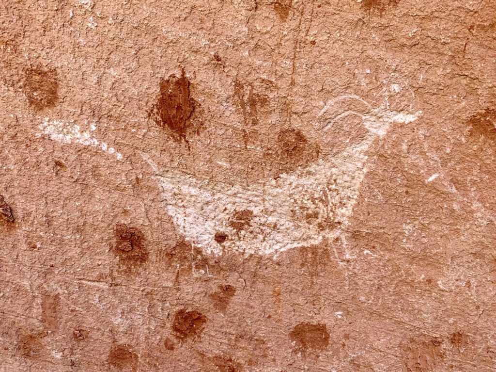
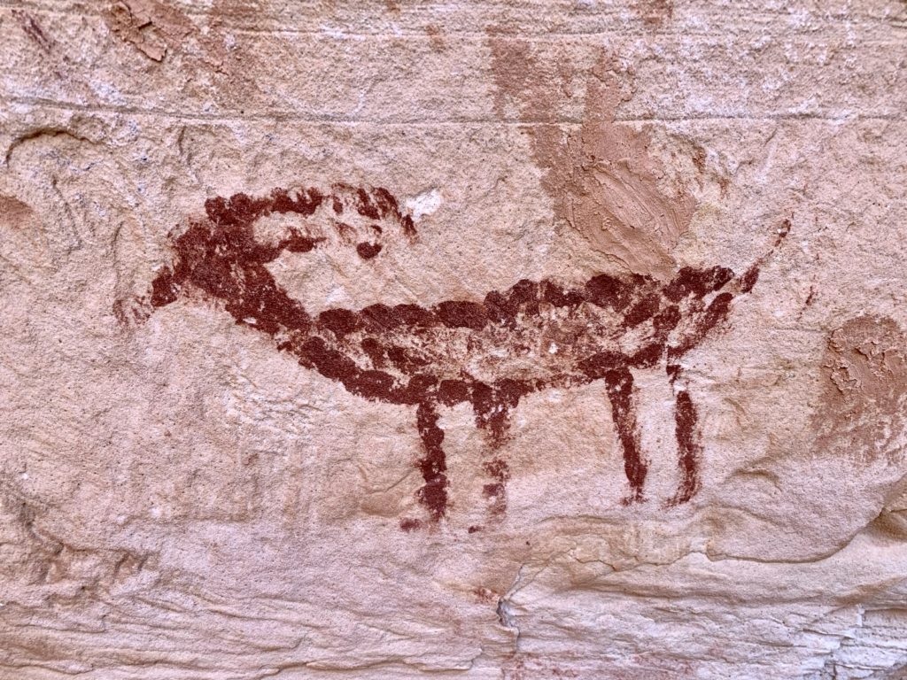
On this trip, we spent two days exploring sites in Bears Ears National Monument. The first day was spent hiking down a canyon to a major rock art site along the San Juan River. The second day was spent exploring a ruin and rock art site along Comb Ridge, an impressive 80 mile long monocline that runs from the Abajo Mountains south to the San Juan River. While neither of these locations are top secret, they also aren’t on most people’s radar and I haven’t seen abundant information on the web and I’ll continue that trend. We only saw one other party on each hike. Like at Hovenweep, this seemed extra special given the unusually busy 2021 travel year we’d been experiencing. Bears Ears holds a treasure trove of adventures. If you see a pull out and a user trail, there is likely something special ahead.
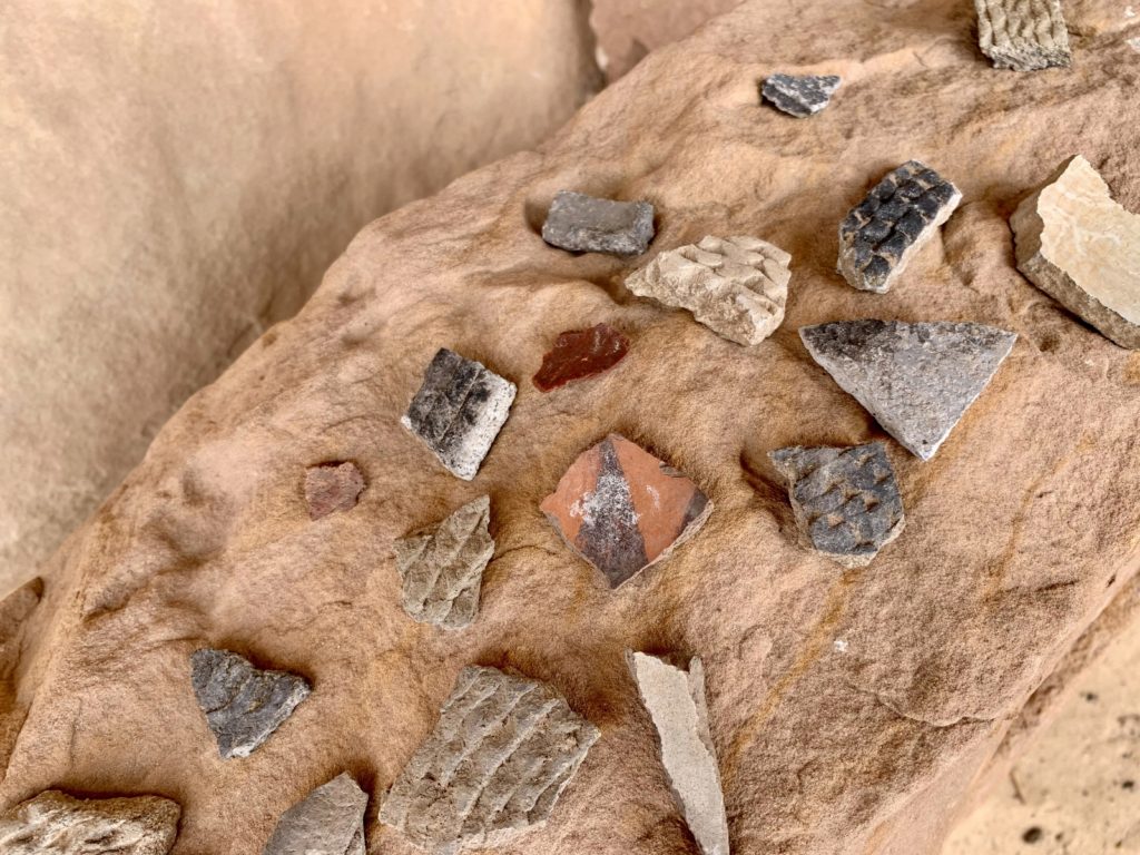
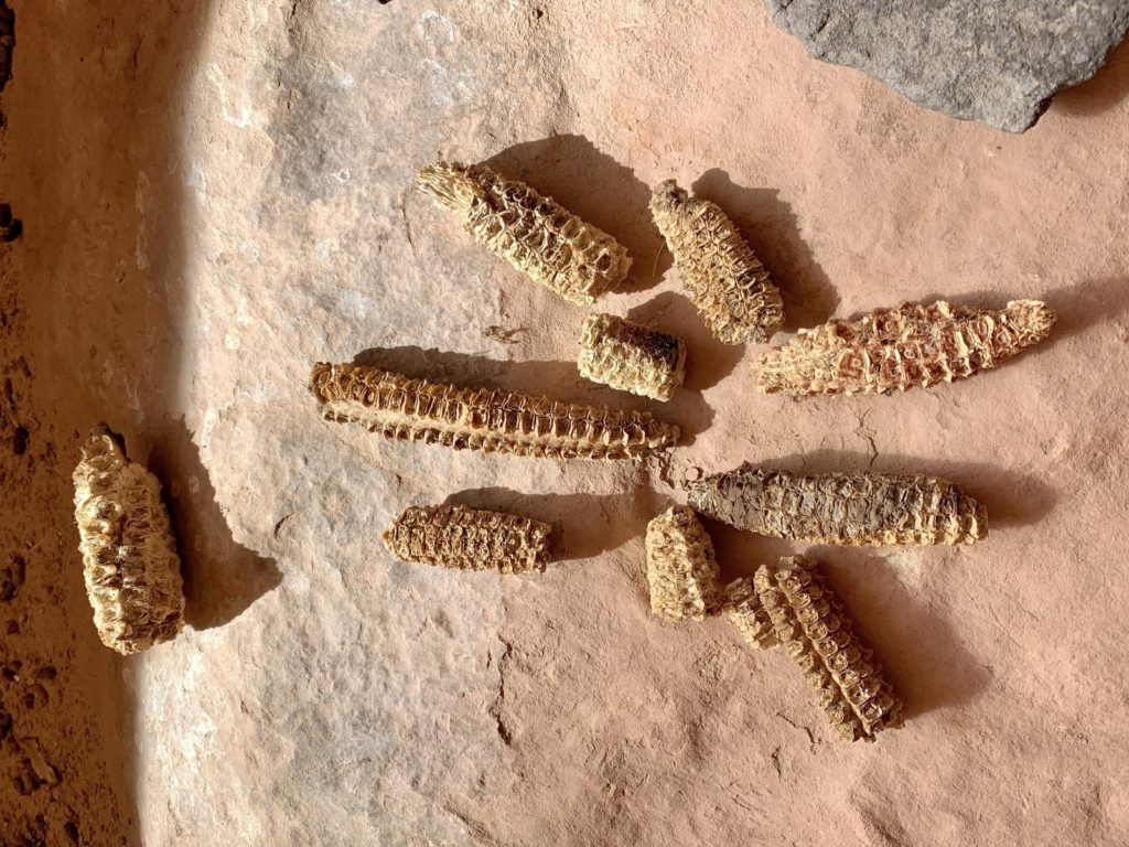
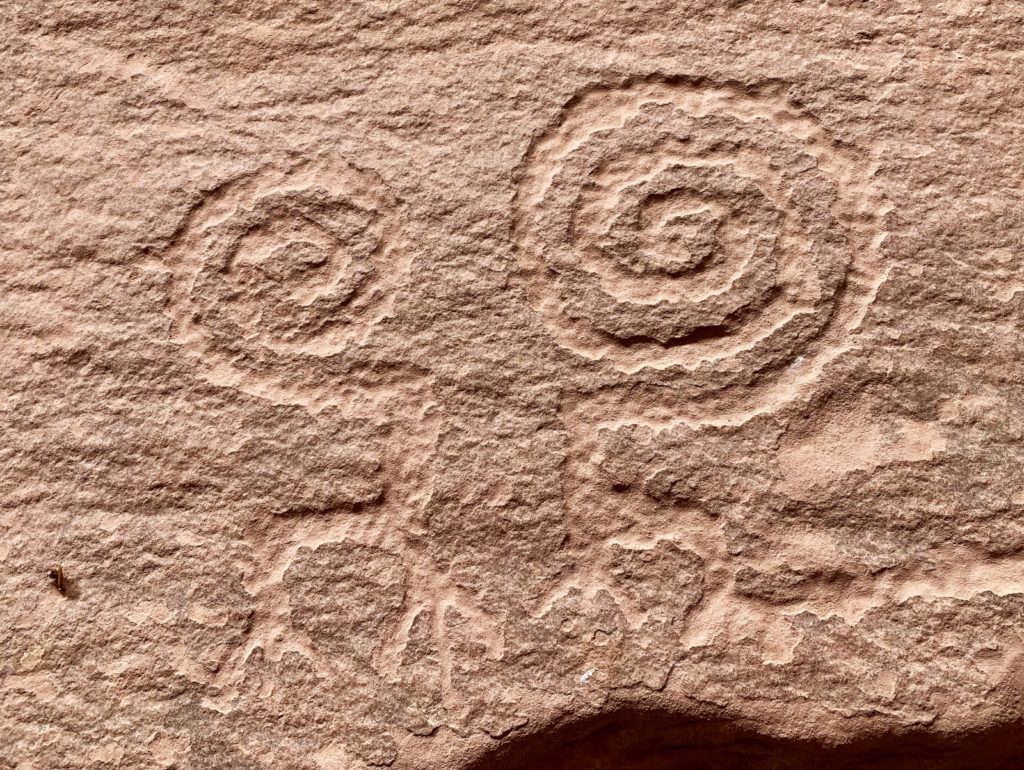
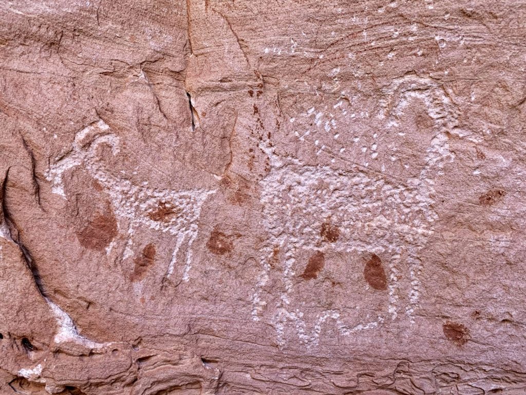
Rock Art Site Along the San Juan River

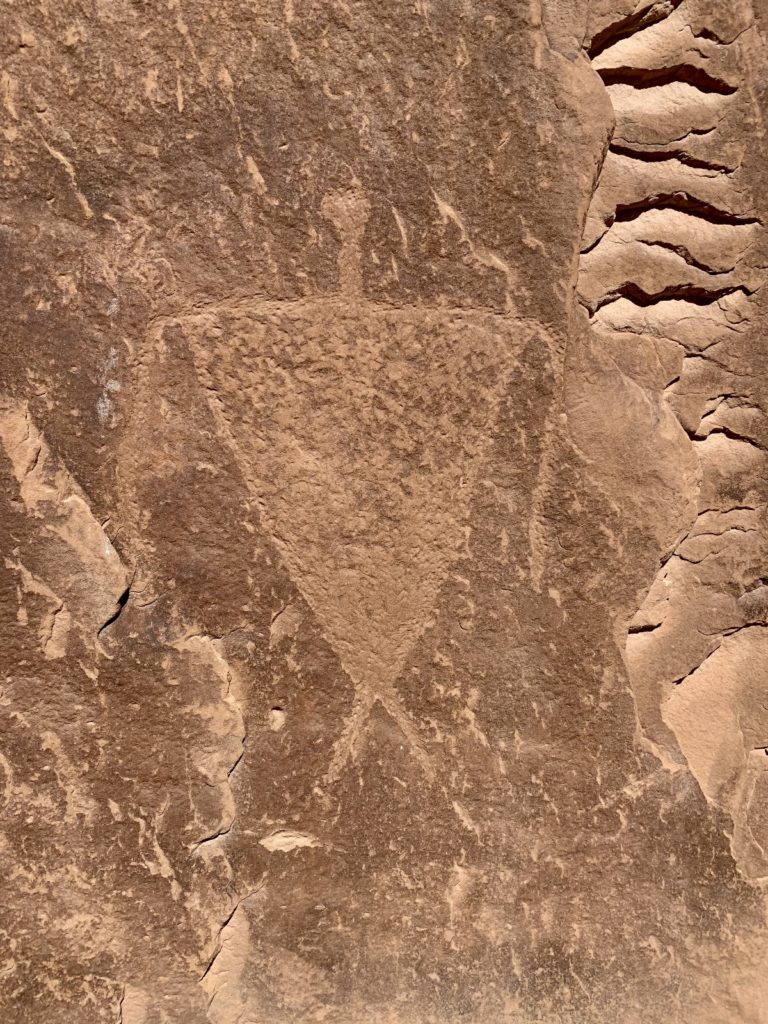

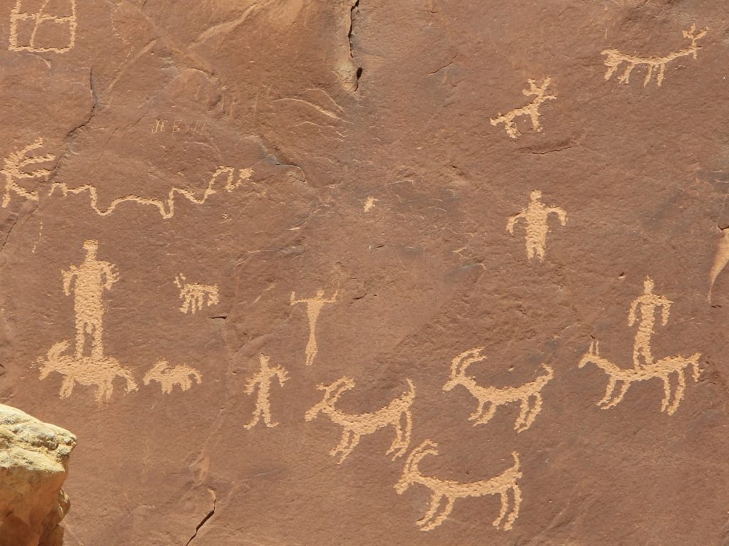
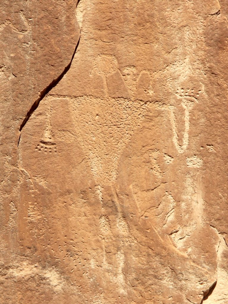
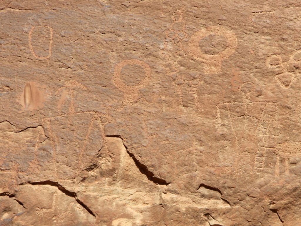
Comb Ridge Ruins & Rock Art
Natural Bridges National Monument
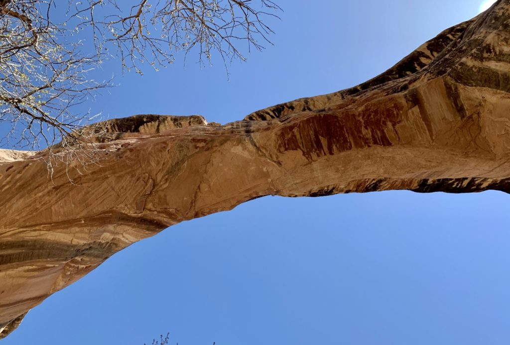
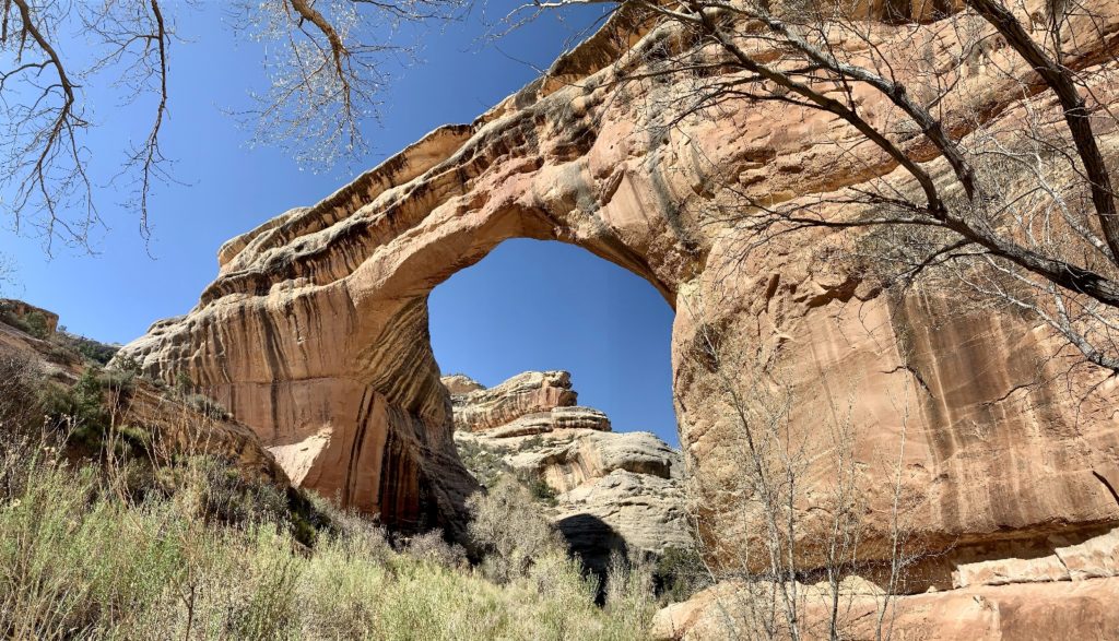
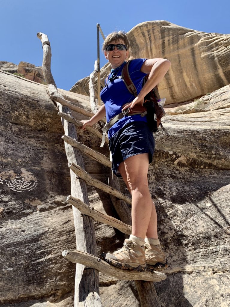
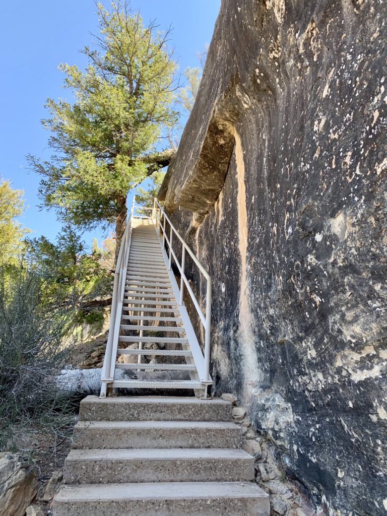
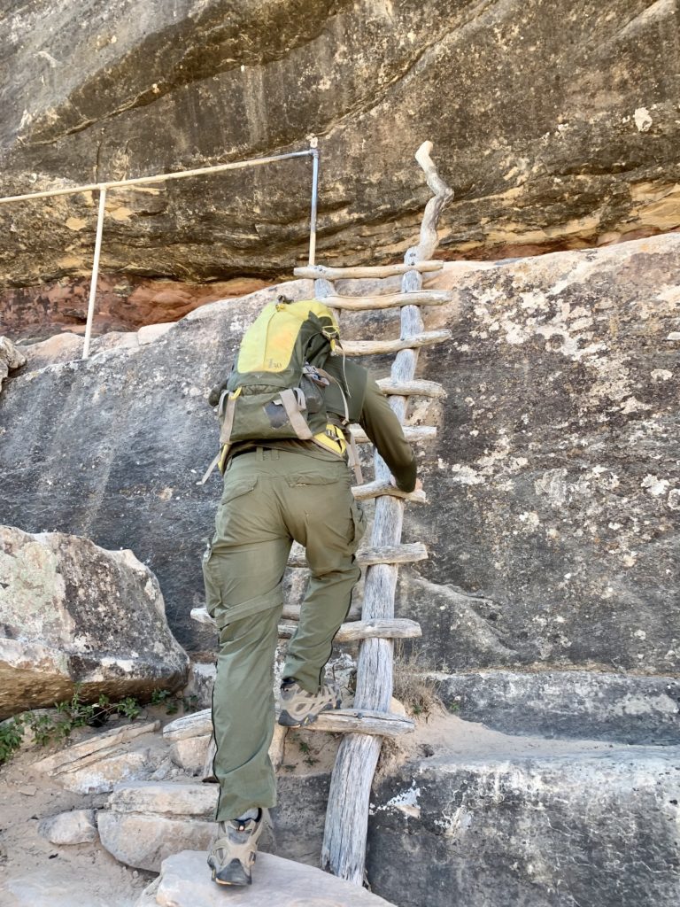
No visit to SE Utah would be complete without stopping by Natural Bridges National Monument which preserves three massive natural bridges. As explained on the park’s website, some streams wound back and forth in folds like ribbon candy. Thin canyon walls separated the different turns. As water pounded against these walls, eventually the rock crumbled. This left thin natural bridges of rock above the newly-made streambed. We’ve hiked in this lightly-visited monument several times. While the entire area is stunning, the trail down to Sipapu Bridge remains my favorite stretch. At 220 feet high and with a span of 268 feet, Sipapu is one of the world’s largest arches. Its just 0.6 miles to the bridge, but it is quite the adventure with 500 feet elevation loss, 2 flights of metal stairs, and three wooden ladders.
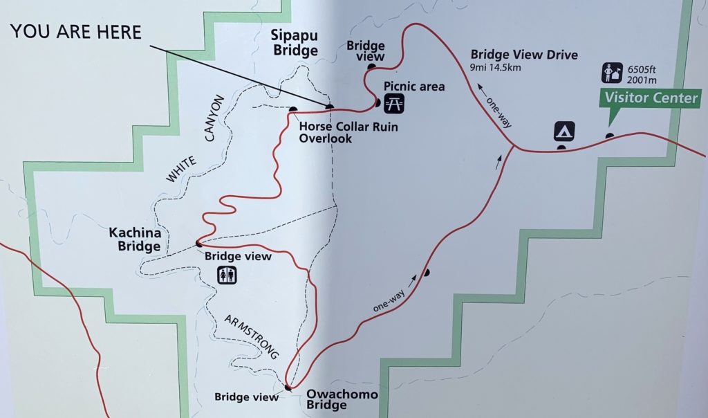
Natural Bridges National Monument is surrounded on all sides by Bears Ears National Monument. If you are visiting one, I highly recommend making time to visit the other. We followed this advice and made a quick stop to make the short trek down to the bridge (and for me to get my National Park Passport stamp). For more information on hiking in Natural Bridges National Monument, click here and here for a detailed series from our previous visits.
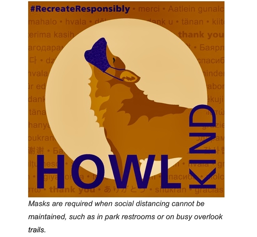
Please Recreate Responsibly
During our 2021 Spring Adventures, many COVID related restrictions were still in place. This was especially true in some of the small communities near Navajo Nation which was deeply impacted by the pandemic. At National Parks, masks were still required. Please be respectful and considerate of those around you and follow all applicable restrictions.
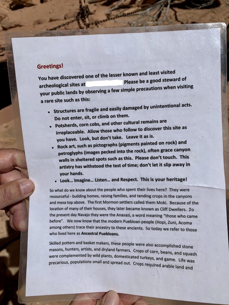
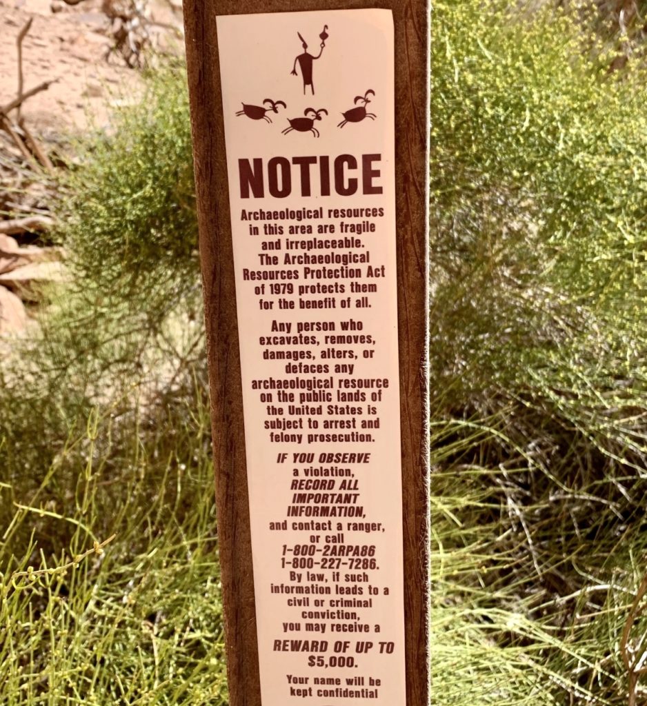
If you explore off the beaten path in Southern Utah’s monuments, sooner or later you will come across a little known archeological site. This happened to us during our time in Bears Ears and Natural Bridges. Please treat these sites with respect. It isn’t just the right thing to do, its the law!
Related Posts
- 2021 Spring Adventures: Back on the Road!
- 2021 Spring Adventures: We Arrive in Moab
- 2021 Spring Adventures: Moab Area Explorations Continued
- 2021 Spring Adventures: Moving on to Canyonlands National Park Needles District
- 2021 Spring Adventures: More Needles Fun
- 2021 Spring Adventures: Canyons of the San Rafael Reef
- 2021 Spring Adventures: That’s a Wrap!
- Utah’s Natural Bridges National Monument (part 1)
- Utah’s Natural Bridges National Monument (part 2)
The Adventure Continues
Join us for our next post as we wrap up our Utah adventures at the San Rafael Reef. And don’t forget to check out our Amazon RV and Adventure Gear recommendations. We only post products that we use and that meet the Evans Outdoor Adventures seal of approval. By accessing Amazon through our links and making any purchase, you get Amazon’s every day low pricing and they share a little with us. This helps us maintain this website and is much appreciated!
Such interesting and beautiful pictures as usual! Keep them coming!
Very cool! I’m going to have to visit that region again! And probably again and again.
We definitely saw what you meant about the roads to Hovenweep. We took one road in and a different road out- neither one good! 😉