Redrock canyons, a large natural bridge, and rock art in a desert oasis
Distance: 19 miles
Type: car shuttle required
Difficulty: normally moderate hike made more difficult by recent flooding
Best season: spring and fall
It was October 1st and we only had a couple days left in Utah. Backpacking the Escalante River from the town of Escalante to the bridge crossing on highway 12 had been on my bucket list for several years. It looked fantastic, but something else always won out. We hadn’t planned on bagging the pack this trip, but we really enjoyed our backpack of Coyote Gulch at the beginning of vacation and wanted to end the trip with a similar adventure.
The ideal way to backpack the Escalante is with a 14 mile car shuttle. There were several businesses that would have provided fine shuttle service, but I had a better idea. I texted our good friend Lisa to see if she would be able to make the trip down. Her weekend plans had just fallen through enabling her to join us. What a great way to end our trip—a scenic backpack and two days catching up with a dear friend.
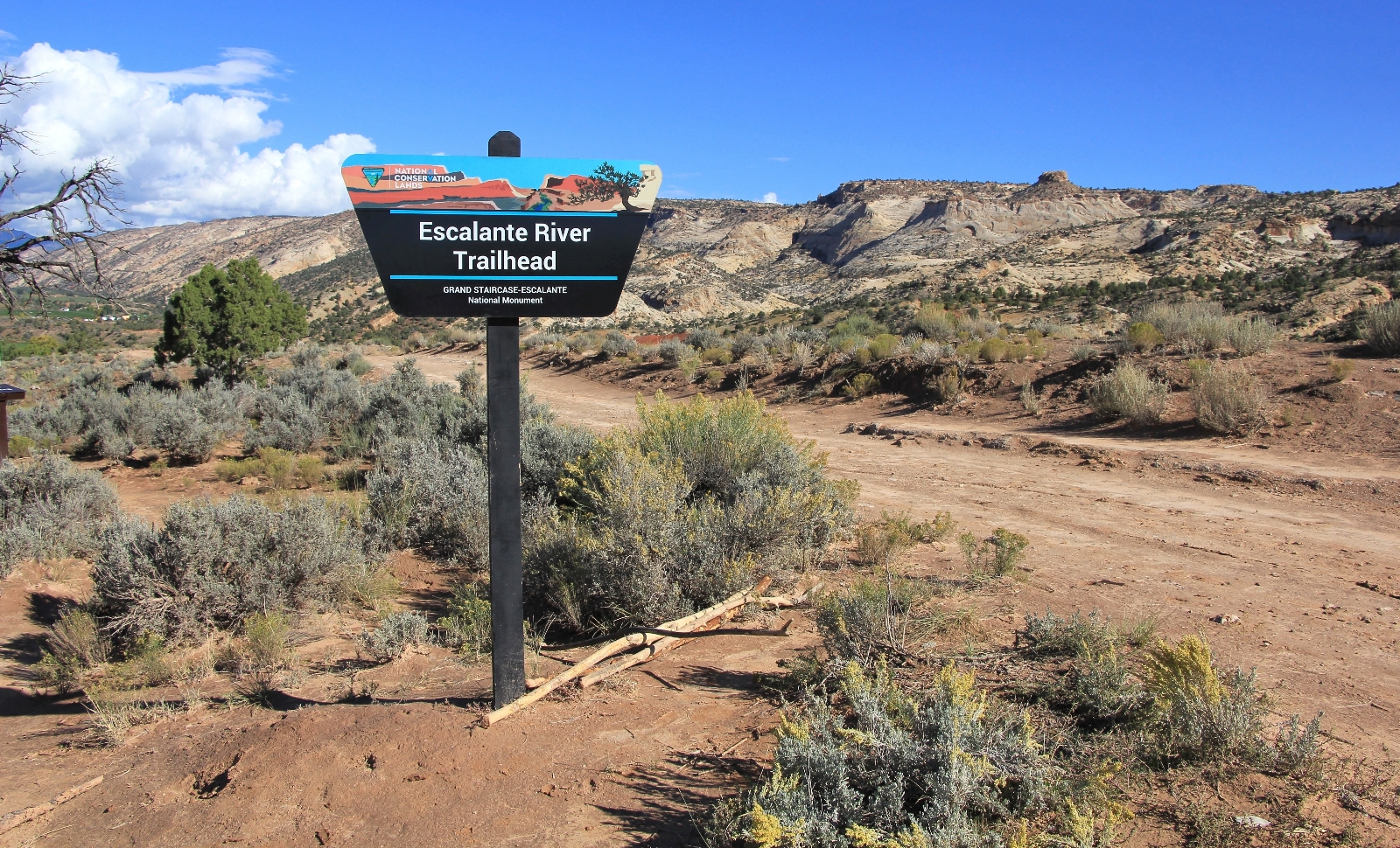
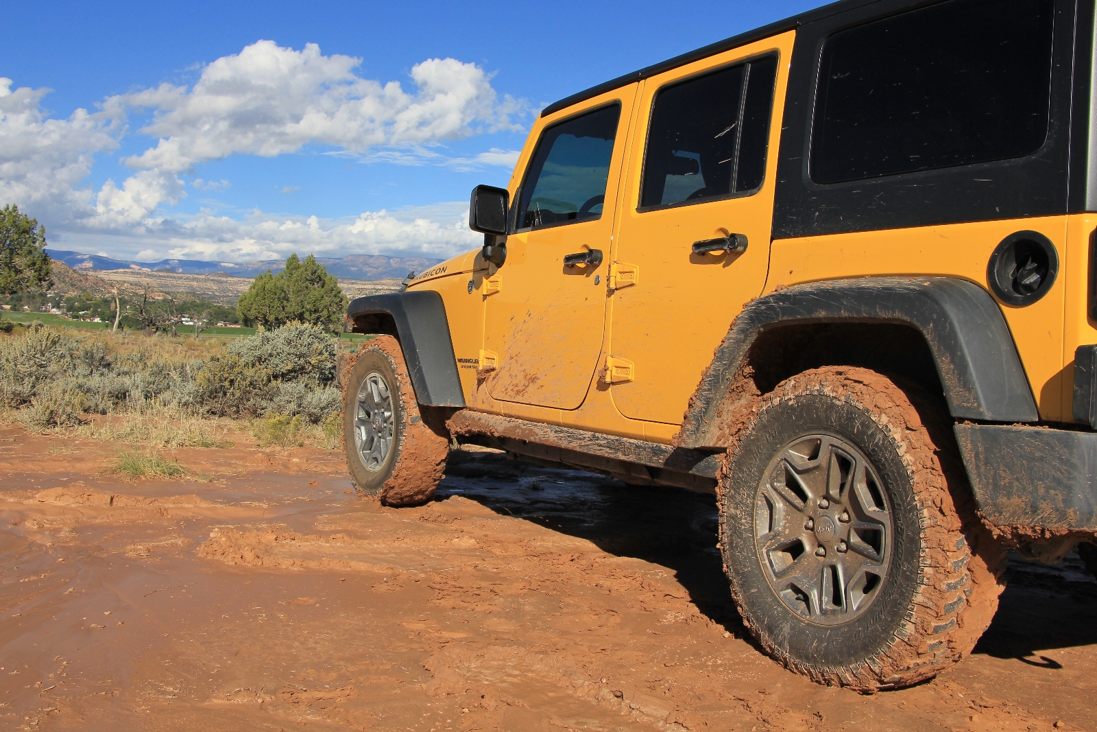
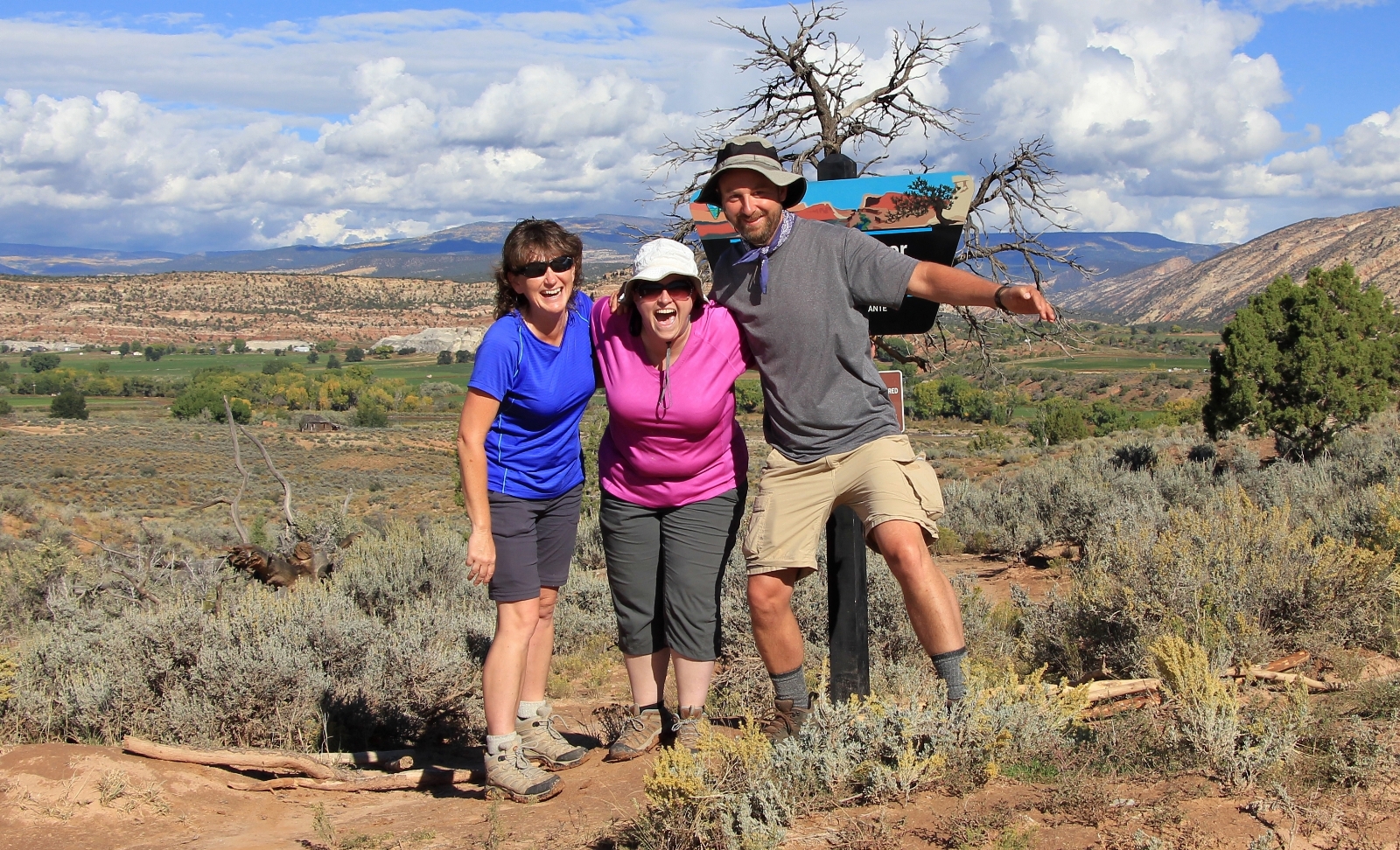
We met Lisa at the Escalante River Trailhead (elevation 5,200’) where highway 12 passes over the Escalante River. The plan was to leave her vehicle there for our exit the following day. We filled out the free backpacking permit, put a few last minute touches on our gear, loaded Lisa’s pack into the Jeep, and headed west toward the town of Escalante. On the east side of town, we made our way down a muddy road to the Escalante Town Trailhead (elevation 5,730’).
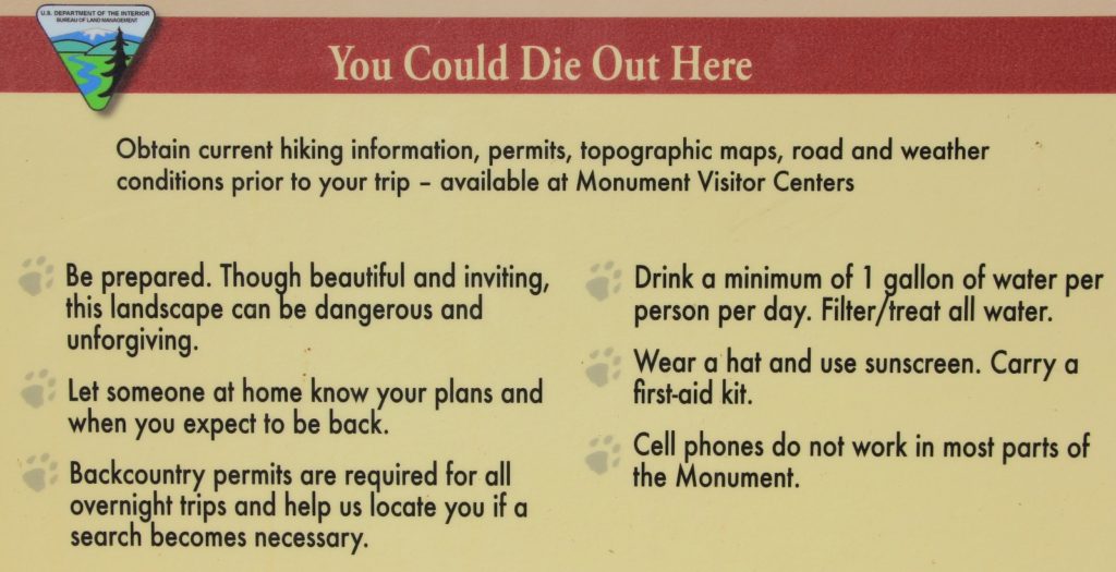
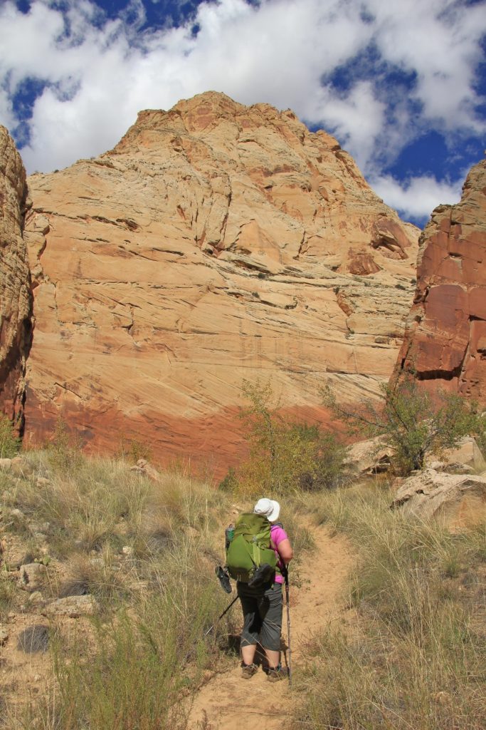
Getting out of the Jeep, we immediately realized how slick the mud was going to be on the trail. I’m pretty sure we looked like baby giraffes on an ice skating rink. The area had experienced several days of heavy rain just before our arrival. The deluge of water sent river levels soaring from less than 2 to near 2,000 cubic feet per second. Staff at the Grand Staircase Escalante National Monument Visitor Center told me hikers had reported the floods washed away much of the Escalante River trail, but this wouldn’t cause us problems since you just follow the river. This seemed reasonable enough to me, especially since we had just done a similar pack at Coyote Gulch. By the end of the day, we’d realize how incorrect that was.
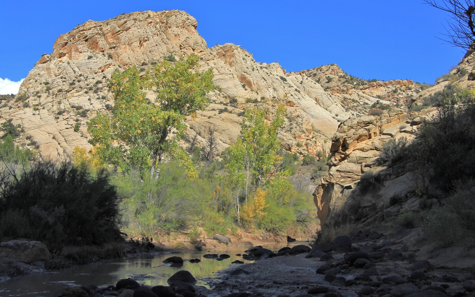
With only one other car at the trailhead, it looked like we’d have solitude on this pack. Its owners were a couple from Chicago who were day hiking just a short distance in. They were the only people we’d see for the next two days. The trailhead was set up on a bit of hill and we had great views of the town of Escalante. Conditions were perfect with blue sky, fluffy white clouds, and beautiful morning light for photography. We snapped a couple memory shots and started down the trail at 10:30.
A few interesting facts about the Escalante River:
- It is 85 miles long, originating near the town of Escalante (where we were starting our pack) and terminating at Lake Powell.
- It drains over 200 sq miles of the Colorado Plateau.
- In 1866 it became the last major river to be discovered in the American West.
- In 1996 it was included in President Clinton’s Grand Staircase-Escalante National Monument designation.
From the trail register, we followed a single track road downhill to a hiker’s gate. Even in this stretch, before reaching the river, views were stunning. We came to the banks of the Escalante at just half a mile in. Hiking guides I had read made this section seem a little difficult to navigate, but it was very straight forward. We immediately had to cross the river only to cross back over a short distance later—we’d get used to that. We passed through another gate and into Grand Staircase Escalante National Monument.
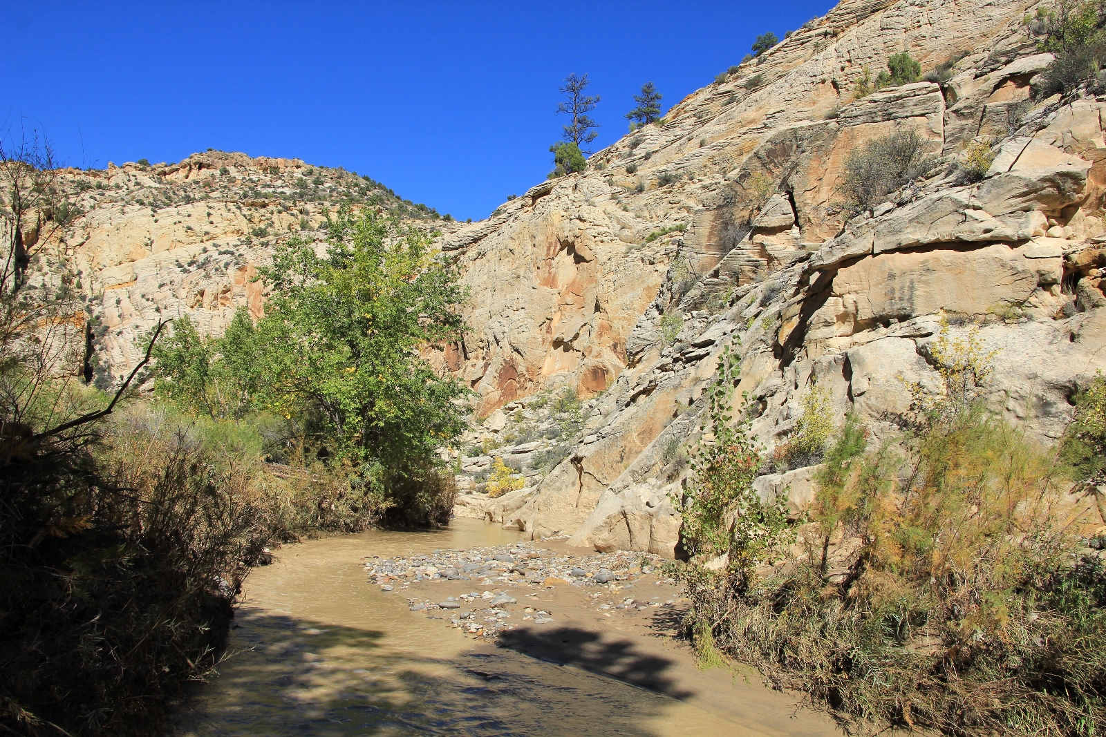
The river was very muddy, much more so than when we had hiked the lower stretch a few years prior. The level was only ankle to calf deep, but it did appear well above normal flow. I was hoping the clarity would improve as some of the tributary streams entered, but it never did. It quickly became clear we would not be getting water out of the Escalante without allowing significant time to settle.
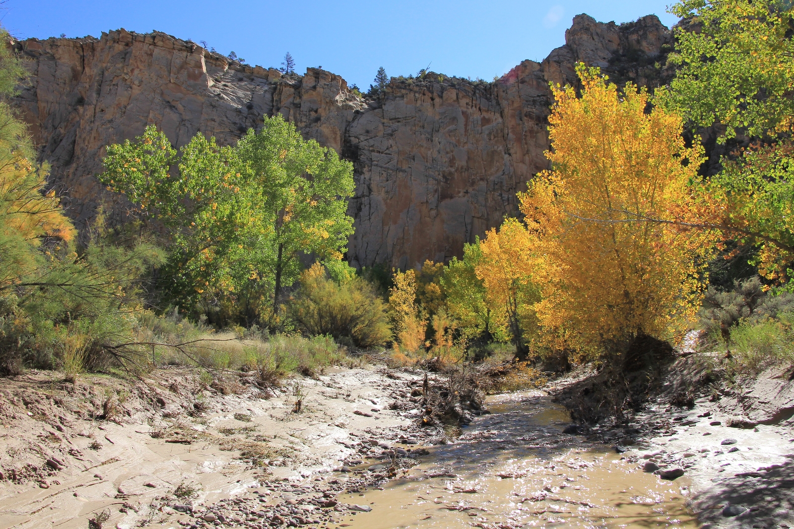
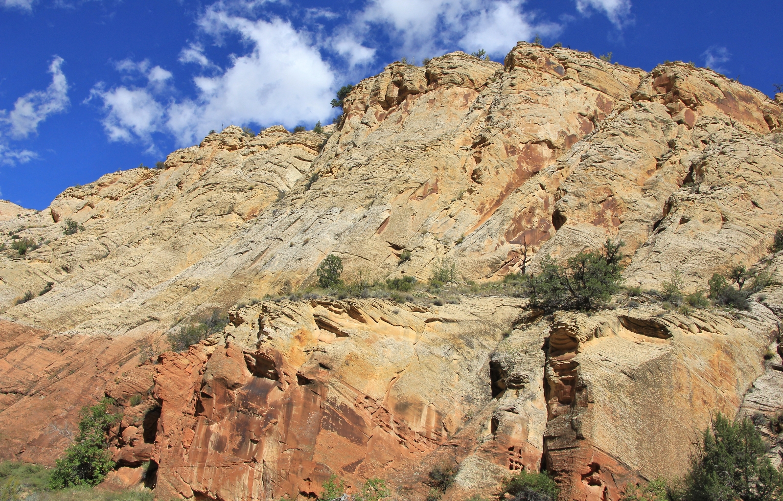
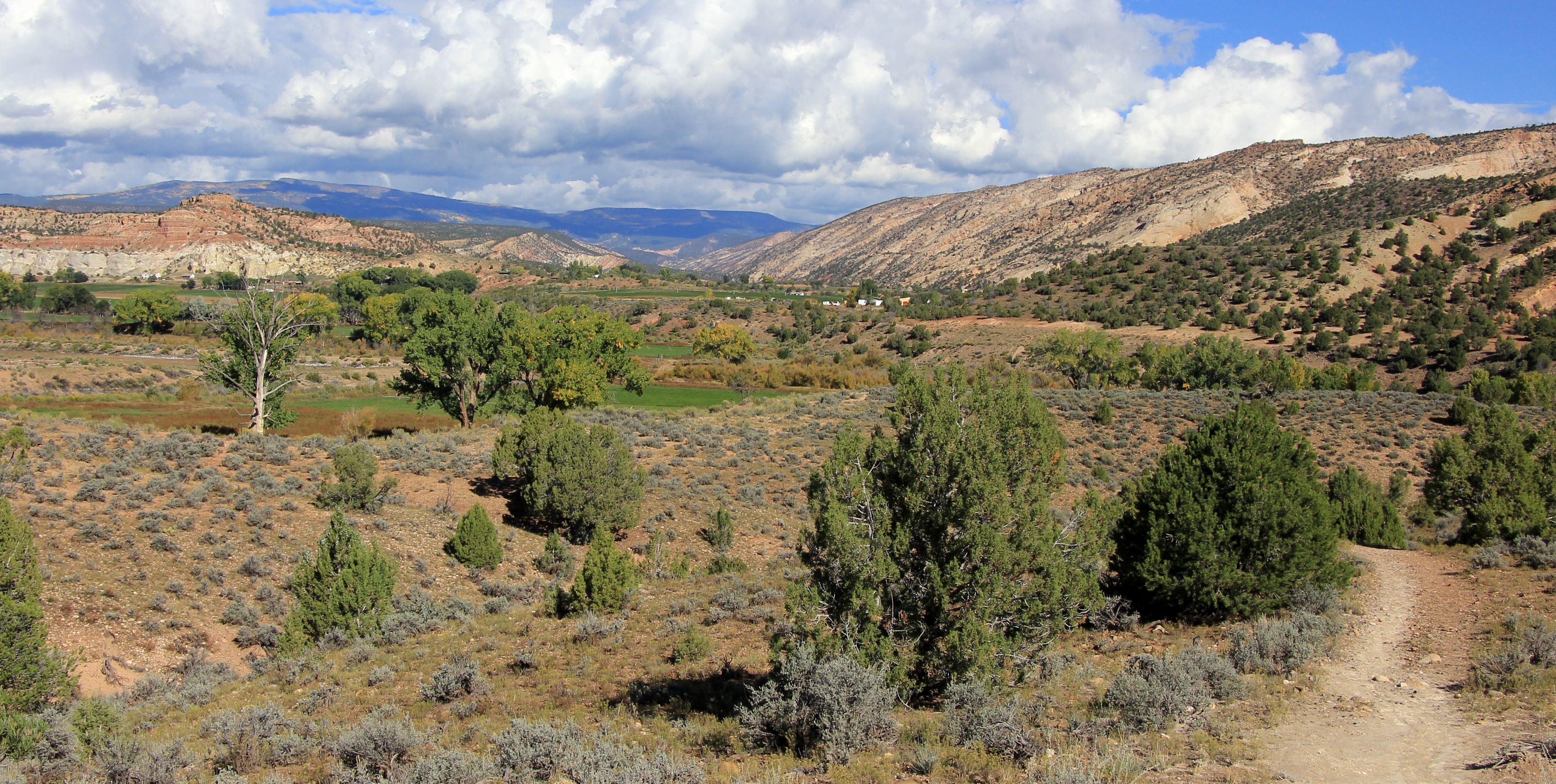
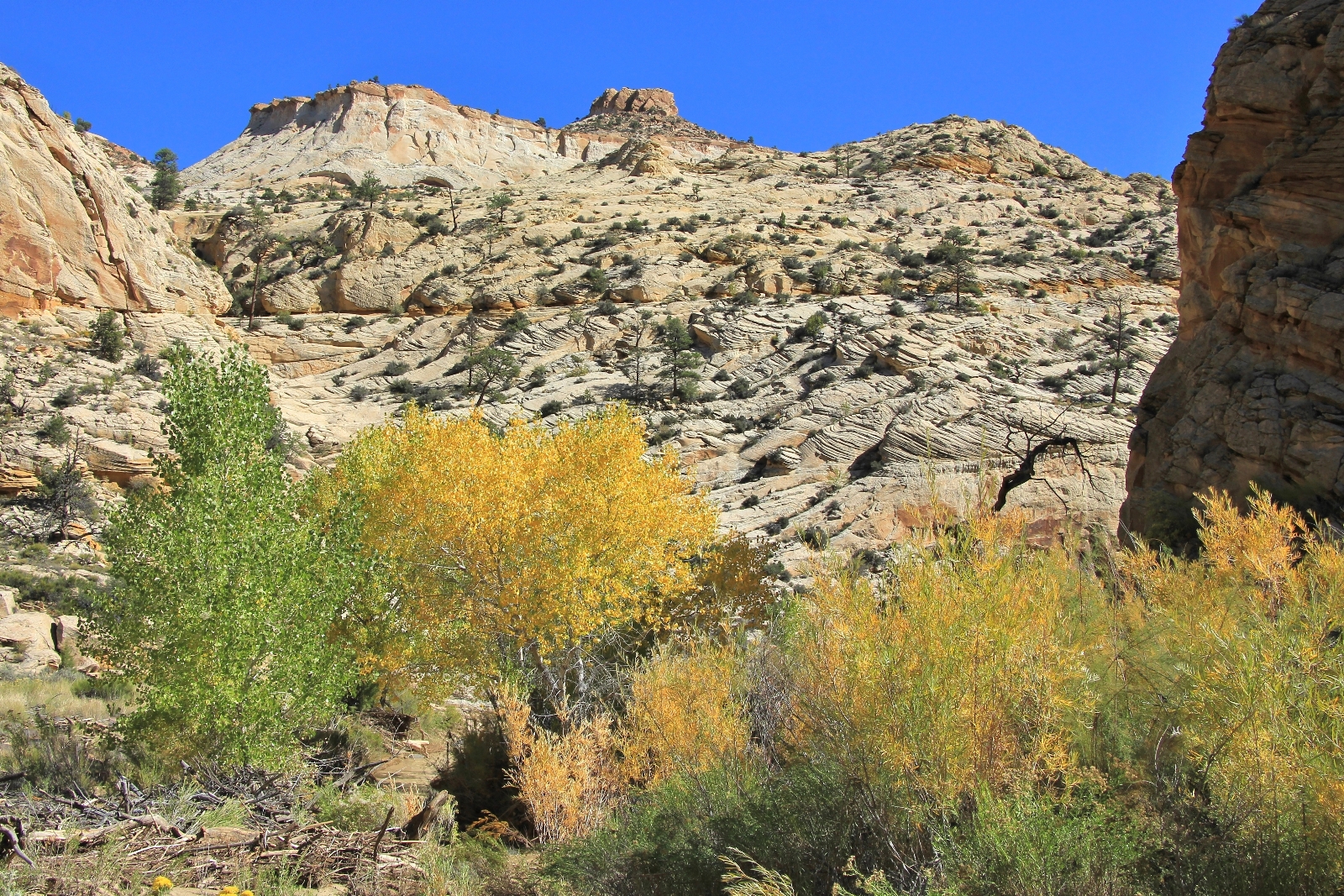
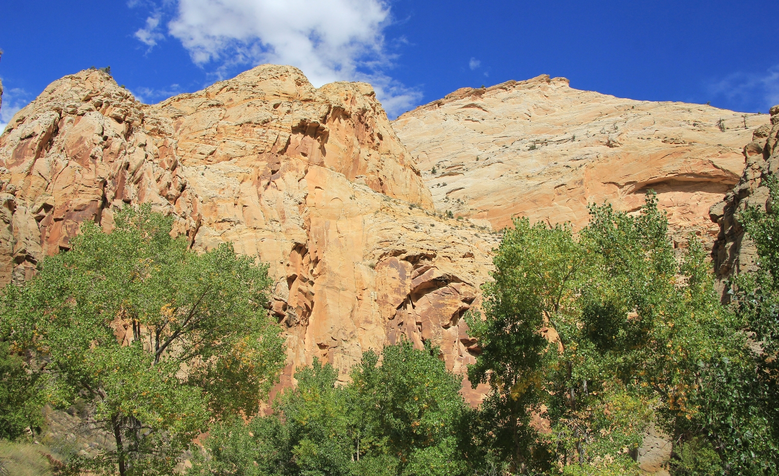
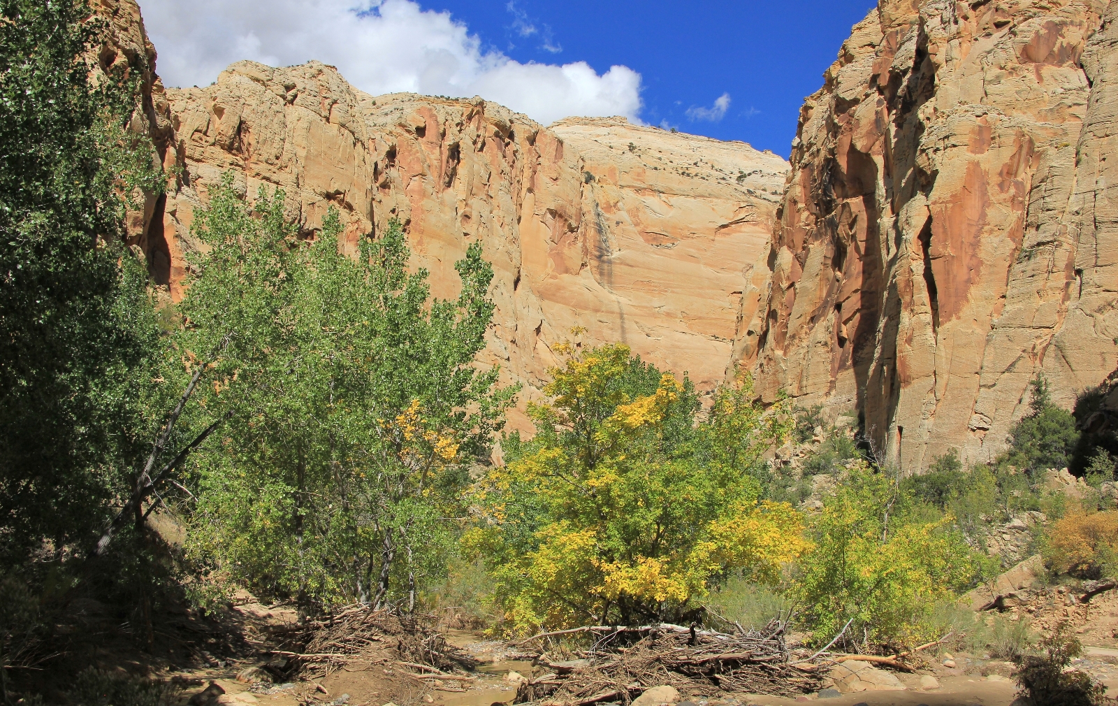
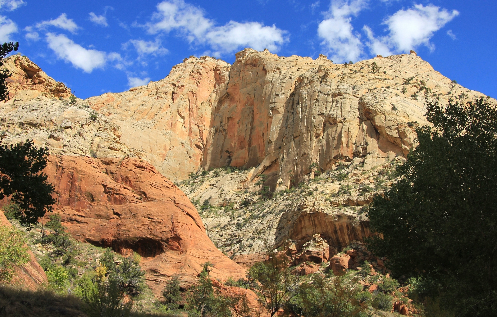
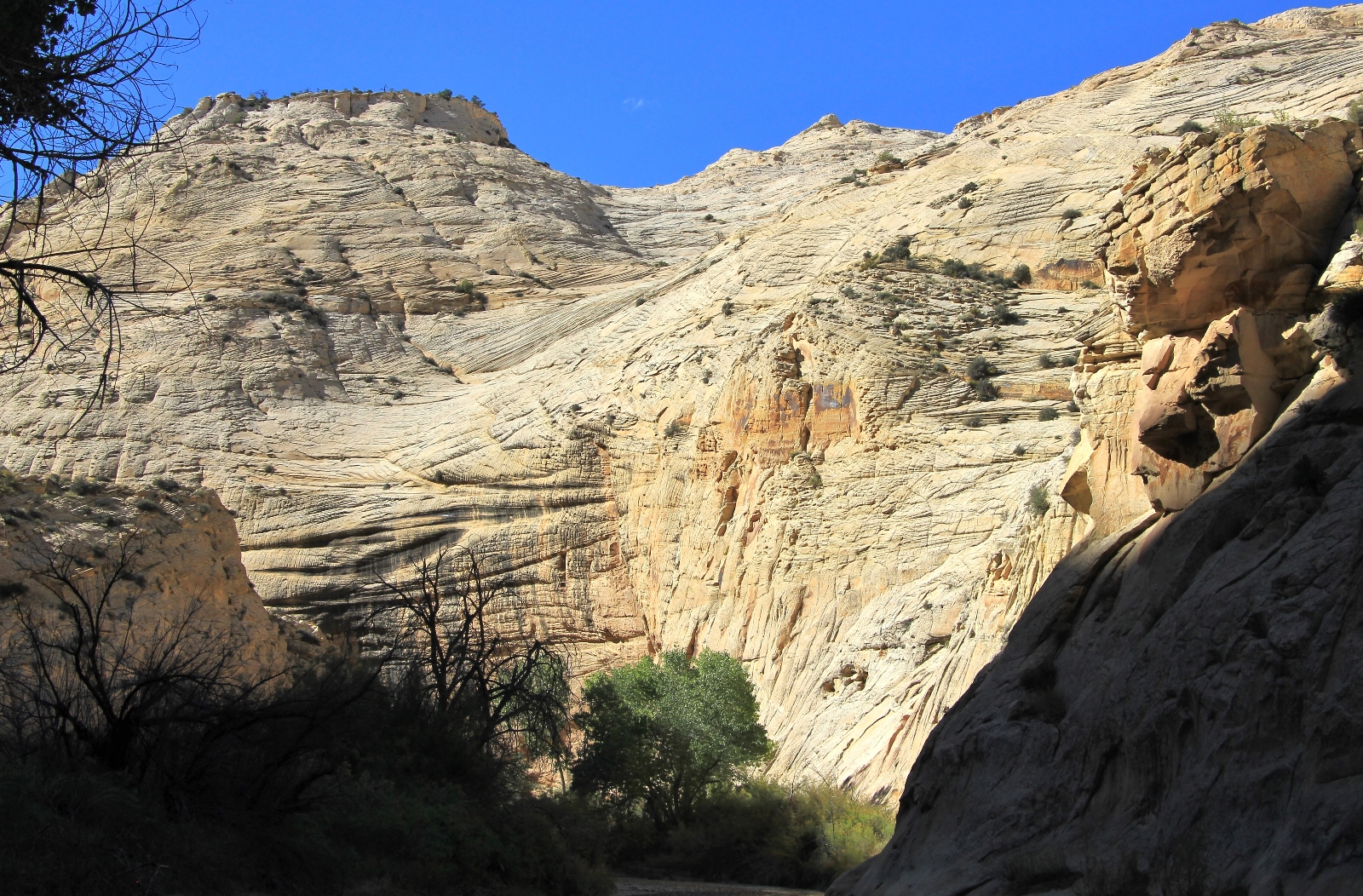
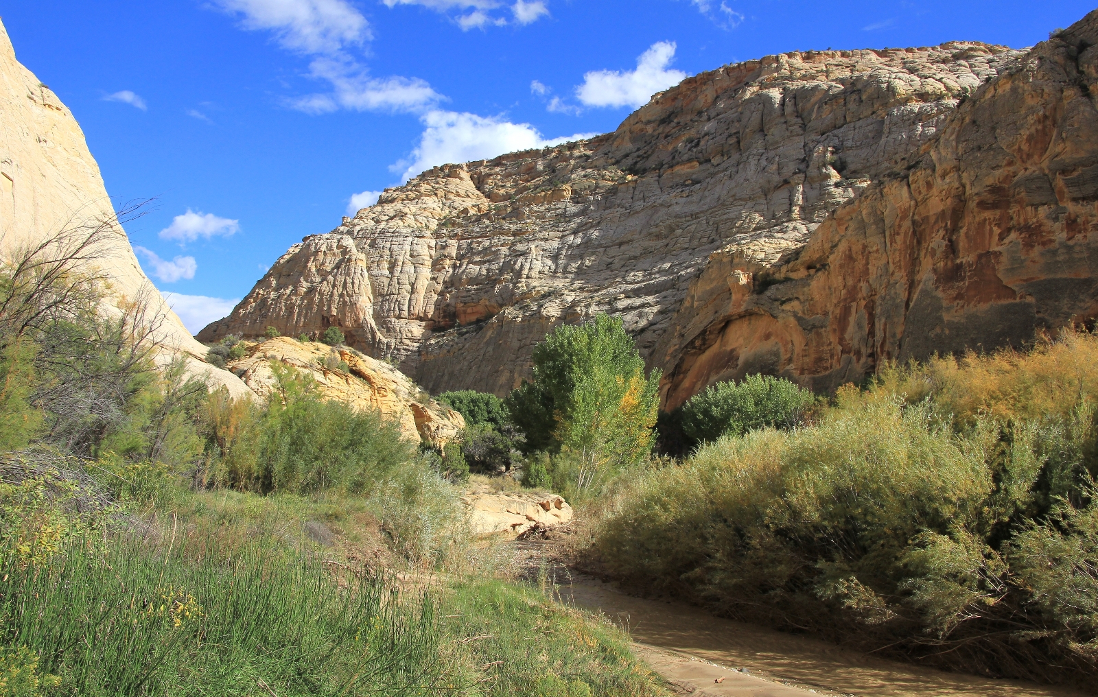
This first stretch of river was very easy to navigate and hiking was pleasant. We had gone from sagebrush flats above to a secluded river canyon in the blink of an eye. Civilization felt far behind us, replaced by cottonwood trees and fanciful sandstone designs. Soon, we were surrounded on both sides by towering cliff walls. Best of all, there were some nice fall colors starting, especially in these upper stretches of the canyon.
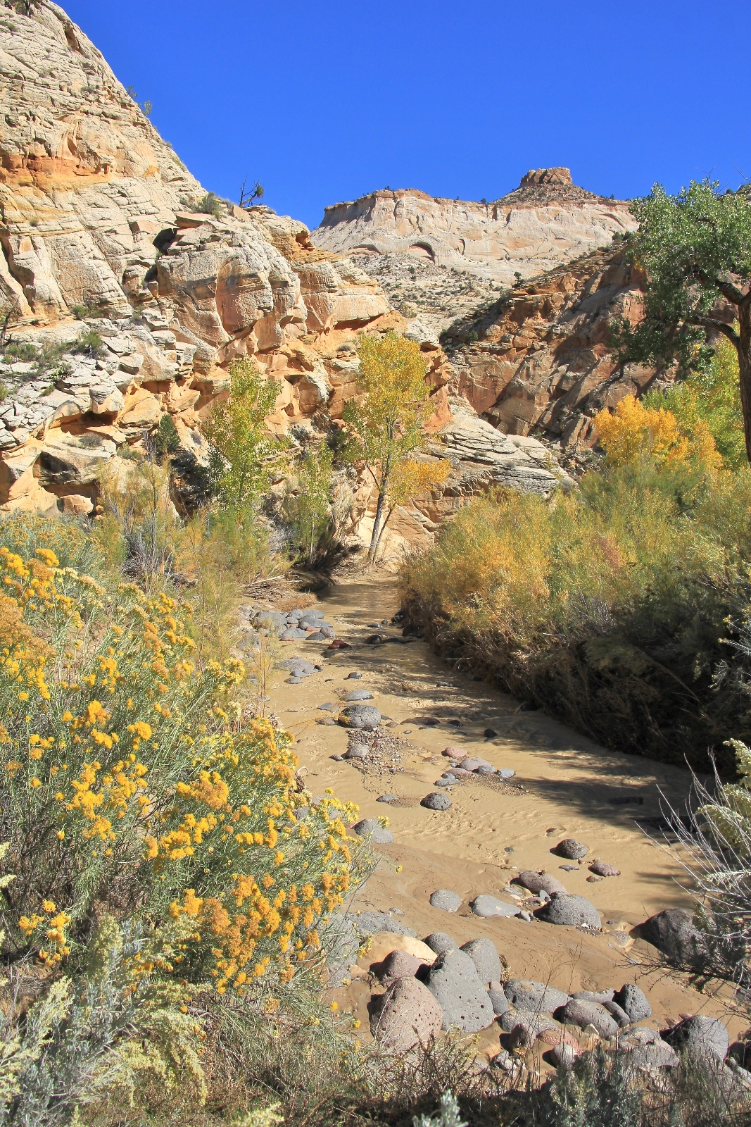
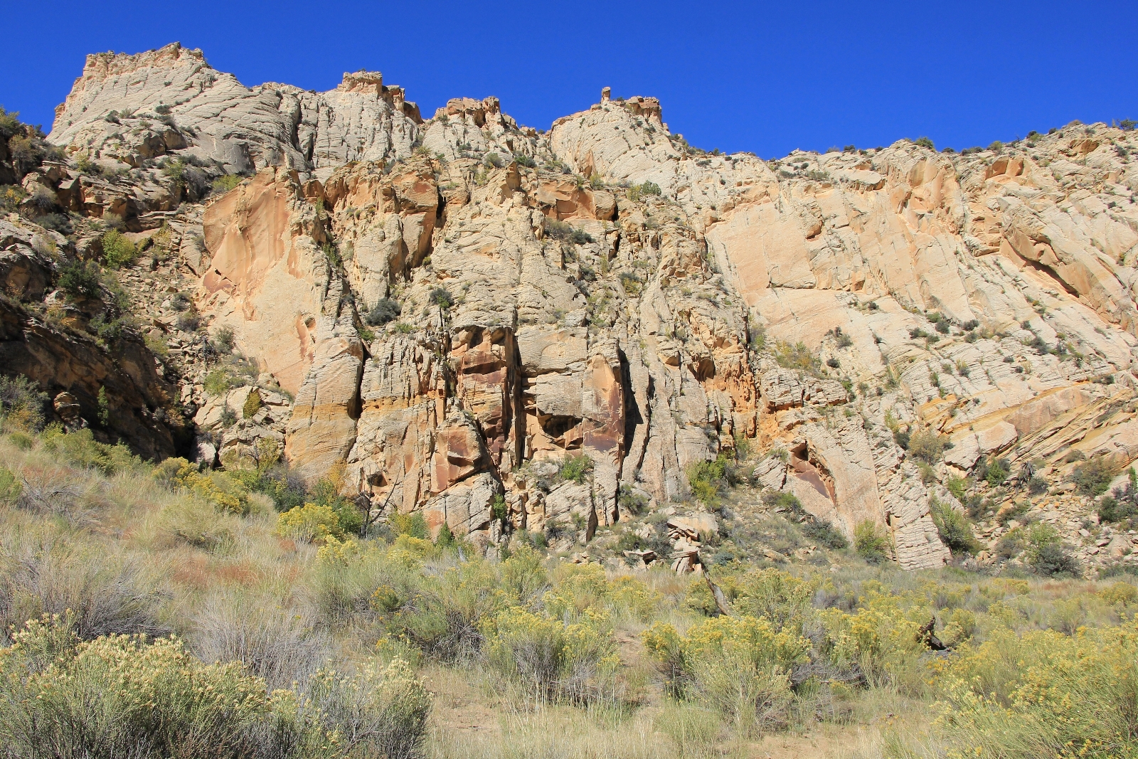
At 0.8 miles we forded Pine Creek. The stream bed was pretty rocky, but we were able to easily cross. Pine Creek was at least as large, if not larger, than the upper Escalanate had been. The river volume increased significantly, but was still only calf deep in most places. Just past Pine Creek, we passed the Escalante River gauging station. The canyon was several hundred feet deep by now and this would increase dramatically over the next half mile.
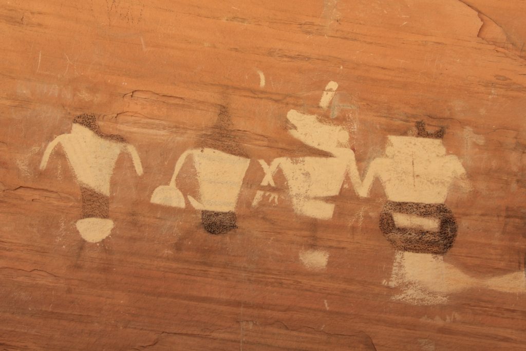
We had a wonderful time covering the first several miles of trail. The weather spectacular, the scenery sublime, and we were on the hunt for three rock art panels we had read about.
The first panel was located at the base of a sheer cliff wall baking in the sunlight. Some of the petroglyphs were moderately faded and it was a small panel, but it was a nice find.
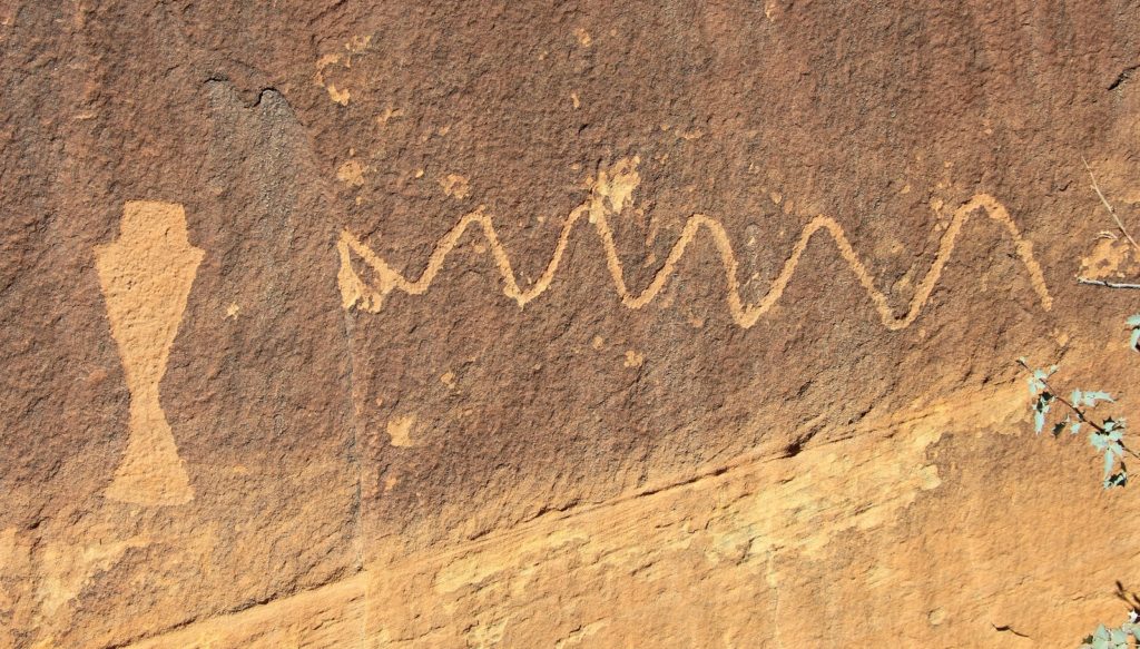
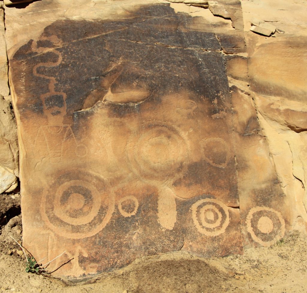
The second and best panel was also located at the base of a massive cliff wall. This was a really cool panel with concentric circles, bighorn sheep, lizard guy, and a couple alien guys. Unfortunately, there was some graffiti here, but it was still a nice panel.
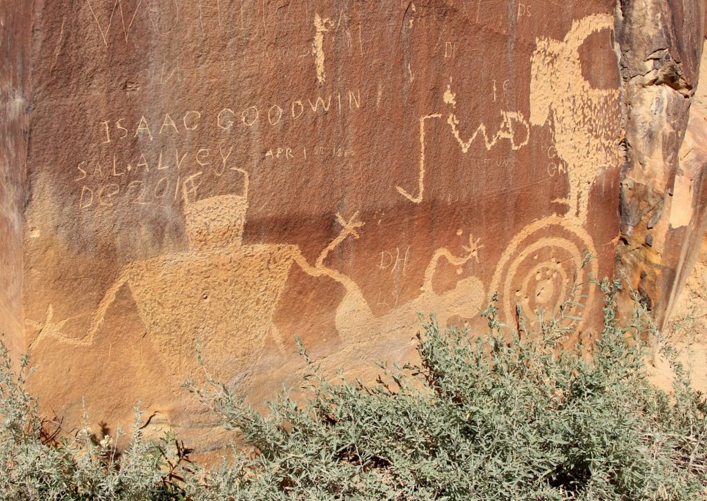
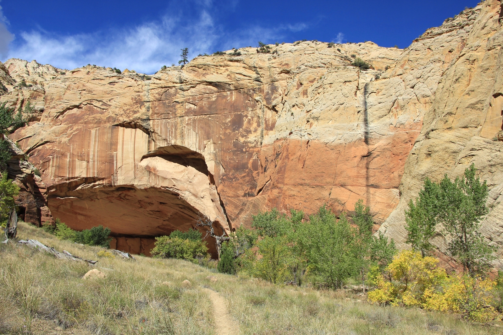
The third panel was located in a massive alcove. These pictographs looked like they were quite interesting and massive when first made, but they had faded severely over time.
Up to this point, navigation had been easy. We had spent a significant amount of time in the water but had also made easy treks across the benches.
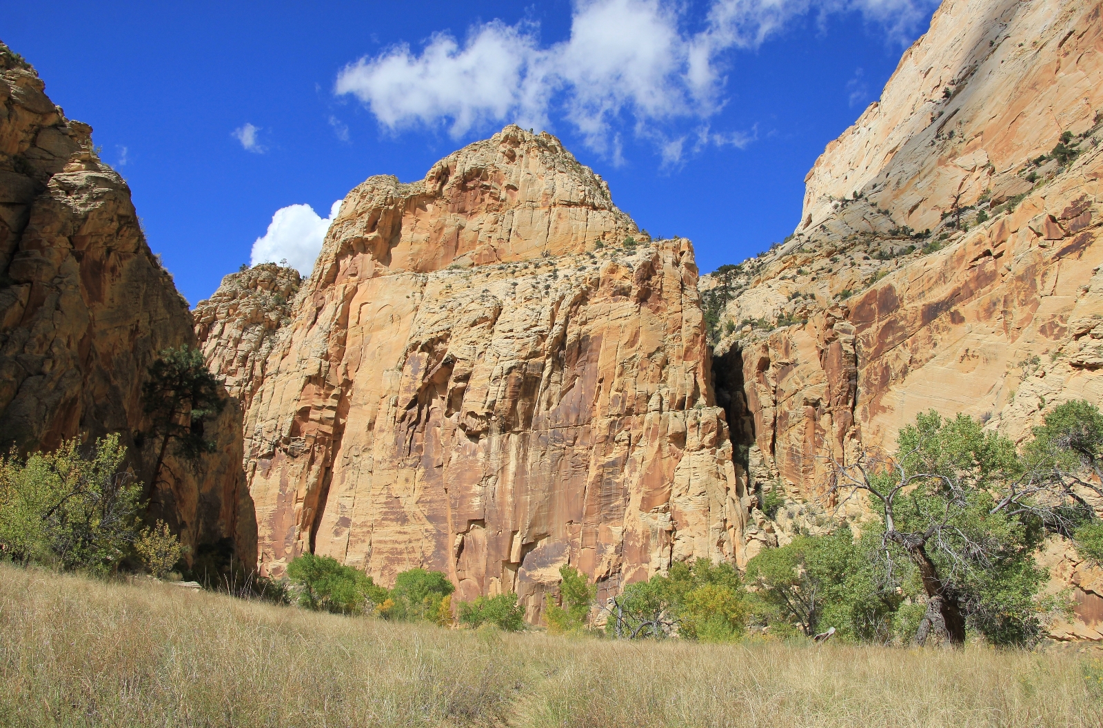
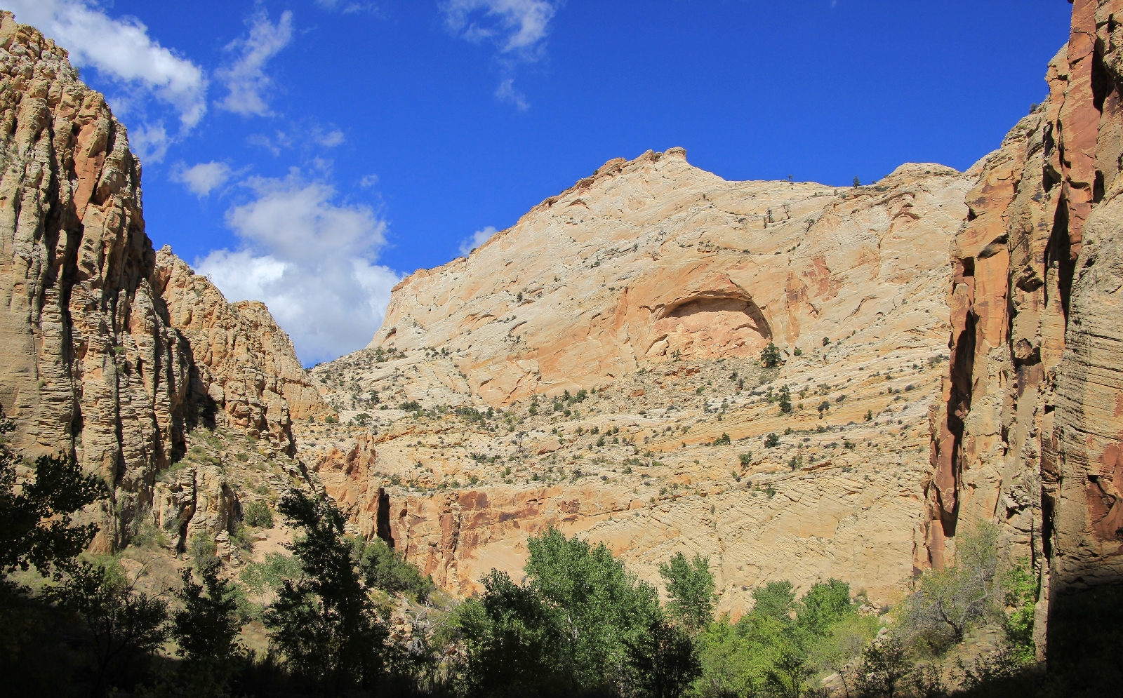
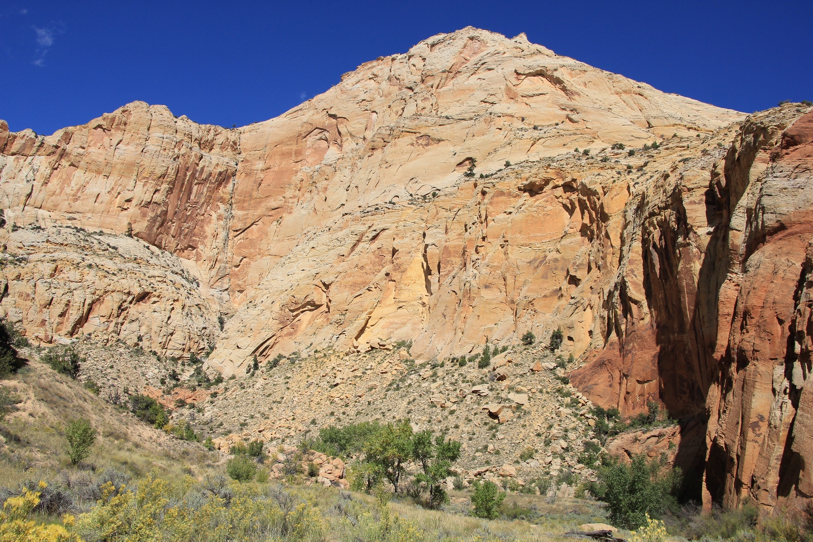
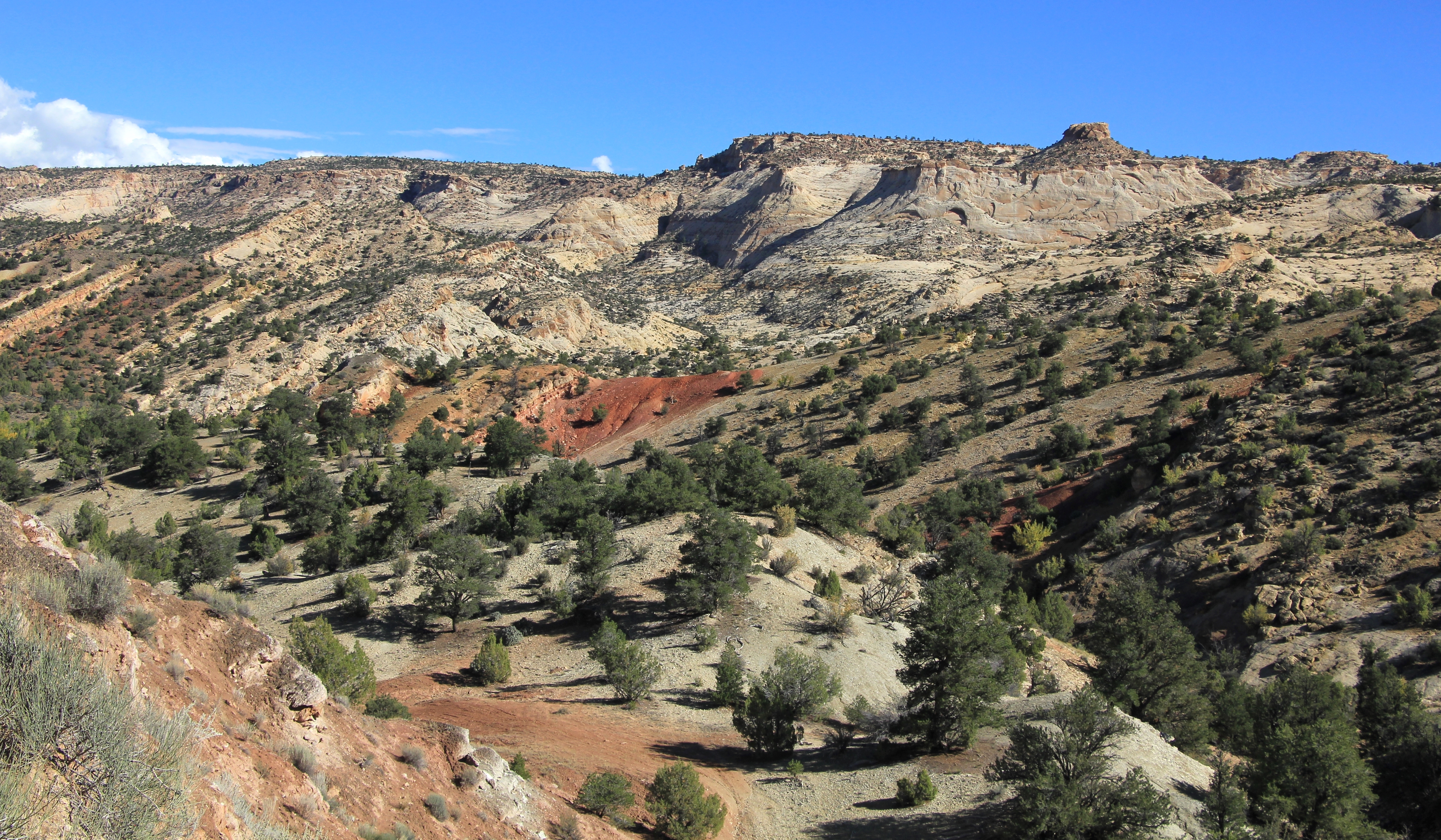
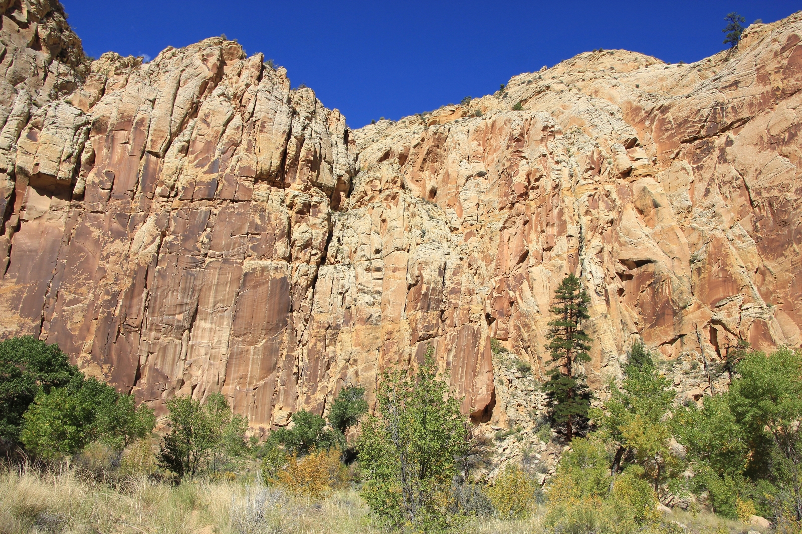
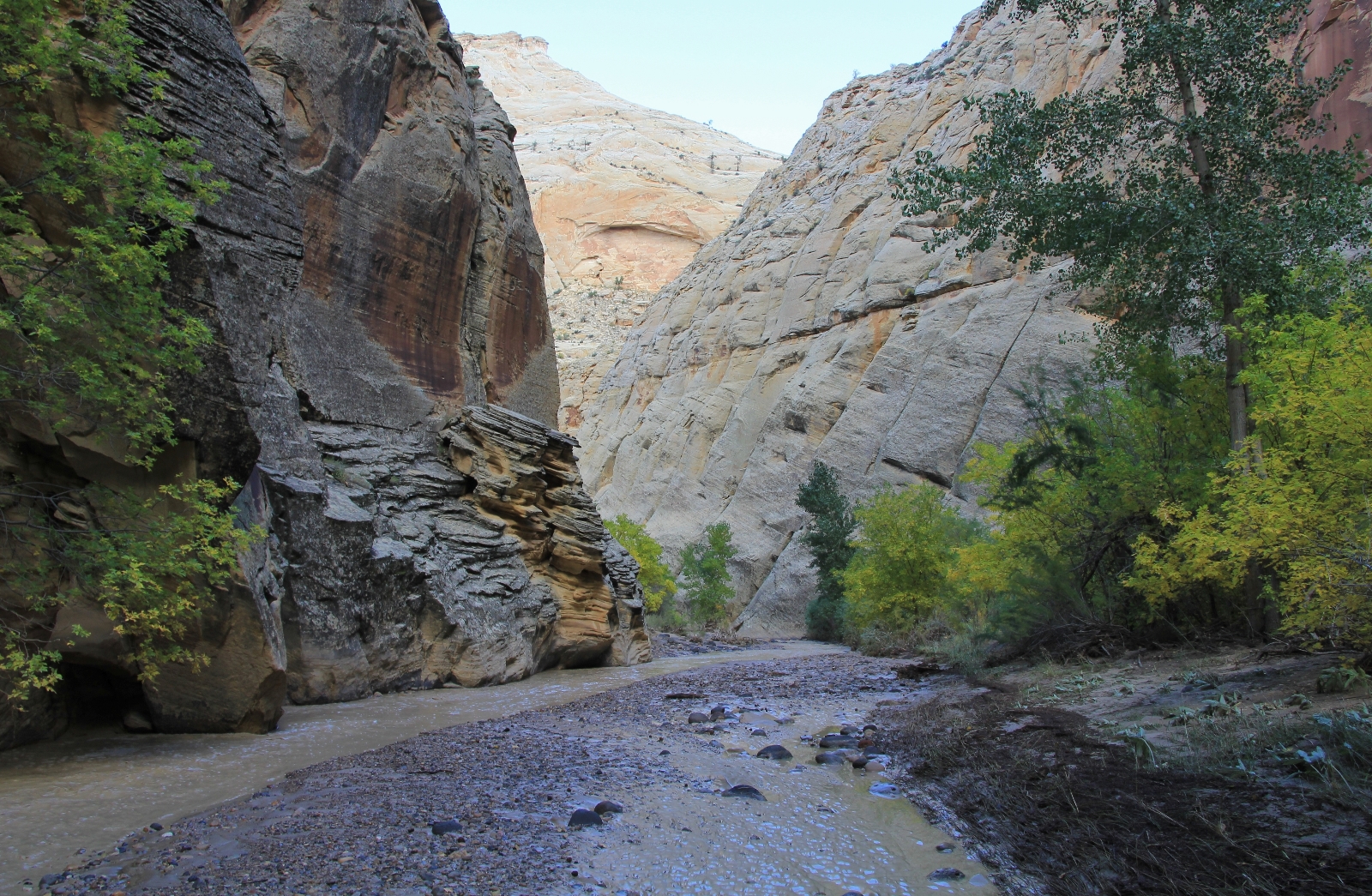
From the third panel, hiking and navigation became more difficult due to the recent floods. First, we encountered knee deep areas of quick sand alongside and in the riverbed. In other areas, we’d hit greasy stretches of mud that made our legs slide in all directions like the baby giraffe on an ice skating rink. User trails up onto the benches had been erased by flood waters forcing us to climb and drop off steep sections of stream bank to cross the river. Other times, we’d have to proceed straight down the river bed—this was made much more difficult than in Coyote by the presence of rocks along the bottom and the unexpected patches of quicksand. When we did find side trails up onto a bench, they would frequently end in thick brush or flood debris and we’d have to backtrack. We never felt lost (you’d have to try really hard to get lost on the Escalante), but it was difficult to find a clear path downstream. It was slow going and it quickly became clear that our mileage was going to be higher than anticipated. Still, it was an impressive stretch of canyon with cliffs 600-1,000’ tall and gorgeous narrow stretches as the river meandered down the canyon.
By mid-afternoon I was becoming increasingly concerned about our water situation. With the muddy conditions, we hadn’t seen anything we’d be able to filter from since Pine Creek. Jason and I were both on our last bottle and it was a relatively warm afternoon with full sun and temperatures in the low 70s. We had gone over nine miles and still appeared to be a ways from Death Hollow where we were pretty sure we’d find better water.
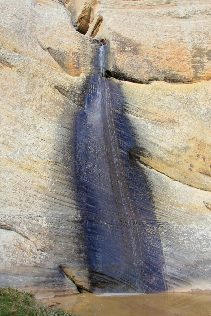
At about ten miles in, Lisa spotted a small waterfall ahead. It was a small stream that reminded me of lower Calf Creek Falls. There wasn’t much of a flow, but the water looked relatively clear. Boy what a relief that was!! The area around the falls was tempting for a pretty little camp site. It was just barely big enough but upon closer inspection there were tons of big river spiders crawling all over. No thanks.
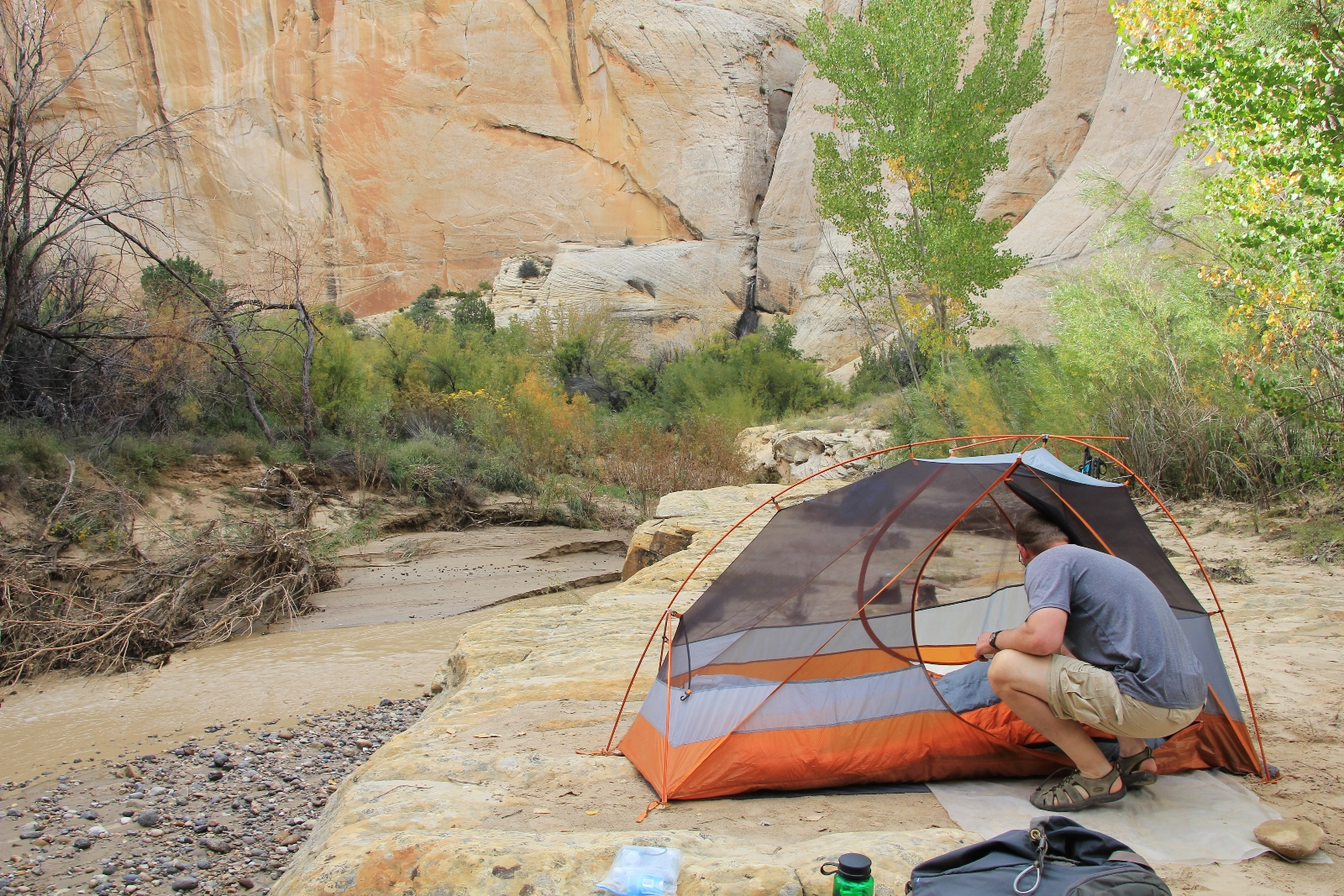
While Jason filtered water, I dropped my pack and explored a short distance downstream with Lisa. We found the perfect spot—a sandy bench just above the river and we’d still be able to see our little waterfall. I backtracked upstream and helped Jason filter two large bags of water. It was 4:30 and we had gone about 10.25 miles. According to our guides, we should have been to Death Hollow at about seven miles, yet it was still up ahead somewhere. The backtracking due to flood debris and primarily sticking to the winding stream had us way over on miles. But we had seen some amazing sites, we had good drinking water, and the view from camp was beautiful. Life is good.
Directions to trailhead:
- Escalante River Trailhead: travel 13.3 miles east from the town of Escalante on highway 12.
- Escalante Town Trailhead: from Escalante (town), travel east of the high school 0.25 miles and turn north at the cemetery. Drive past the cemetery and follow this dirt road half a mile and take a left. The trailhead is located a quarter mile down this road.