Expansive area with a multitude of hiking opportunities on the Washington side of the Columbia River Gorge
Distance: 6.3 miles roundtrip
Type: loop with several different options available
Difficulty: moderate with approximately 1,100′ elevation gain
Best season: accessible most of the year, but best in spring for wildflowers
Warning: watch for poison oak
Happy Easter and welcome to April! While snow is still a possibility in Eastern Washington, the first of April always means renewed enthusiasm for us—we survived another Palouse winter and have three seasons of hiking opportunities to look forward to. While some of my friends hate spring because of the rain, I’m more of a “April showers bring May flowers” girl. It is a season for optimism when everything is waking from winter’s death grip.
Having Good Friday as a paid holiday provides us with a great opportunity to start the spring season with a long weekend away. We’d already enjoyed hikes along the Deschutes River and Mosier Twin Tunnels on the Oregon side of the Columbia River Gorge. Now it was time for an Evans first, a hike on the Washington side of The Gorge.
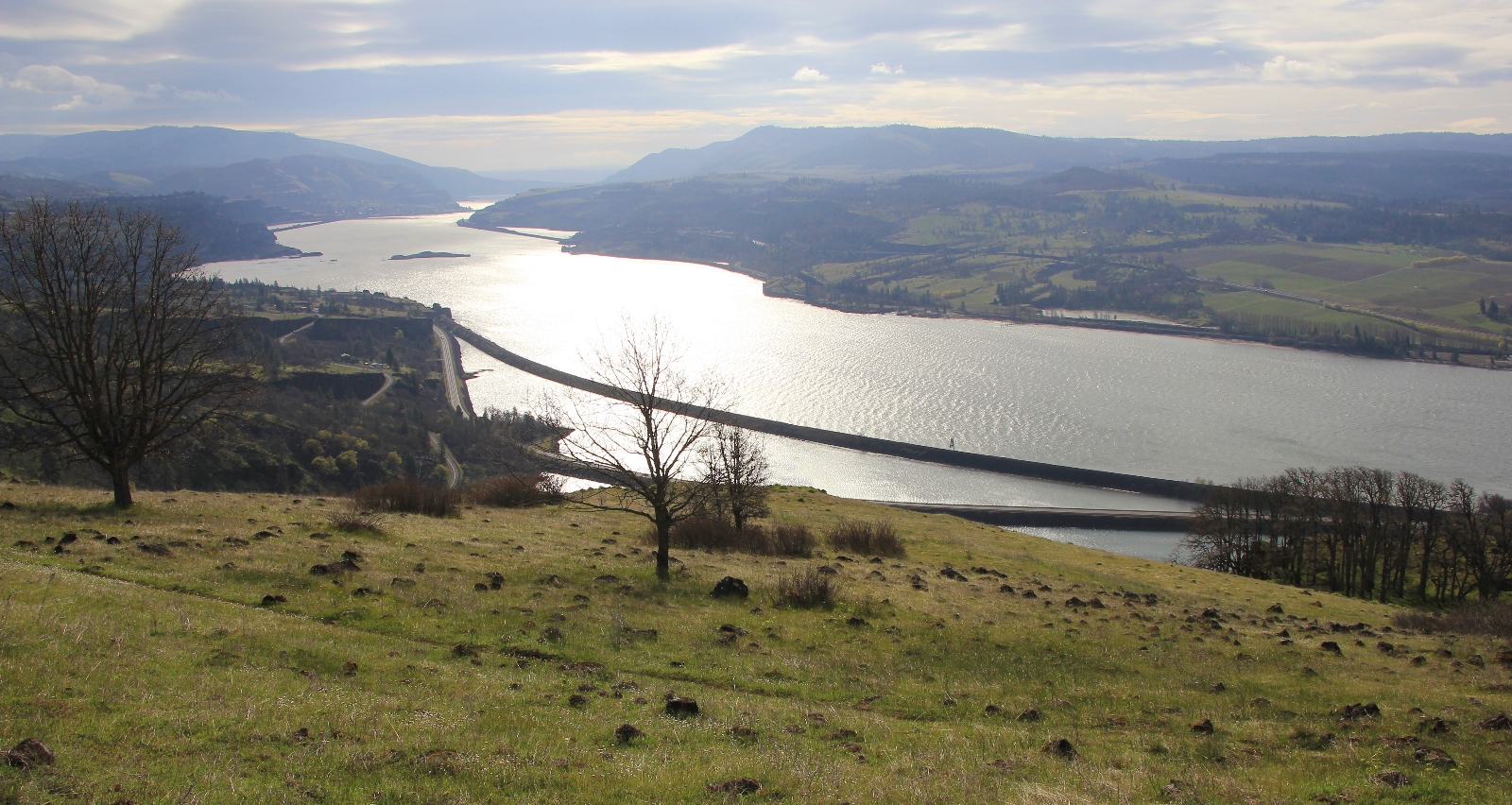
From our hotel in The Dalles, we crossed the mighty Columbia River and made the short drive west along state route 14 to its intersection with old highway 8 (elevation 110′) at the west side of Rowland Lake. There isn’t much of a formal parking lot at the Labyrinth Trailhead, but there are lots of spots for cars to park alongside the road. This is a popular area, especially with so many of the Oregon waterfalls still closed from the 2017 Eagle Creek Fire. We had driven past the trailhead the day before and it was packed. Lucky for us, there were only a couple other cars there at 8:30 on Easter Sunday.
I found this hike in Craig Romano’s Day Hiking Columbia River Gorge guide book, but we did not do the hike exactly as he described it. Instead, I thought it would be more interesting to combine some trails that I found on the Washington Trails Association website. I didn’t have a good map of the area, so it was a bit of a crap shoot where we were going to end up. No biggie, you really can’t get lost here. From the top of any of the trails, Just head downhill and you’ll eventually reach your car.
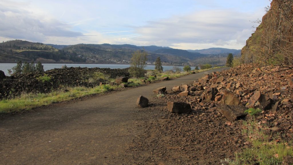
We headed west out of the parking are along the old closed off stretch of highway 8. It was easy to see why they had closed this stretch of the old highway. Large boulders were strewn across the eroding pavement and a waterfall further along had chiseled the road to just a few feet wide.
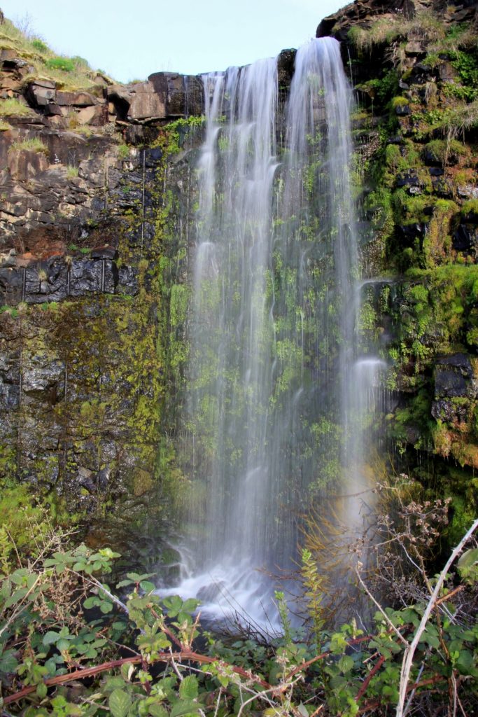
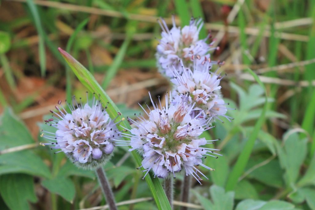
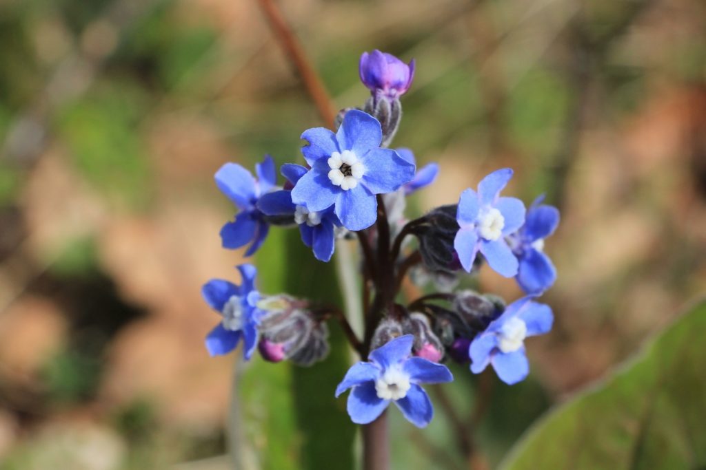
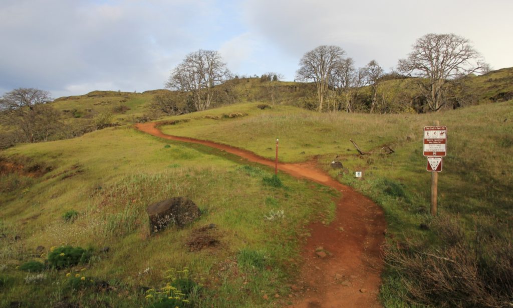
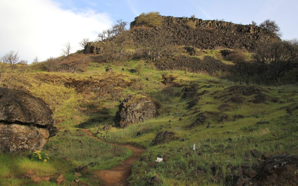
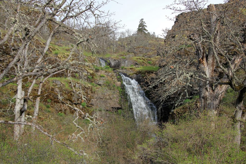
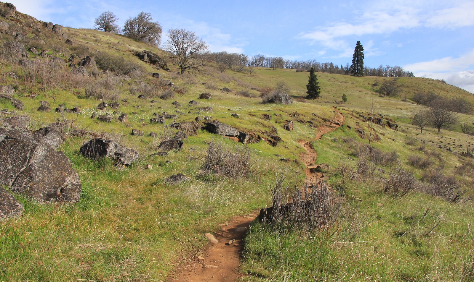
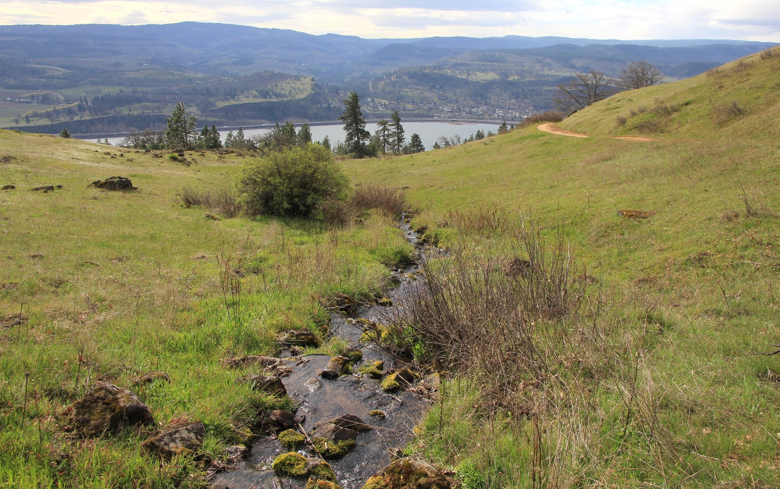
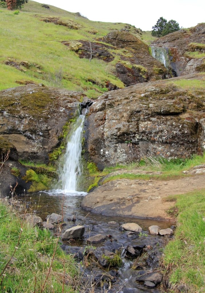
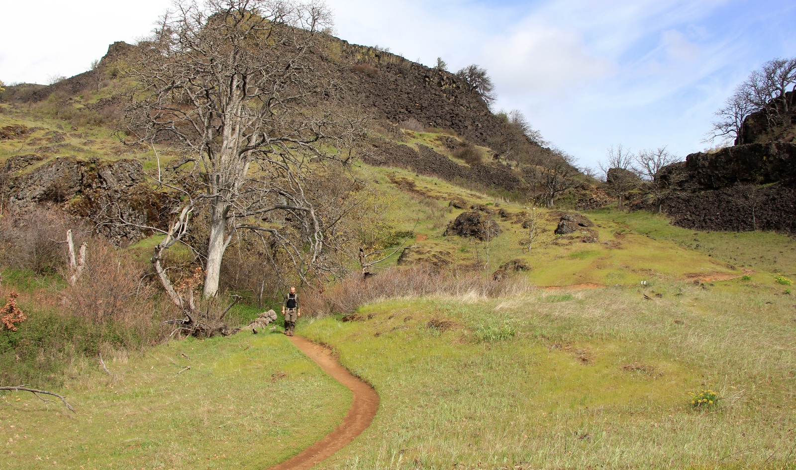
At half a mile, we turned onto the unsigned, but obvious trail to the right and began climbing the Labyrinth. The trail climbed through massive basalt rocks and along pretty Labyrinth Creek with its charming waterfalls. The wildflowers were just starting to bloom and we saw our first shooting star of the season. Supposedly this area is thick with poison oak, but we didn’t see any leafed out yet. This stretch of trail was pretty rocky in places.
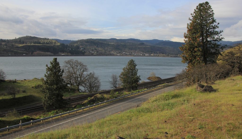
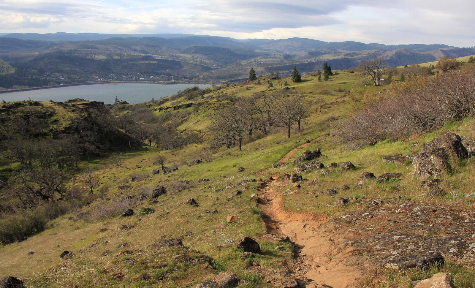
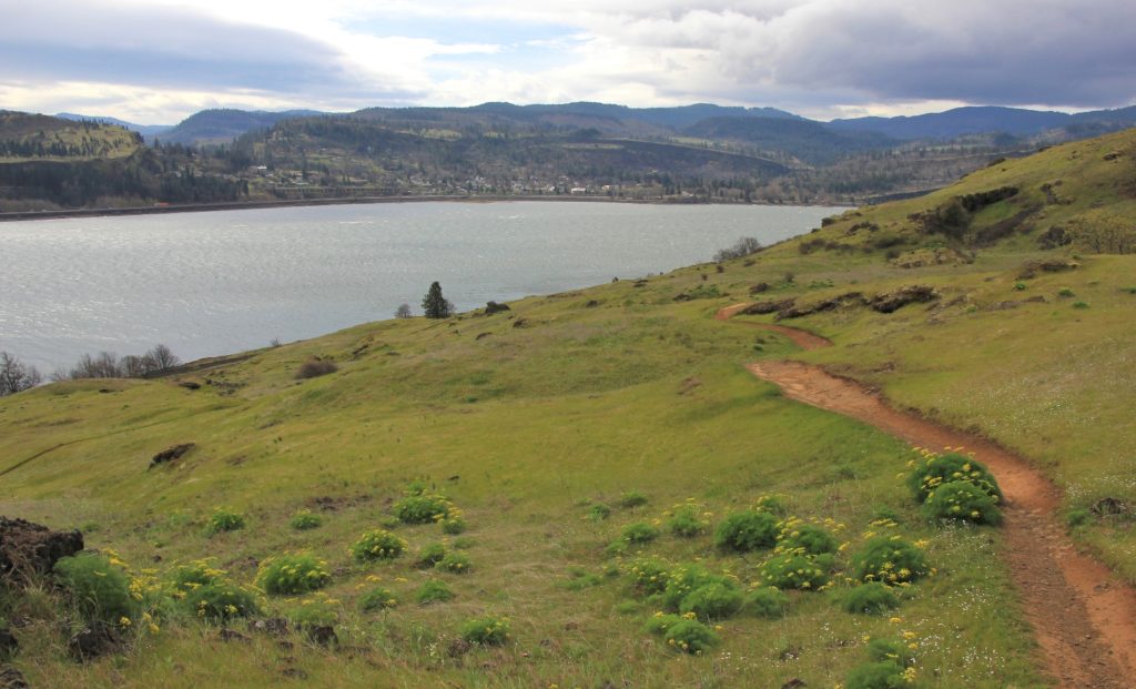
At about 1.25 miles in, we took a spur trail to the right to a nice overlook of the gorge. Continuing on, we made our way through stands of oak trees. After a short detour along a wrong spur trail (beware of social trails), we continued to the left of a barbed wire fence and continued to climb (this seemed counter to our trail description).
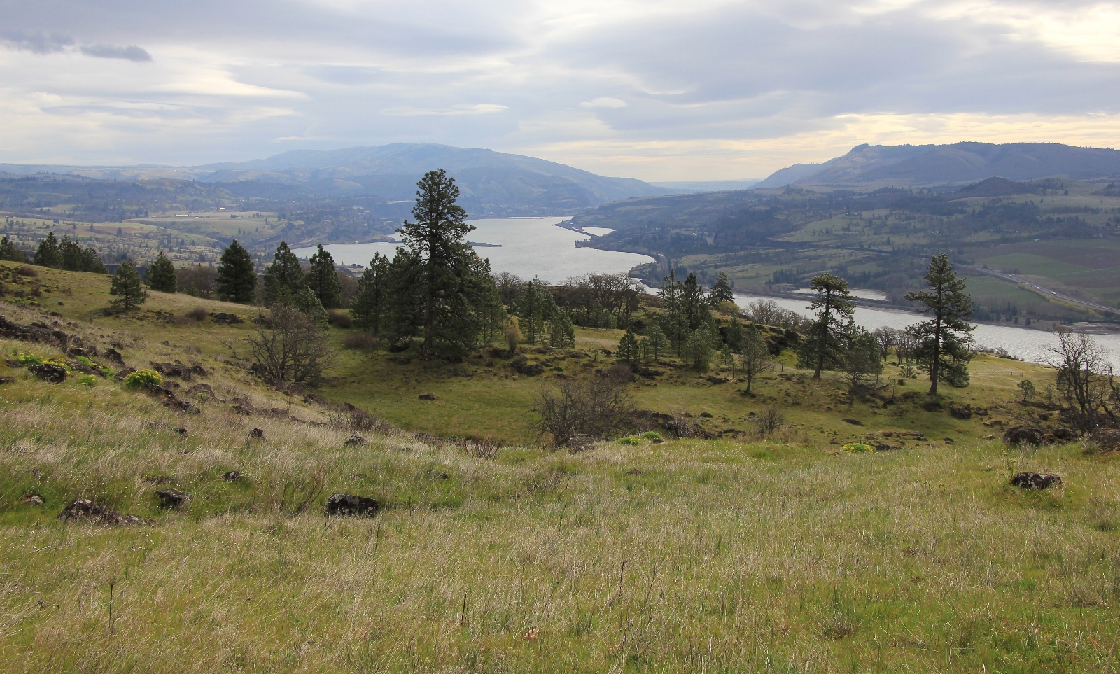
Views of The Gorge became more grand as we climbed. We would have had spectacular views south to Mt. Hood, but the mountain was obscured by low hanging clouds.
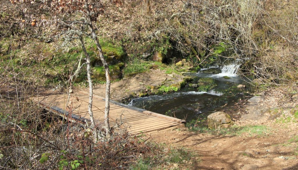
At a couple miles in, we split to the left and climbed to Atwood Road at 1,200′ elevation. We turned left onto Atwood and continued along to a creek crossing on a nice footbridge.
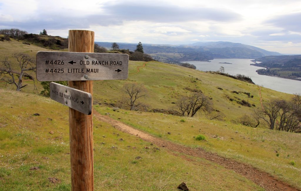
Soon we came to a private property sign where we turned left onto Old Ranch Road and started dropping back down toward the river.
Old Ranch leads over to the Coyote Wall Trail, but before reaching that junction we turned onto Little Maui Trail. The stretch of Little Maui to its junction back with the Labyrinth Trail was very nice and we saw a couple more small waterfalls.
Back on the Labyrinth Trail, we continued the short distance down to Old Highway 8 and back to the car.
We really enjoyed this hike and would like to do it on a sunnier day later in mid-late April when the wild flowers are blooming in earnest. I’ve heard that the hillsides explode with color. After seeing the maze of trails here, I did an exhaustive internet search for a good map. The best I found can be found on the Oregon Hikers website. I recommend taking a copy of this map with you if you visit the area. Most junctions are pretty well marked, but without a good map you might end up on unexpected tracks. Or you could end up doing some road walking like we did when we returned to the area later in the month!
Got Gear?
Click here to see some of our tried and true gear. By accessing Amazon through the links on this page, you get the same GREAT Amazon pricing and they share a little with us. This helps us maintain evansoutdooradventures and is much appreciated! Thank you to our supporters!