Sportsman’s Beach BLM Campground, Walker Lake Recreation Area
After leaving Clyde Holliday State Park in Oregon, we continued our travels south into Nevada. We spent a quick night at Winnemucca before continuing on to Walker Lake near Hawthorne. The BLM offers three camping areas on the west side of the lake with Sportsman’s Beach being the most popular. Sportsman’s provides 34 developed campsites with cabanas, picnic tables, vault toilets, and trash for $6 per night.
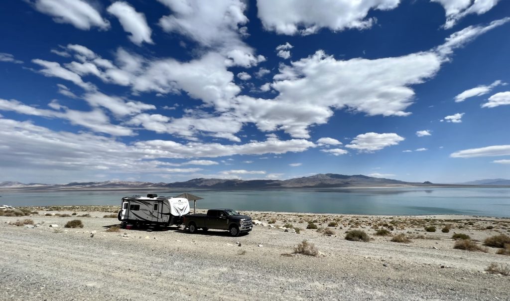
Walker Lake offers a variety of recreational opportunities including swimming, picnicking, boating, water-skiing and camping. The lake is an oasis for migratory birds and Desert Bighorn sheep are often seen on the cliffs along the west side of the lake. The lake is fed by the Walker River and has no natural outlet except absorption and evaporation. More than a century of upstream irrigation diversions have left Walker Lake a fraction of its former self. One source I read states Walker Lake has declined 90% in volume and more than 50% in surface area. Conservation efforts are working to restore the lake; however, it promises to be a hard battle with the West’s ongoing drought.
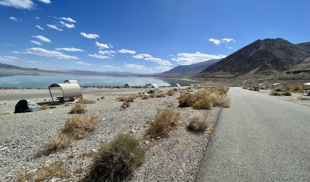
Despite the low lake levels and gusting winds, we enjoyed our brief stay at Sportsman’s Beach. We had a lovely gravel pull-thru spot in the lower loop with a million dollar view of the lake. The campground’s upper loop remained completely empty during our stay. This loop is paved and the sites still have lovely views; however, I suspect you do get a fair amount of highway noise there.
Lower Lee Vining Forest Service Campground
From Walker Lake, it was a short drive down lonely NV-359 to the California border and our first views of the massive Sierra Nevada Mountains—an area we’ll hopefully call home for the next two months. We traveled through the tiny town of Lee Vining and turned west onto Tioga Pass Road (Hwy 120) which leads travelers into Yosemite National Park. Just a few miles up the pass, we turned into Lower Lee Vining Forest Service Campground where we secured a lovely spot for the next two weeks.
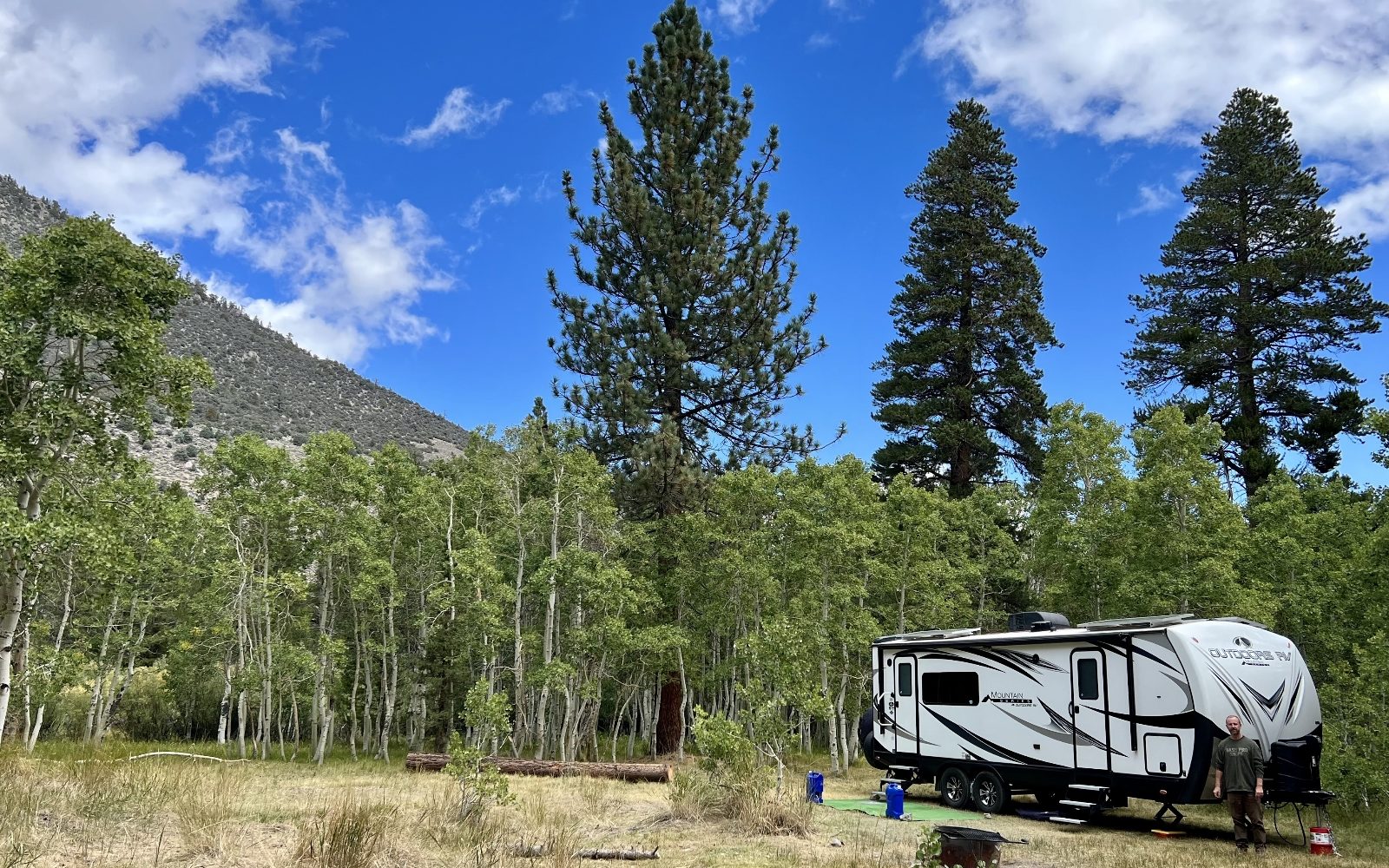
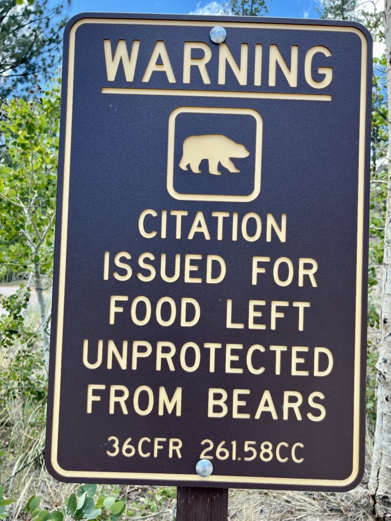
Lower Lee Vining Campground is situated at 7,300 feet elevation in a mixed pine and aspen forest. 51 campsites are available for $14 per night with a stay limit of 14 nights. Garbage and portable toilets are available and each site has a picnic table and fire ring. Drinking water is not available, but the Forest Service has a water fill station just a mile down the road. Each campsite is equipped with a bear locker for food storage. This is a very active bear area and you will want to take the restrictions seriously. We know of people who have had car windows busted out here for a pack of gum. We removed all items with scent from our truck (lip balm, sun screen, hand wipes, food, etc.) We watched one morning as a big black bear passed between our trailer and truck. He paused at our truck, sniffed the air, and continued on to the next campsite. As of the writing of this post, we have not had any issues…but we still have five nights to go!
Lower Lee Vining served as an ideal basecamp for exploring Yosemite National Park, Mono Lake, and the Hoover Wilderness. Our site was bordered by a grove of aspen trees that we enjoyed watching turn from green to gold as September faded into October. We lucked out and had one of the more private sites at the back of the campground. Overall, this is a pretty tightly packed campground with sites way too close together for our preference. We owed a big thanks to Kevin, the campground host, who told us about the open site in the far back. We nearly left the campground when we arrived and found the front half of the campground packed. We had slow, but generally useable Verizon LTE which allowed me to get online for work in the afternoons.
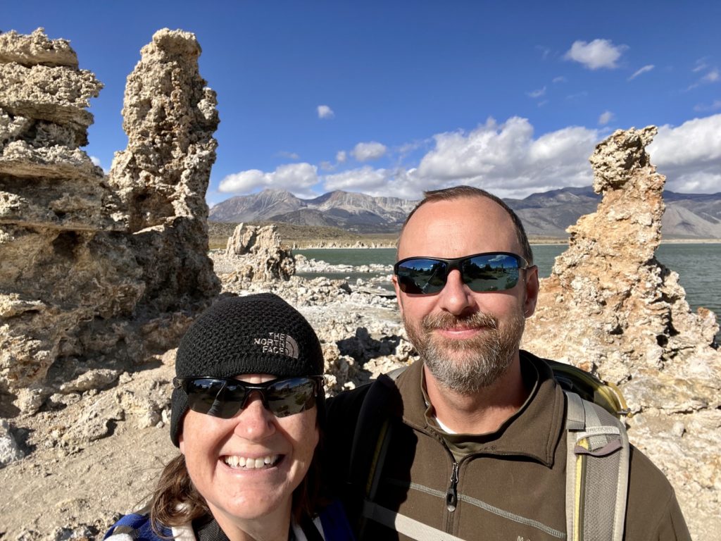
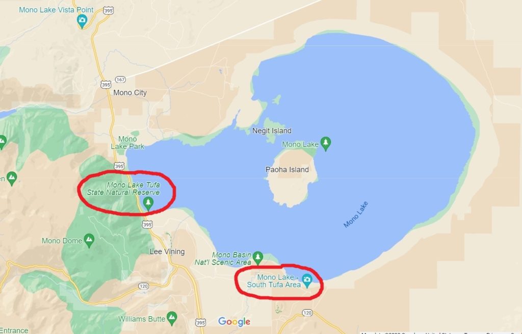
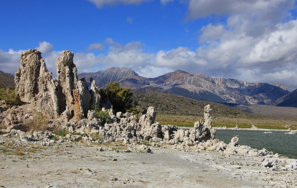
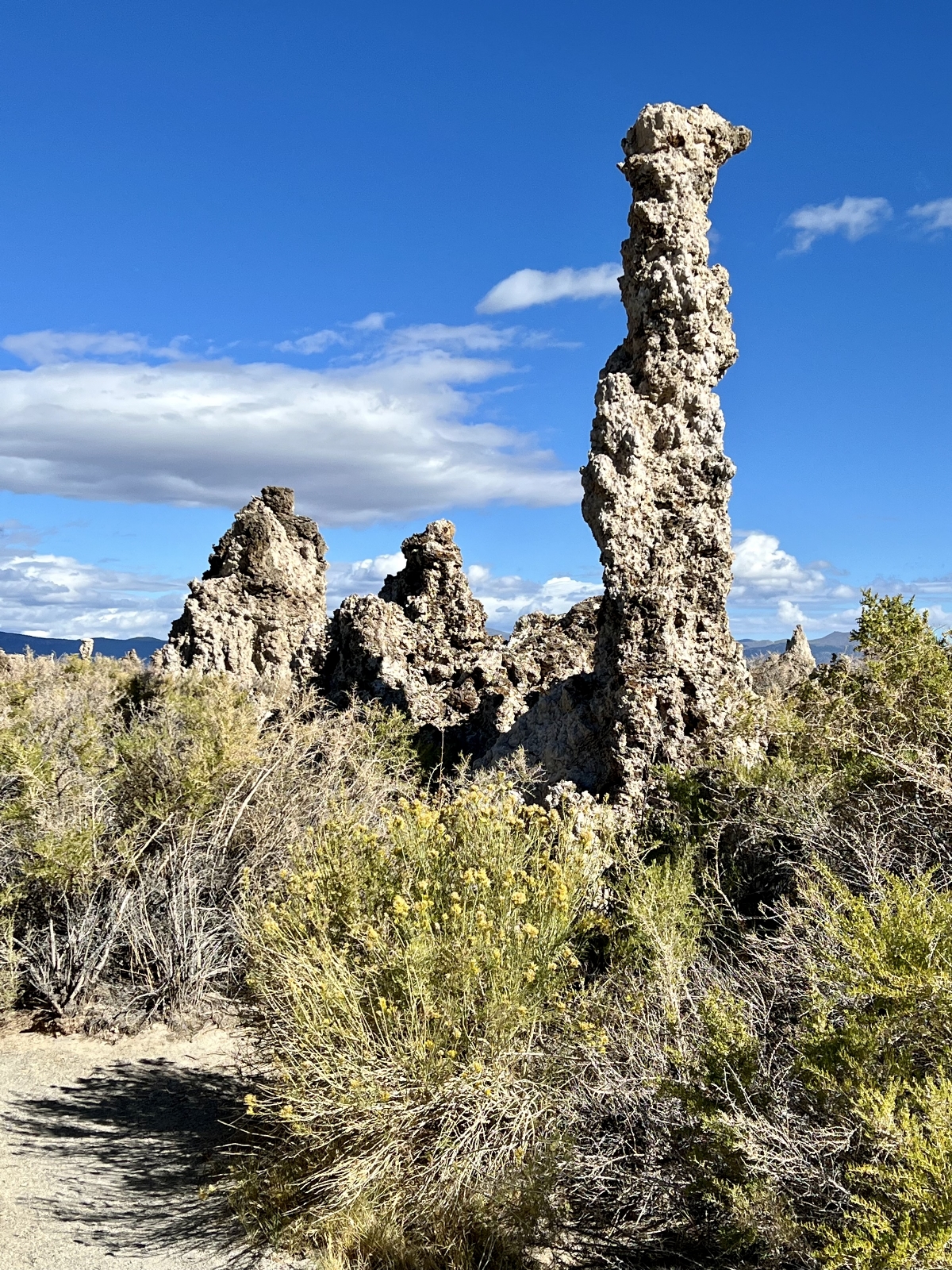
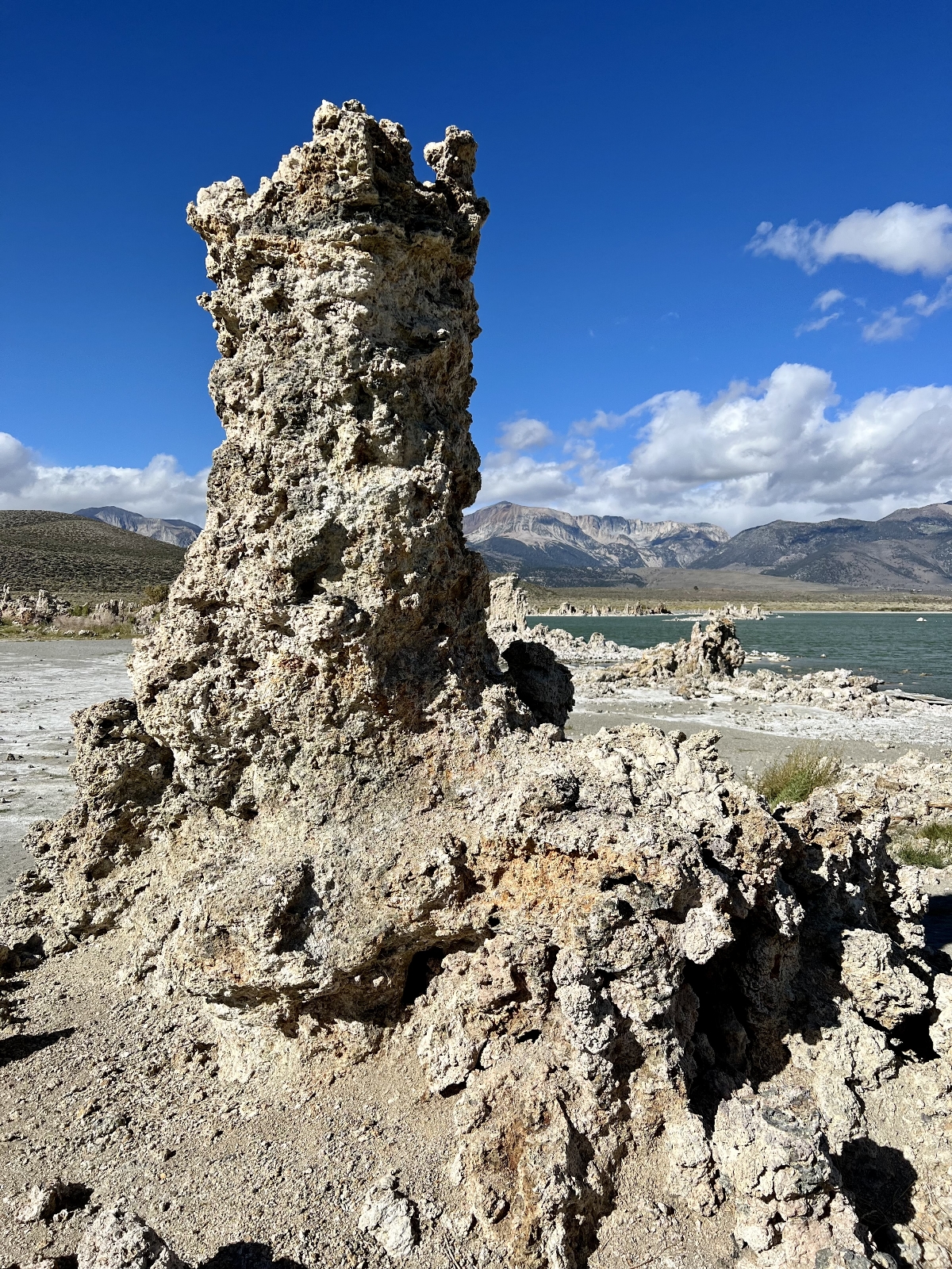
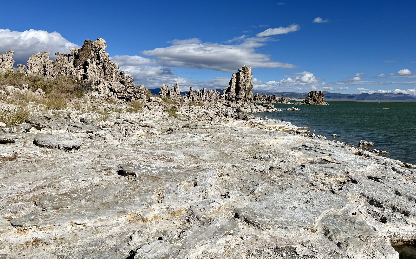
Exploring the Tufas of Mono Lake
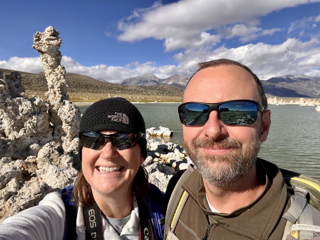
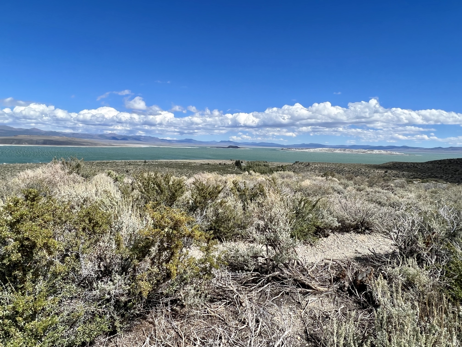
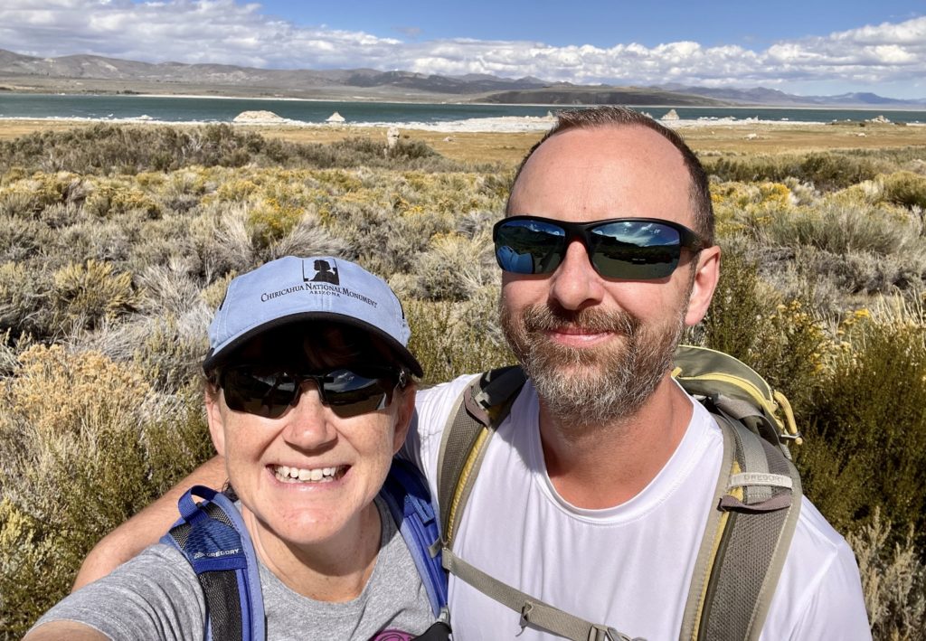
Snow in the Sierras had us looking to lower elevations for our first day of area explorations. Our campsite was just a few miles from Mono Lake and its unworldly tufa formations, so we headed there for hikes at the North and South Tufa areas. Mono Lake lies at the western edge of the Great Basin. Water here never flows to the ocean. Its only escape is evaporation, leaving dissolved salt and other materials behind.
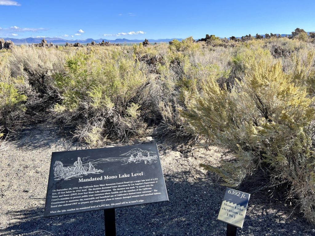
Mono Lake dropped more than 45 vertical feet, shrank to half its volume, and doubled in salinity between 1941 and 1982 when the city of Los Angeles began diverting water from the streams that feed the lake. In 1994, the California State Water Resources Control Board decreased the water diversions by Los Angele’s Department of Water and Power and set a target lake level of 6,392 feet. The lake has a long ways to go to reach target level, but at least it has a fighting chance now.
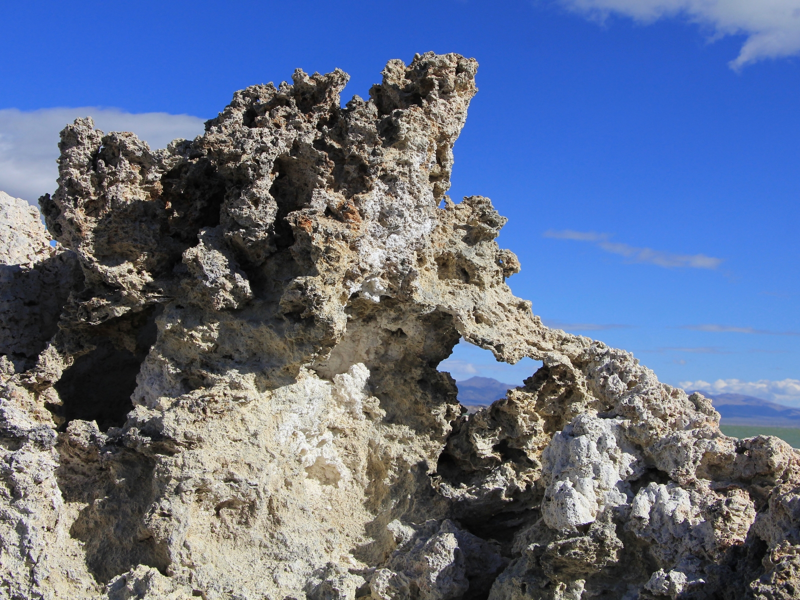
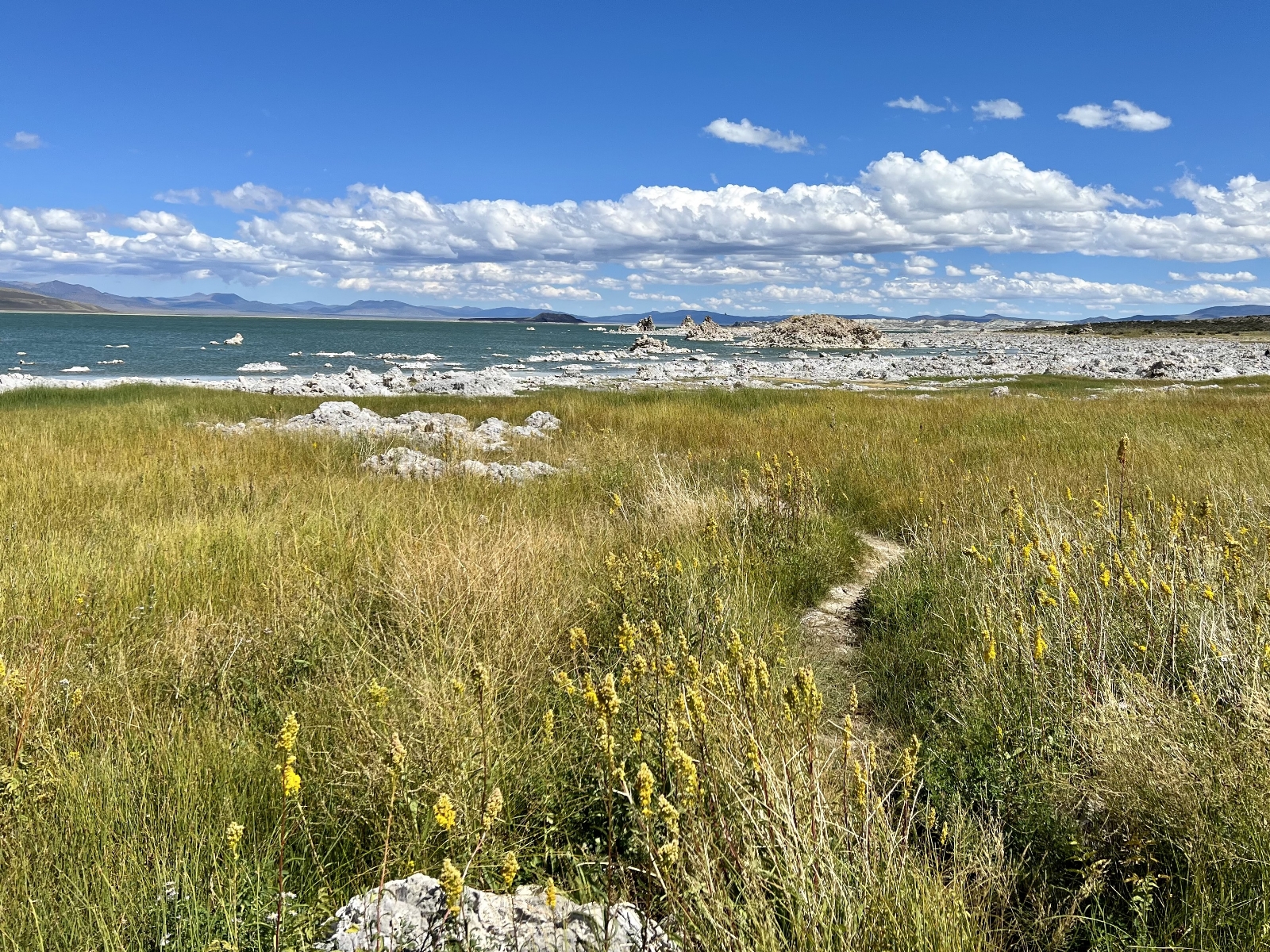
Mono Lake Tufa State Reserve, a unit of the California State Park System, was established in 1981 to preserve the spectacular tufa formations and other natural features found along the shore of the lake. Mono is 2.5x saltier and 100x more alkaline than the ocean from sodium chloride (table salt) and sodium bicarbonate (baking soda) being washed into the lake by streams and springs. When calcium-rich springs flow up through the lake bottom, the calcium bonds to carbonates in the lake water. Together they form calcium carbonate, a solid limestone-like material. This material builds on itself, gradually forming the crazy tufa towers found along the edge of Mono Lake.
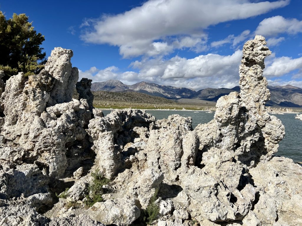
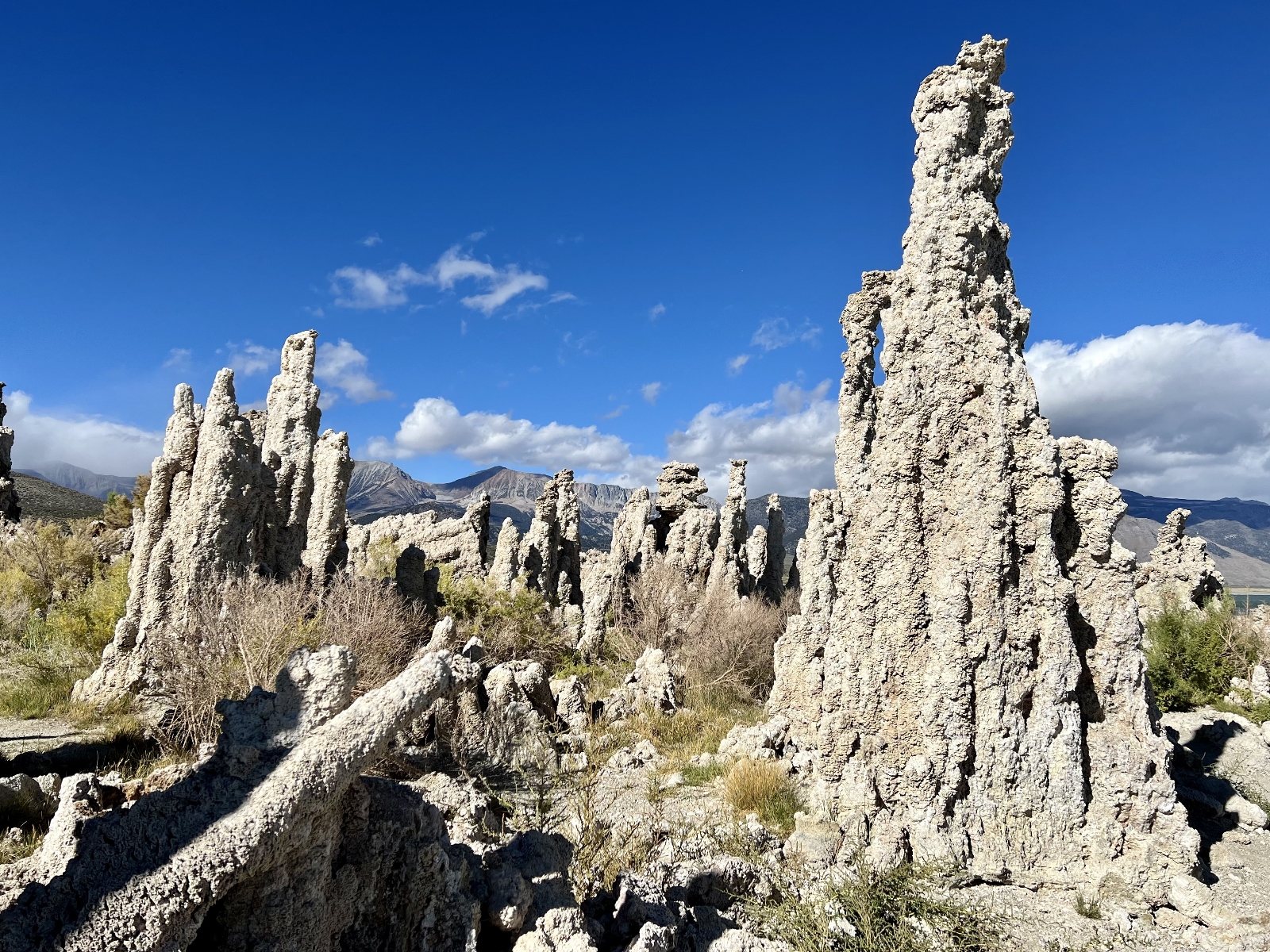
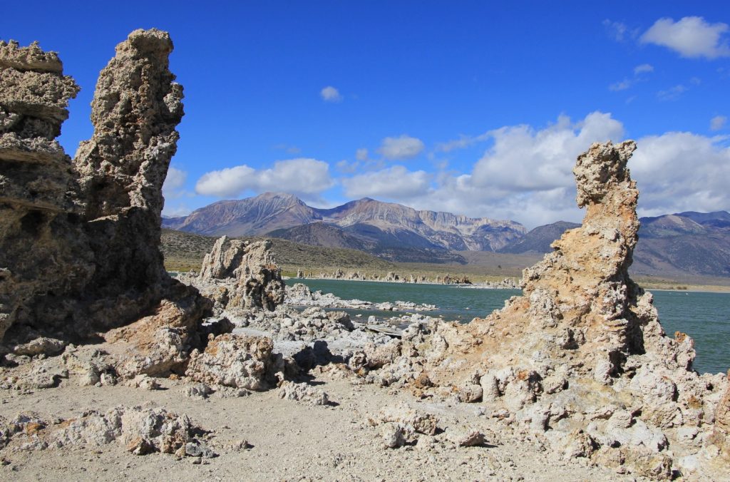
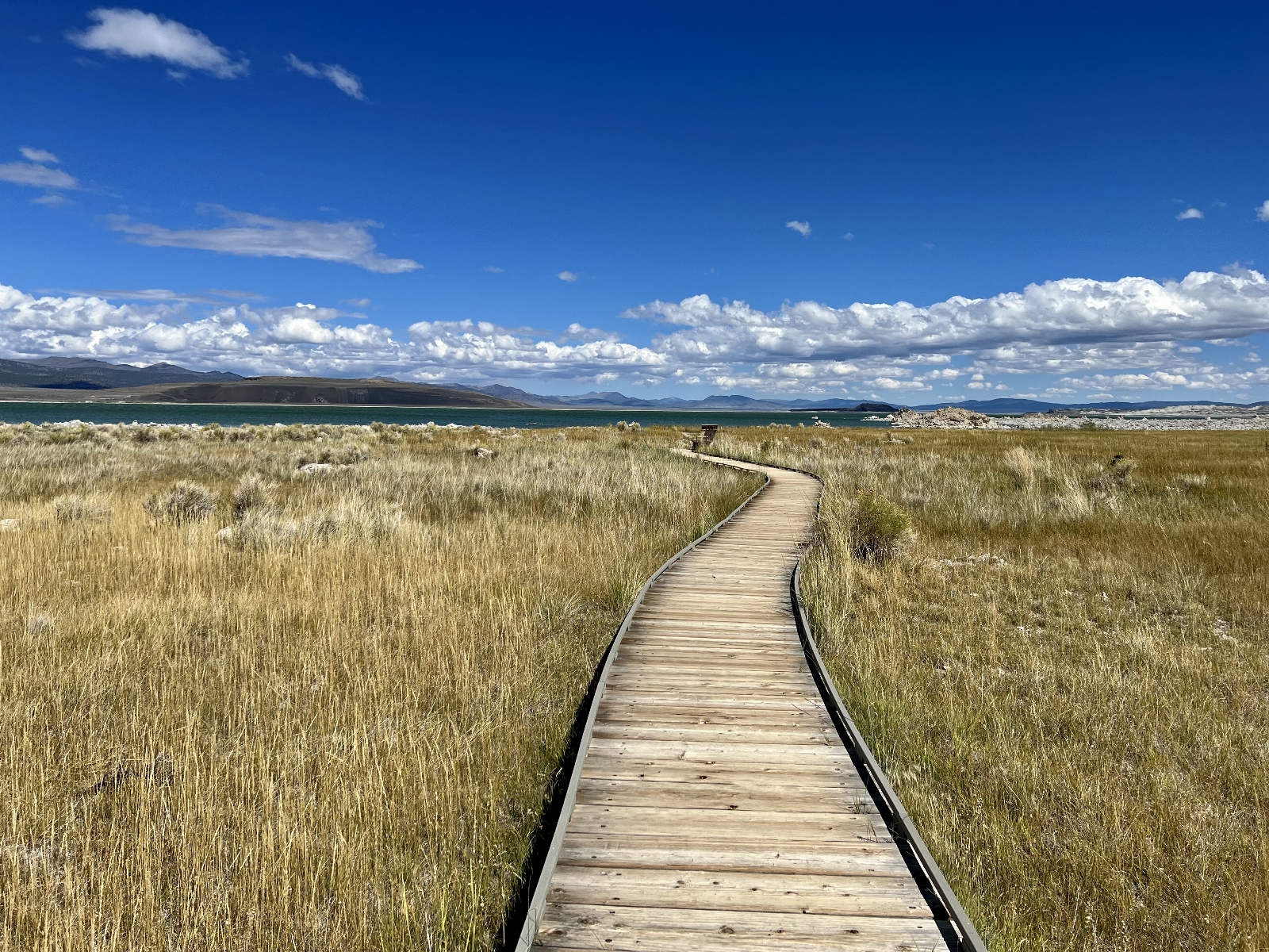
The South Tufa Trail winds along Mono’s southern shoreline among the most impressive tufa towers. Put this short and easy hike high on your list if you are passing through the area. If you are up for a slightly longer hike with stellar views of the massive Sierra Nevada Mountains to the west, continue east along the lakeshore to Navy Beach. This is a popular spot for kayakers, but winds can be fierce here so keep a close eye on the weather! The South Tufa Trail is a 0.8 mile loop or combine South Tufa and Navy Beach for a 2.0 mile loop. Both are very easy walking.
Just north of Lee Vining is the Mono Basin Scenic Area Visitor Center. This is supposedly a great spot for information, although it was closed the day of our visit. It is worth a stop there just for the view down to Mono Lake. We hiked from the center down the Mono Lake Trail to the North Tufa and Old Marina area. The tufa weren’t as good as at South Tufa, but the views of Mono Lake on the descent from the visitor center were stunning. This was a 2.6 mile roundtrip hike with 320′ elevation gain.

The Adventure Continues
Please join us on our next adventure as we begin our series of Sierra Nevada hikes and visit Yosemite National Park. And don’t forget to check out our Amazon RV and Adventure Gear recommendations. We only post products that we use and that meet the Evans Outdoor Adventures seal of approval. By accessing Amazon through our links and making any purchase (even things as simple as toothpaste!), you get Amazon’s every day low pricing and they share a little with us. This helps us maintain this website and is much appreciated
Looks like a GREAT Place to be! <3