April 15-21, 2019
After spending a week visiting family and exploring the Yakima area, we moved the RV a couple hours south to the Washington side of the Columbia River Gorge. The Gorge near The Dalles, Oregon is a favorite of ours in the spring. Normally brown hills are brilliant green and the spring wildflowers abound here on the open hillsides. Despite all the trips we’ve made, there are still many hikes on my to-do list.
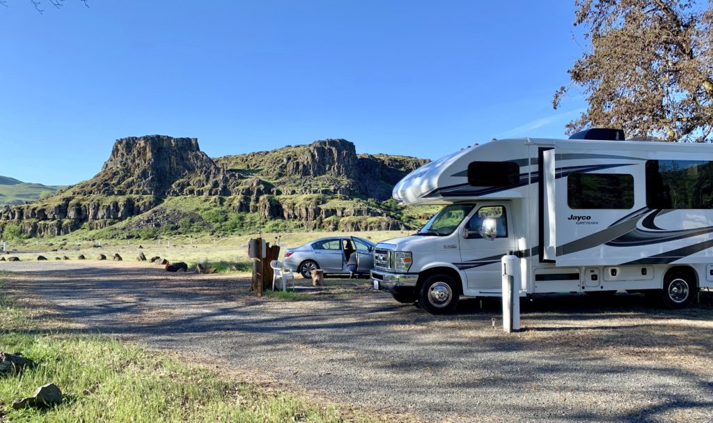
We had hoped to get into a sweet boondocking area near Lyle, Washington along the Klickitat River that we had spotted last year, but no sites were available. We knew of several other free sites, but they were further upriver than we wanted. Instead, we decided to take the Greyhawk to her first state park, Columbia Hills. The park has some rock art I’d been wanting to see and would serve as a great base camp for area hikes.
Washington’s Columbia Hills State Park
We arrived at Columbia Hills State Park, across the Columbia River from The Dalles, Oregon, and found just one other RV parked in the small campground. Site number one, reserved for the camp host starting May 1, was open. Of all the sites, it had the best view and offered the most seclusion. We registered for four nights and enjoyed them so much we extended our stay another two nights. We enjoyed most of the park’s hikes and historical sites. I’ll show you more of that in my next post which will be dedicated to the park.
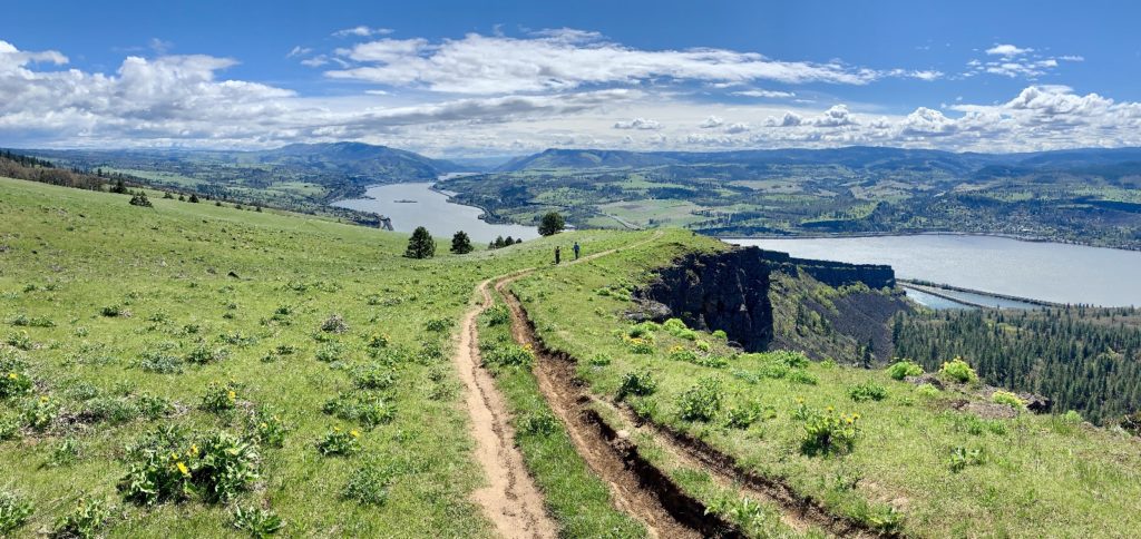
Lyle Cherry Orchard
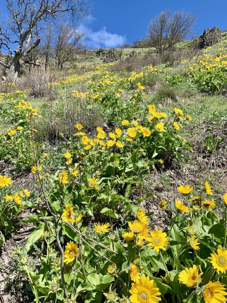
In addition to exploring Columbia Hills, we hiked some trails that had been on my radar. First up was a lesser known trail on the Washington side of The Gorge. The Lyle Cherry Orchard trail makes a stiff climb around basalt cliffs and through colorful fields of yellow balsamroot to provide commanding views up and down the Columbia River Gorge. The 540 acre property is owned by Friends of the Columbia Gorge Land Trust and includes an abandoned cherry orchard at its summit.
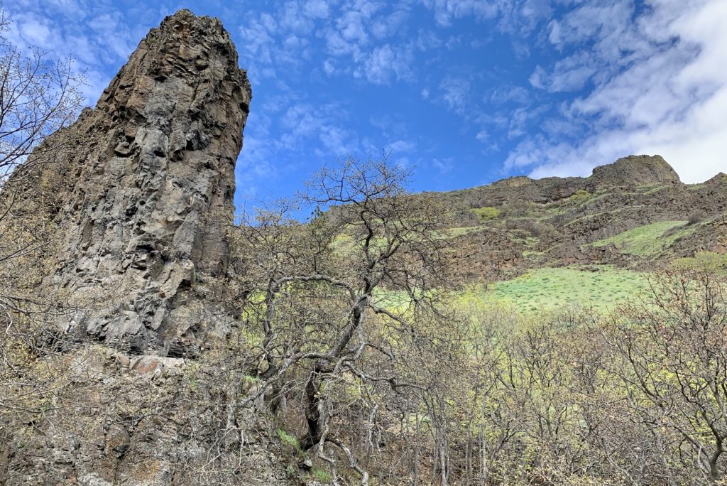
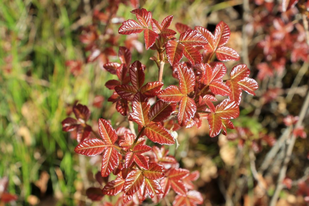
Not many of the cherry trees have survived and we didn’t see any in bloom. No worries—the views and wildflowers are the real show here with the best time to visit being mid-late April. We enjoyed a beautiful day on the trail and escaped tick free which is more than several of our fellow hikers were able to report. We also managed to avoid the masses of poison oak that were just leafing out alongside, and in the middle of, the trail.
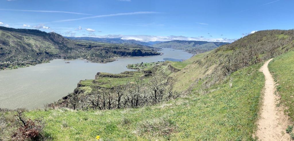
This moderately difficult out and back trail is 5.5 miles roundtrip with 1,500′ elevation gain, most of that in the first mile. This hike is not family friendly due to some exposed sections during the climb as well as rattlesnakes, ticks, and TONS of poison oak! The trailhead is located at a large unmarked gravel pull out just to the east of the town of Lyle, Washington on highway 14.
Beacon Rock State Park
If you’ve traveled I-84 along the Columbia River east of Portland, Oregon, you’ve likely noticed 848-foot Beacon Rock towering above the shoreline on the Washington side of the river. Like many, I’d driven past this massive basalt monolith more times than I could count, but had never crossed the river and made the mile long hike to the top.
Beacon Rock is the core of a volcano that erupted 57,000 years ago. Ice-Age floodwaters scoured away the softer rock on the outside, leaving the landmark we see today. Beacon was named by Lewis and Clark who camped there in 1805 on their journey to the Pacific as well as on their return trip in 1806. Well known to the local Native American tribes, they had noted that the rock marked the last of the Columbia River rapids and the beginning of tidal influence from the Pacific Ocean, 150 miles away.
Henry Biddle purchased the rock in 1915 for just $1. “My purpose in acquiring the property was simply and wholly that I might build a trail to the summit.” Biddle spent three years constructing the mile long trail to the summit complete with over 50 switchbacks, handrails, and bridges.
Less than twenty years later, the Army Corps of Engineers decided the iconic rock would make good fill material for a jetty at the mouth of the Columbia River near Astoria, Oregon (really?!). The Biddle family tried gifting the rock to Washington State to make it a state park; however, Washington refused the gift (really?!). Washington State changed its mind when Oregon offered to accept the gift. Wow.
Today, Beacon Rock State Park features 9,500 feet of Columbia River shoreline and more than 26 miles of trails. Much of the 4,464 acre park was developed by the CCC, their stone mason structures still visible throughout the park. Click here for a map of the park or here for a park brochure. Please note a Washington State Discover Pass is required for all day use.
Our main reason for visiting Beacon Rock State Park was to hike the two mile roundtrip (600′ elevation gain) trail to the top of the iconic rock. We enjoyed 360 degree views of the Columbia River Gorge, but it is the trail itself that is the centerpiece of this hike. I don’t know how you could hike to the top of Beacon and not be impressed by Henry Biddle’s trail.
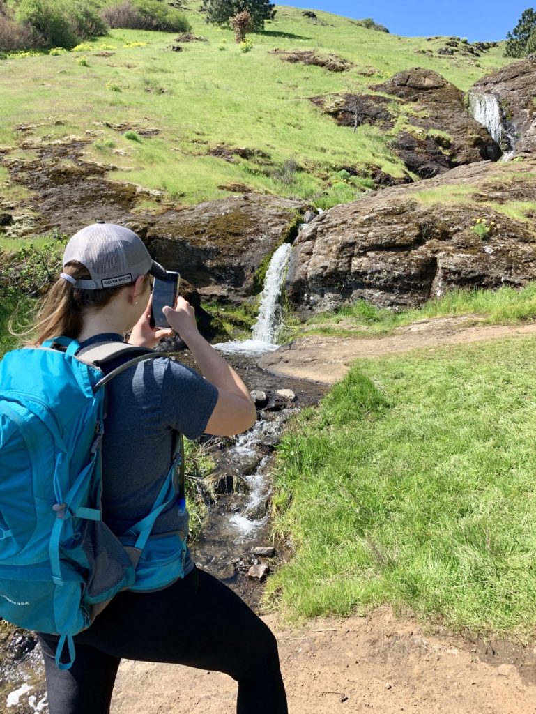
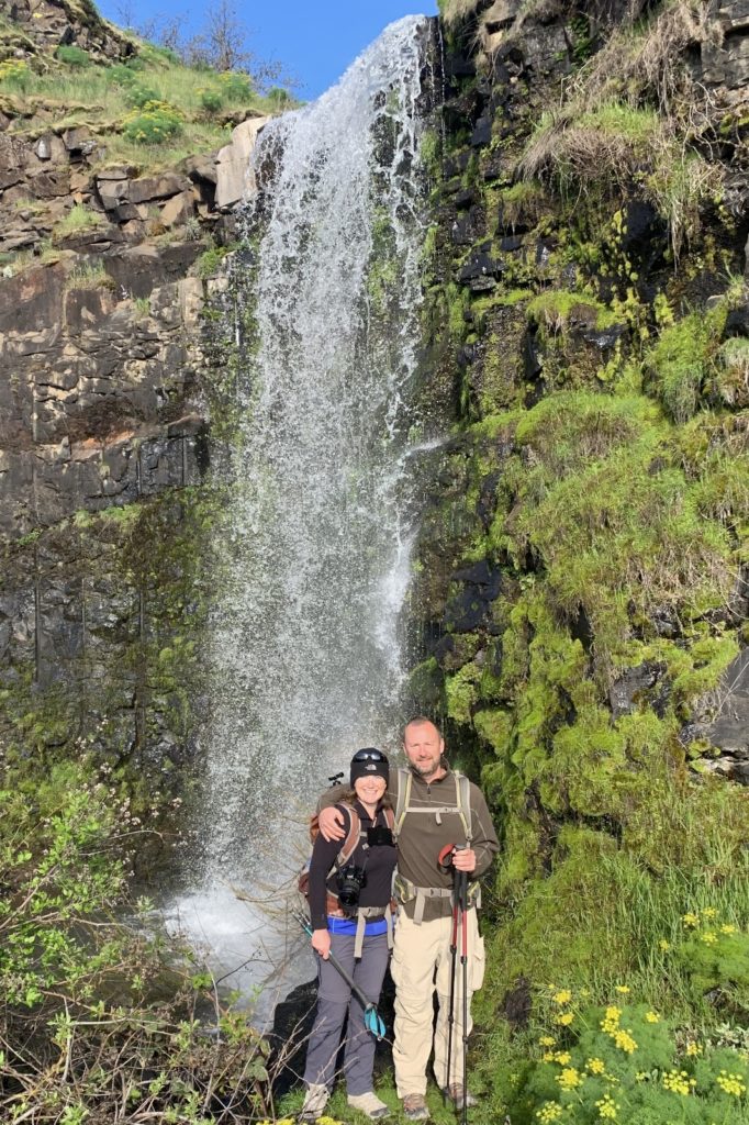
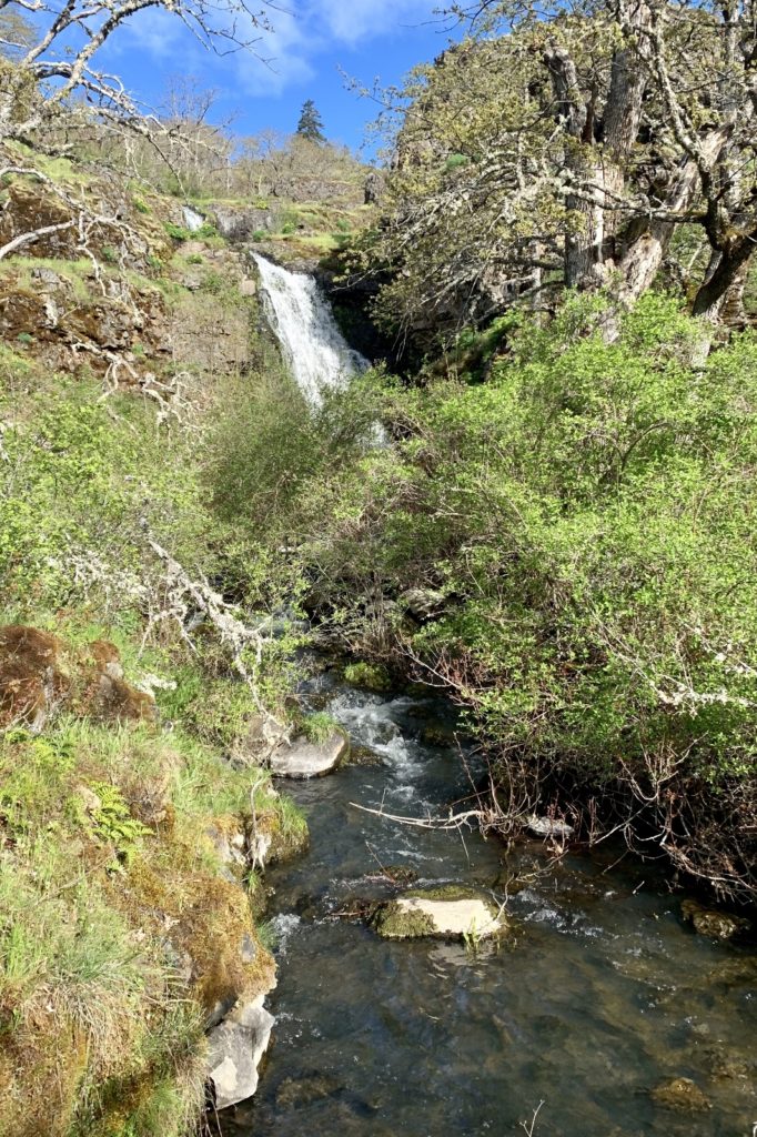
After summiting Beacon Rock, we hiked to nearby Rodney Falls on the Hamilton Mountain Trail. This was a 2.5 mile roundtrip hike with 600′ elevation gain through lovely Douglas fir forest. Fifty foot Rodney Falls was one of the more impressive waterfalls we’ve seen, but it was incredibly difficult to photograph due to multiple drops and angles. If you visit, be sure to go to both the lower viewpoint at the bridge as well as to the Pool of the Winds at the upper viewpoint. The two viewpoints give very different perspectives.
Coyote Wall – Labyrinth Loop
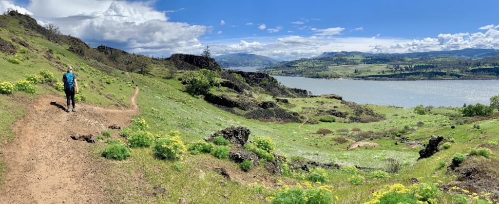
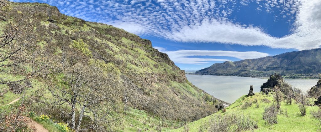
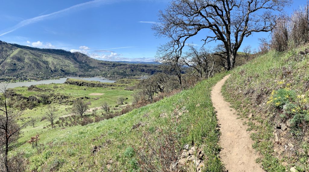
Last spring, we hiked the Labyrinth and Coyote Wall trails on separate visits to The Gorge. These trails, located just a few miles west of Lyle, Washington in the Catherine Creek area, were in uncharted terrain for us. It wasn’t until after the hikes that we realized they would make an excellent loop. Fortunately, we had a good excuse to return to the area.

On the last day of our trip, our good friend Michelle drove out from Portland and joined us on the trail. Earlier in the week, we had agreed we’d hike in the Catherine Creek area. I knew both Labyrinth and Coyote Wall trails were on Michelle’s bucket list, so I proposed looping the two together—she was all in. We enjoyed a windy, but beautiful day on the trail. Lupine and paintbrush weren’t yet in bloom, but the yellow balsamroot and green hills provided lots of spring color. Like Lyle Cherry Orchard, this is a great hike for views of the Columbia River. There are also spectacular views of Mt. Hood on a crystal clear day, which we didn’t quite have.
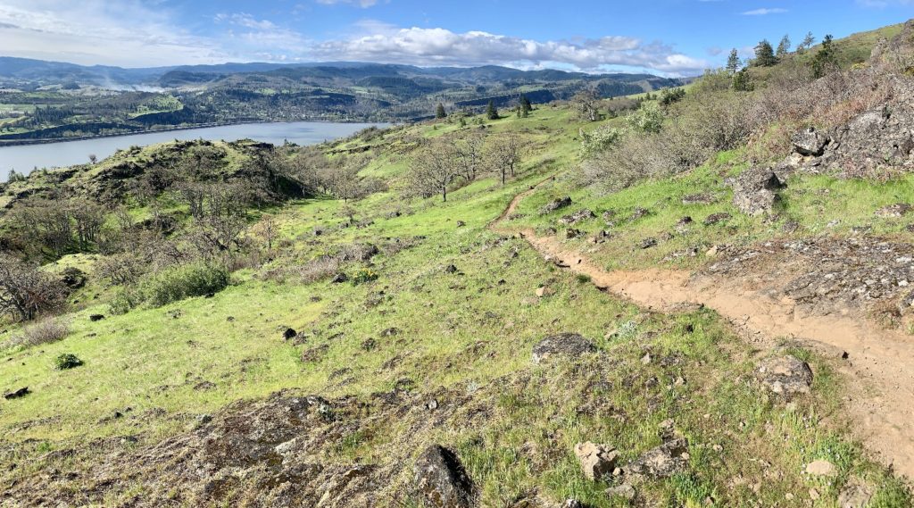
Combining these two trails makes for a moderately difficult loop of 7.55 miles with 1,800′ elevation gain. The trail can be accessed via the Labyrinth Trailhead (gravel area at the junction of Hwy 14 and Old Hwy 8) or the nicer Coyote Wall Trailhead (4.7 miles east of Bingen just off Courtney Road). The most detailed trail description and best (but not great) map I’ve found is located here. Like most other trails in the drier part of The Gorge, watch for prolific poison oak on the trail!
The Beacon Rock area was especially beautiful. The views you photographed were excellent. So glad your friend, Michelle could join you on a couple of hikes!
Looks like a very fun time! I enjoyed reading about it. Now I have some more places to put on my togo list.