Explore the world’s largest concentration of sandstone arches!
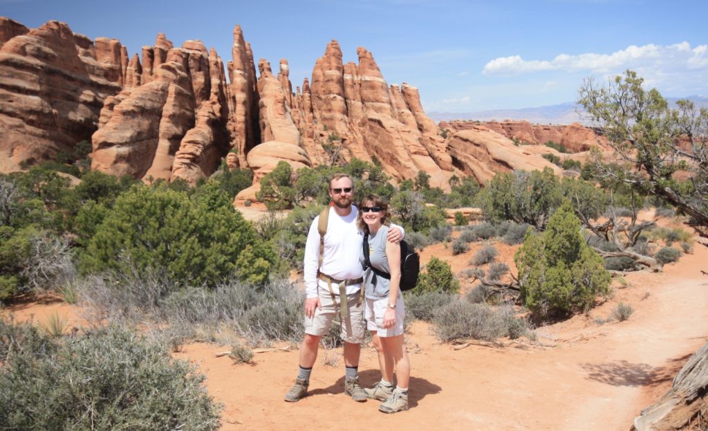
Our very first hike in Utah was at Arches National Park near Moab. It just took that one hike—we were hooked on the Colorado Plateau and its spectacular red rock. We’ve visited Arches twice now and have hiked most of the iconic trails, but we still have some bucket list items to check off. Arches isn’t just for hikers. Go for a scenic drive, rock climb, star gaze, camp, bicycle, or ride your horse. Whatever your favorite activity, be sure to bring your camera and be prepared for some of the most awe-inspiring scenery you’ve ever experienced!

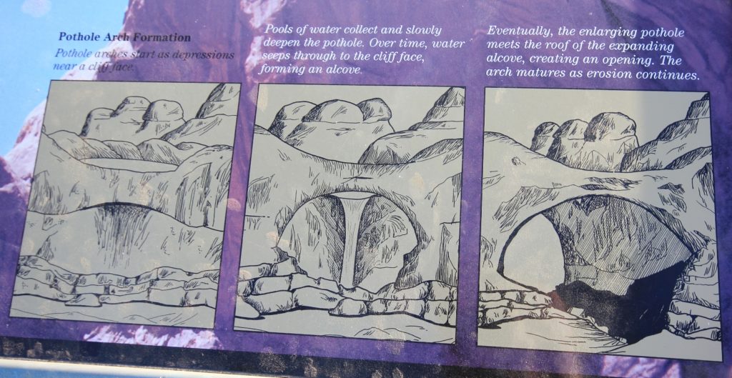
With over 2,000 arches, Arches National Park has the largest concentration of sandstone arches in the world. How in the heck does a place like Arches even exist? According to the park’s website: 65 million years ago, the area was a dry seabed. The red rock features we see today would have been buried thousands of feet below you. Then the landscape slowly began to change. First, geologic forces wrinkled and folded the buried sandstone making lumps across the middle. As the sandstone warped, fractures tore through it, establishing the patterns for rock sculptures of the future. Next, the entire region began to rise, climbing from sea level to thousands of feet in elevation and the forces of erosion carved layer after layer of rock away. Once exposed, deeply buried sandstone layers rebounded and expanded. This created even more fractures, each one a pathway for water to seep into the rock and further break it down. Today, water shapes this environment more than any other force. Rain erodes the rock and carries sediment down washes and canyons to the Colorado River. In winter, snowmelt pools in fractures and other cavities, then freezes and expands, breaking off chunks of sandstone. Small recesses develop and grow bigger with each storm. Little by little, this process turns fractured rock layers into fins, and fins into arches. Arches also emerge when potholes near cliff edges grow deeper and deeper until they wear through the cliff wall below them.
Every visit to the park should start at the visitor center. From there, most visitors take in one or more of the following areas: Park Avenue & Courthouse Towers, Balanced Rock, The Windows, Delicate Arch & Wolfe Ranch, and Devils Garden. Those looking for extra adventure can go on a ranger led tour through the Fiery Furnace. For a full list of trails, visit the park’s hiking page. To date, we’ve been able to check the following destinations off our bucket list:
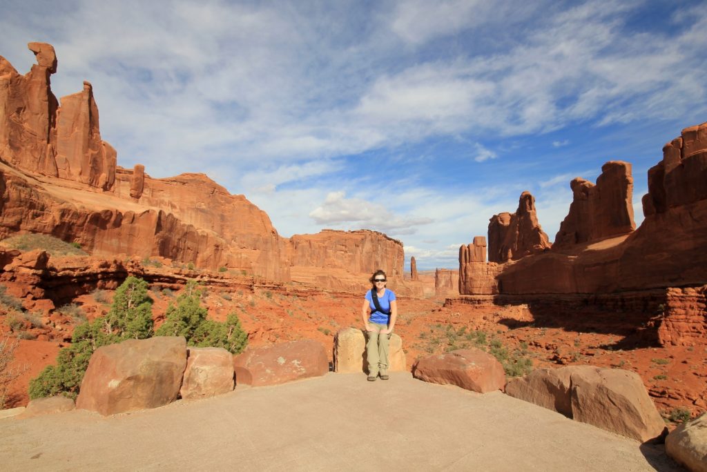
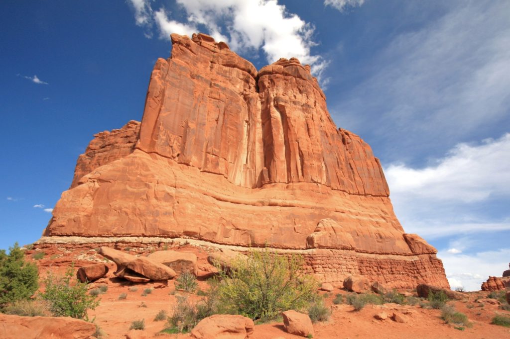
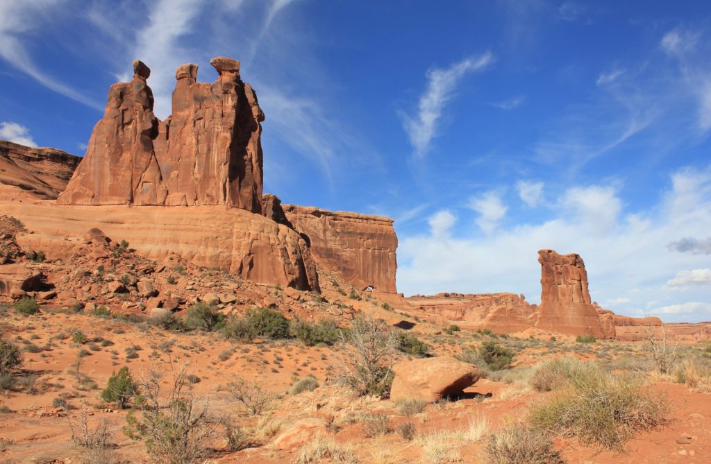
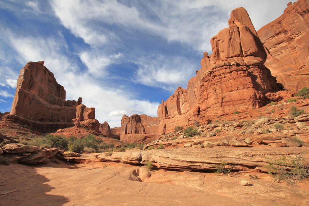
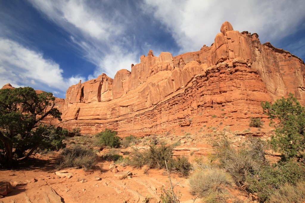
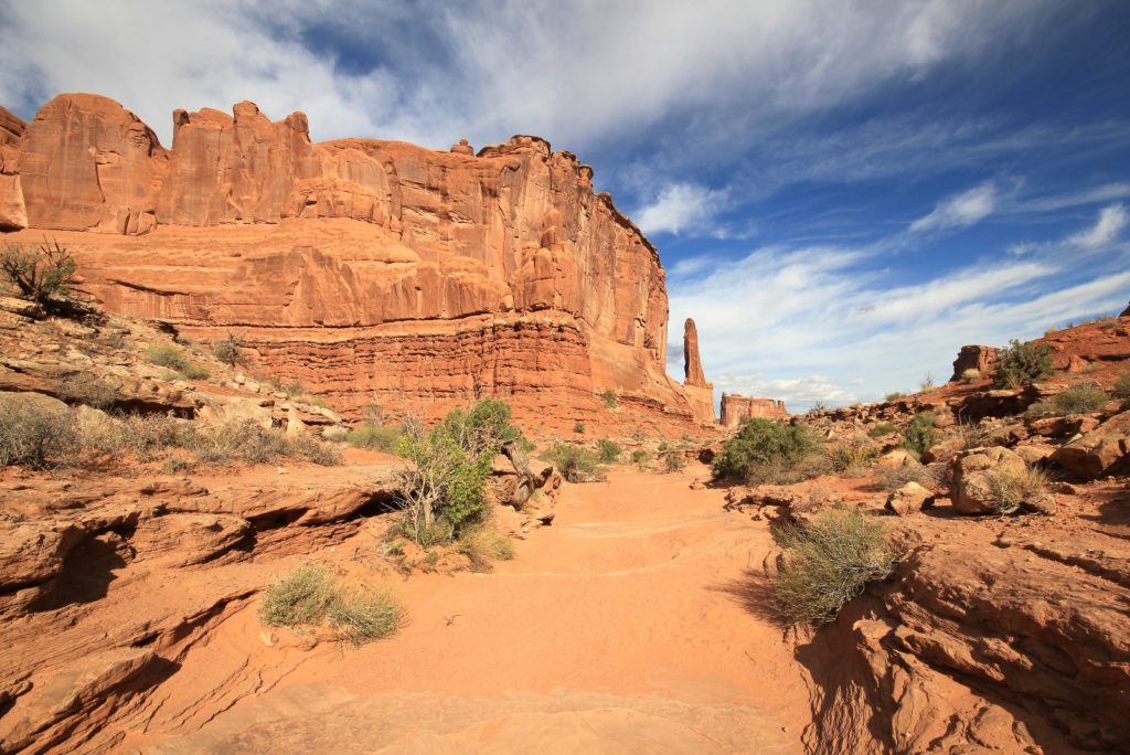
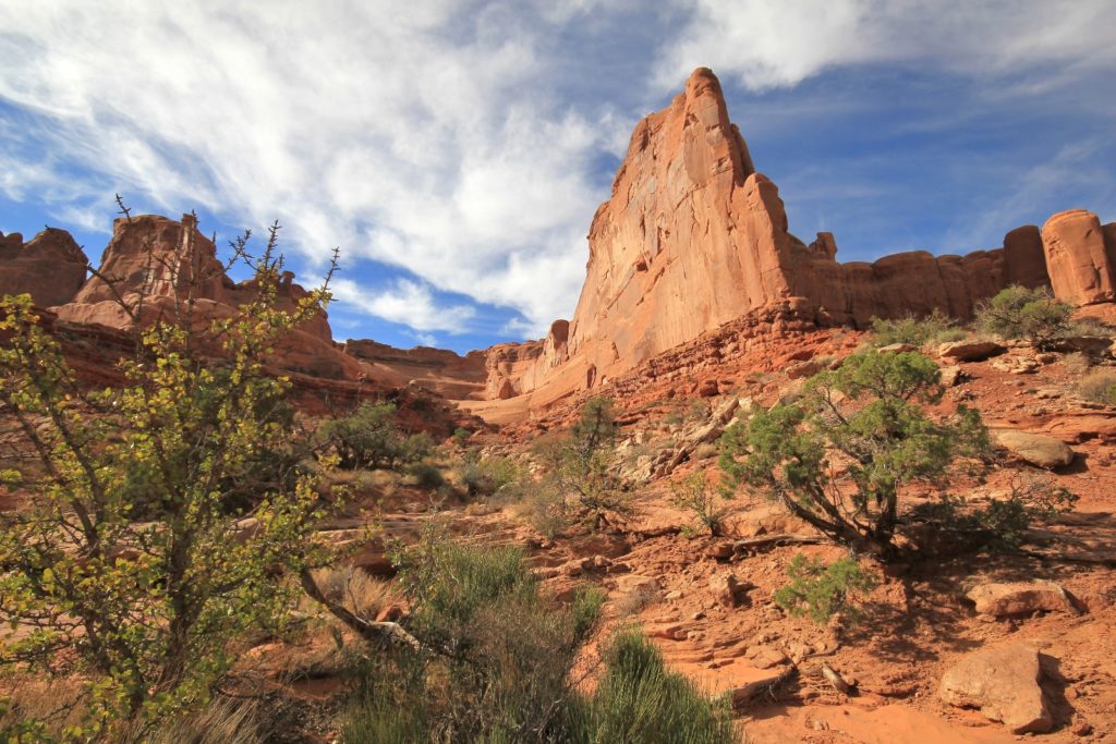
Park Avenue & Courthouse Towers
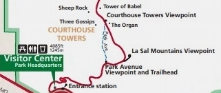
Driving into Arches, Park Avenue & Courthouse Towers is the first major stop. Here you can enjoy the viewpoint or take a 2.0 miles out and back hike. The trail descends into a spectacular canyon where red cliffs tower on both sides. The end of the trail provides excellent views of Courthouse Towers including Three Gossips, Sheep Rock, Organ, and Tower of Babel rock formations. Most people don’t go past the viewpoint making this a nice trail for those who like a quieter park experience. This trail has 320′ of elevation change and is rated as moderate.
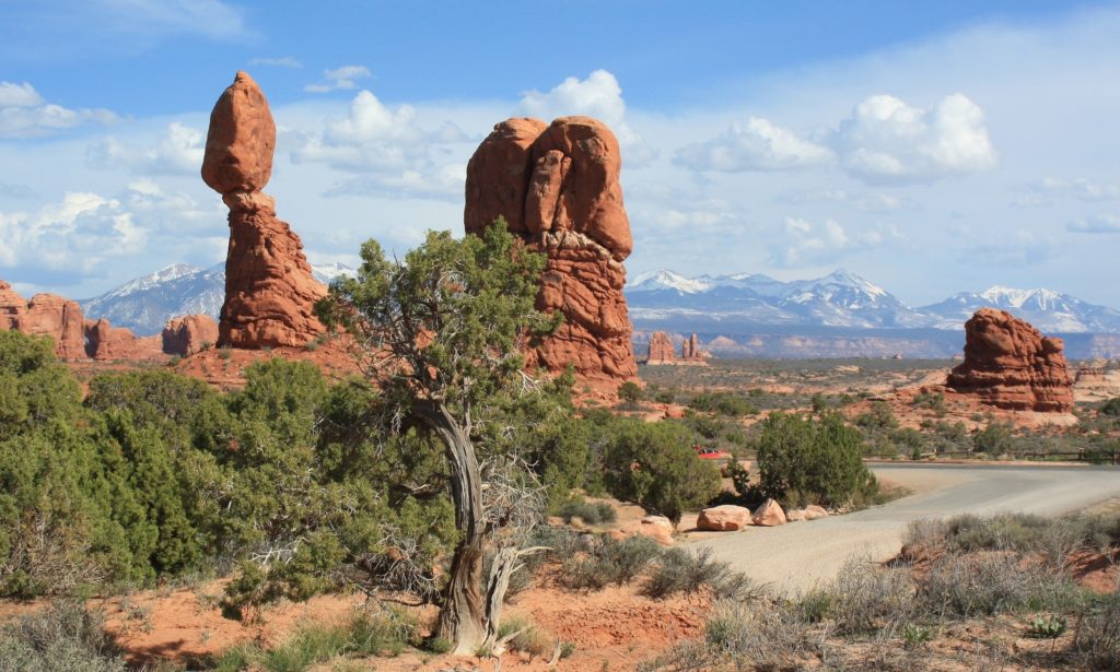
Balanced Rock
The next stop along the drive is Balanced Rock, one of the most iconic features in the park. This 3,600 ton rock stands 128 feet tall. Take the 0.3 mile loop trail around the base of the picturesque rock formation and follow it to a viewpoint where you can see The Windows and La Sal Mountains (especially picturesque when snow covered). This trail is rated as easy and the beginning is paved making it accessible to wheelchairs.

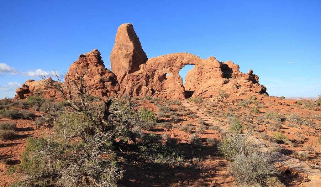
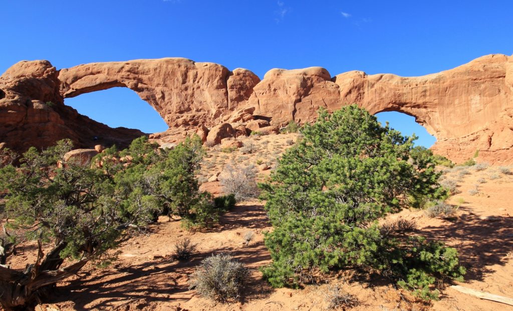
The Windows
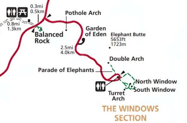
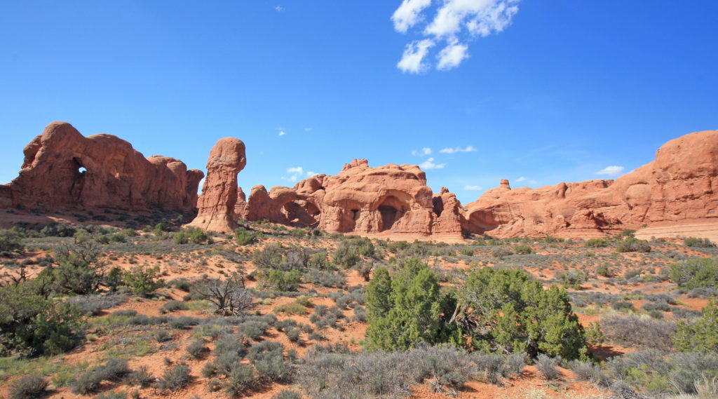
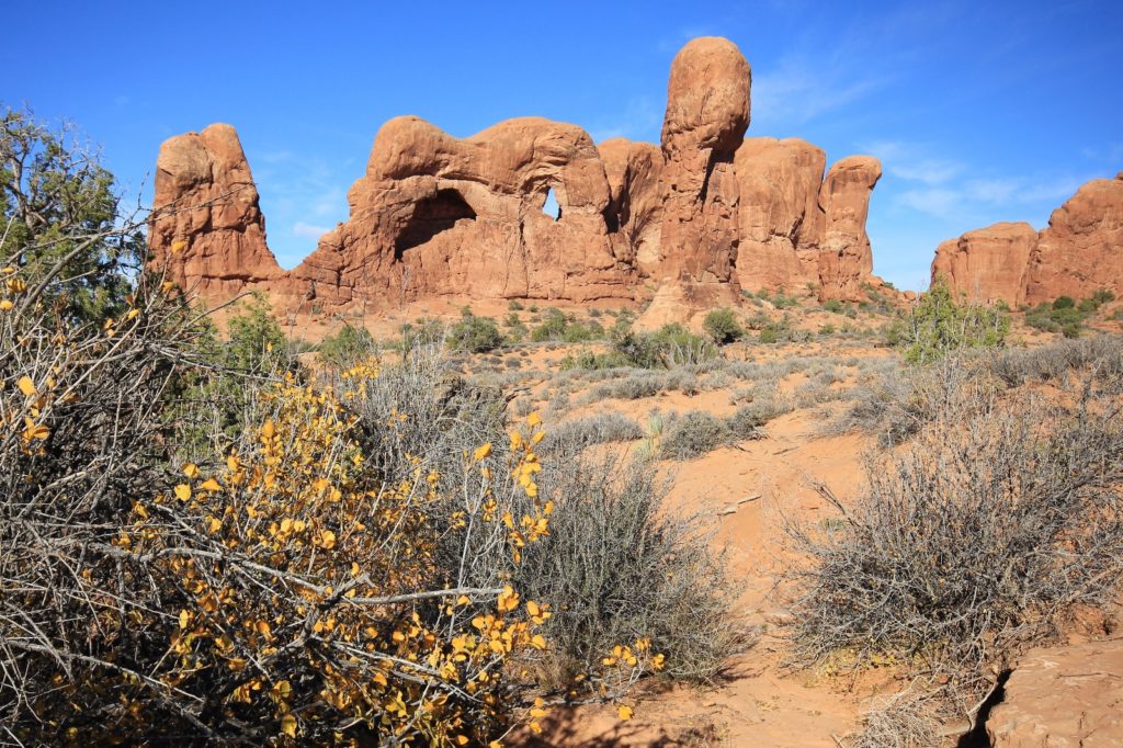
Just past Balanced Rock, be sure to take the 2.5 mile side road to The Windows. Here you’ll find a 1.0 mile loop trail that leads to North Window, South Window, and Turret Arch. I highly recommend adding the slightly longer primitive trail around the backside of North & South Windows which I thought provided the best view of the side-by-side arches. This trail is rated as easy and is extremely popular.
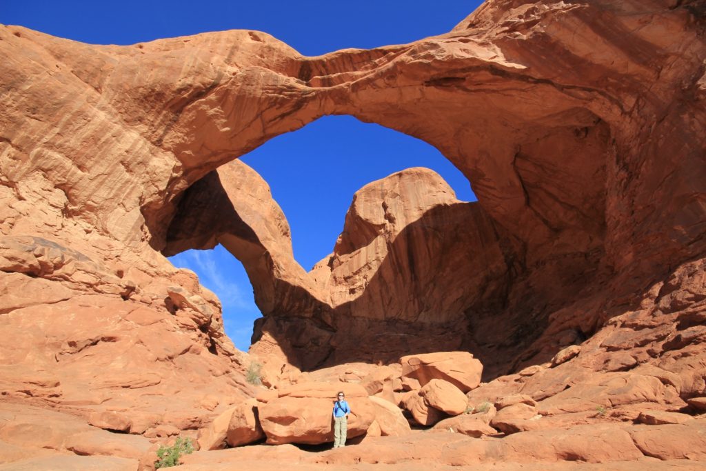
From the same parking area, don’t miss the 0.5 mile roundtrip hike to Double Arch. Two massive arch spans are joined at one end, making for an impressive and unique photo opportunity that was one of my favorite spots in the park. This is the third-largest arch in the park with the larger opening measuring 144′ wide by 112′ high and the smaller opening measuring 67′ wide by 86′ high. Movie buffs might recognize this backdrop from the opening scenes of Indiana Jones and the Last Crusade. This trail is rated as easy.
Delicate Arch
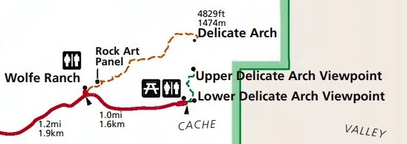
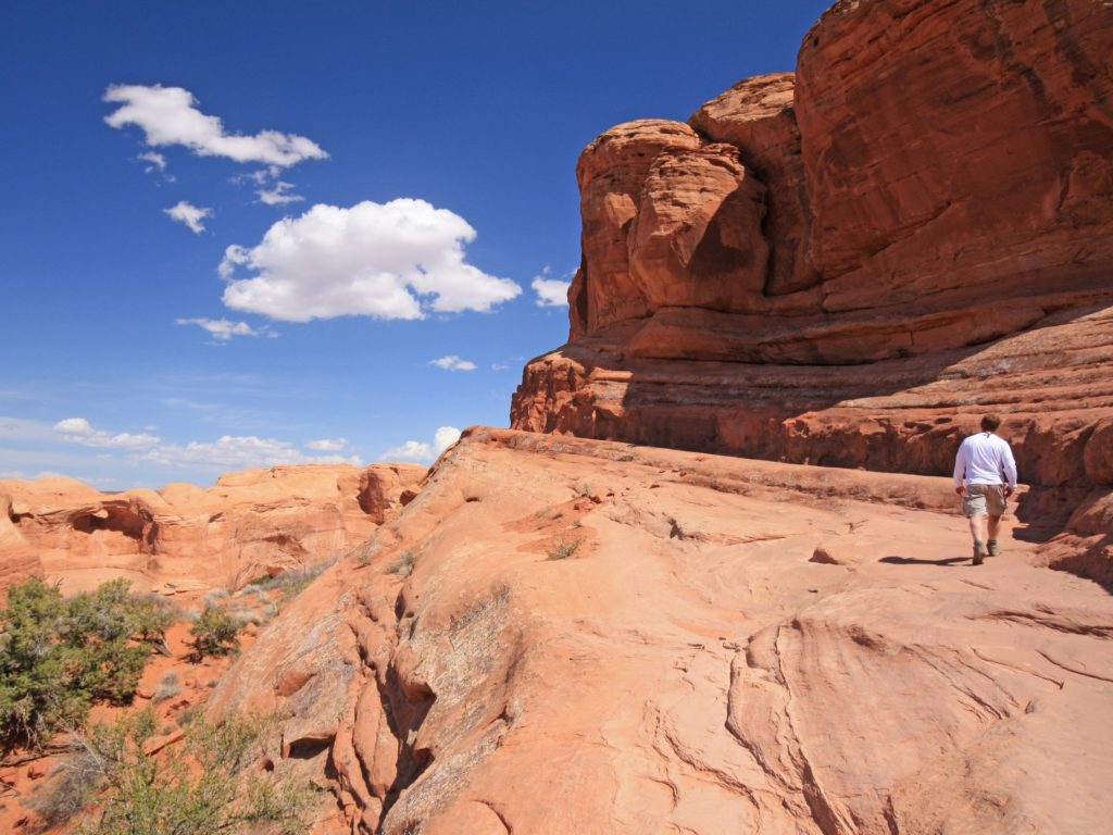
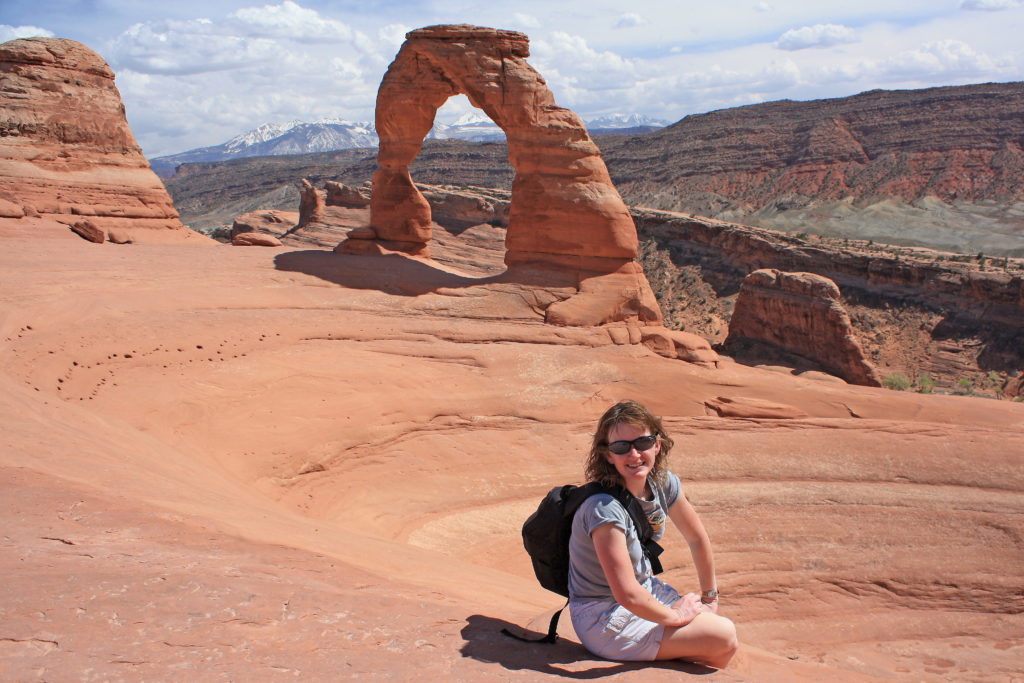
Next is the world’s most famous natural arch, Delicate Arch. Anyone who has seen a Utah license plate will recognize this unique arch. The opening under the arch is 46′ high and 32′ wide making it the largest free-standing arch in the park. There are three options for viewing the arch, all of which are accessed via a short side road 2.5 miles past Balanced Rock. For those not up to a moderate hike, I recommend visiting Upper and Lower Delicate Arch viewpoints. For those able to tackle a 3.0 mile roundtrip hike with 480′ elevation gain, I highly recommend the hike from Wolfe Ranch to the base of the arch. This trail is rated as difficult and involves some exposure to heights.
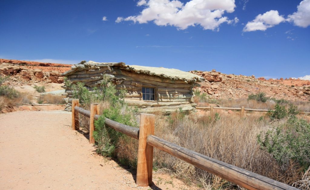
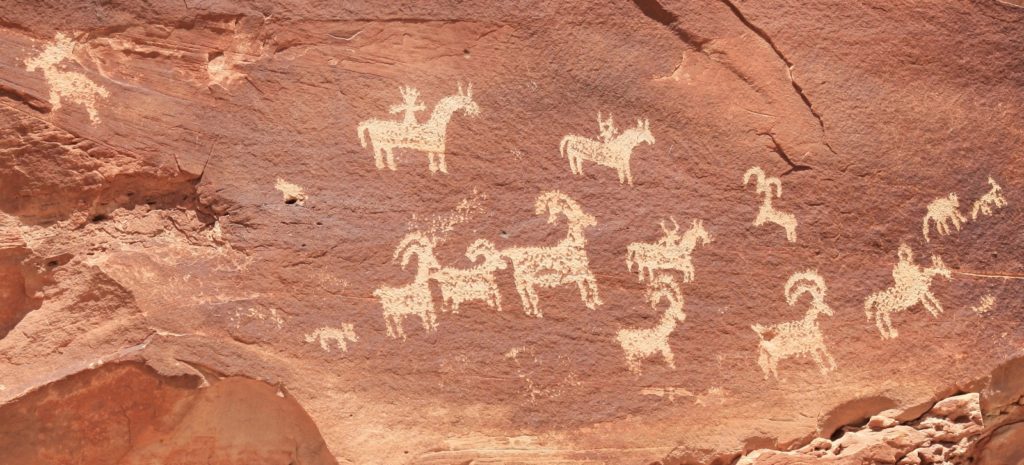
On your hike to Delicate Arch, be sure to pay a quick visit to Wolfe Ranch. Civil War veteran John Wolfe settled here in 1898. Seeking a drier climate for a nagging war injury, he and his son settled a 100+ acre property along Salt Wash. Just beyond the ranch is an excellent petroglyph panel depicting horse and riders surrounded by bighorn sheep. These are relatively modern glyphs that date to sometime between 1650 and 1850.
Devils Garden
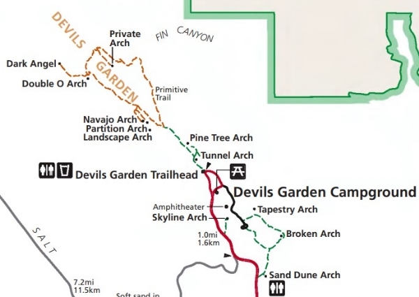
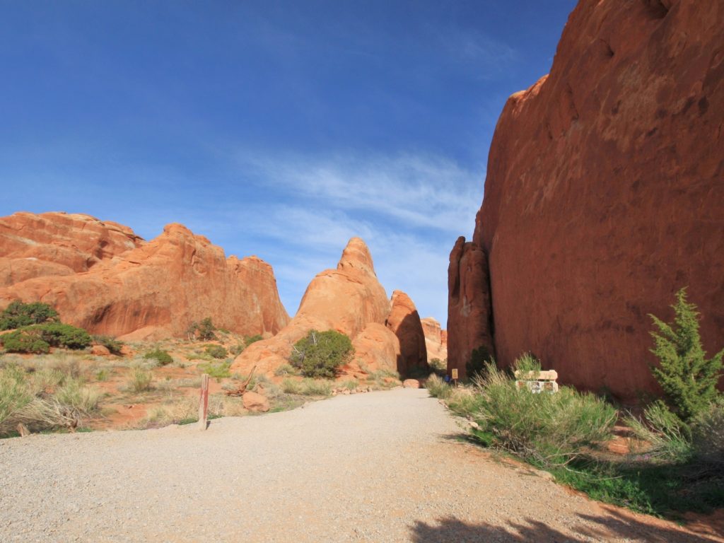
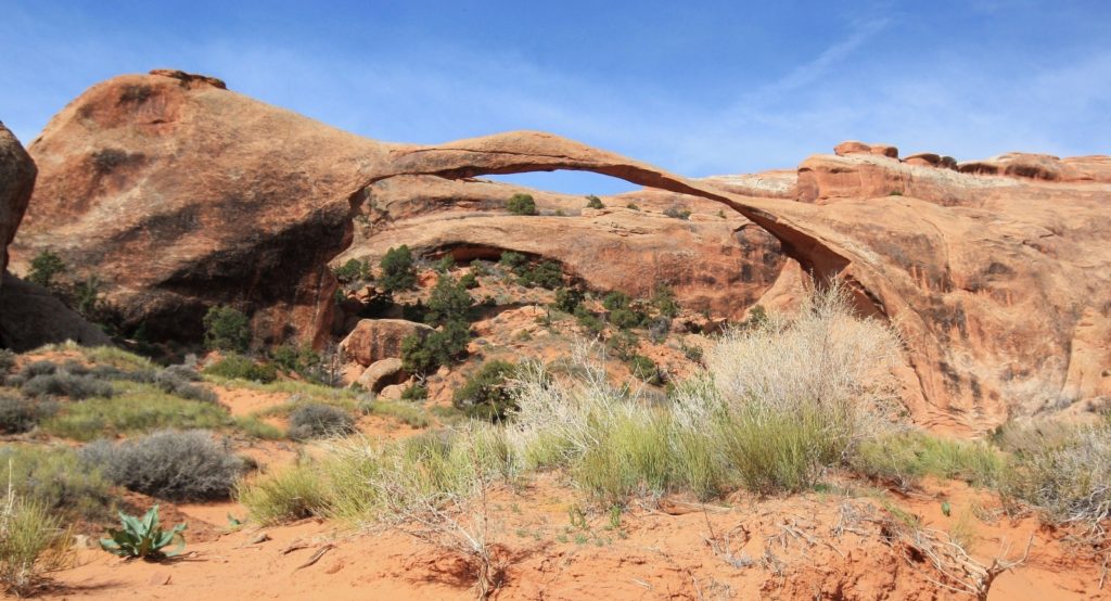
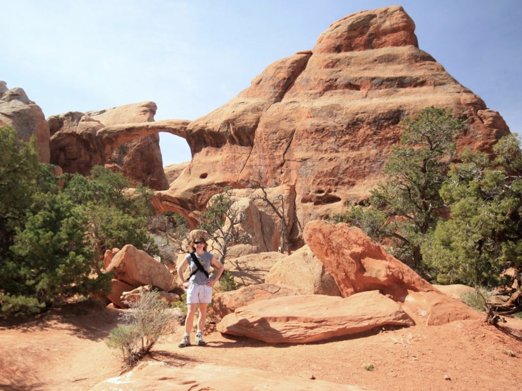
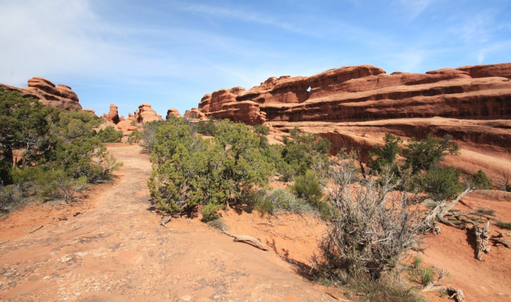
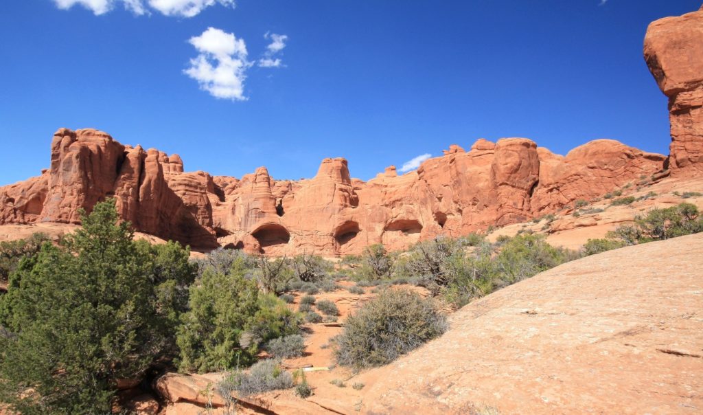
At the end of the main park road lies Devils Garden Campground and a couple different trails. One trail takes hikers to Tapestry, Broken, and Sand Dune arches. We still haven’t hiked this trail, but the arches looked interesting from the road. We have hiked the longer and more challenging Devils Garden Trail. That was our first Utah hike, ten years ago now. There are multiple route options here. Those wanting an easy hike can visit Landscape Arch. Landscape is a particularly lovely arch and well worth the 1.8 mile roundtrip hike along a well maintained trail that winds among massive sandstone fins.

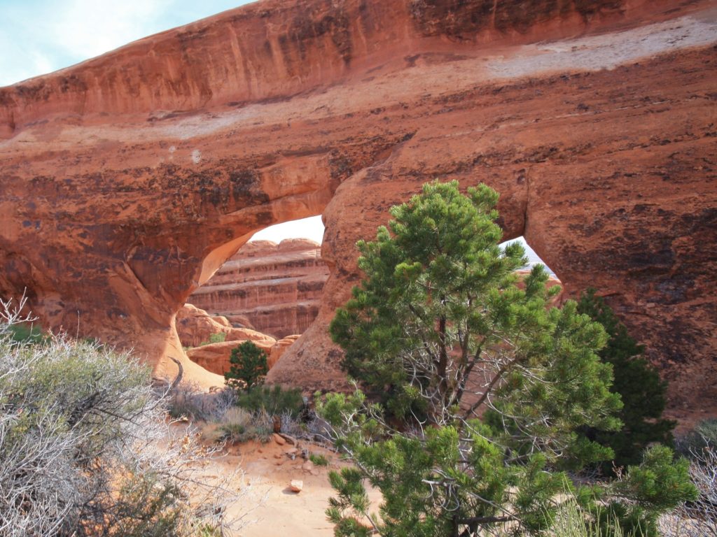
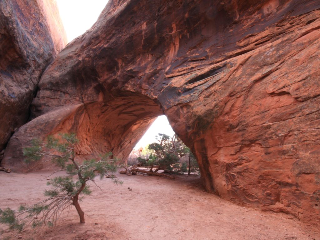
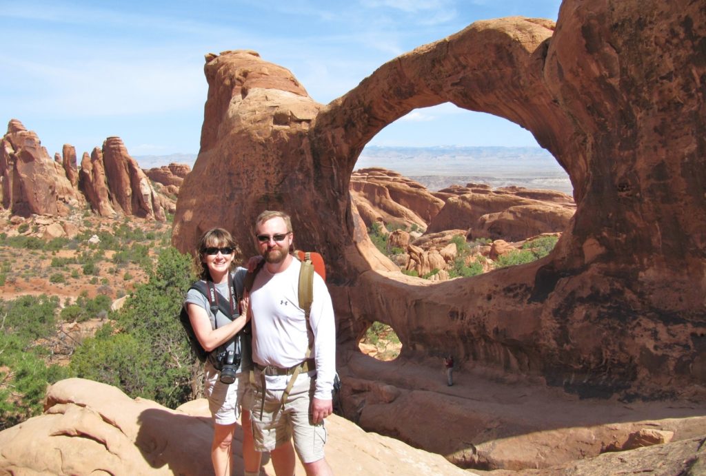
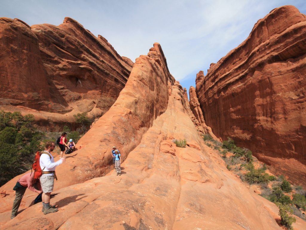
Those looking for a more ambitious adventure can continue on to Double O Arch. The trail beyond Landscape climbs steeply over sandstone slabs. This was our first time hiking on steep slickrock and navigating via cairns, so we felt like we were having a real adventure! A spur trail to Navajo Arch and Partition Arch is worth the side trip. Continuing on, the trail goes over uneven surfaces and narrow ledges with steep drop-offs as you navigate following cairns. Double O is a particularly photogenic arch. Be sure to climb through the arch and view it from the backside. Now you have a choice, you can turn around and retrace your steps back to the trailhead. This option is rated as difficult and is a 4.2 mile roundtrip hike. Or if you want even more adventure, consider the more primitive option.
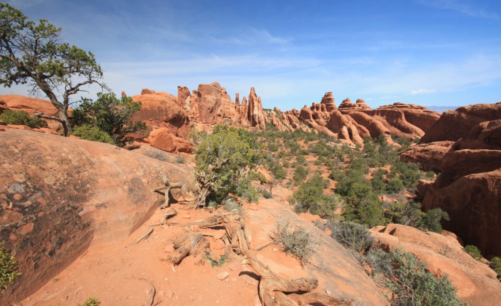
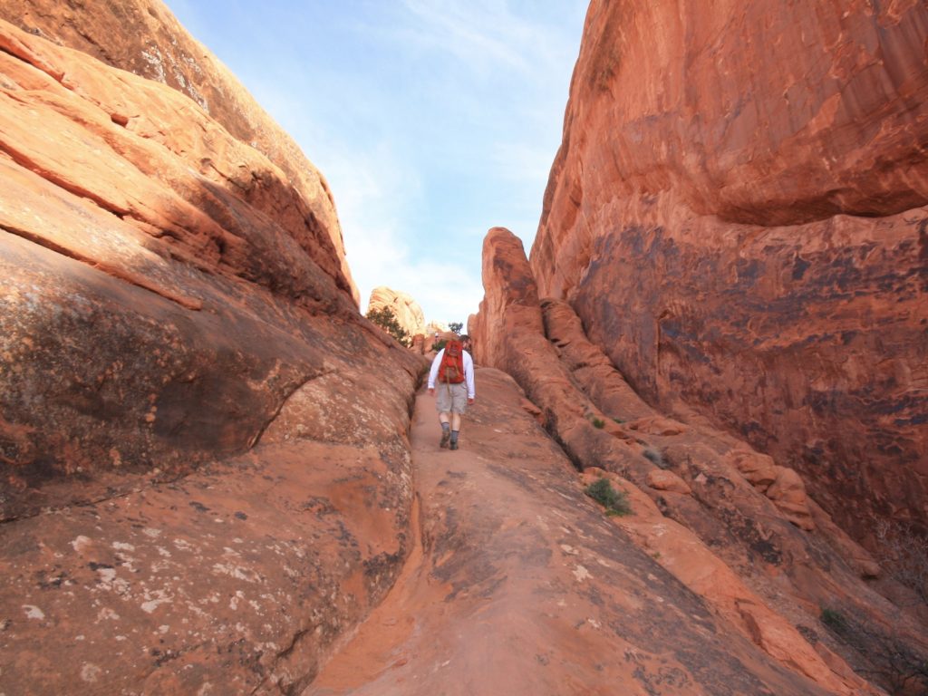
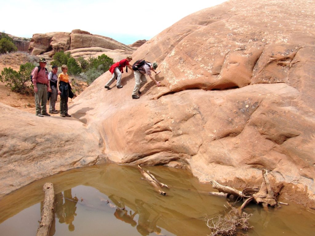
Those willing to double their mileage and navigate more difficult terrain might want to consider returning to the trailhead via the Primitive Trail. You’ll find few trail markers, steep slopes, narrow drop-offs, rock scrambling, and you’ll have to navigate around a water filled pool. But you’ll also find stunning scenery and very few hikers. This is a 7.9 mile roundtrip hike that is rated as difficult. I do not recommend this route for inexperienced hikers, but anyone with moderate route finding skills should definitely put this on their bucket list.

Logistics
Arches National Park is located in southeast Utah, five miles north of Moab on US 191. The park is generally open 24 hours a day and is very busy between March and October. The visitor center is open every day except Christmas Day. Check out their exhibits, movie, and bookstore and be sure to top off on water there before venturing into the park (the only other water source inside the park is at Devils Garden). Plan on spending a minimum of half a day in the park exploring the scenic drive and a few of the viewpoints and short trails. Those who like to hike and explore will want to plan several days here. Be sure to follow these safety tips for hiking in the desert and please stay on trail to protect this fragile desert environment. 1.5 million people visit the park each year and every person can have a huge impact on the landscape.
*Pro Tip: this is an extremely busy park. I highly recommend avoiding the area on weekends and holidays. Better yet, visit in the off-season for the most peaceful experience.
Services
- Devils Garden Campground is the only campground at Arches National Park. There are no other services within the park.
- The tourist mecca of Moab is just five miles south of the park entrance. Here you will find everything you need including gas, hotels, restaurants, RV parks, medical services, and grocery stores. Our favorite stop after hiking is Moab Brewery!
Nearby Attractions
Such SPECTACULAR scenery! I know I will never get there but, I enjoy it from your pictures and discriptions! The red of the rocks and how they somehow get piled in unique ways is Wonderful!
Amazing photos. Great trail advice. Awesome adventure! Thank you for sharing all this info. It looks like a lot of work went into putting this post together. I especially like the map snippets. Well done, guys!