Colorful rock formations delight hikers on this steep and rocky trail
Distance: 4.0 miles round trip give or take depending on route choice
Type: lollipop
Difficulty: moderately strenuous with a total elevation gain around 900′ (most of the gain is over a half mile rocky stretch)
Best season: spring and fall (hot in summer, icy in winter)
Finally, I would get to see Smith Rock State Park. This busy park just north of Bend, Oregon had been high on my bucket list for about eight years. At a seven hour drive from home, it was always just out of reasonable reach for a weekend trip. For years I watched for the perfect opportunity.
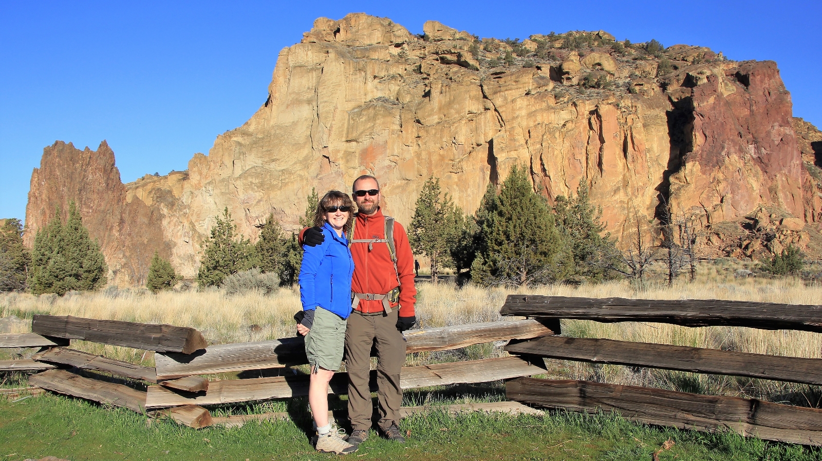
This past April, we had a two week Utah vacation that fell through at the last minute due to some issues at home. We were able to regroup after a few days and still had a little over a week to go explore somewhere. With spring weather arriving in Bend, we seized the opportunity to finally explore Smith.
After a beautiful driving day and nice hikes at Hat Rock and White River Falls state parks, we awoke to 30 degrees and a layer of frost covering our car at a hotel just outside Smith. It was a chilly start to the morning, but the forecast was for blue skies and temperatures reaching near 70 degrees. It would be a perfect spring day on the trail.
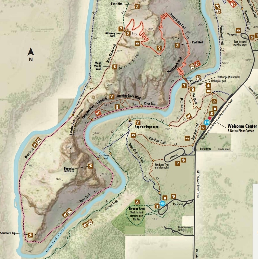
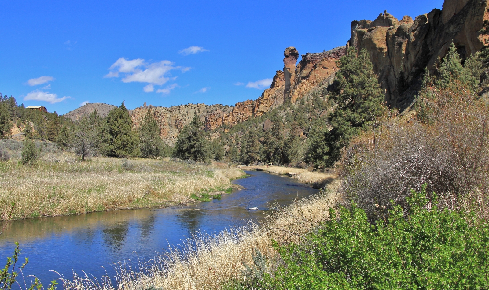
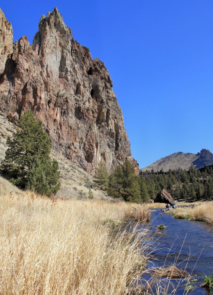
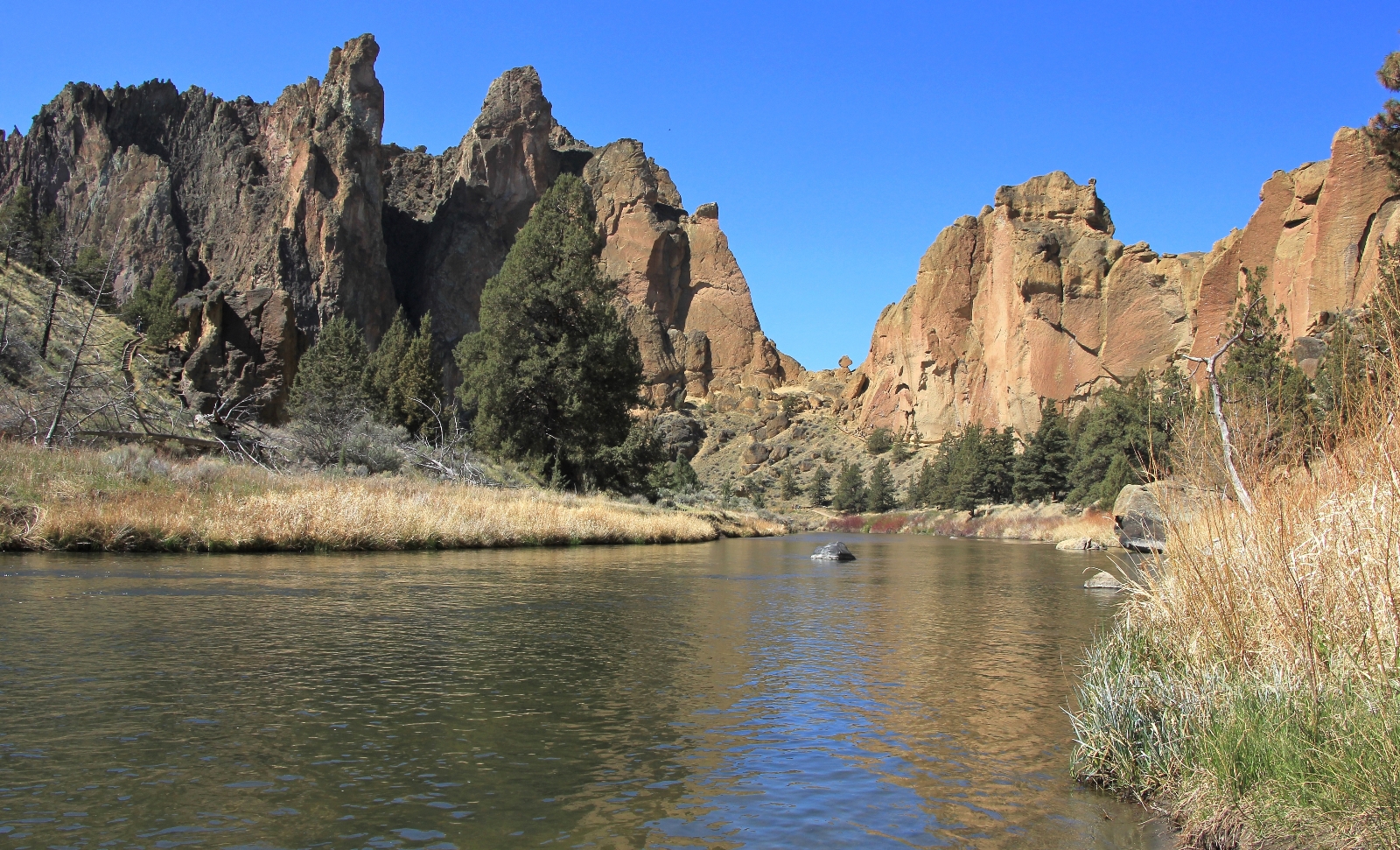
Smith Rock is a 650 acre state park in central Oregon’s high desert. Its towering cliffs of tuff (compressed volcanic ash) and basalt present nearly two thousand rock climbing routes. At first glance, it really just looks like a big rock sticking out of the otherwise flat landscape. Upon closer inspection of a map, Smith is a maze of towering rock walls with fun names like Dihedrals, Marsupials, Monkey Face, Christian Brothers, Morning Glory Wall, Rope-de-Dope, Ships and Gullies, and West Side Crags. If those names aren’t enough to stir the imagination, the colors and shapes of the rocks, snaking waters of Crooked River, and far reaching views of snow-covered Cascade peaks will make you forget an outside world exists.
In addition to its popularity as a world class rock climbing location, Smith also offers trails of all difficulty levels including the popular Misery Ridge Loop and the longer and quieter (but no less impressive) Summit Trail Loop. I planned for us to spend two days at Smith with one day dedicated to each of these trails. The Smith Rock hiking guide rates both of these as “most difficult”, but there are trails here for everyone. Check out the park’s excellent trail guide to find the best option for you.
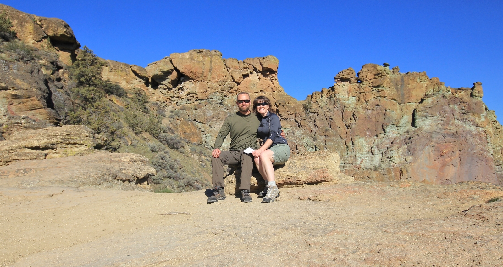
We arrived at Smith shortly after 8:00 and found it was already relatively busy, especially considering it was a week day. If visiting on a nice spring day, I suggest getting there early. Smith has pretty simple facilities, the visitor center is in a yurt and the only bathrooms I saw were portable honey-buckets up top and a fancy composting toilet down in the canyon.
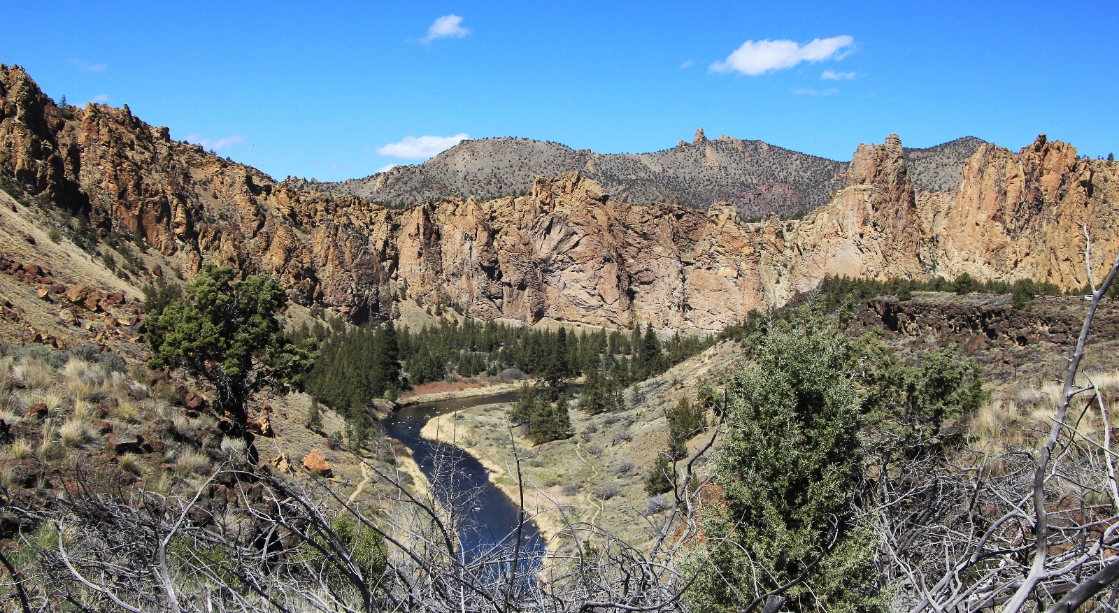
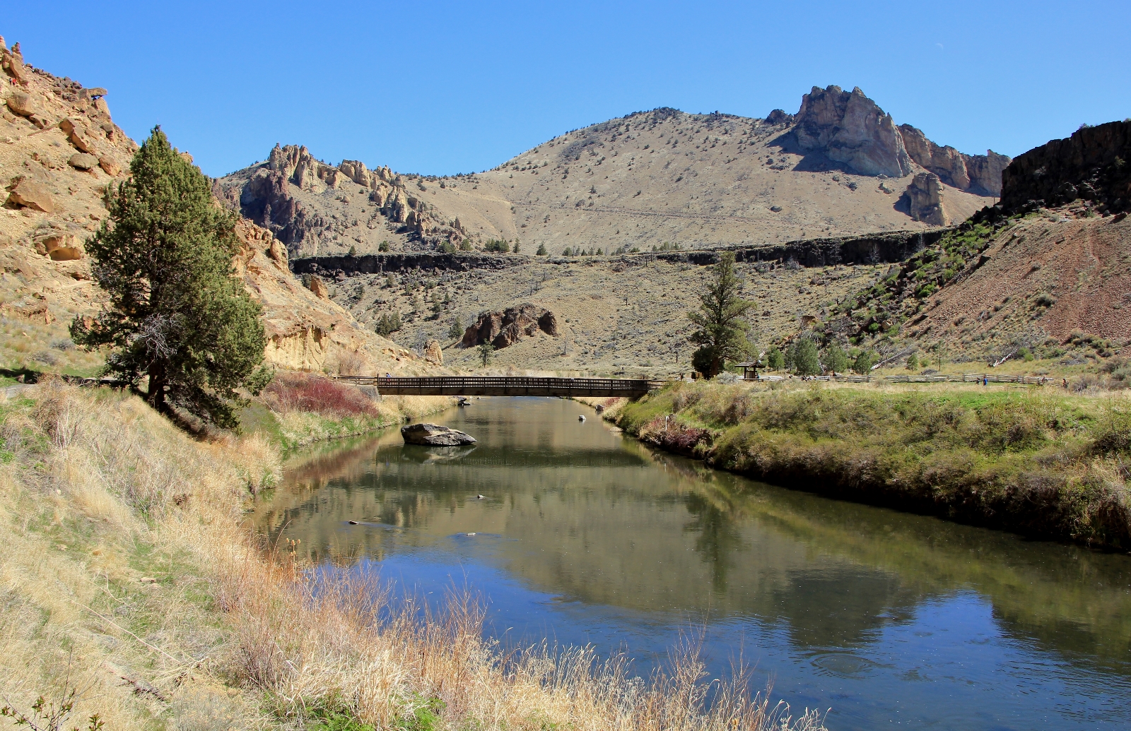
From our parking spot near the visitor center (elevation 2,846′), we started out on the Canyon Trail and were immediately treated to beautiful morning light and phenomenal views across Crooked River over to Picnic Lunch Wall.
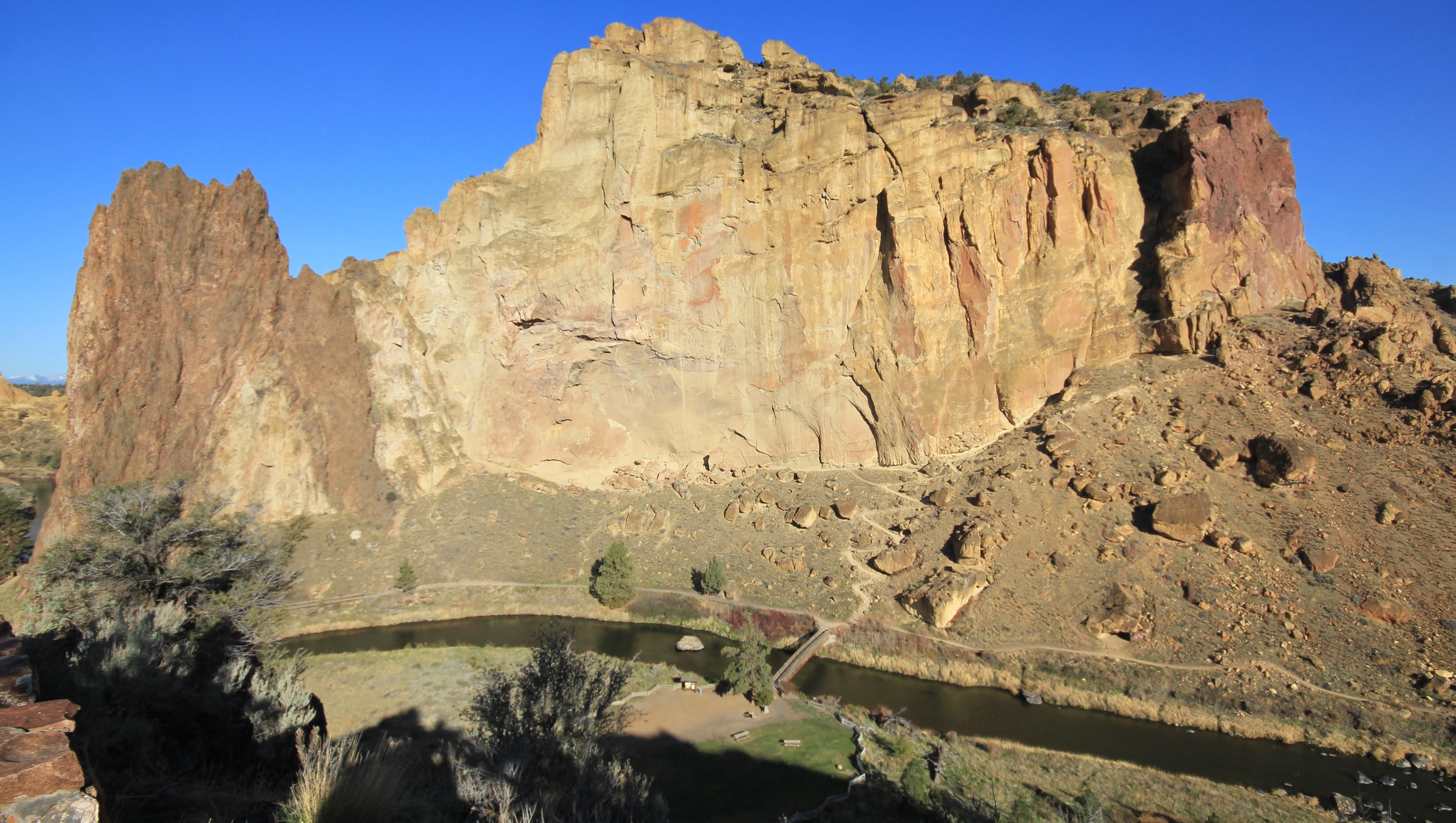
After just 0.2 miles on the Canyon Trail, we turned right onto the Chute Trail which quickly dropped us 200 feet over just 0.1 miles of steep rocky trail. Here we found a large flat area with helicopter pad for emergency evacuations, information kiosk, water fountain, composting toilet, and nice footbridge across Crooked River (elevation 2,660′).
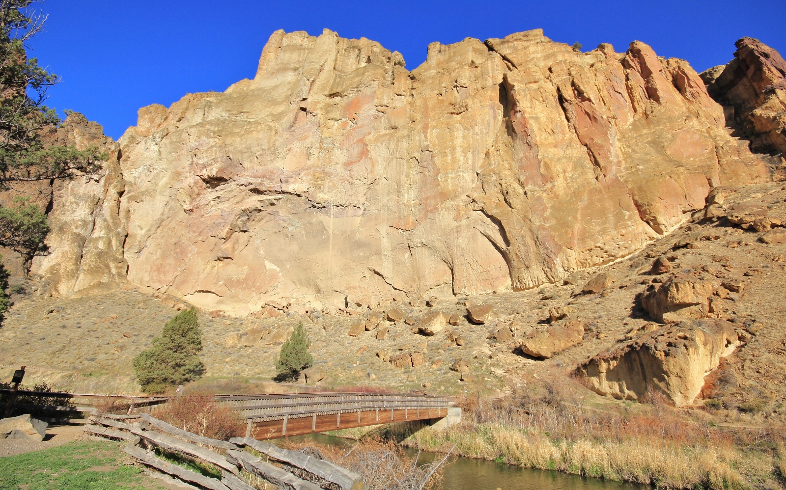
We crossed the footbridge and immediately found ourselves at a three way junction. To the left and right, the River and Wolf Tree trails follow Crooked River. In front of us was the Misery Ridge Trail with a “Caution: Steep Rough Trail” sign. We continued straight and immediately began our ascent up Misery.
![]()
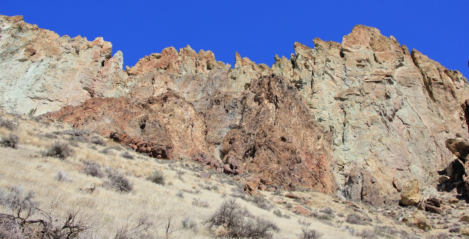
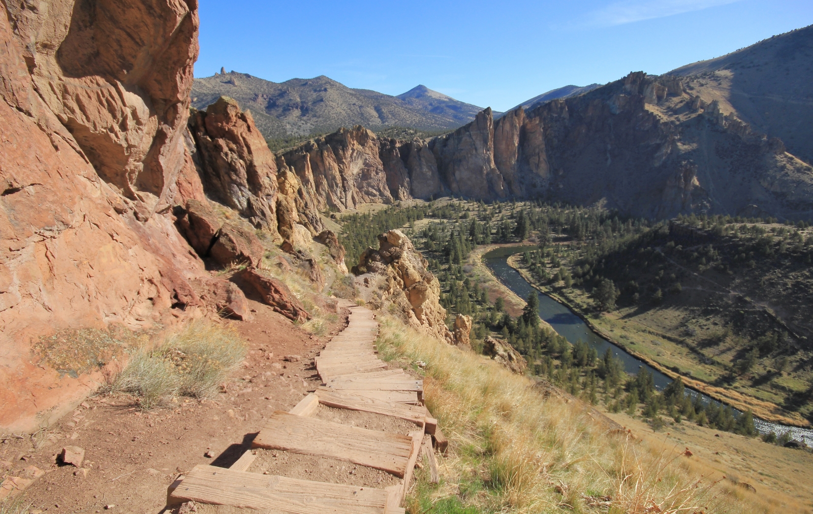
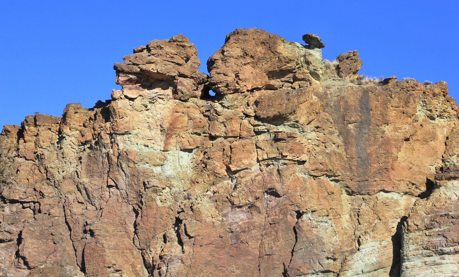
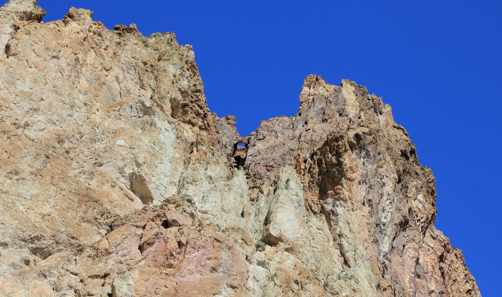
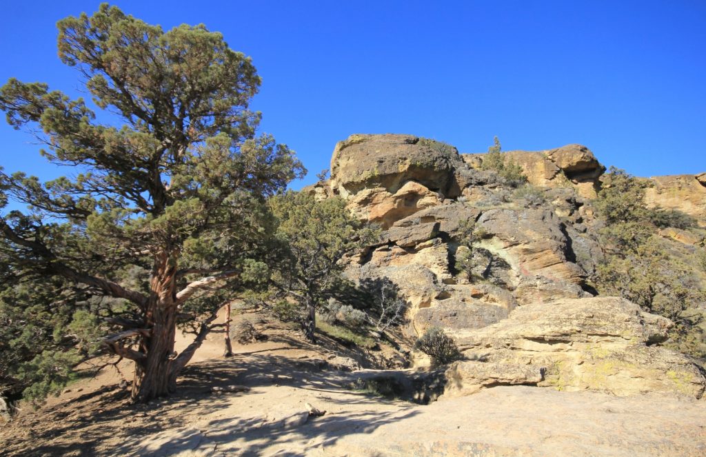
For the next 0.68 miles, it was a steep and sometimes rocky climb to the summit at 3,360′ elevation. First was a series of tight switchbacks below Picnic Lunch Wall. We’d had a great view of these from the start of the Canyon Trail—now we were huffing and puffing our way up them. The morning sun was casting a beautiful glow on the rocks and it was hard to go more than a few steps without stopping for a photo.
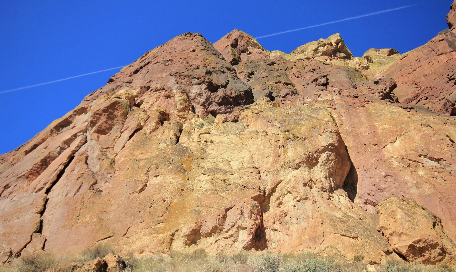
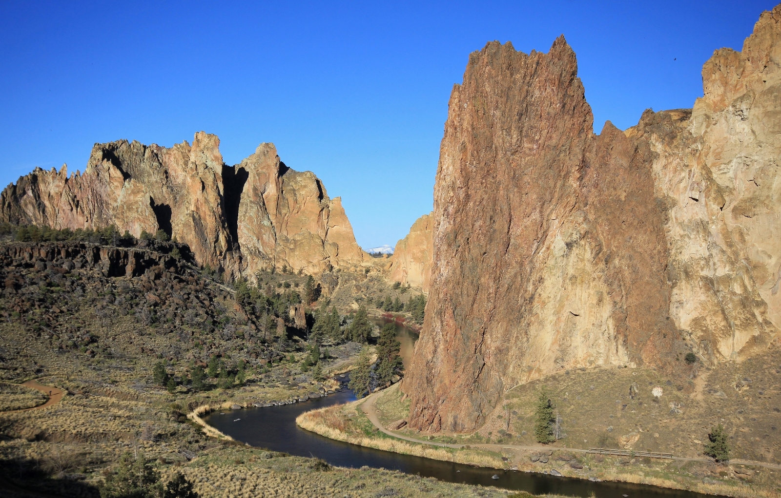
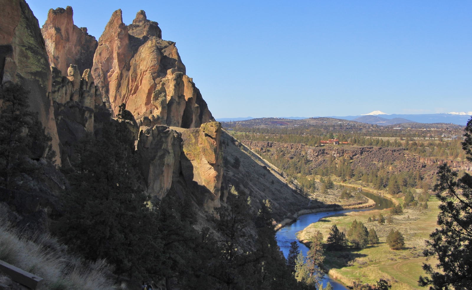
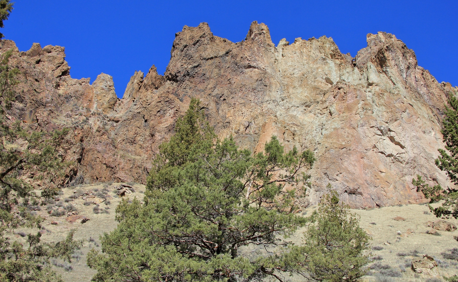
Continuing on, the trail moderated a bit and we had fantastic views to the northeast toward our route for the following day. We passed under Ship Rock and then Red Wall where the rocks were a stunning assortment of colors.
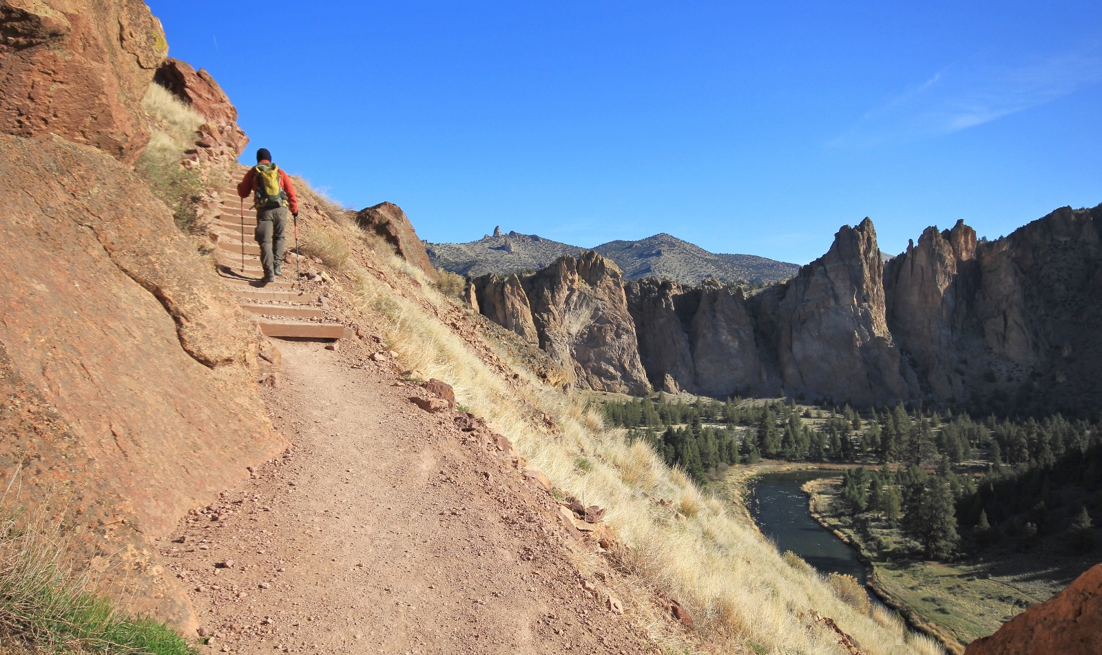
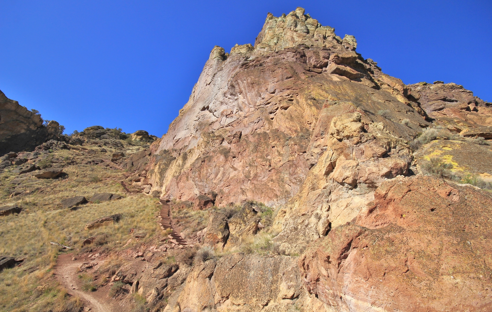
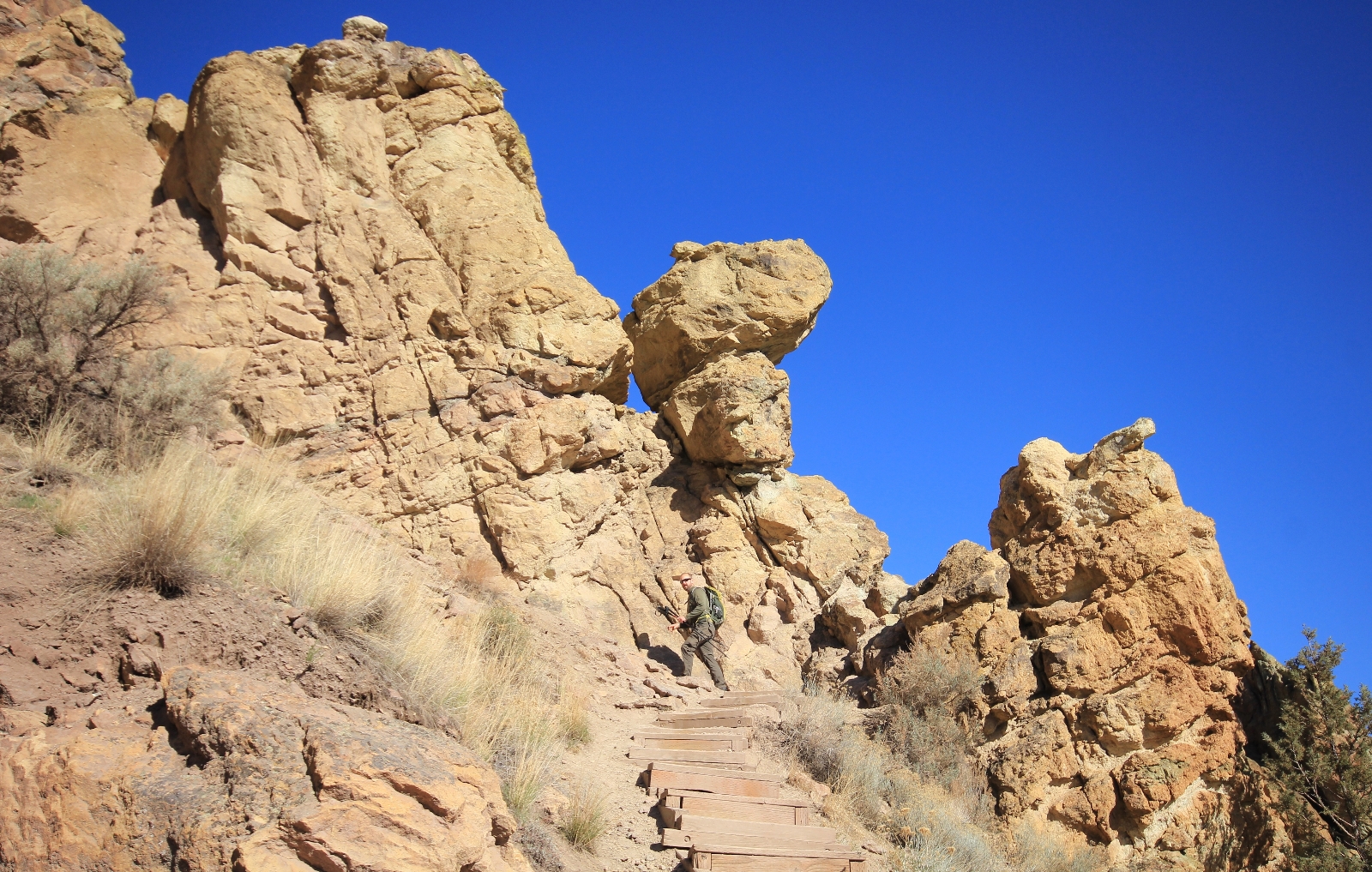
Continuing on, the trail again became steep and rocky. In areas with the worst erosion, park staff have placed wooden steps which really helped improve our footing.
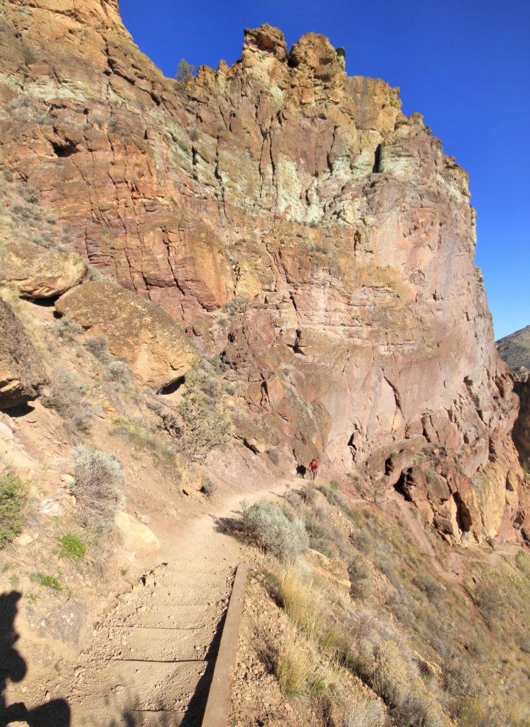
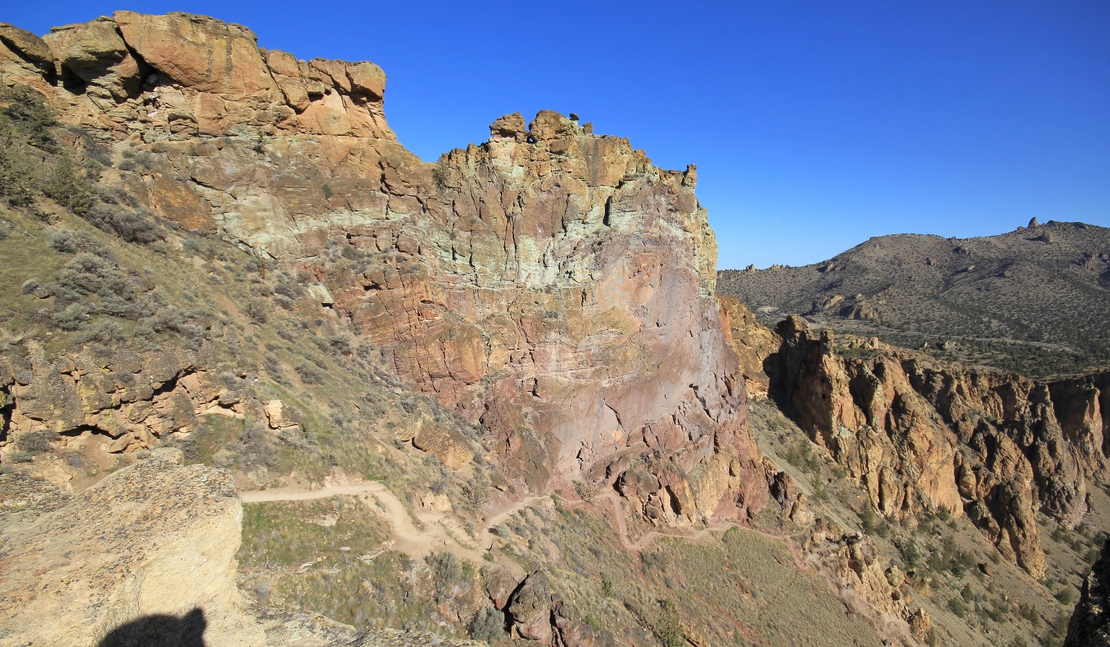
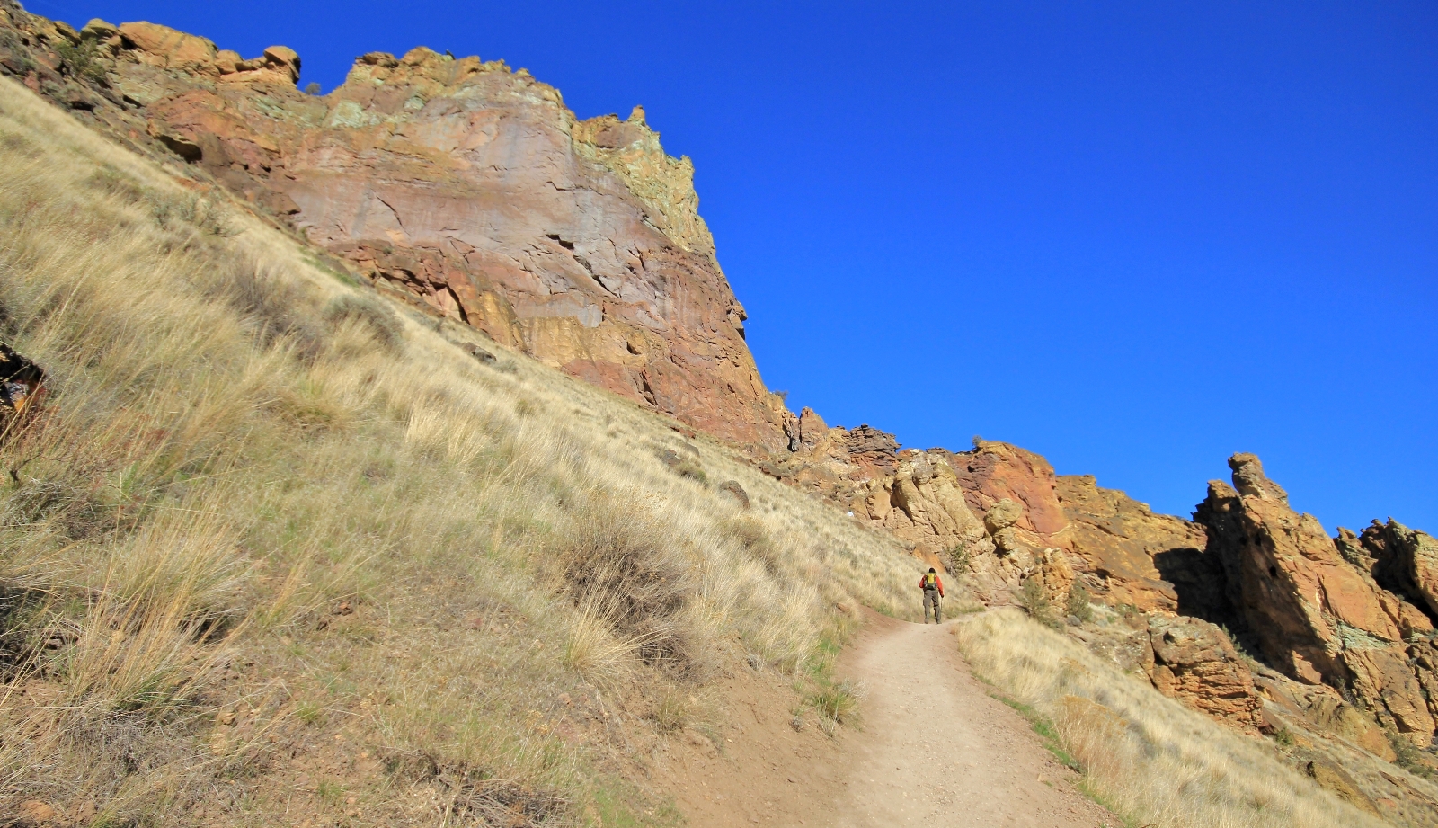
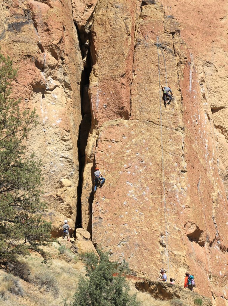
At approximately one mile from the trailhead, we arrived at a viewpoint. We took a short break for photos and to enjoy the view. We struck up a conversation with two Portland men in their 50s who were on their way to climb Monkey Face, a colorful tower on the west side of the park. We met up with them again later at the base of Monkey. We had never talked with rock climbers before and really enjoyed our conversation with them.
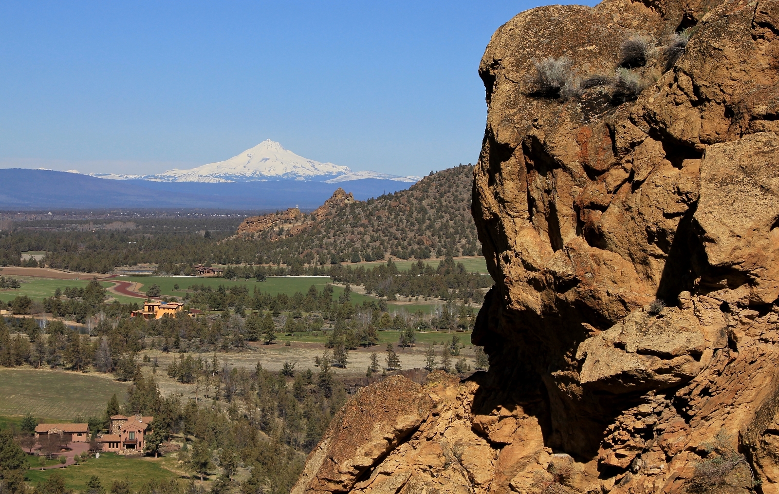
Past the viewpoint, the elevation gain once again moderated and we were treated to stunning views of snow-capped Cascade peaks to the west. In the distance, Mt. Bachelor, Sisters, Three Fingered Jack, Mt. Jefferson, and even far off Mt. Hood to the north were visible on this beautiful spring day.
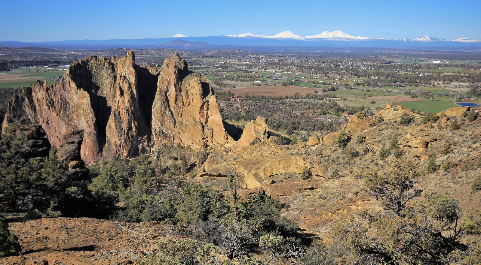
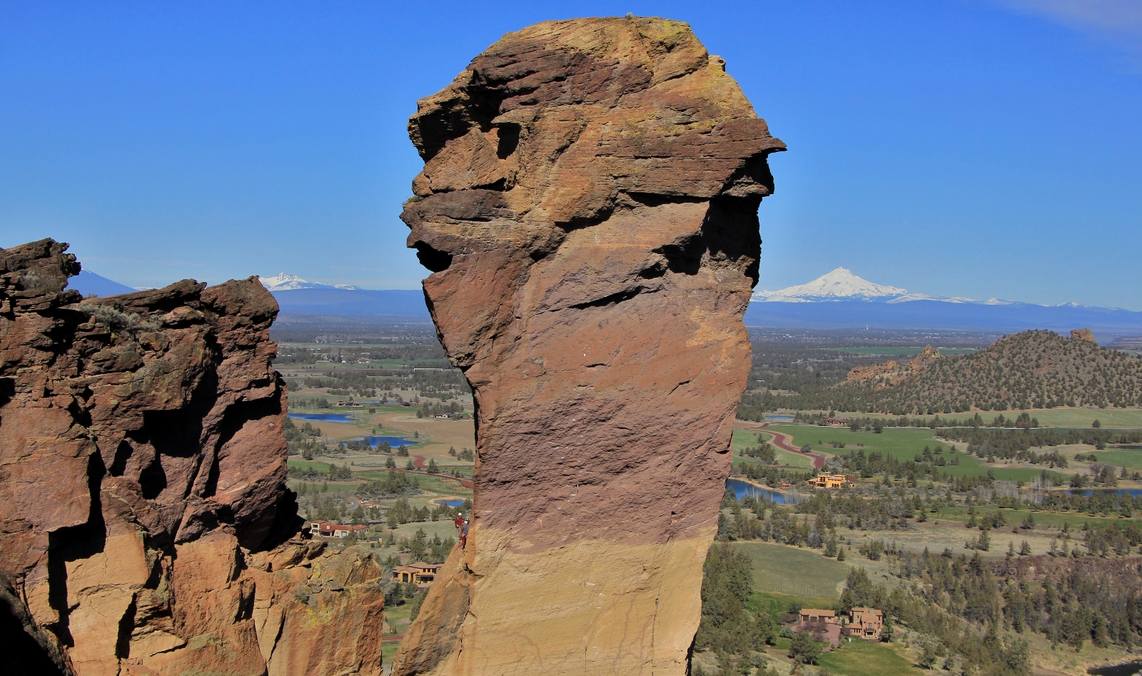
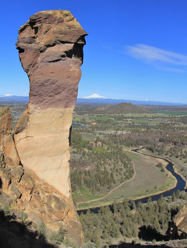
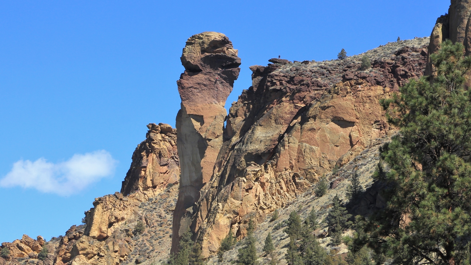
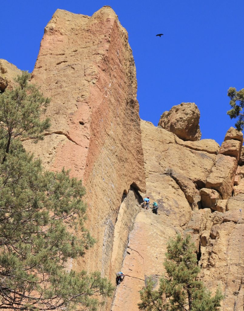
Within about a third of a mile past the first viewpoint, we arrived at an overlook of one of the park’s most iconic rocks, Monkey Face. Here we had another fun conversation with a couple from the Seattle area. This was their first time at Smith Rock and they were watching three of their friends climb Monkey.
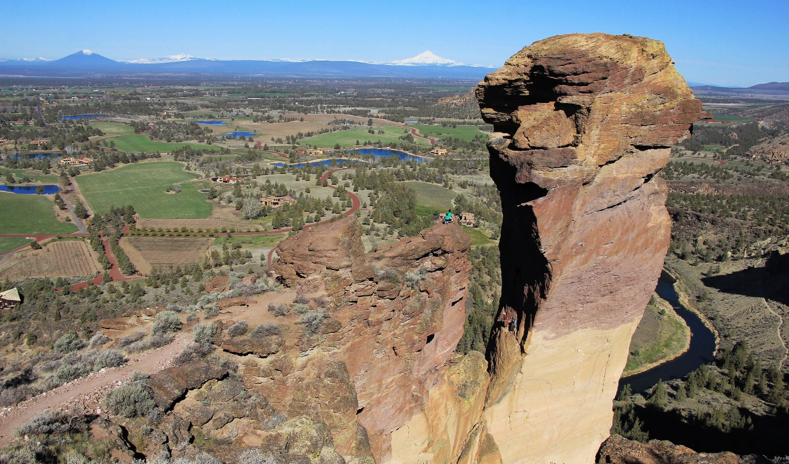
According to www.mountainproject.com, Monkey Face holds some of the most challenging rock climbing routs in the world. I know nothing about rock climbing, but some of the route names are entertaining. Monkey Space, Monkey Off My Back, Just Do It, Spank the Monkey, and Astro Monkey are just a few of the routes up this photogenic rock.
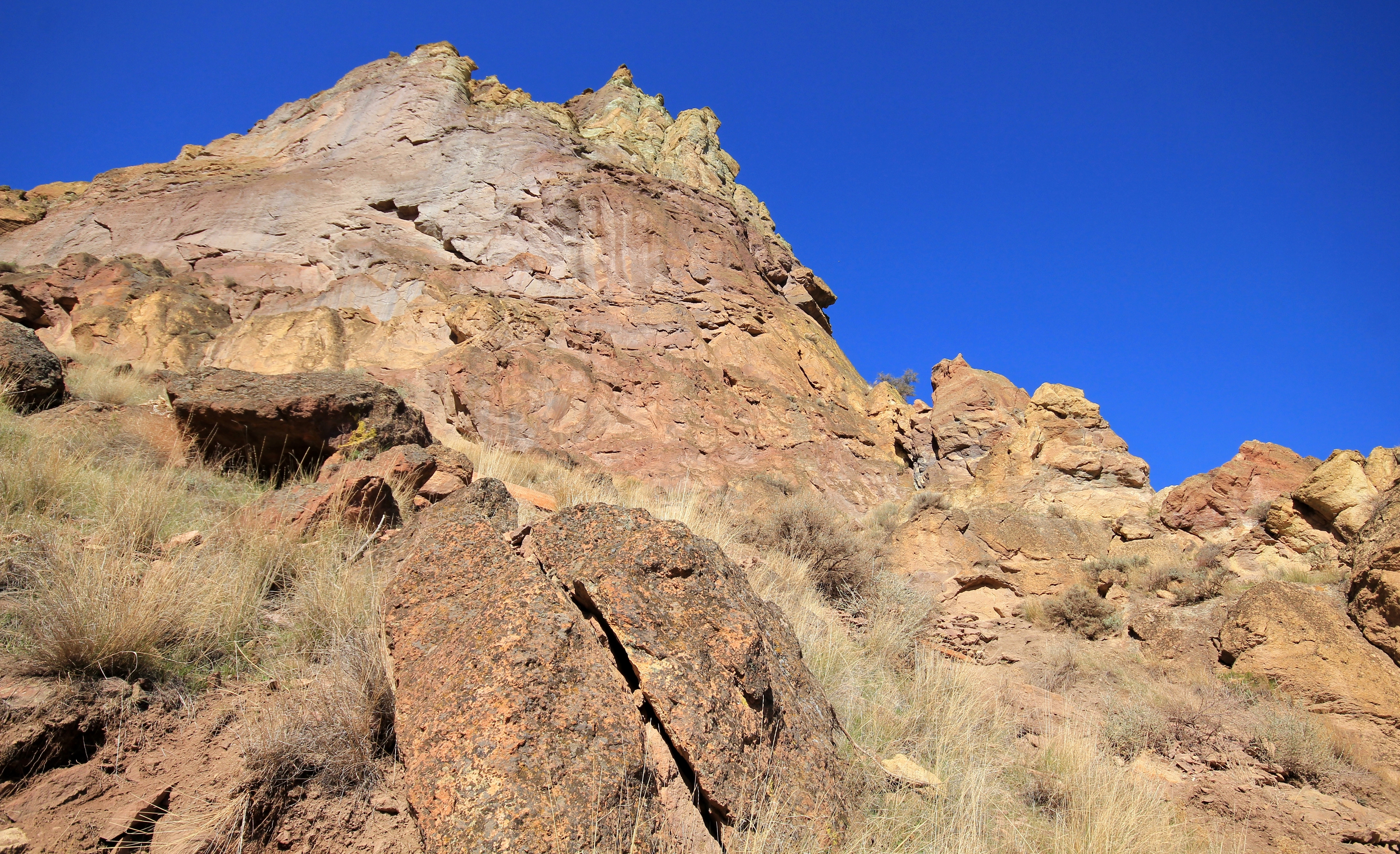
Past the overlook, the trail immediately began a steep quarter mile descent down the back side of Misery Ridge. Footing on this section of the trail was precarious as we dropped over scree covered switchbacks.
At the base of Monkey Face, we turned left onto the Mesa Verde Trail which dropped us another half mile to the River Trail along the banks of Crooked River at 2.0 miles from the trailhead. We took a nice break here on a sandy beach.
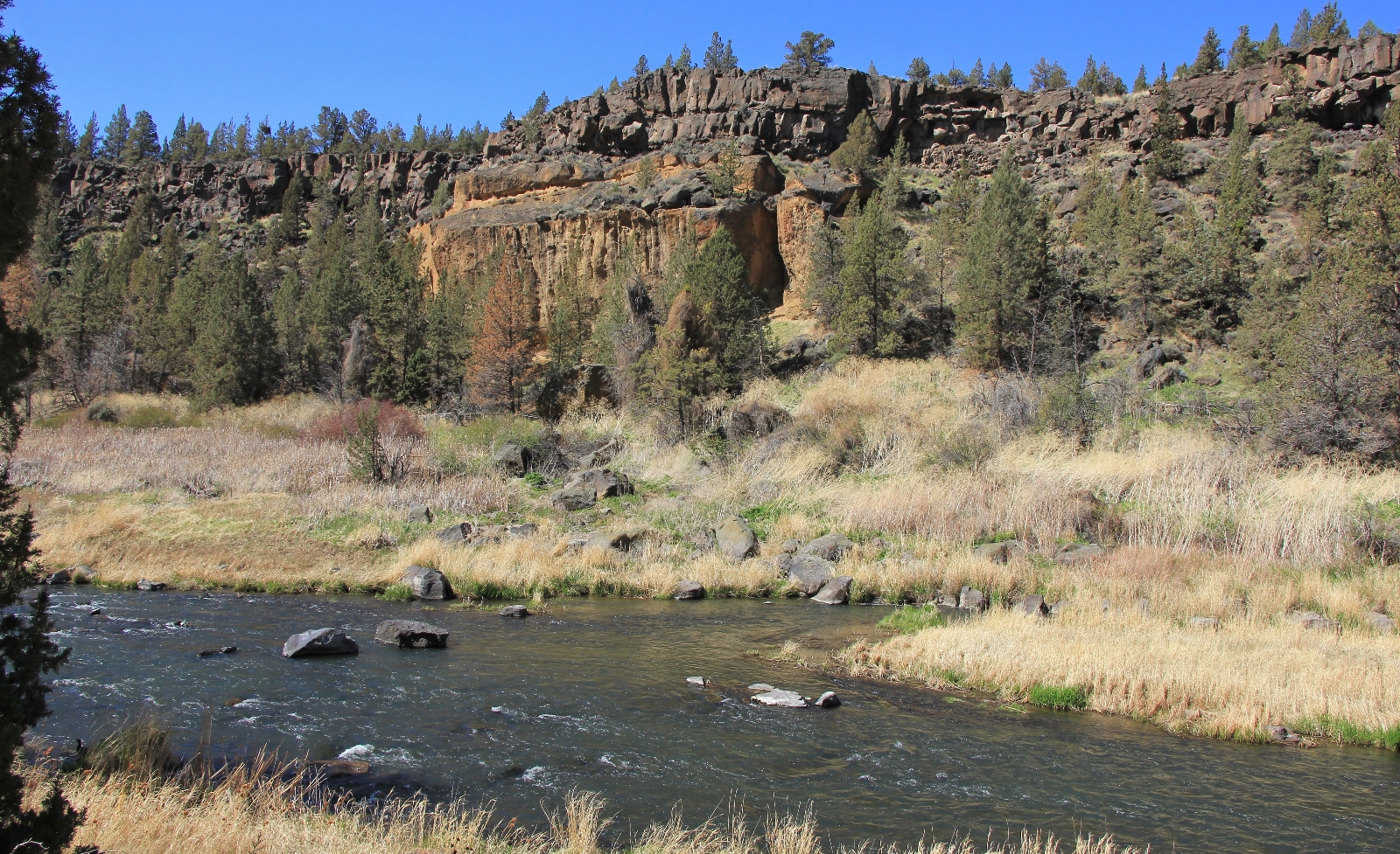
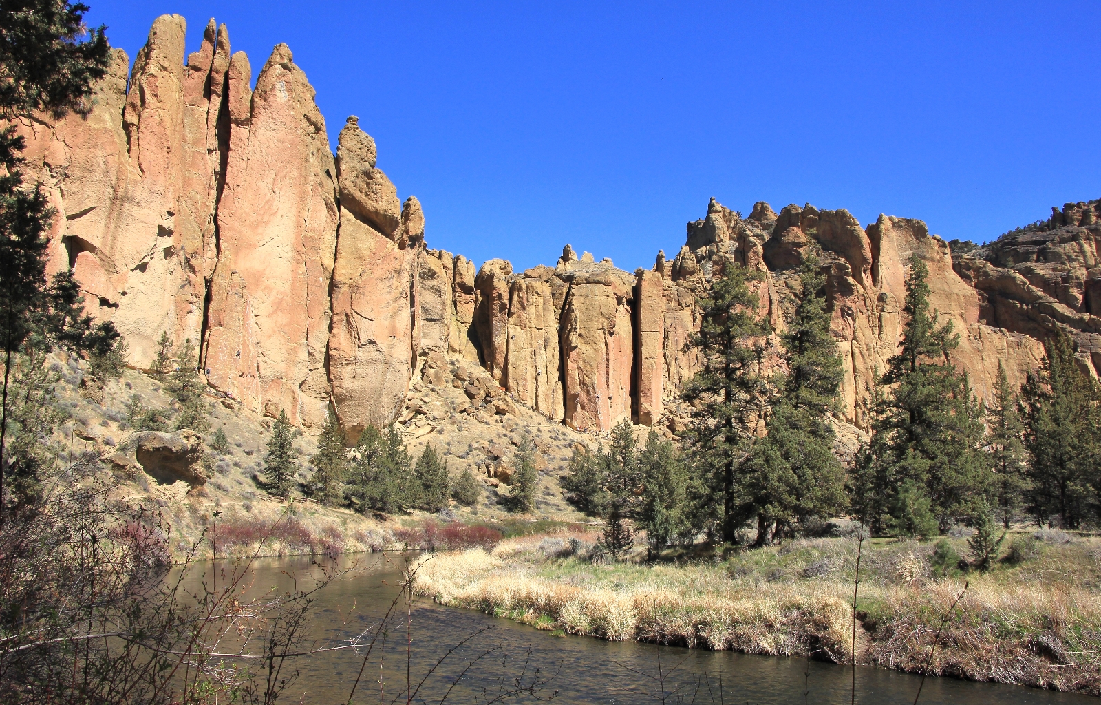
Now headed south along the River Trail, we enjoyed an easy return hike along flat trail. While the hiking was easier, the views were no less impressive. We enjoyed the quiet gurgle of Crooked River to our right while colorful cliffs towered to our left.
After working our way around Southern Tip, we began seeing significantly more people on the trail—mountain bikers, trial runners, hikers, and climbers on their way to their favorite route. Everyone was enjoying the beautiful spring day. By now we were in full sun and had stripped down to t-shirts and shorts. What a treat after a long, cold winter!
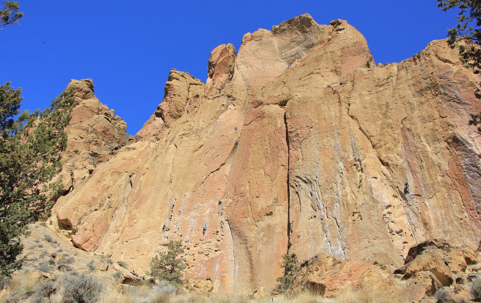
As we looped our way back around to the footbridge over Crooked River, we began seeing climbers on every rock face. We passed Christian Brothers, Dihedrals, and Morning Glory Wall. These appeared to be very popular climbing routes and we enjoyed watching the tiny specks slowly make their way up the colorful walls.
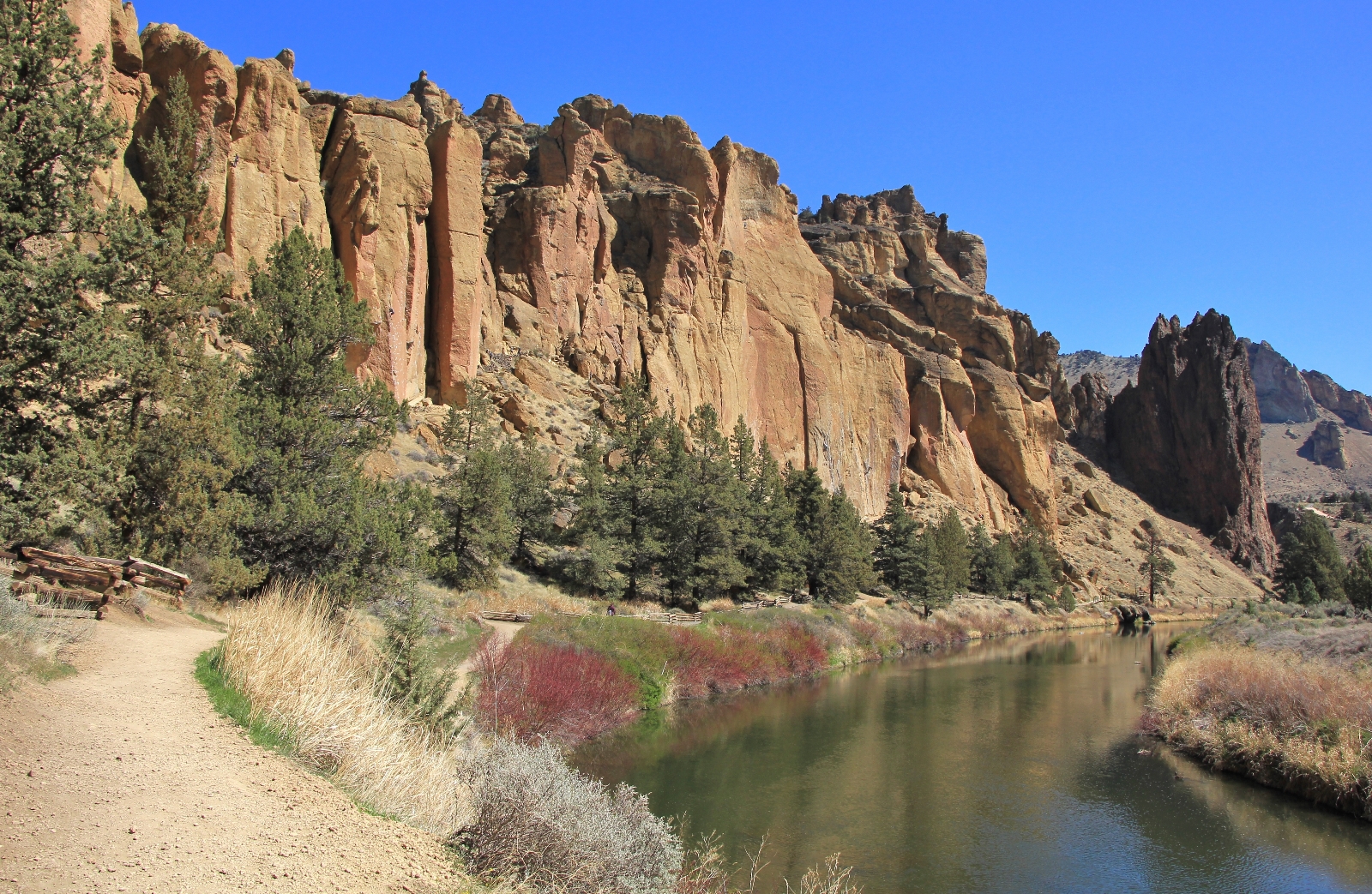
Back across the footbridge, we had hiked just 3.8 miles and were wanting more adventure for the day. To extended our hike, we turned right onto the Canyon Trail instead of returning to the parking lot via the Chute Trail. Be sure to check out our next post to see what we thought of our hike along the Canyon Trail!
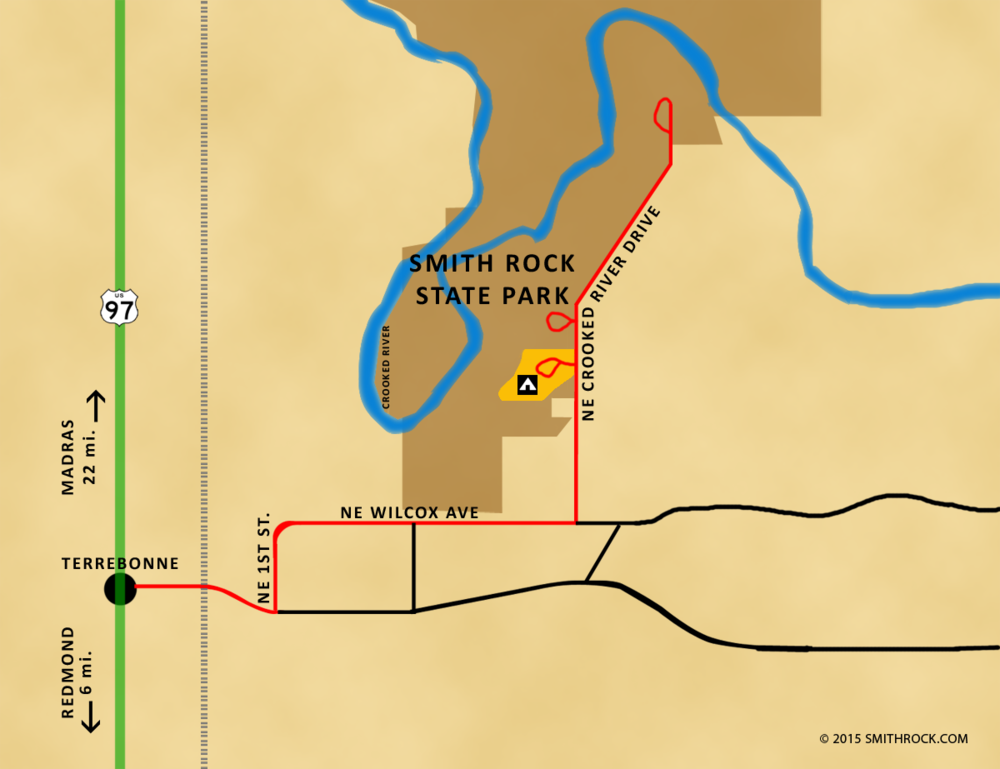
Directions to Smith Rock State Park: from Redmond, Oregon, travel north on US 97 six miles to the small town of Terrebonne. Turn right at the sign for Smith Rock State Park and follow signs the short distance to the park. An Oregon State Park Pass or daily pass ($5) is required for all visitors. There are three fee stations available (one in RV parking lot, one just past the yurt Welcome Center, and the Northern Point area at the end of the road (closed during winter months). Open dawn until dusk daily.
Related Posts:
Check out these other hikes from our April 2018 Oregon vacation:
Oregon’s Columbia River Gorge: Hat Rock State Park
Central Oregon’s White River Falls State Park
Central Oregon’s Smith Rock State Park: Canyon Trail
Central Oregon’s Smith Rock State Park: Summit Loop
Central Oregon’s Deschutes River: Dillon Falls
Central Oregon’s Steelhead Falls
Oregon’s Santiam Foothills: Shellburg Falls
Oregon’s Silver Falls State Park: Trail of Ten Falls
Washington’s Columbia River Gorge: Coyote Wall
Oregon’s Columbia River Gorge: McCall Point & Rowena Plateau
Got Gear?
Click here to see some of our tried and true gear. By accessing Amazon through the links on this page, you get the same GREAT Amazon pricing and they share a little with us. This helps us maintain evansoutdooradventures and is much appreciated! Thank you to our supporters!
You covered this well known place well , one that I frequent often because my oldest son is an avid rock climber along with two of my grandsons . I’m not a climber , but go there for the hikes and photographing the climbers . You picked the best time to go there also , because in the early to mid summer it gets packed with people and can be very warm too .
Thank you Rich,
Smith sure did live up to the bill! The hiking was superb and we really enjoyed watching the rock climbers. In addition to exceptional strength and physical conditioning, it seems to me that it must be an extremely mental sport as well. I can really respect something that ties the mind and body together. I was glad we waited for a nice spring day. I can’t imagine being there in the summer!
Happy holidays to you and your family Rich. May 2019 bring many wonderful hikes and waterfall photos 🙂
Lusha