Three day backpack into Utah’s famed Coyote Gulch
Distance: 26.5 miles
Type: out and back
Difficulty: moderate (beware of poison ivy, especially near the springs in Coyote Gulch)
Best season: spring and fall
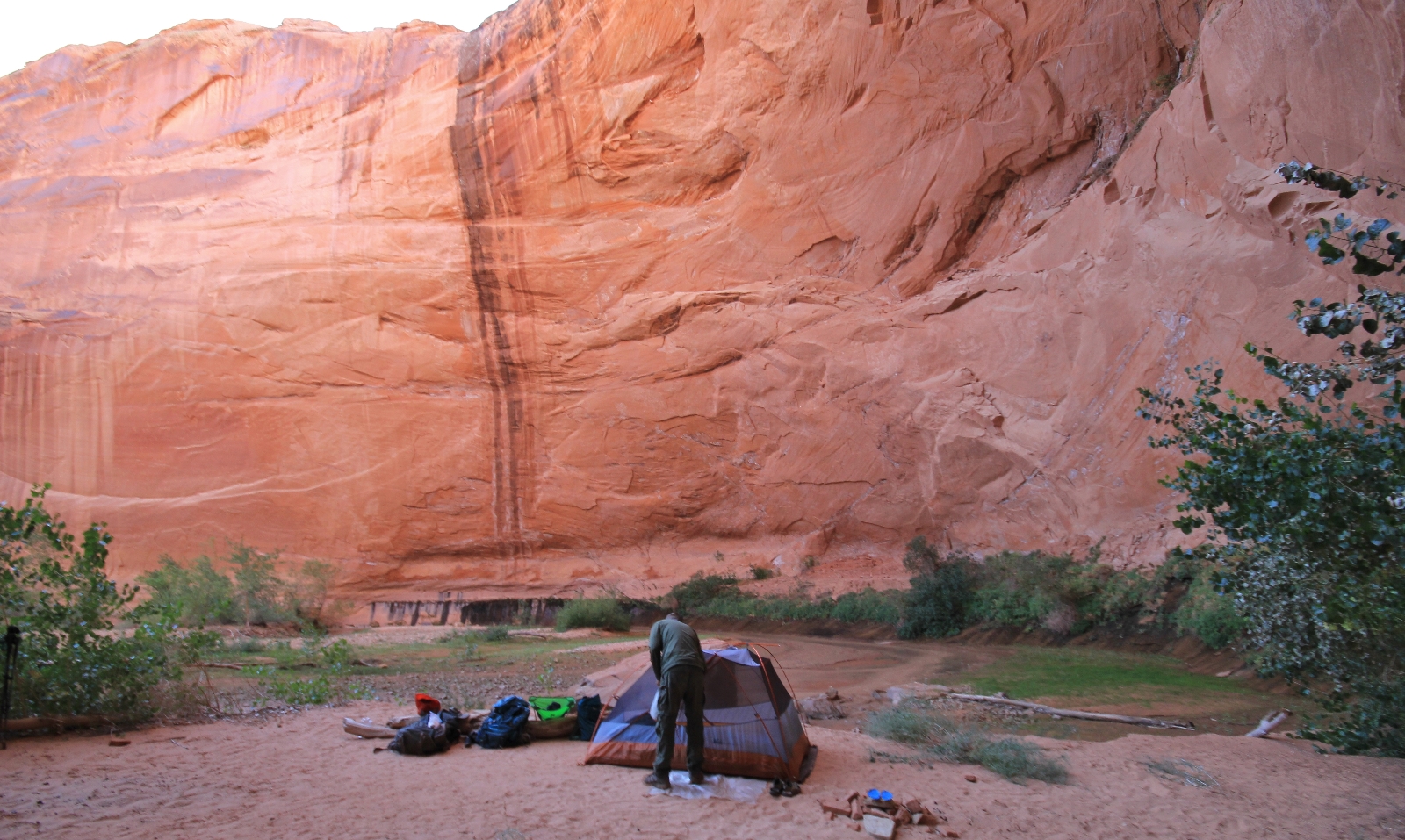
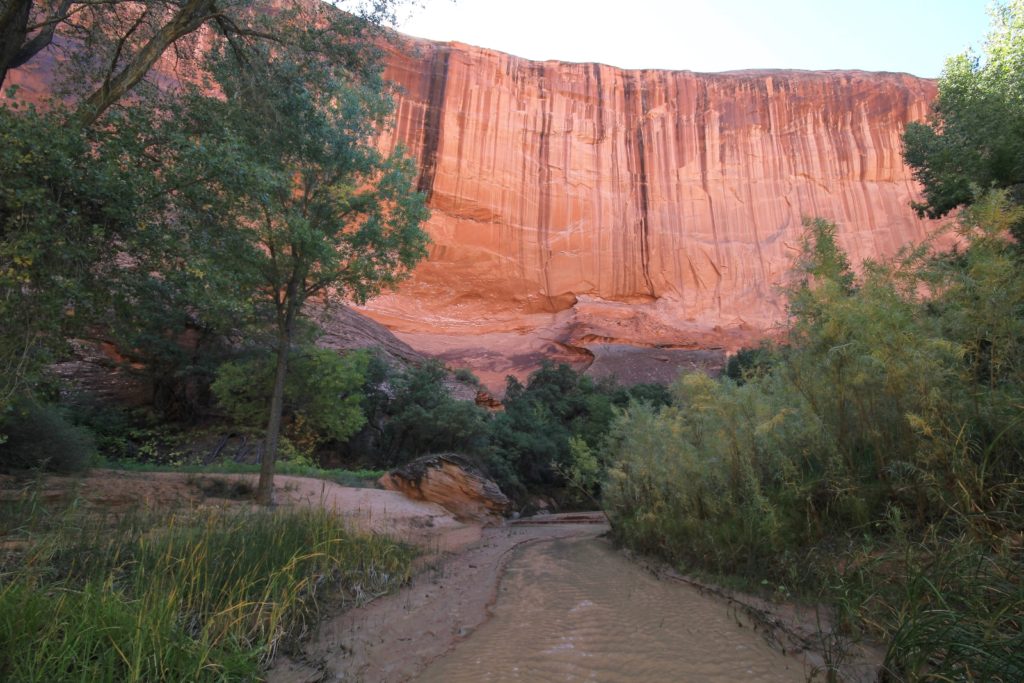
Night one in Coyote Gulch was a warm one with temperatures around 55 degrees at dawn—a stark contrast from the 28 degrees we saw near Bryce Canyon the prior morning. We had coffee and breakfast while watching the morning light slowly filter into the canyon, the scenery around us glowing in soft golden light.
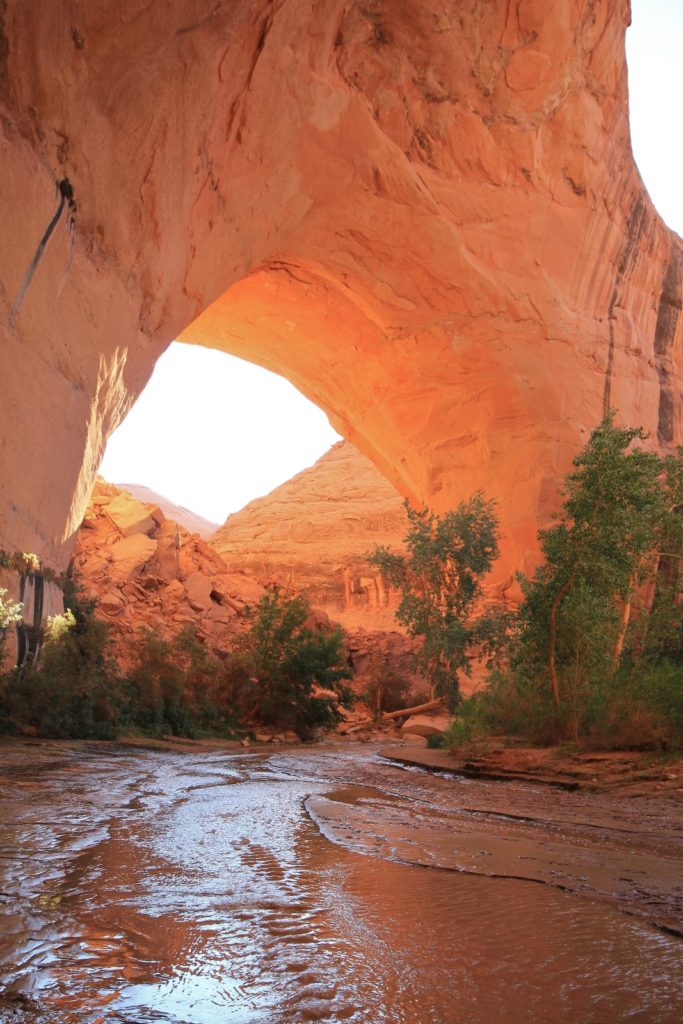
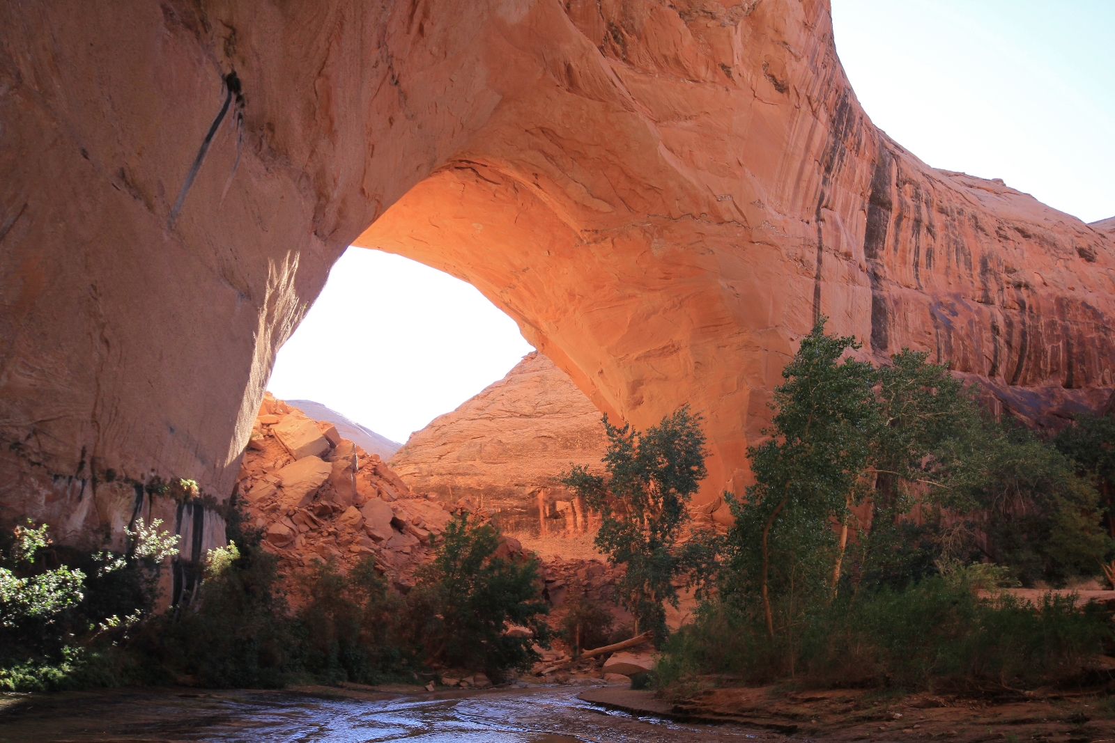
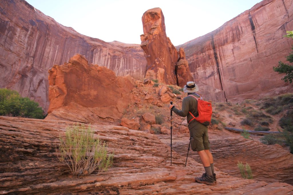
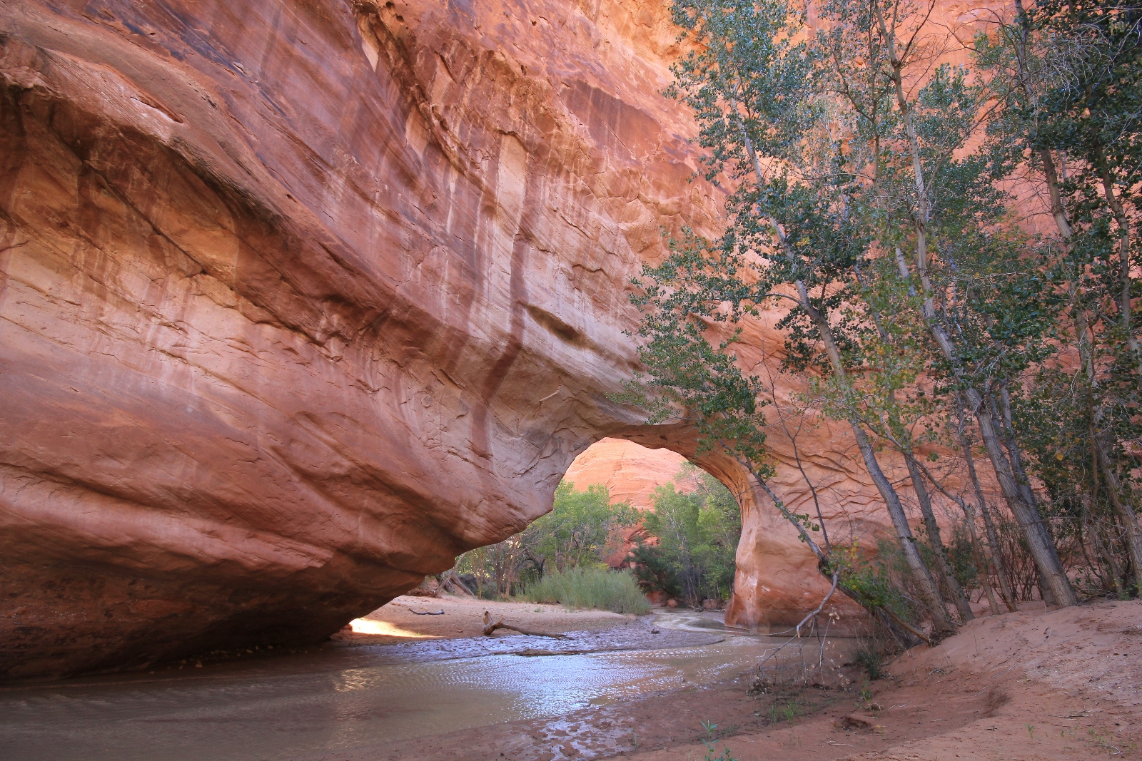
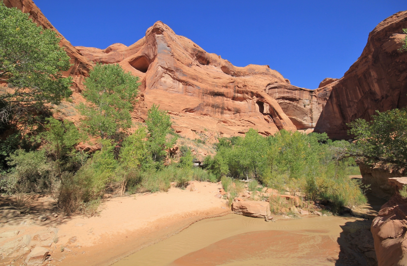
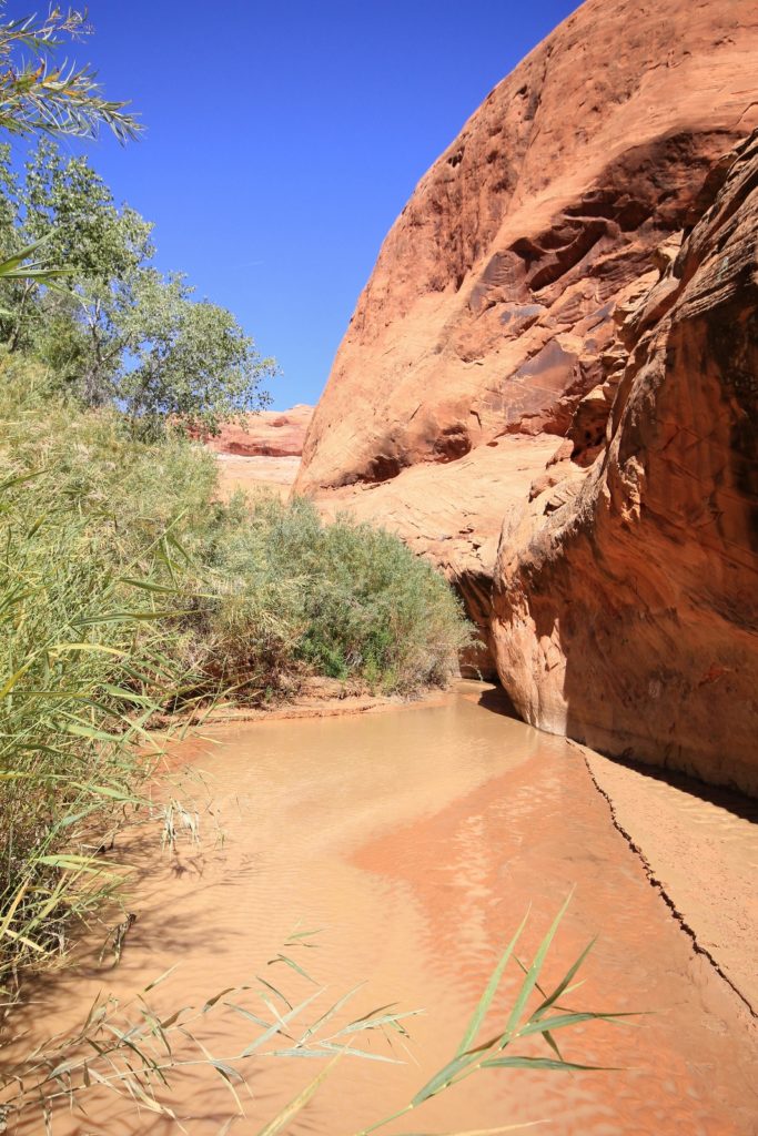
 It had been a beautiful pack in and now it was time to explore the depths of Coyote. After researching and dreaming of this trip for several years, I thought I knew well what to expect. I quickly realized nothing could have prepared me for what we were about to experience. The towering cliffs rising above, the lush green foliage contrasted against red rock, the sounds, the feeling of water lapping at our legs, the sheer beauty and massiveness of it all—every photo I had seen failed to convey how special the canyon truly is. This sentiment would be echoed by fellow backpackers later in the day. My photos fail as well, but I hope they show a bit of what our day was like.
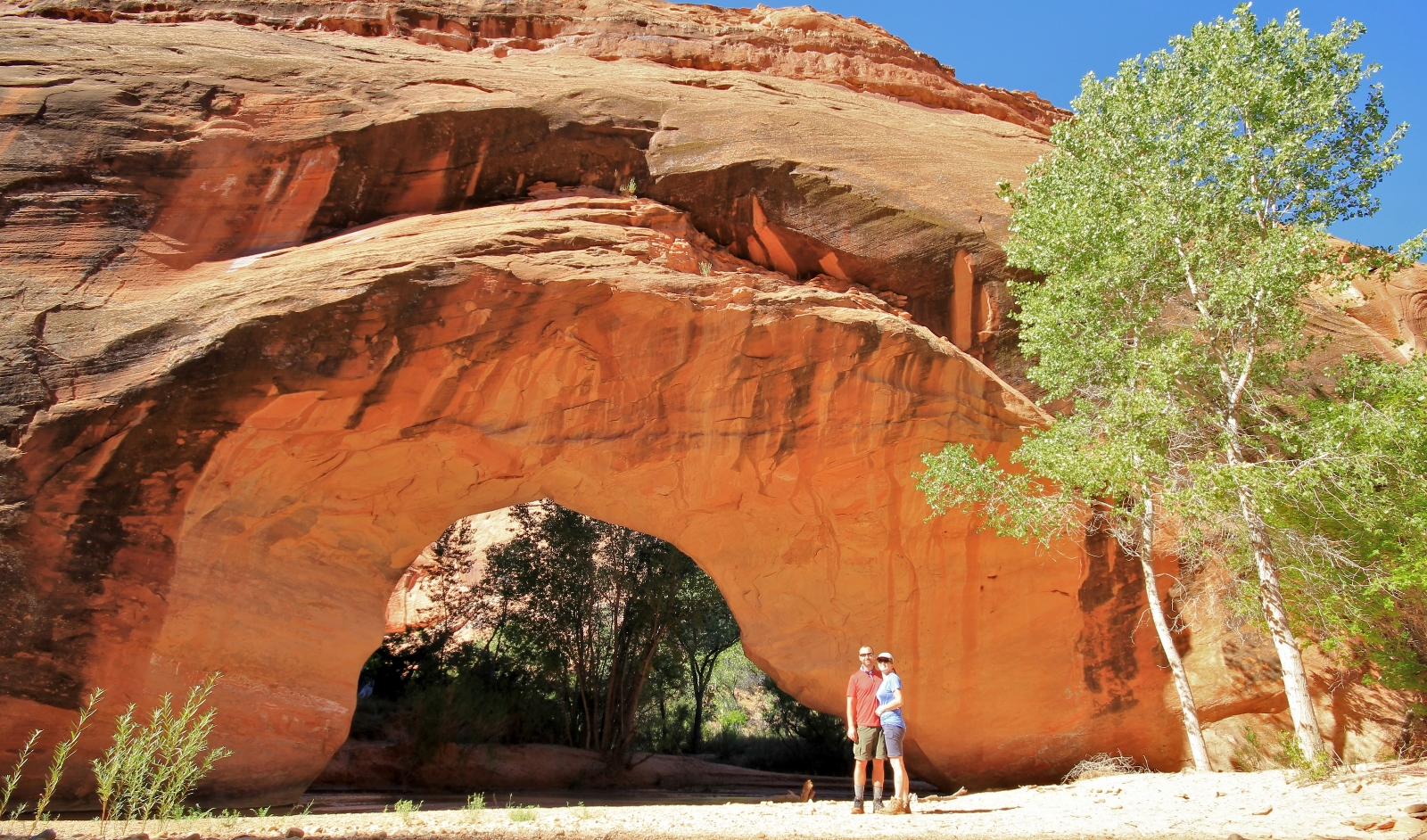
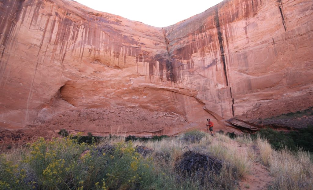
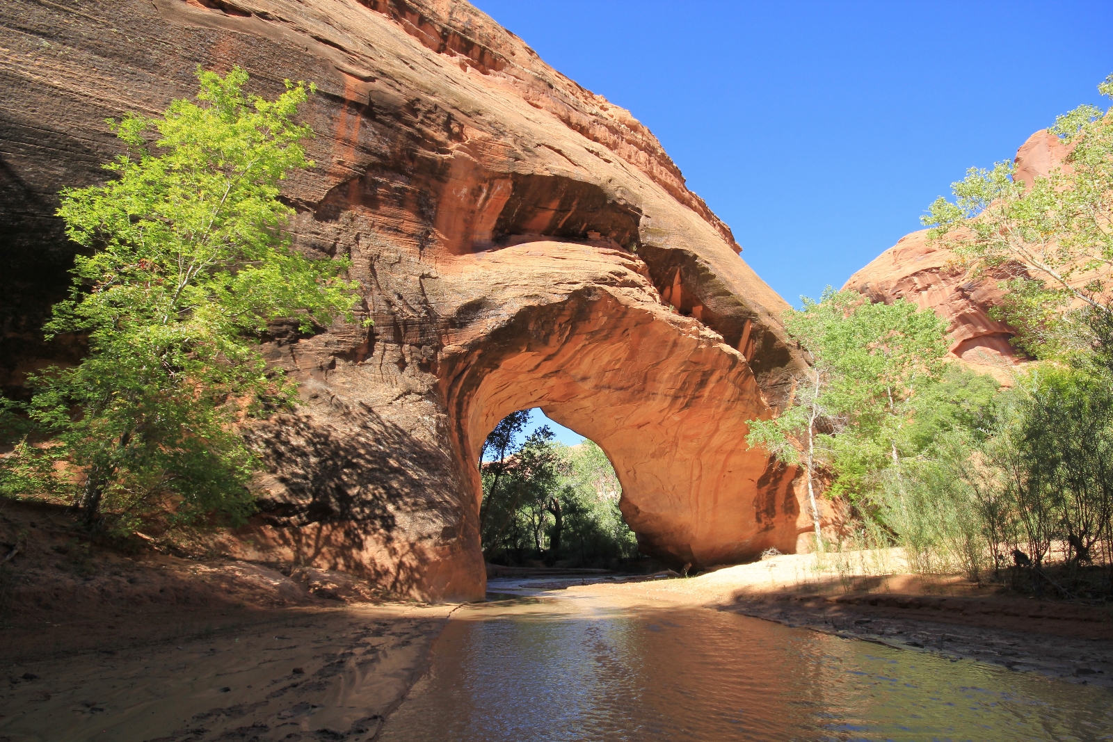
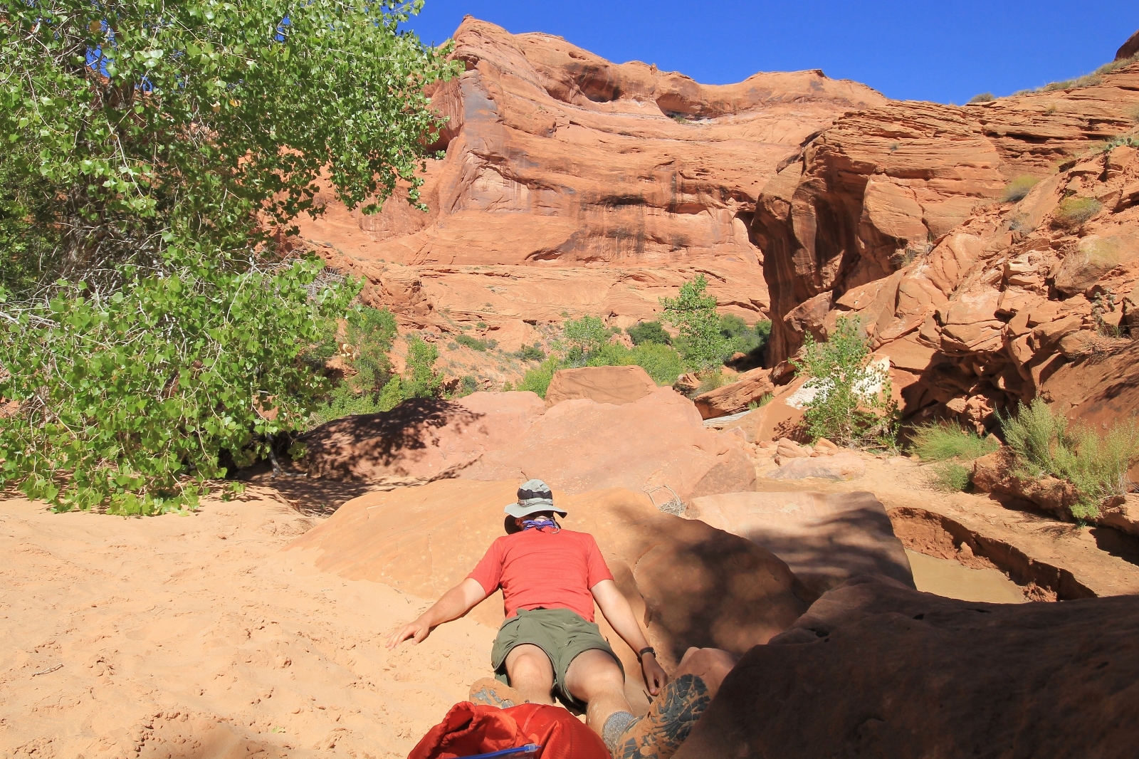
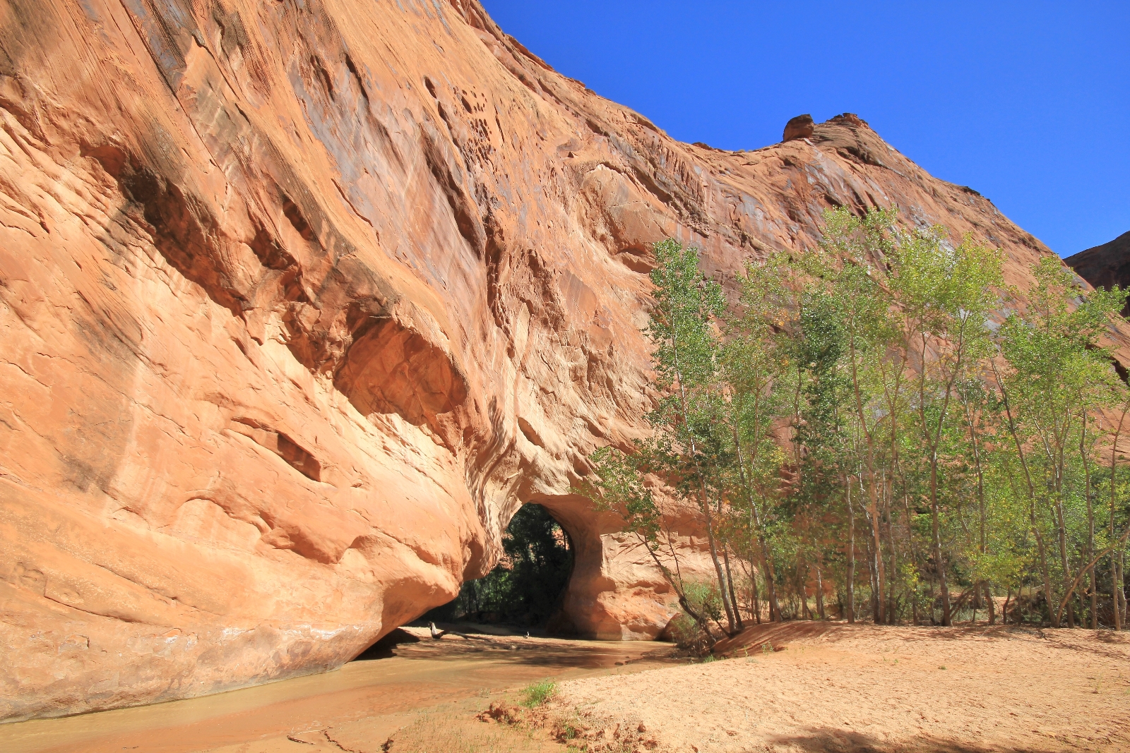
We loaded up our day packs and left camp about 9:00. We stepped off the sandy bench where our camp was located and into the calf-deep waters of Coyote’s perennial stream. With each step the sounds of splashing water echoed off the alcove walls as we proceeded downstream toward Jacob Hamblin Arch where we found four different camps set up on either side of the arch. We wouldn’t see any other camps between Jacob Hamblin and Cliff Arch, but the area was rich with lovely campsites. If we make it back someday, I’d like to camp closer to Coyote Natural Bridge and away from the crowds at Jacob.
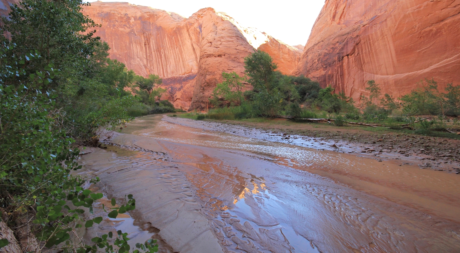
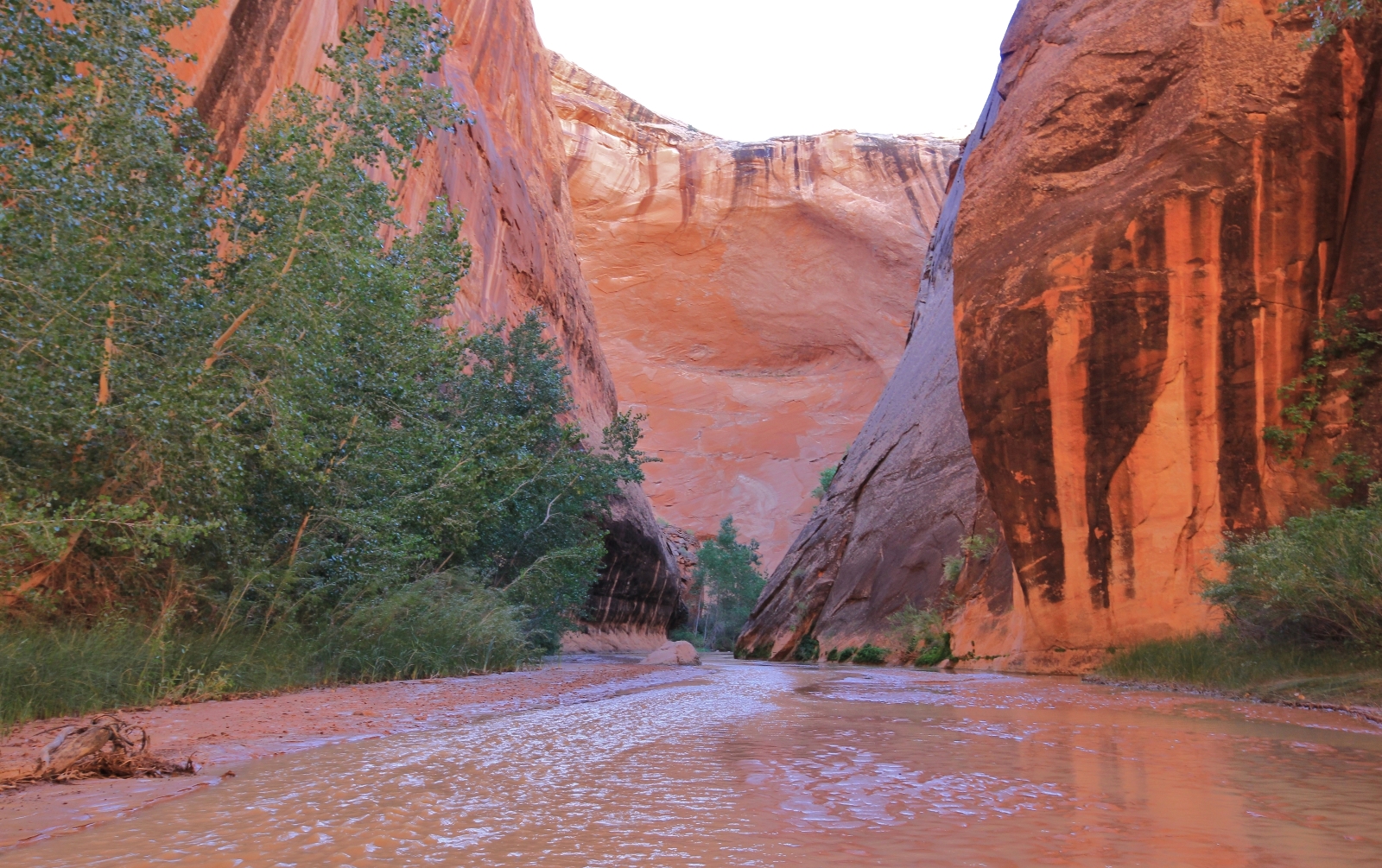
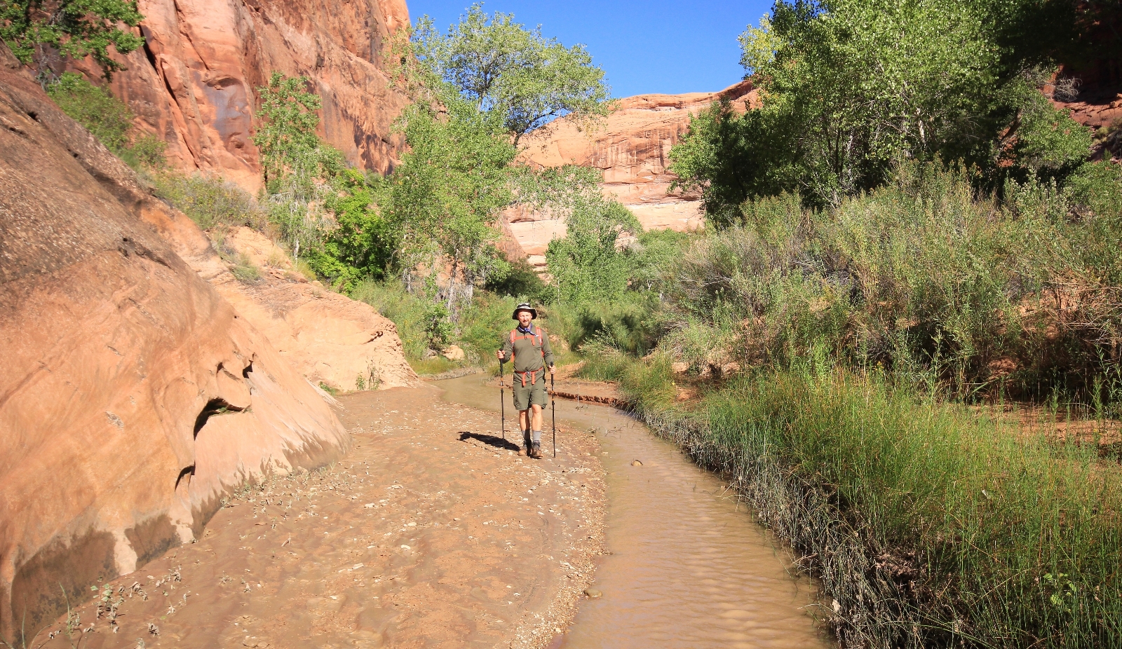
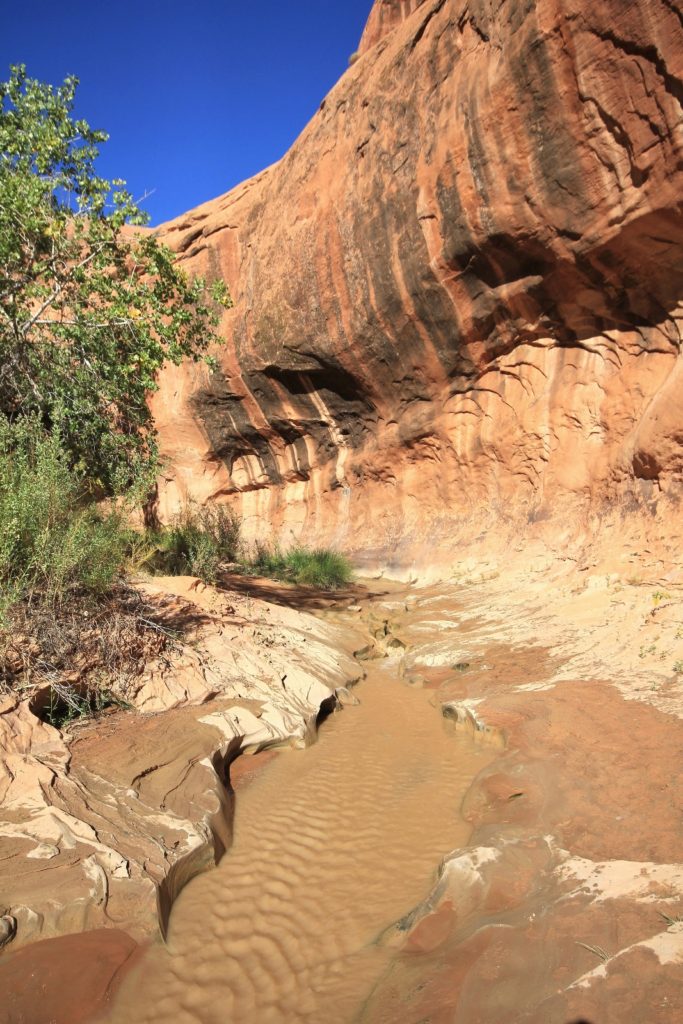
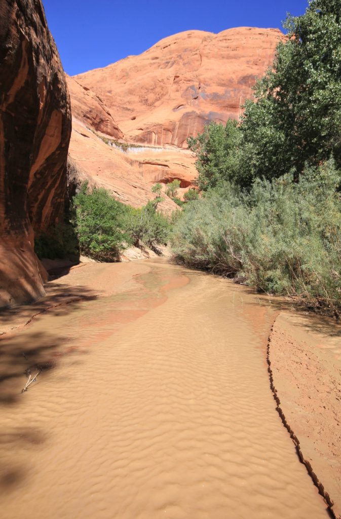
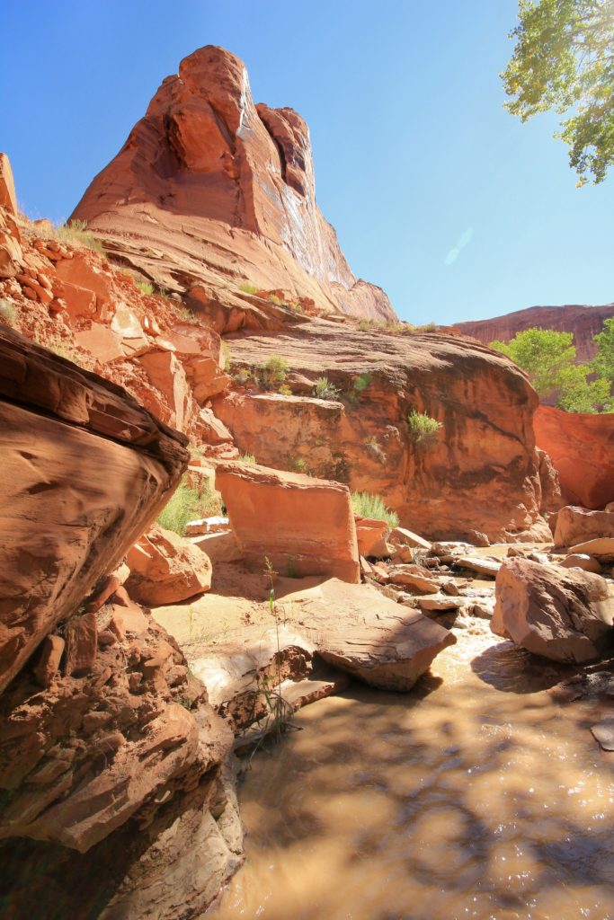
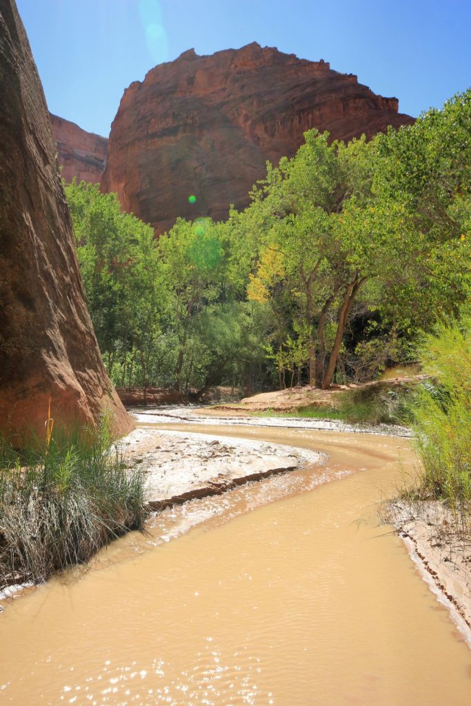
Most of our hiking was either in the streambed or along the water’s edge. The going was easy and enjoyable, but following the stream added to our mileage for the day (following user trails onto the benches creates a more direct route and shorter overall distance). In many areas, the shore right above water level was slick with greasy mud. This was caused when stream levels swelled during recent flooding and then slowly receded. It likely firmed up within a couple days of our visit, but for now there were places that were a bit slick. Still, we didn’t have any problems like we would later in the week on the Escalante River. While longer in distance, hiking in the streambed made for a much more beautiful and peaceful experience. The water temperature was comfortable and with air temperatures in the 60s – 70s, it was simply a delightful day.
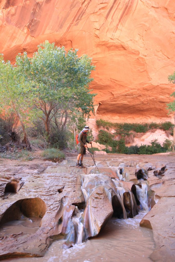
 At around two miles from Jacob Hamblin Arch, we came to a spot known as Swiss Cheese Falls.
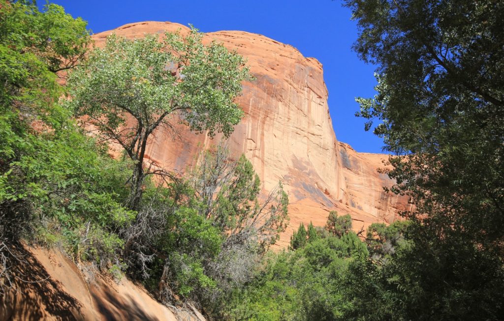
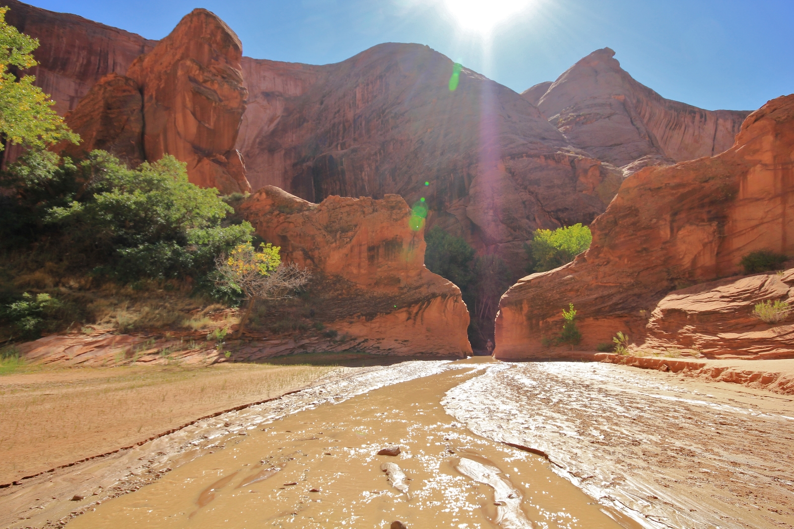
A short distance further we came to the Rincon, an area where the canyon constricted and the stream cut through a sandstone fine. From this angle, it did not appear that we could continue to follow the stream where it funneled through the narrow passage so we crossed back over and took a high hiker trail around the fin.

 About a half mile further we arrived at Coyote Natural Bridge (elevation 3,900’). We waded down the stream and through the opening to the other side. The opening was larger than I had imagined. We enjoyed a nice break here and loved having the place to ourselves.
At about five miles from camp and nearing Cliff Arch, we came to a boulder area on the left. We picked our way through with the aid of some well-placed cairns. I found a place to cross the stream for some nice shots of Cliff Arch.
We took a long break near Cliff Arch and decided to make it our turn around point. It was at least another two miles to the Escalante River- likely longer for us since our mileage was running higher than my guidebooks had described.
As we started our return hike I asked Jason, “How would you even begin to describe the beauty of this canyon to someone?” After a short distance we passed a couple who had camped near Jacob Hamblin. As we chatted, I laughed to myself when the husband said, “I don’t have a clue how I’m going describe this to my coworkers back home!”
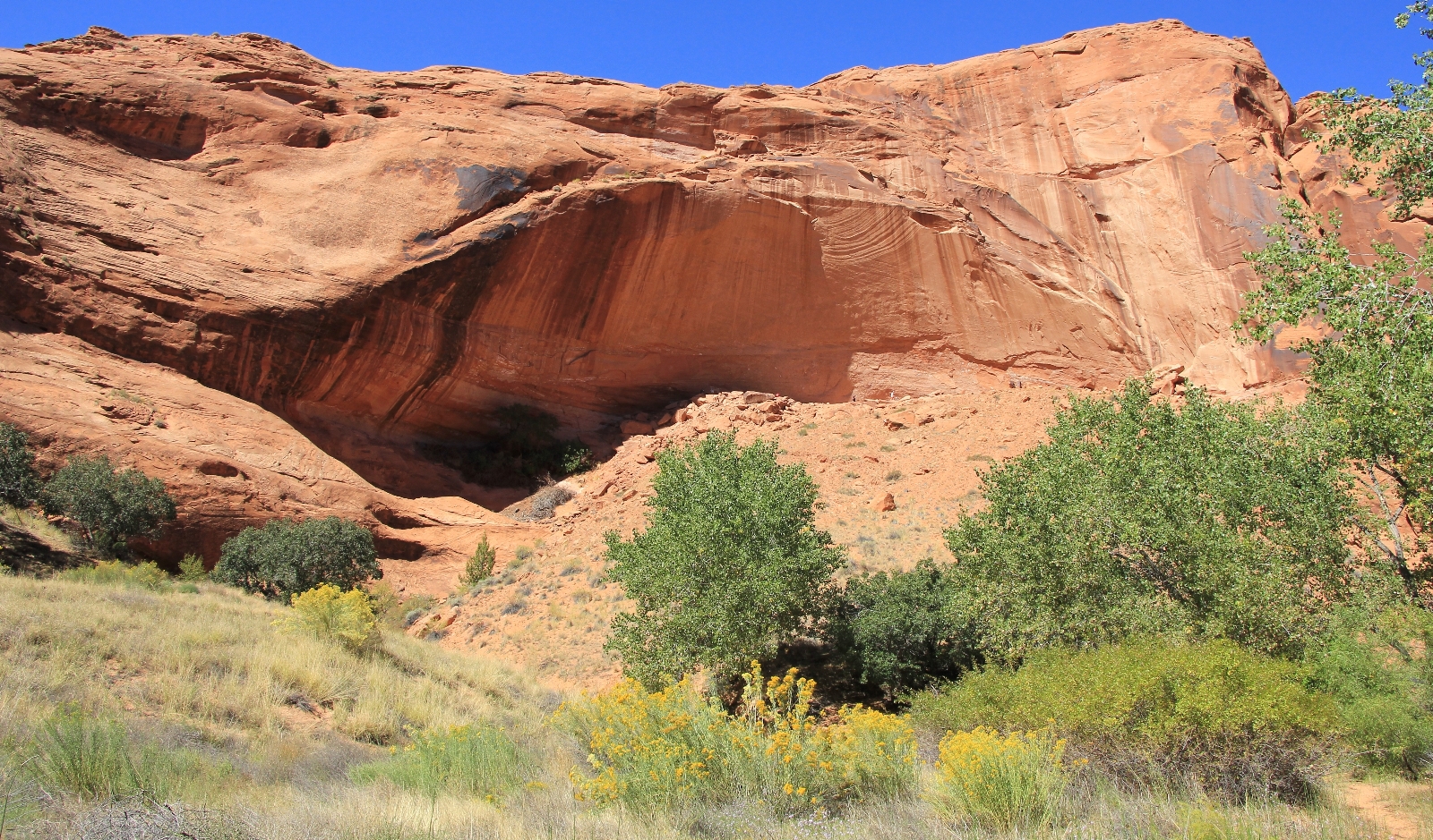
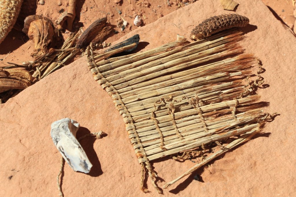
Returning upstream, I was in search mode for a pictograph panel I had heard of. After bushwhacking our way up a couple cold trails, we popped up onto a bench and found a massive alcove above the canyon floor. We scrambled up the steep but relatively short trail to the base where we found some ruins in poor condition. To my delight we found corn cobs, animal bones, pottery shards, arrow points, woven material and a pictograph panel. The site was well worth the searching and detour.


 Continuing upstream, we neared the Rincon we had bypassed earlier in the day. As we approached, I saw a man walking right through the narrow cut. From this downstream angle it was clear we could easily continue straight upstream without making the lengthy bypass up onto the bench.
As we approached camp, something seemed not quite right with my backpack. As we got closer, I could see all the compartments were open and the contents strewn about the sandy bench. My first thought was that someone had looted our camp, but Jason’s pack was untouched. I closely examined the tent and it too was untouched. The food bag was intact. Kindles, backpacking stove, and other expensive gear were all accounted for. We were perplexed until I remembered stories I had heard of backpacking in the desert. I was left with one conclusion—ravens had looted my pack in search of food. Those smart little bastards had actually unzipped every compartment on my pack and pulled the contents out. I had enjoyed them as neighbors the evening before, but now I wasn’t so keen on them. Oh well, at least the only damage they caused was to our garbage bag. I hope they enjoyed my used toilet paper!
We arrived back at camp around 4:00 after eleven miles of exploring. It had been an unbelievably beautiful and unique experience hiking the canyon. I was a little disappointed we didn’t make it all the way to the Escalante, but it had been a wonderful day and I was very satisfied.
Directions to Hurricane Wash Trailhead: from the east side of Escalante, Utah, travel east on highway 12 4.5 miles and turn right on unpaved Hole-in-the-Rock Road. From there it is a rough 33.8 miles to the trailhead where you will find no amenities. Note that Hole-in-the-Rock Road is typically very washboard, rocky in places, has a few deceptively steep descents in and out of washes, and can be difficult even for 4WD vehicles after a rain. A permit is required to backpack Coyote (acquire at a monument visitor center or self-register at the trailhead).