Great early season hike to a pretty little waterfall
Distance: 6 miles round trip
Difficulty: easy (mostly flat with good tread)
Type: out and back
Best Season: winter, spring, and fall (hot and snaky in the summer, watch for ticks in the spring)
Anyone who knows the Evans knows we hate winter. Darkness, cold, and limited hiking opportunities leave us counting the days until spring. The winter of 2016-2017 was truly the winter of our discontent. With numerous records set on the Palouse, winter was wearing real thin with us when March began with about a foot and a half of fresh snow in the first week. Then temperatures suddenly warmed and we received several inches of rain. Communities across the Palouse experienced significant flooding.
Without doubt this had been the region’s worst winter since we became hikers. We are accustomed to enjoying low elevation favorites throughout the worst of the winter weather. Locations like Asotin Creek, Charley Creek, and Green Gulch in Asotin County are usually accessible year around, but that hadn’t been the case this year. Since Thanksgiving, we had only been out a handful of times- once to Charley Creek (Asotin County) which was 99% snow/ice covered and twice to Hells Gate State Park in Lewiston, Idaho. We were itching for adventure.
In mid-March, we finally got our opportunity with the forecast calling for cloudy, but dry conditions and mild temperatures. With all the recent rain and snow melt, we decided to check out Towell Falls along Rock Creek near St. John, Washington. We felt confident the trail would be snow free and the falls raging.
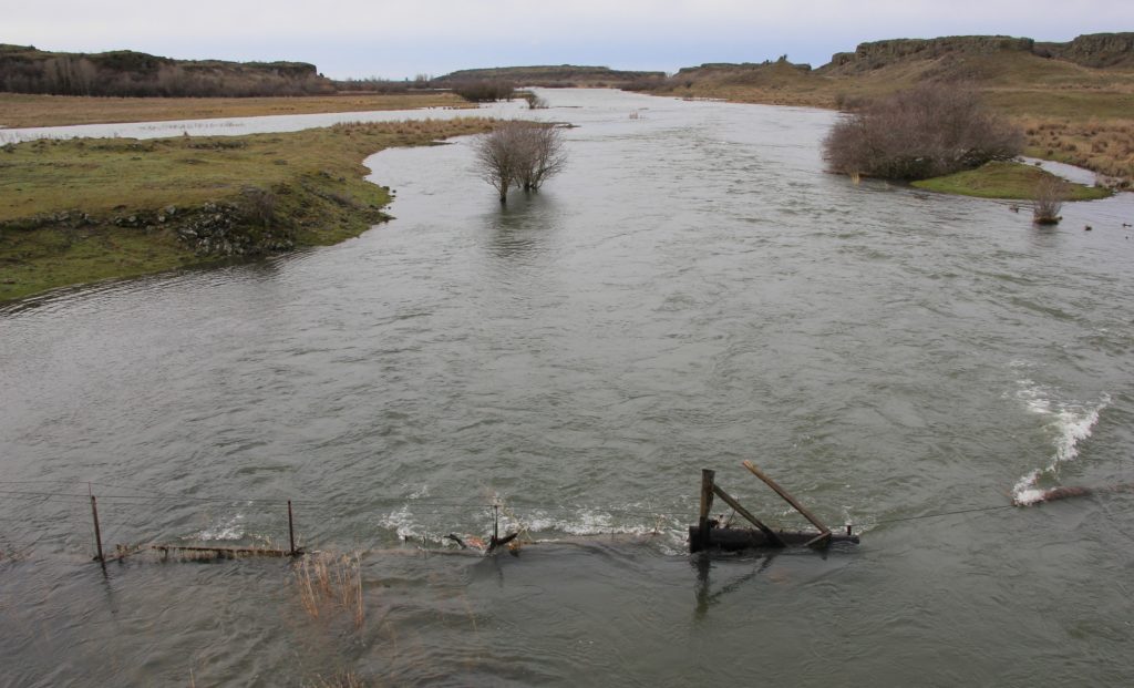
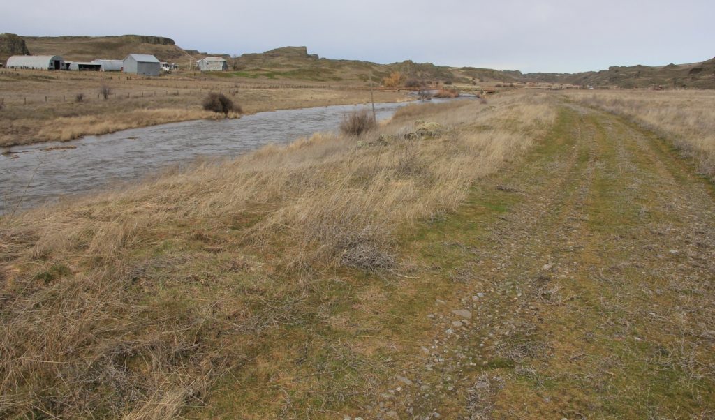
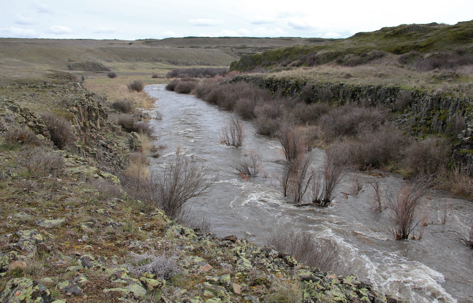
As we drove to the trailhead, our prediction was confirmed when we crossed Rock Creek near the outlet of Rock Lake just west of Ewan, Washington. The stream had flooded its banks and was making a wide berth across the channeled scablands of Eastern Washington. The creek turned south as we continued west along SR-23. We’d meet up with her again at the old Escure Ranch.

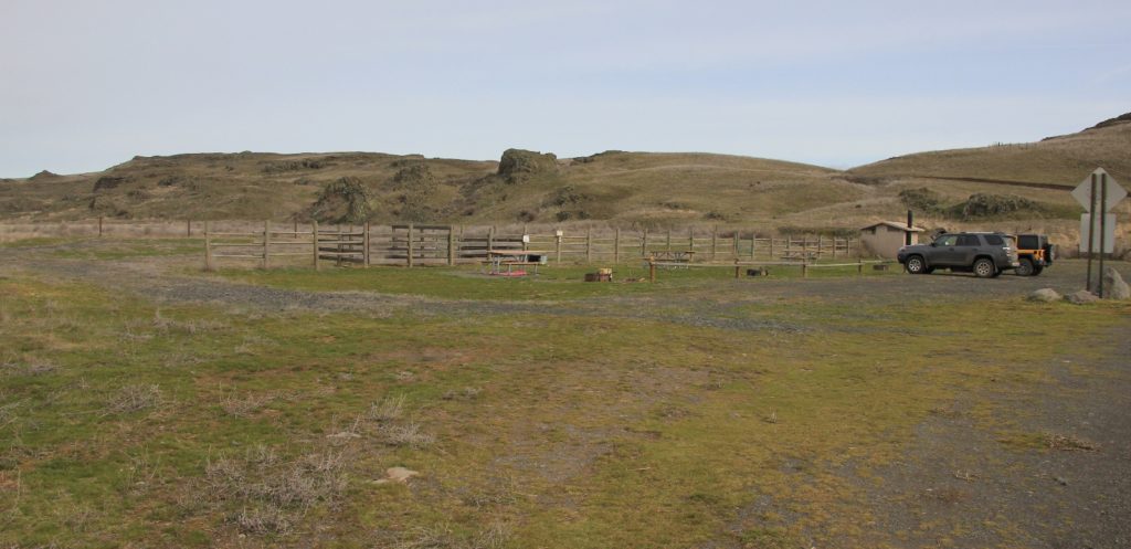
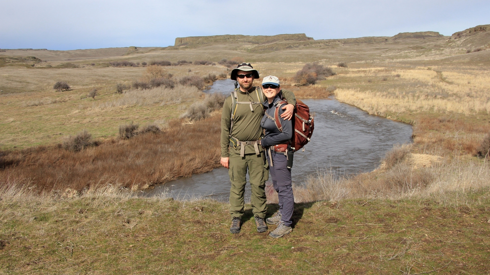
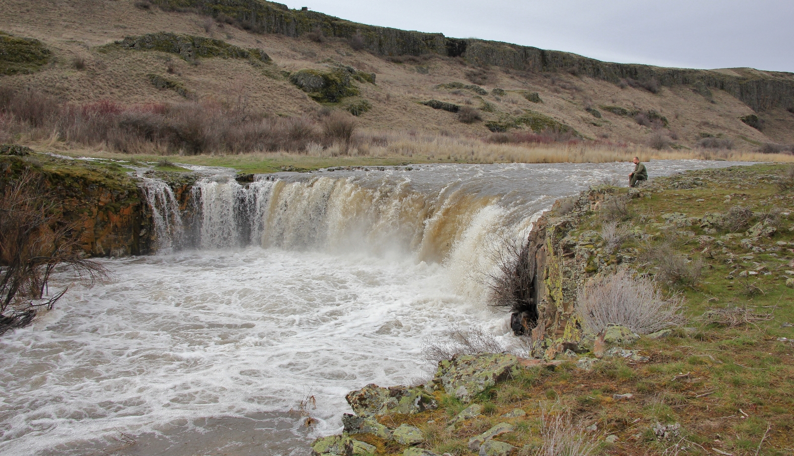
The last couple miles of access road weren’t nearly as bad as I thought they might be, but we did take our Jeep Wrangler through some impressive water-filled pot holes. There were only two other vehicles at the trailhead near the old Escure Ranch when we arrived—nice! BLM has a nice map of the area here. I walked to the bridge over Rock Creek and snapped a few photos. The creek looked more like a raging river. I was excited to see the falls.
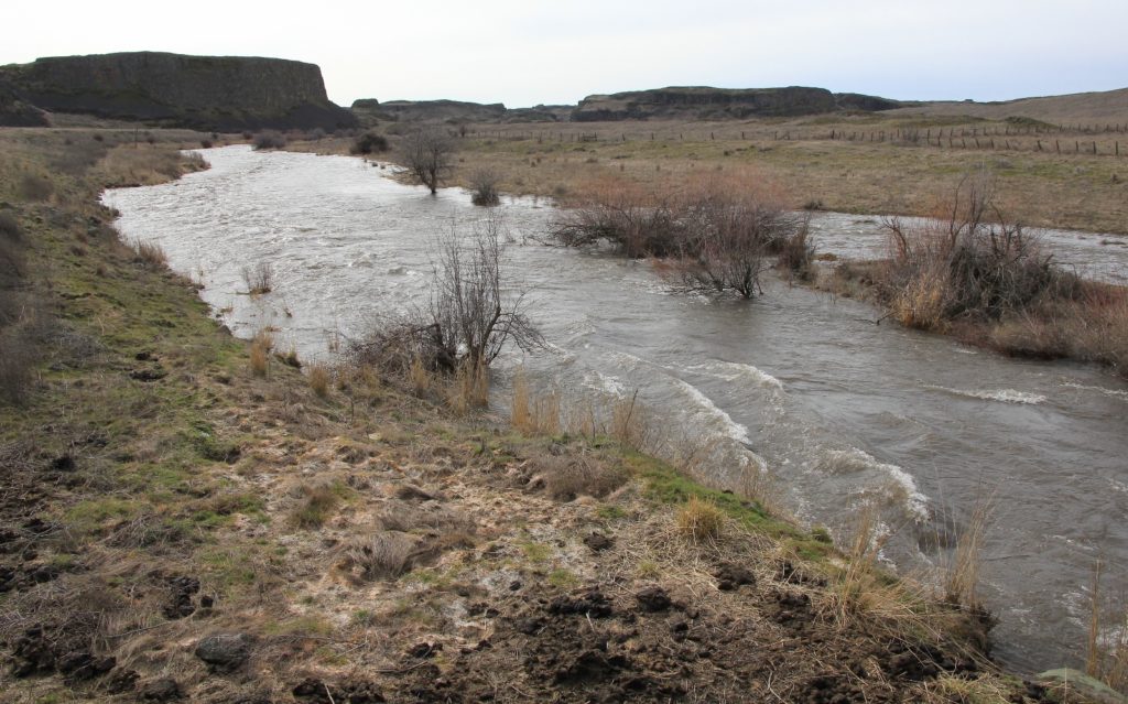
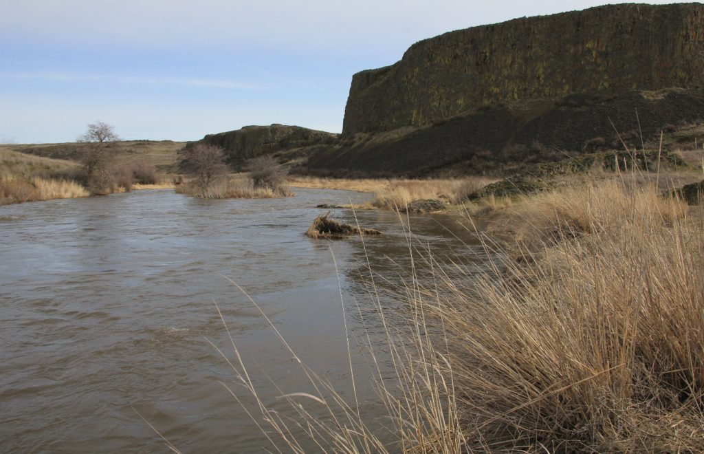
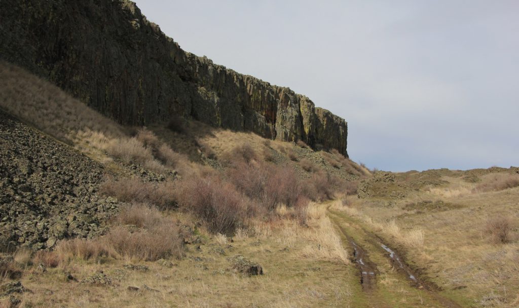
We had a pleasant three mile hike to the falls. The trail is a closed rancher road, so the hiking is very easy. Terrain is typical Eastern Washington scabland geology with massive basalt cliffs jutting out of the otherwise desolate prairie. After a long winter, the 50 degree day felt downright balmy. We passed one other hiker, but otherwise we had the trail to ourselves. It was crazy seeing all the water—in places Rock Creek had formed two channels and was thundering down the canyon. We did have one short stretch of flooded trail, but we were able to easily negotiate around and keep dry feet.
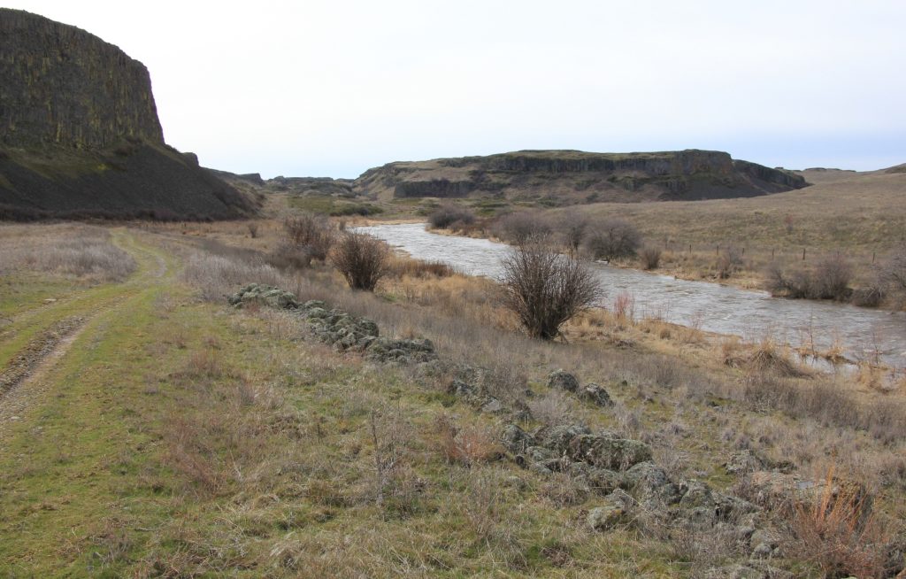
My favorite stretch of trail was near the top of a rise about half way to the falls. A short climb above Rock Creek provides for some nice views.
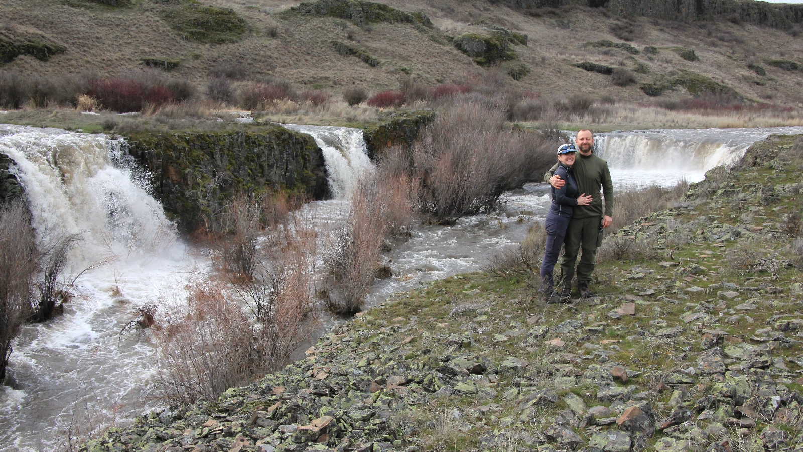
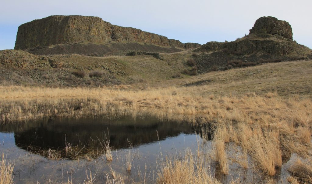
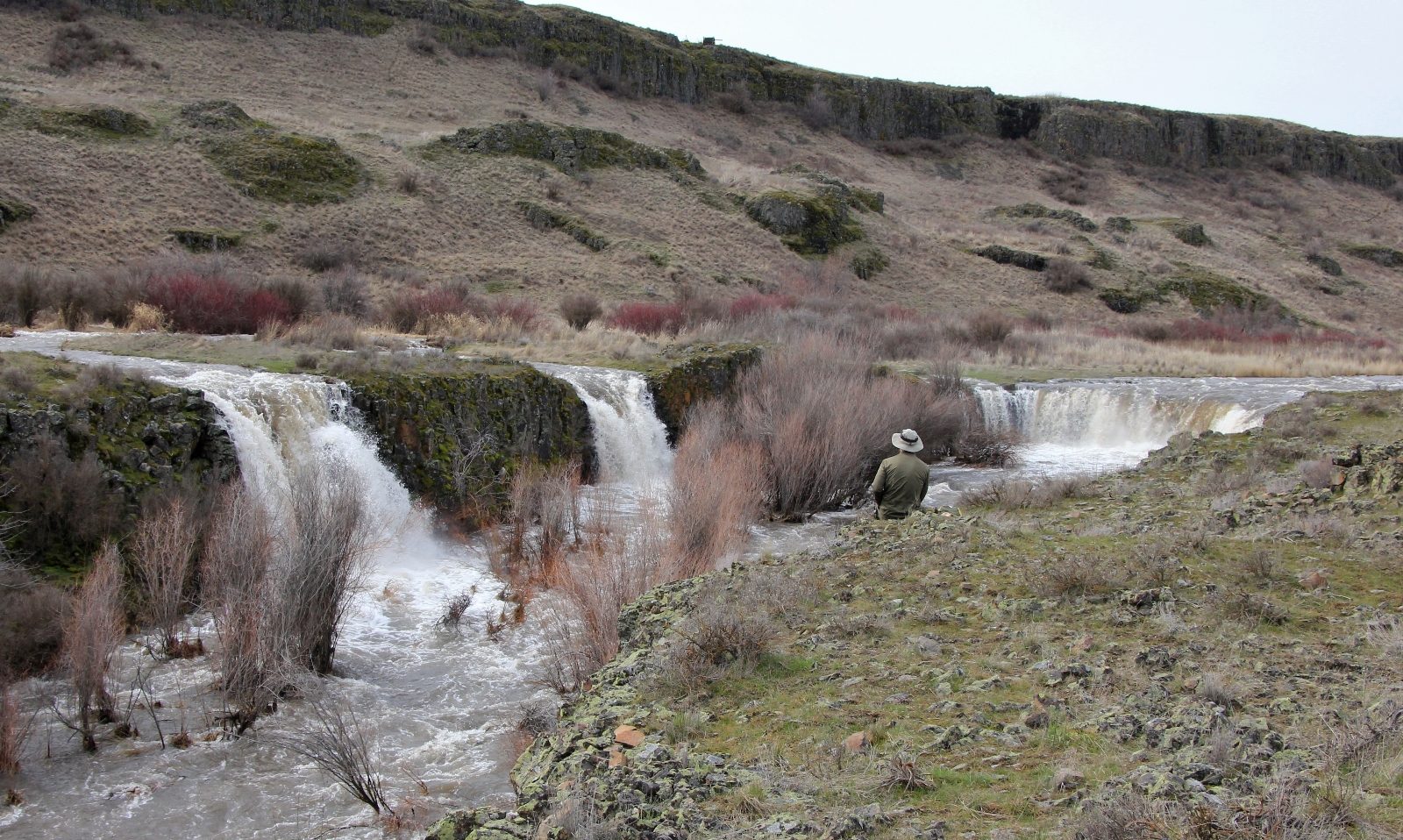
At the falls we found a very different sight than two years earlier. The main fall was about three times wider and there were two side falls that hadn’t been there before. It was spectacular. We had a snack break and enjoyed having the scenery to ourselves.
As we were finishing up, we saw a lone woman with a dog coming down the trail. We exchanged a wave and began our return hike. As we climbed away from Rock Creek, I saw the woman snap a few photos then quickly return to the trail. She wasn’t far behind us and was zipping along at a fast pace. As she neared, I stepped aside to let her pass. We exchanged a few pleasantries and she mentioned she wanted to keep us in sight for the return hike because she had been nervous hiking in by herself. I invited her and her adorable dog Camper to join us and she gladly accepted the offer.
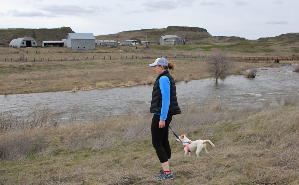
Amanda appeared to be in her late 20s. She had earned a degree in hospitality with a minor in business from Eastern Washington and had spent the past several years doing seasonal work. She loved the travel and opportunity to be outdoors in beautiful locations. She had worked near Glacier, Yellowstone, and Grand Targhee. We had a lovely hike back with her and enjoyed exchanging hiking ideas.
It was a wonderful day out on the trail. With the official start of spring just days away, our hiking prospects were definitely looking up!
Directions to trailhead: from Sprague, Washington, travel south on SR-23 12.2 miles to Davis Road. Turn right onto Davis Road and travel 4 miles to a “Y”. Stay to the right and continue 3 miles to Jordan Knott Road. Turn left onto Jordan Knott and travel 2.1 miles to Rock Creek Management Area (BLM). Follow the BLM access road roughly 2.5 miles to the large parking area on the banks of Rock Creek within sight of the old Escure Ranch. Pit toilets and picnic tables are available.
Sweet hike and with the creek running high the falls are awesome . Nice photos as always and written well , makes me feel like I was along for the walk .
Rich
Thank you Rich. Not nearly as impressive as the Oregon falls you visit, but Towell is a nice little gem in an otherwise dry environment. 🙂