Lovely pair of mountain lakes on the east side of Oregon’s Eagle Cap Wilderness
Distance: 8.5 miles round-trip (good options available for longer trips)
Type: out and back (loop and shuttle options available)
Difficulty: moderate with 1,300′ elevation gain and multiple stream crossings
Best season: July – October
By the middle of July we were itching to get into the heart of Oregon’s Eagle Cap Wilderness, but several feet of lingering snow on the passes forced us to cancel a four day backpack to Steamboat and Swamp Lakes. It isn’t unusual for snow to persist in the Eagle Cap well into the summer, but this had been an exceptional year. The first half of July had been 25 degrees below normal with above normal precipitation including a fresh layer of snow in the Eagle Cap a week before our trip. We postponed our long pack and looked for an accessible destination for a quick overnight trip. Bonny Lakes seemed like a great choice.
Like Steamboat and Swamp Lakes, Bonny Lakes are located within Oregon’s Eagle Cap Wilderness; however, their proximity on the far eastern side of the Wallowa Mountains leads to a drier environment. The area receives less snow and the trails clear earlier than a short distance away at Lakes Basin where we had backpacked the previous July. Mary Aegerter, my former college professor and fellow hiking blogger (www.hikingfromhere.com), rated it as her favorite Eagle Cap backpack.
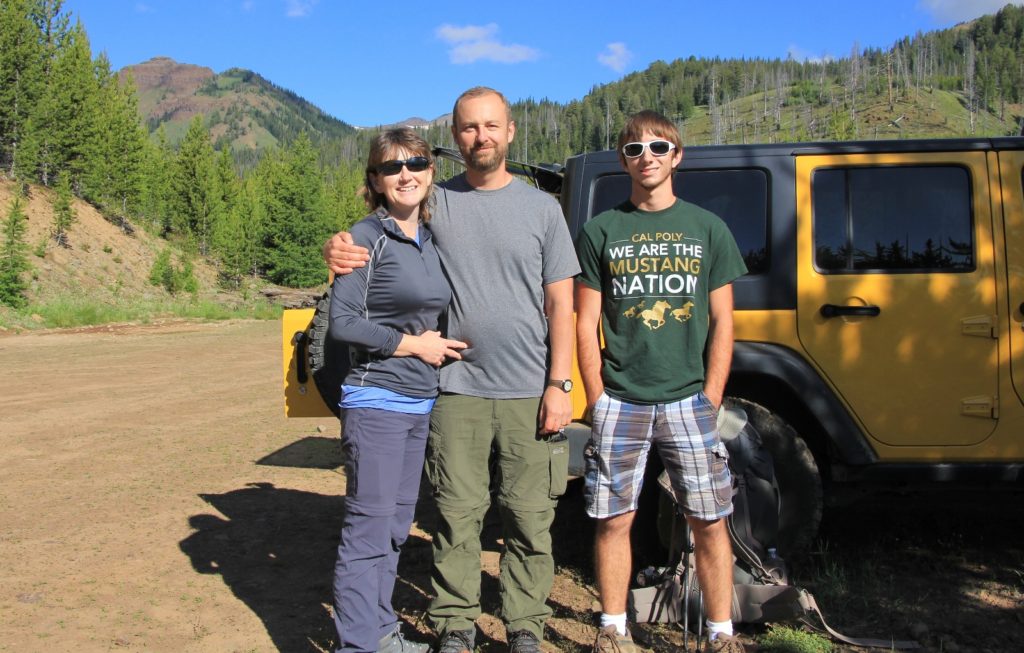
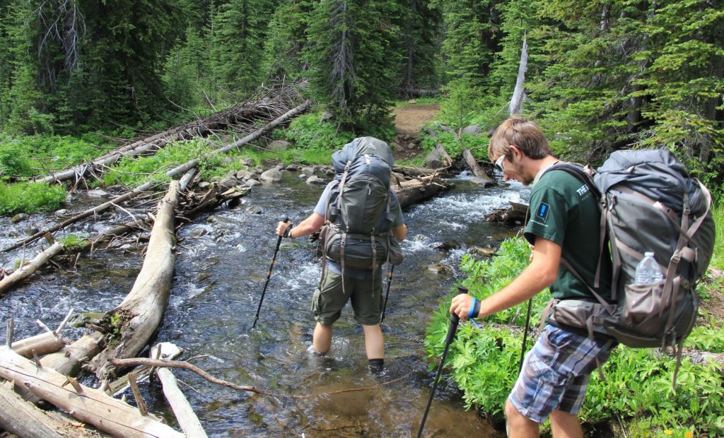
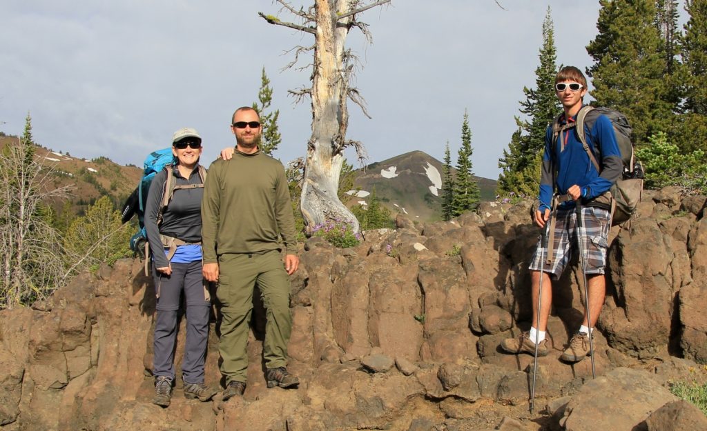
Our nephew Max was home on summer break from Cal-Poly and was able to join us. We made the drive from our home in SE Washington to the small town of Joseph, Oregon and then on to the Tenderfoot Trailhead (elevation 6,469’). Unlike most trailheads in the Wallowa Mountains, no parking pass was required. There were only three other cars in the parking lot when we arrived and one more that arrived shortly after us—a stark contrast to most other trailheads in the Eagle Cap.
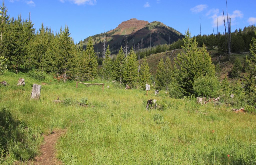
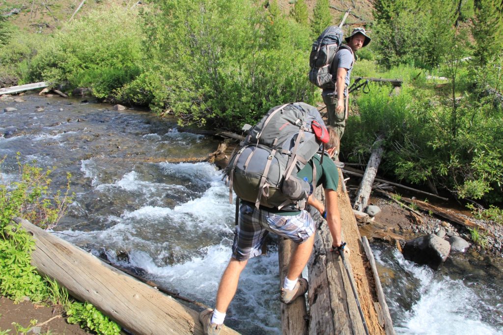
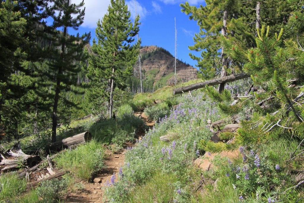
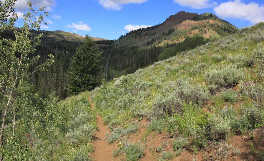
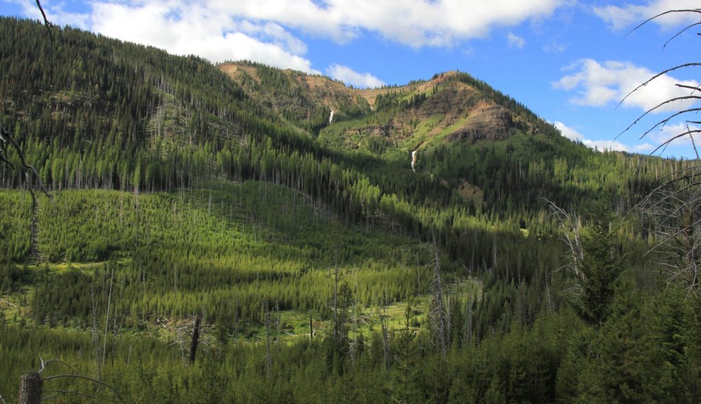
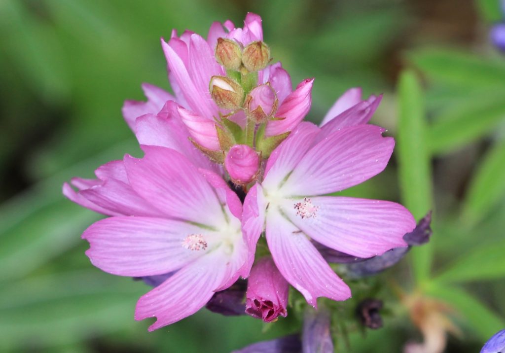
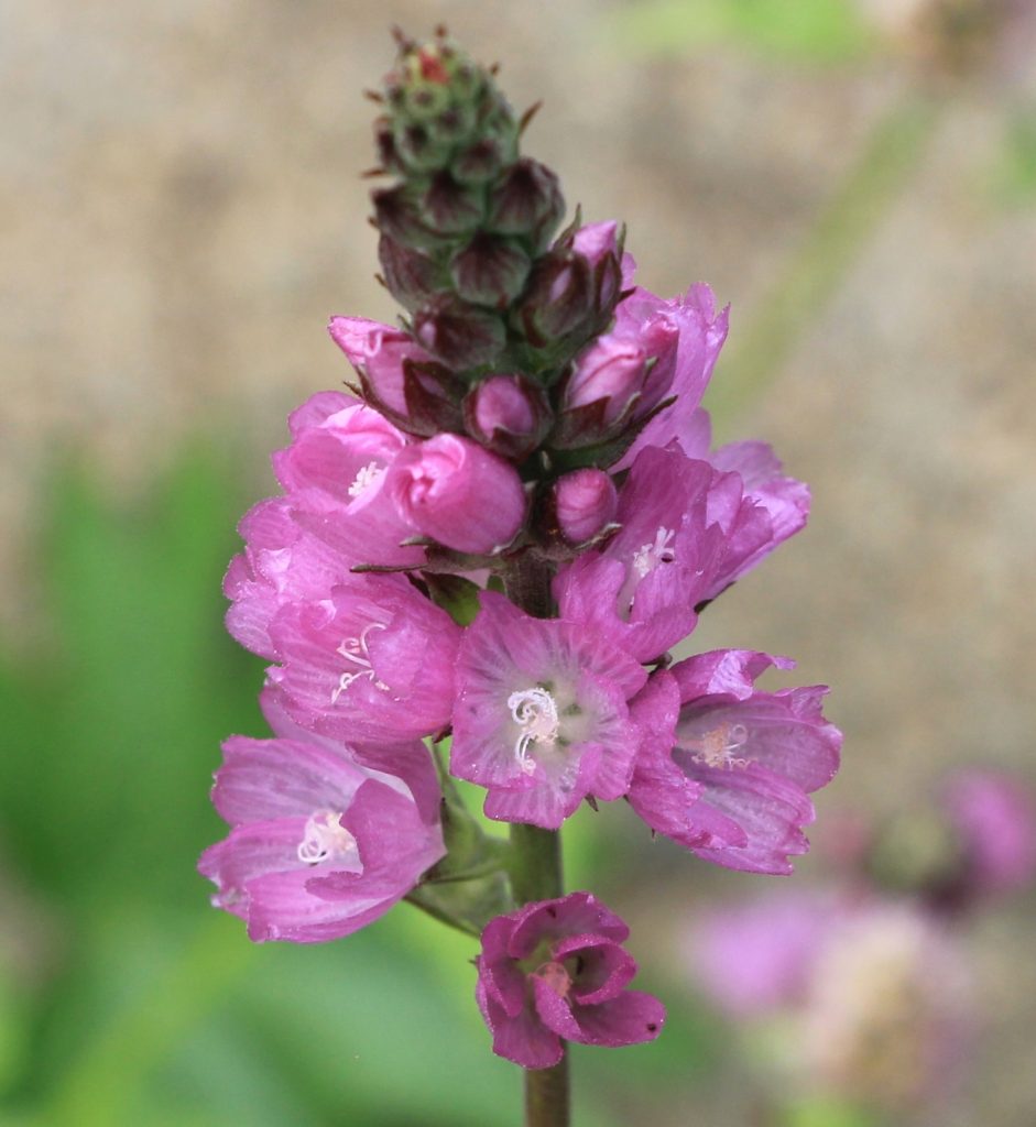
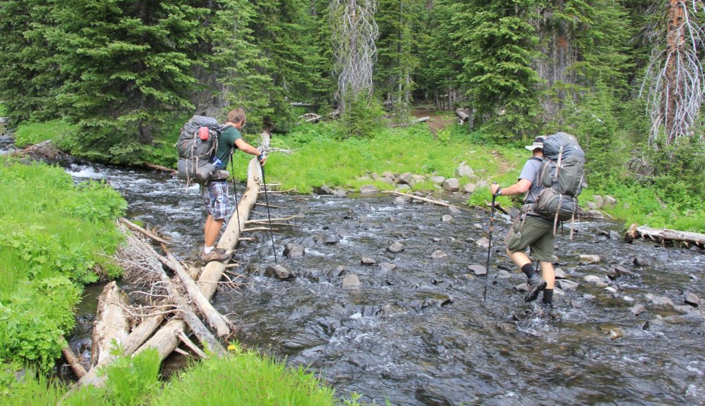
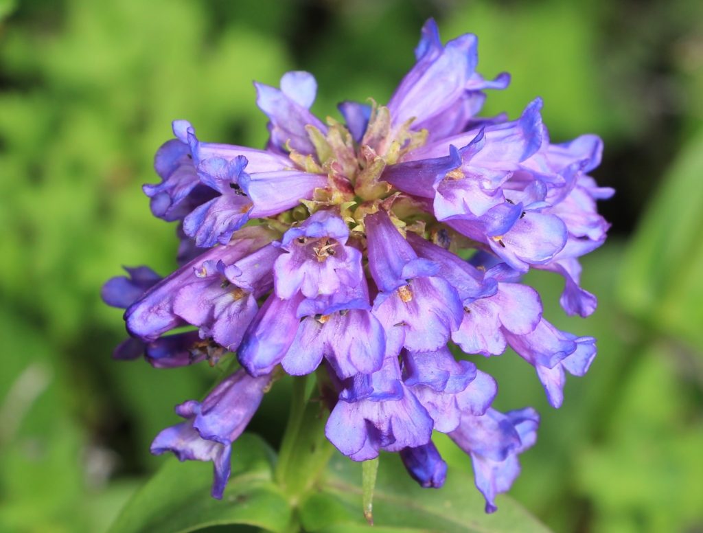
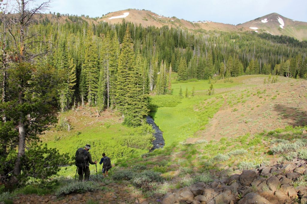
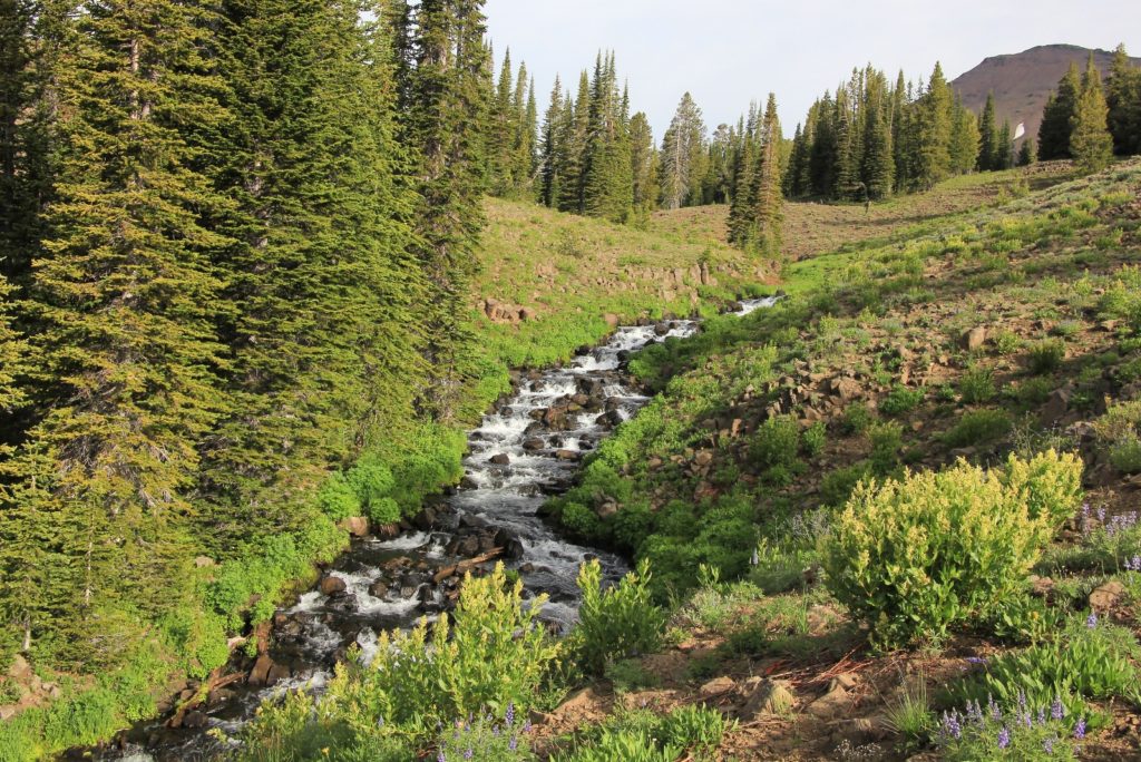
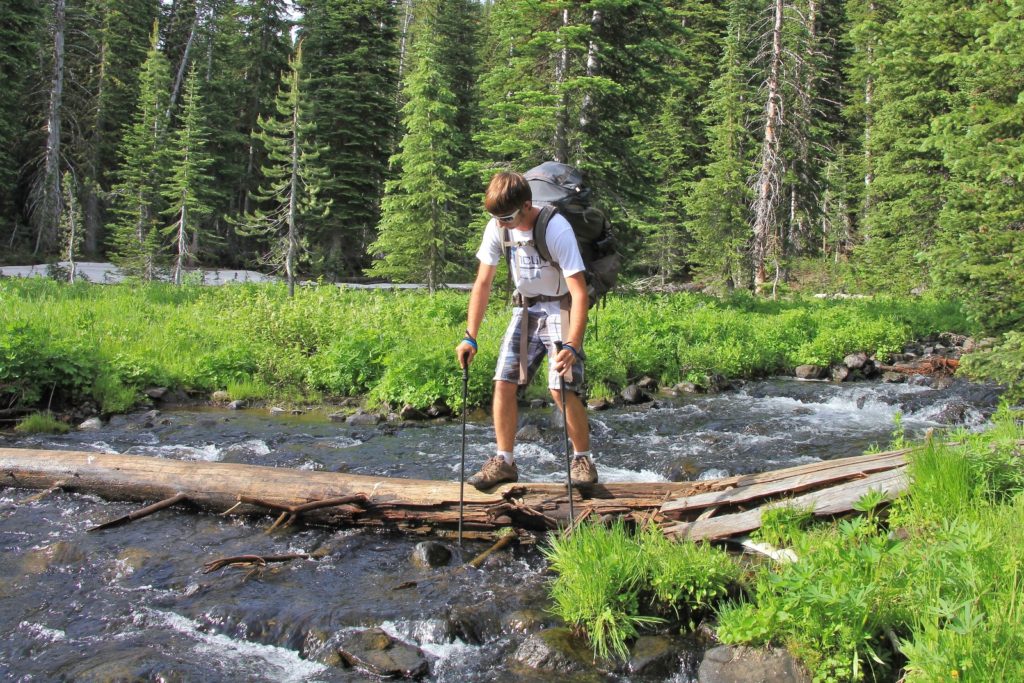
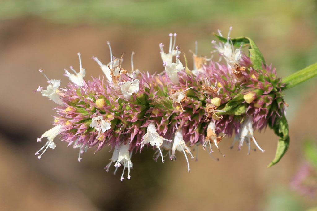
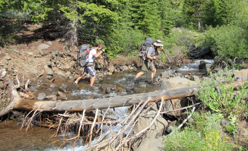
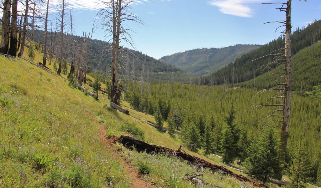
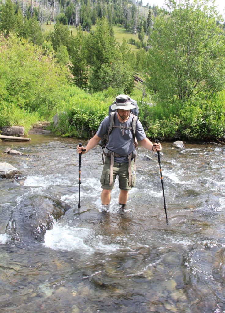
We hit the trail on a beautiful July morning with mostly sunny conditions and temperatures in the upper 50s. Almost immediately we crossed into the Eagle Cap Wilderness. A couple minutes later we encountered our first major stream crossing at Sheep Creek. We were able to go downstream a short distance and cross on a large log. The trail made a short climb and then graded alongside the hill for about a mile. This first section went through an area that burned in 1989, but is recovering nicely. We had nice wildflowers and views along this stretch.
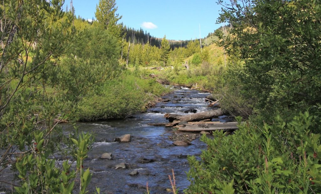
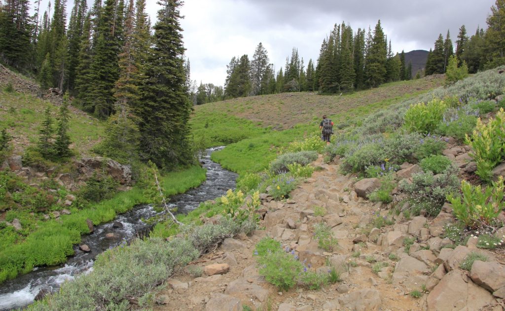
At almost a mile in, we came to a good sized stream crossing that we were able to rock hop across. A short distance later we came to a junction, the right branch leading up to McCully Basin while the left continued toward Bonny Lakes.
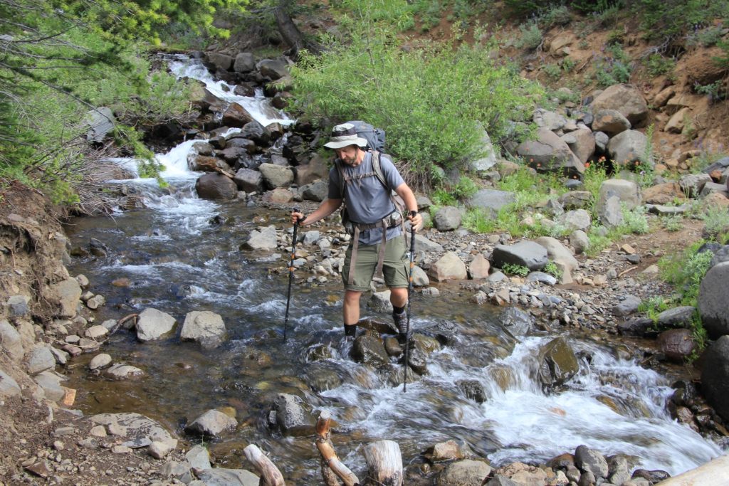
We had a couple more stream crossings that we were able to hop across, but then we reached a couple larger ones. Dry feet were no longer an option. We ended up with a total of four wet crossings—all were easy and never more than mid-calf deep. We came to another trail split at about 2.3 miles in. Straight ahead climbs up over the Imnaha Divide. We proceeded to the right following signs for East Fork Wallowa River.
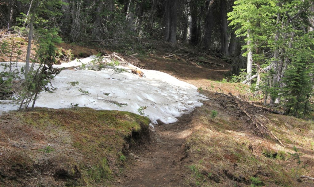
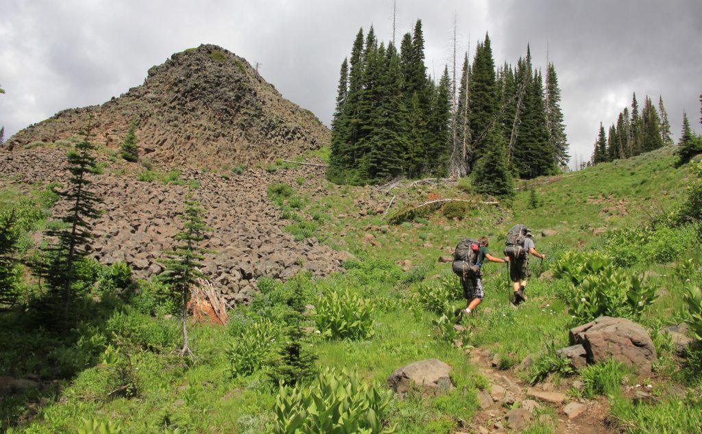
It was another 1.6 miles, much of that along a pretty stream, up to Bonny Lakes with another significant stream ford. We hit some snow patches in a few places and had a few downfall trees to get around, but navigation was easy. Much of the trail was over gentle grade, but there was one good climb as we neared the lakes.
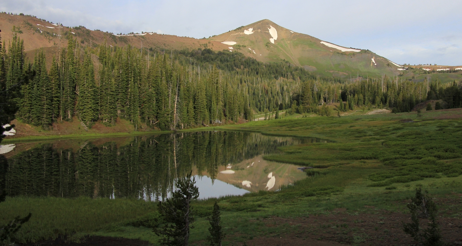
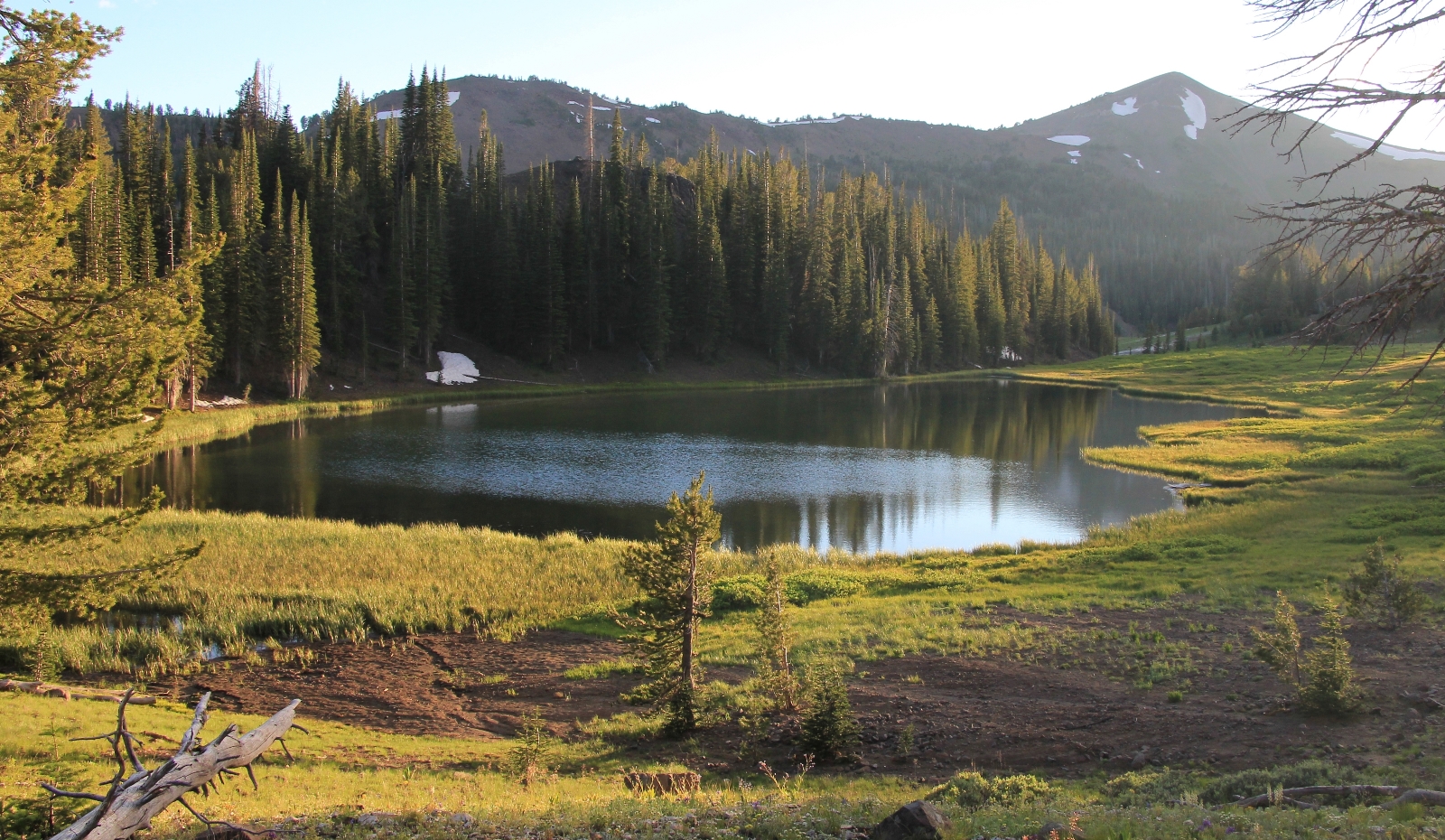
We arrived at Lower Bonny Lake, a small body with moderately marshy shoreline. Not seeing any appealing campsites, we continued along the right side to the far end where we chatted with two retiree backpackers. From there we continued up the trail in search of Upper Bonny Lake. We had climbed maybe 50 yards when I happened to turn around and saw Upper Bonny tucked behind a low ridge that separated the two lakes.
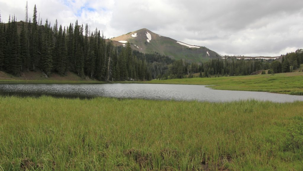
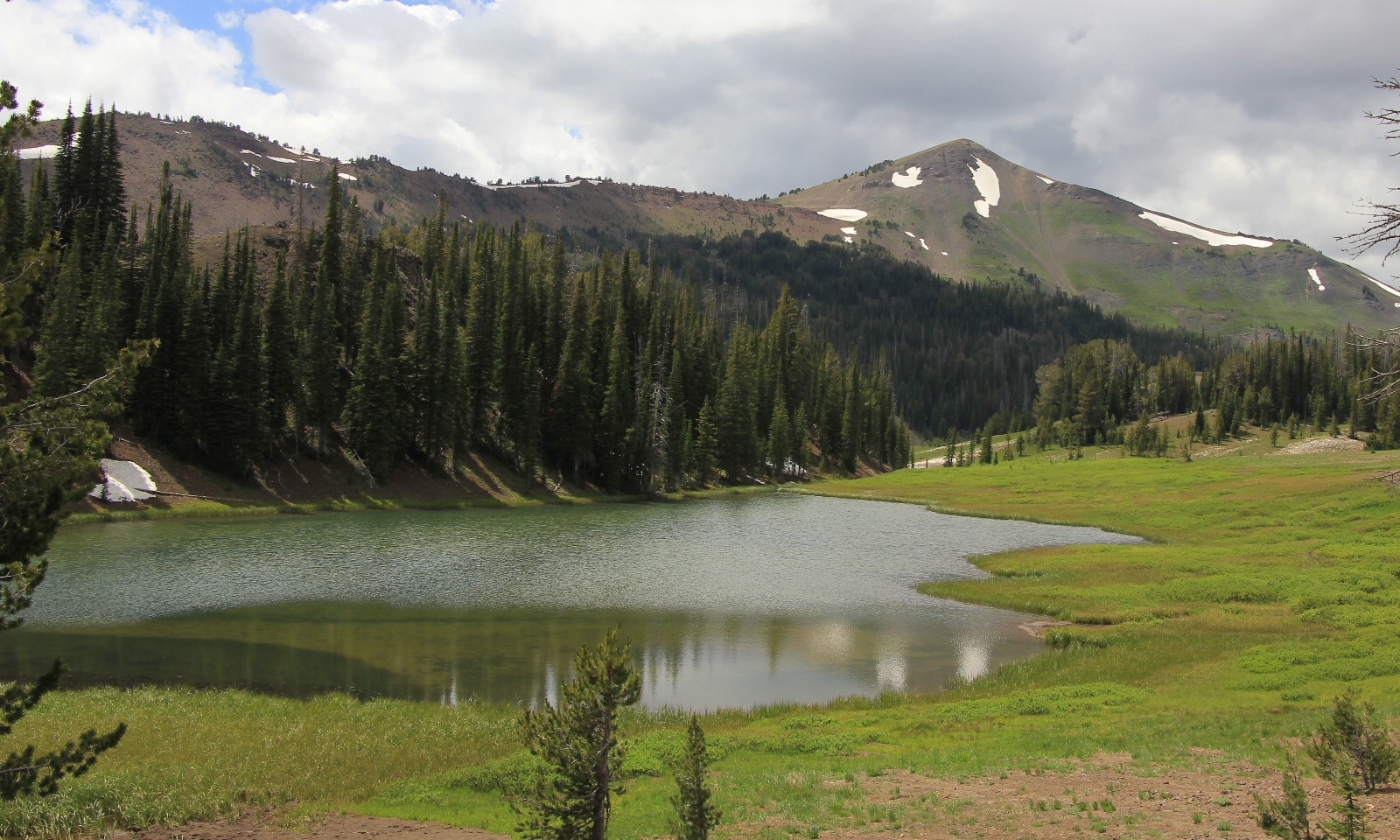
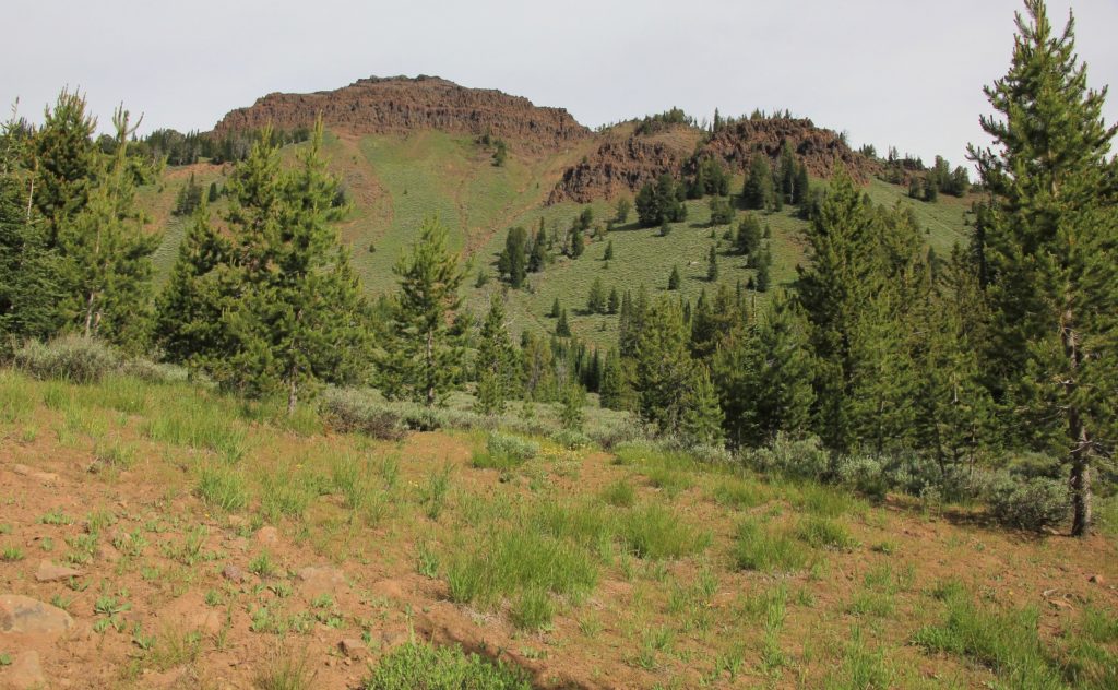
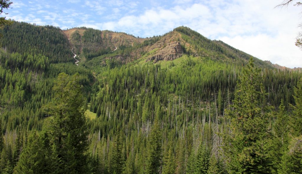
Upper Bonny was quite marshy, no doubt from the recent snow melt and early season conditions. While I certainly wouldn’t rate it as one of my favorite Eagle Cap lakes, it did have a nice backdrop including massive Aneroid Mountain. We found a nice campsite at the end of the lake that was elevated just a bit and got us above the marshy area. Best of all, we didn’t see anyone the rest of the day. While the Lakes Basin is much prettier, you won’t find solitude at most of those lakes.
The plan had been to set up camp then day hike up to Dollar Pass and Lake, but my plantar fasciitis and Achilles tendonitis was flaring and Max was pretty sore footed from hiking in wet boots. We agreed to set up camp and hand around for the afternoon.
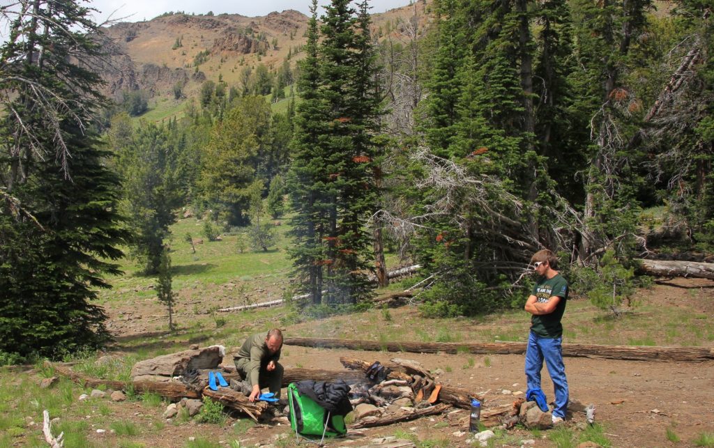
We spent a lazy afternoon under mostly cloudy skies and around a nice campfire. We rarely have a campfire while backpacking, but they weren’t banned at this lake and it was nice to dry our boots out. Storms threatened a couple times, but in the end it stayed dry for us. Surprisingly, mosquitoes weren’t bad considering how marshy the area was.
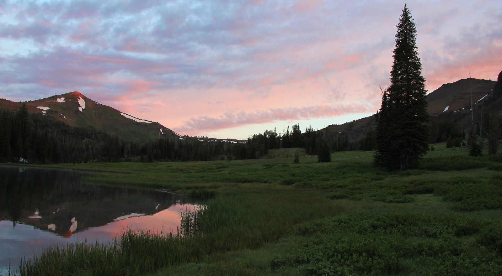
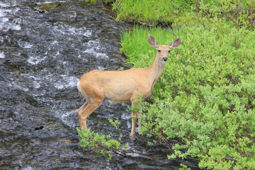
Sunday morning we rolled out of bed just in time to see a nice sunrise. It was 36 degrees, but we were comfortable in our layered gear. We enjoyed a cup of coffee and breakfast as elk and deer fed in the meadows above camp. We packed up camp and hit the trail around 7:30.
We had a nice morning hike out. Our only trail company was a young couple backpacking in. The man had his arm in a sling. I commented that he was a trooper backpacking like that. His reply, “summer only comes around once a year!” “Amen brother,” I replied.
I would like to go back and do this hike again with sunnier conditions. There are a couple options for extending into a longer pack that we’ll consider next time. Option one will be to climb Dollar and Tenderfoot passes and return via the North Fork of the Imnaha River. Option two will take us up Dollar Pass, over to Aneroid Lake, and down to Wallowa Lake, but that option will require a shuttle
Directions to the Tenderfoot Trailhead: From Joseph, Oregon, drive east on the Imnaha Highway 8 miles then turn right on the Wallowa Mountain Road. Drive 12 miles and turn right on Road 100 and continue about 4 miles to the end of the road. No privy at trailhead.