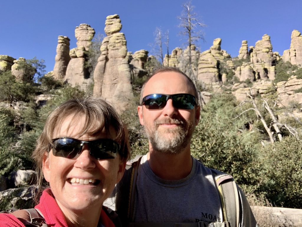
A short distance down the road from our previous adventure at Fort Bowie National Historic Site is one of our favorite units of the National Park System, Chiricahua National Monument. The monument was established on April 18, 1924, to protect an extensive area of rhyolite hoodoos and balancing rocks. We first visited the monument back in March 2012 and were immediately struck by the fascinating geology and diverse flora we found. Hiking around the hoodoos reminded us a lot of Bryce Canyon without the crowds. During our winter 2021-22 travels, we didn’t plan many visits to places we’d already been since most of Arizona remains undiscovered to us. But there was no doubt that Chiricahua was going to be an exception to that rule.
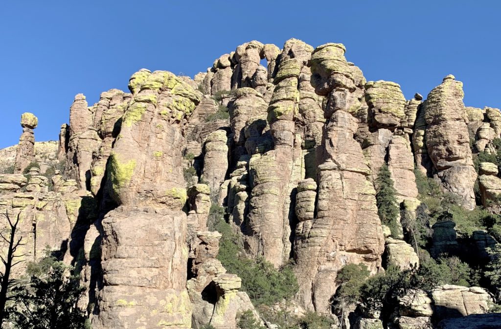
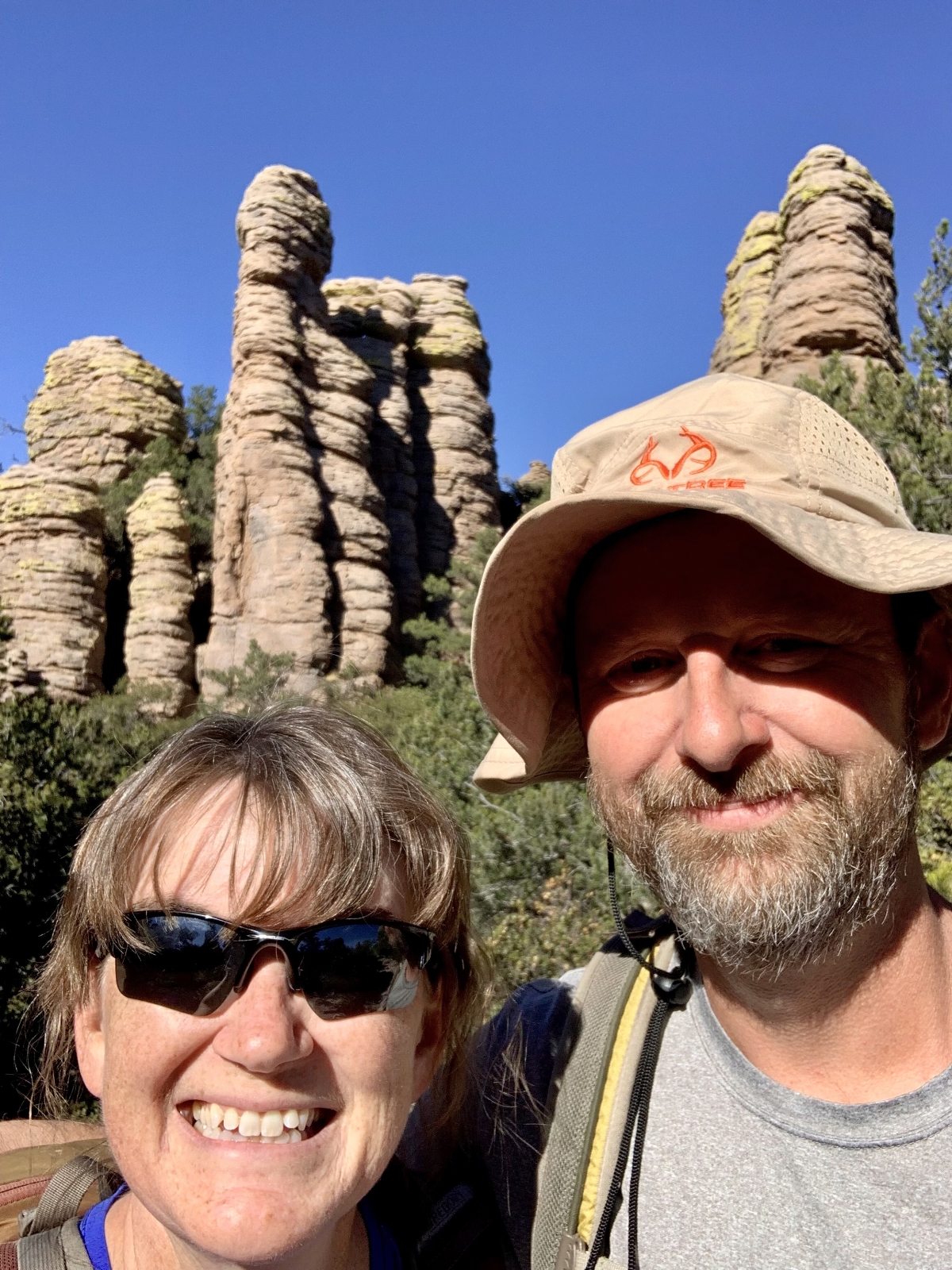
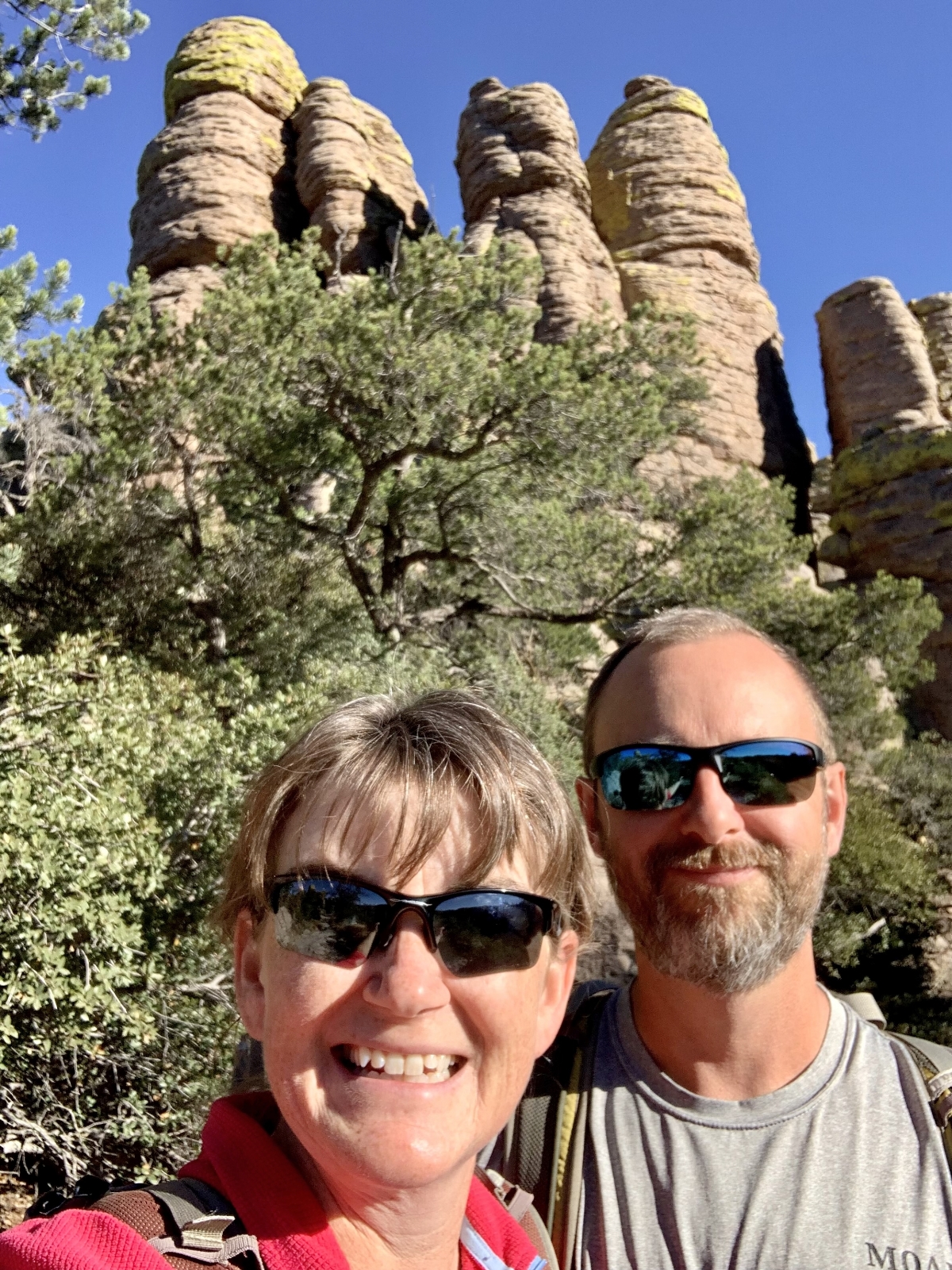
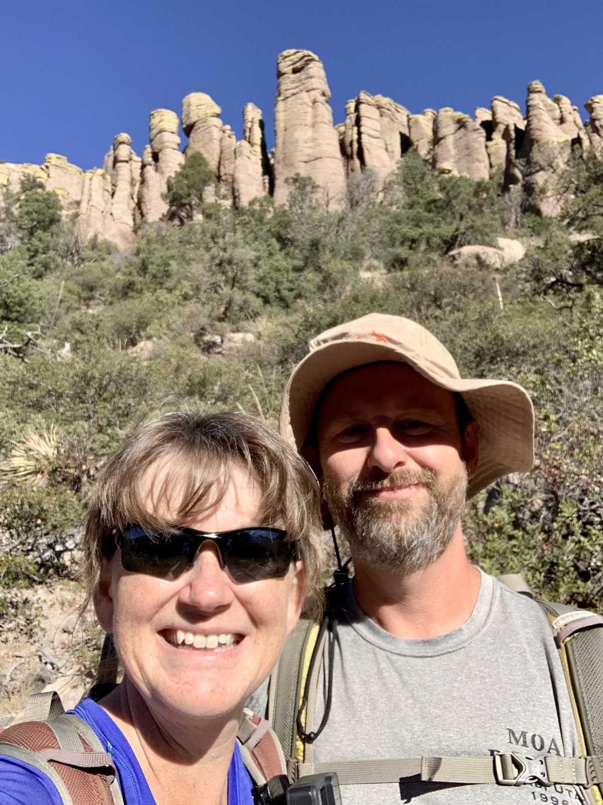
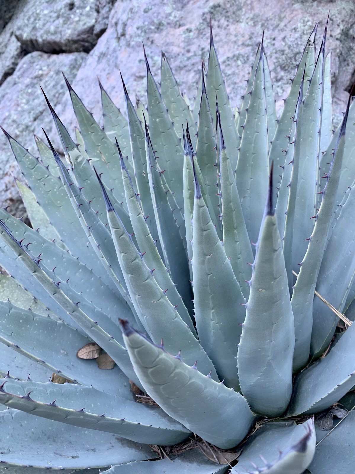
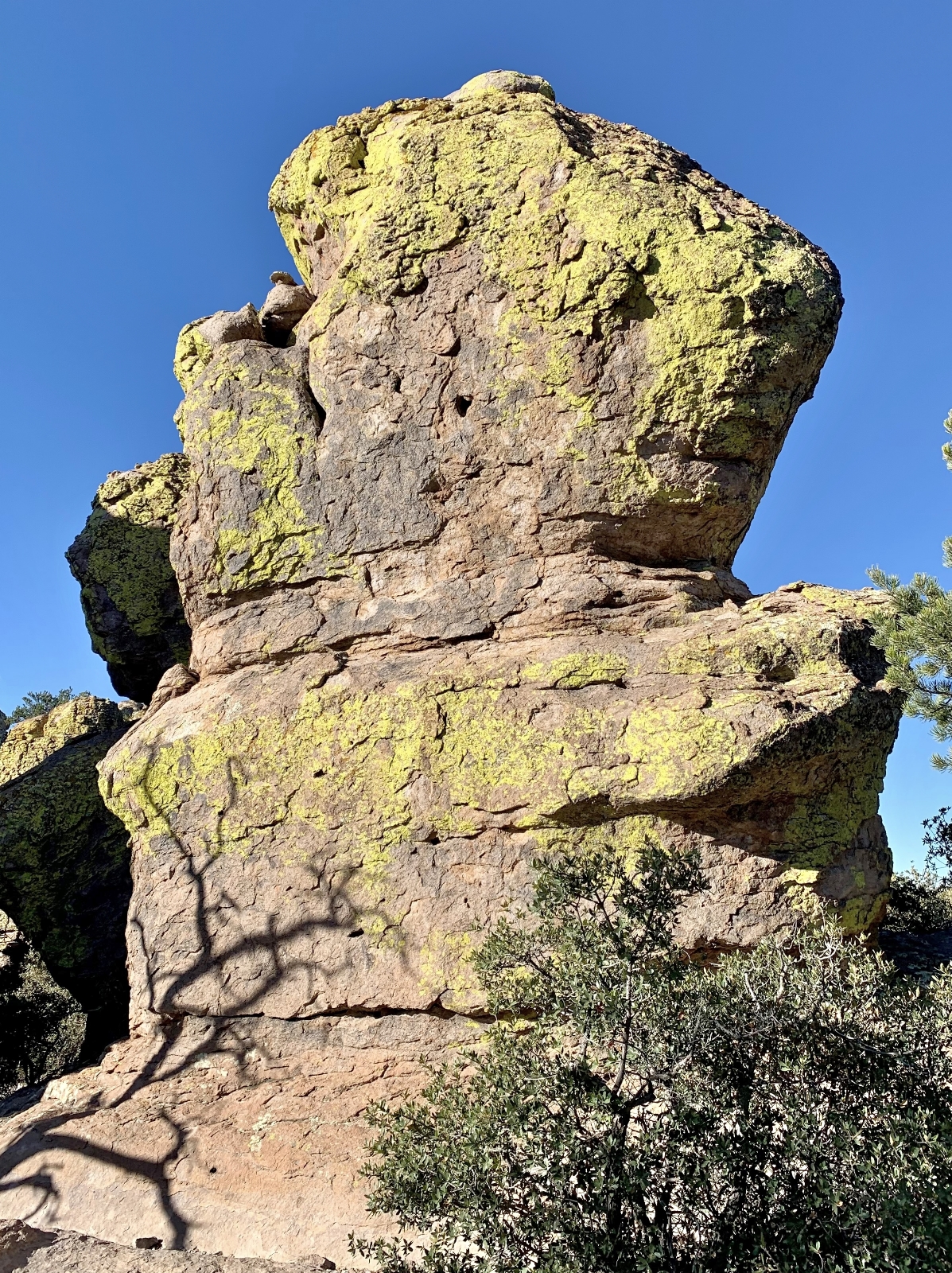
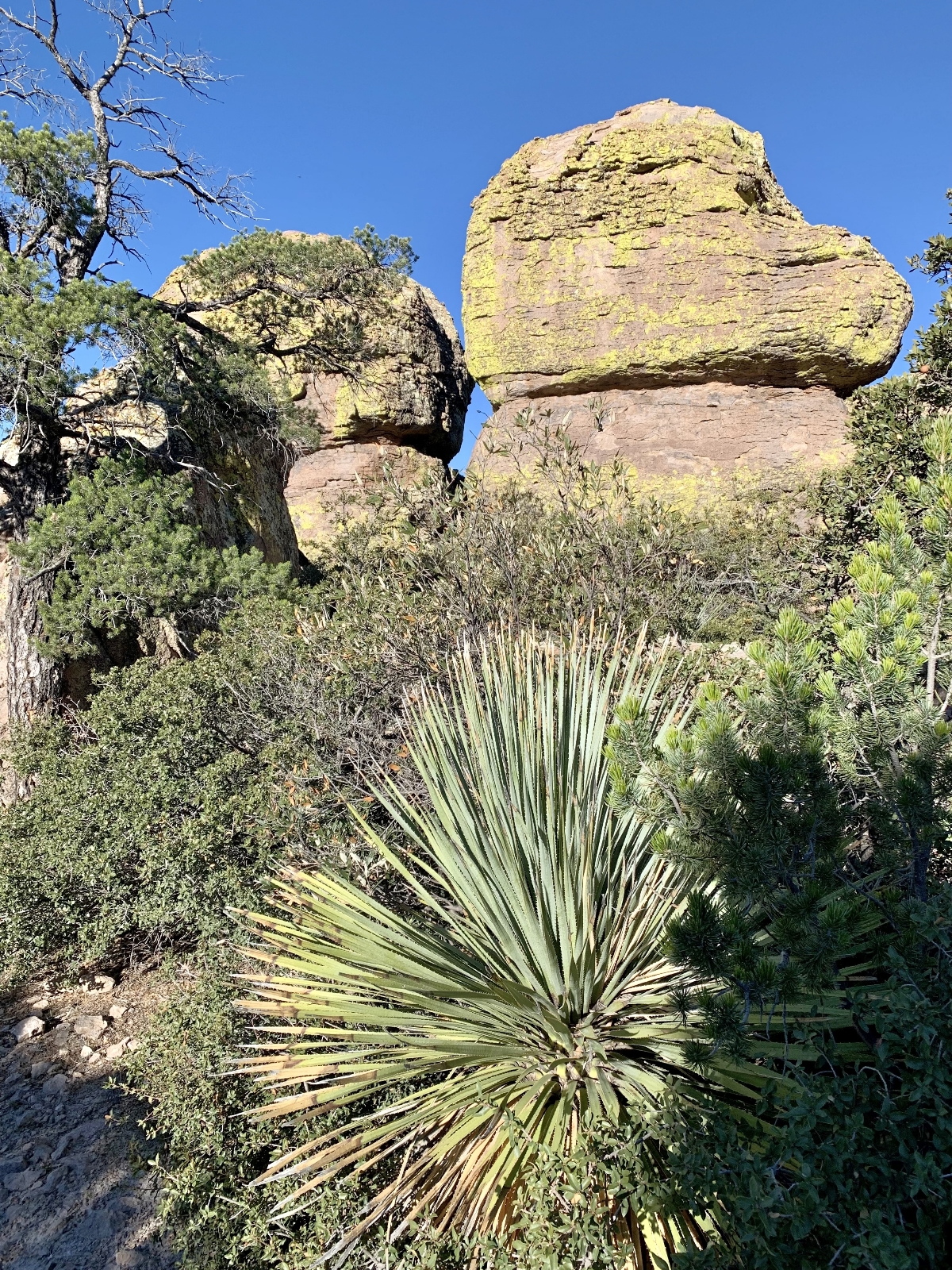
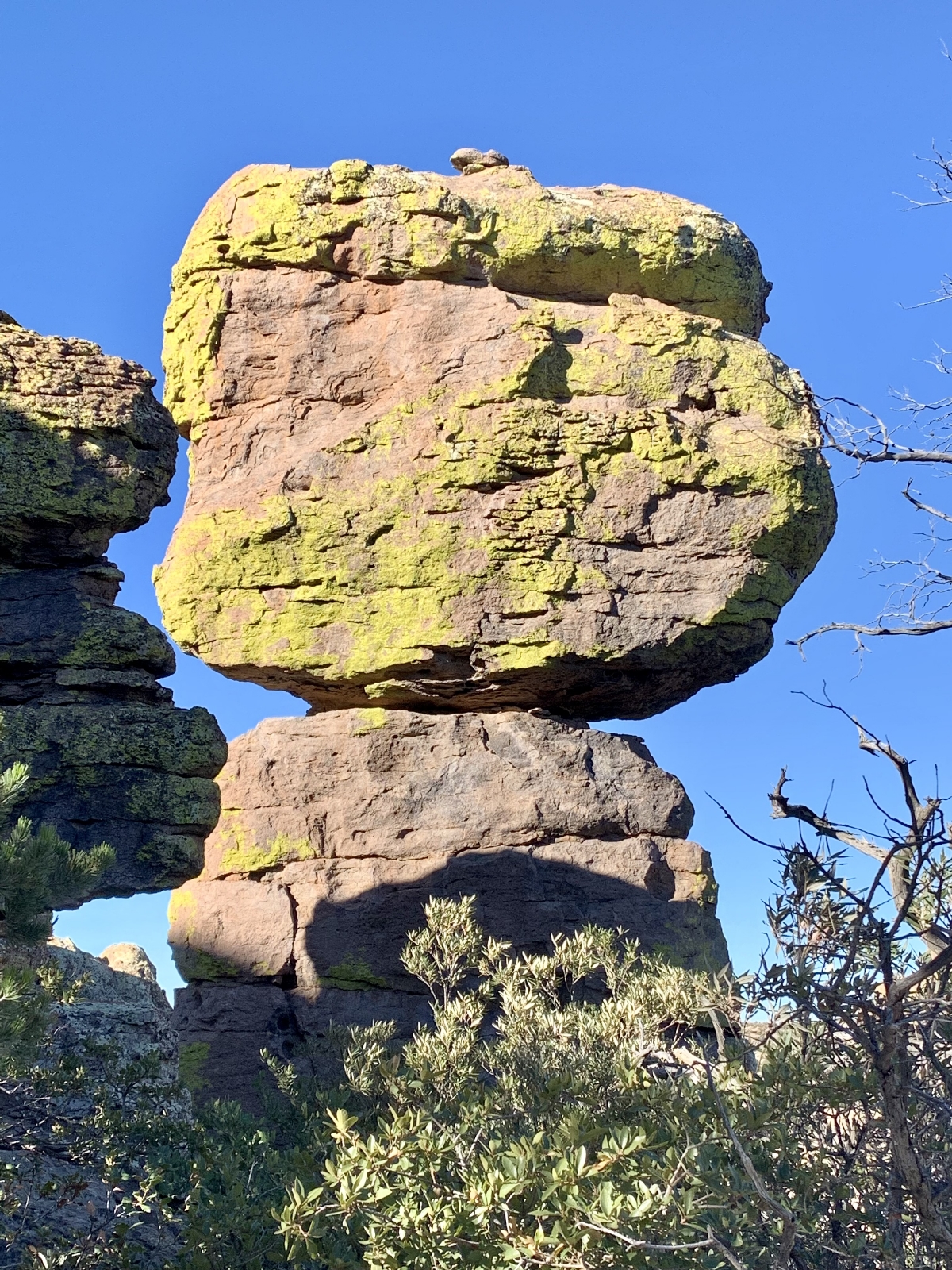
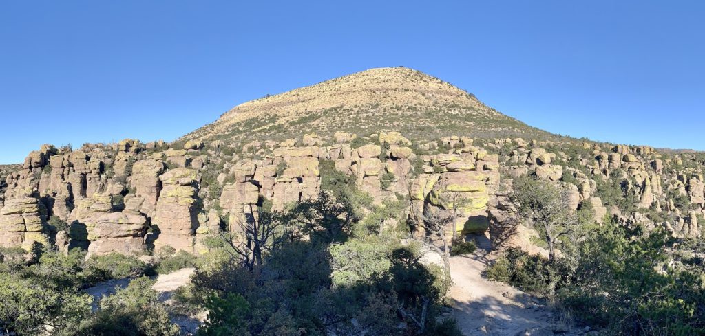
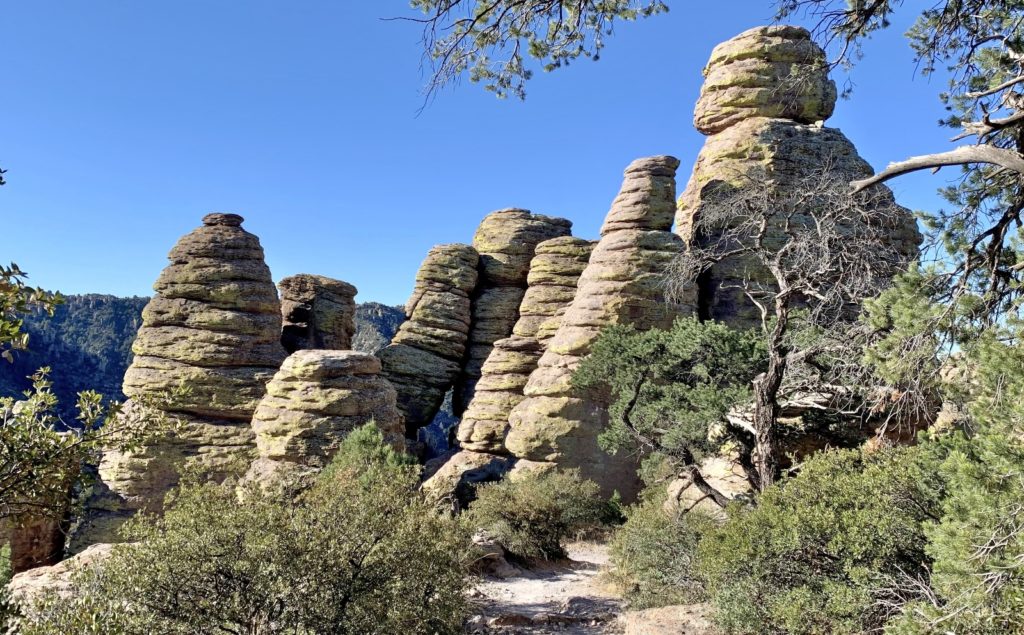
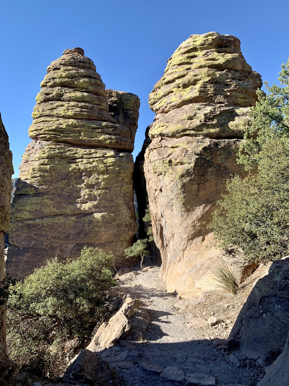
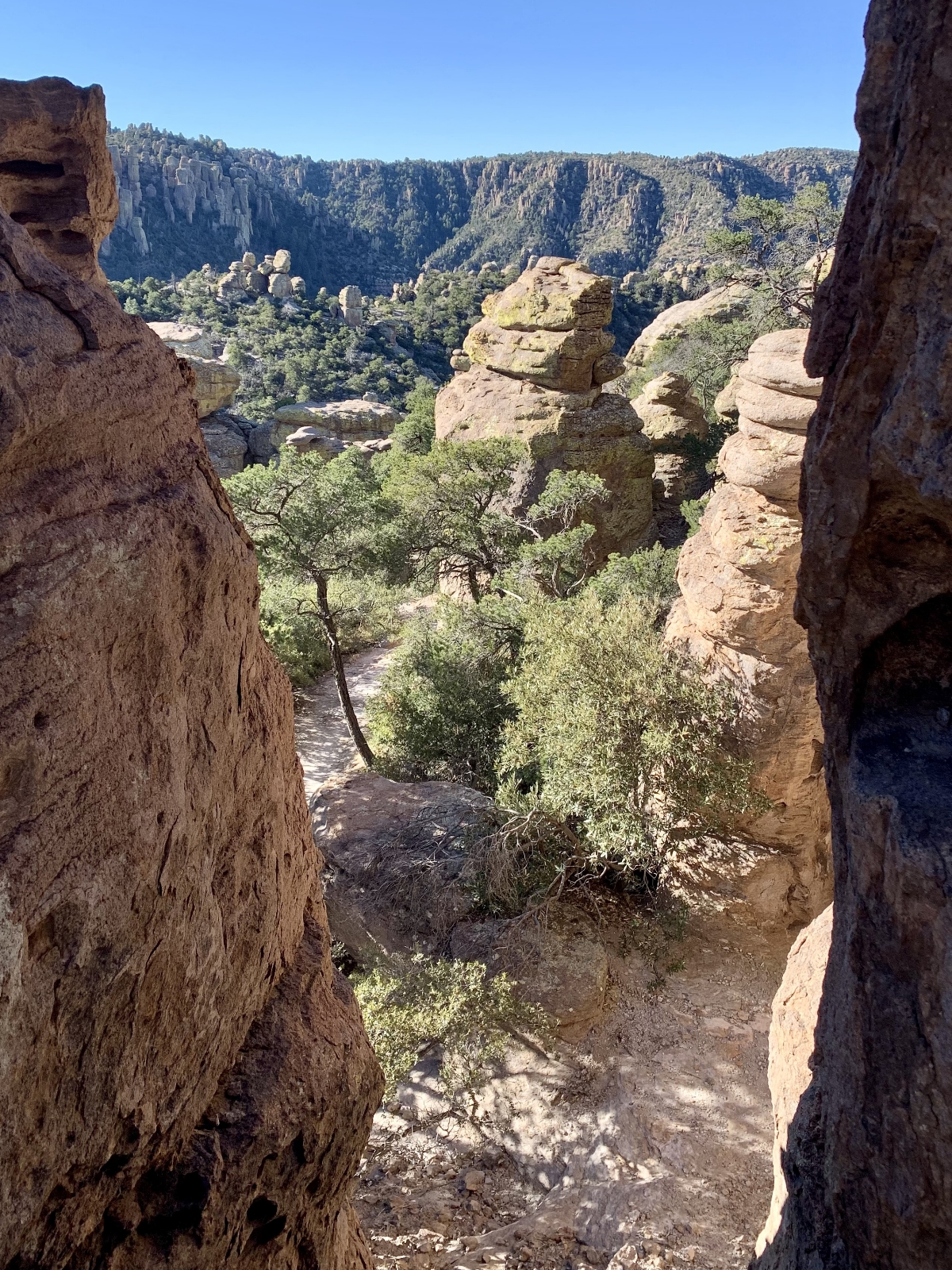
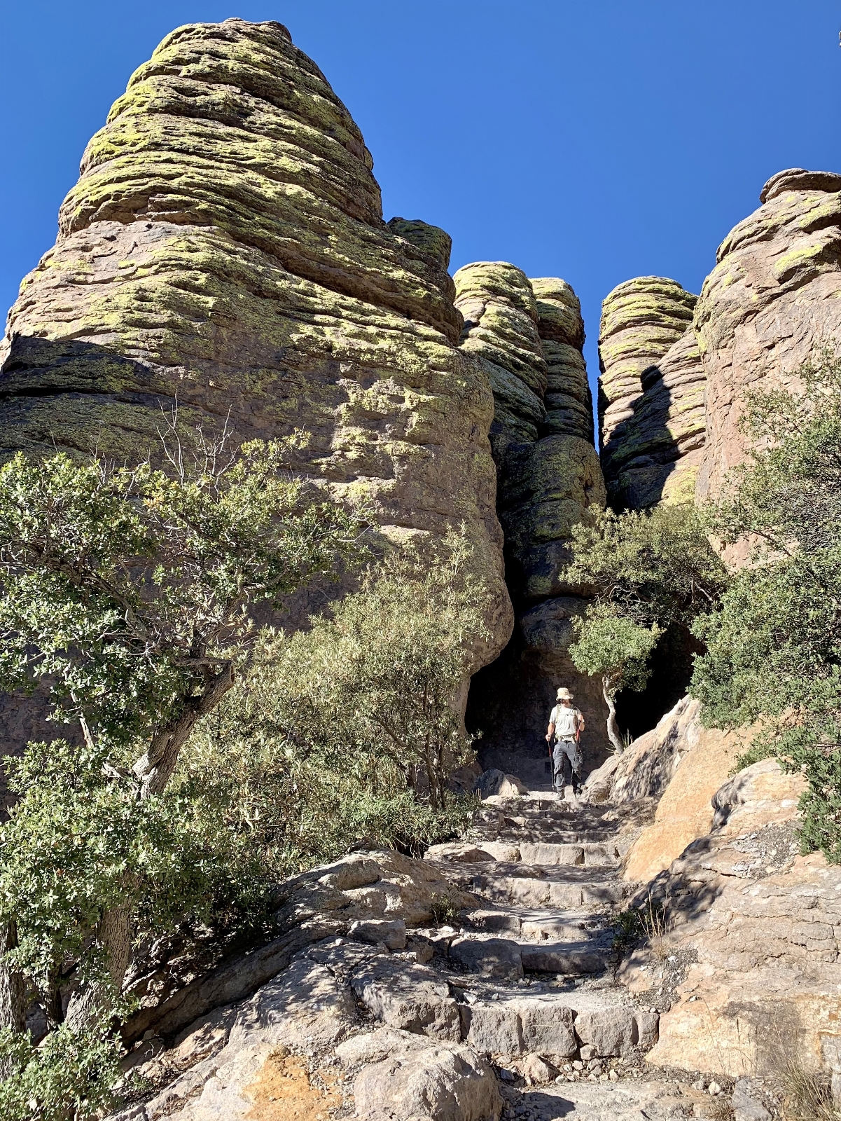
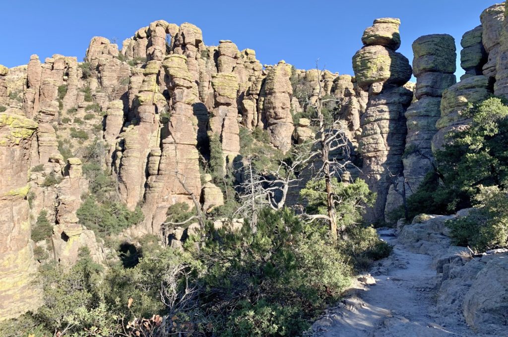
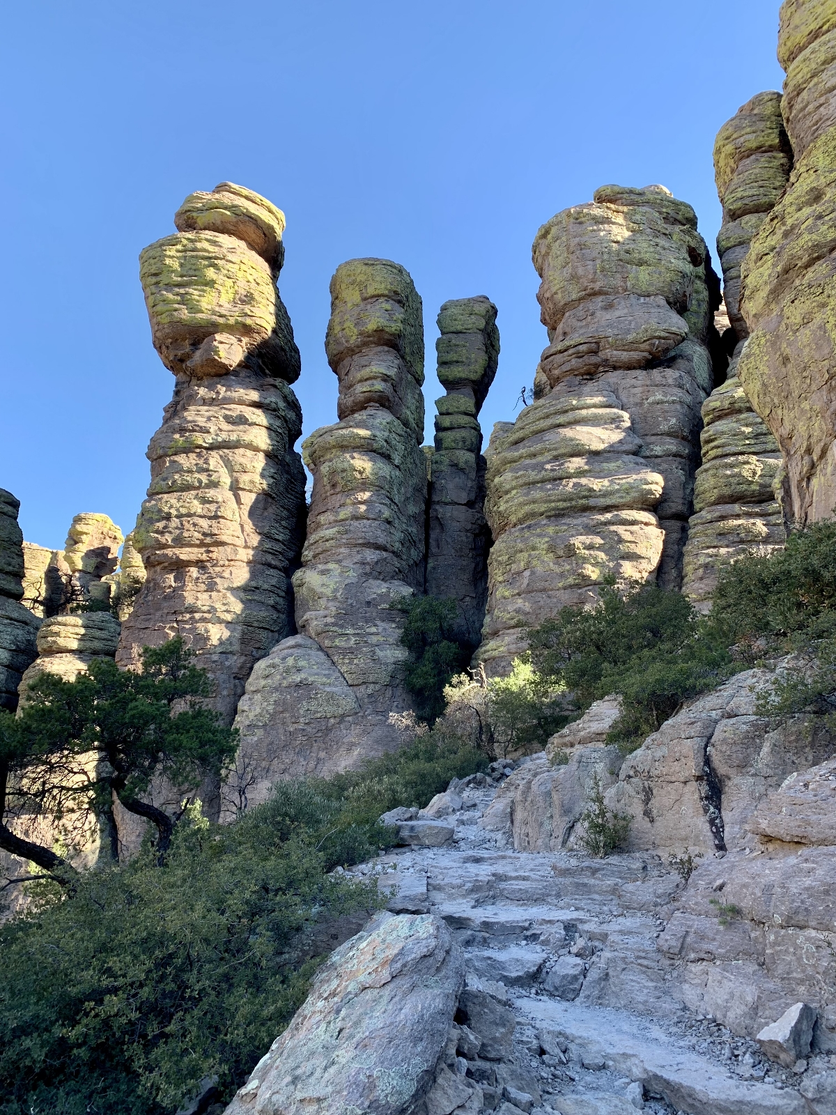
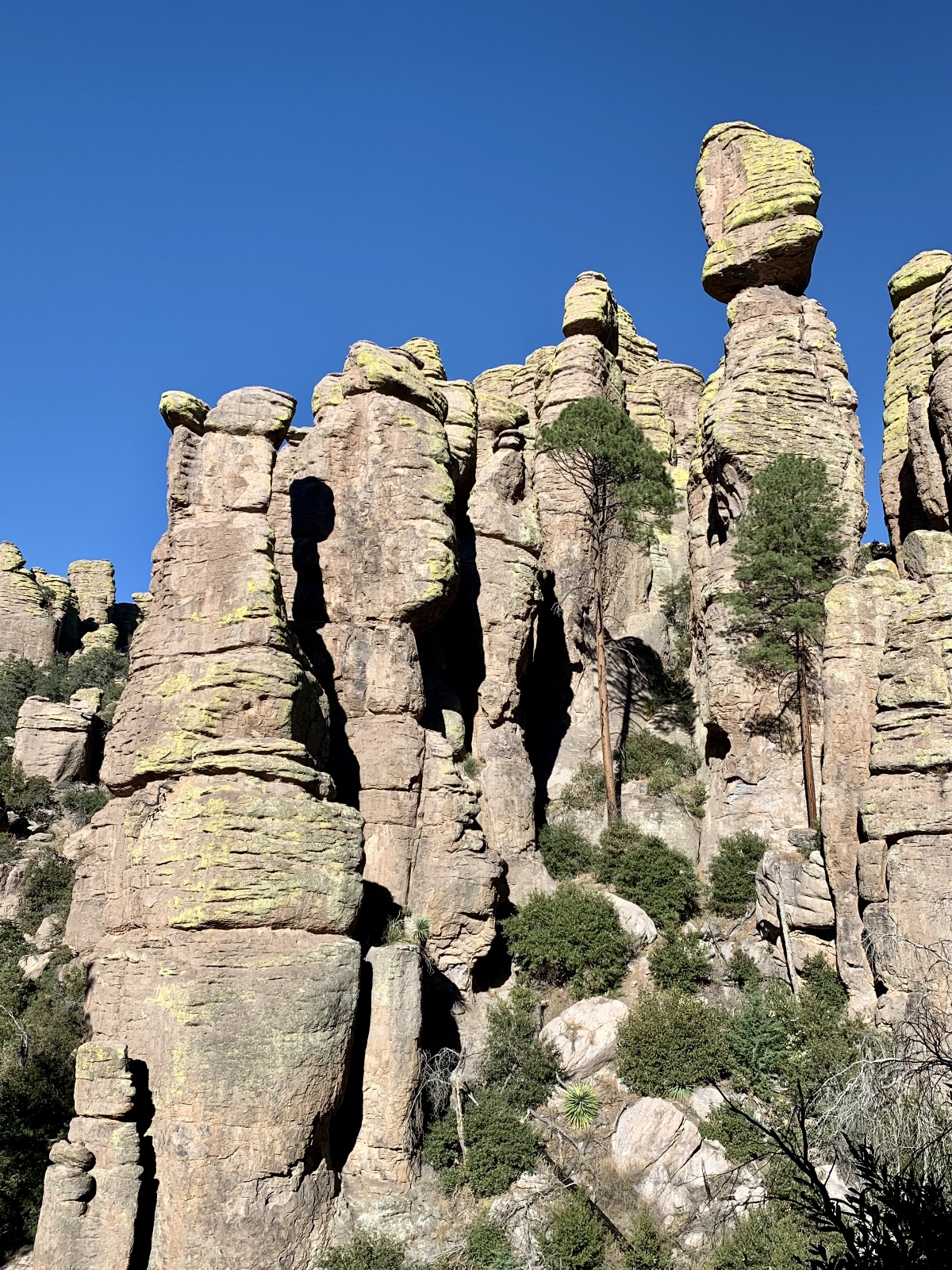
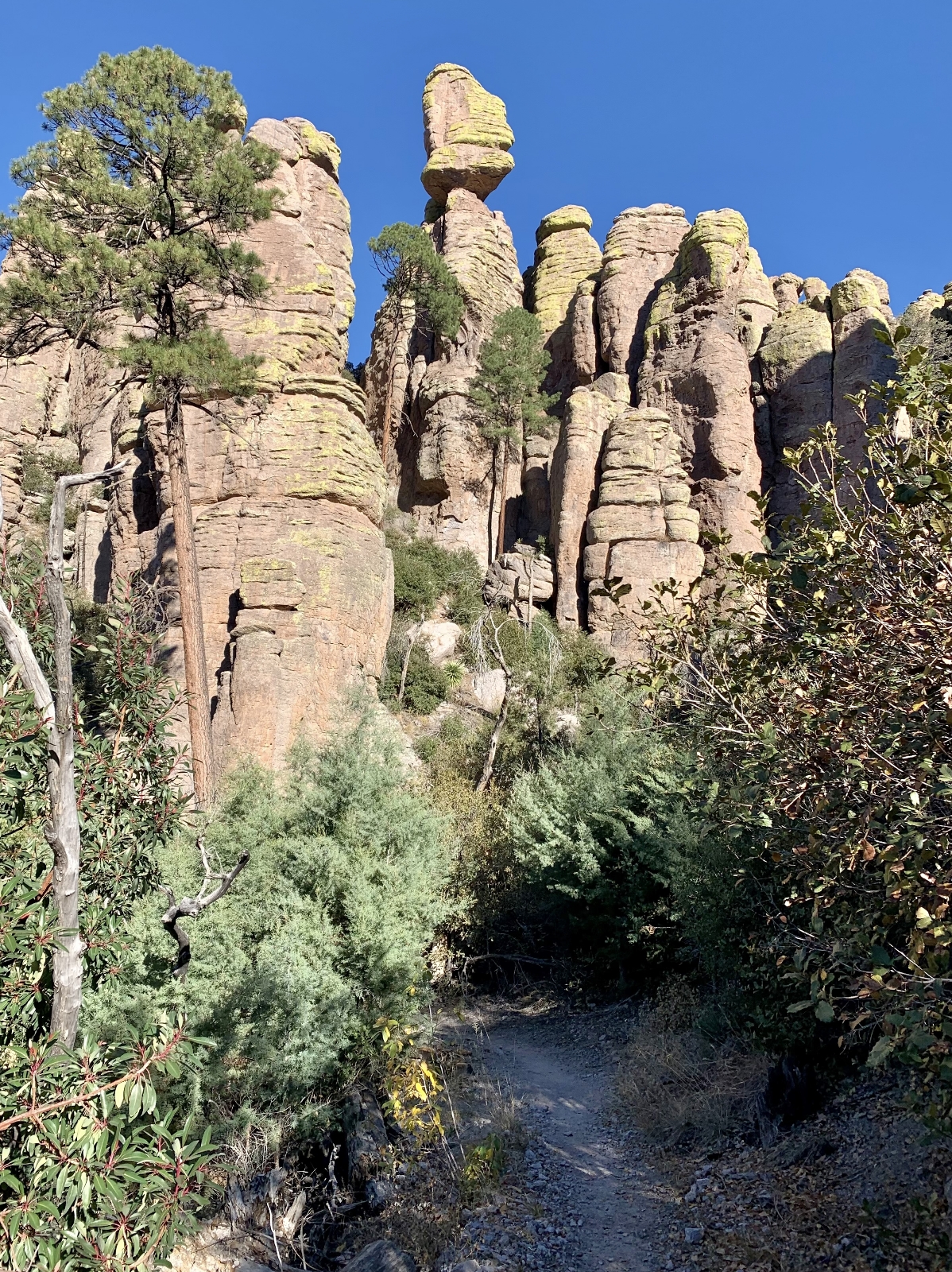
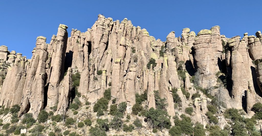
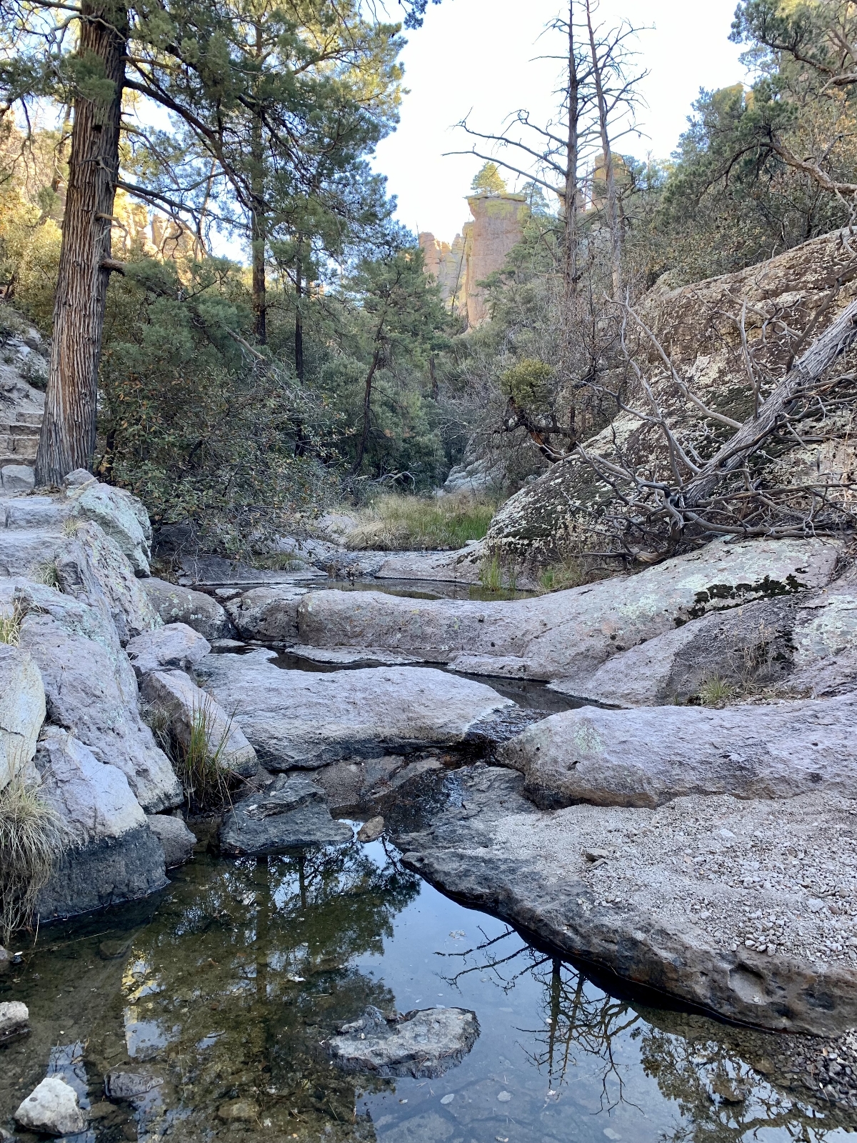
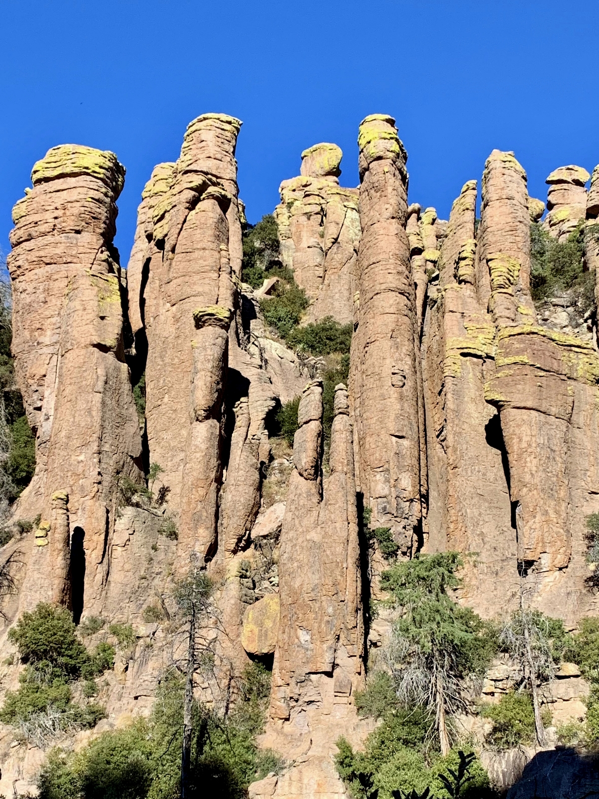
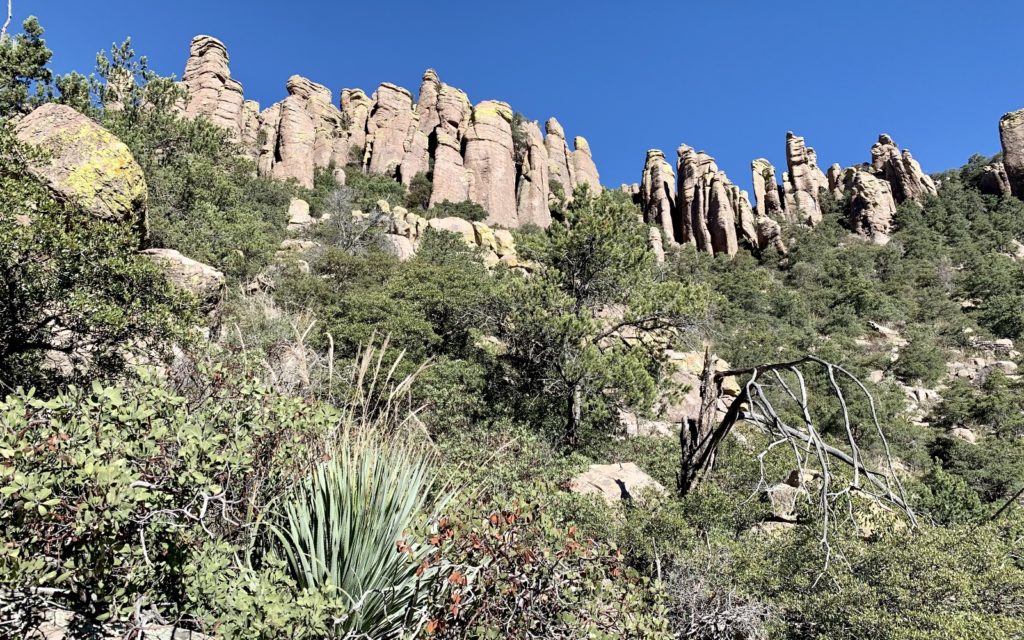
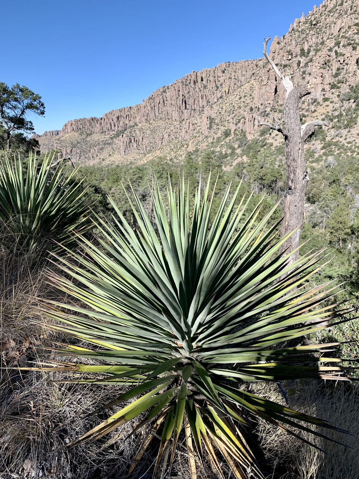
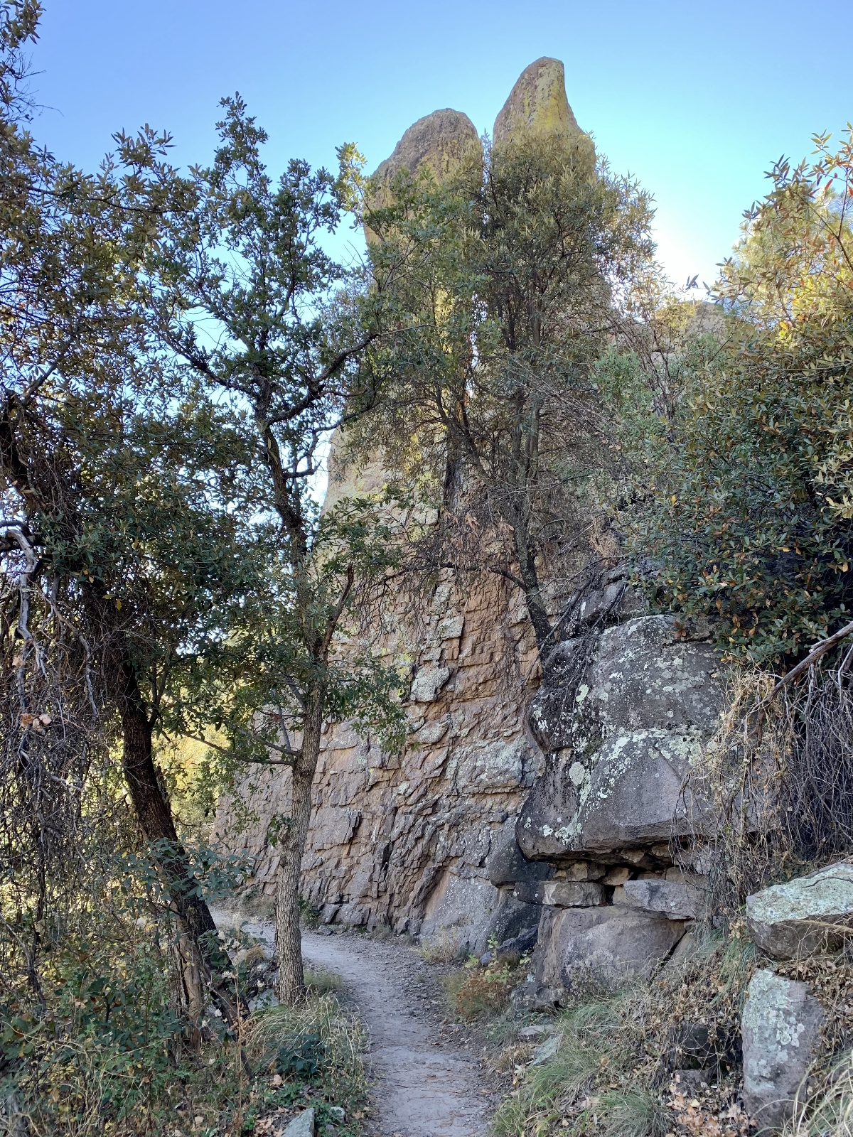
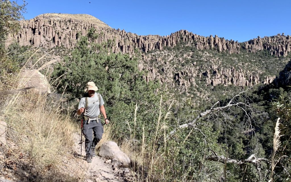
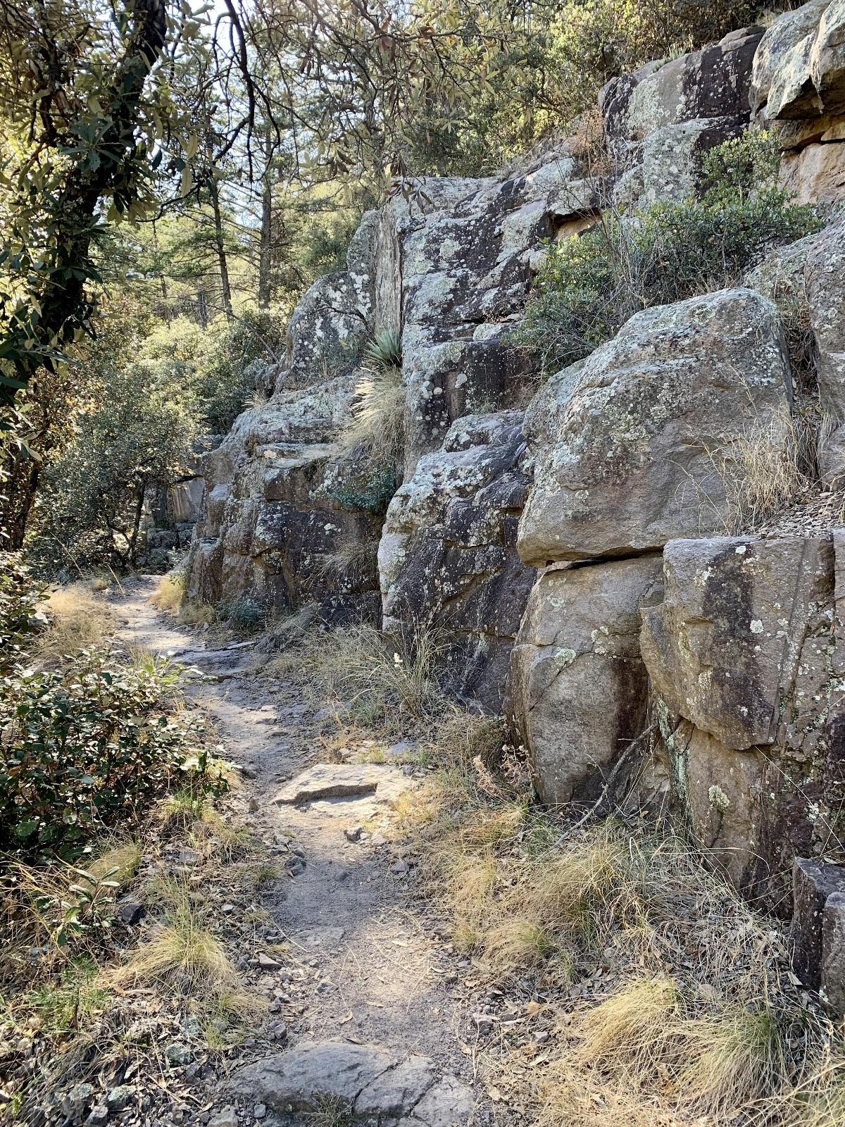
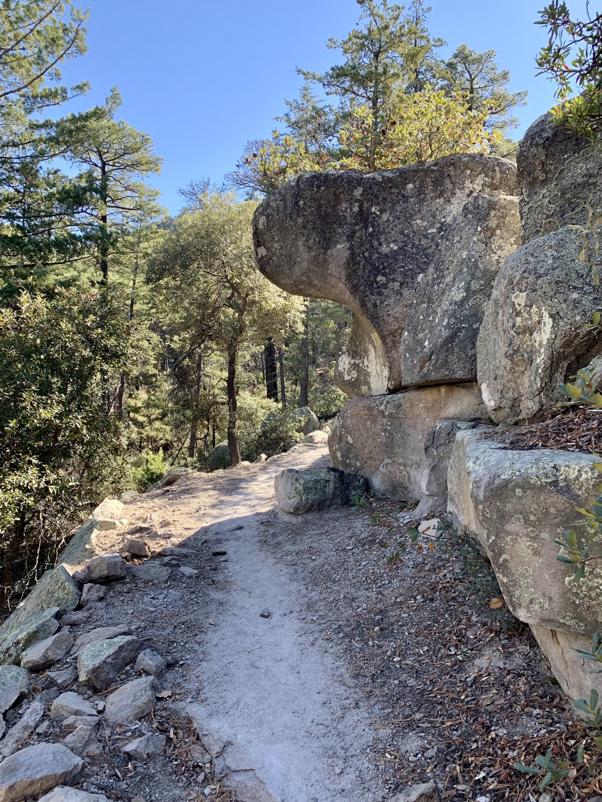
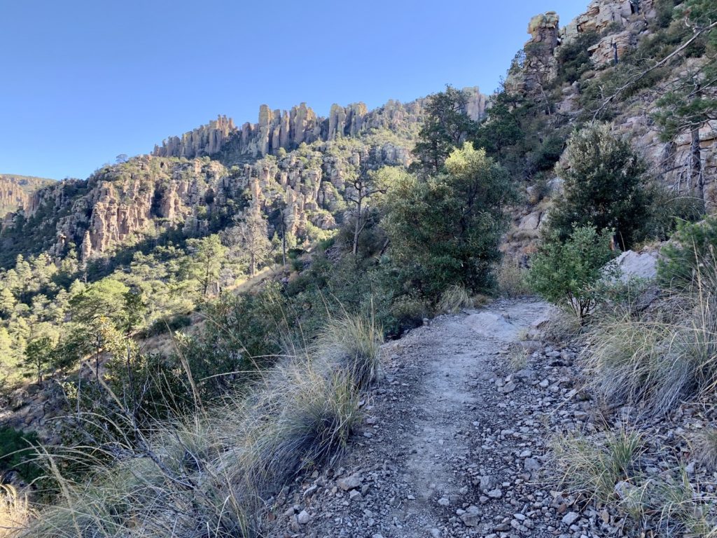
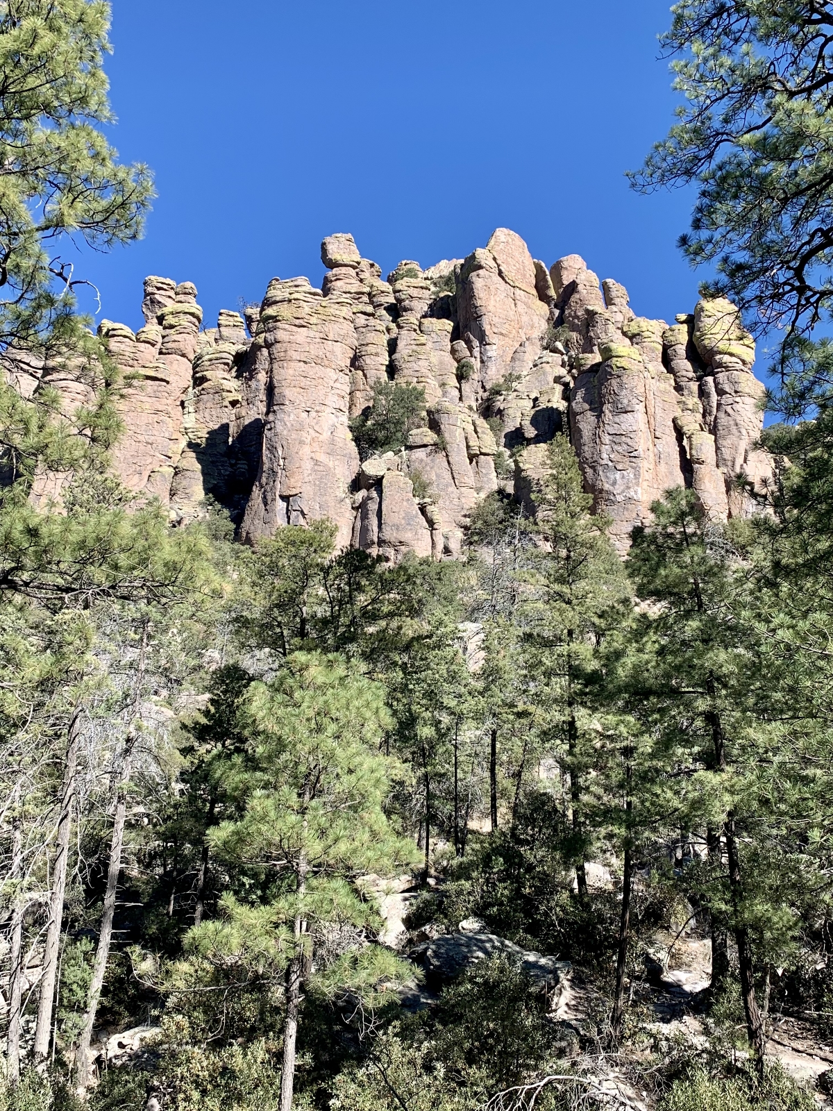
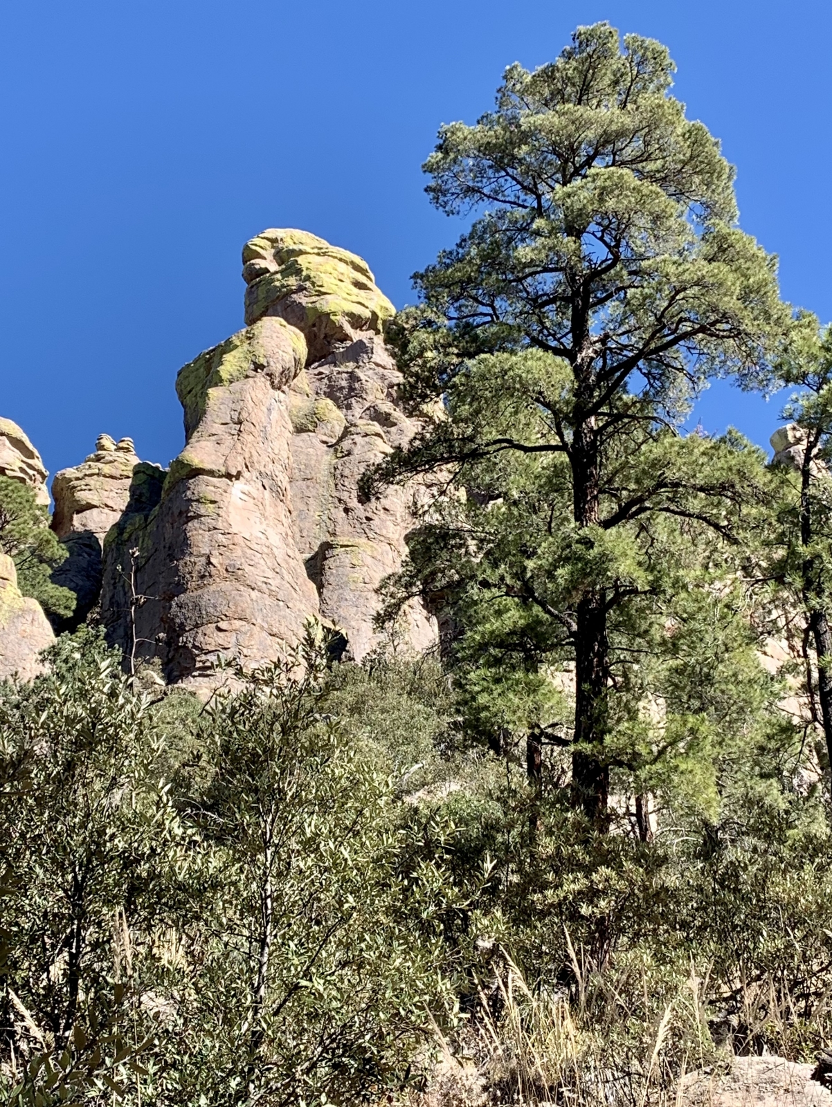
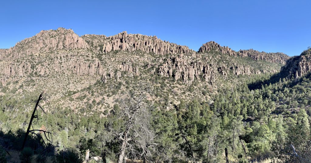
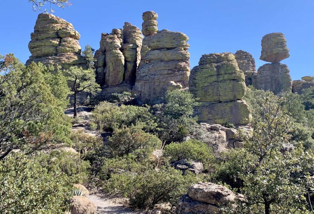
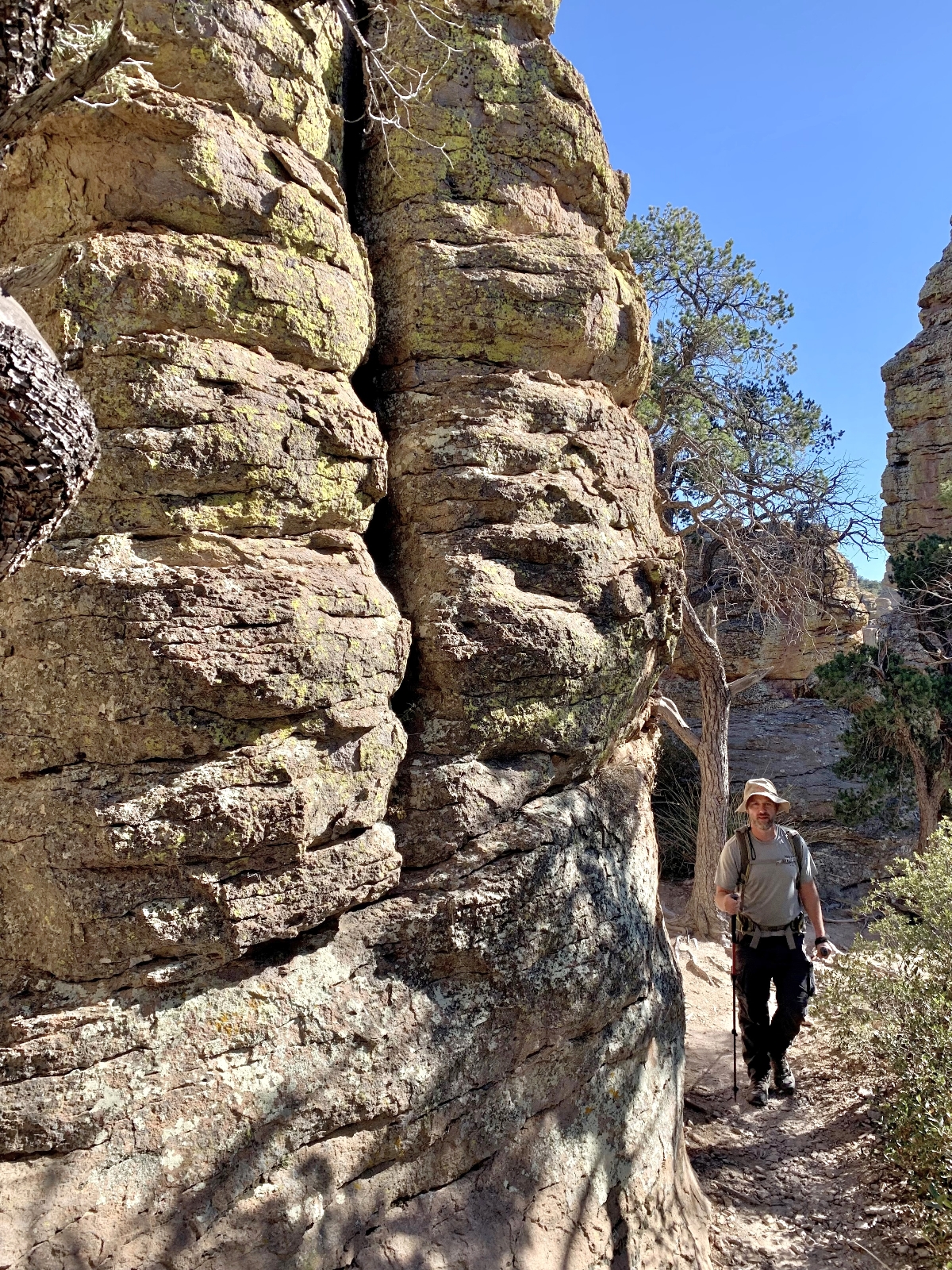
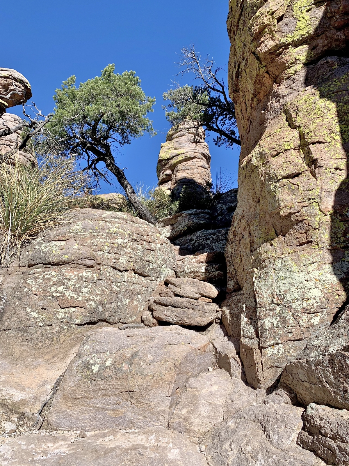
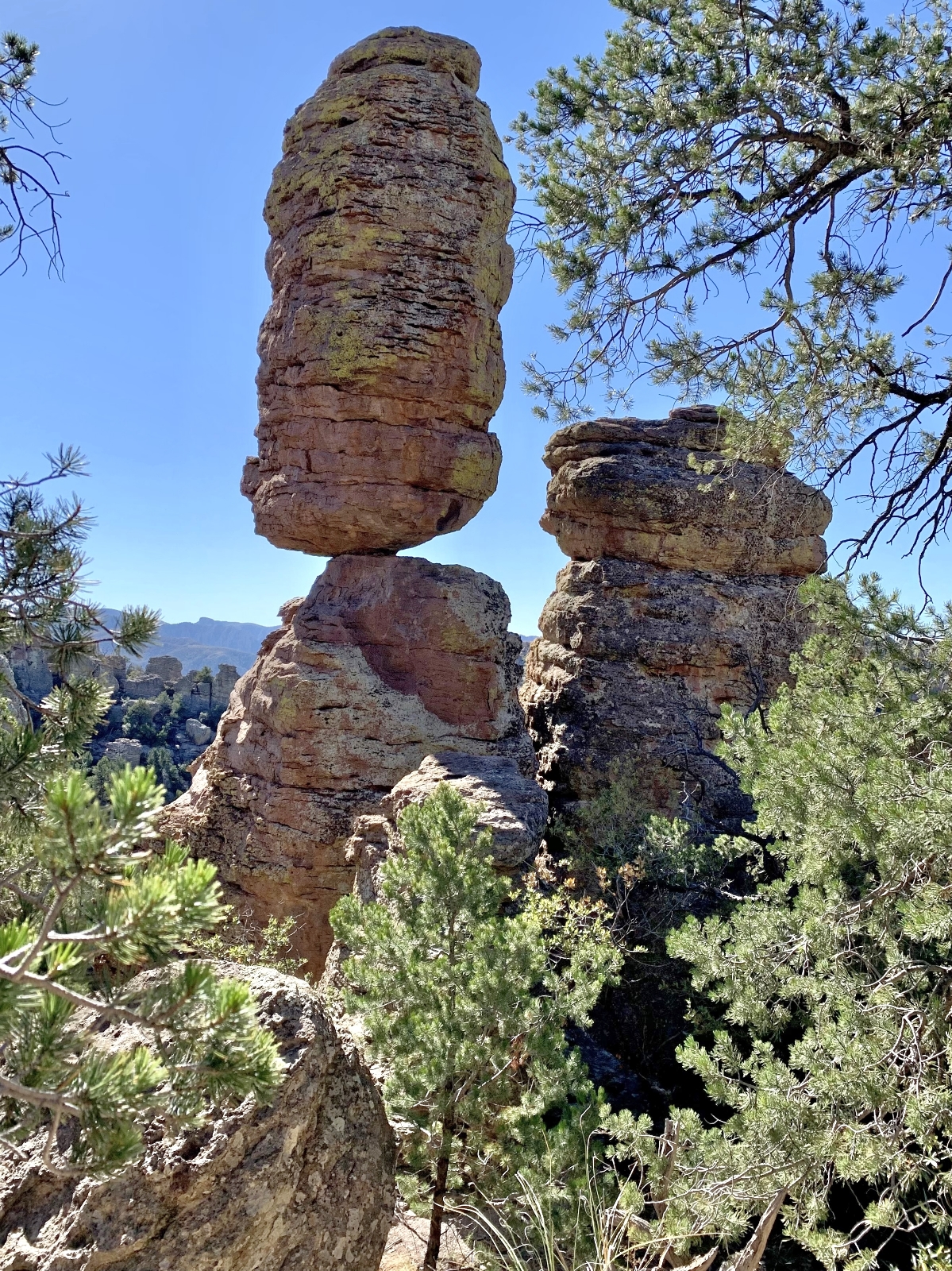
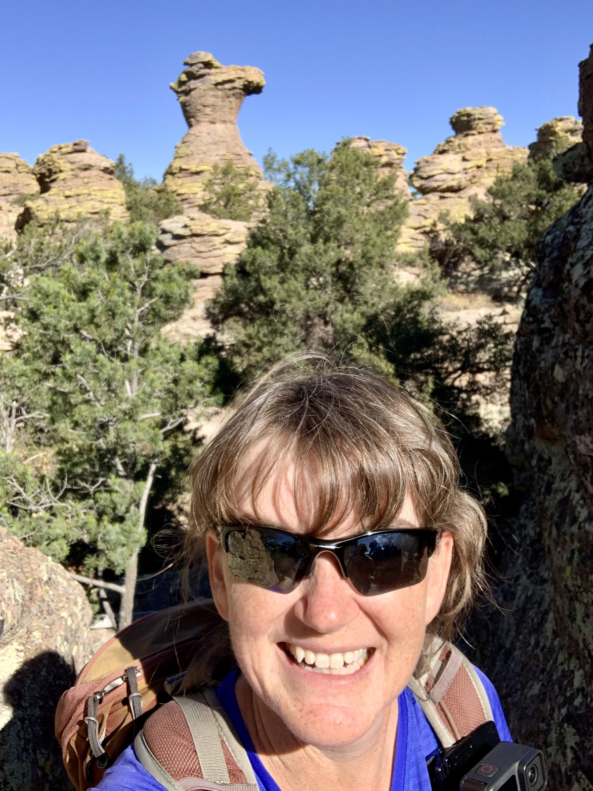
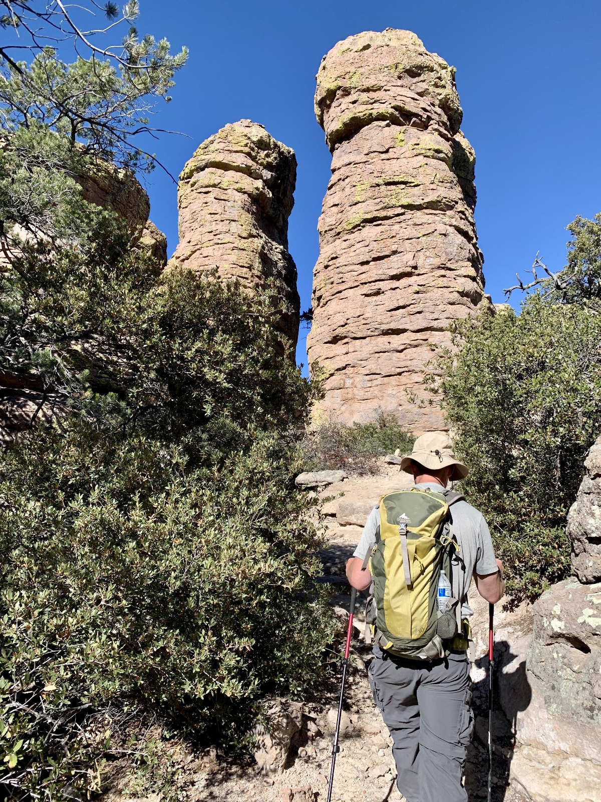
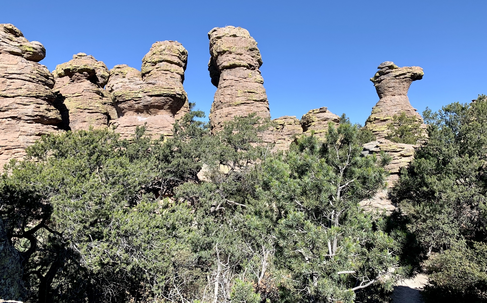
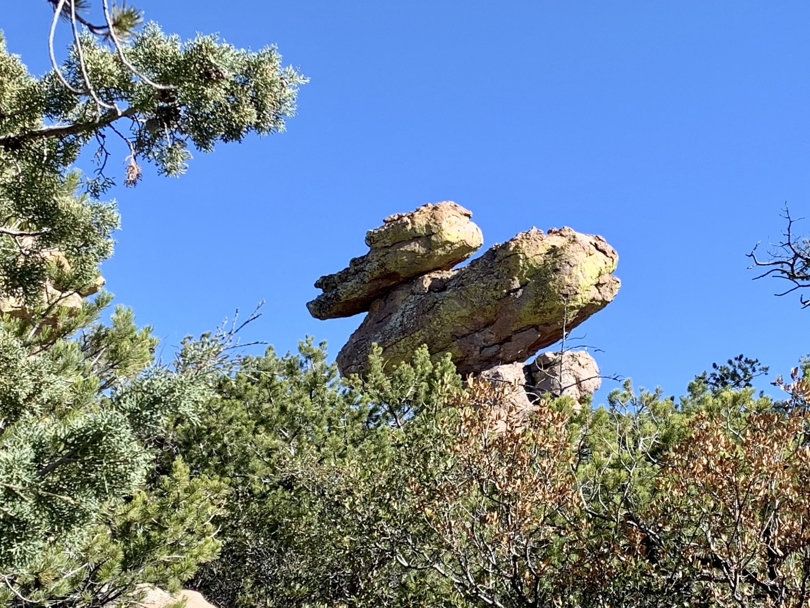
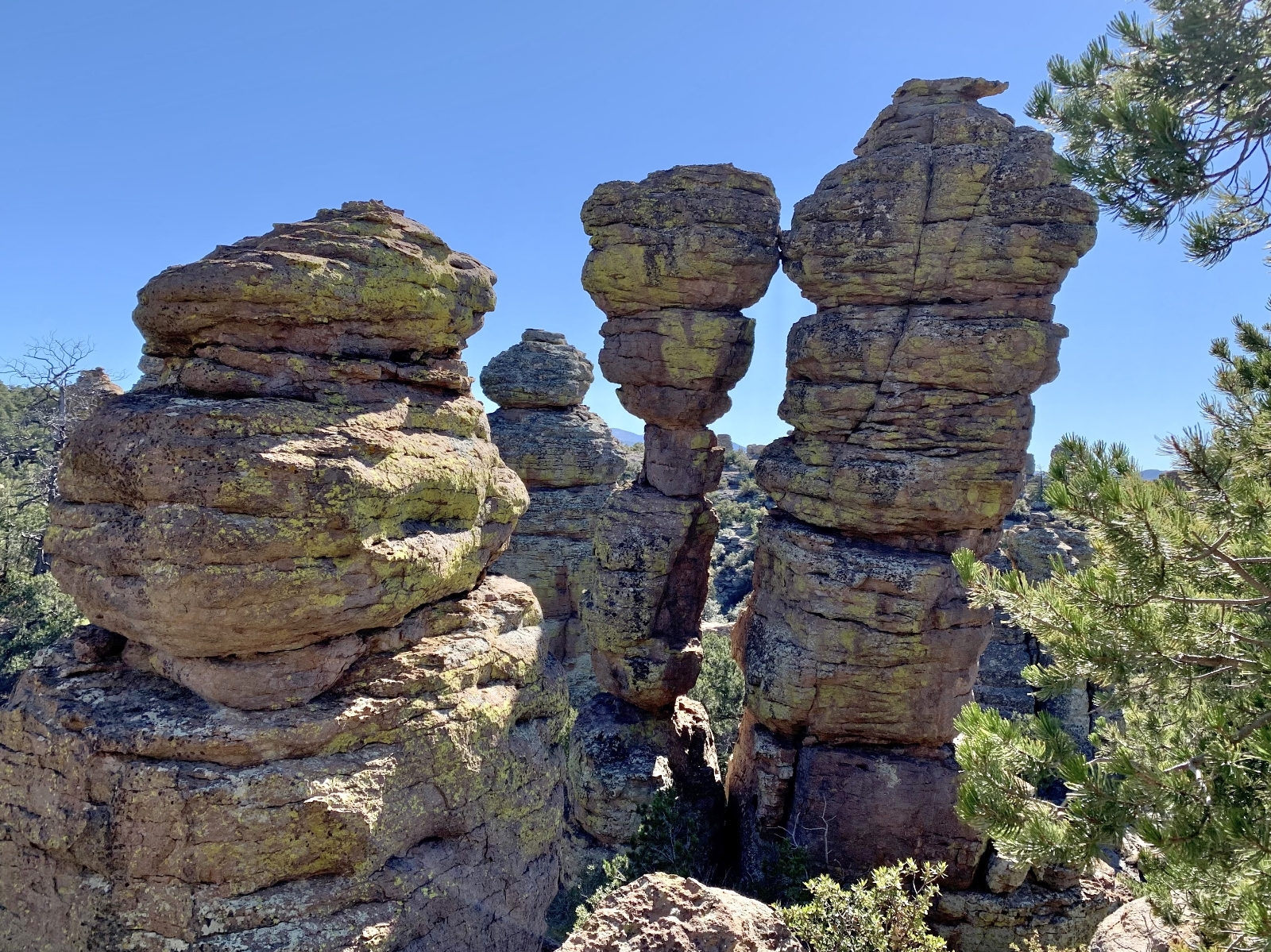
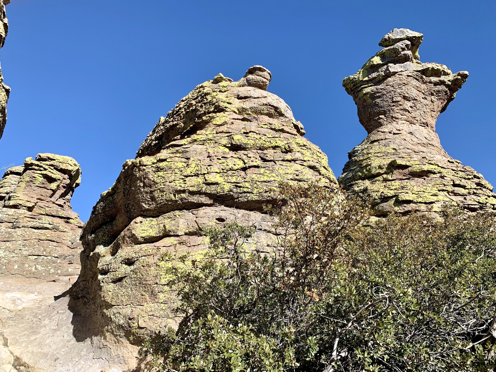
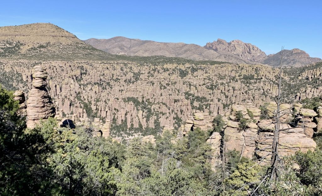
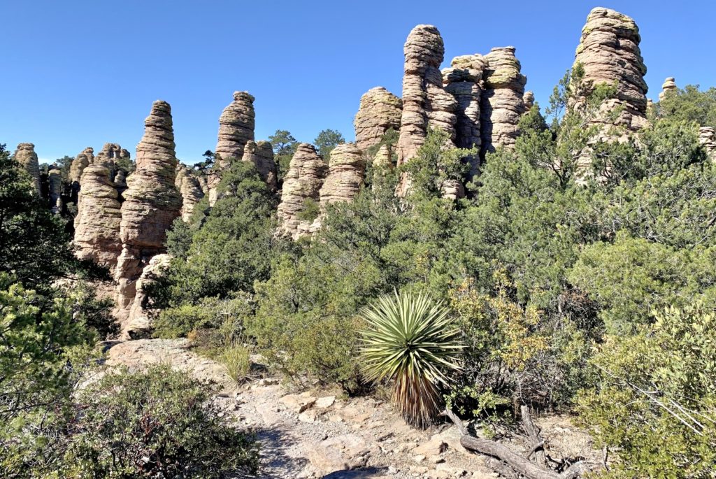
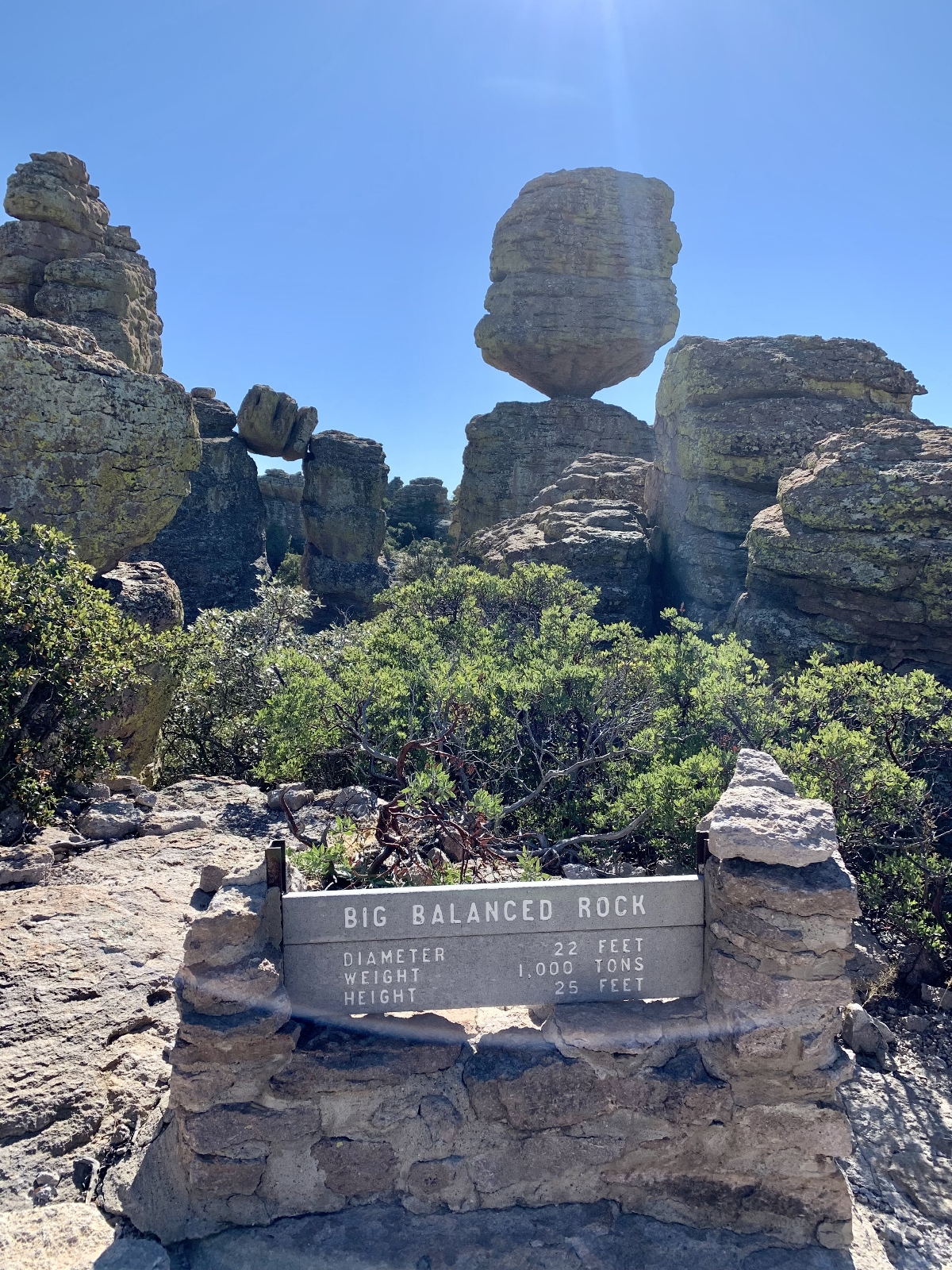
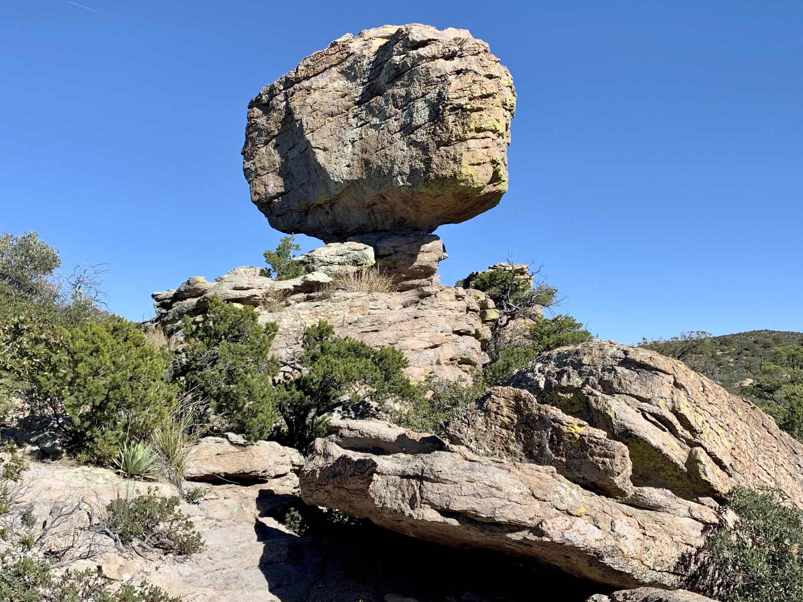
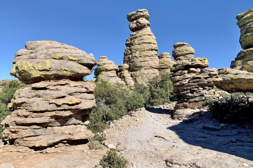
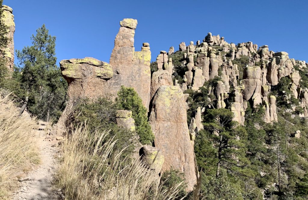
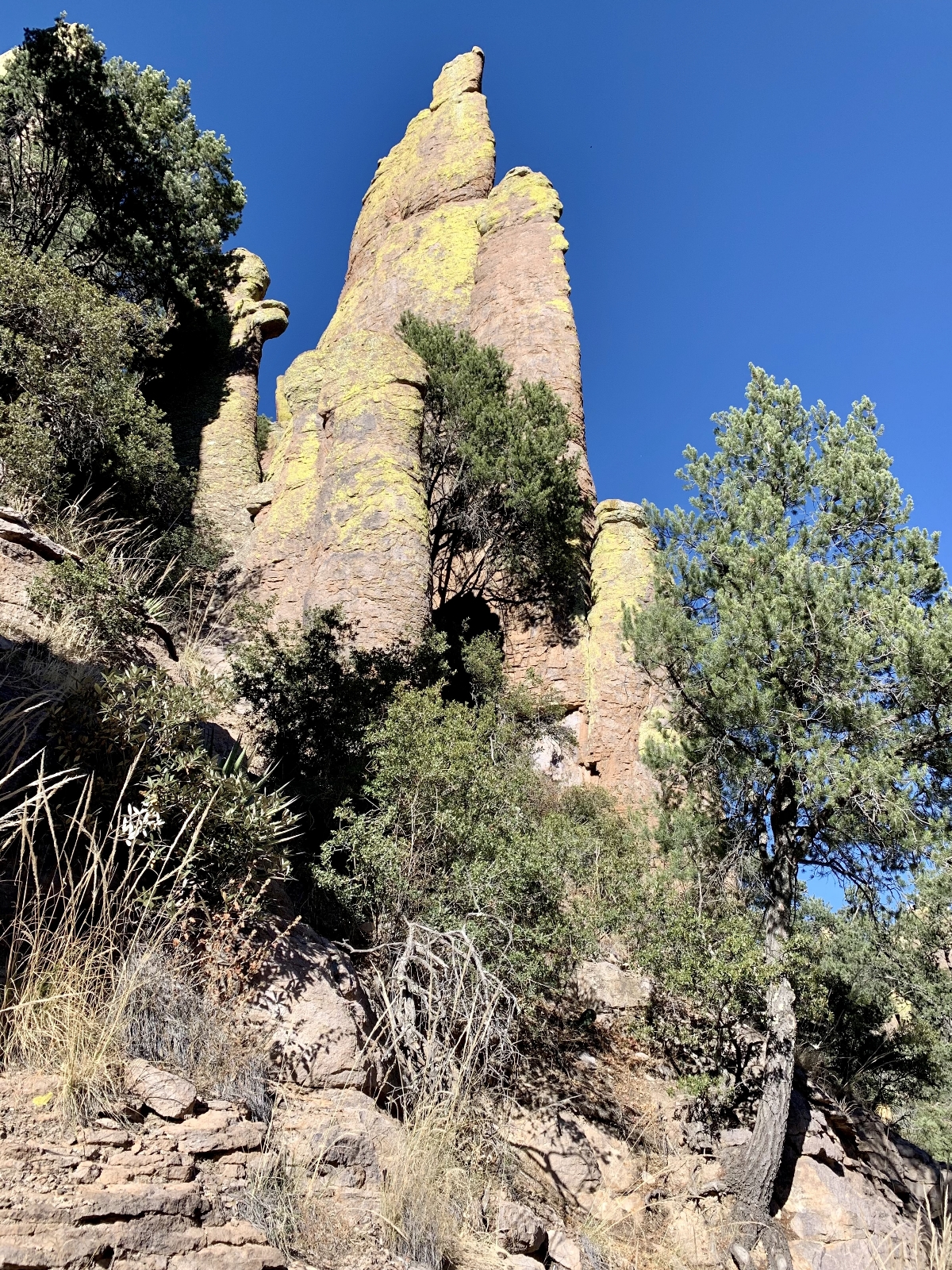
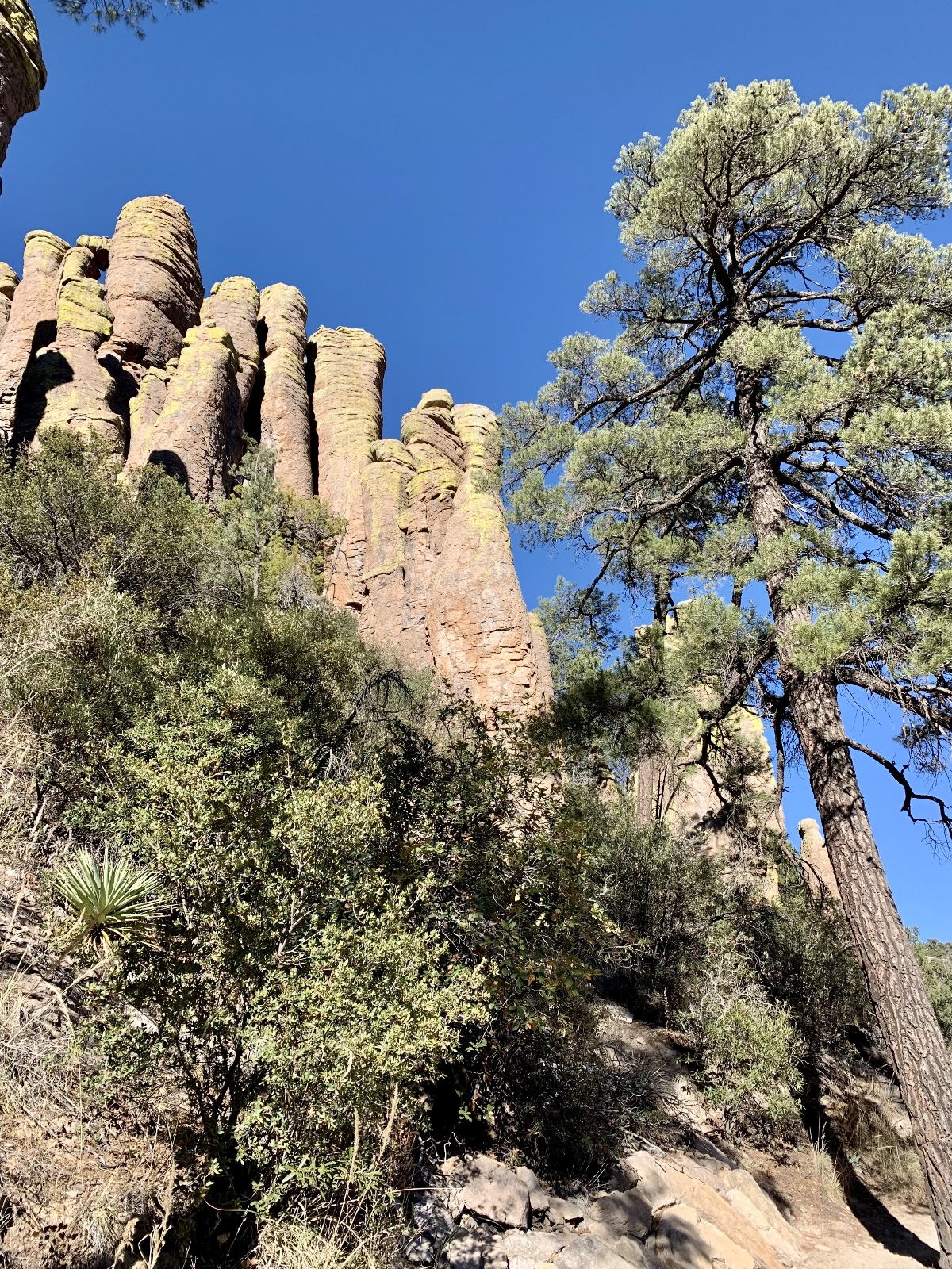
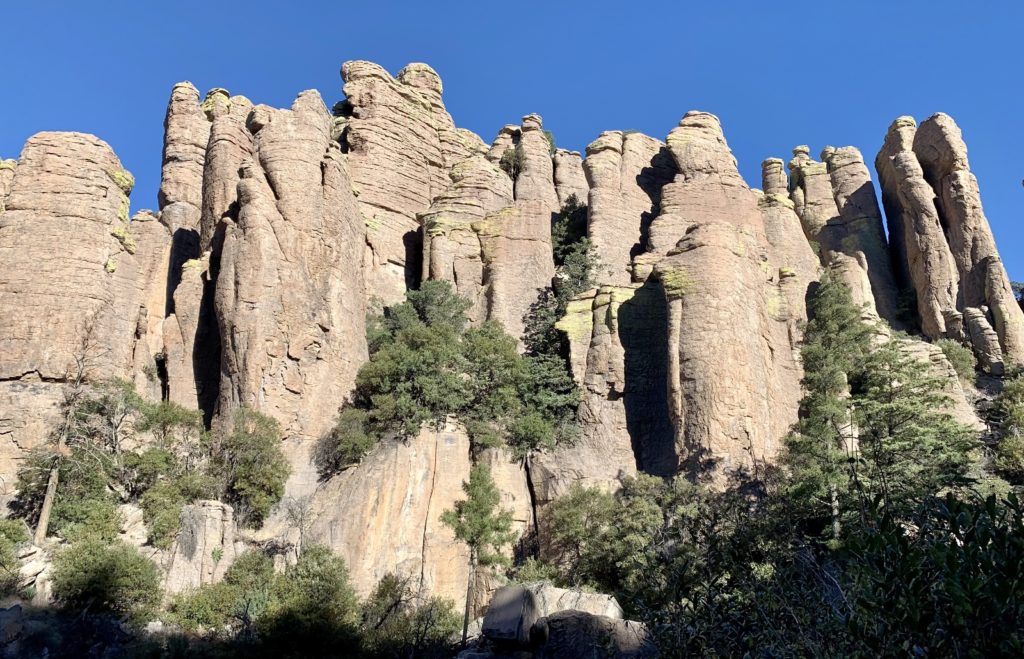
Approximately 27 millions years ago, a cataclysmic volcanic eruption south of present-day Chiricahua spewed ash and molten debris to form the approximately 12 mile wide Turkey Creek Caldera. Ash and debris settled and compacted, forming a thick layer of rock called rhyolite tuff. The rock layer fissured and eroded over time, forming the spectacular rhyolite rock pinnacles we see today. At times rising hundreds of feet into the air, many of these pinnacles are balancing on a small base, seemingly ready to topple over at any time. It is easy to see why the Apaches called this place “The Land of Standing-Up Rocks.” Today, many of the rocks are covered with bright neon green lichen, a plantlike organism that consists of algae or cyanobacteria and fungi.
Visiting Chiricahua National Monument
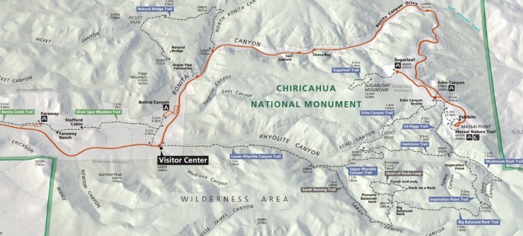
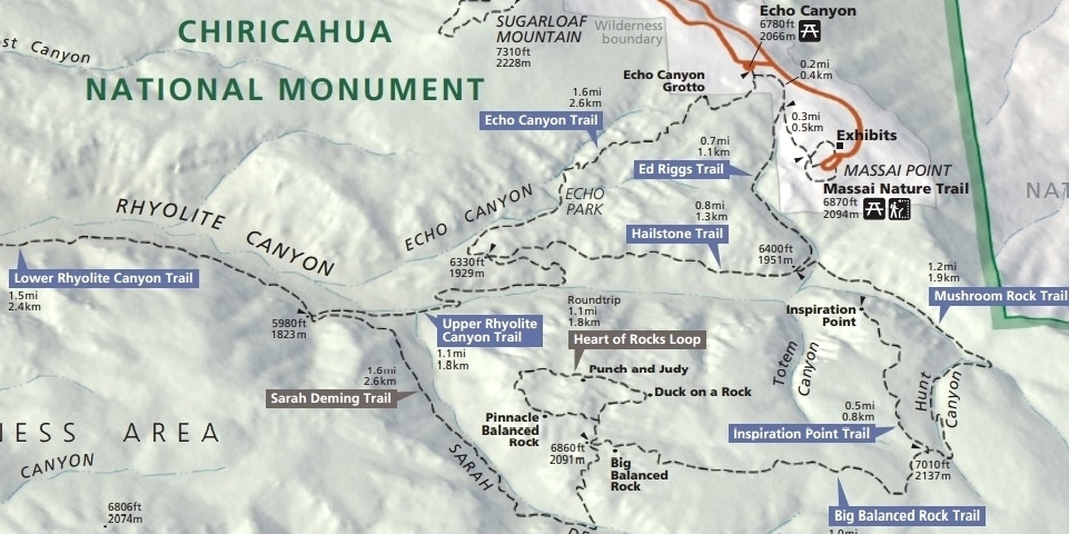
Chiricahua National Monument packs a lot of goodie into its 12,025 acres (click here for park map). Drive the 8 mile Bonita Canyon Drive from the visitor center to Massai Point—I promise you will find yourself gawking out the window at the massive rock formations towering above. For the best views, hike down into the hoodoos on some of the monument’s 17 miles of trail. Visit the Faraway Ranch, which was owned by Swedish immigrants Neil and Emma Erickson and is now preserved within the monument. The National Park Service offers ranger lead tours of the ranch; however, those weren’t being offered during our visit due to the COVID pandemic. Stop at the visitor center to view their exhibits relating to the geology, natural history, and cultural history of the area. And be sure to bring a picnic lunch to enjoy at one of the scenic pullouts.
Camping is available inside Chiricahua National Monument at the Bonita Canyon Campground. It is located in a shady pine and oak grove near the riparian area of Bonita Canyon Wash. It has 25 sites with flush toilets, running water, picnic tables, and garbage. Vehicle length limit is 29 feet and camping is limited to 14 days. Campsites can be reserved through Recreation.gov.
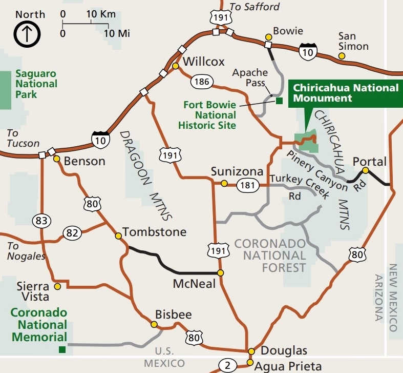
Chiricahua National Monument is located 120 miles southeast of Tucson. Take I-10 east from Tucson to the first exit for Willcox. Travel 3 miles into town to the stoplight and turn right. You will follow Arizona State Highway 186 for 32 miles to the junction of Arizona State Highway 181. Turn left and 4 miles later you will be at the Chiricahua entrance station. The park is open 24/7 and the visitor center is open from 8:30 am to 4:30 pm (MST) every day of the year. Chiricahua National Monument is a fee free park. No entrance fee is required!
Hiking
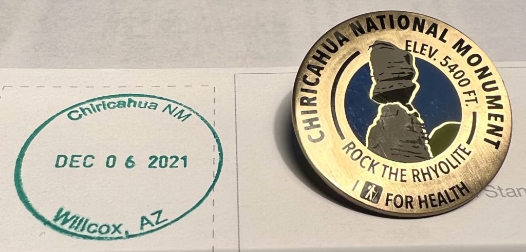
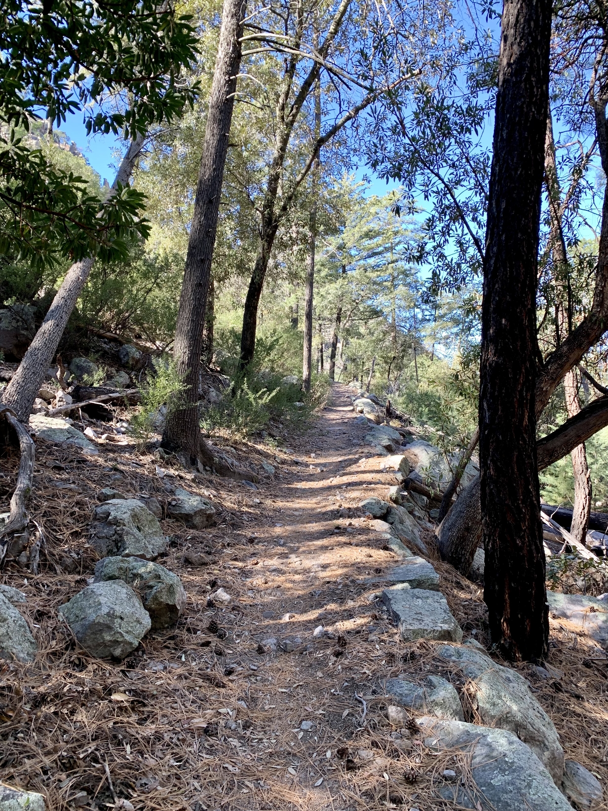
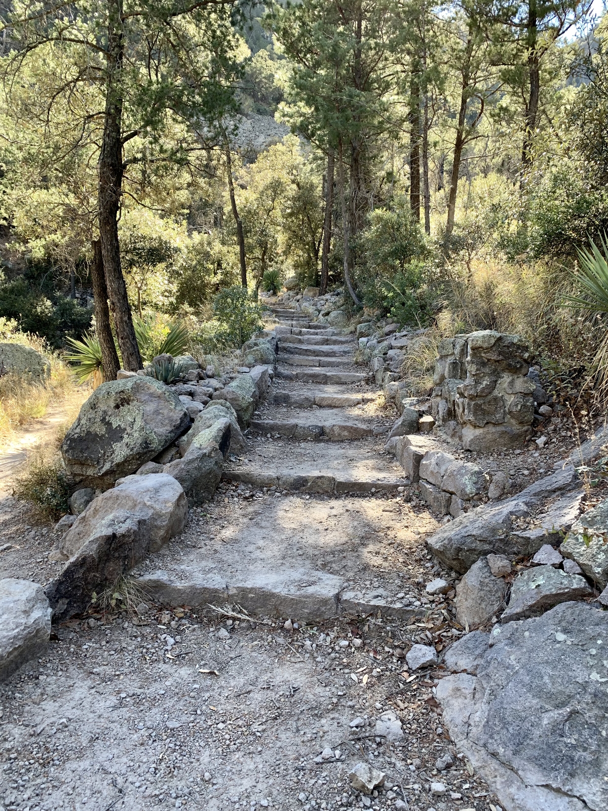
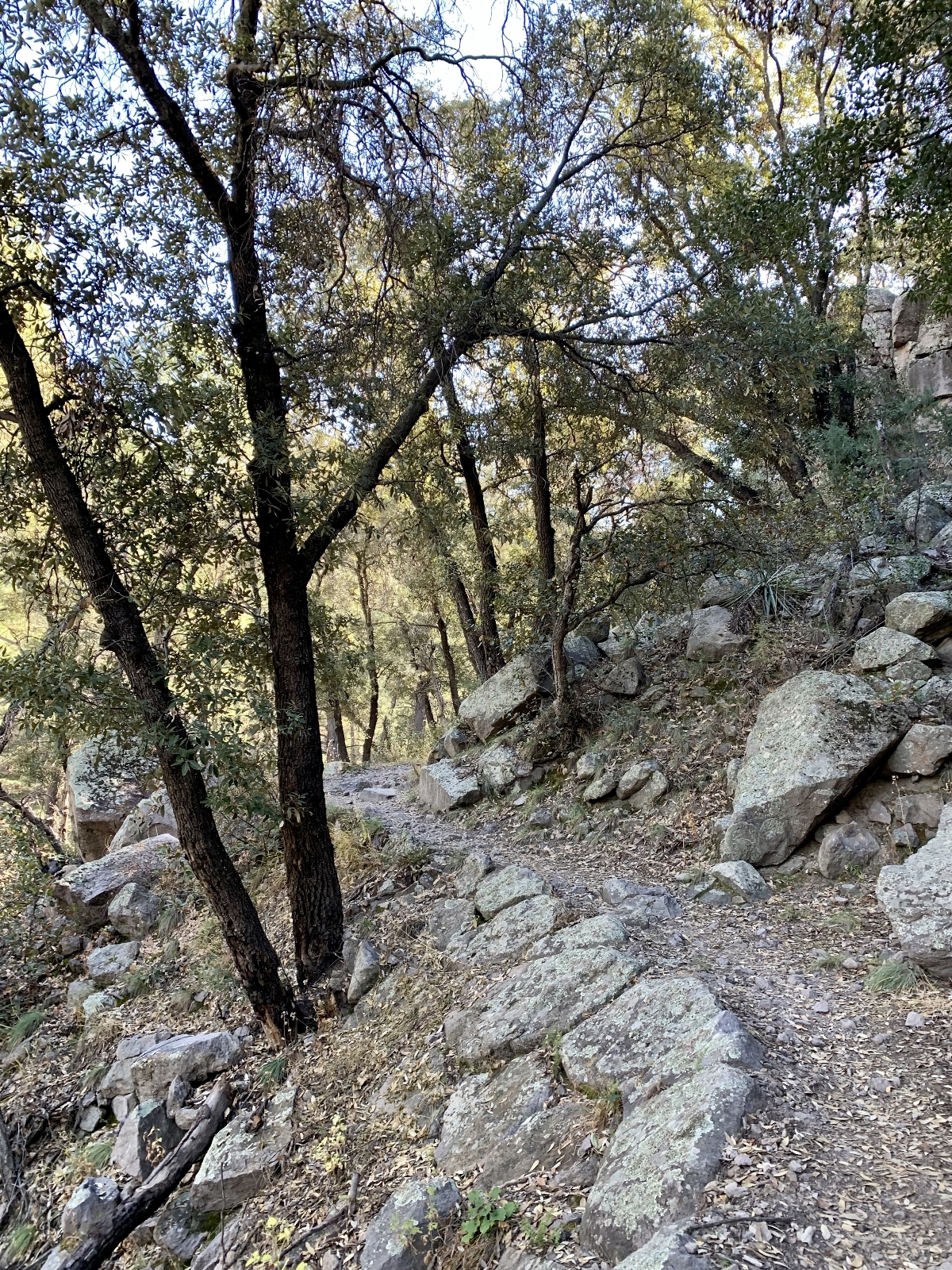
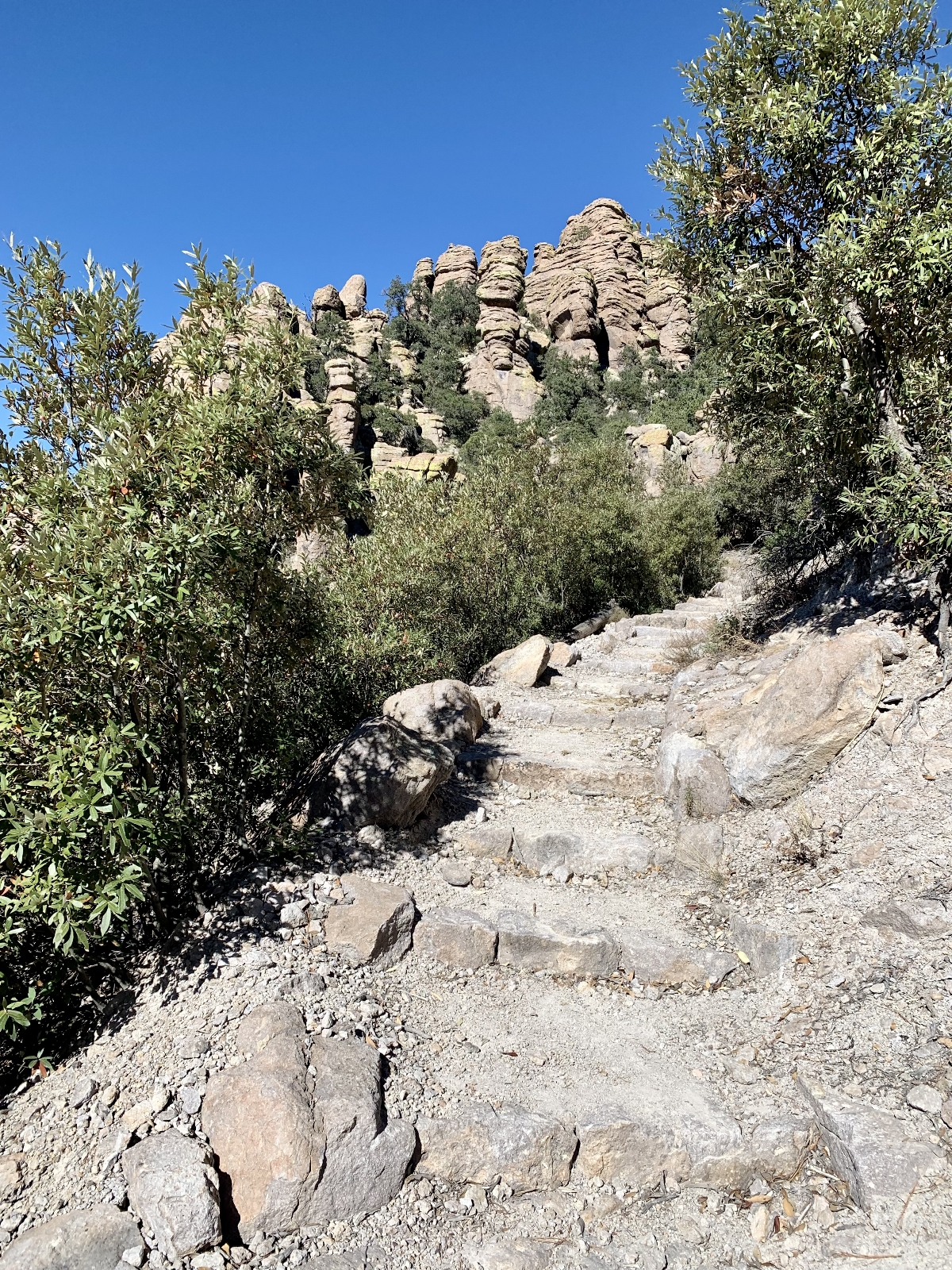
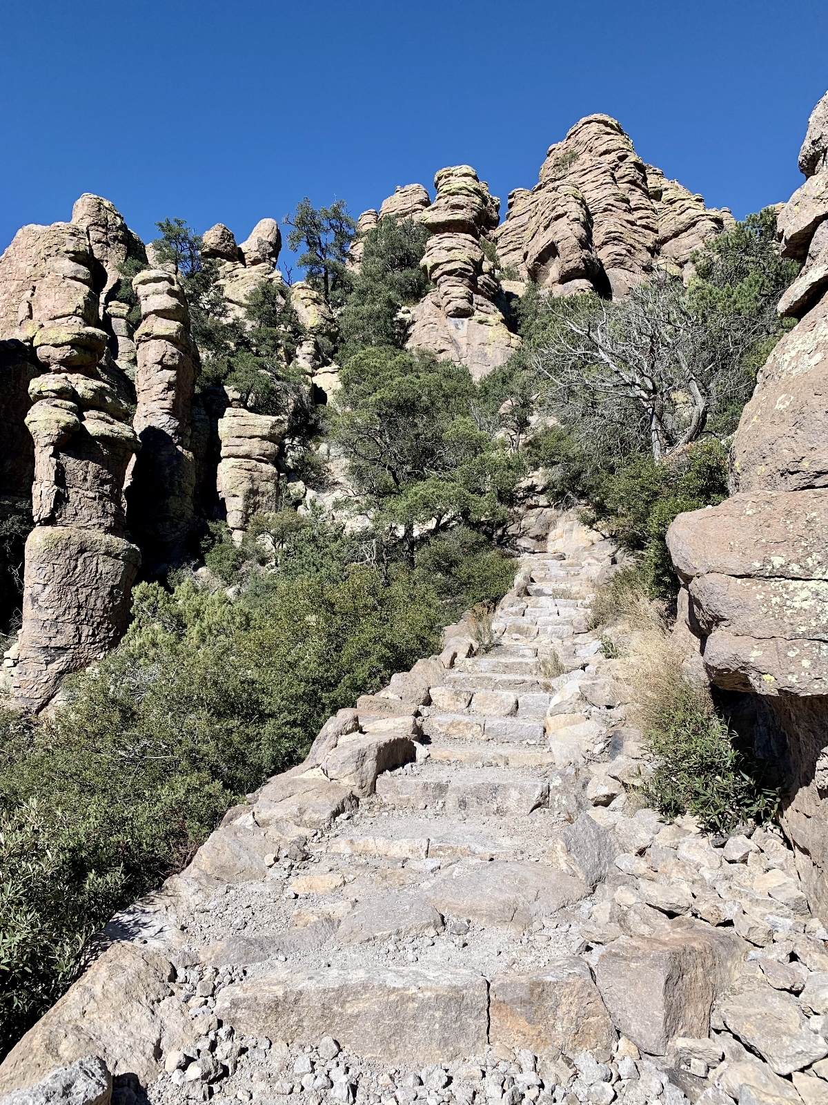
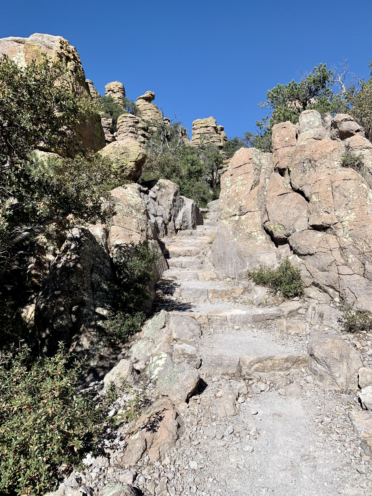
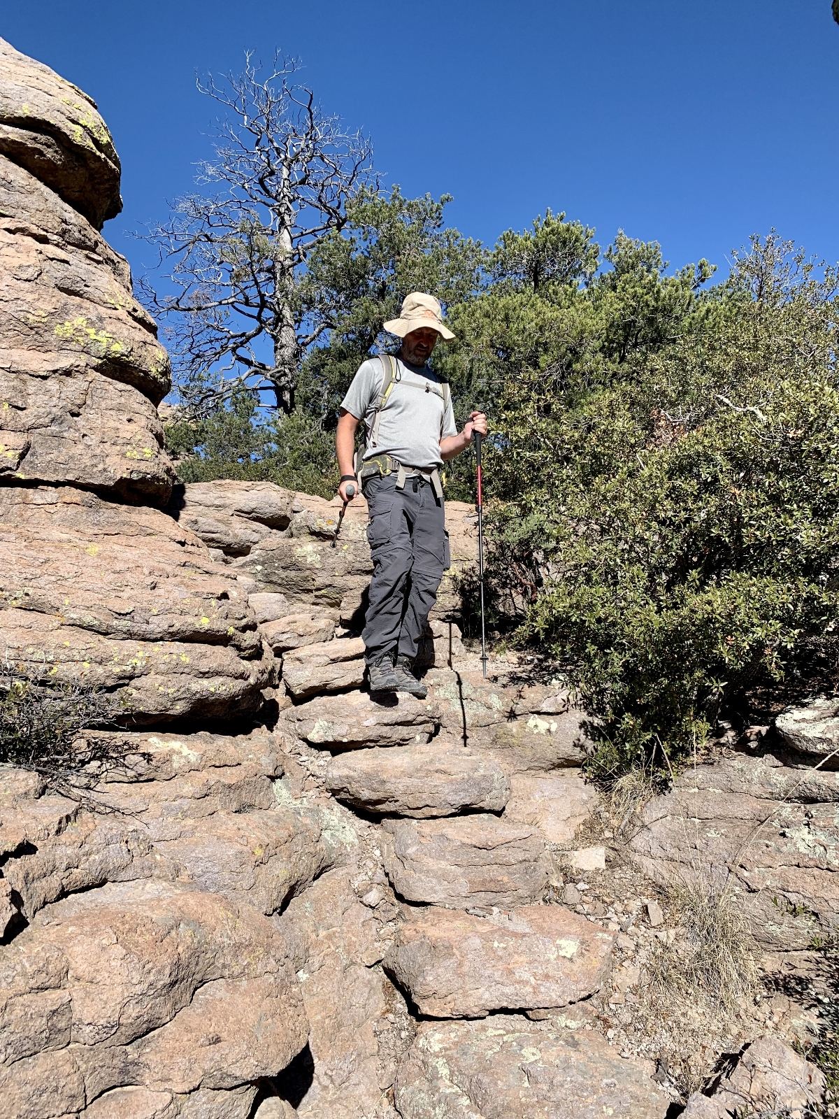
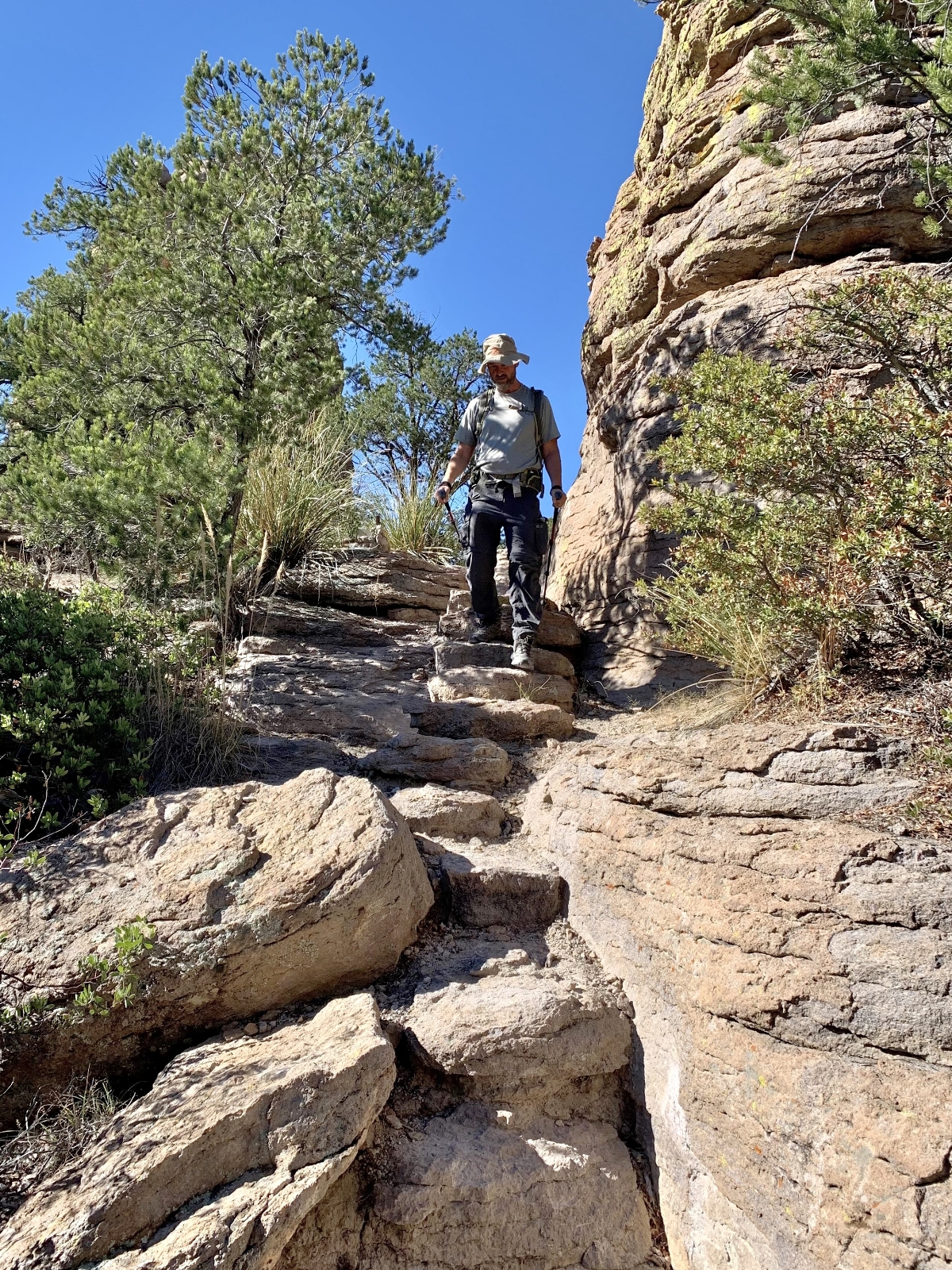
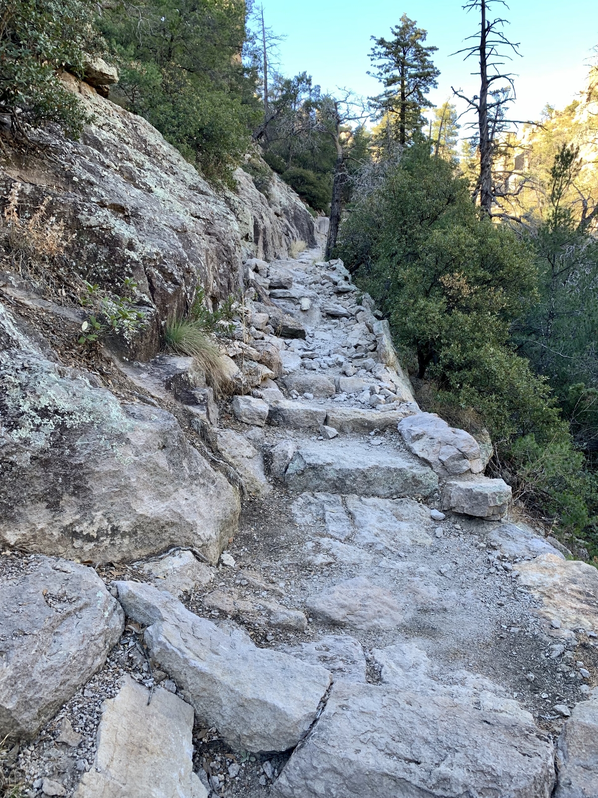
There are 17 miles of hiking trails at Chiricahua National Monument (click here for guide). Like the other SE Arizona National Park Units, Chiricahua offers an I Hike for Health pin for those hiking a minimum of 5 miles in the park. Each individual seeking the reward must have a photo or selfie of themselves on each trail hiked and present the pictures to park staff at the visitor center. Each of the six participating parks has its own pin design and motto. Chiricahua’s motto is “Rock the Rhyolite”.
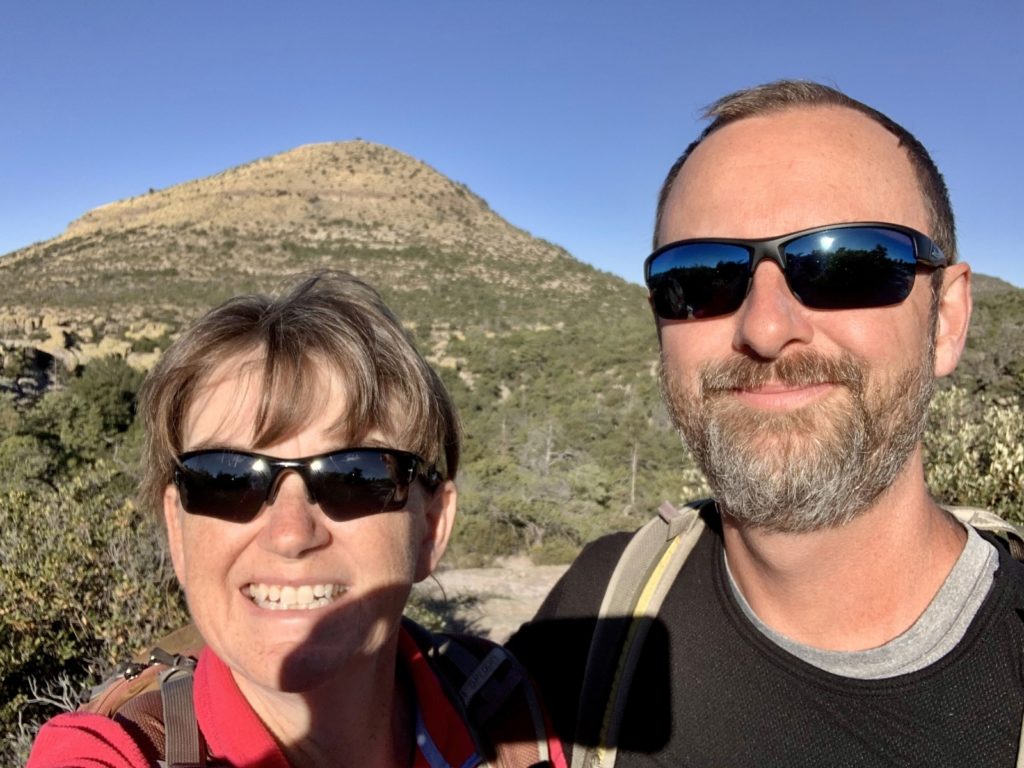
We earned our Rock the Rhyolite pin by hiking the Big Loop. This hike is described by the park as “for folks wanting to do everything, this route consists of the Echo Canyon, Upper Rhyolite Canyon, Sarah Deming, Heart of Rocks, Big Balanced Rock, Inspiration Point, Mushroom Rock and Ed Riggs trails. The trail traverses up and down across the canyons to combine the best of the wilderness scenery.” Total loop length is 9.5 miles and it is rated as strenuous. We did not hike the side trail to Inspiration Point which shaved one mile off the route. We hiked this same route back in 2012 during our first visit to Arizona. Of the many trails we’ve hiked over the years, the Big Loop remains one of our favorites and was definitely worth the repeat.
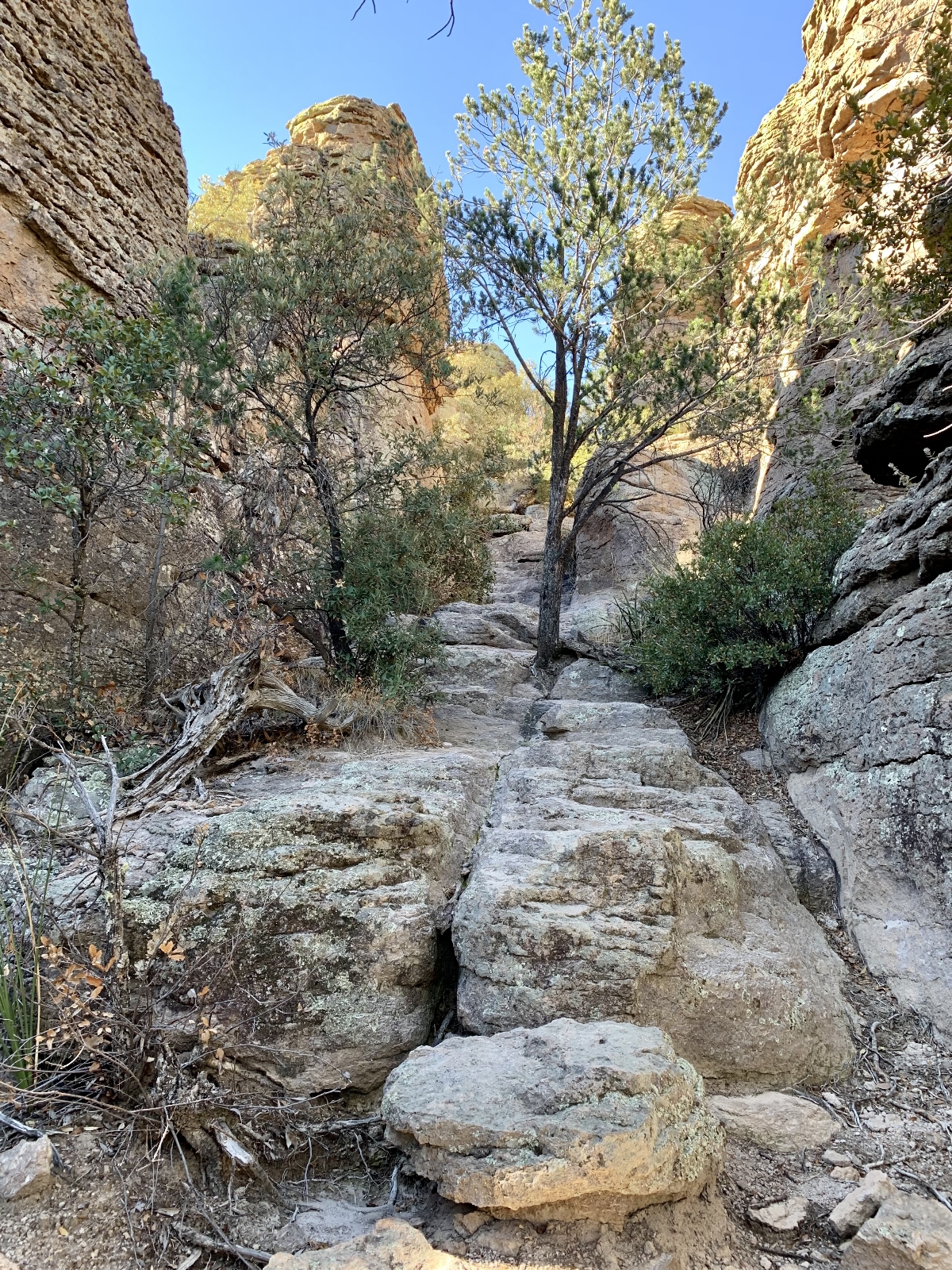
One thing that struck us on this visit was how much more lush and green the forest was. During our 2012 visit, Chiricahua was recovering from the massive Horseshoe 2 Fire that ignited on May 8th, 2011 in the Coronado National Forest. The human-caused fire scorched about 222,954 acres and destroyed 23 structures, burning approximately 70% of the Chiricahua Mountains including much of the monument. The scenery was still beautiful, but we saw signs of the fire everywhere along the trail and throughout the monument. Fast forward over a decade and the forest has recovered nicely and the flora all looked green and healthy.
We could have easily spent another couple of days at Chiricahua National Monument. I hope to return in the next few years to hike the Natural Bridge, Sugarloaf Mountain, Bonita Creek, and Silver Spur Meadow trails as well as take the ranger lead tour of Faraway Ranch. But for now, here’s the photo tour from this visit:
Travel Tips & Safety
In addition to the usual travel and safety tips, the Chiricahua National Monument website offers these tips for visiting their unique location:
- The narrow and winding scenic drive prohibits recreational vehicles and trailers longer than 24 feet on the Bonita Canyon scenic drive beyond the visitor center. If your trailer is longer than 24 feet, or if your RV has a tow vehicle, park it/detach it in the Faraway Ranch parking lot, a large parking lot about 1.5 miles before the visitor center. There is very limited parking in the visitor center parking lot.
- Bring your own drinks and snacks. A few snack item are available at the bookstore at the visitor center, but there are no vending machines or restaurants at the park.
- Check your gas guage. The closest gas stations are in Sunizona – 27 miles southwest, or Willcox – 37 miles northwest.
- Do not allow children to run ahead or throw rocks.
- When hiking wear sturdy shoes, carry and drink plenty of water, have a map, and know your route. Dress in layers to adjust for changing conditions.
- Don’t forget about the possible impacts of the elevation. The Visitor Center is at 5,400 feet and Massai Point is 6,870 feet. Watch out for altitude sickness. Signs include: headache, nausea, shortness of breath, and tiredness.
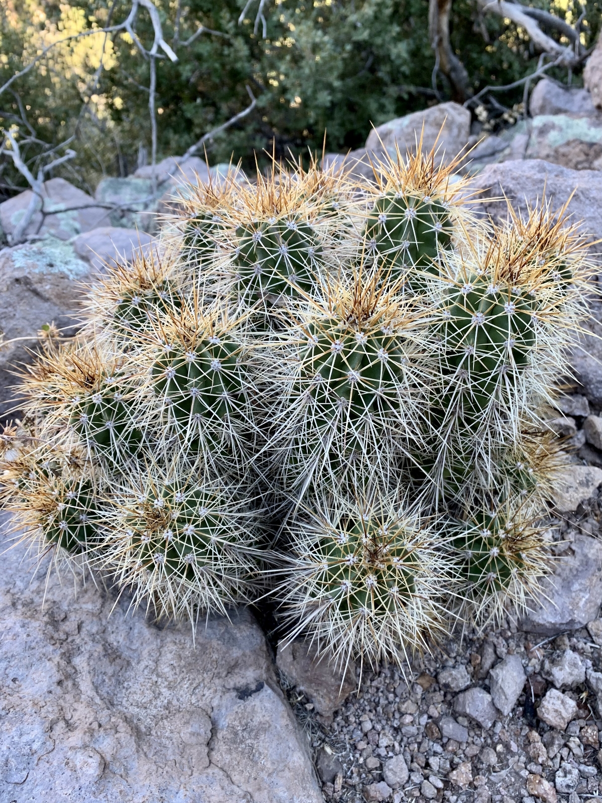
- Stay on the trails. Cactus, rattlesnakes, and heat are hazards in the summer. Watch for snow, ice, and slippery spots in winter. Loose rocks are always an issue.
- Keep an eye on the weather. Thunderstorms with dangerous lightning are common July-September. Snowstorms are common December-March.
The Adventure Continues
Be sure to join us for our next post as we ‘climb and explore’ at nearby Coronado National Memorial. And don’t forget to check out our Amazon RV and Adventure Gear recommendations. We only post products that we use and that meet the Evans Outdoor Adventures seal of approval. By accessing Amazon through our links and making any purchase, you get Amazon’s every day low pricing and they share a little with us. This helps us maintain this website and is much appreciated!
Rhyolite. Fascinating.
Wish I could have copied some of your gorgeous photos for the school project I’m doing but I’m keeping you at hand for when I get to make the trip, hopefully late next year. Amazing.
Oh thank you Patrice! Happy to help in the future!
Lusha