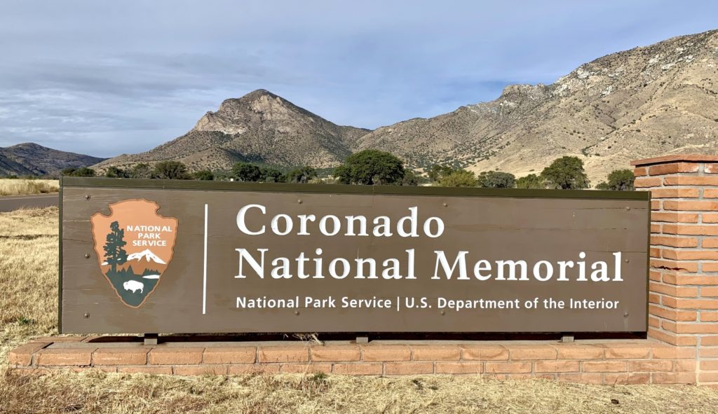
Coronado National Memorial was our third National Park Unit visited while based out of Kartchner Caverns State Park in December 2021. Coronado was established to commemorate the Coronado Expedition of 1540 – 1542 and the lasting legacy of the first interaction between Native Americans and Europeans in the American Southwest. The southeast Arizona park offers hiking and a scenic drive with sweeping views of the San Pedro River area which is widely regarded as the corridor that the expedition used on their way north to the mythical Cíbola. The little-known park shares its southern border with Mexico, reminding visitors of the collective shared history that the U.S. has with its southern neighbor.
As a memorial site, as opposed to a monument or historic site, there are no tangible artifacts or relics of the Coronado Expedition within the park. Since many of these first interactions between Natives and Europeans were violent and bloody, the park serves as a site of conscience—a place where one can reflect on the past and the trials and tribulations that the Natives of this region endured. It is also a place to learn about the blending of cultures which gave rise to a unique combination of traditions, music, arts, and architecture that is distinctively representative of the people and places of the American Southwest and northwest Mexico.
Cíbola — The Seven Cities of Gold
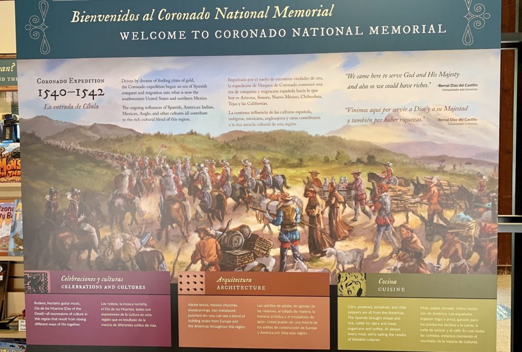
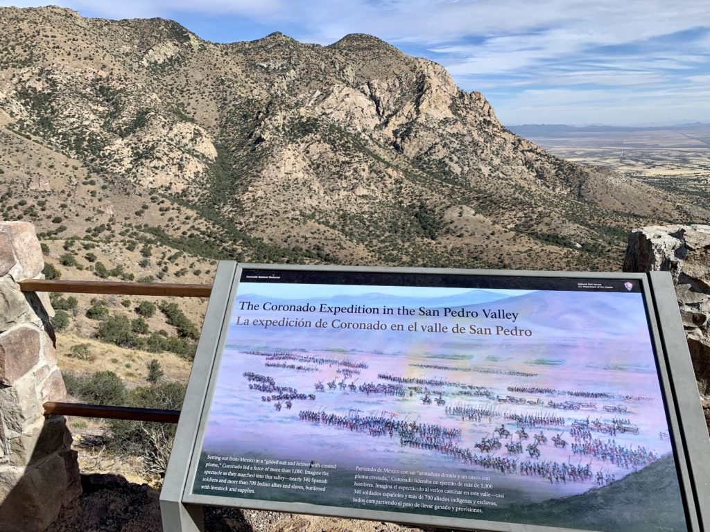
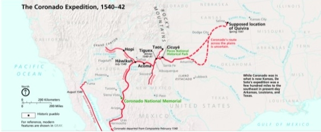
In the 16th century, the Spaniards in New Spain (present Mexico) began to hear rumors of Cíbola, the Seven Cities of Gold, located across the desert hundreds of miles to the north. The tales were fueled by the reports of four shipwrecked survivors of the failed Narváez expedition. The men said they had heard stories from natives about cities with great and limitless riches. A massive expedition was organized, led by Francisco Vázquez de Coronado. The armed expedition consisted of over 300 Europeans, over 700 Indian allies and slaves, and a handful of Franciscan priests.
When Coronado finally arrived at Cíbola (in present day New Mexico) in 1540, he discovered that the stories were unfounded and that there were no treasures — only adobe towns. While there, Coronado heard an additional rumor that there was a city with plenty of gold called Quivira located on the other side of the Great Plains. When he finally reached the area (thought to be near present day Salina, Kansas), he found little more than straw-thatched villages.
Unfortunately, but predictably, interactions between the Europeans and Natives frequently turned violent. The pueblo of Tiguex is one such example. The Europeans arrived to find friendly inhabitants; however, the Natives’ mood soon turned to open hostility when violations of hospitality and friendship were committed by the Spaniards. A series of battles followed, resulting in the Spaniards killing the occupants of one pueblo and forcing the abandonment of several others.
Coronado’s expedition set the stage for the colorful, yet often violent, development of the American Southwest. He may have failed in his primary objective to find Cíbola, but he brought back knowledge of this mysterious land and its people. The door was now open for future Spanish explorers and missionaries to colonize the Southwest, developing the distinctive Hispanic-American culture we know today.
Visiting Coronado National Memorial
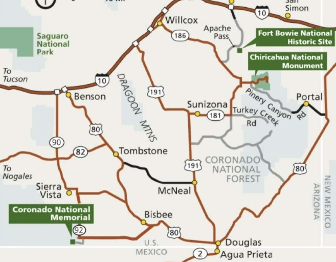
From Tucson, take I-10 east and take exit 302 / Hwy 90 to Sierra Vista/Fort Huachuca. Continue south on Hwy 90 to Sierra Vista. Merge onto Hwy 92 and continue south for about 14 miles to S. Coronado Memorial Drive. Turn south and follow Coronado Memorial Drive (it will turn into E Montezuma Canyon Rd) 5 miles to the Visitor Center.
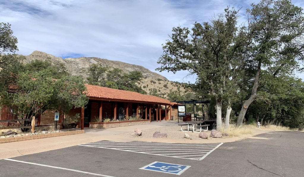
Coronado National Memorial is open every day of the year from civil twilight dawn to civil twilight dusk (1/2 hour before sunrise to 1/2 hour after sunset). The park closes each night and visitors are expected to be back from hikes and activities by closing. Coronado is a free park, there is no fee to visit. The visitor center is open daily (except Christmas day) from 8:00 am to 4:00 pm. Buses, RVs, and trucks with trailers should park in the picnic area. The visitor center features exhibits, museum items, gift shop, educational bookstore, and picture window for wildlife and bird watching opportunities. Rangers provide information and offer selected winter and spring programs.
Next to the visitor center is a picnic area which is open daily from dawn to dusk. There are 25 sites located beneath the trees, three ramadas, and several water faucets and fountains. Restrooms are wheelchair accessible and the area is relatively level. Outdoor grills are provided for cooking fires. Visitors need to bring their own charcoal or wood (no wood gathering is allowed). Overnight camping is prohibited. Pets should never be left unattended in vehicles and must be kept on a leash.
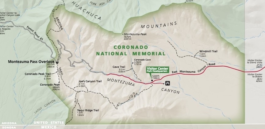
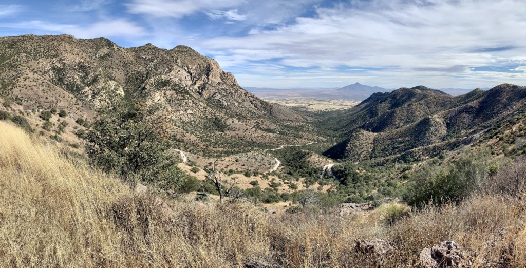
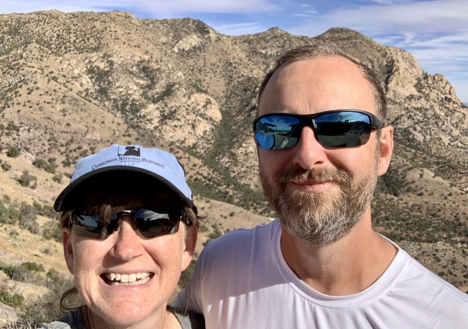
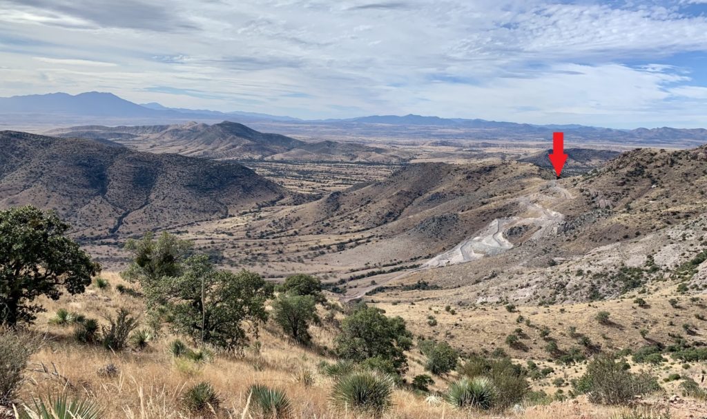
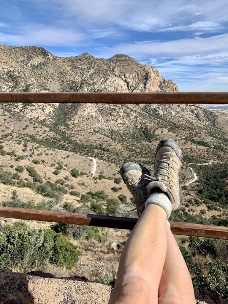
Montezuma Pass is the most outstanding physical feature found at the Memorial. Not surprisingly, it is also the most visited location at Coronado. It is accessible by scenic road or by hiking trail from the visitor center. At an elevation of 6,575 feet, the pass offers sweeping views to the east of the San Pedro River Valley and to the west over the San Rafael Valley. On clear days, Baboquivari Peak, at an elevation of 7,720 feet, on the Tohono O’odham Indian Reservation, can be seen 80 miles to the west beyond the Santa Rita and Patagonia mountains. Restrooms and two picnic tables are available.
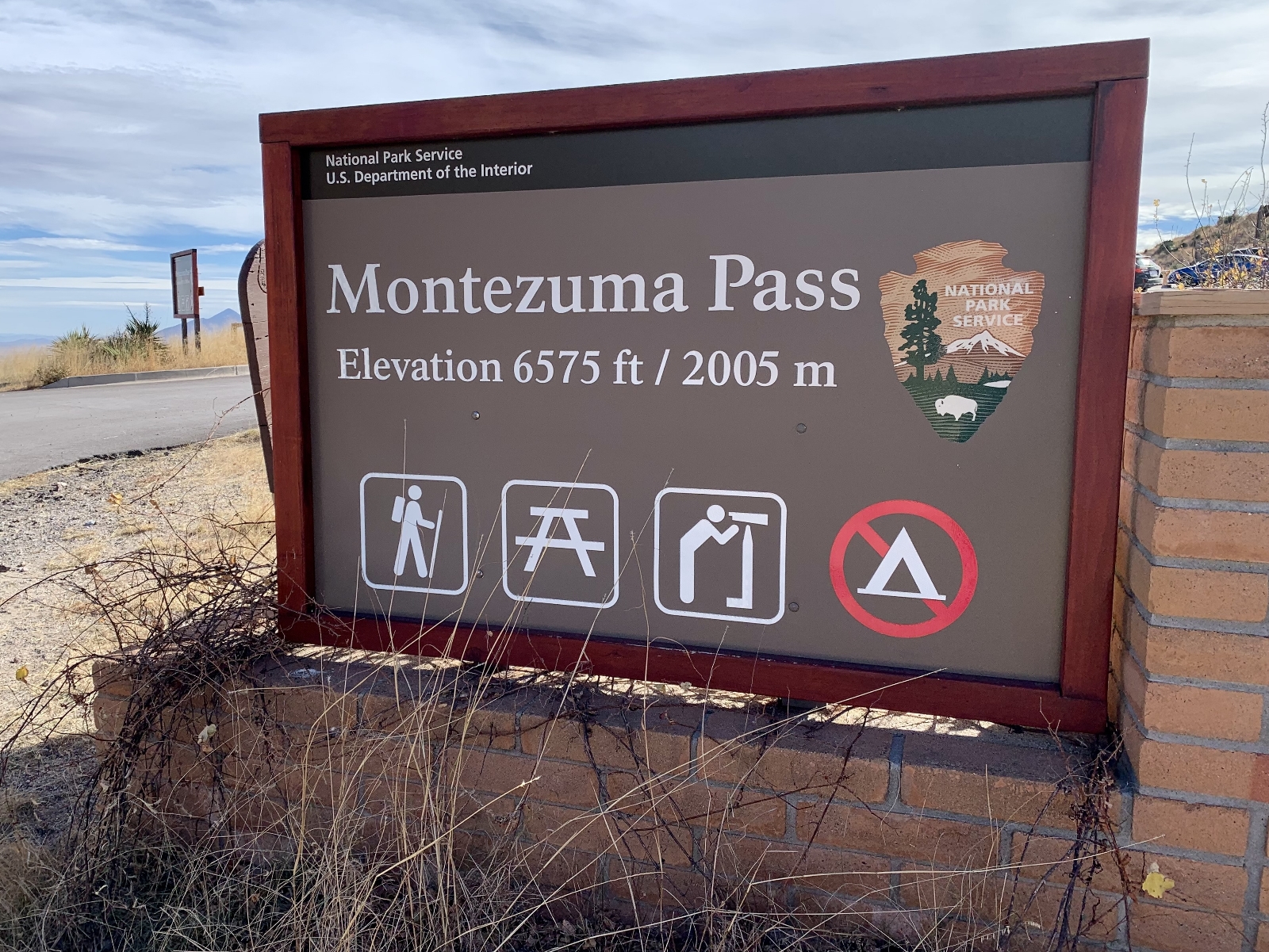
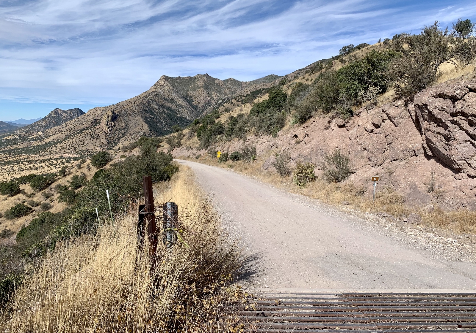
The road to Montezuma Pass is open all year from dawn to dusk (monsoon flooding or winter snow may temporarily close the scenic road). It is located 3 miles west of the visitor center and is accessible by a winding mountain road that is paved for one mile and a graded dirt road for the upper two miles. Vehicles over 24 feet in length are prohibited due to steep grades and tight switchbacks.
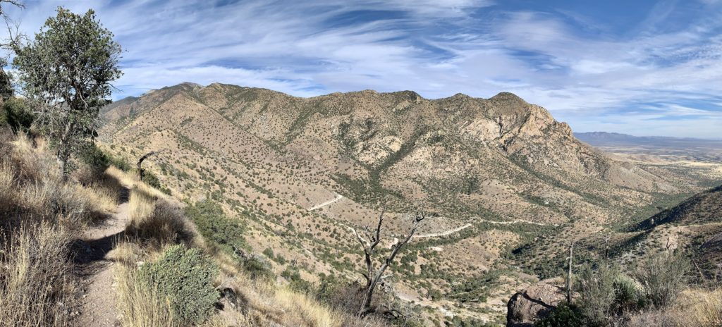
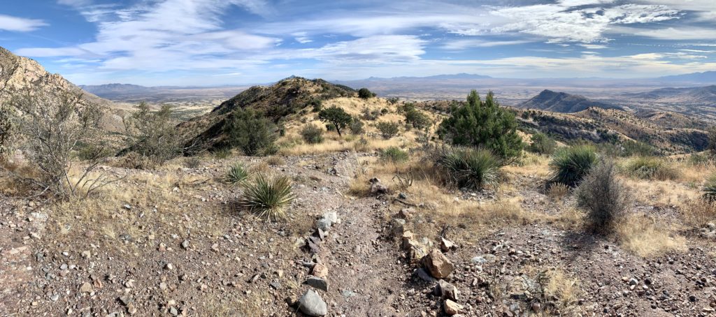
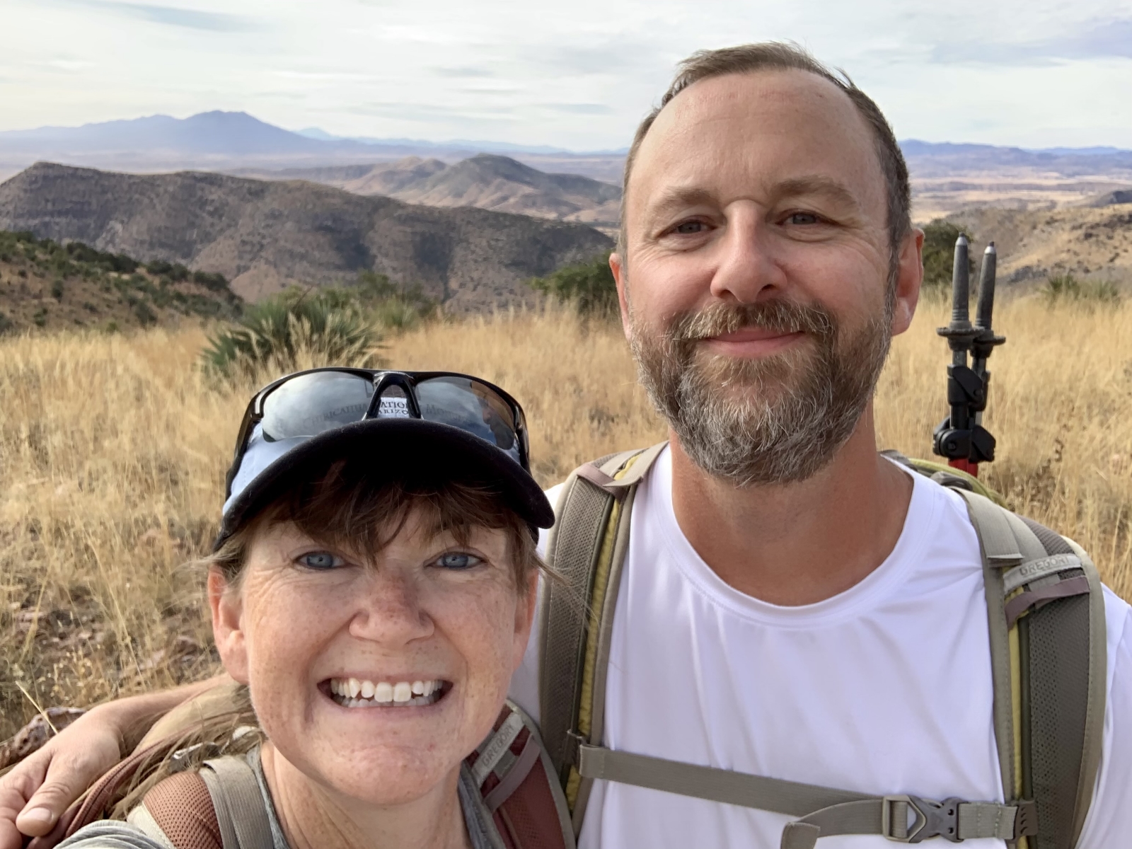
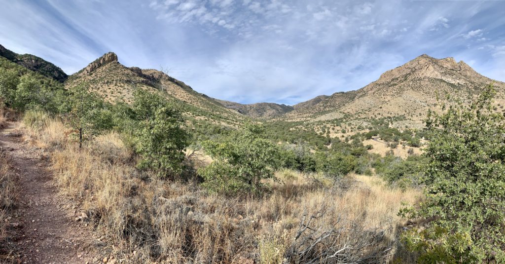
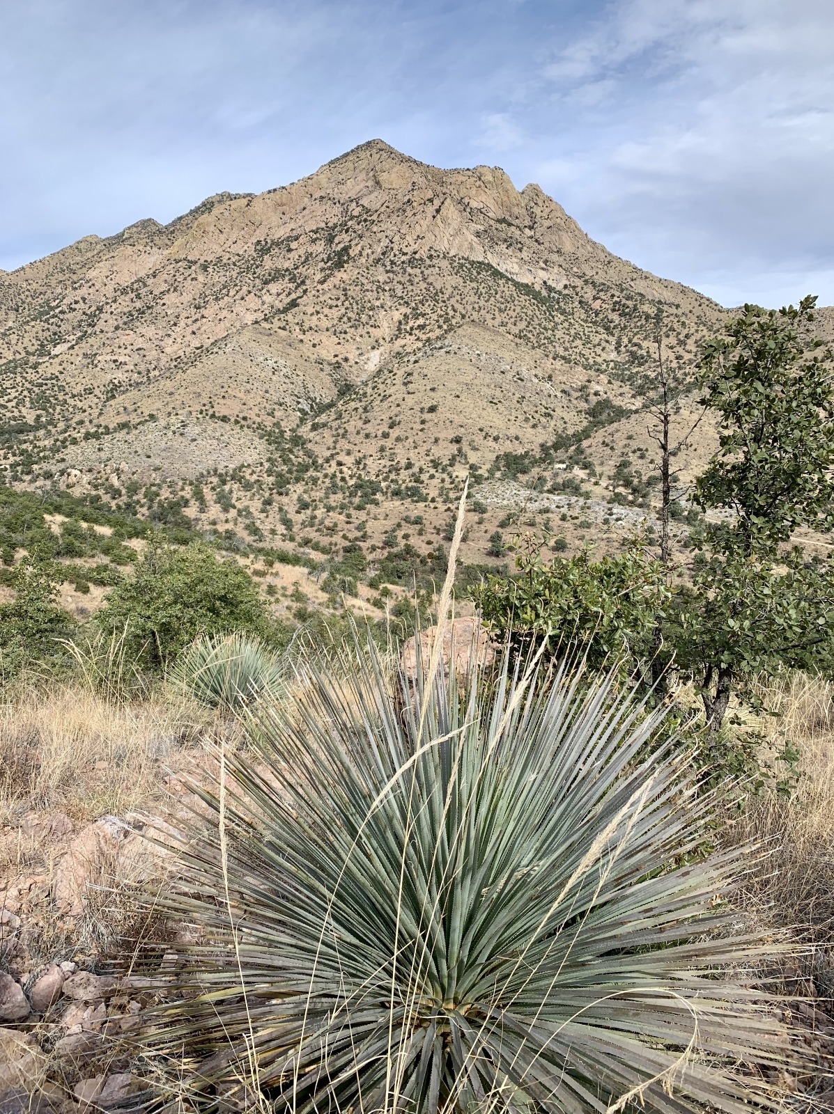
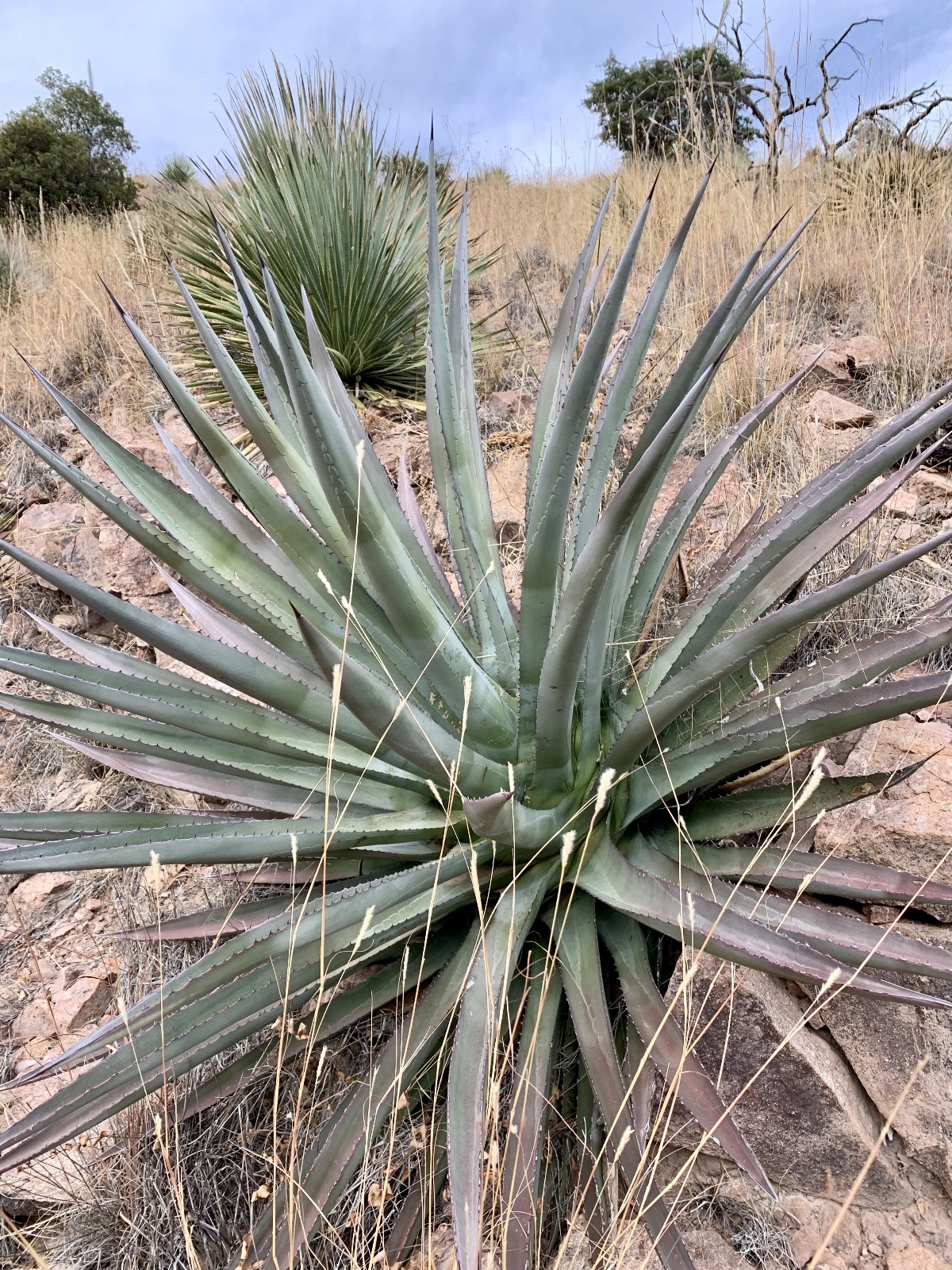
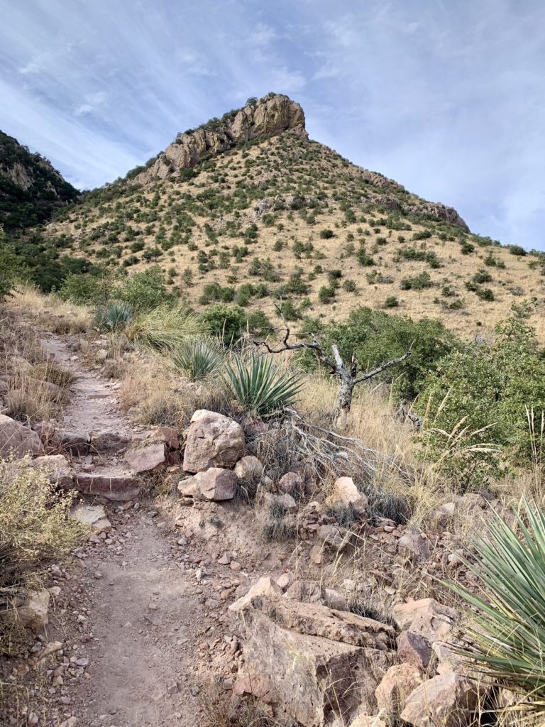
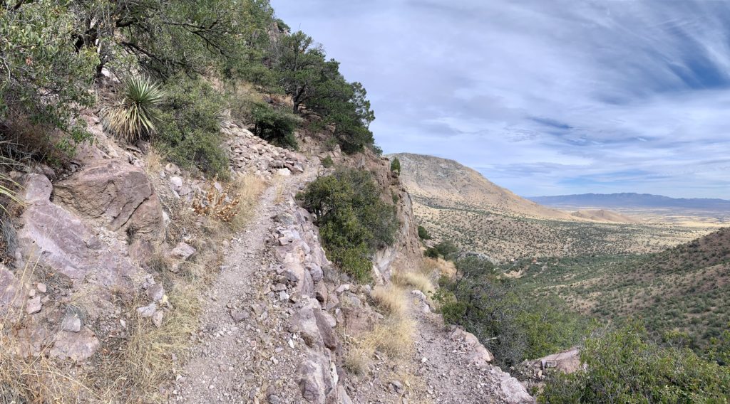
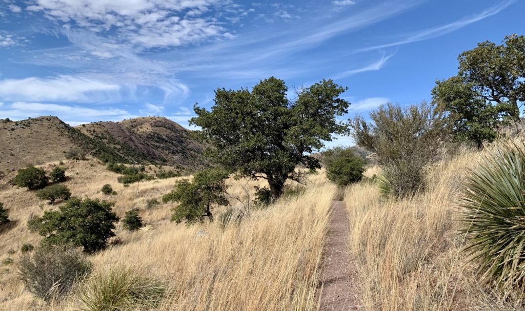
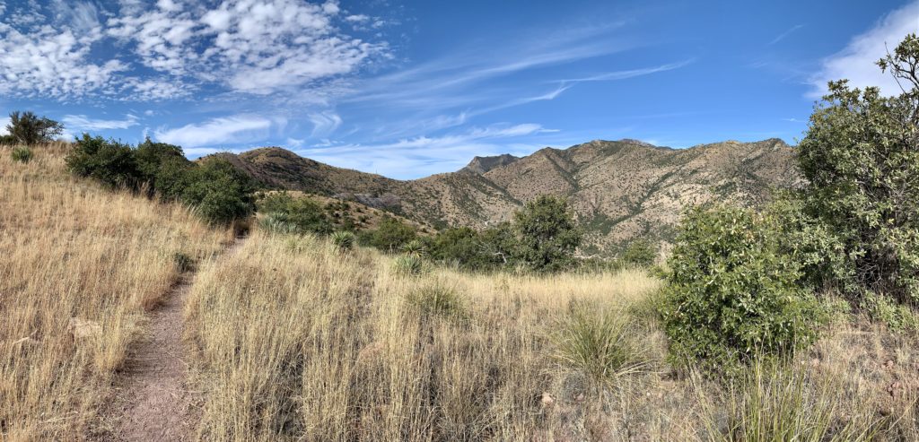
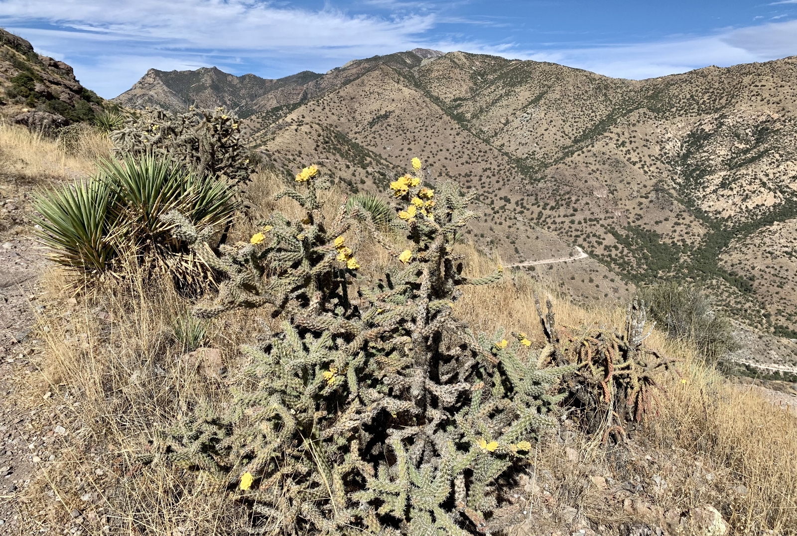
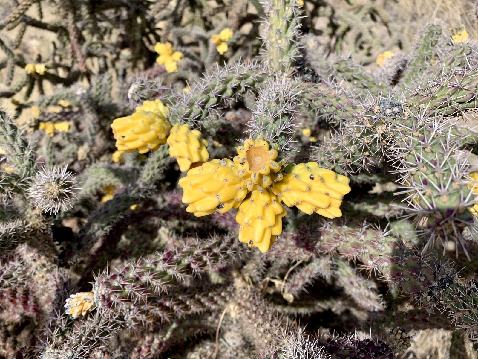
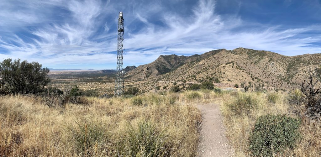
For those wanting the best solitude and views, I recommend hiking to Montezuma Pass via Joe’s Canyon Trail. Of the handful of people we saw at Montezuma Pass, we were apparently the only ones crazy enough to hike somewhere you could drive! But it was well worth the effort. The 6.0 mile roundtrip hike from the visitor center climbs roughly 1,500 feet in elevation through four distinct life zones—each defined by differences in elevation, temperature, and precipitation. We enjoyed the variety in flora as we passed from grasslands and oak woodlands to piñon and juniper pine forests. Adding to the diversity, Coronado lies at the crossroads of four distinct ecosystems: Rocky Mountains, Sierra Madre Mountains, Sonoran Desert, and Chihuahuan Desert creating one of the most biologically diverse regions in the United States. We especially enjoyed all the cacti and agave we saw along the trail.
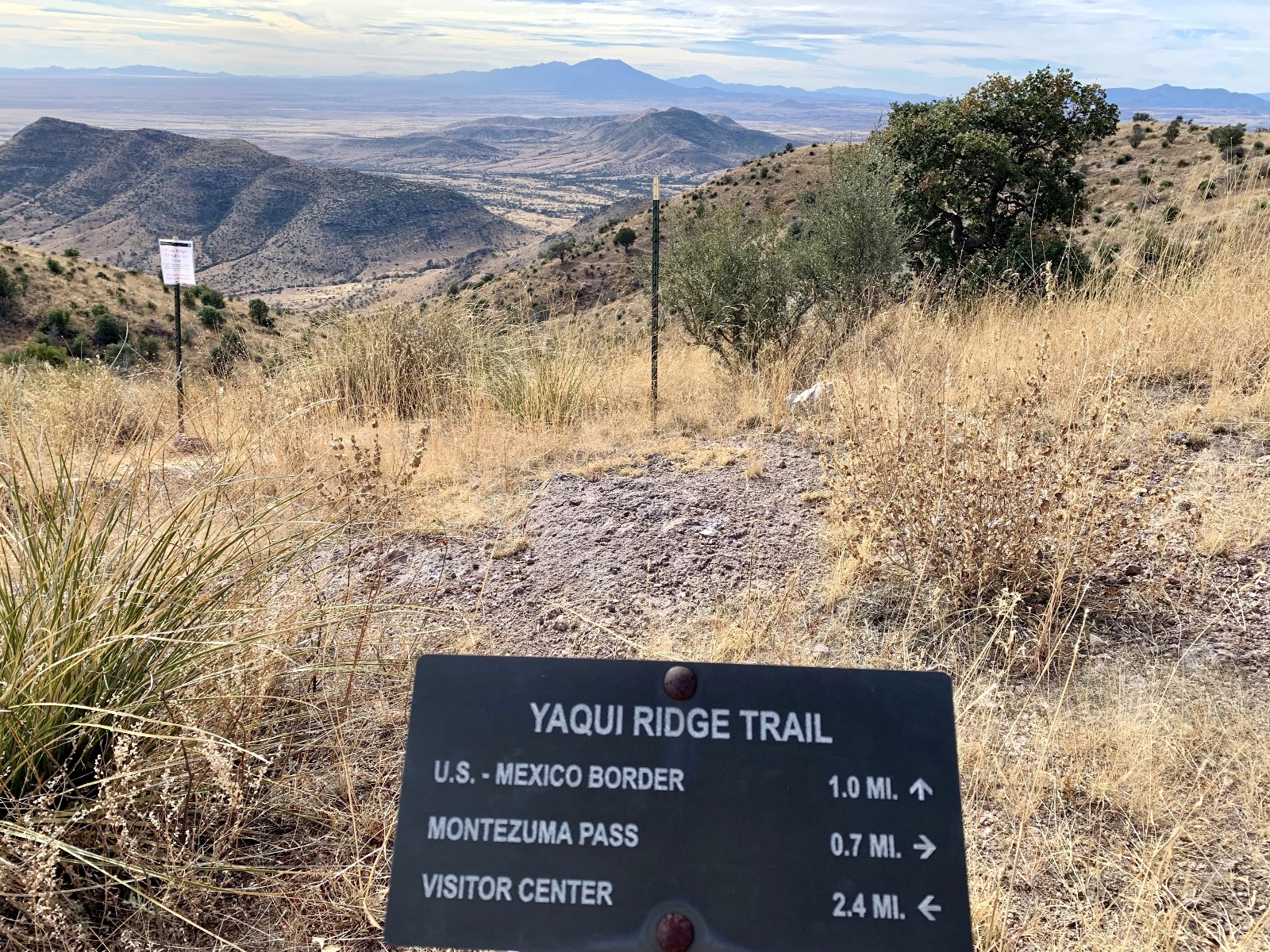
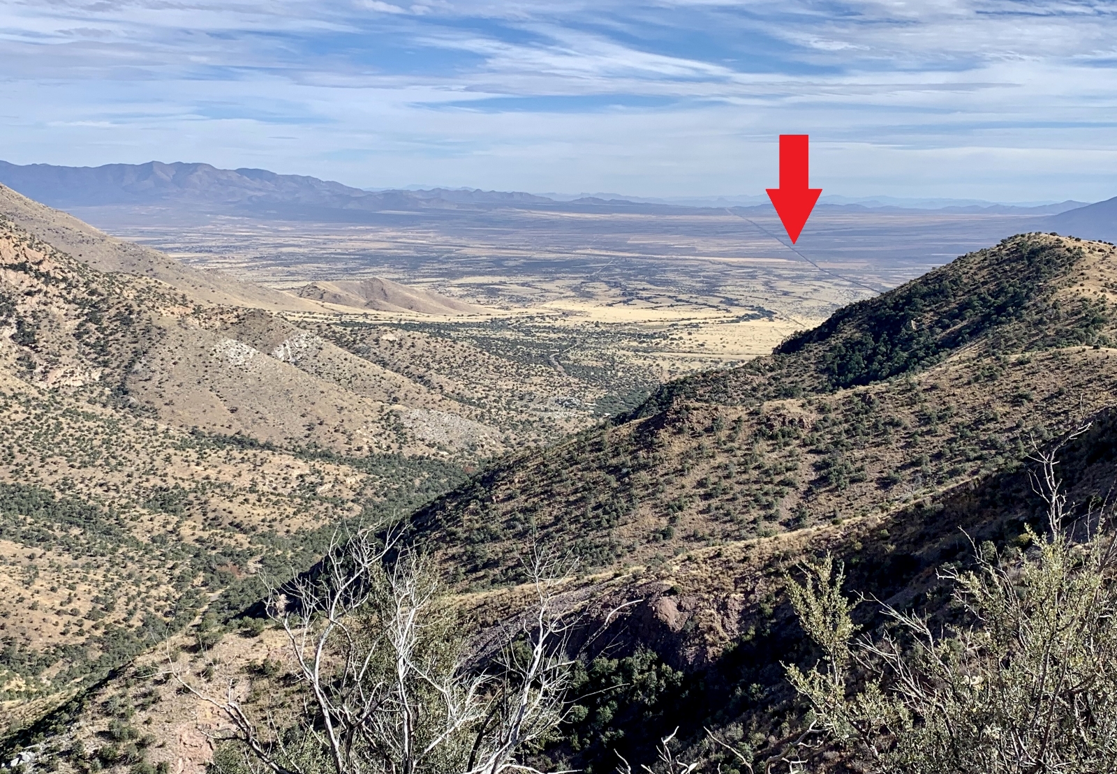
In addition to the flora along Joe’s Canyon Trail, we enjoyed fantastic views of the San Pedro River Valley to the east, San Rafael Valley to the west, Montezuma Peak and the Huachuca Mountains to the north, and Sonora, Mexico to the south. Our plan had been to add on the mile long Yaqui Ridge Trail to the US-Mexican border; however, it was closed due to construction of the Border Wall through Coronado National Memorial. We could see where the existing Border Wall stops at the southwest corner of the Memorial and a freshly bulldozed road running the length of Coronado’s southern border where the additional section will be built.
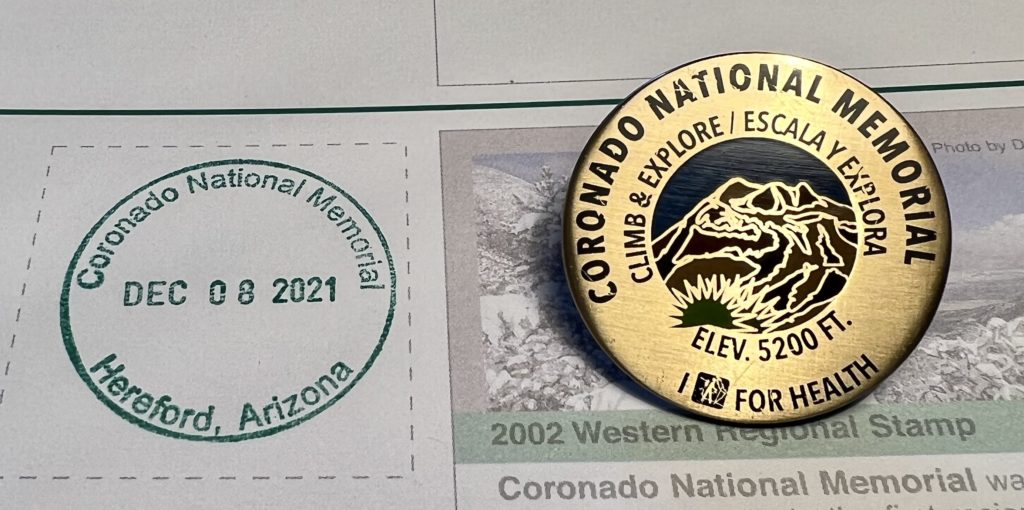
Like the other National Park Units in southeast Arizona, Coronado National Memorial offers the I Hike for Health program. Coronado offers over 8 miles of hiking trails (click here for guide). Those individuals who hike a minimum of 3 miles and present a photo or selfie of themselves on each trail hiked to park staff at the visitor center will receive a Coronado National Memorial “Climb and Explore” pin. Our hike to Montezuma Pass and back earned us our third pin of the trip.
Given the close proximity to the U.S.-Mexican border, I recommend reviewing the safety recommendations provided on the Coronado National Memorial webpage. These are sound recommendations for hiking/visiting any area. I will say we felt 100% safe during our visit and while hiking alone on the park’s remote trails. We saw nothing suspicious. As always, we were aware of our surroundings, but we felt no different hiking there than we do anywhere.
The Adventure Continues
Be sure to join us for our next post as we explore the Dragoon Mountains of southeast Arizona. And don’t forget to check out our Amazon RV and Adventure Gear recommendations. We only post products that we use and that meet the Evans Outdoor Adventures seal of approval. By accessing Amazon through our links and making any purchase, you get Amazon’s every day low pricing and they share a little with us. This helps us maintain this website and is much appreciated!