Unique pothole arches, stunning canyons, narrows, and rock art—Utah’s Escalante River at its finest
Distance: 22.5 miles round trip for the three day backpack described here or 9.5 mile round trip day hike to Golden Cathedral from Egypt TH
Type: out and back
Difficulty: moderate with 1,200′ elevation loss from Egypt to Escalante River, numerous river crossings for the route described here
Best season: spring and fall
Neon Canyon and the Golden Cathedral—most people won’t recognize these location. For those who hike in SE Utah, they are must see destinations. We’d been trying to get up Neon for a few years, but each time the weather had deteriorated.
For our 2017 Utah vacation, Jason and I originally planned to backpack Harris Wash and then do Neon as a separate day hike. We invited our friend Lisa to join us. Turns out she was already planning to be in the area with her friend Yvonne. While discussing options, Lisa suggested “how about we backpack to Neon and include a day up nearby Choprock Canyon?”
A few months ago I hadn’t even heard of Choprock Canyon. Over the long winter months, I took to watching YouTube videos by a handful of hikers. Jamal Green had fantastic footage on Choprock inspiring me to add it to my bucket list. When Lisa suggested Choprock and Neon in the same trip I immediately said yes! Adding to the package deal, Yvonne would be joining us. I had heard a lot about Yvonne over the years and I was happy for the chance to get to know her. The plan was set for a three day backpack.
We hadn’t been on a backpack since our trip to Utah the previous September-October. Record precipitation from October through April had put a damper on our usual hiking. We were ready for a heavy pack, sunshine, and a new adventure. Our half day hike the previous day in Red Canyon had been a nice warm up and now it was time to put some miles on.
On the morning of day one, Jason and I checked out of our hotel and headed for the Escalante Interagency Visitor Center. We begin all our backpacks into Grand Staircase-Escalante National Monument and Glen Canyon National Recreation Area there. We obtain the required permits and check on road/trail conditions and water levels/availability. This country is no joke and it pays to be prepared.
From the visitor center, we made the approximately 45 minute drive to our prearranged meeting location just off the junction of Hole in the Rock and Egypt roads. Lisa and Yvonne were ready and waiting. The approximately ten mile long Egypt road was quite washboarded, a little rutted in places, and had one area of slick rock to negotiate across, but it was in much better condition than I had imagined. We arrived around 10:00 to find a mostly full parking lot.
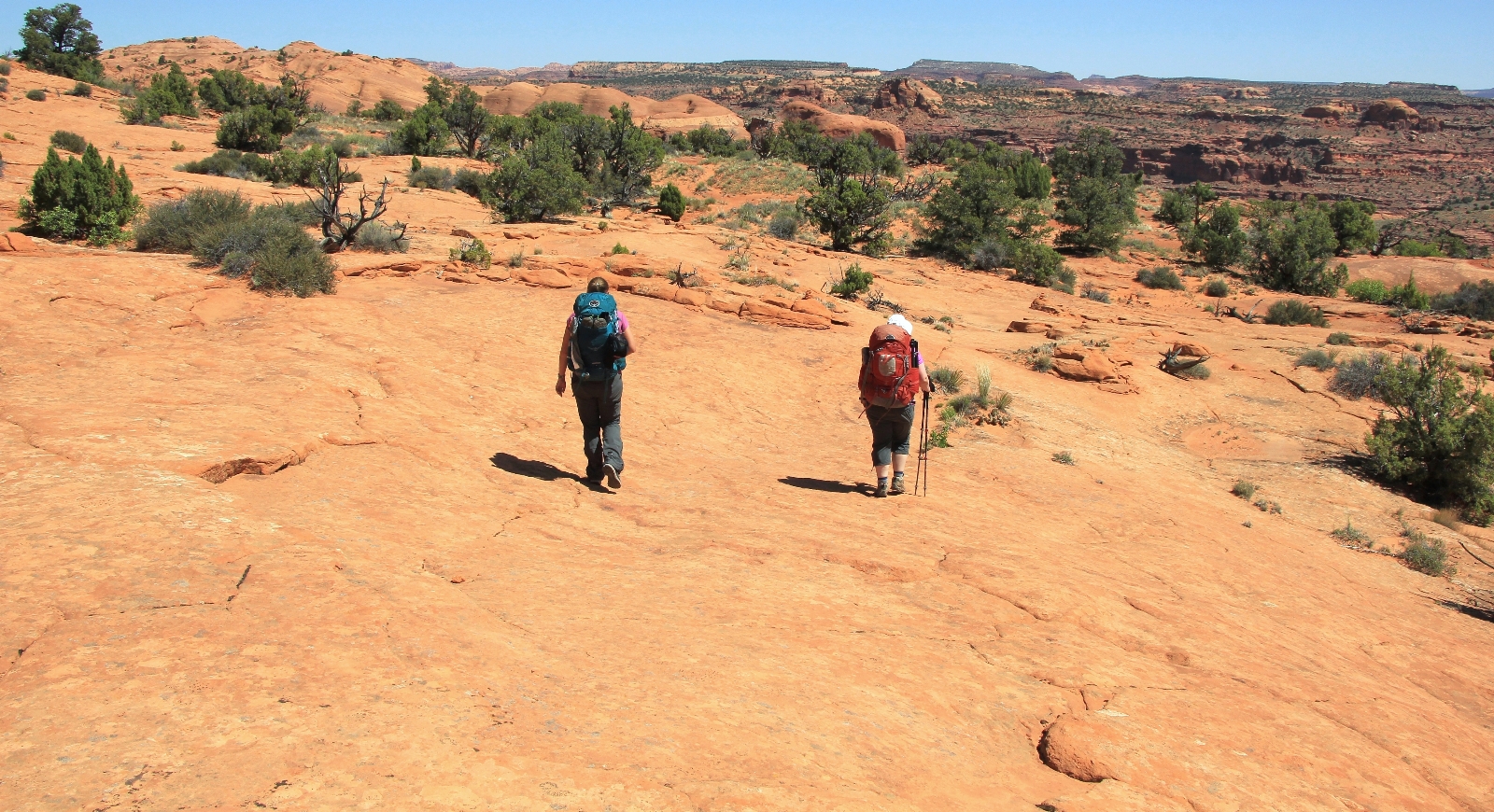
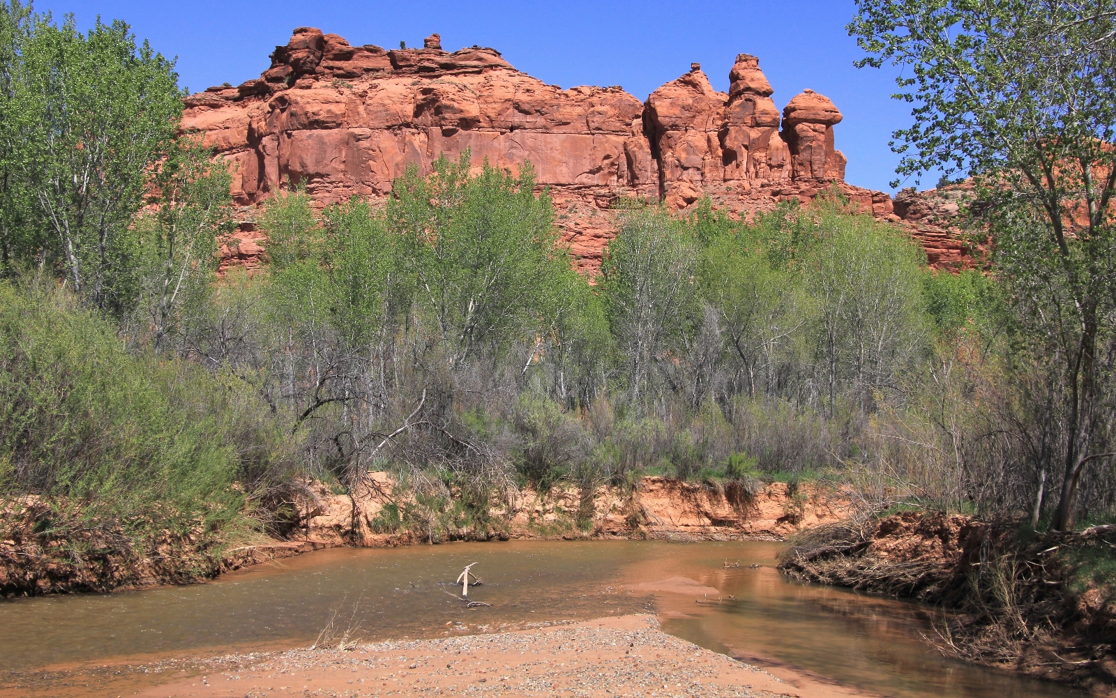
From the trailhead (elevation 5,597’), the earth plummeted below us and we could see for miles. Temperatures were already in the 60s and we had full sun shining on our faces—harsh conditions for photography, but otherwise a beautiful start.
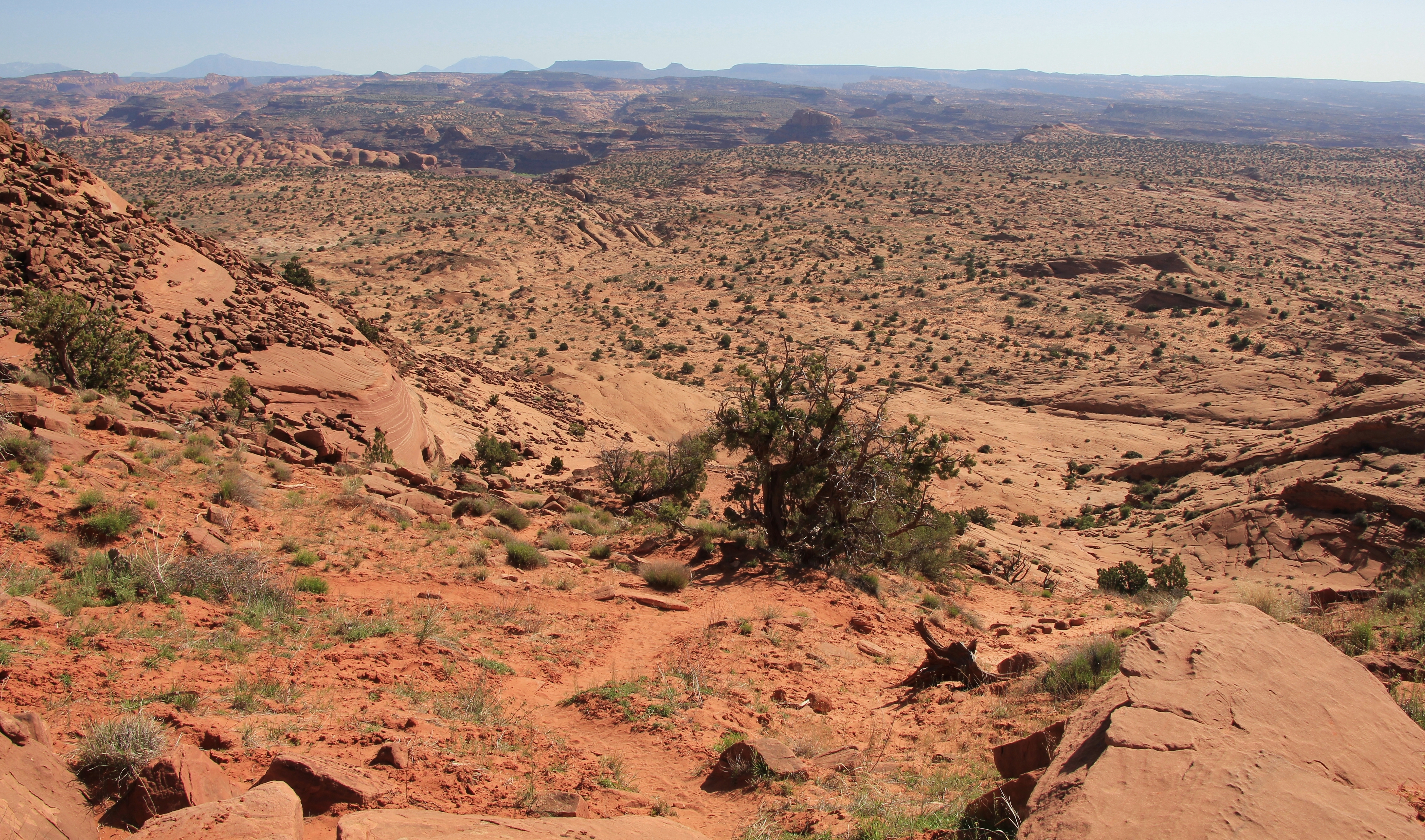
The trail began with a pounding 450 foot descent down steep slickrock for the first half mile. Views of Fence Canyon and the Escalante River Canyon were as impressive as the rapid descent. The route is pretty well cairned, but it is not a maintained trail and from my research it isn’t uncommon for people to go the wrong way. I was glad to be with Yvonne and Lisa who had done the hike before.
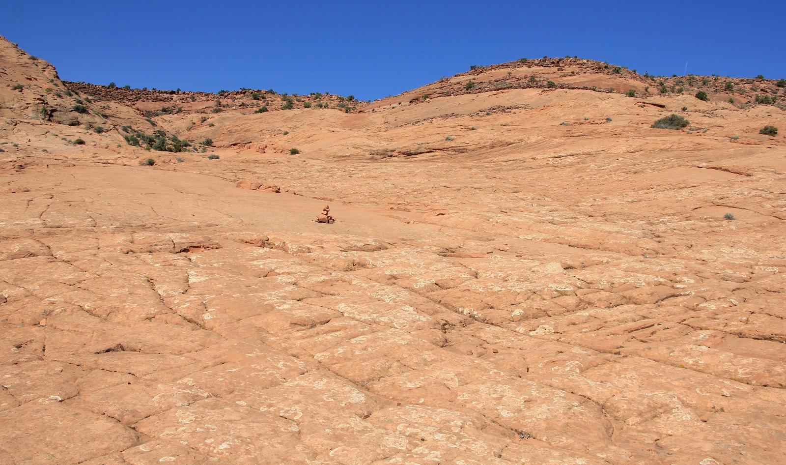
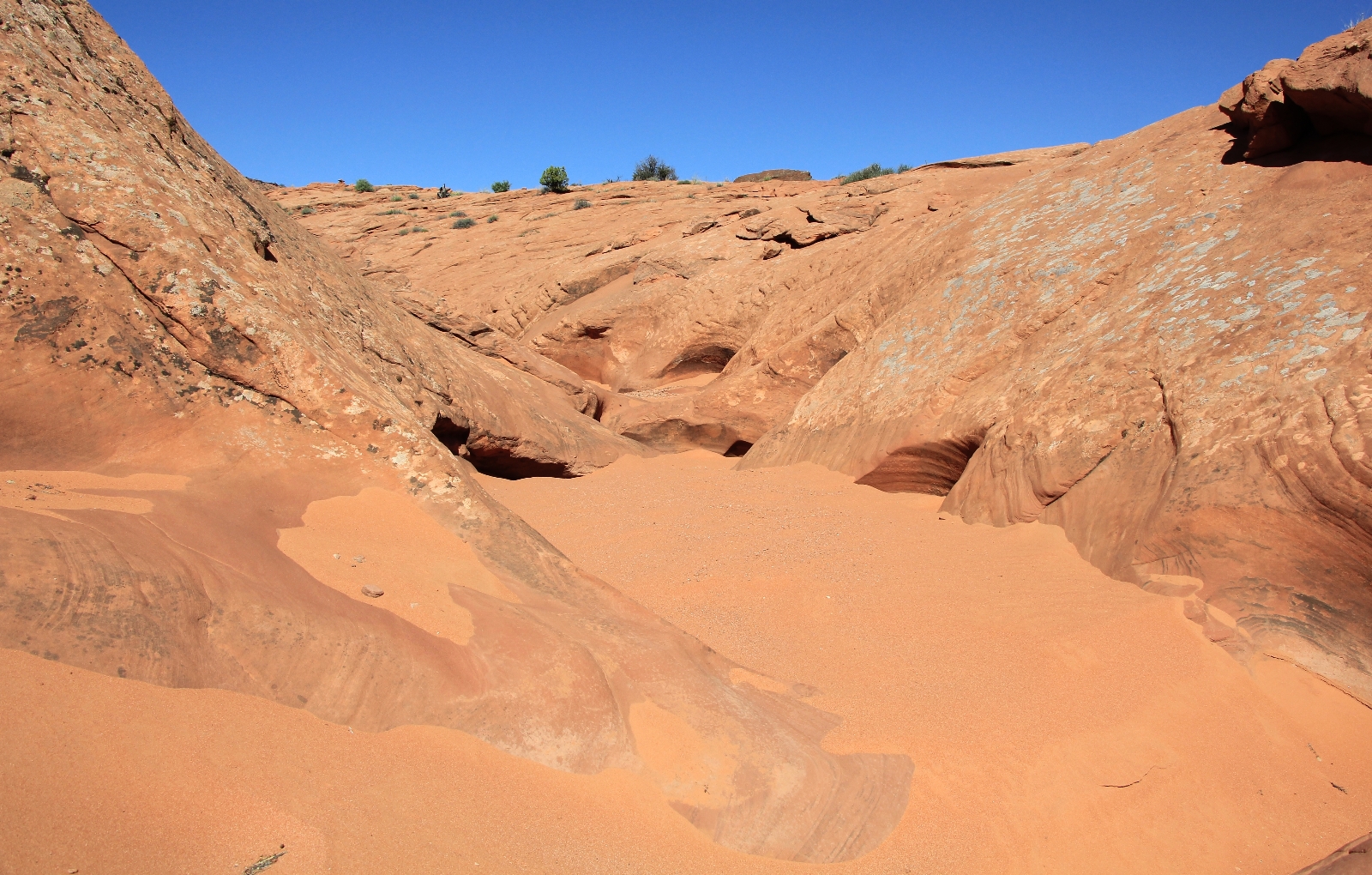
The trail bottomed out and began alternating between stretches of deep sand and slick rock.
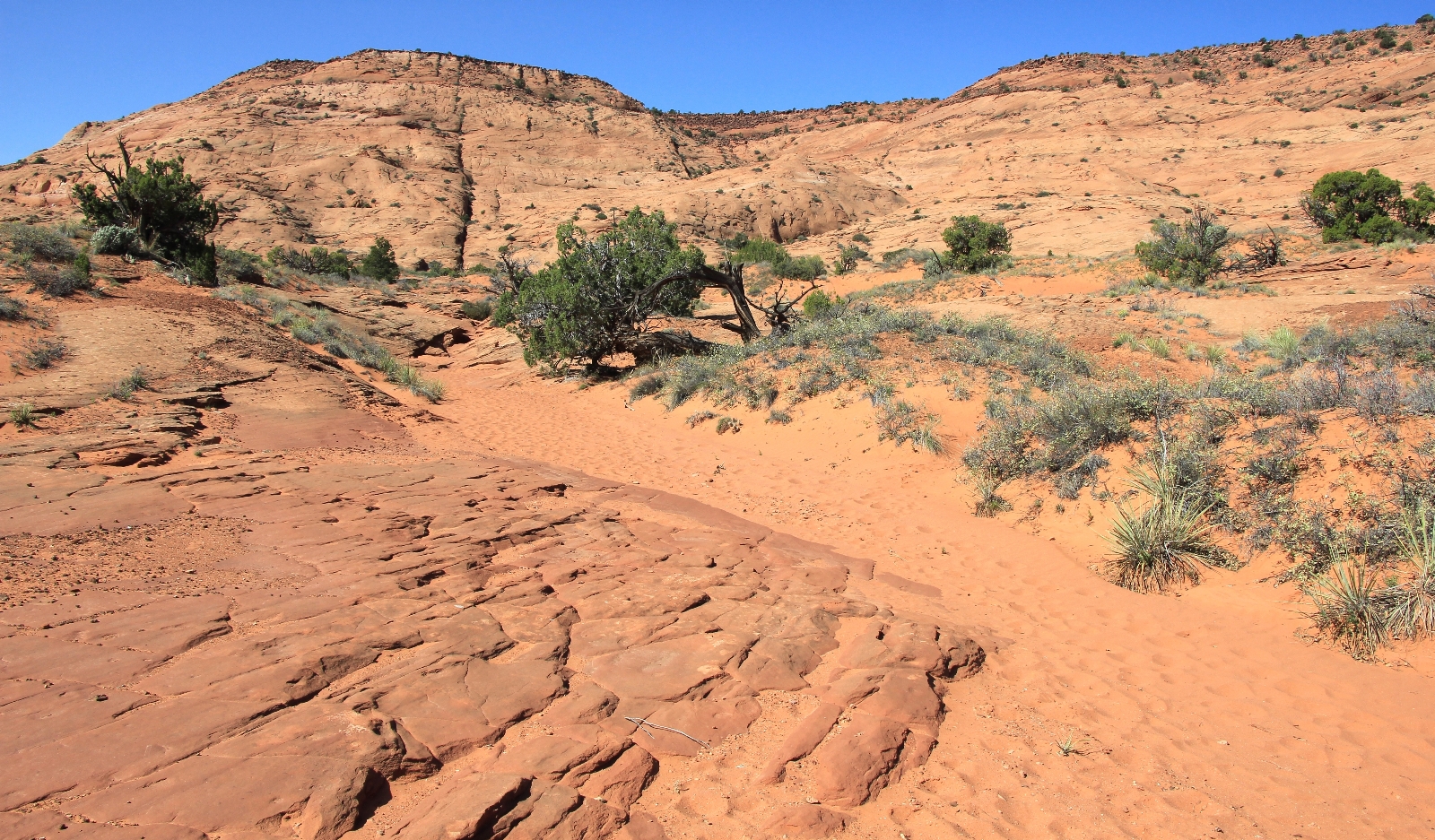
We entered Glen Canyon NRA and shortly after came to the shallow upper stretches of Fence Canyon.
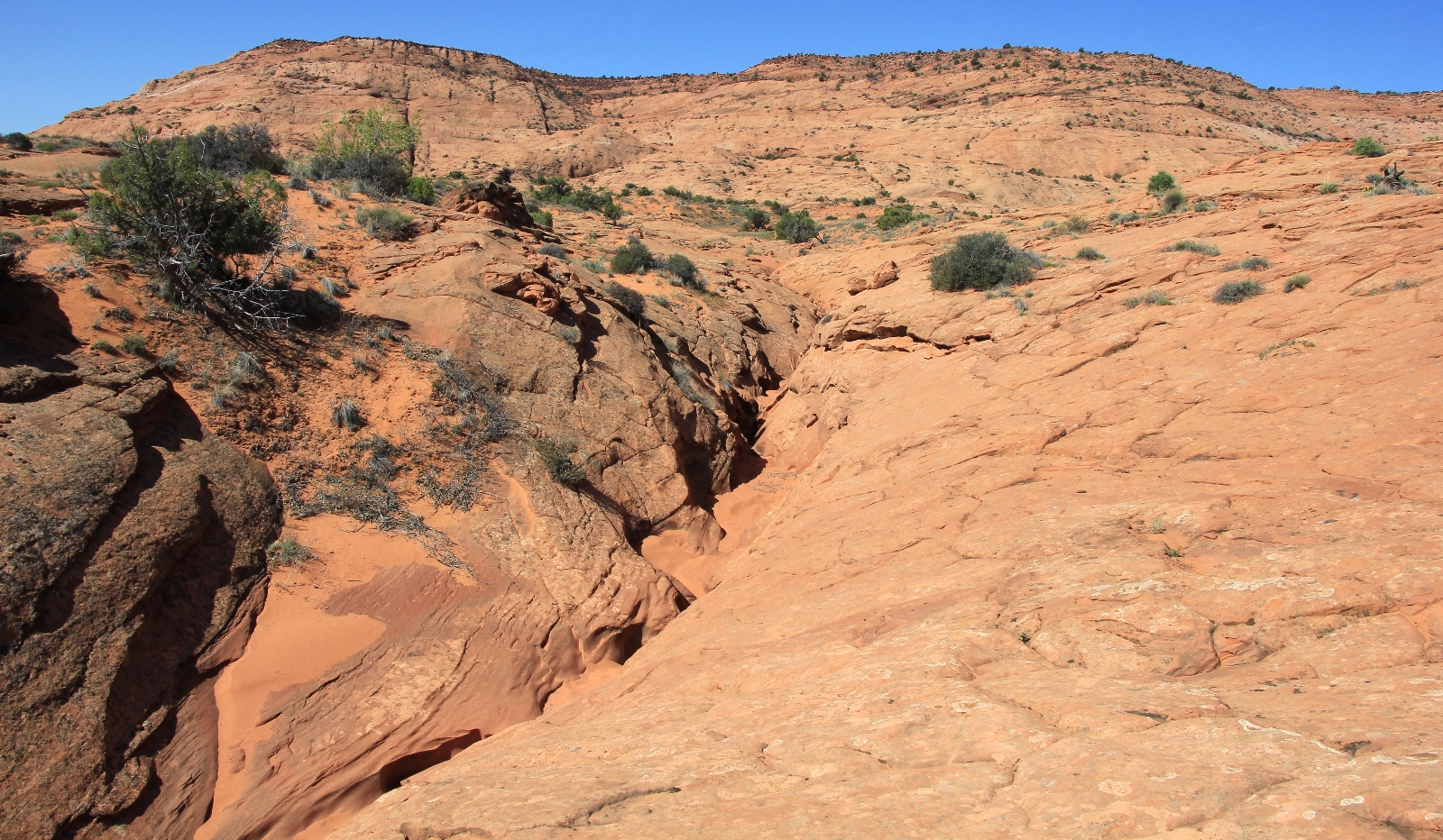
There was a little baby narrows here that we decided to explore. Despite my sunglasses, things sure were seeming especially bright. Initially I didn’t think much of it, figuring it was the intense desert sun that I wasn’t accustomed to after a long, dark winter. Then the kaleidoscope effect started—the beginnings of a migraine. Dammit! I hadn’t had a migraine for over six months. In fact, as I thought about it, my last migraine had been on the final day of our Coyote Gulch backpack the previous fall. That was just a few miles from where we were now. I told the group to continue their side explorations while I waited on the main trail. I took some Excedrin and sat in the shade with my eyes closed. These were some nervous moments for me. I never know what the headache and sensory sensitivity is going to be like. It could be mild or it could be debilitating for days. I didn’t want to turn around, but it was nerve wracking not knowing what the rest of the day would bring. The group returned from their side hike and we continued on.
Back on the trail, we kept to the left of Fence Canyon. A short distance before Fence reaches its big pour off, Lisa and Yvonne wanted to explore down in the canyon to see what it looked up to the pour off. Jason and I found a shady spot for me to rest while the ladies explored. Upon their return, they reported seeing an arch. I was disappointed to miss an arch, but the break in the shade had done me a lot of good.
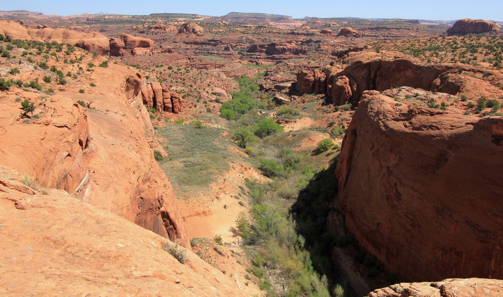
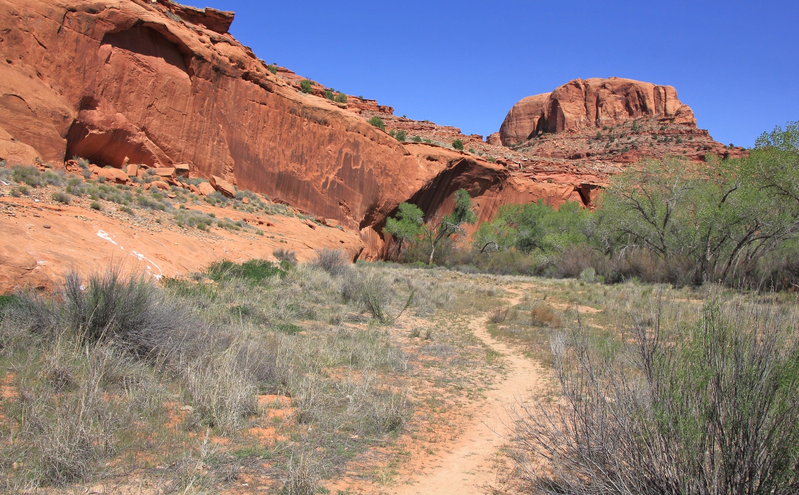
We continued down the trail, keeping to the left of Fence Canyon. The next stretch was easy hiking and the views were impressive. Soon we came to the final descent into Fence along well switch backed trail. The trail was a bit steep in a couple places, but overall it was an easy descent. I especially enjoyed the views up into North Fork Fence Canyon on our left side as we neared the bottom. I was also thrilled to see that the cottonwoods were mostly leafed out. The bright greens were beautiful and would add character and color to our shots.
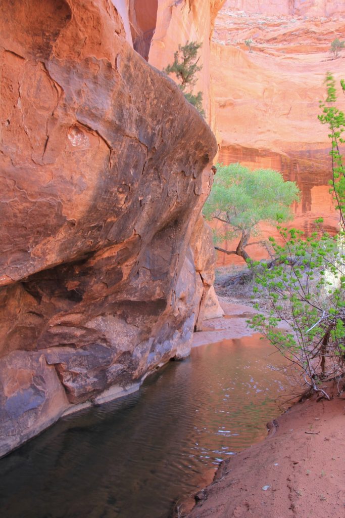
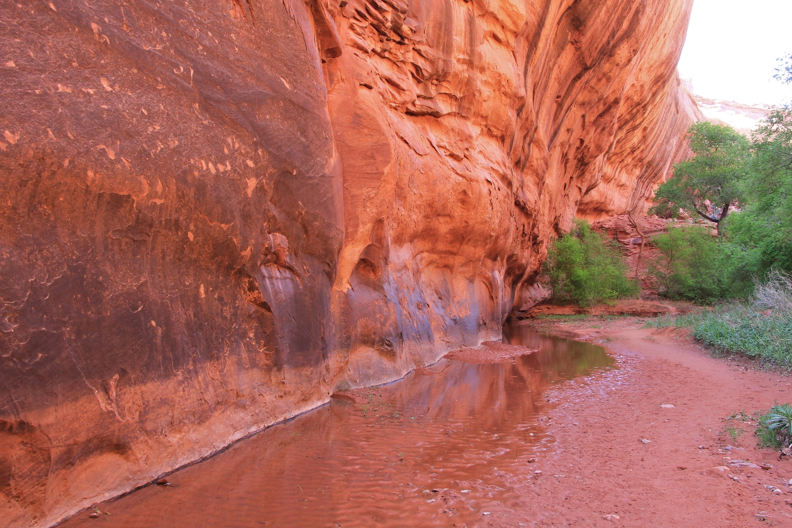
Reaching the bottom of Fence Canyon, we found good water. The stream was only about a foot and a half across and maybe 5-6” deep, but the water was pretty clear. What a relief after our Coyote Gulch and Escalante River backpacks the previous fall! We had done those after massive flooding and the water was much too muddy for filtering. We hopped the stream and found a large campsite up against the canyon wall and under a bunch of cottonwood trees. We were about 3.4 miles from the trailhead and just yards from the Escalante River. This would be a good base camp between Choprock Canyon to the north and Neon Canyon to the south. We all agreed to make camp here.
We immediately went to work setting up our tents and getting the basics of camp ready. We took a nice lunch break under the shade of our cottonwood trees before grabbing our day hiking gear and setting off for Neon Canyon. So far we hadn’t seen anyone on the trail despite the full trailhead parking lot.
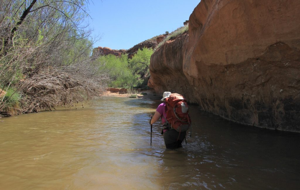
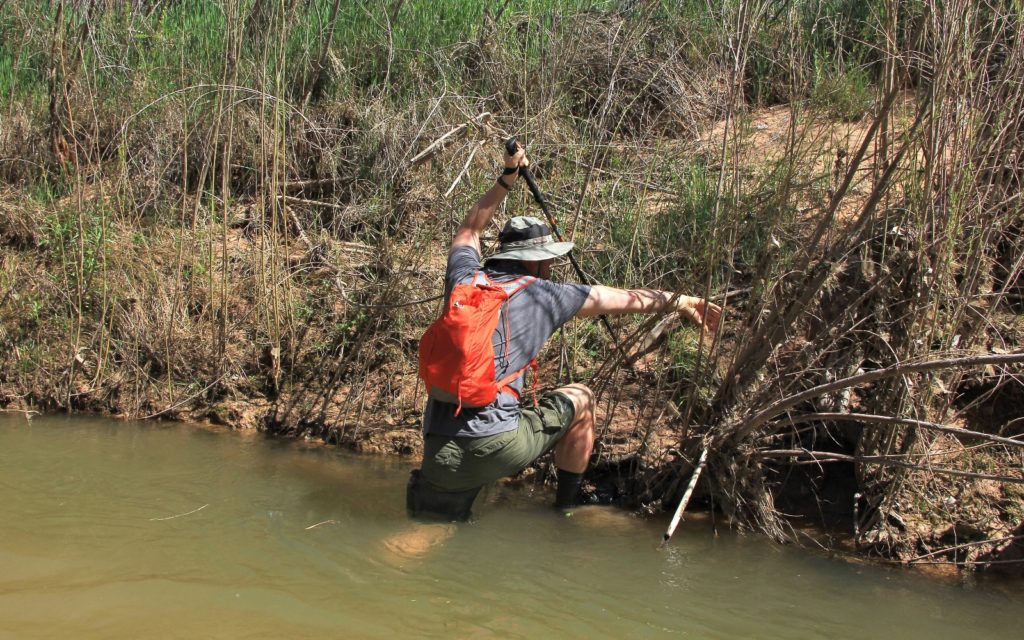
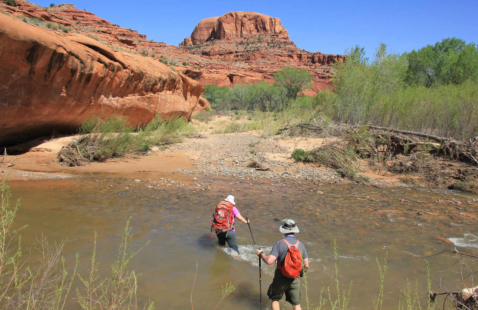
The Escalante River was just past our camp. We turned right (downstream) and immediately had to make our first crossing. We didn’t actually cross the river here—instead we waded down the west side, past some cliffs, and exited on the same side of the river. The water was up to my upper thighs in places, but the temperature was mild for so early in the season (Yvonne would disagree with me on that point… perhaps I should say it was mild for someone from Washington and cold to someone from the desert!) Once back on dry land, we immediately found a good bench trail and followed that.
As we neared the next river crossing, we saw a couple who appeared to be a bit lost and bushwhacking about. They caught up with us and asked questions about the number of river crossings. It seems they were on their way back from Neon, miscounted the crossings, and thought they had missed exiting via Fence Canyon. We gave them some instructions and reassurances that they hadn’t missed Fence.
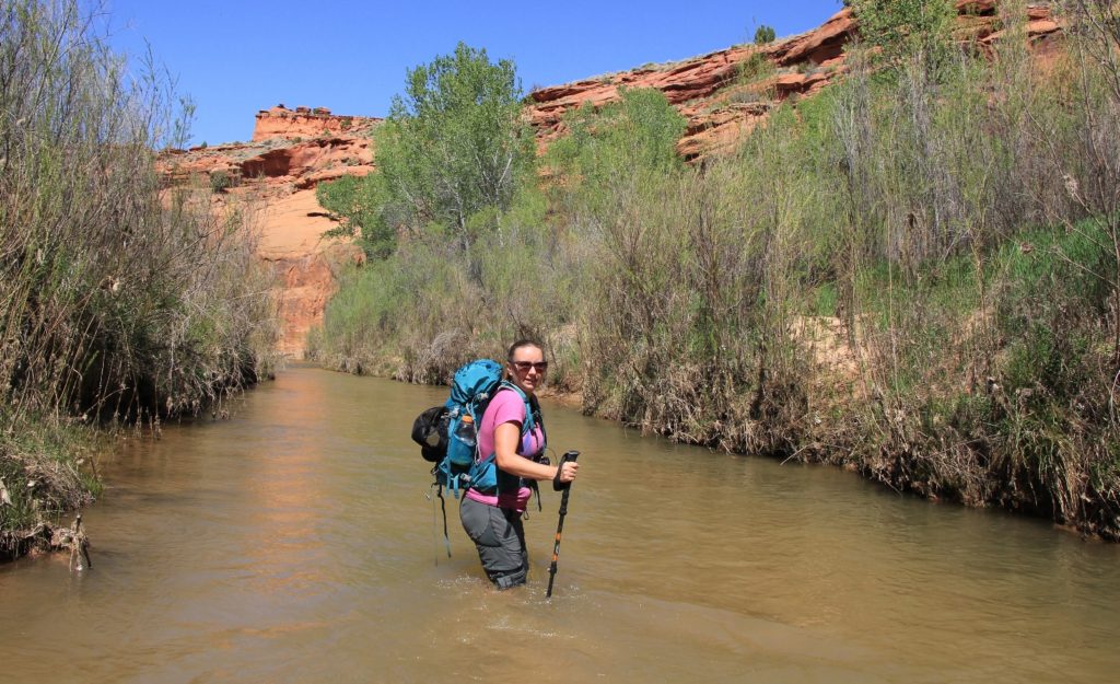
Our second river crossing was another deep one, hitting us in the nether-regions. Yvonne made it half way across the river before deciding to turn around. She had rolled her ankle a few days earlier and the uneven footing in the river crossings was proving difficult for her. She felt too unstable and didn’t want to risk further injury immediately prior to her big move to Hawaii to be a lava tour guide. Admittedly, it was a steep climb getting out from this second crossing. Lisa and I only made it with Jason’s help. Yvonne headed back to camp while Jason, Lisa, and I continued on. I felt bad leaving Yvonne, but she was very gracious about us going forward since we hadn’t seen Neon or the Golden Cathedral before.
Now on the east side of the river, we continued downstream about ten minutes to our third river crossing which was much easier. The river wasn’t nearly as deep and there wasn’t a steep bank to climb down or up.
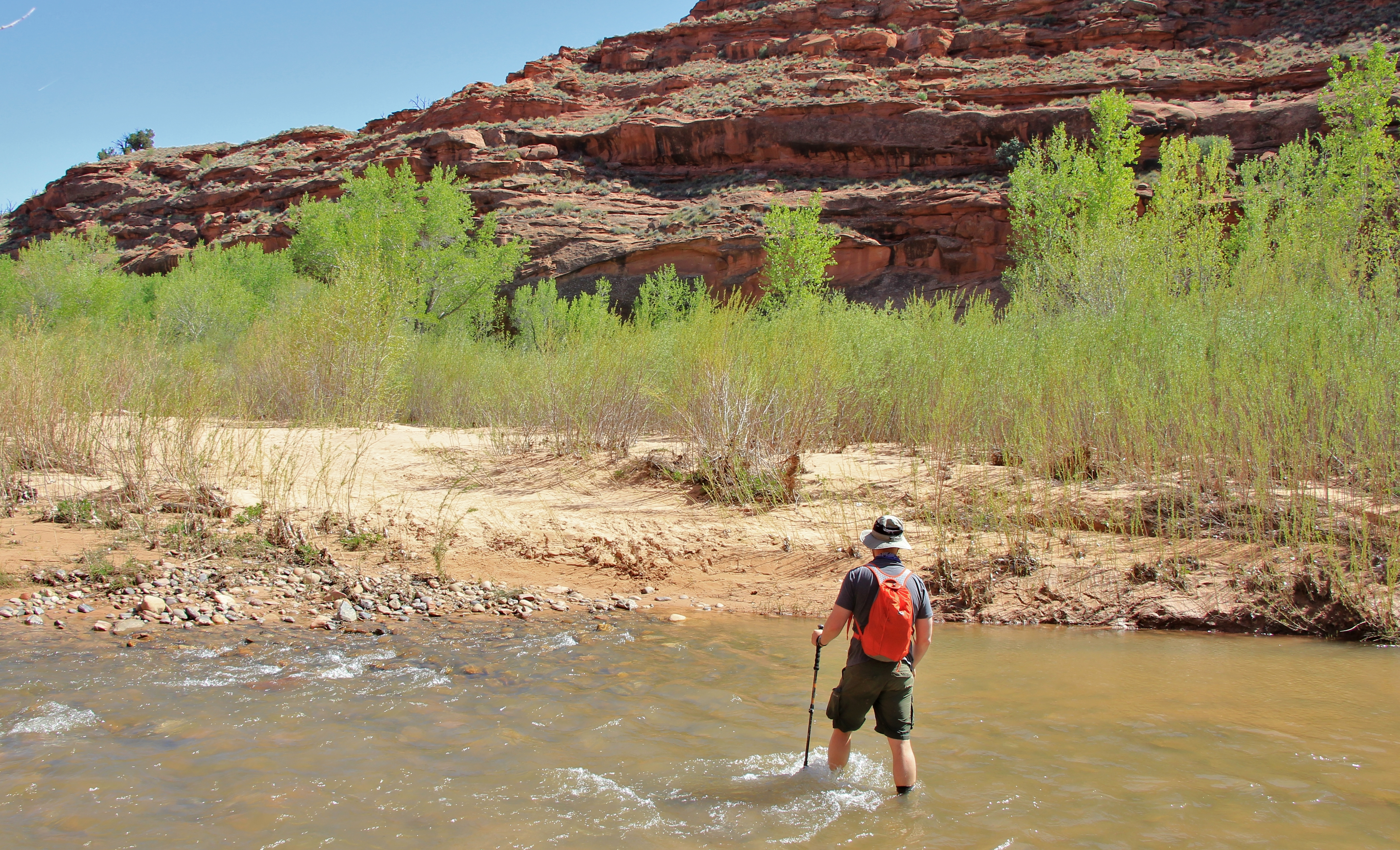
We walked a short distance and found ourselves at the fourth river crossing. This was another shallow and easy crossing.

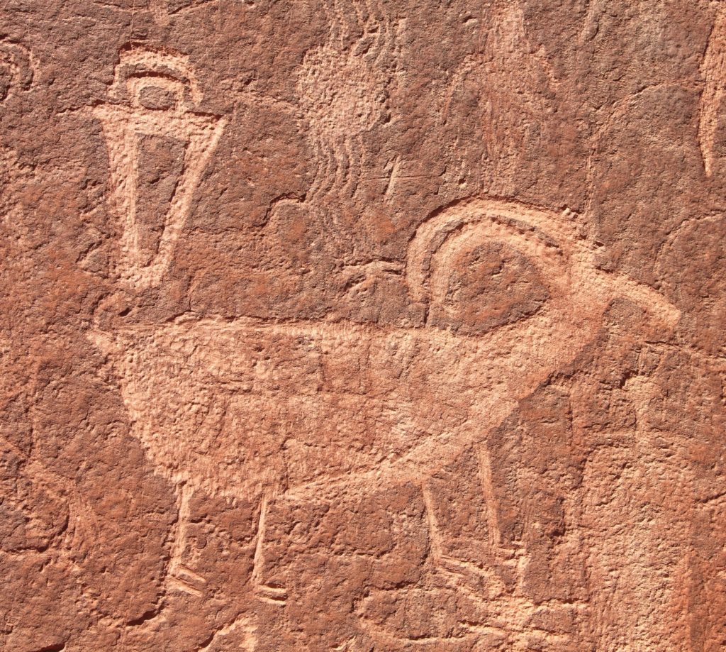
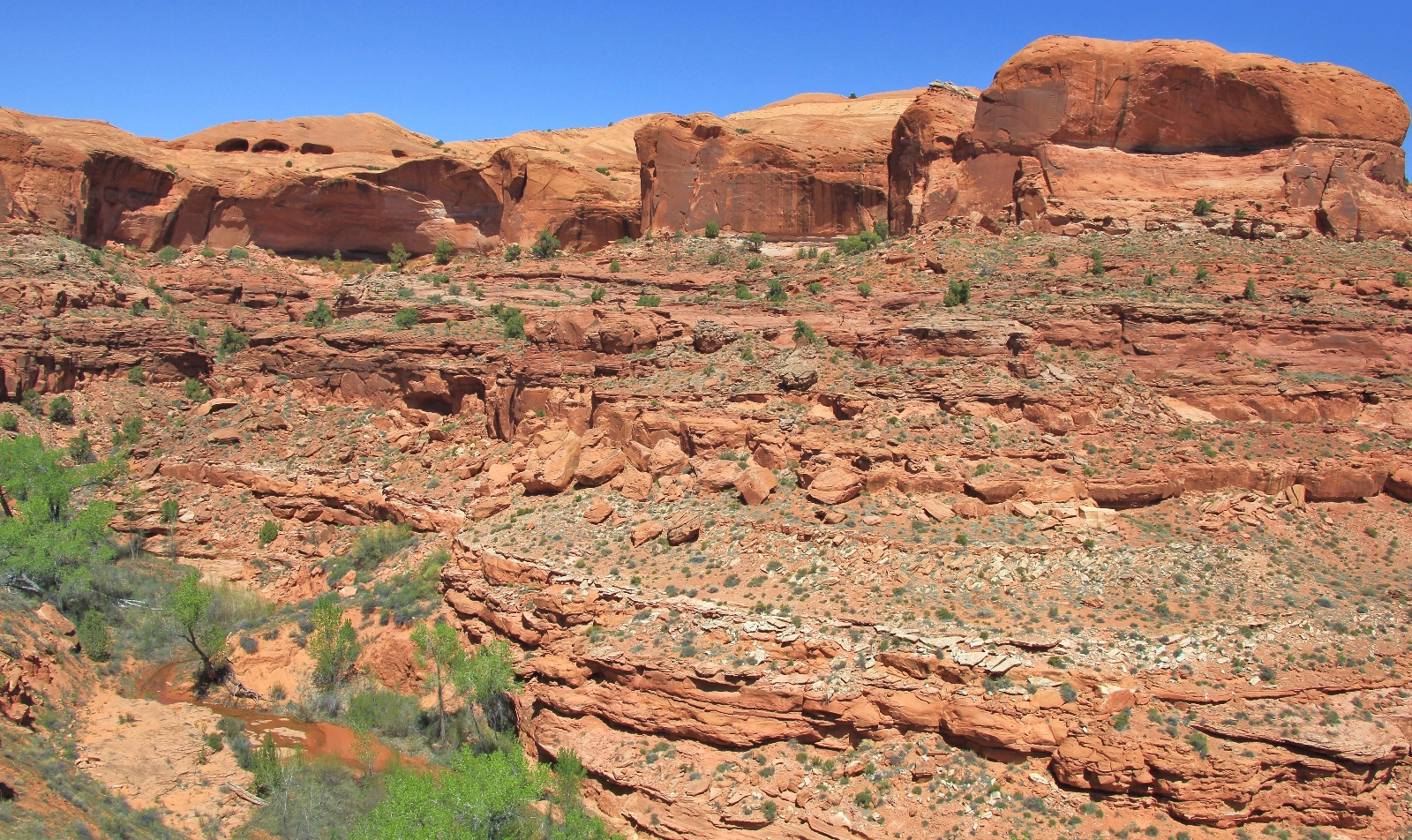
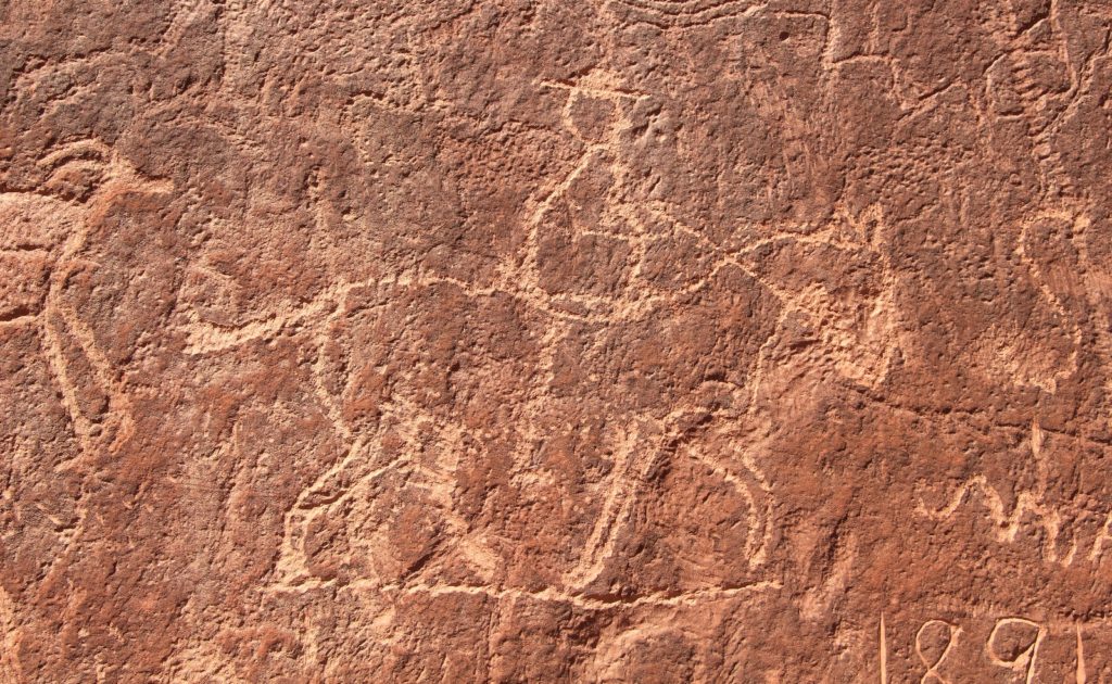
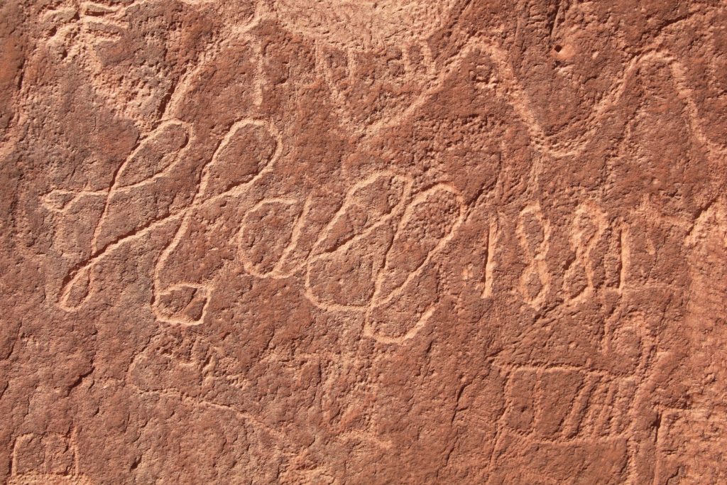
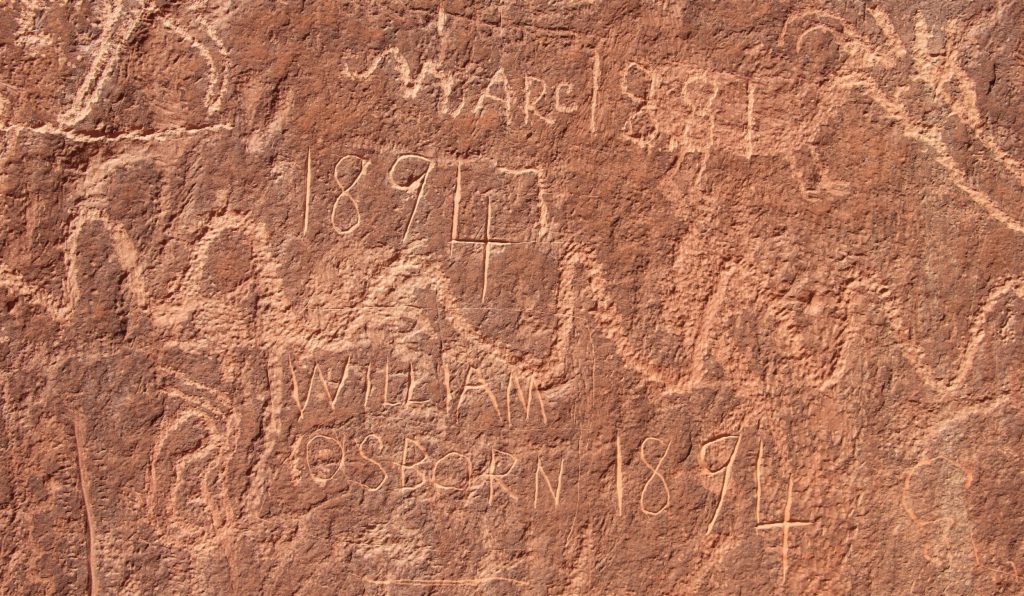
About ten minutes from the fourth crossing we arrived at the base of a cliff with an impressive petroglyph panel. I had seen photos and thought I knew what to expect, but I didn’t realize just how big it was going to be. Many of the glyphs were quite good with bear and turkey prints, bighorn sheep, hunters, centipedes and the usual interesting figures.
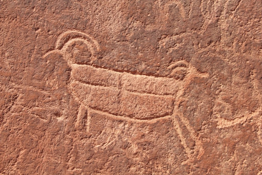
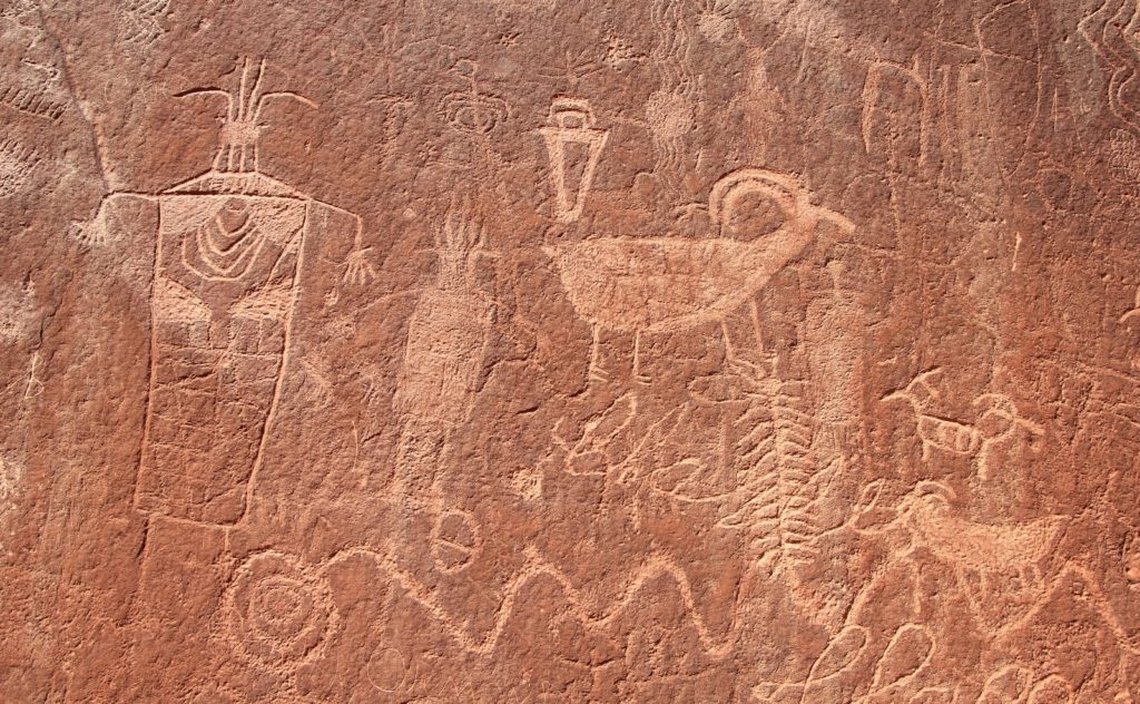
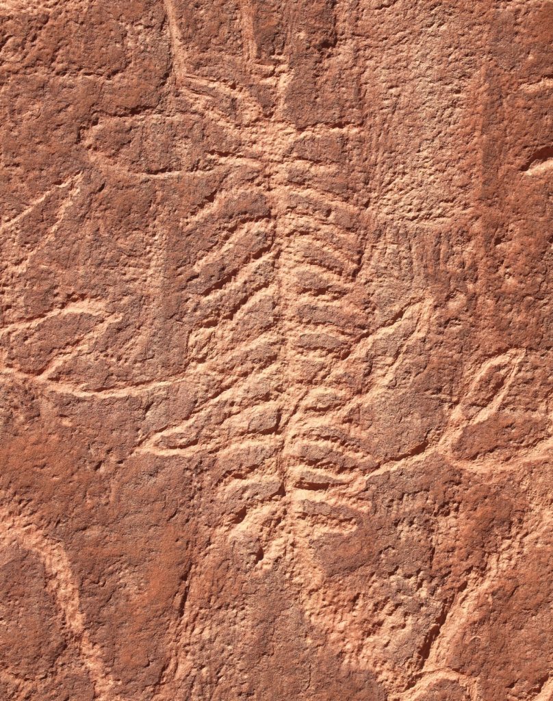
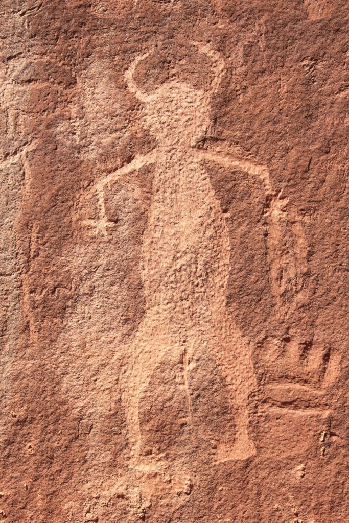
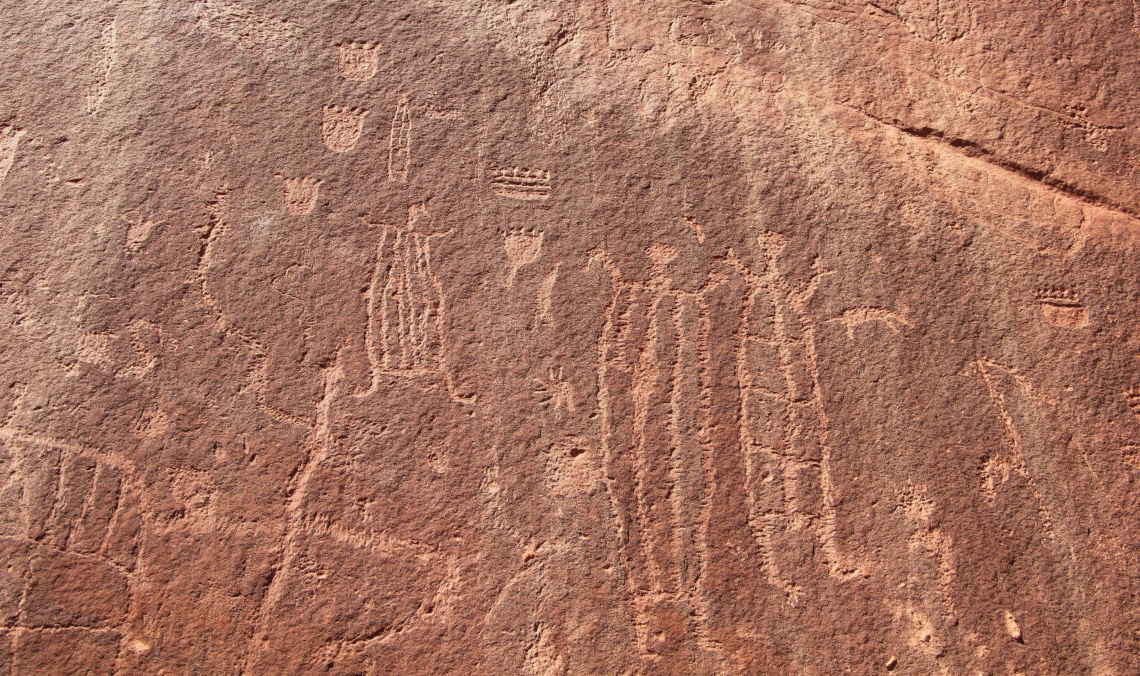
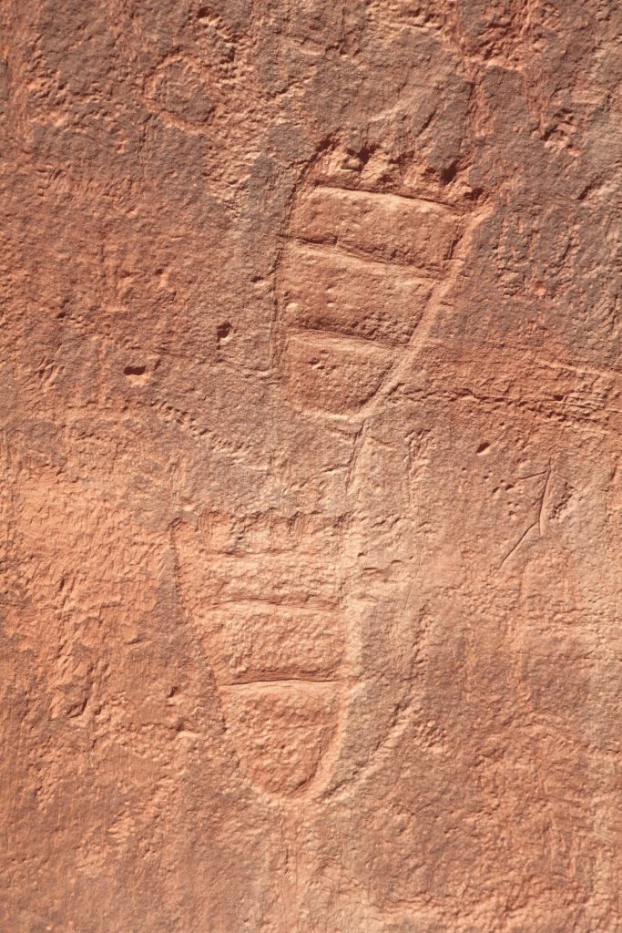
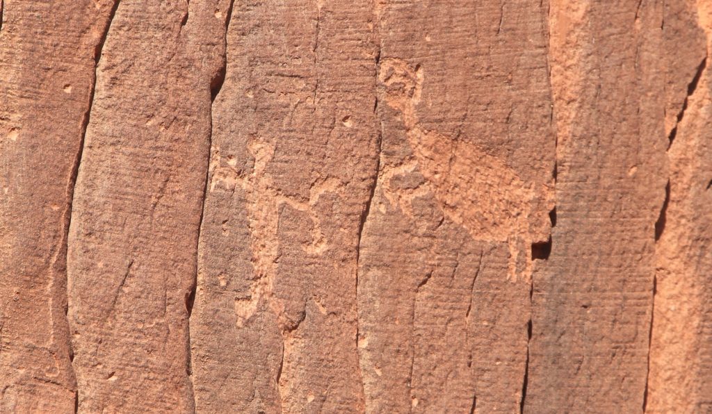
We also saw some “gringo-glyphs” and a few historic inscriptions from the 1880s.
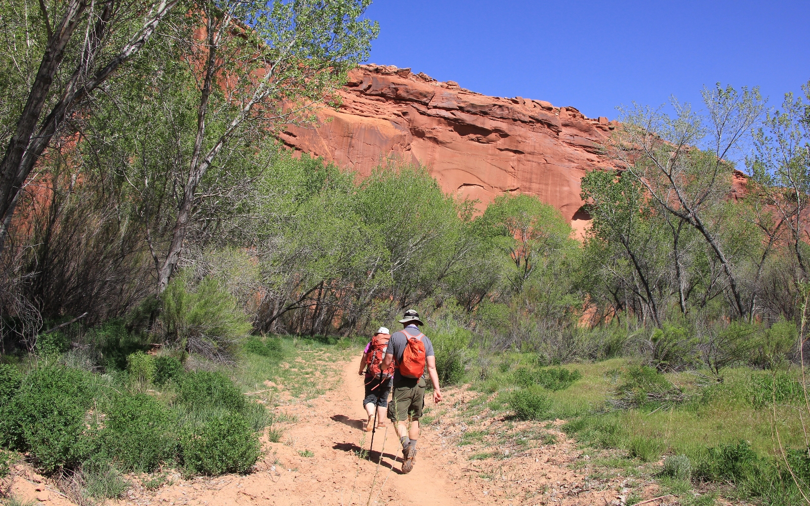
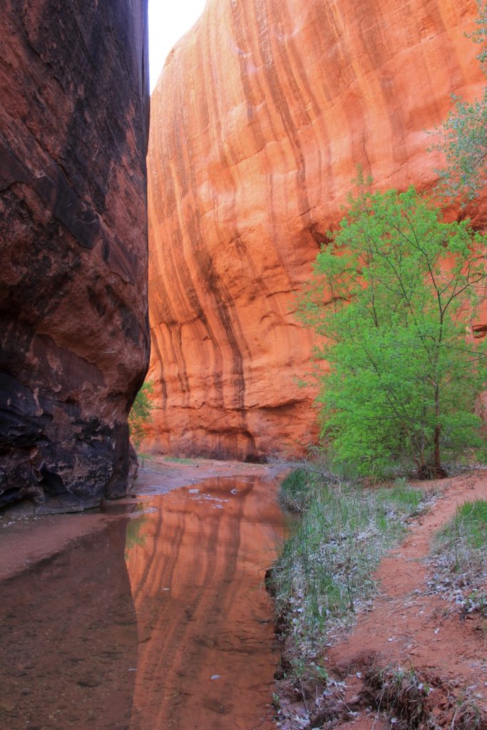
A short hike downstream from the panel and we were standing in front of the old massive cottonwood tree that is the guardian to Neon Canyon. The brilliants greens of the freshly leafed out cottonwood contrast beautifully against the red rock cliffs.
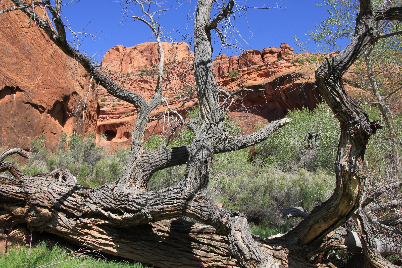

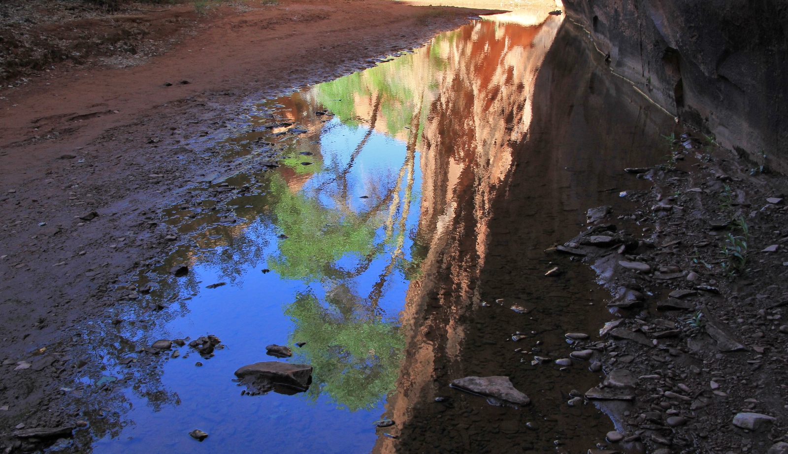
Even without the Golden Cathedral at the end, Neon is a stunningly beautiful canyon worthy of the effort to get there. We saw a lot of water pools and even filtered some at one point. It was from a clear looking pool in the shade of an alcove and was wonderfully cool and of surprisingly good flavor. Lisa commented that this was way more water than her and Yvonne had seen in Neon the first of May a few years prior.
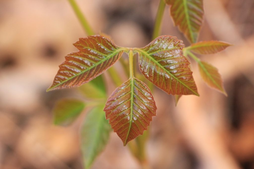
Navigation up Neon was easy. It is a narrow canyon and it would be impossible to get lost. We did have one short climb up and over a rocky area near the end, but other than that it was pleasant hiking up the canyon bottom. The last quarter mile or so had an abundance of poison ivy that we were careful to avoid.
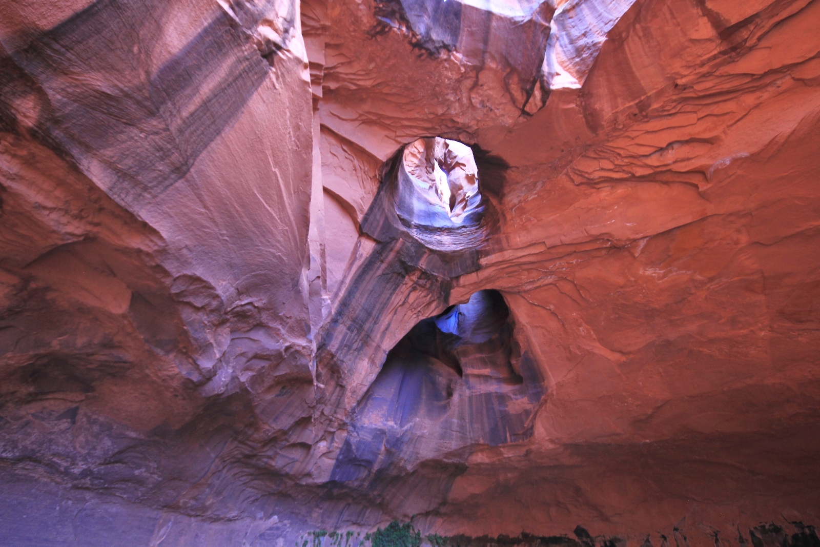
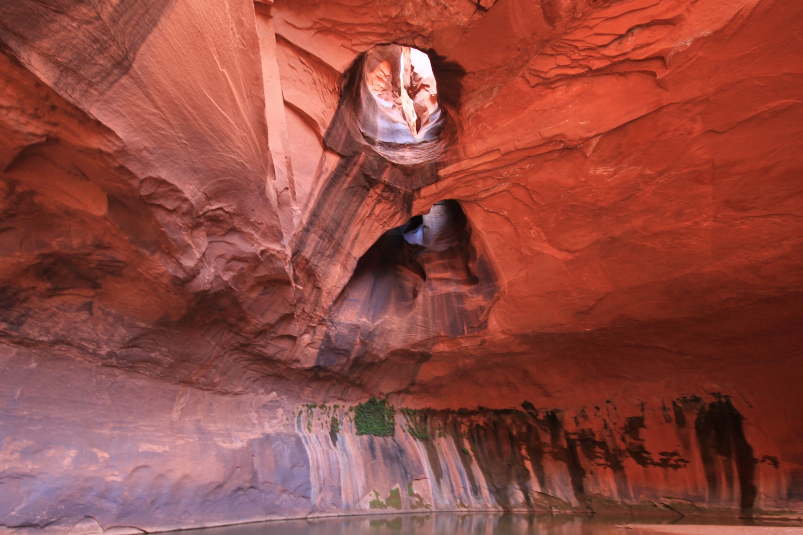
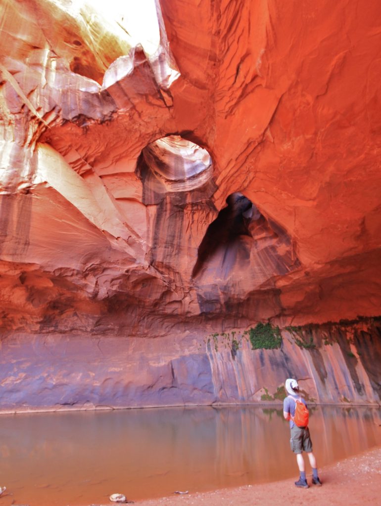
The Golden Cathedral, located one mile up Neon Canyon, was a bit of an overwhelming sight. I had seen many photos over the years, but this is one of those special places you just can’t experience through a photo. You prepare yourself and think you know what it will be like, but there is no way you can comprehend it from a photo. The pour off and pothole arches are so massive and beautiful that even the best photo can’t do them justice. It is a wonderful place to stand in awe and feel small. We weren’t there at the ideal time of day for lighting, but it was still beautiful. I wasn’t super happy with any of my photos, but I felt a sense of accomplishment for finally reaching this special place.
We returned to camp around 7:00 after an 8.6 mile day. While filtering water for dinner, Jason and I struck up a conversation with a father and daughter who were camped nearby. They were from New Hampshire and had hoped to see the Golden Cathedral, but got lost on their way down into Fence Canyon. They had to leave the following morning at first light in order to start a five day backpack in the Needles District of Canyonlands National Park. Not too many things are more impressive than Golden Cathedral, but Salt Creek in the Needles might just be one of them. Jason and I recounted a few memories from our backpack in Salt Creek two years prior and wished them a safe and fun trip.
It was an enjoyable evening at camp, catching up with an old friend and getting to know a new one. It had been a long day full of adventure. We were all beat and turned into bed early. With no chance of rain in the forecast, we left the rain fly off our tent. The stars put on quite a show and the nearly full moon lit up the canyon.
Directions to TH: from the Mormon pioneer town of Escalante, Utah travel east on highway 12 4.5 miles then turn right on Hole in the Rock Road. Travel 16.3 miles down this typically washboarded road then turn left (east) onto Egypt Bench Road. Continue 10 miles down this generally rough road to the Egypt Trailhead. I would recommend a 4WD and high clearance vehicle for the Egypt road; however, I was amazed to see a sedan just half a mile from the TH.