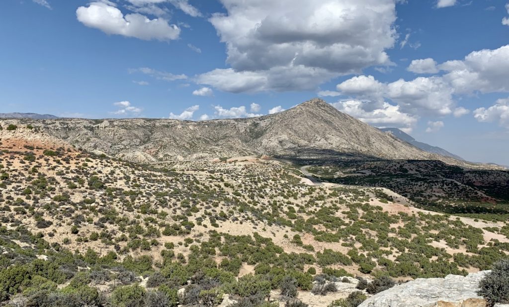
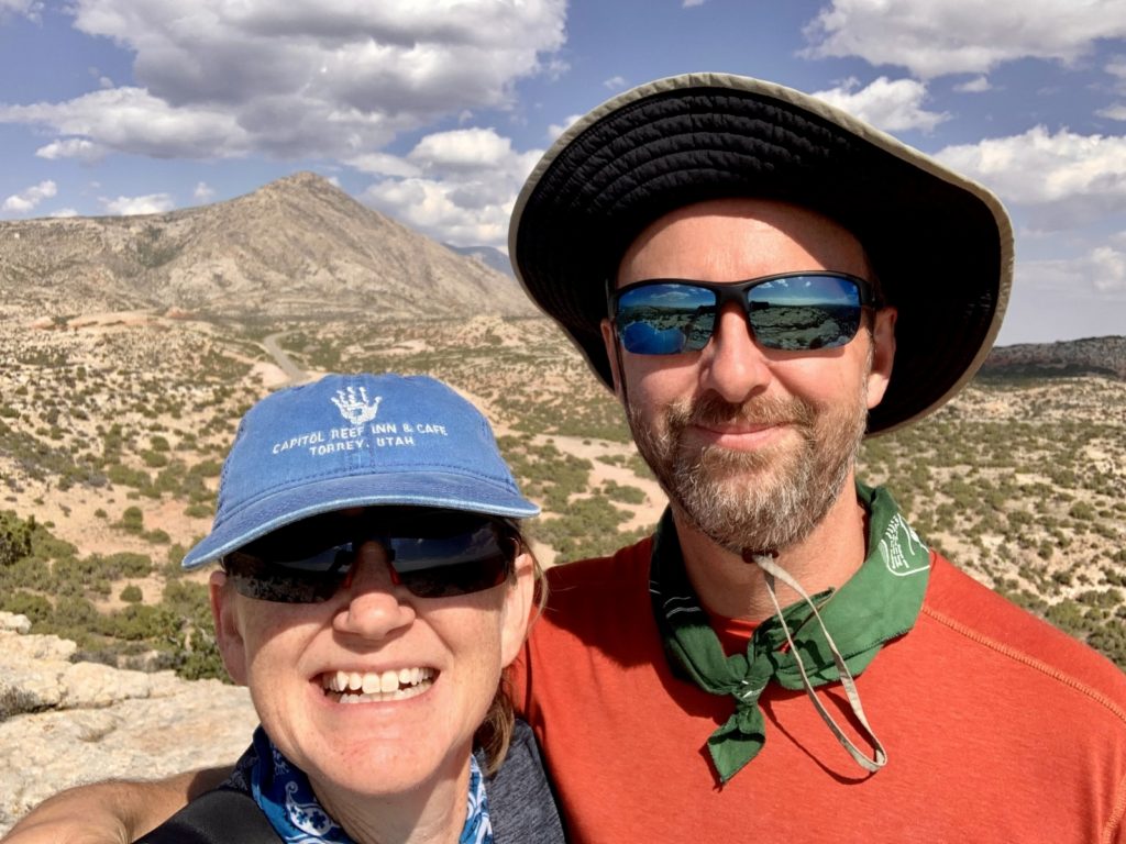
During our fall 2021 adventures, we spent eight days at Bighorn Canyon National Recreation Area. In addition to a day spent kayaking (see previous post), we hiked many of the park’s trails and visited three of its ranches. We never saw more than one other couple on any of the trails or at any of the ranches and we recommend these sites for those seeking tranquility and a taste of the real Old West.
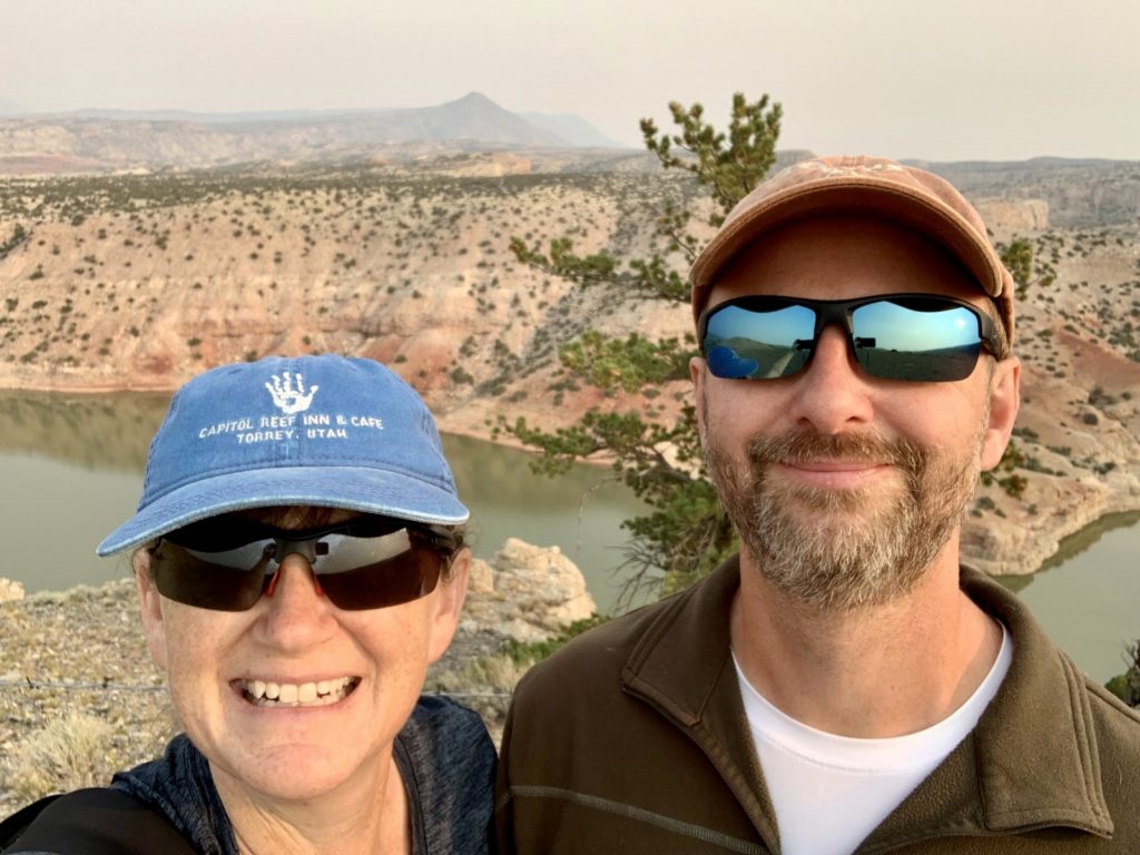
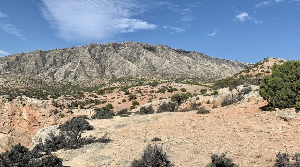
All sites described below are located off the park’s main road (highway 37) northeast of Lovell, Wyoming between the Crooked Creek Ranger Station and Barry’s Landing. The viewpoints all photograph significantly better in the afternoon; however, temperatures 10-20 degrees above normal had us doing all our hikes in the morning to beat the worst of the heat. Conditions in the park were pretty smoky the day we arrived and then off and on throughout our stay. There were a few fires in the area this season, but we hear most of the smoke was from fires in California and Oregon.
Mouth of the Canyon Trail
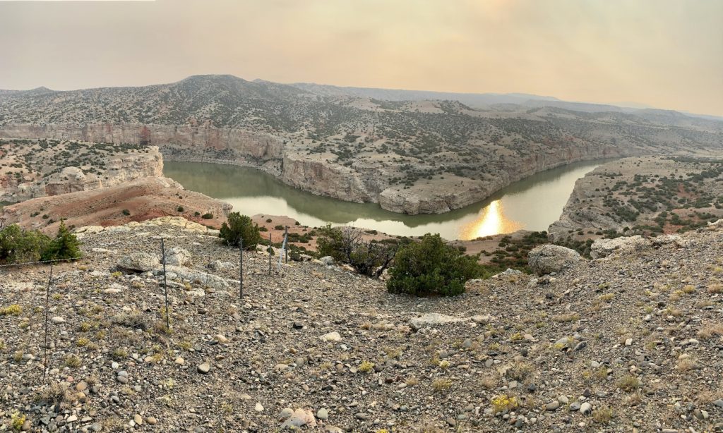
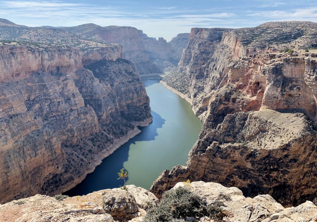
Mouth of the Canyon is a 2.1 mile lollipop loop that begins next to site B19 in Horseshoe Bend Campground. It climbs to a commanding view of the confluence of Crooked Creek with Bighorn Canyon. I heard that wild horse sightings are common on this trail, but we did not see any. This was our first hike and conditions were the smokiest that day. Under better conditions, we would have had good views of the nearby Pryor and Bighorn Mountains.
Ranger’s Delight Trail
Ranger’s Delight is a short 0.66 mile out and back trail to a nice overlook of Bighorn Canyon. The trail is steep and rocky, but the views are worth the short climb. We added on the Connector Trail that links Ranger’s Delight with the State Line trail and were rewarded with an additional viewpoint. The trail begins at a signed pull-out approximately 0.5 miles north of the Montana state line.
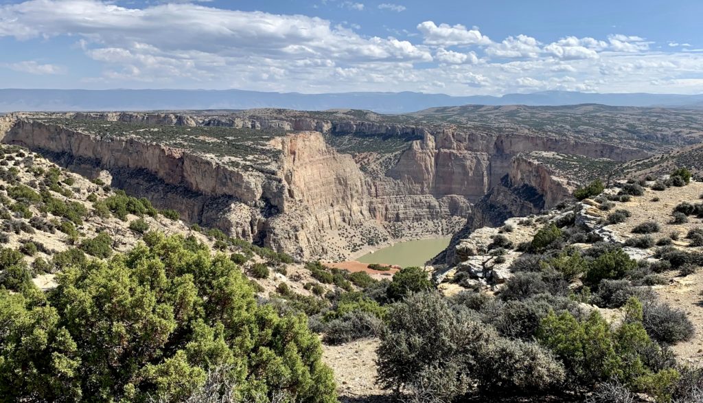
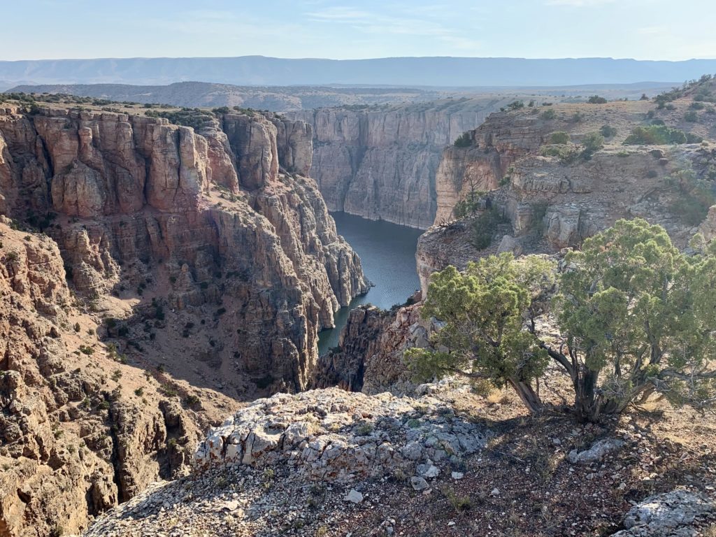
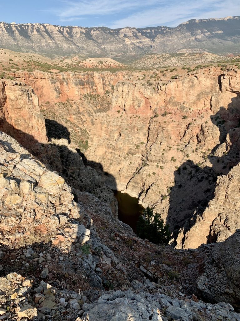
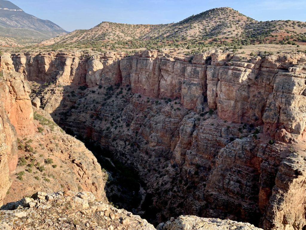
Sullivan’s Knob Trail
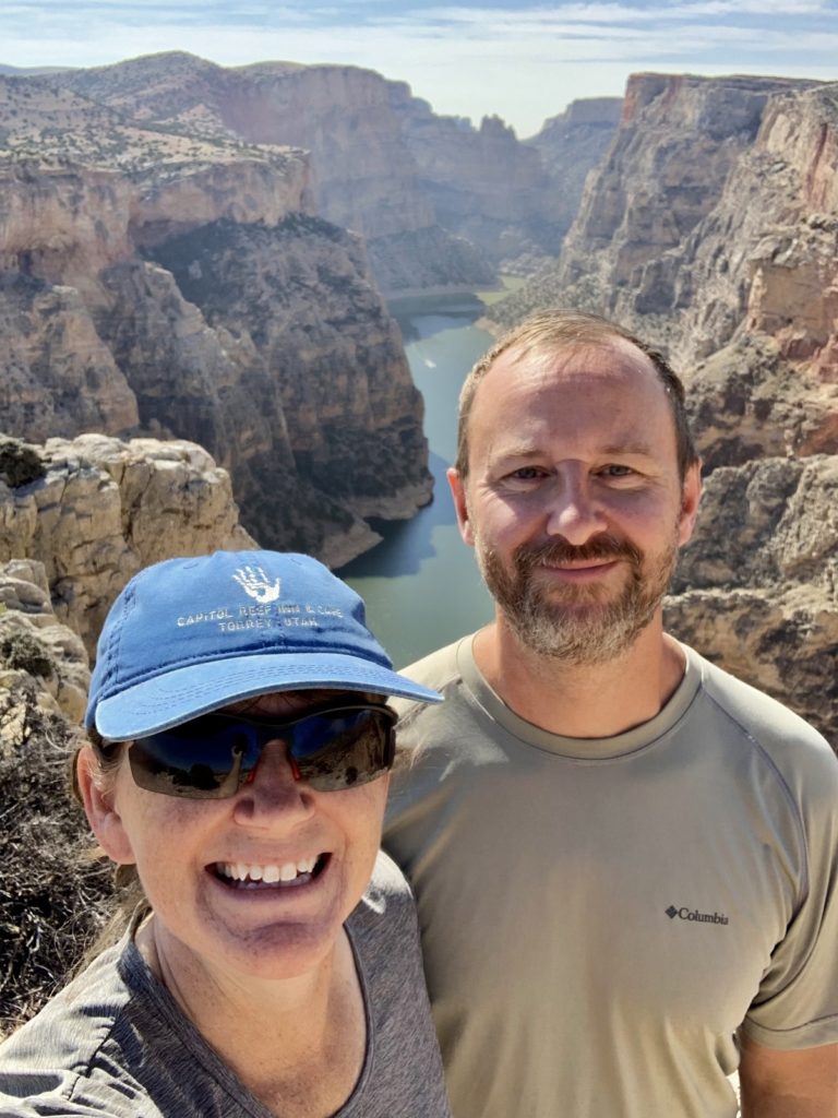
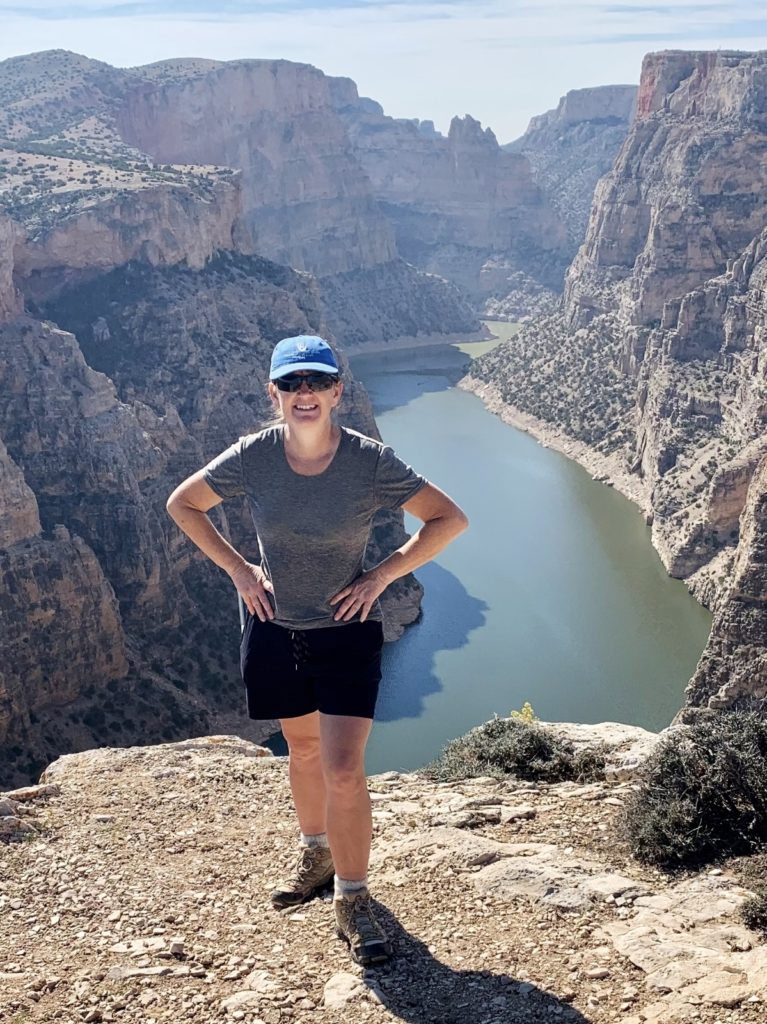
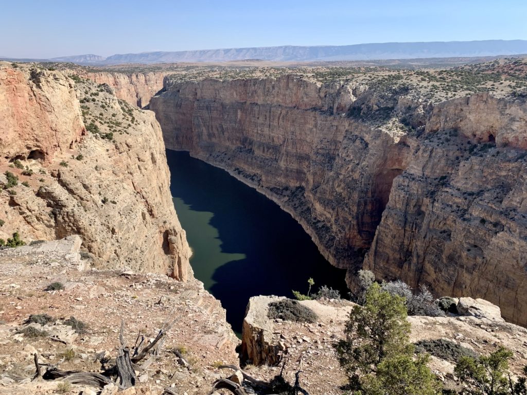
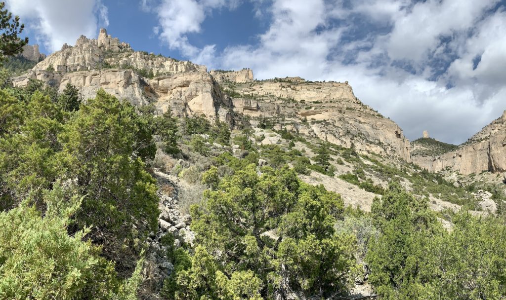
Sullivan’s Knob is a 0.75 mile out and back that has a big payoff for very little effort. This was our favorite canyon viewpoint. There is a little up and down on this trail and the tread is rocky in places. The trail begins at a parking area one mile north of the Devil’s Canyon Overlook junction. From the road, you can’t tell that this is the trailhead. Just looking for a sign saying “parking area” and a one way sign pointing in.
Two-Eagles Interpretive Trail
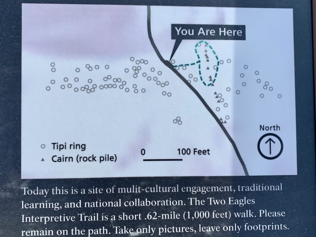
The Two-Eagles Interpretive Trail is a 0.6 mile lollipop route of cultural significance. The site consists of more than 140 stone tipi rings used by ancestors of the Crow, Shoshone, and other native people. The stones were used to weigh the lower edges of lodge skins to prevent the structure from being blown over by a hard wind (and this area does get hard winds!). When the camp was moved they were rolled off the leather and left for future use. Radiocarbon dating of charcoal found in cooking fires shows that the tipi rings at Two Eagles date to the last 1,000 years, though some elsewhere in the recreation area are 2,000 years old. The interpretive trail begins at a well-marked pullout north of Sullivan’s Knob.
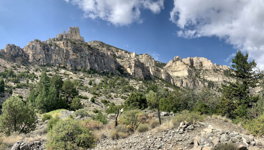
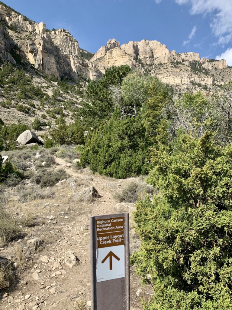
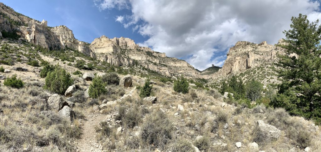
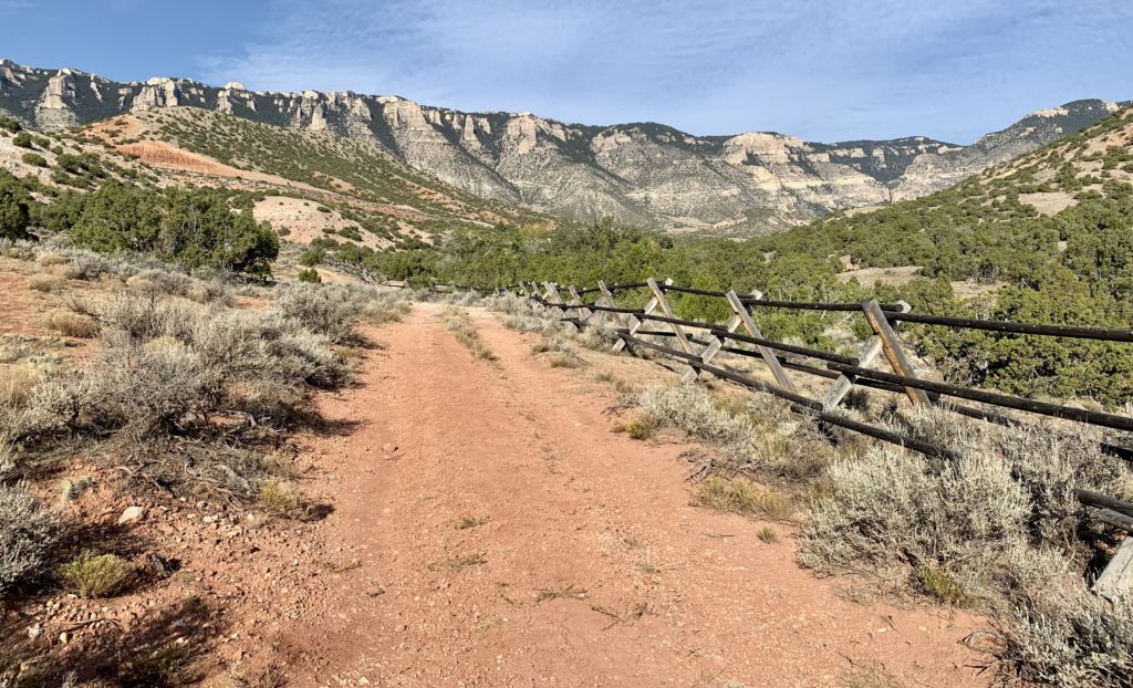
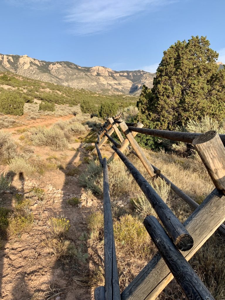
Upper Layout Creek Trail
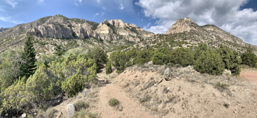
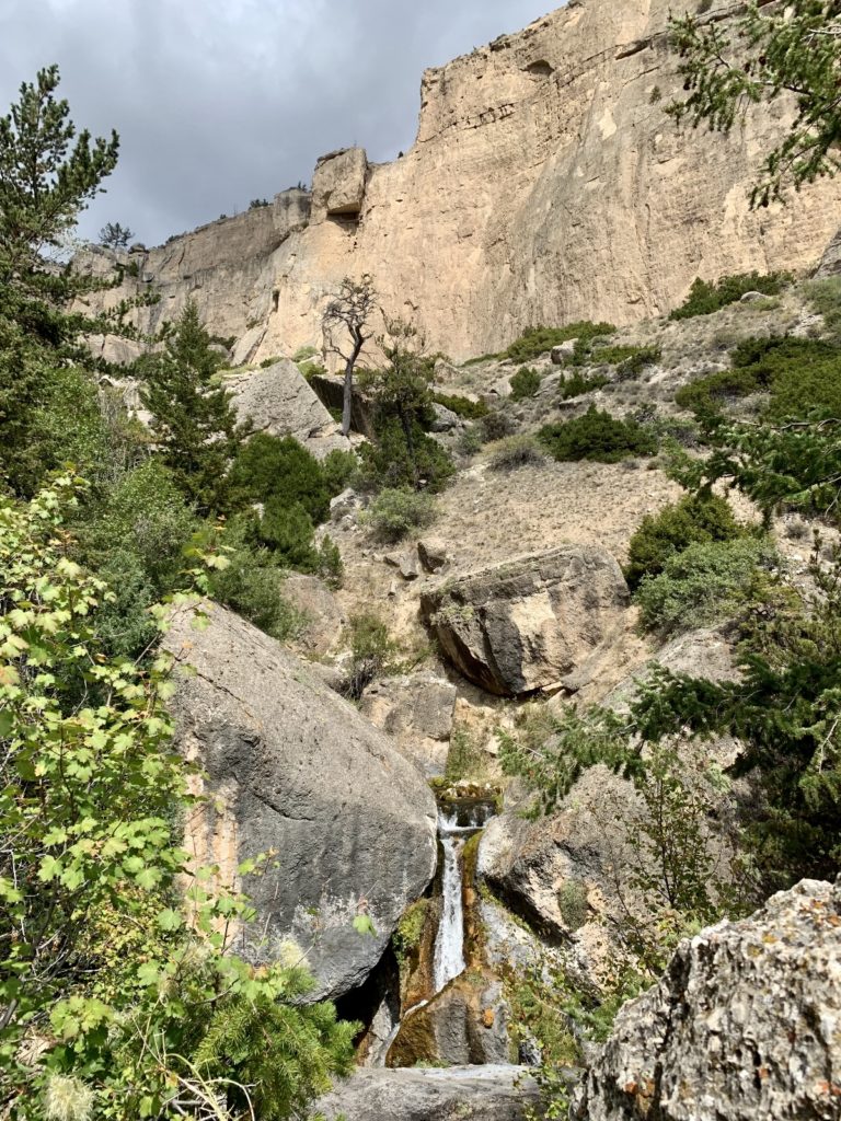
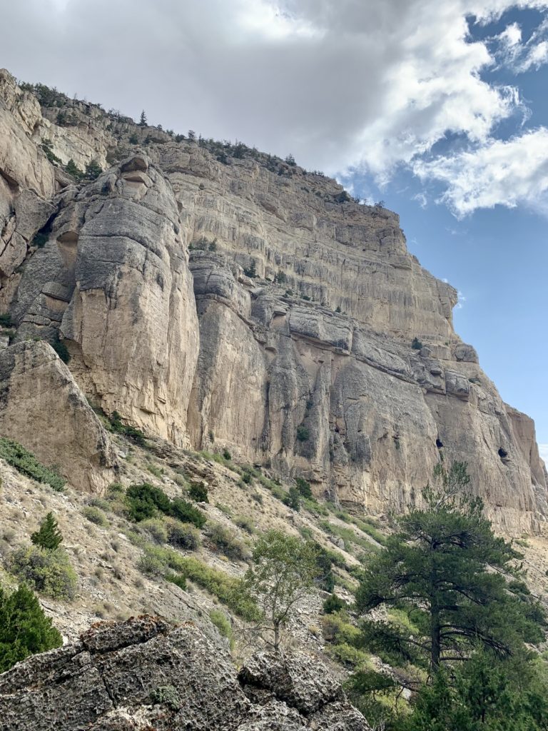
Upper Layout Creek is a steep 2.0 mile out and back trail up a rugged and stunningly beautiful canyon. There is a small waterfall at the end, but the towering canyon walls are the real star of this hike. This was our favorite trail at Bighorn and we highly recommend it for anyone able to negotiate the steep and rocky trail tread and gain ~650’ elevation over one mile. Note: the mileage listed here is for those with high clearance vehicles able to negotiate the moderately rough access road. We made it fine in our truck thanks to good tires and clearance, but it was tough turning our long-box truck around in the small area at the road’s dead end. For those in a car, park at the Ewing-Snell Ranch and walk the road just past the horse corals. I did not measure the distance, but I’m guessing it would double the mileage for the hike.
Lower Layout Creek Trail
Lower Layout Creek is a 3.75 mile lollipop route with roughly 225’ elevation loss and a commanding view of Bighorn Canyon. Wild horses, bighorn sheep, and deer frequent the area with its year around water source. We saw five wild horses and two deer during our hike. The trailhead is located at the cattle guard just south of the Ewing-Snell Ranch turnoff. At the cattle guard, park on either side of the road then follow the rough single-track road down Layout Creek. At the powerlines, the route turns to trail and you’ll want to be careful there—wild horse trails crisscross the area making some spots a bit confusing.
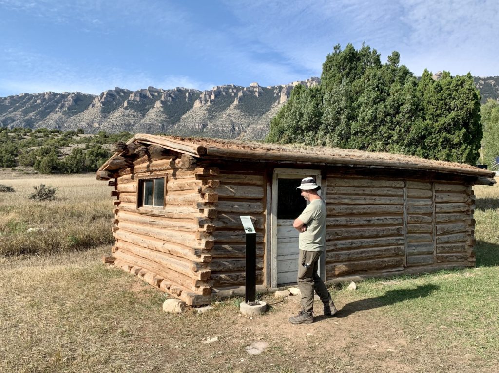
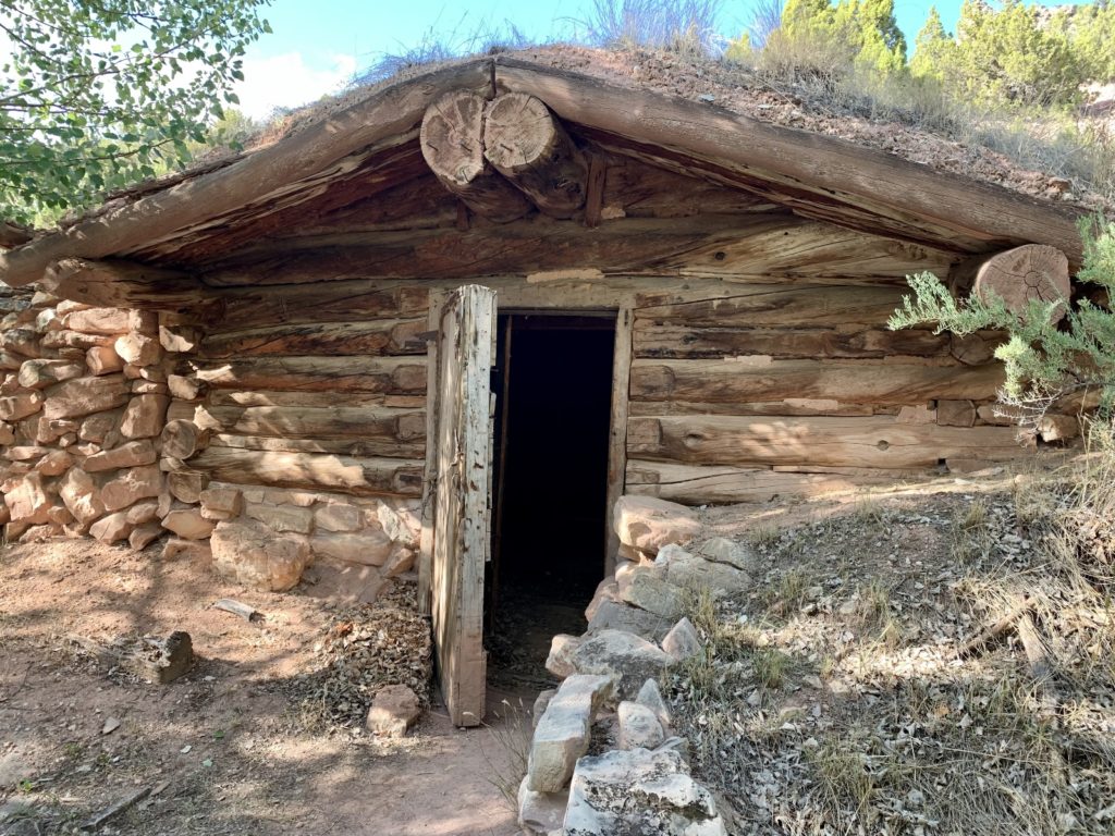
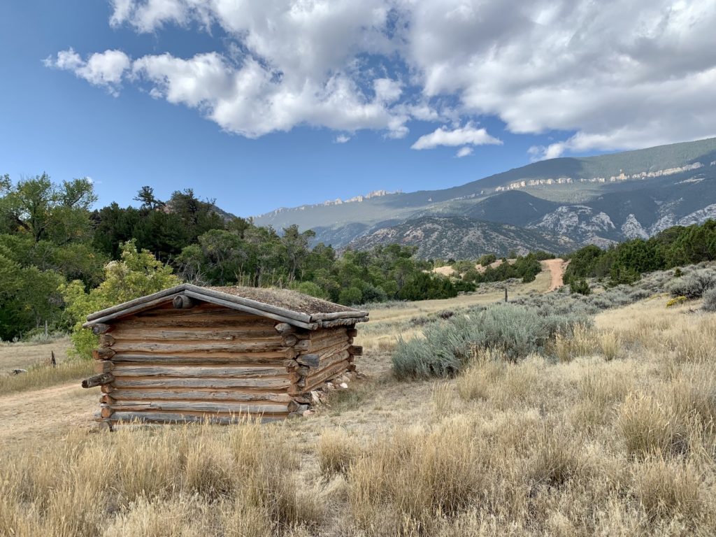
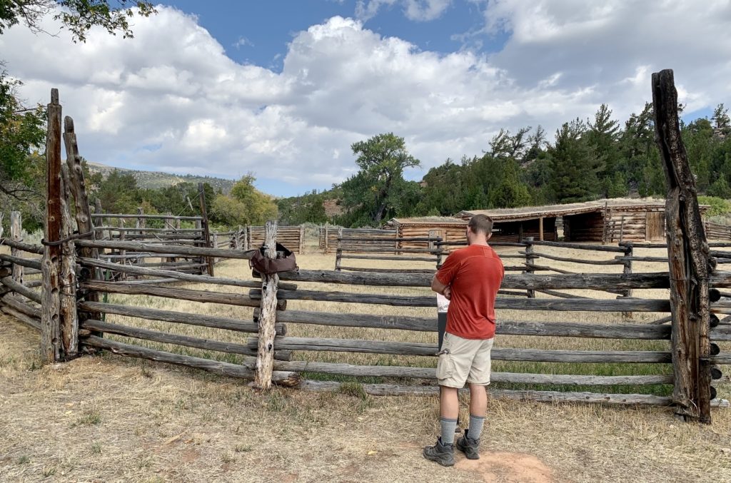
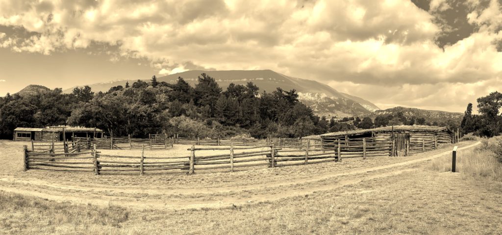
Ewing-Snell Ranch
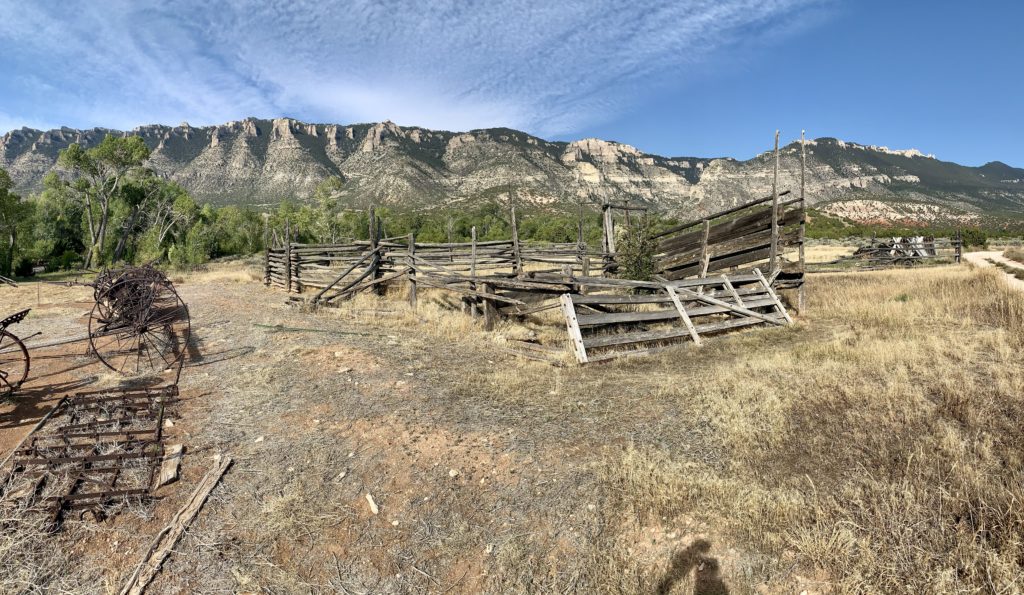
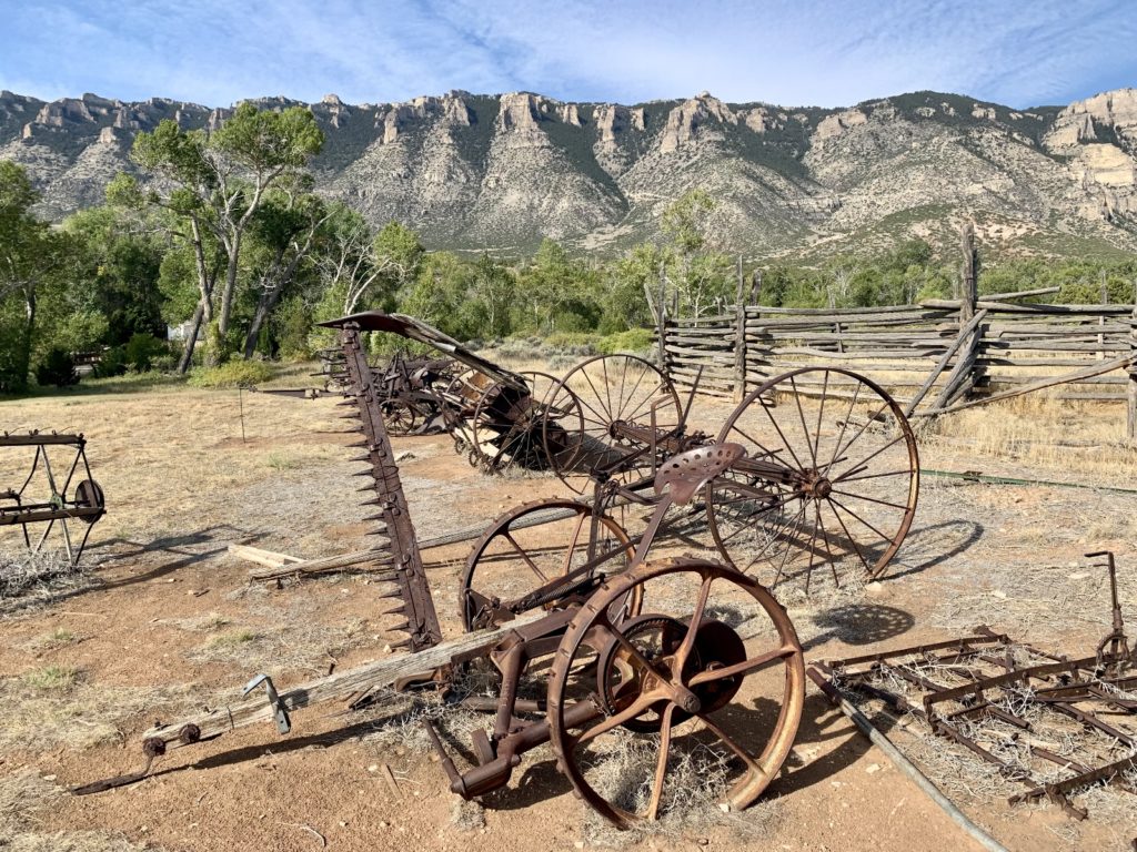
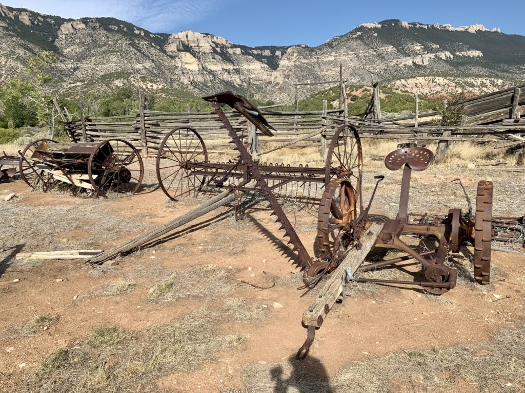
While at Bighorn Canyon, we visited three of the four historic ranches. The Ewing-Snell Ranch is a quick roadside stop with the easiest access. From the main park road, just past the Pryor Mountain Wild Horse Ranch boundary sign, a sign to the left directs you to the parking area. From here, a short walk leads to the old cabin site. The Ewing-Snell cabin was destroyed by a fire in December 2015, but it appears as though the park may be rebuilding it. A couple log buildings remain and there is a nice footbridge over the creek there. Like many, Erastus T. Ewing came to Bighorn Canyon looking for gold. Finding none, he decided to try his hand at ranching. In 1897, he filed to appropriate 200 inches of water per year from Layout Creek for irrigation, mining, and milling. My favorite part of this ranch was the collection of rusty machinery by the horse coral with scenic Upper Layout Creek Canyon in the background.
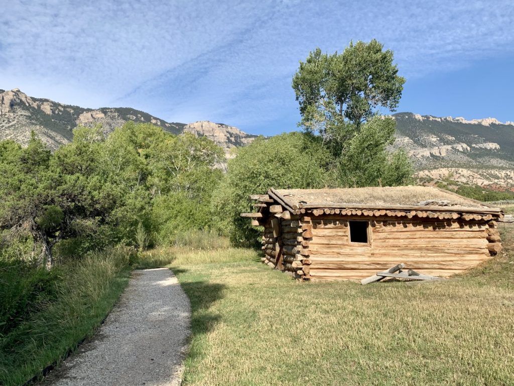
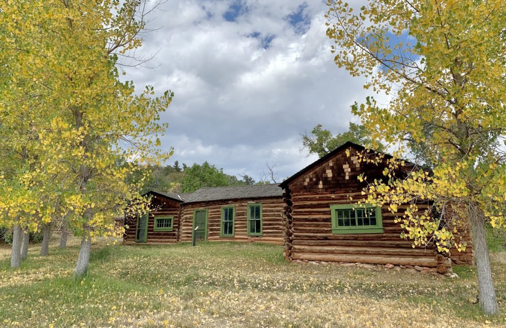
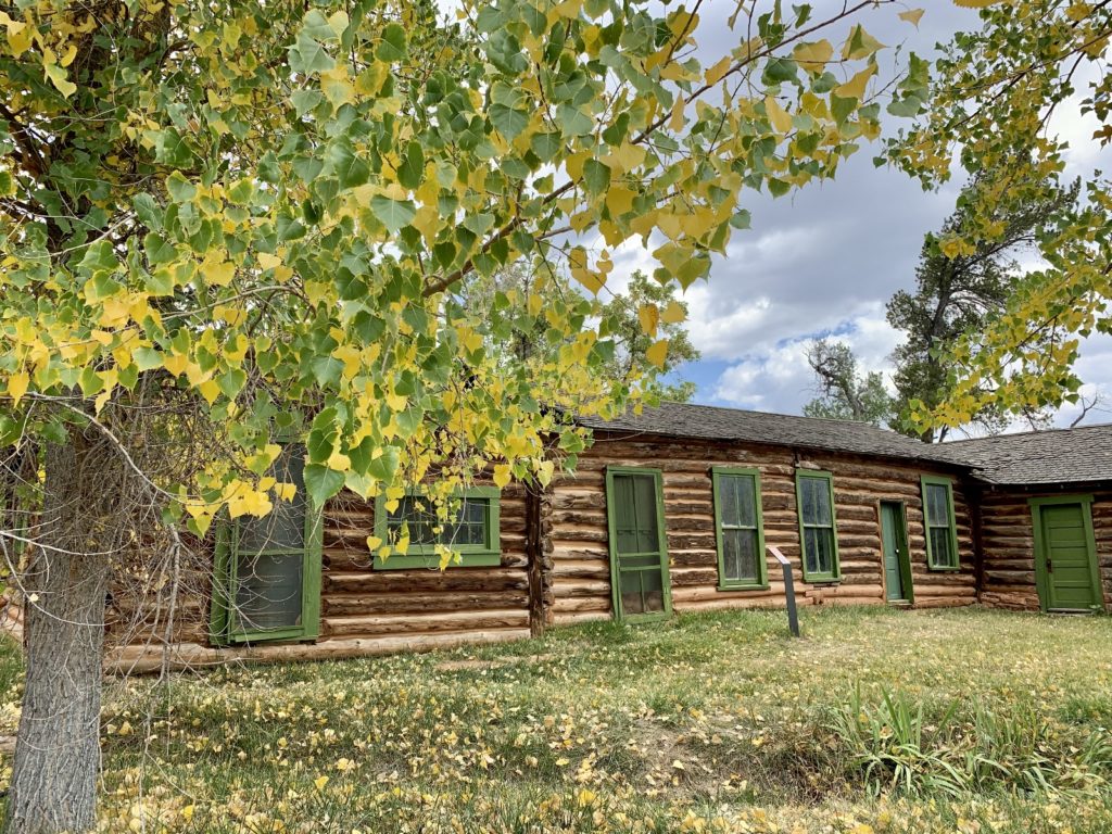
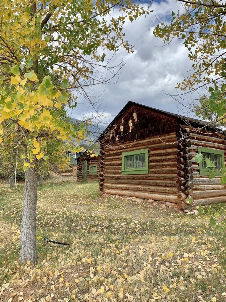
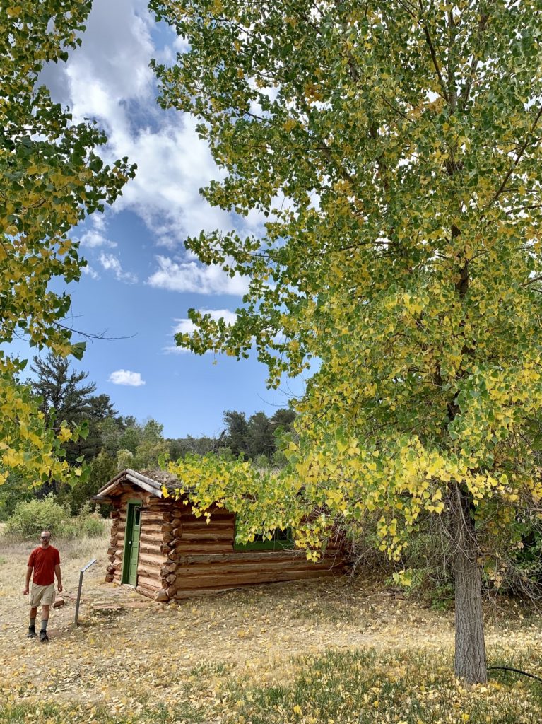
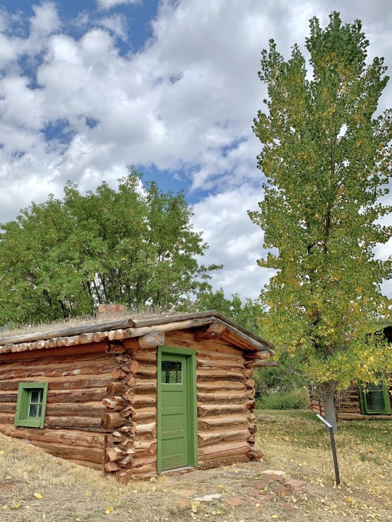
Hillsboro
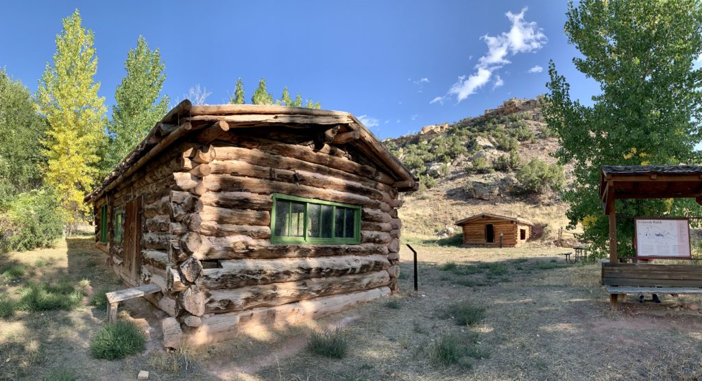
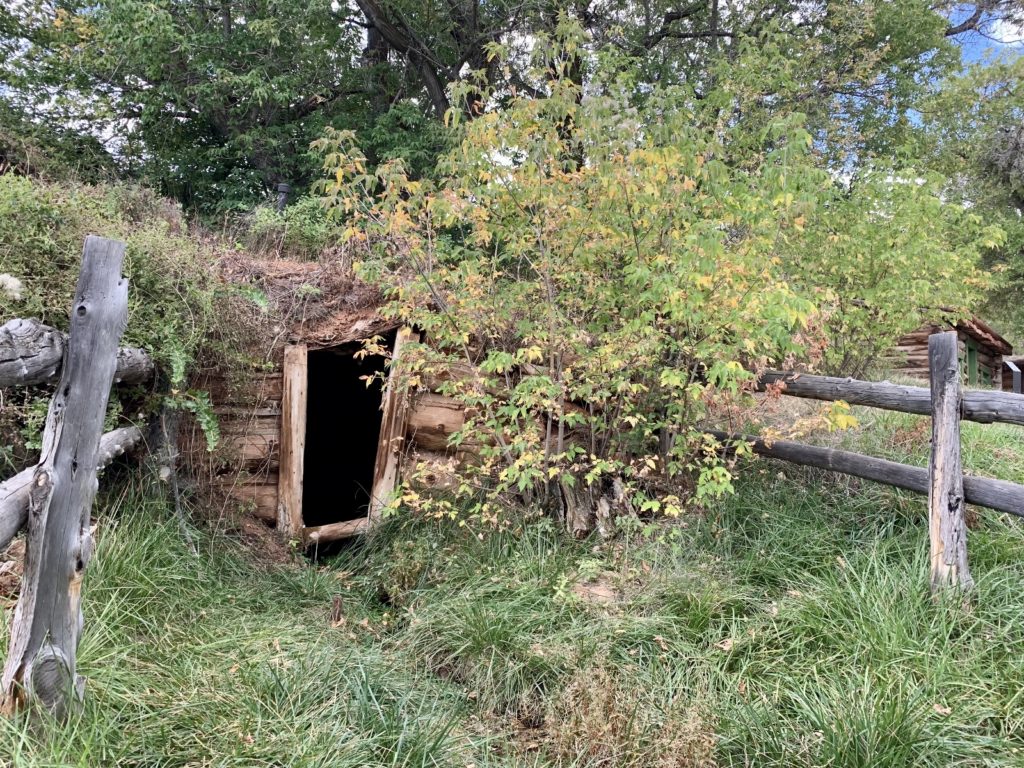
Dr. Grosvenor Barry came to the Dryhead area around 1902 in search of gold. His wife and son joined him after the original cabin on South Fork of Trail Creek was completed in 1903. After the mining companies failed, the Barrys decided to stay on at the Trail Creek Ranch and changed its name to Cedarvale when they started accepting paying guests who came for hiking, fishing, hunting, and horseback riding. The remains of the dude ranch and the small community of Hillsboro still bear witness to the ingenuity of the people who called this place home.
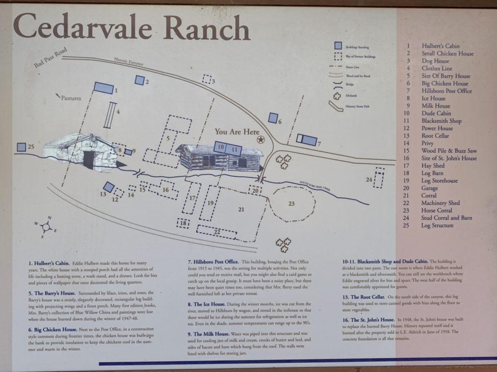
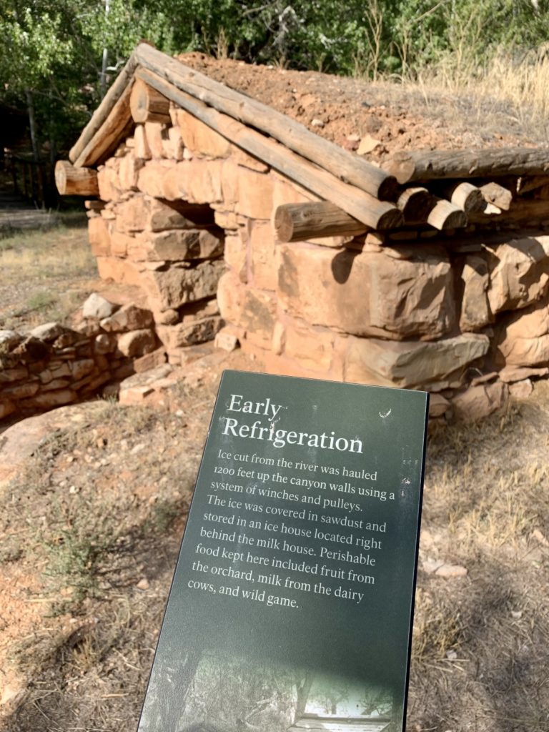
Doc Berry and his family created a luxurious home at Hillsboro. Brochures for the ranch touted the modern conveniences available including electricity. Doc built his own power plant using a nearby spring and stored the power generated in glass batteries. The main house looked rustic on the outside, but inside the logs were plastered and papered in pretty patterns. The ranch house burned down in 1948.
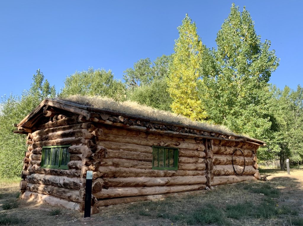
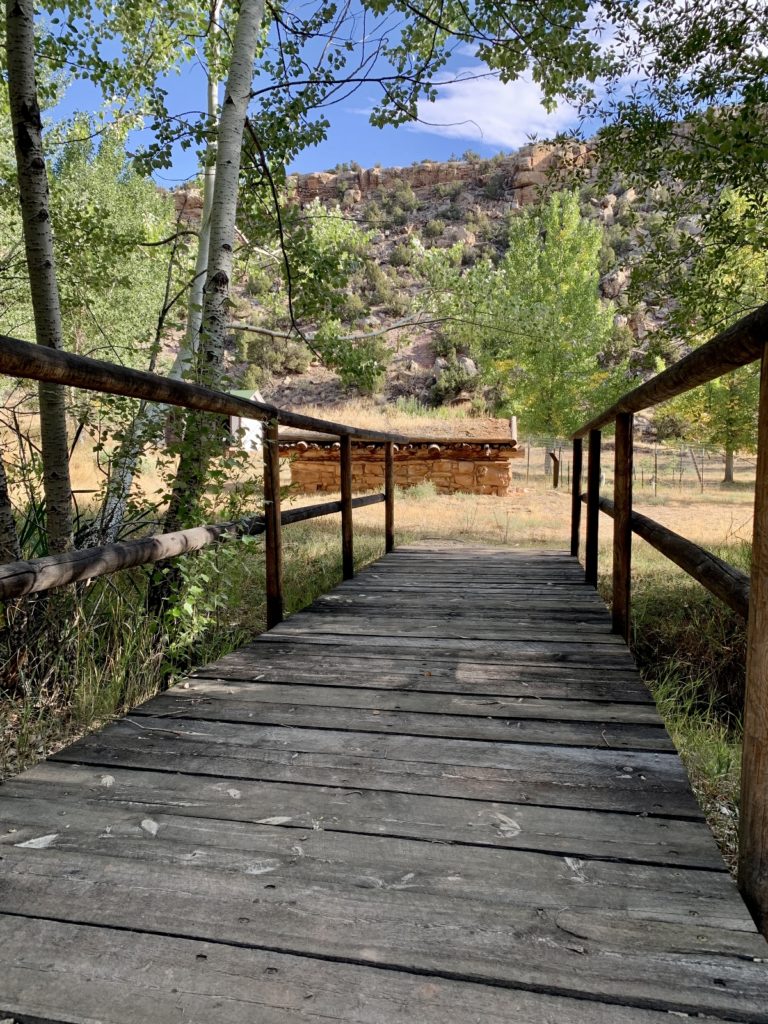
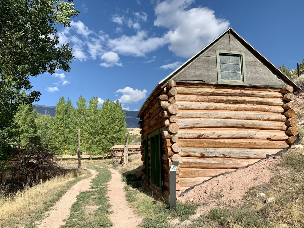
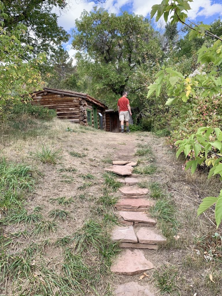
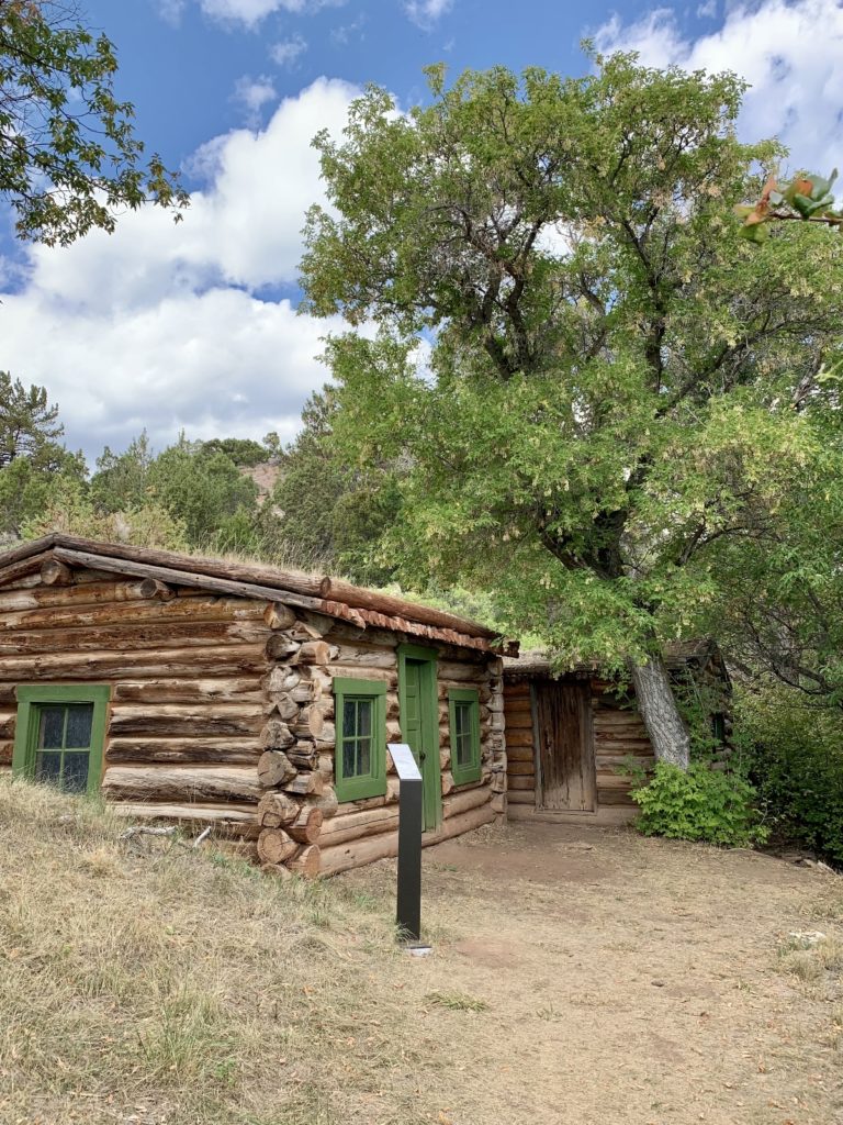
Today, Hillsboro is a nicely preserved site with multiple log structures and interpretive signs. The scenic location along Trail Creek alone is worth the 1.4 mile roundtrip hike. To reach the trailhead, follow a short dirt road just past the Trail Creek Campground before Barry’s Landing. During our visit, the road was accessible to any car with average clearance.
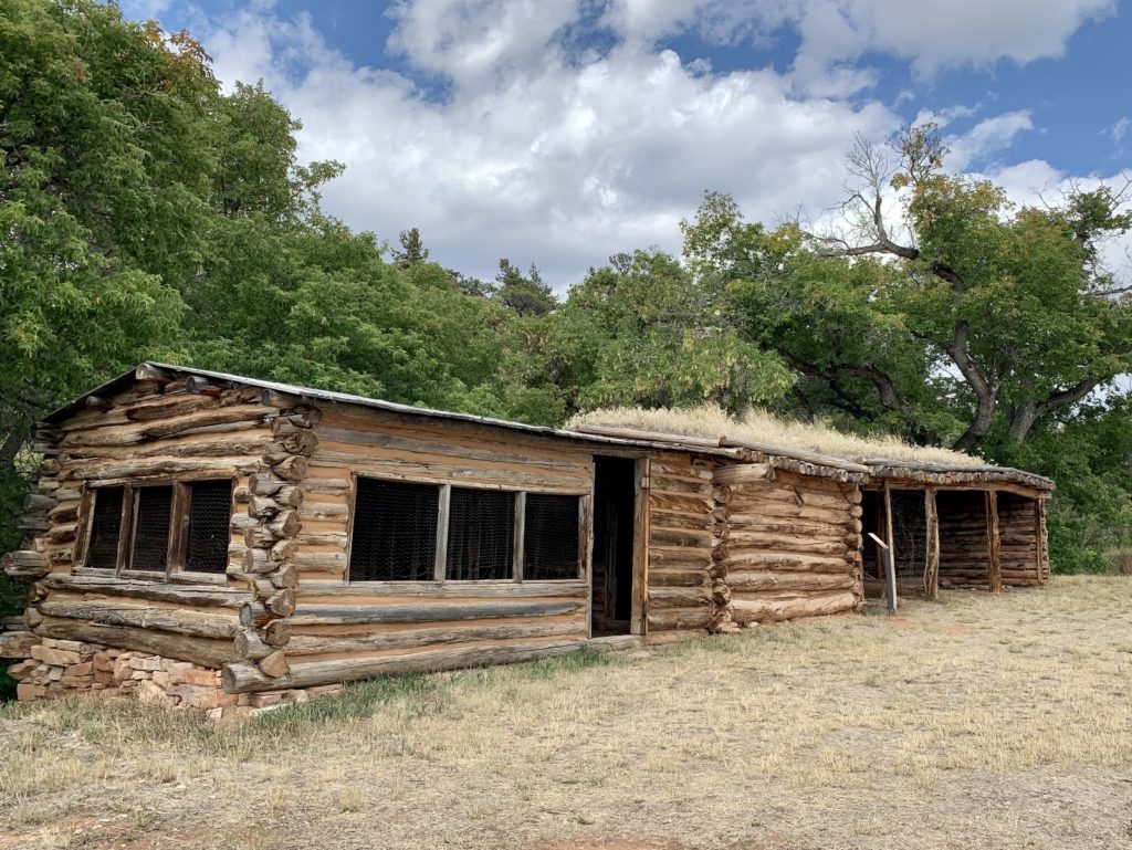
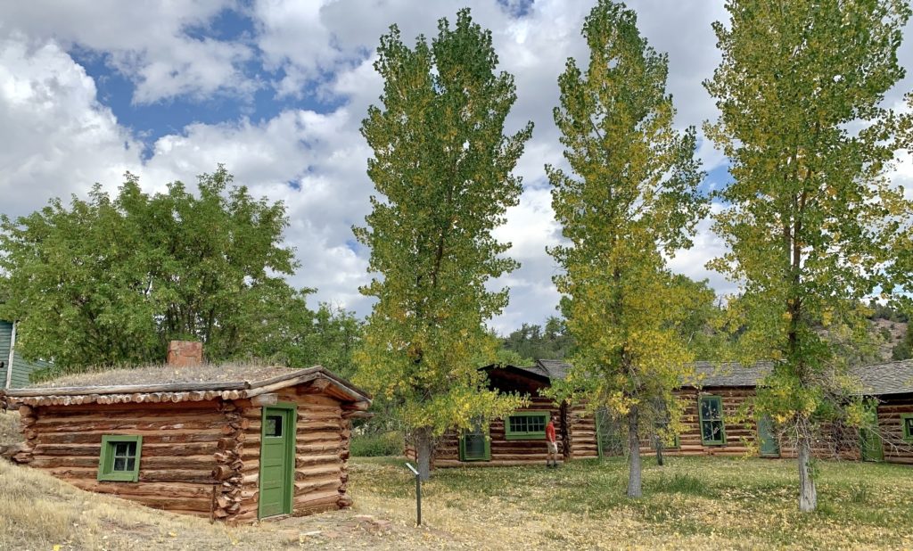
Lockhart Ranch
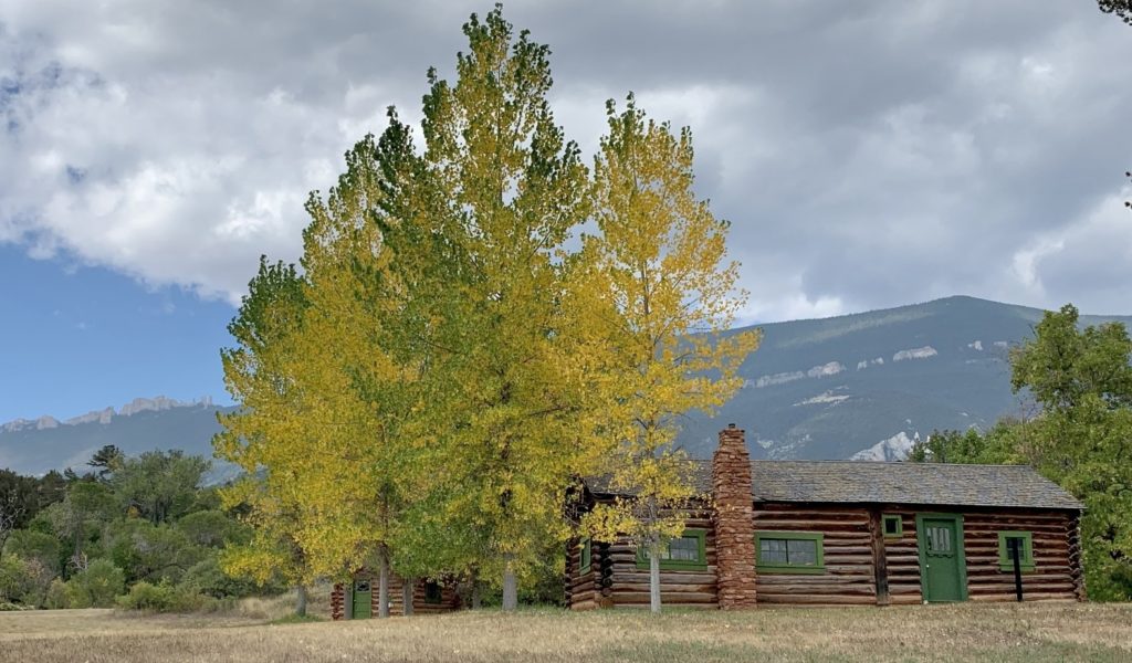
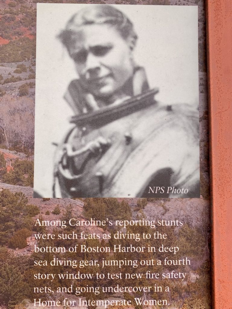
Caroline Lockhart, reporter, writer, editor, and rancher was born in Illinois in 1870. She grew up on a family cattle ranch in Kansas and received her higher education in the East. In 1889, at the age of 18, Caroline became a reporter for the Boston Post. Women reporters were not common, and to be successful, one had to be resourceful. At the time, a popular technique employed by women for getting a story was “stunt journalism”. Caroline practiced this technique with such feats as diving to the bottom of Boston Harbor in deep sea diving gear, jumping out of a fourth story window to test new fire safety nets, getting into a lion cage, and going undercover in a home for intemperate women, all to personally experience the subject before writing about it. While working for the Philadelphia Bulletin, she interviewed many famous people and did extensive traveling for her stories. On assignment out west she interviewed Buffalo Bill Cody, an encounter which eventually brought her to Cody, Wyoming in 1904.
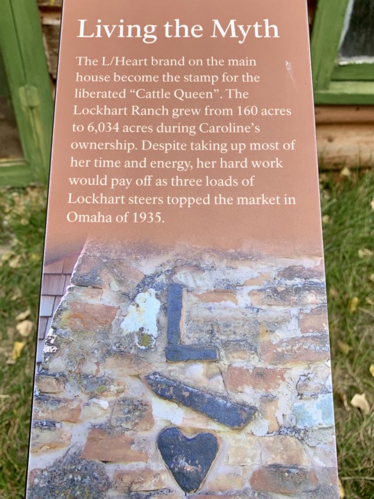
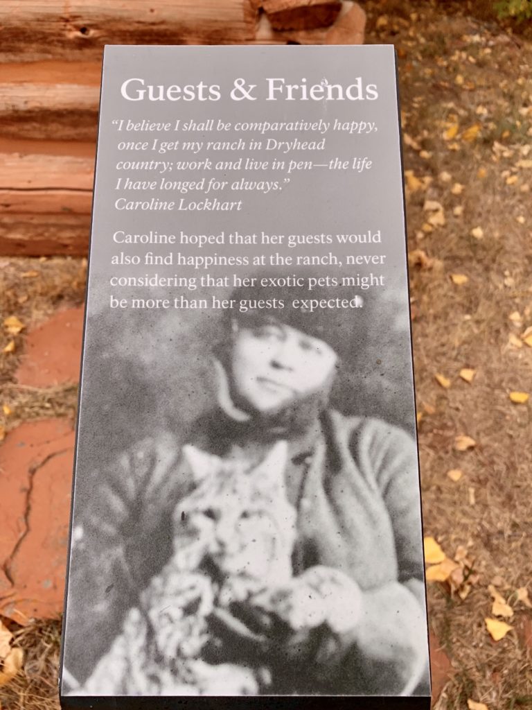
In 1927, Caroline relocated to her ranch in the Dryhead. “My job is writing books and the last thing I had in mind when I came into the Dryhead was filing on land and engaging in the cattle business, and certainly not locating in a country where a fresh track in the main travelled road is an event.” The Lockhart Ranch grew from 160 acres to 6,034 acres during Caroline’s ownership. Despite taking up most of her time and energy, her hard work paid off as three loads of Lockhart steers topped the market in Omaha in 1935. In 1955, with failing eyesight, Caroline sold the ranch and moved back to Cody where she died on July 25, 1962 at the age of 91.
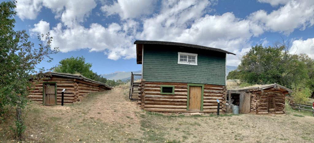
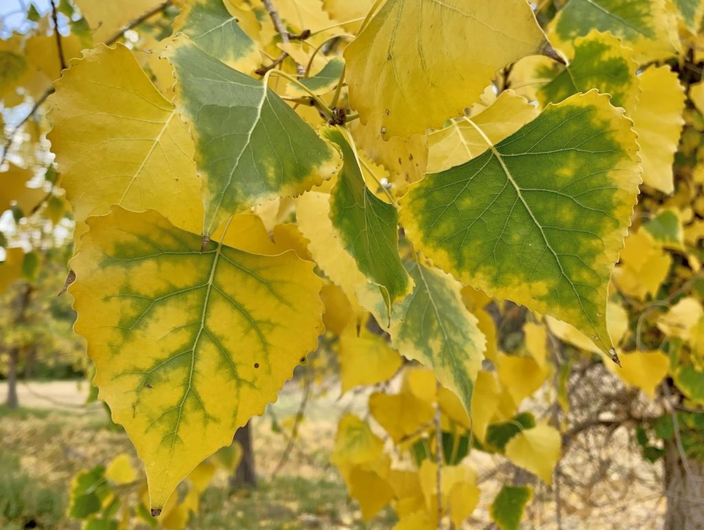
The Lockhart Ranch was by far our favorite of the three historical sites we visited. There are many well-preserved buildings to explore and the Park Service has done a nice job with the interpretive signs. As an added bonus, we enjoyed great views of the surrounding countryside and caught some nice fall colors. I think I would have liked Caroline—sounds to me like she had a lot of moxie. We logged 1.1 miles walking down the old single-track access road and exploring all the buildings. To reach the ranch, drive the main park road to a well-marked junction just before the road turns and begins its descent to Barry’s Landing. Continue straight at the junction on a wash boarded gravel road to a small parking area with privy. The road is accessible to all vehicles provided you don’t mind the dust and wash board.

Tips for Hiking in Bighorn Canyon
- Wear sturdy shoes—the trails are rocky and lined with cactus.
- Keep an eye out for rattlesnakes and poison ivy.
- Start your hike early, apply sunscreen, and bring lots of water—you won’t find much shade on these trails.
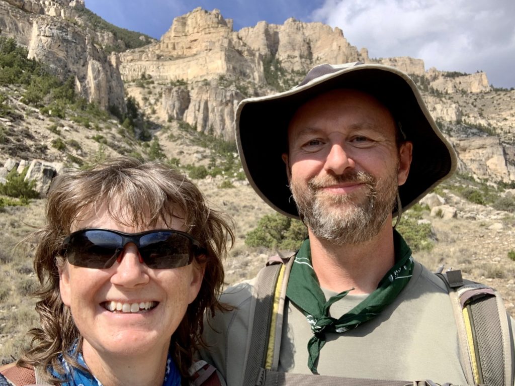
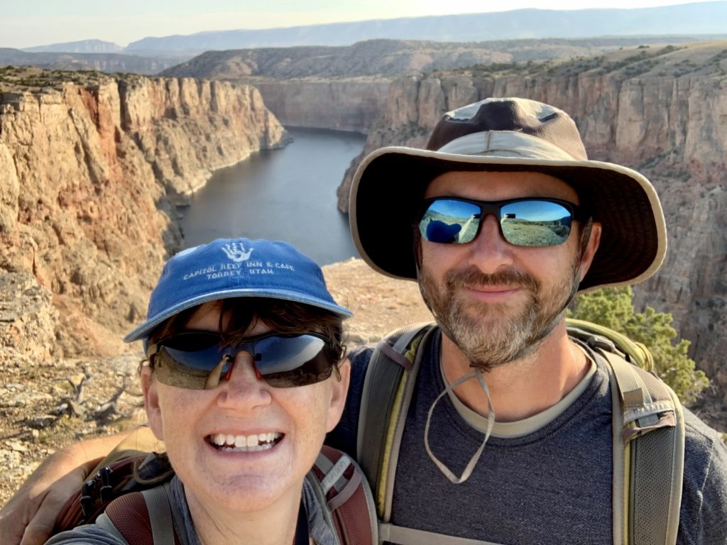
- Don’t get too close to the rim while taking that selfie! Thanks to the park administration for keeping the viewpoints wild and not cluttering them with fences to protect people from themselves.
Bighorn Canyon National Recreation Area Wrap Up
Despite the hot temperatures and some wildfire smoke, we thoroughly enjoyed our visit to Bighorn Canyon National Recreation Area. This lesser-known park is an undiscovered gem of the National Park system. Camping, boating, hiking, wildlife viewing, and immersing oneself in the Old West are all first class here. I imagine the area is busier during the summer boating season, but early September was delightfully quiet. If you find yourself passing through NE Wyoming, do yourself a favor and take at least a day to hit the park’s highlights. If you are interested, see our last blog post for a suggested one day itinerary.
Related Posts
Bighorn Canyon National Recreation Area Part 1: Introduction
The Adventure Continues
Please be sure to join us for our next post as we move into the nearby Bighorn Mountains and Cloud Peak Wilderness for some fall colors and high mountain lakes. And don’t forget to check out our Amazon RV and Adventure Gear recommendations. We only post products that we use and that meet the Evans Outdoor Adventures seal of approval. By accessing Amazon through our links and making any purchase, you get Amazon’s every day low pricing and they share a little with us. This helps us maintain this website and is much appreciated!
Beautiful pictures as usual ! I enjoyed how you describe each picture taken too.
I loved reading about your visit there!