October 14-20, 2019
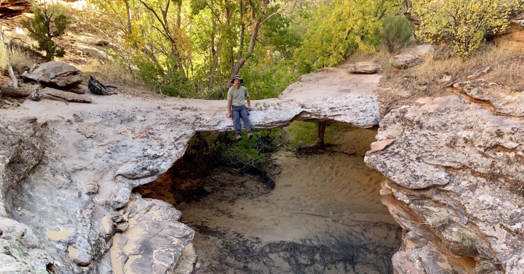
Day 26: Escalante Natural Bridge Hike
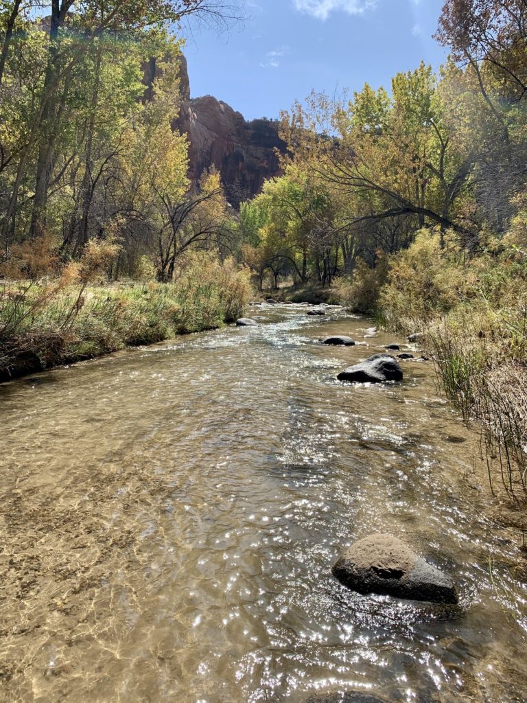
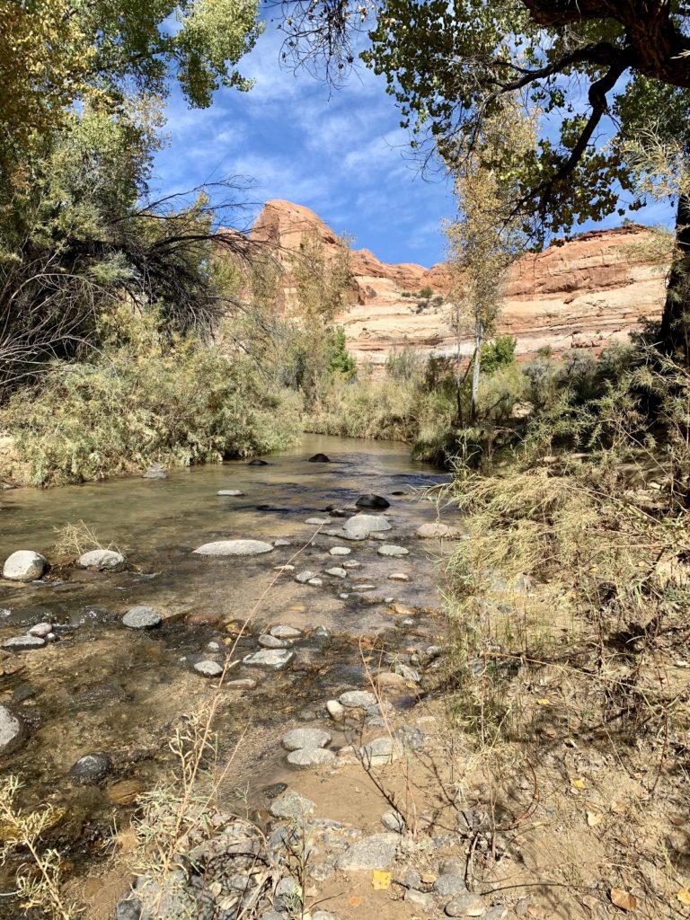
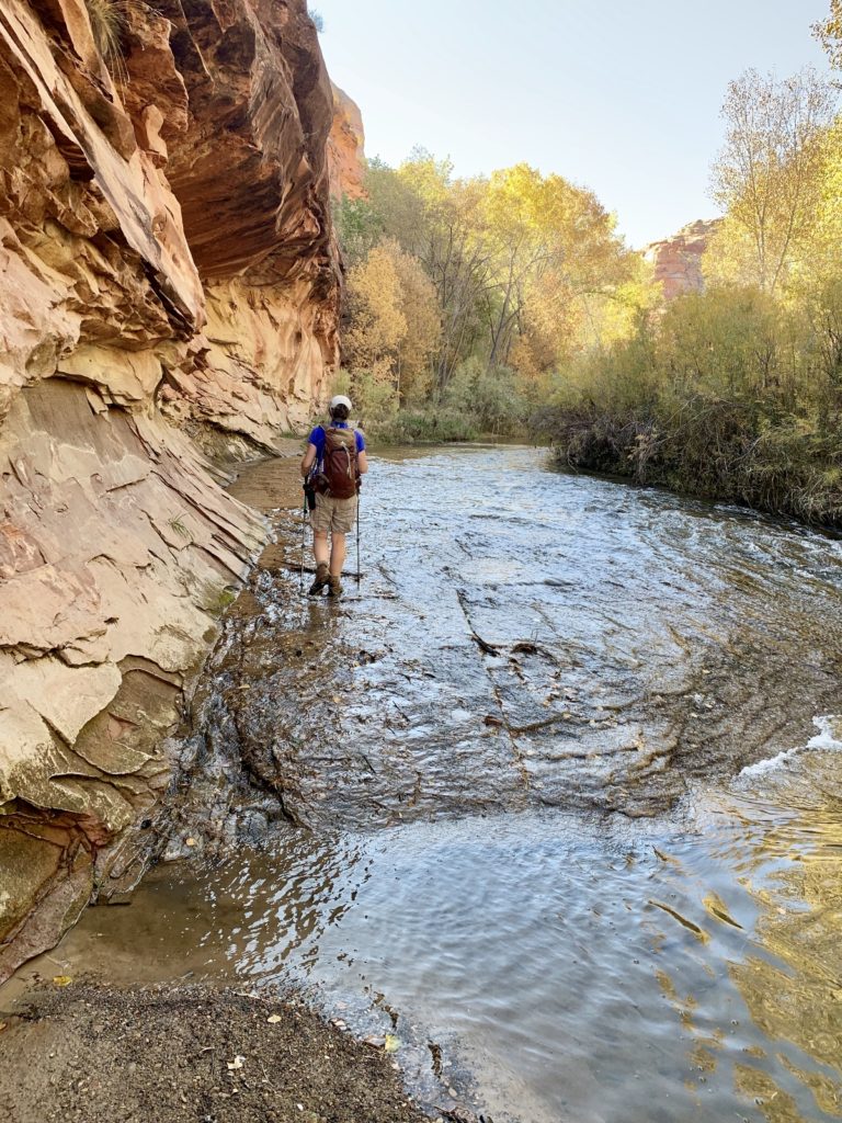
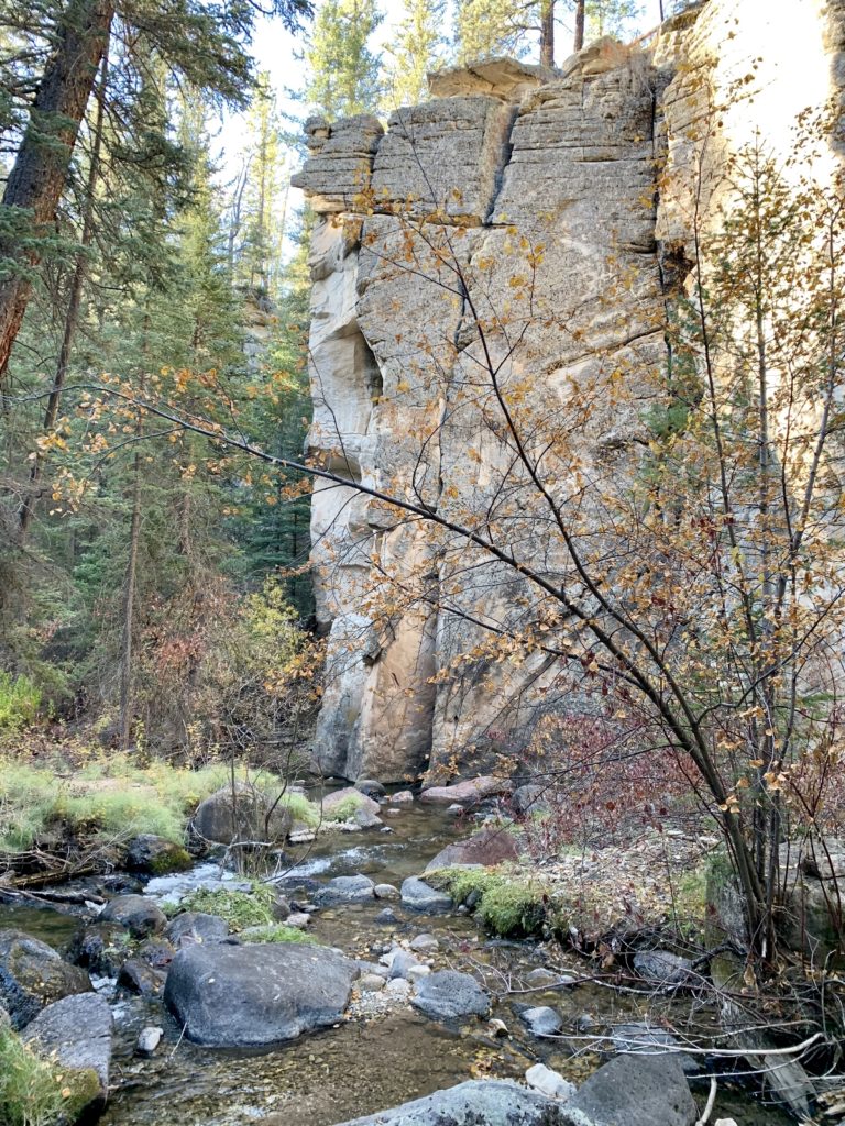
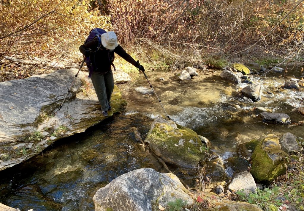
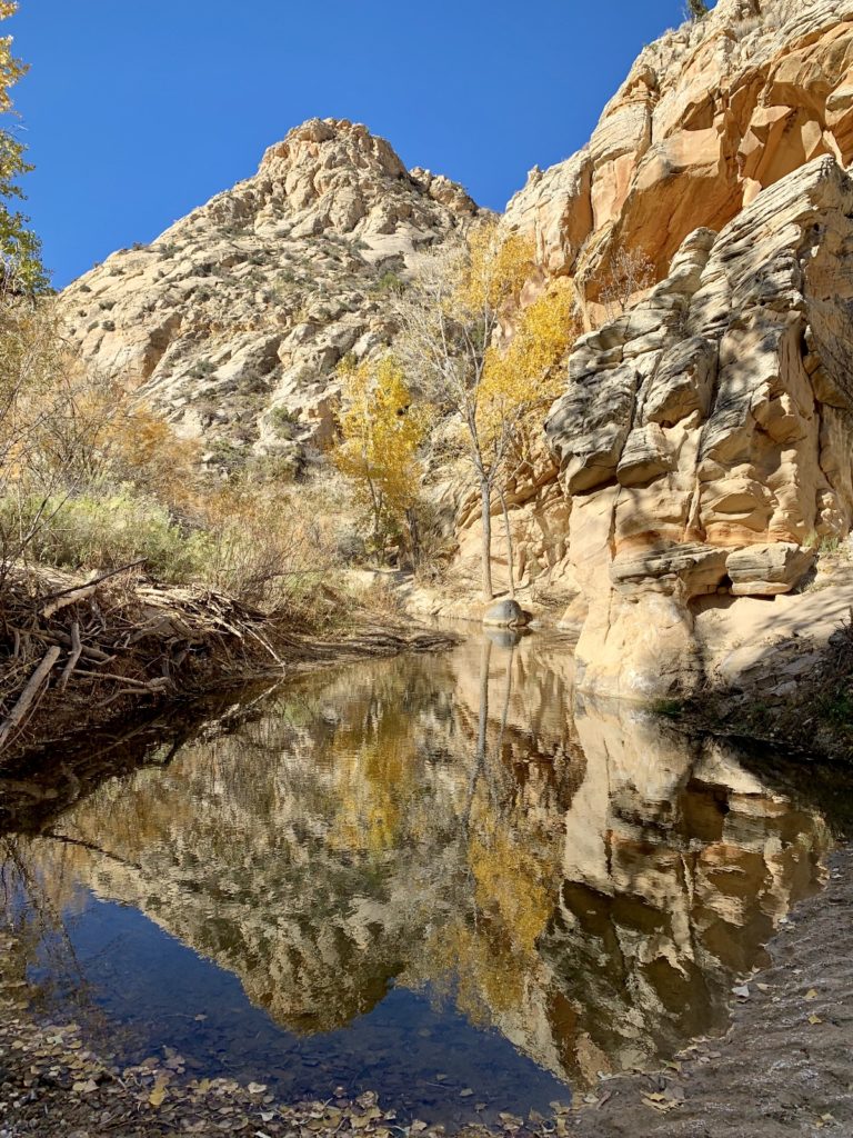
Today we did a repeat hike to Escalante Natural Bridge. This is a relatively easy 4.0 mile roundtrip hike to a beautiful natural bridge along the Escalante River. We’ve done the hike a few times over the years, including our memorable 2016 backpack, but I never tire of the scenery. The hike involves four easy crossings of the river which are refreshing on a warm day!
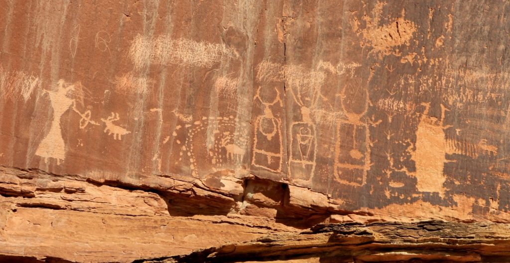
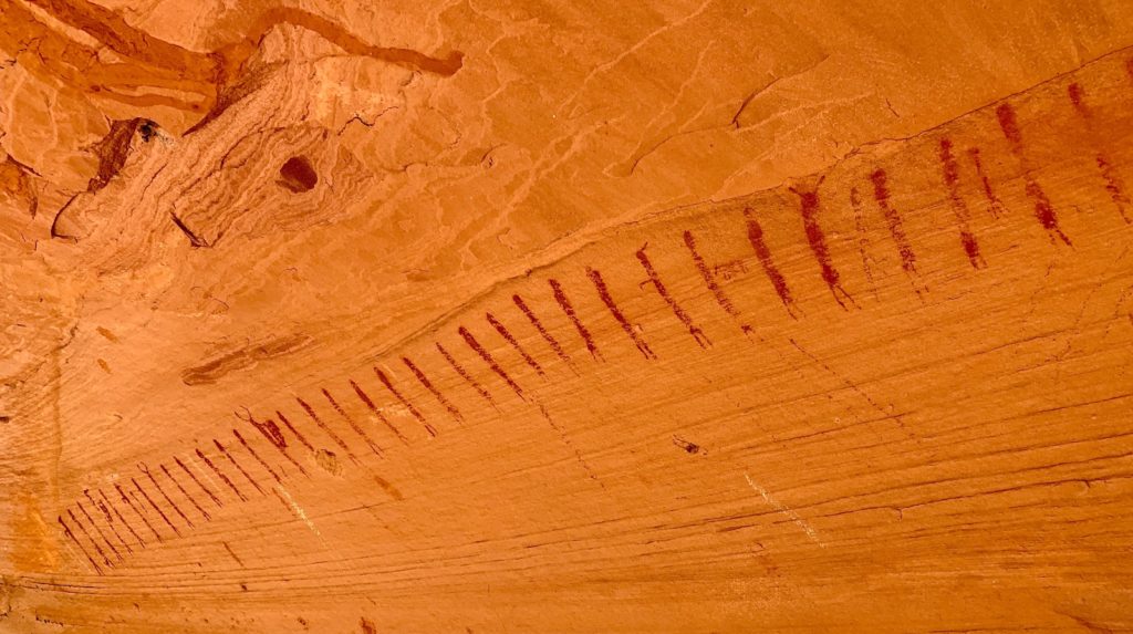
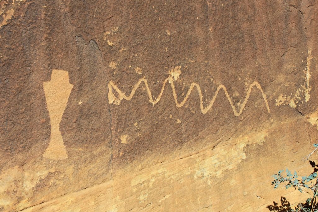
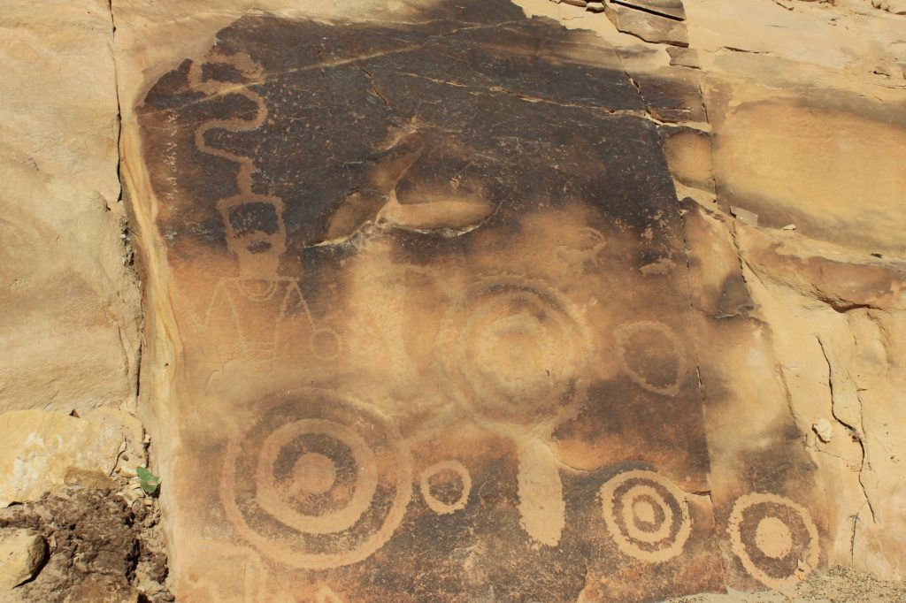
While in the area, we also visited a nearby petroglyph panel that I recently learned of. I love the turkey prints on the right side.
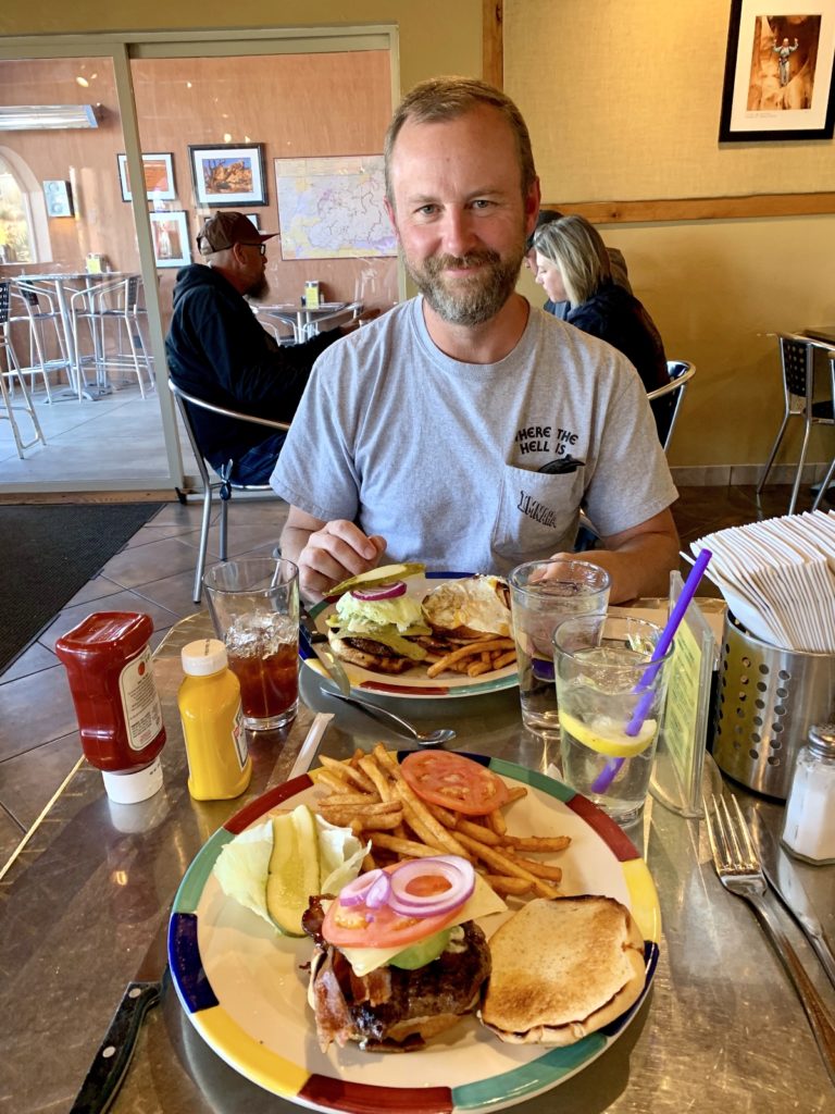
After our hike, we treated ourselves to burgers at Circle D Eatery, a favorite stop when we’re in Escalante. Jason had one with green chilies and I had one with avocado – yum!
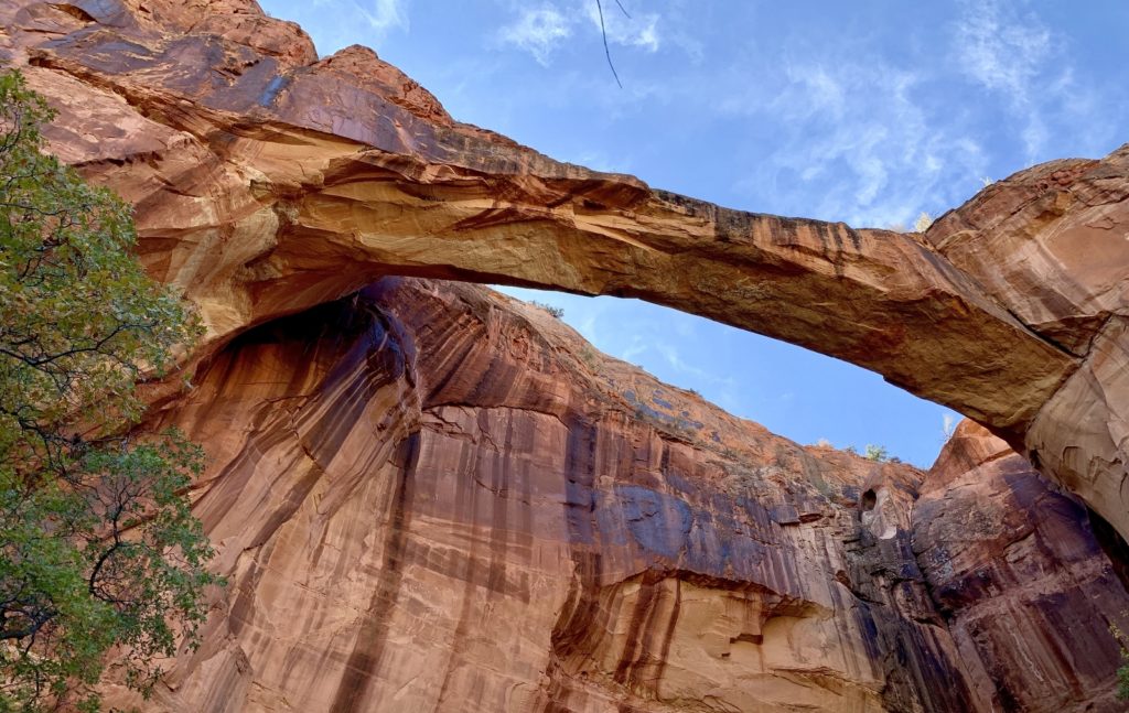
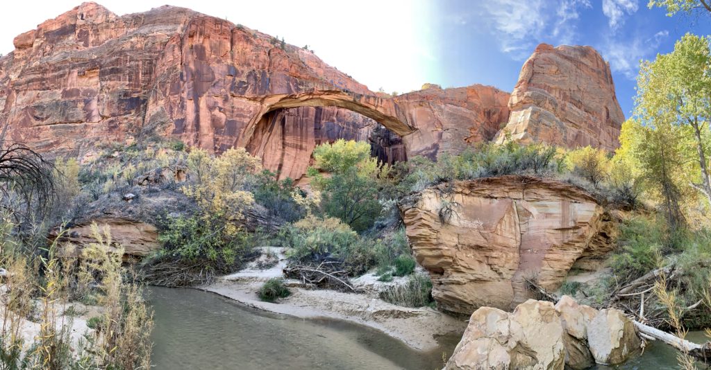
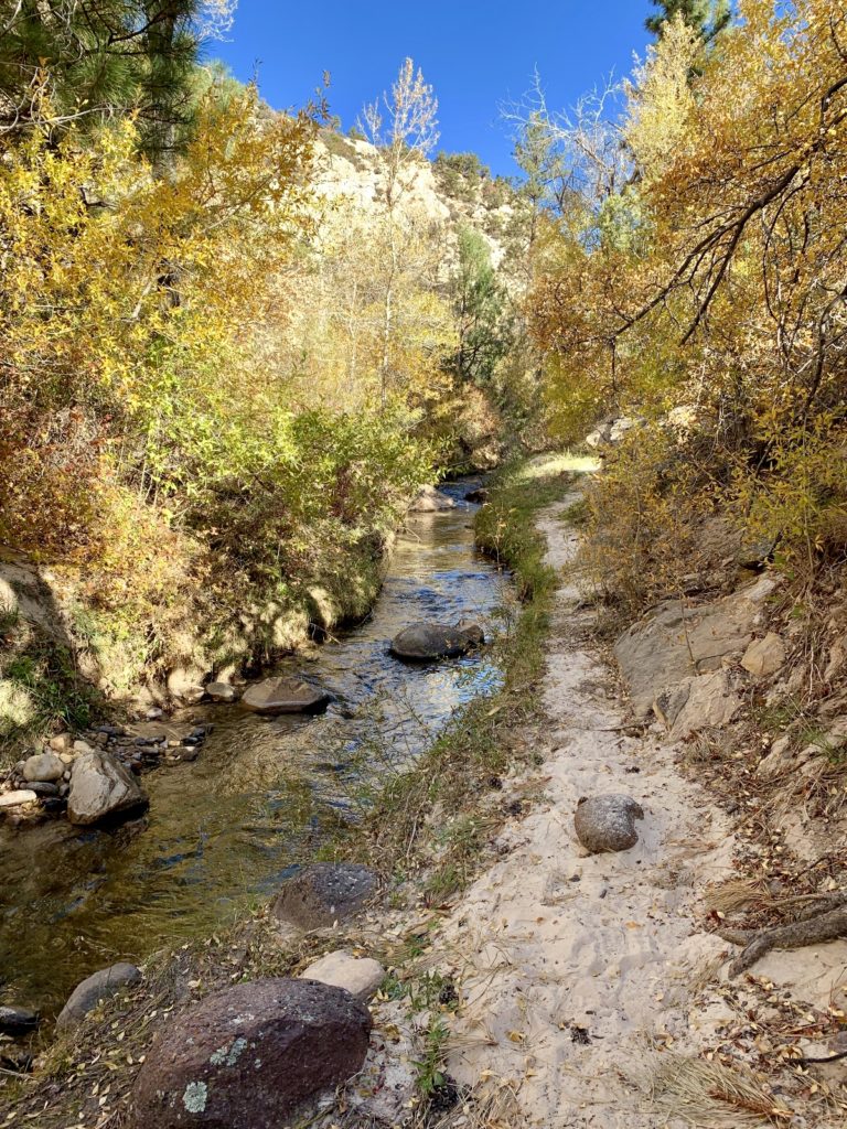
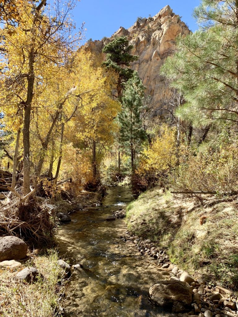
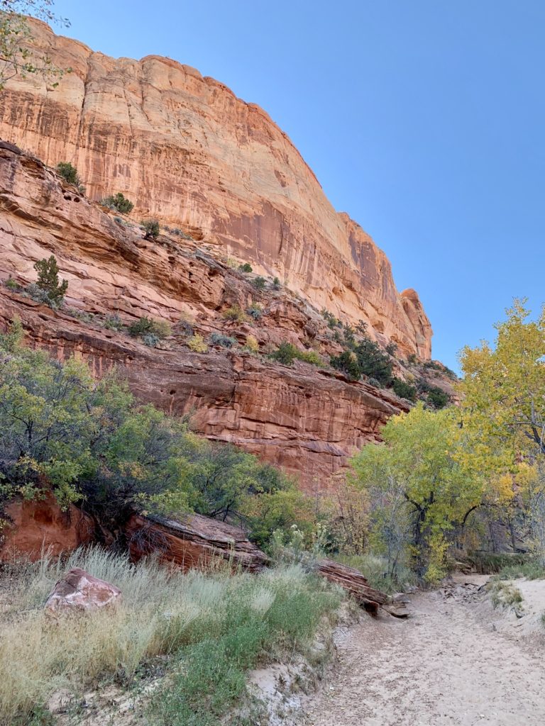
Day 27: Bowington Arch Hike
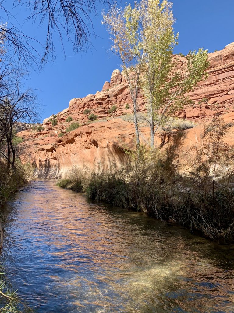
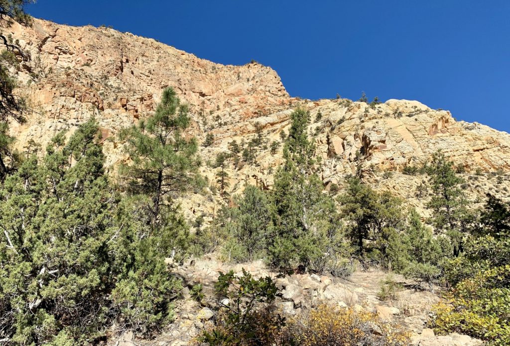
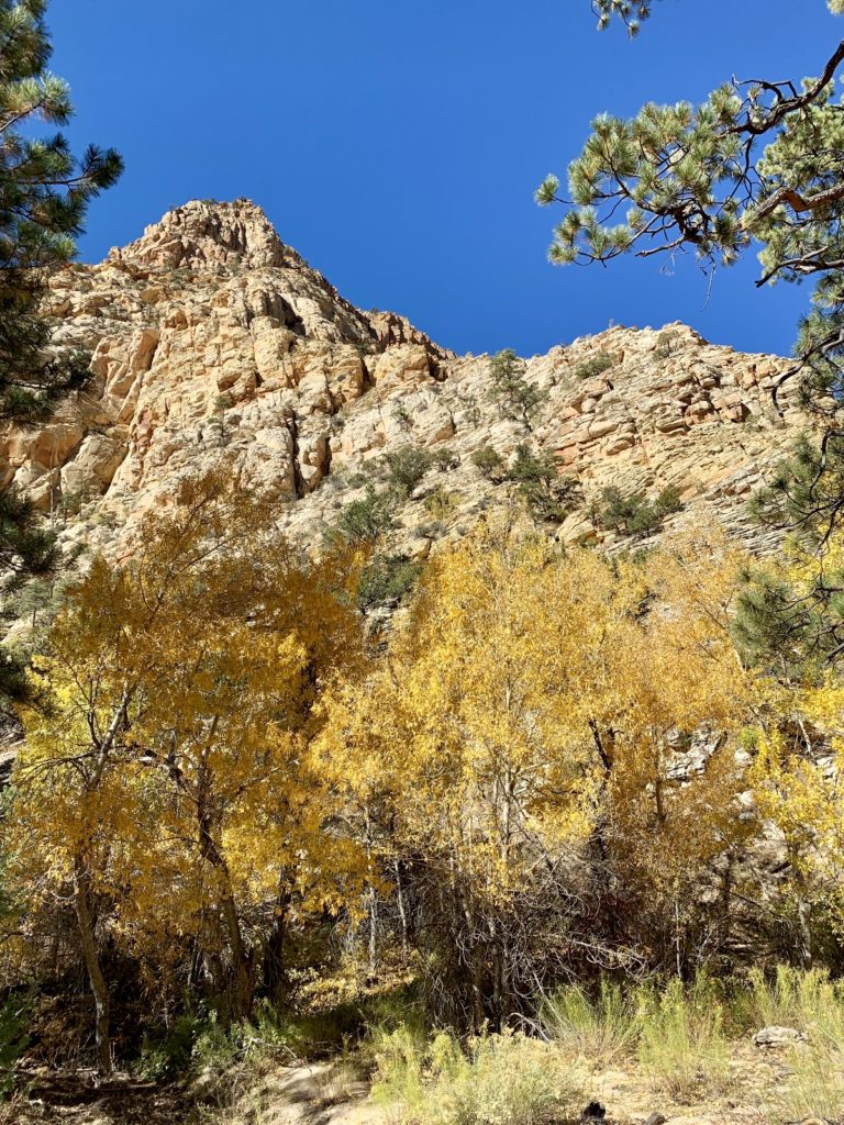
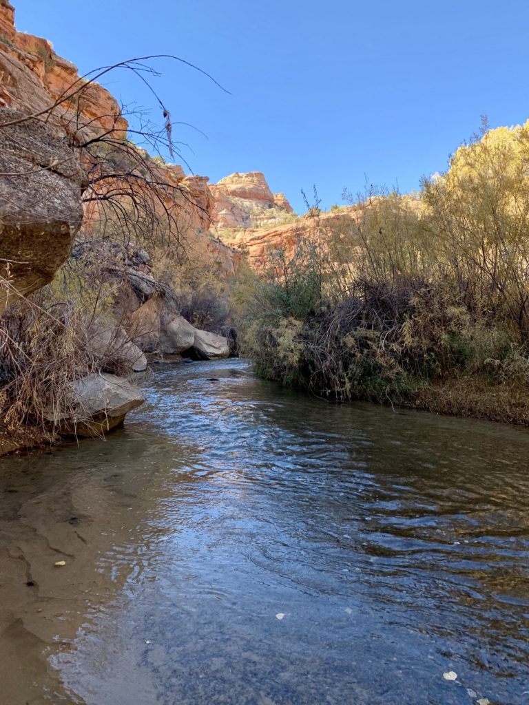
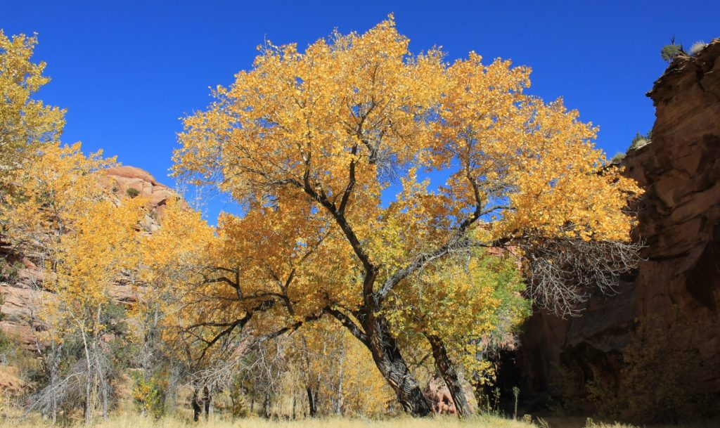
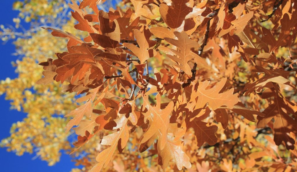
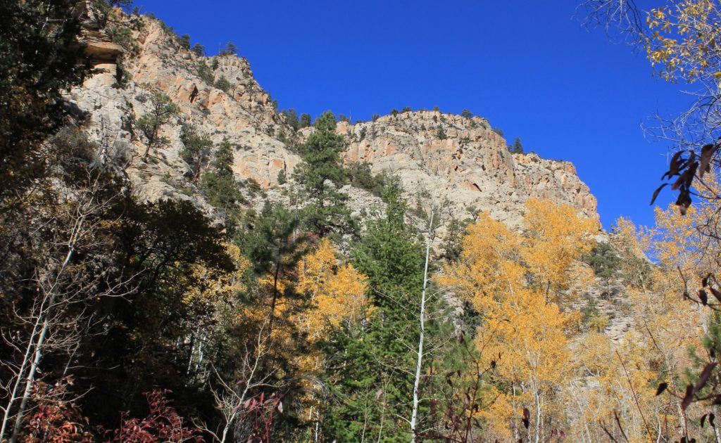
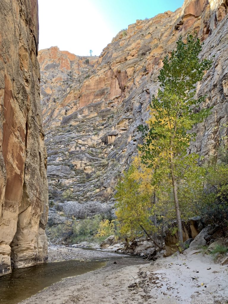
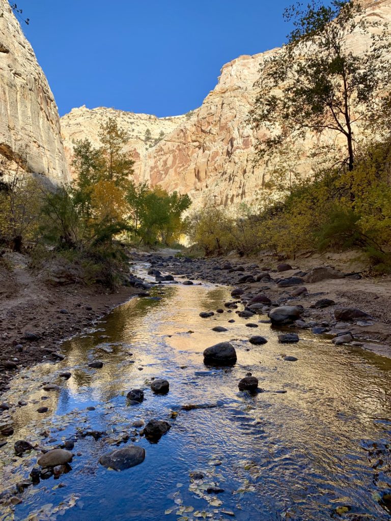
Seeing that the cottonwoods along the Escalante River were starting to sport some nice fall colors, we chose a hike that would take us along the river’s edge. We picked Bowington Arch, a 7.8 mile roundtrip hike that sees very little traffic.
Our hike began at the Escalante River Trailhead along UT-12. This is the same trailhead as for the Escalante Natural Bridge only we headed downriver this time. We had four easy river crossings and generally easy hiking aside from some areas of deep sand as we made our way down river.
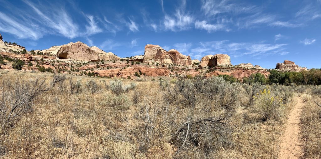
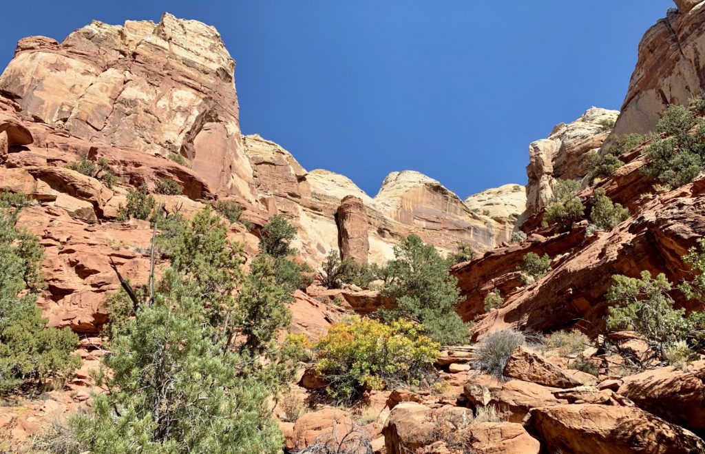
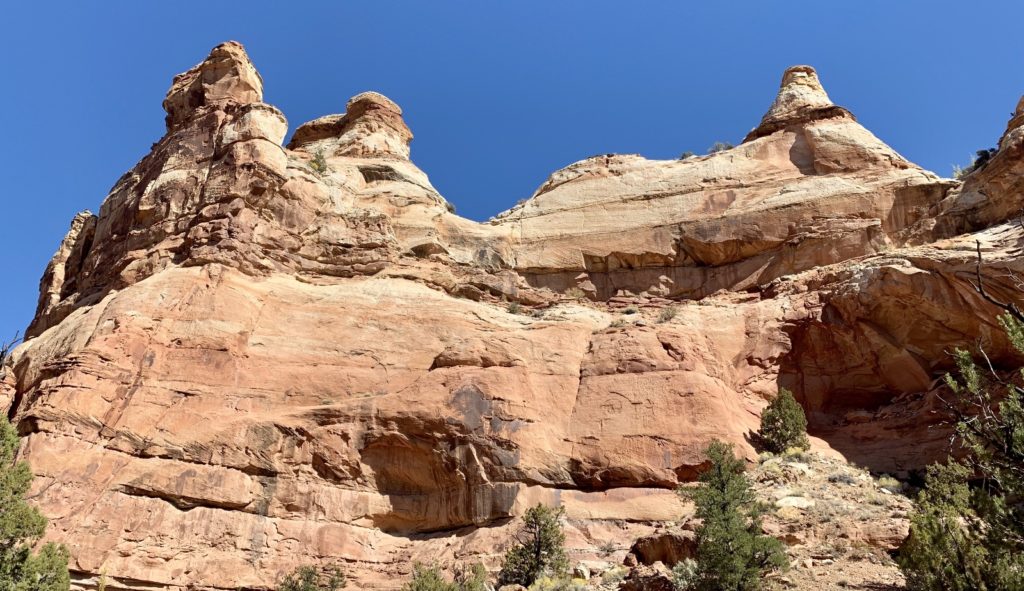
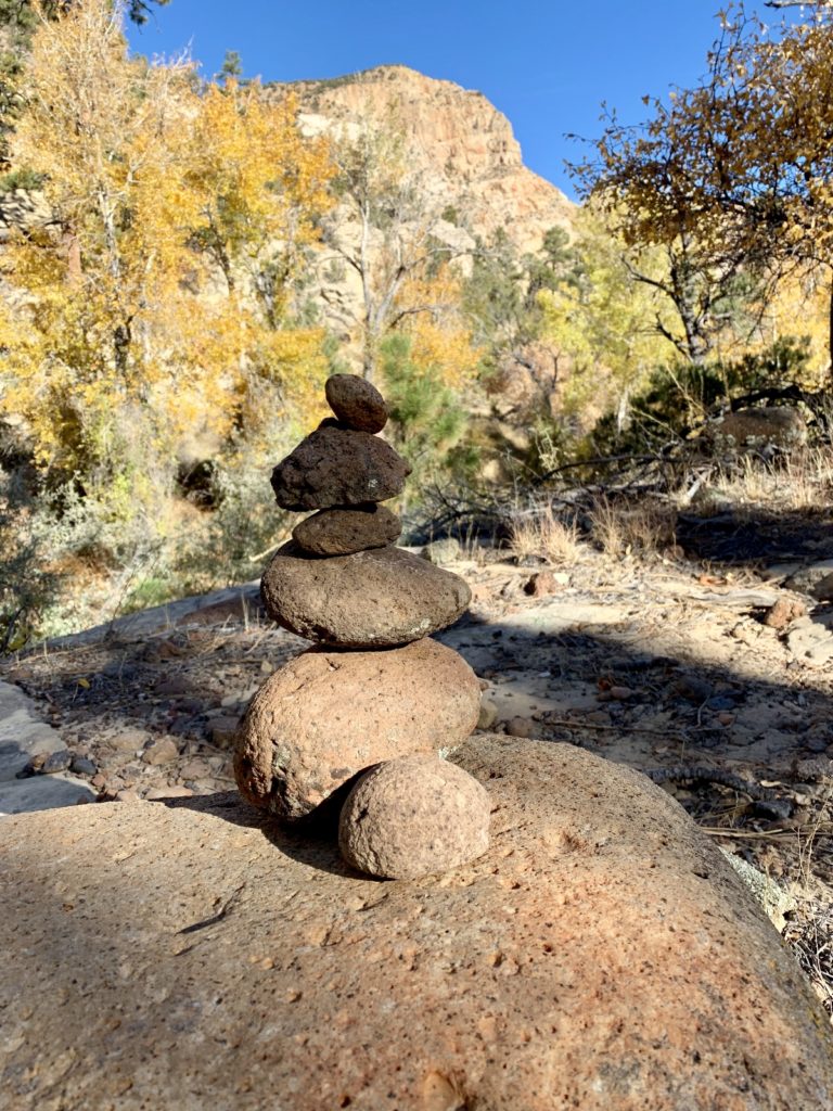
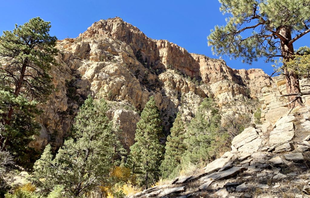
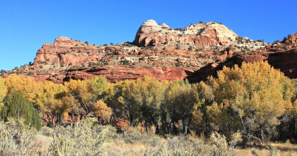
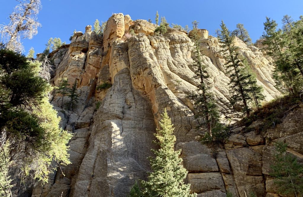
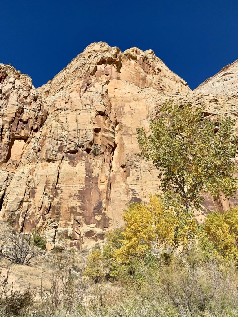
At around three miles, we left the official trail and turned east up a side canyon. Generally we stayed in the bottom of the canyon following the wash and trying to avoid the worst of the cactus and sticker weeds. As we made our way up the canyon, the towering rock formations and canyon walls became quite spectacular including some multi-colored towers that reminded me a little of The Needles District in Canyonlands National Park. We had a few pour overs to navigate around, but all were easy with a little scouting.
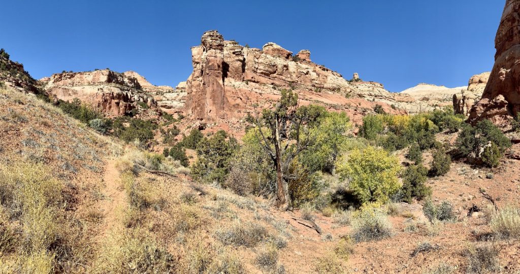
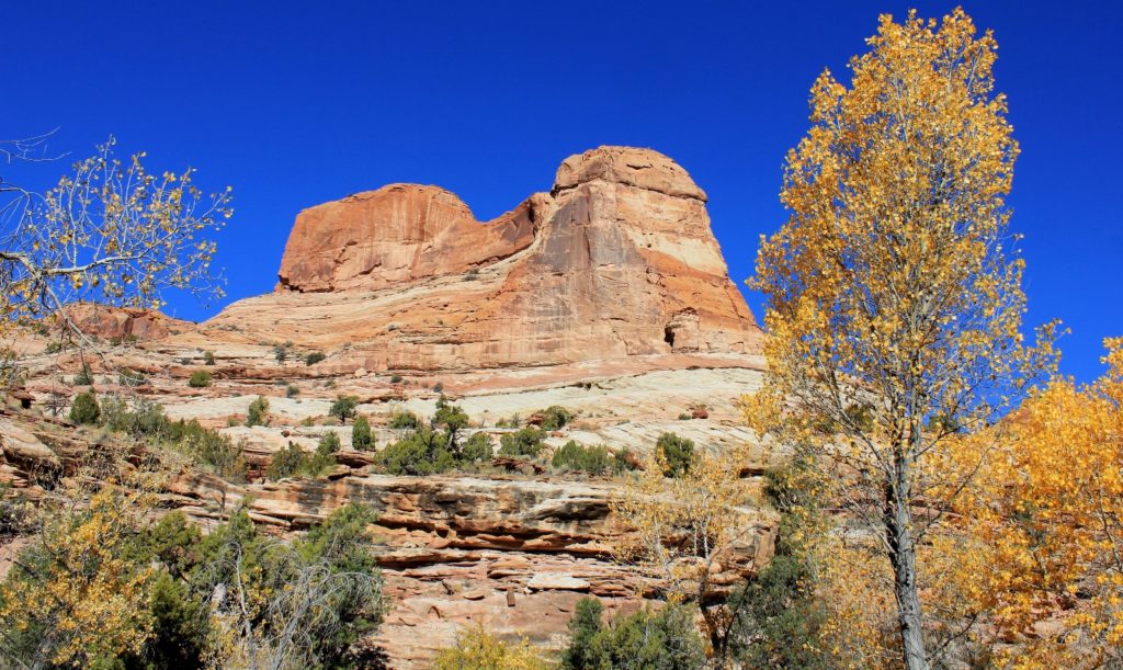
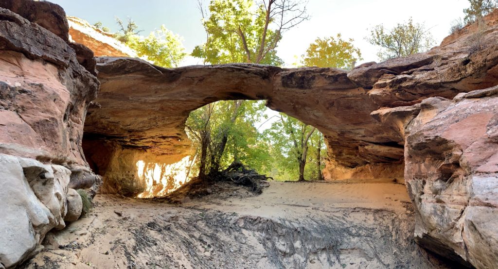
Bowington Arch was a beautiful destination at the end of the canyon. The hike would have been worth it for the surrounding scenery and solitude alone!

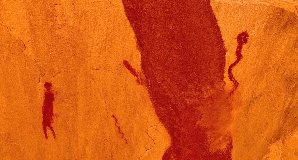
On our return hike, I looked over and saw something red on an alcove wall. It was a pictograph panel that had venomous snakes and a line of figures that reminded me of the Procession Panel near Bluff.
Day 28: The Box of Pine Creek
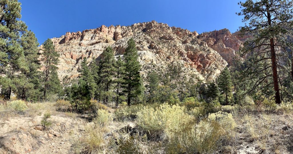
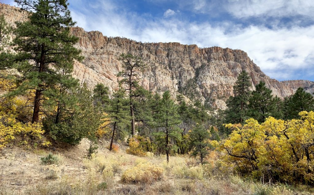
For years I’ve wondered about the Box Trail up Pine Creek located in Box-Death Hollow Wilderness. It sounded very beautiful, “this canyon provides a backcountry landscape like no other in the Escalante region. Here you find a blend of slickrock canyon and cliffs, mountain forest, and a clear, cold creek.” It is recommended as a 8 mile shuttle hike, but we didn’t have a shuttle. We stopped by the monument’s visitor center and I asked if we’d see good scenery if we could only go up a few miles. The nice woman didn’t hesitate and said, “oh absolutely!”
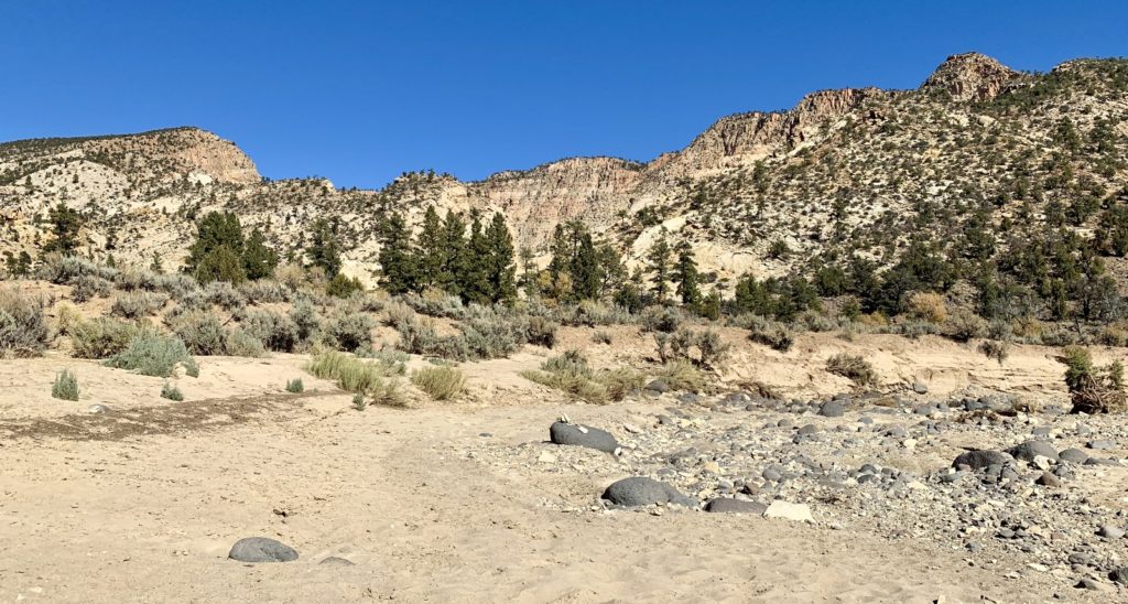
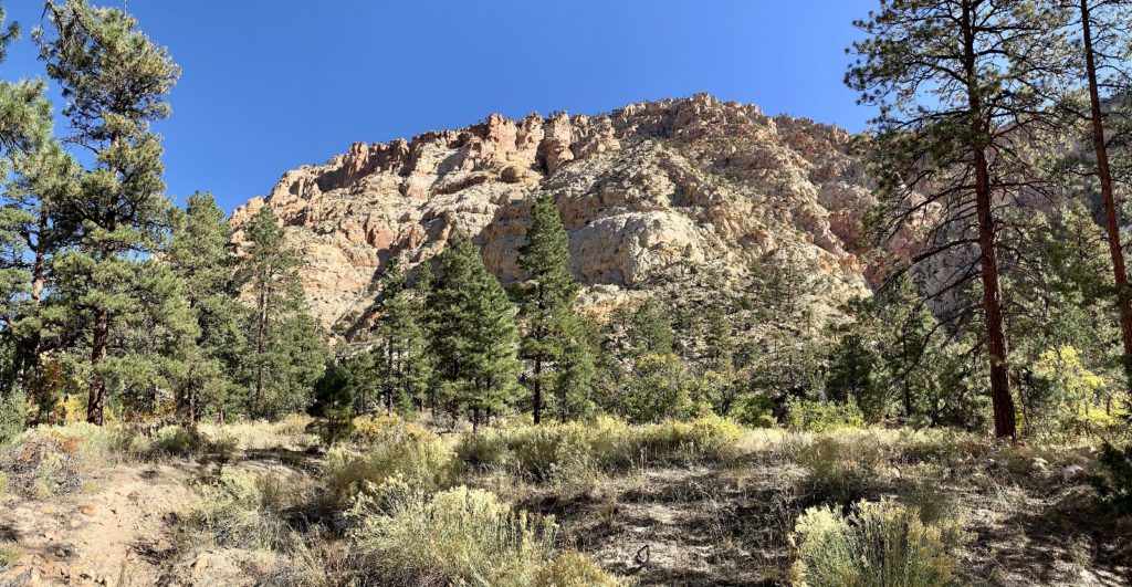
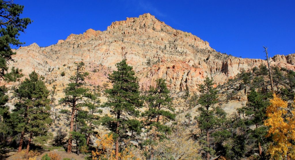
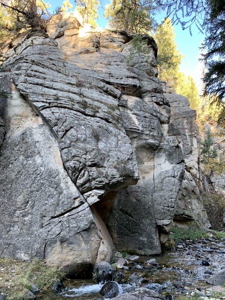
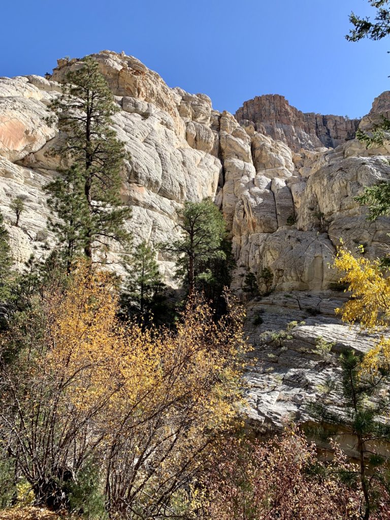
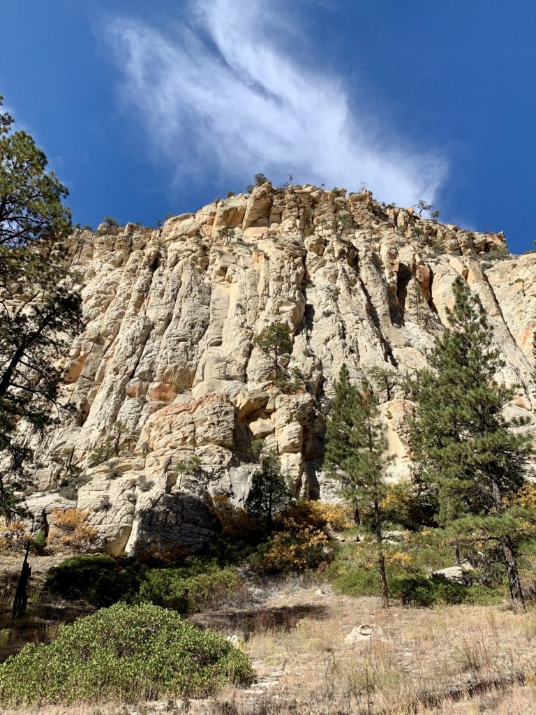
We drove to the Lower Box Trailhead and the scenery was spectacular from the moment we stepped out of the Jeep. The diversity we encountered is unmatched in all our travels. Massive Ponderosa pine trees towered overhead while creek-side shrubs were ablaze in reds, yellows, and oranges. Cactus lined the trail while small lizards frantically crossed in front of us and chipmunks scurried about. Massive Navajo sandstone canyon walls towered 800-1,200 feet above us.
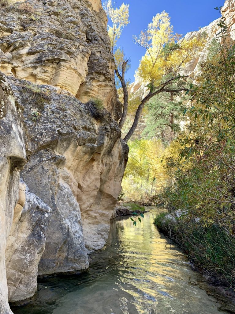
Pine Creek was lovely. One of the upper Escalante River’s main tributaries, it originates with springs high above on Boulder Mountain. The creek is rarely more than mid-calf deep, but you’ll make roughly 50 crossings if you hike the entire trail. We crossed 8 times on our short 2.25 mile trek up the creek. Surprisingly, we saw quite a few 10″ trout in the crystal clear water.
Our 4.5 mile roundtrip trek up Pine Creek left me wanting to hike the entire trail. When I mentioned to our friend Lisa how incredible the hike was, she indicated she would be interested in running a shuttle with us so that we could do the 8 mile through hike together. She would be joining us over the weekend providing the perfect opportunity to hike all of The Box.
Day 29: Work Day
Yep, I still have work days. Today was a monumental day as I hit a big milestone with the project I’m in charge of. It feels great to put the “DONE” stamp on phase one and move on to some fresh material.
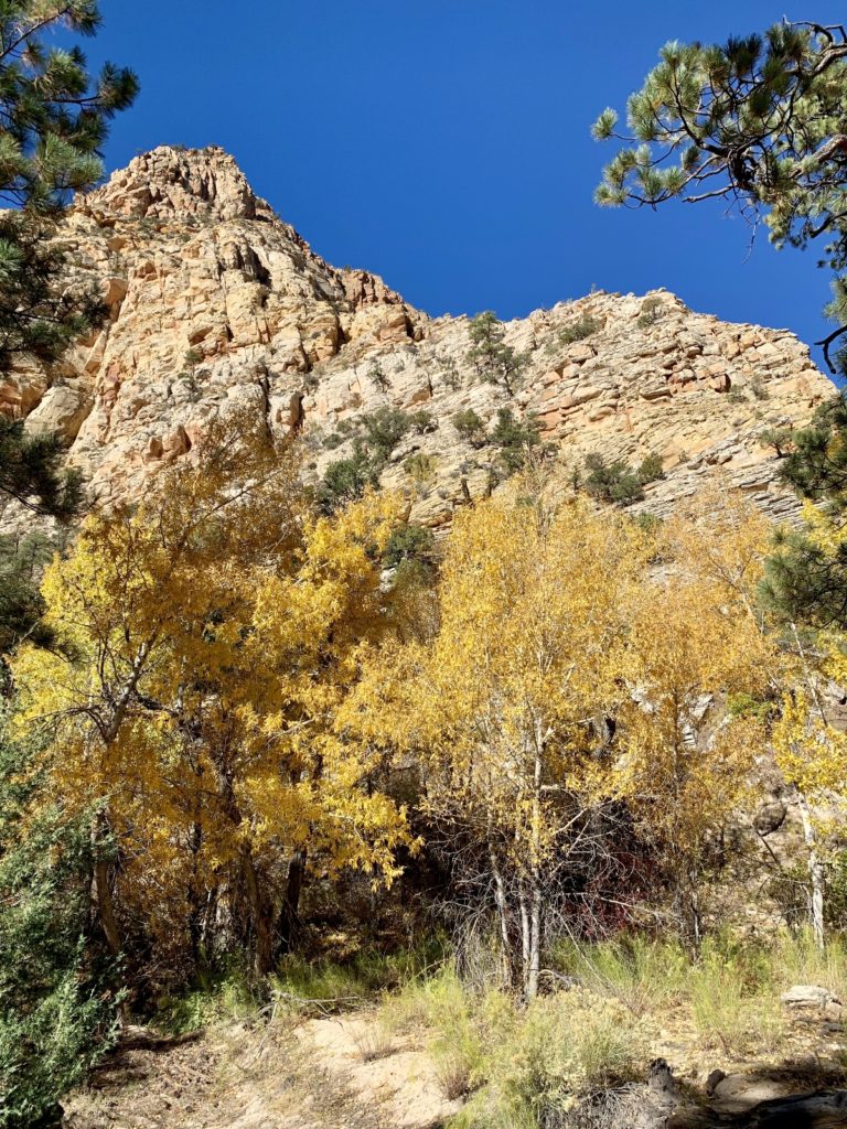
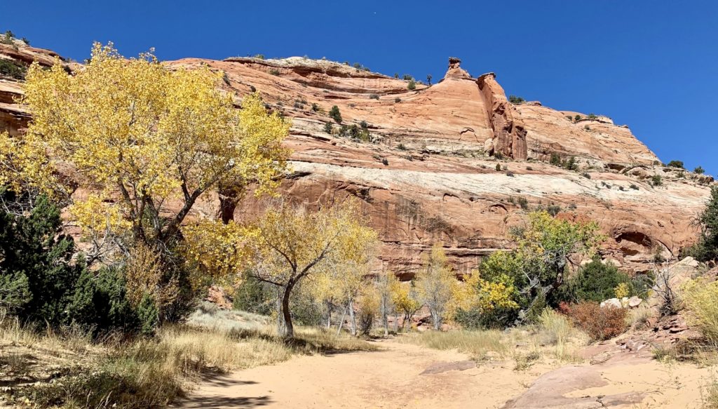
Day 30: Maverick Bridge & (Almost) Phipps Arch
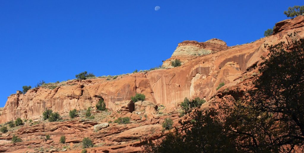
For today’s hike, we returned to the Escalante River Trailhead and hiked down stream to Phipps Wash which enters on the west side of the river. Fall colors along the river and in the side canyons were even more beautiful than two days ago. Turning up Phipps Wash, we were greeted with deep sand which slowed our hiking, but the towering canyon walls were beautiful in the early morning light.
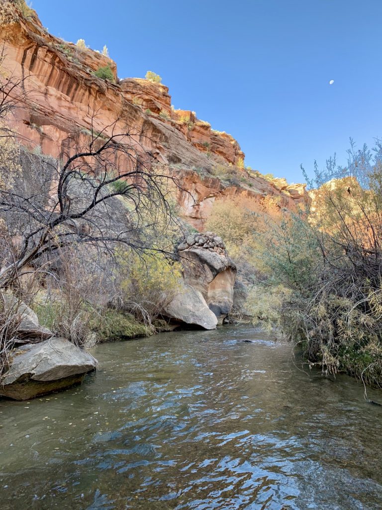
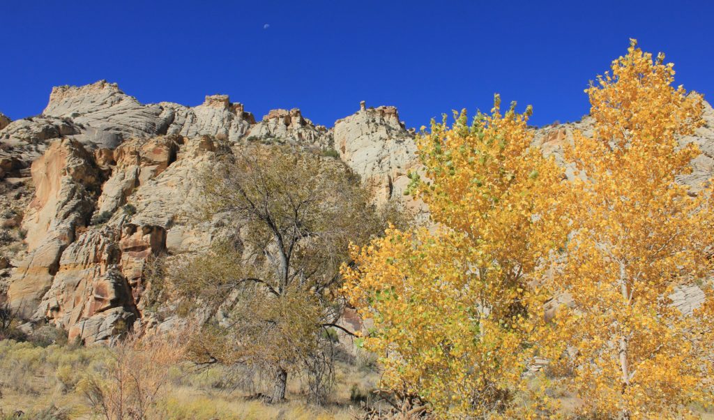
We took the first major side canyon to the right which lead us to Maverick Bridge. Navigation was easy and the canyon was stunning with massive sandstone towers rising above us. About the time I was saying, “we should be there anytime,” I looked down and I was standing on top of the bridge! The bridge was small, but a fun little side trip that I really enjoyed.
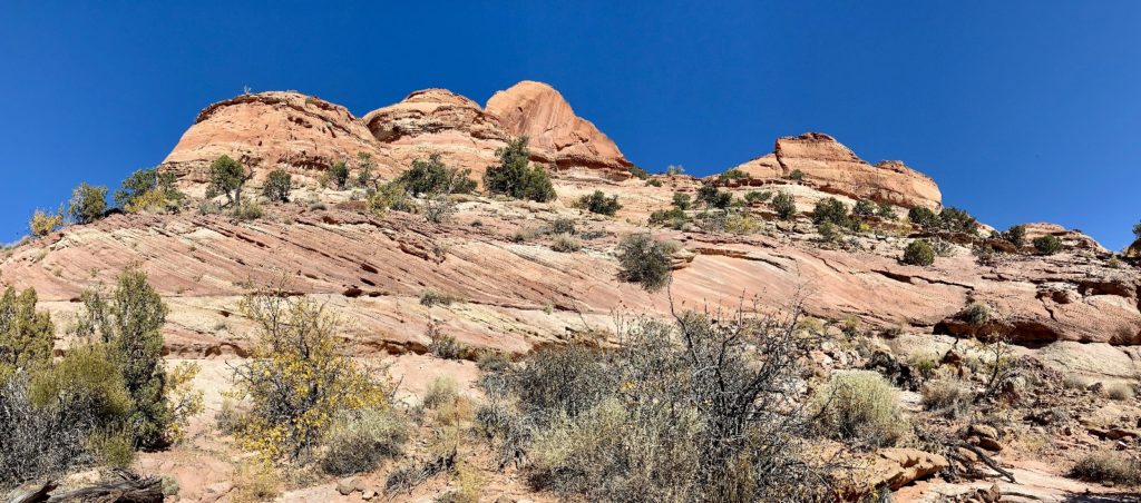
From there, we continued up canyon to the side canyon for Phipps Arch. The trail immediately left the canyon bottom and started climbing up layers of sandstone. We could see a little dirt trail and a few cairns, but it was also a lot of guess work and route finding. We worked our way up and over a few bands and ended up finding really good trail that was marked by big cairns. We followed it to a massive alcove where we got cliffed out. We went back to where the false trail led us astray and continued to work our way up. Finally we got to a point where I wasn’t comfortable going any farther due to the steep ascent. Jason went a little farther and said it got worse.
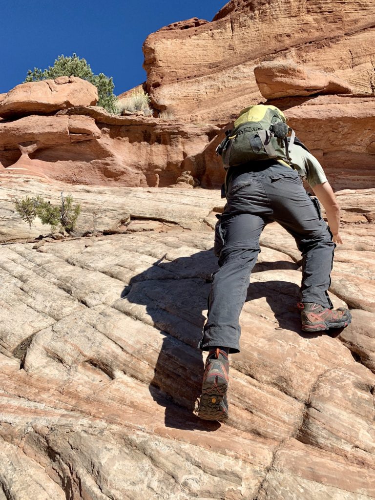
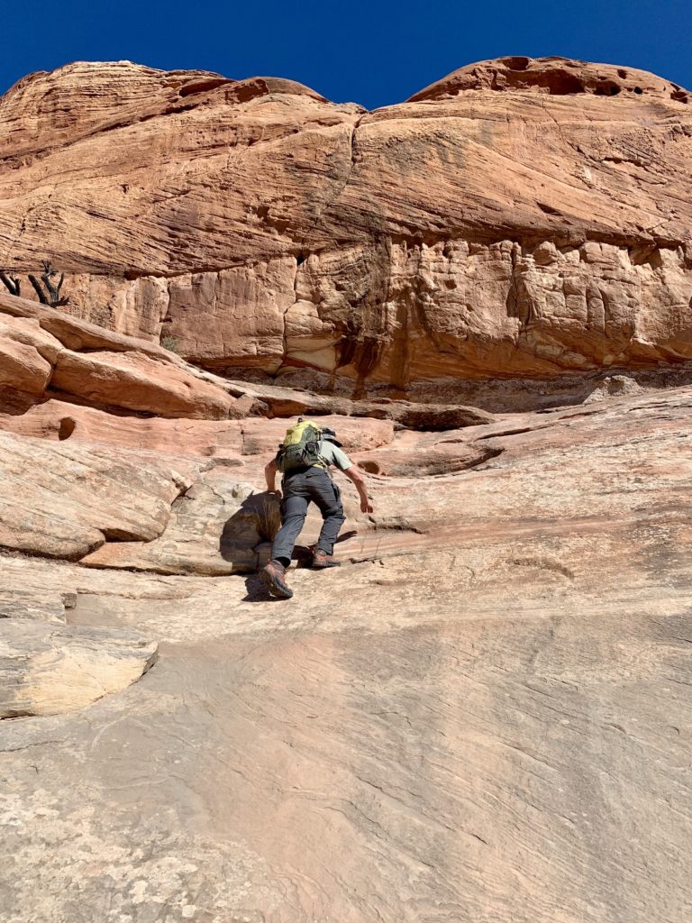
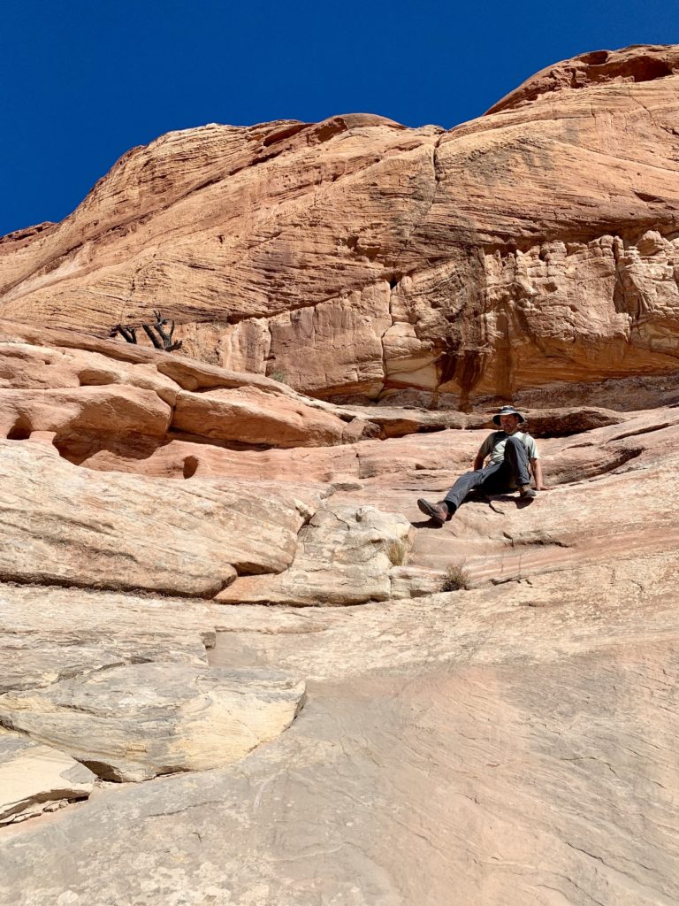
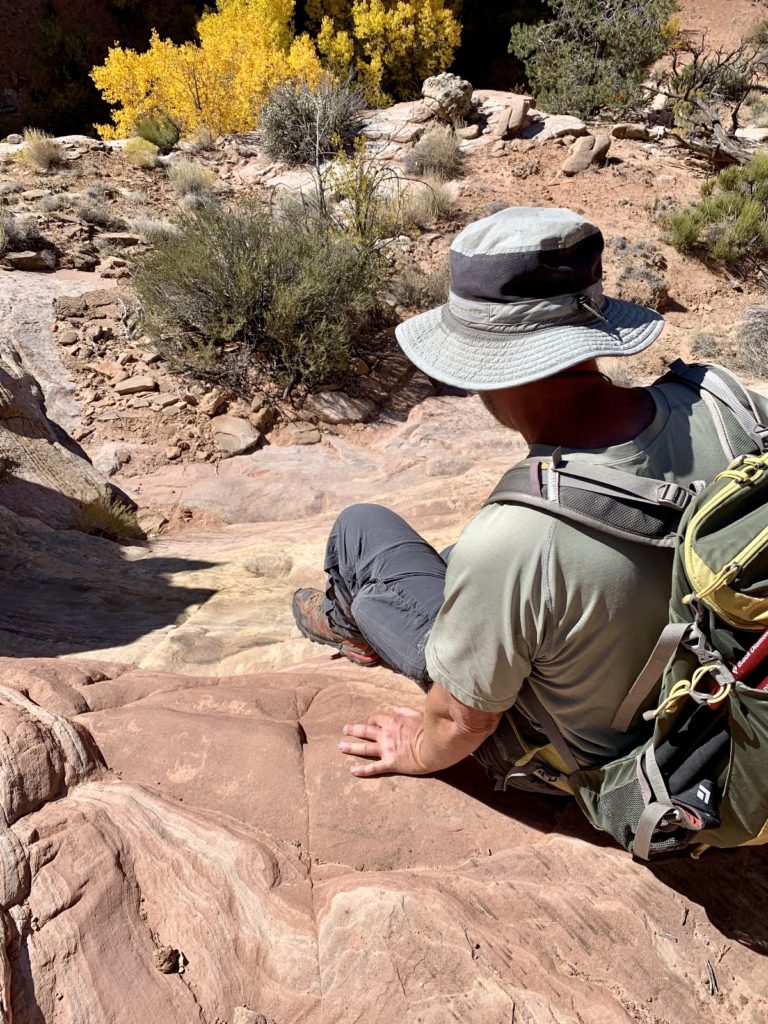
It was a bit disappointing not seeing Phipps, but it was hard to be too disappointed while surrounded by such a beautiful canyon with flaming yellow cottonwoods. We covered about 7.5 miles and only saw two other parties making this another great hike for solitude.
Day 31: Return to The Box on Pine Creek
With our friend Lisa joining us for the weekend, we were able to leave one vehicle at the Lower Box and then drive to the Upper Box Trailhead to make the 8 mile hike along Pine Creek. The upper trailhead is about 1,400′ higher than the lower access making for a much chillier start to the hike. Temperatures weren’t much above freezing when we made our first of roughly 50 creek crossings for the day. Icicles hung from logs that crossed the stream and we had to be careful of rock hoping due to ice on top of the rocks. Not wanting to slip, I just waded through all the crossings. I knew from our hike earlier in the week that there was no way to keep my feet dry the entire day and hiking with wet feet does not bother me. Those first dozen crossings were quite cold, I won’t lie. The key is to just keep moving once your feet get wet!
The character of the upper section of trail was much different than what we had seen in the lower stretches. Ponderosa pine and cactus were replaced by beautiful spruce and Douglas fir. The canyon walls were not as high, but they were much more narrow creating just a small corridor along the stream. This made stream crossings in the upper half much more frequent.
I’d seen several reports that the trail is closer to 9.0 miles and I think those are probably more accurate. There was a fair amount of deep sand covering the trail in the middle stretches, but navigation was never difficult. I lost count of the stream crossings, but I believe the reports I saw of “over 50” and “54” crossings. None of the crossings were ever difficult or deeper than upper calf, but there is no way to keep your feet dry on this hike. As for solitude, we saw just one other person on the trail. This trail gets very little press when compared to other area trails like Coyote Gulch, the slot canyons, and The Golden Cathedral. It is a true hidden gem and I’m so happy we got to experience the entire route.
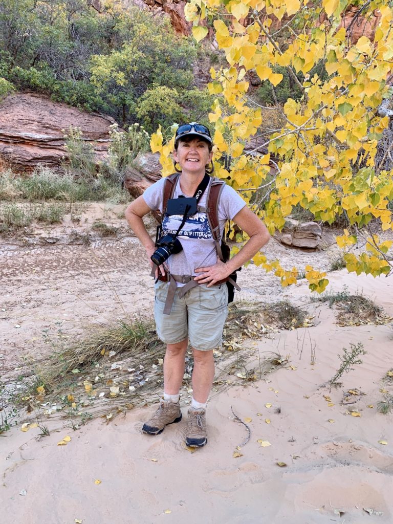
Day 32: Upper Escalante River
On Sunday, Lisa had just a few hours to hike before returning home to Salt Lake City. Jason stayed behind while us girls hit the Upper Escalante River for some fall colors. We started at the trailhead on the east side of the town of Escalante and hiked a couple miles down the river.
Tonight is night 14 at our dispersed camping site along Hole In the Rock Road near Escalante. We have maxed out our time here and will need to move tomorrow morning. We are pleased that our fresh water, grey and black waste, and propane tanks have lasted the full time (although it did take some serious conservation efforts). This location has been quite windy and dusty, but was fantastic for its proximity to lots of great hiking and you can’t beat free! We’ve been within sight of other campers every night, but no one has camped right on top of us and everyone has been quiet allowing us to enjoy relative solitude. Only once did we have noise at camp when some parents allowed their teenager to race an ATV repeatedly through the camping area, kicking up clouds of dust and sand on us and everyone else within sight. We don’t have a problem with ATVs—we had one for over a decade. But we were never rude enough to race it back and forth past people’s campsites. Go find a real trail!
One Month Anniversary
This week we celebrated one month on the road. This still feels like some crazy kind of dream and I often have to pinch myself back to reality. Like all things in life, there is good and there is bad. At the end of this first month, I find myself quite homesick. I miss my mom the most, but am also missing the rest of our family, friends, coworkers, the routine of every day life…and even Walmart! But every day I am overwhelmed by the beauty of the places around us and the kindness of the people we’ve met.
Over this first month, I’ve taken 2,509 photos, we’ve traveled 1,144 miles from home staying in 9 different locations, and we’ve hiked 16 trails. We are learning what is a comfortable travel pace for us and we’ve learned to cement all our plans in jello (as a new friend and fellow RVer likes to say). We have learned that we like RV parks more than we might have imagined—mostly for the convenience of having hookups for a few days, but also for the nice people we’ve met. We still plan to mostly boondock, but we’ll be enjoying some parks along the way.
People seem surprised that we don’t know our exact route for the winter, but it is fun flying by the seat of our pants for the first time in our lives. We will be wherever the weather and our imagination drive us.
I just love all of your pictures and the places you are hiking to are a dream come true! I see Jas is getting into rock climbing as well. Wishing we were there with you!
Love to you both!
AS usual the scenery was spectacular! Anxious for the next ones!
Love the journey…Full time RVing is not easy but so worth the memories. Keep the stories coming.
You were on the right route for Phipps Arch. I was just there 4 weeks ago. Your pictures show the crux – a steep section of class 3 climbing that is just 20 feet, but nasty. My mountaineering experience made it normal for me, but you need proper boots and skills.
Thanks for the feedback. I was pretty sure we were on the right track, but nice to have that confirmed. Jason made it most of the way up, but turned around when I said I wasn’t comfortable going further. I’m still working on increasing my comfort on steep sections of slickrock- don’t get much practice up here in Washington 🙂
Happy trails,
Lusha