Running along the eastern edge of the Sawtooth Range, this wilderness encompasses some of the most spectacular high alpine landscape in the Sierra.
Sierrawild.gov
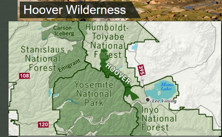
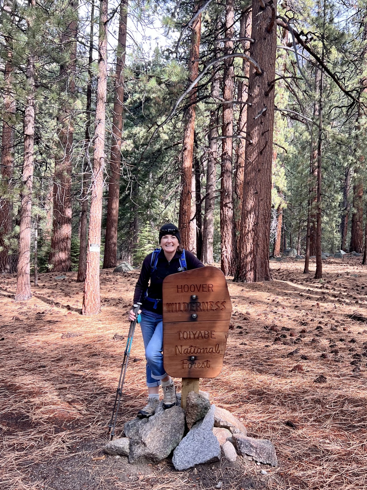
During our two week stay at Lower Lee Vining Campground near Yosemite National Park, we spent five days hiking in the nearby Hoover Wilderness. Sharing a border with the Yosemite Wilderness along the Sierra crest, the Hoover is widely known for its extreme mountain terrain. What I didn’t know was how numerous and stunning its lakes are.
Simply put, we absolutely loved each day of hiking in the Hoover Wilderness and it set a high standard by which we’ll be measuring all our remaining Sierra hikes. Trailheads were easily accessible, scenery was stunning, and trail traffic was light. Each of the five hikes we took lead us to shimmering mountain lakes with jagged mountain peaks behind them. Trails were generally very rocky, but well-signed and easy to follow. In this post, I’ll cover the three hikes that we accessed off Highway 395. In our next post, I’ll cover the remaining two hikes that we accessed via the Tioga Pass Road just east of Yosemite National Park.
Barney Lake
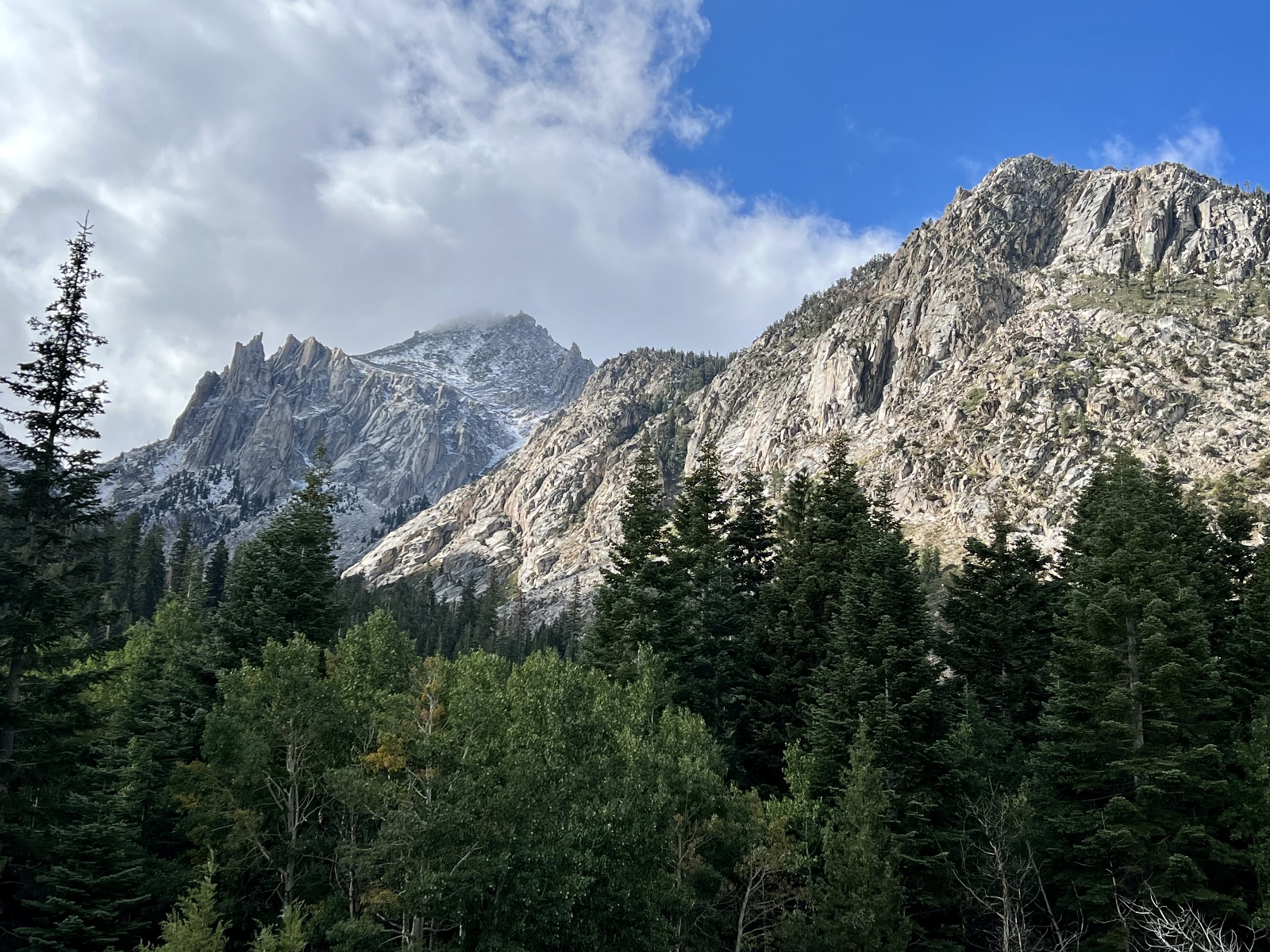
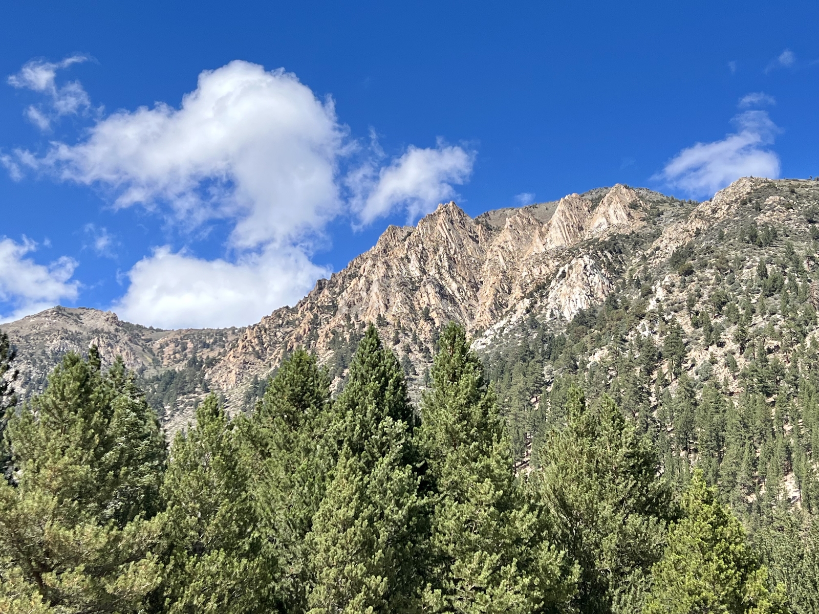
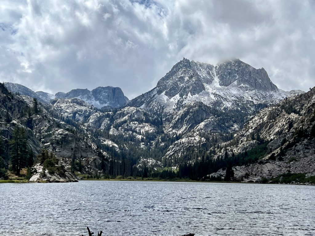
Our first hike in the Hoover Wilderness was along Robinson Creek to Barney Lake near the town of Bridgeport. The first real fall storm hit that morning leaving a layer of pristine white snow on the tallest mountains. During our hike, the sun began to poke through the clouds making for stunning views of the snow covered peaks.
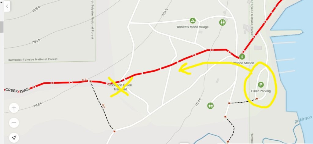
This is the first time we’ve ever successfully navigated a wilderness trail only to get lost in the trailhead parking lot! The AllTrails map showed a Robinson Creek Trailhead, but this is not where you park. Parking is in the marina parking lot along Upper Twin Lake. Then you hike through the resort campground to get to the trailhead. This was not quite as straight-forward as you’d think and we were grateful to AllTrails for leading us to the start of the trail.
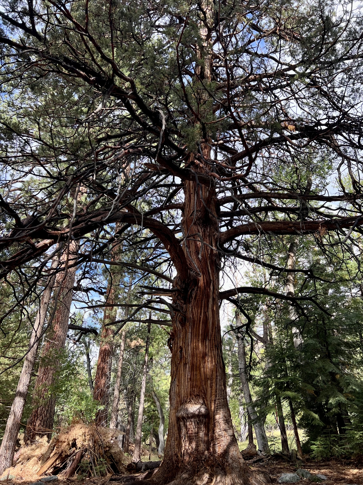
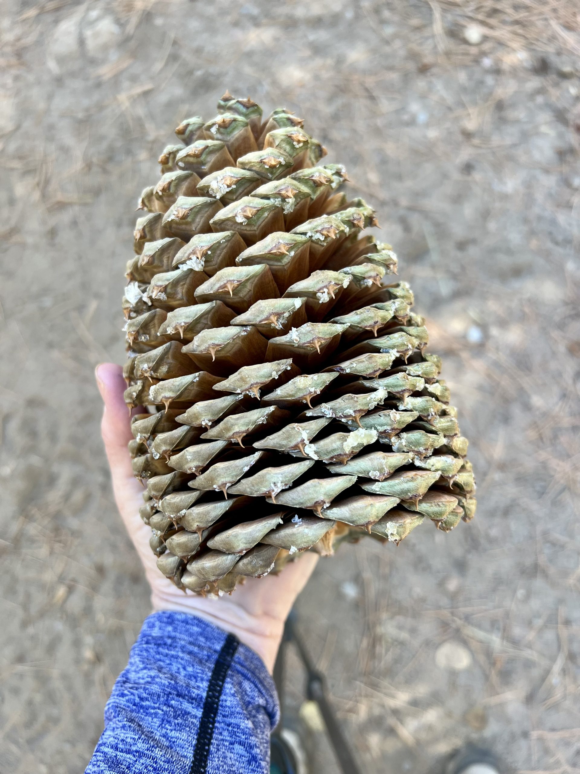
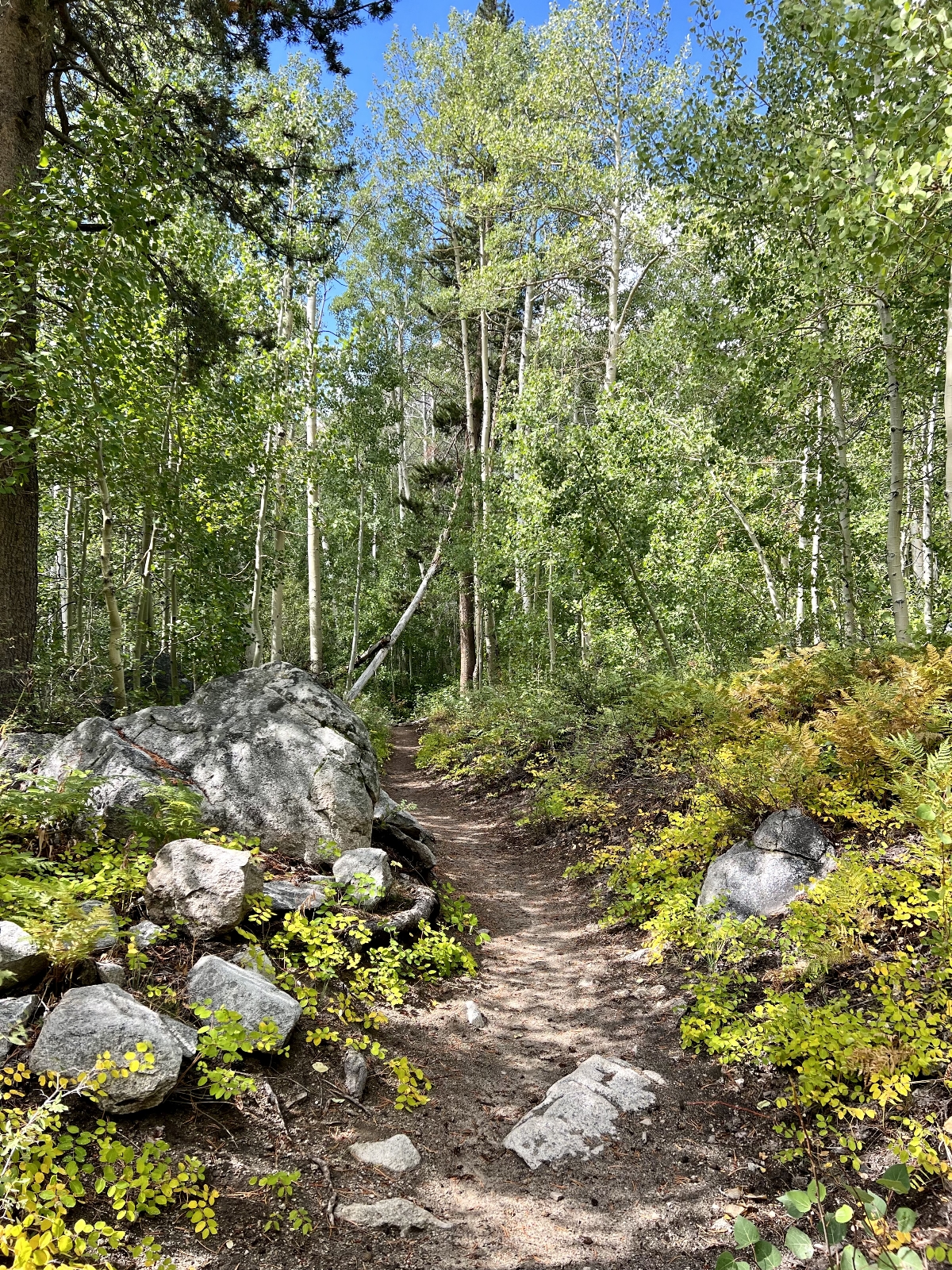
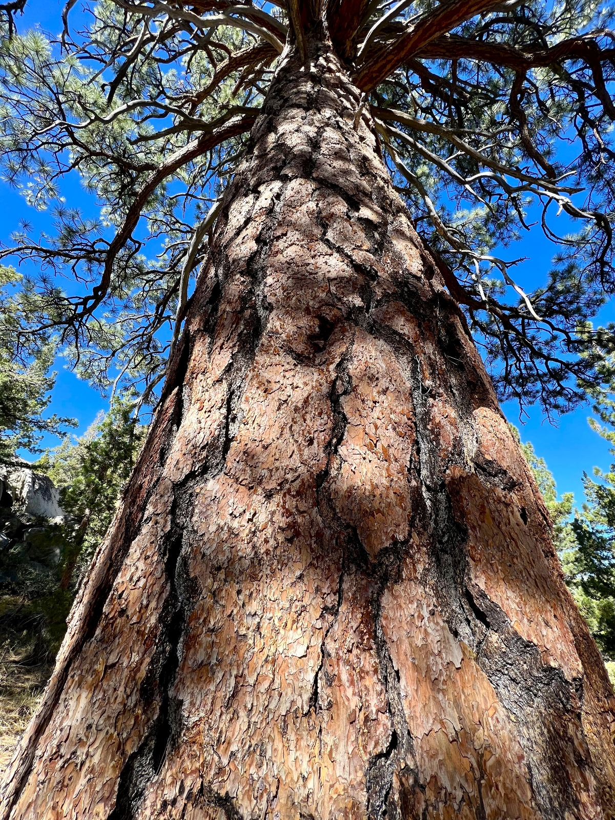
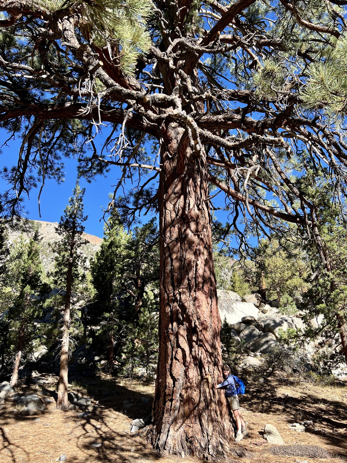
Once officially on the Robinson Creek Trail (elevation 7,000 feet), it was smooth sailing. We hiked through thick forest with some of the most massive pine trees we had ever seen. We wondered if they were ponderosa pine like we have back home, only much bigger. We later found out they are Jeffrey pine which are closely related to the ponderosa. They are common in the Eastern Sierra and are stunning with thick red bark and massive pine cones…I mean, really massive!
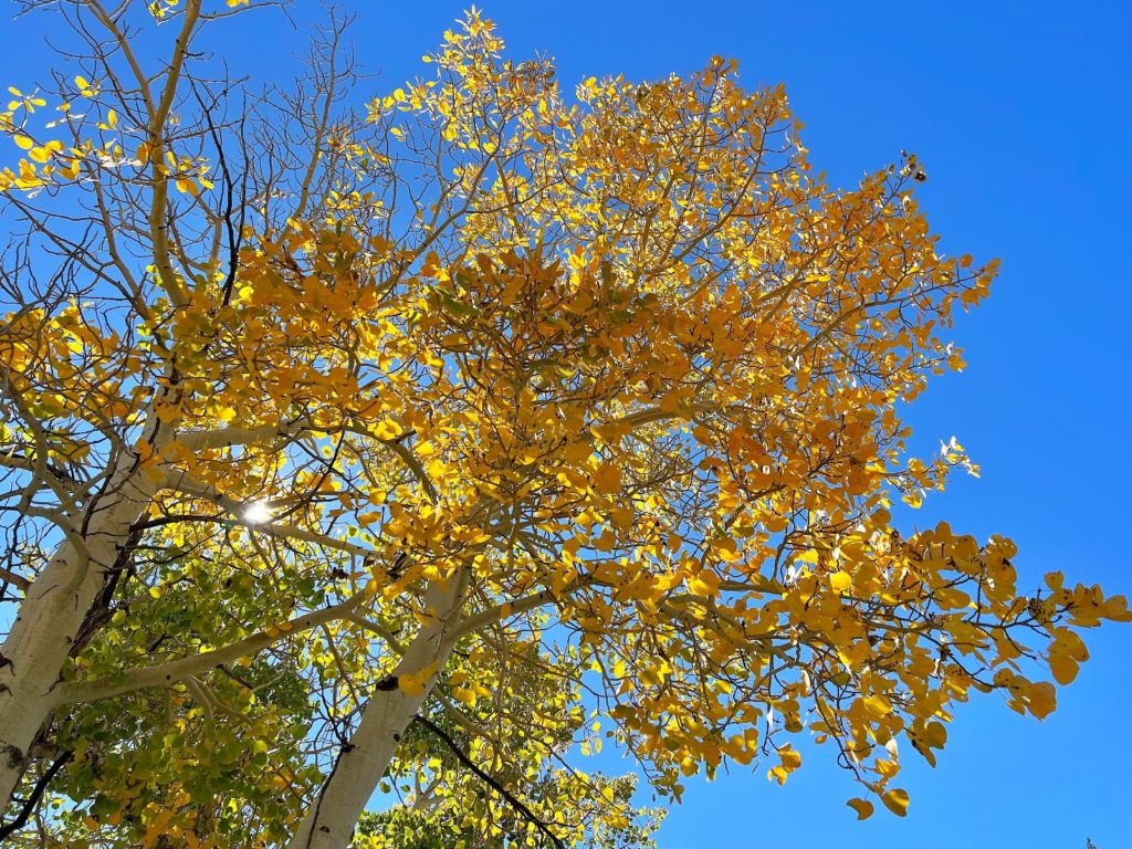
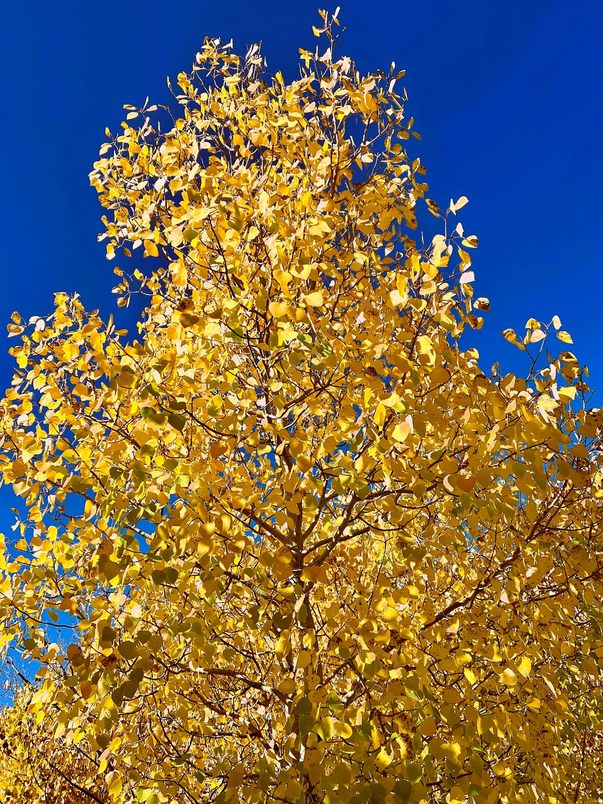
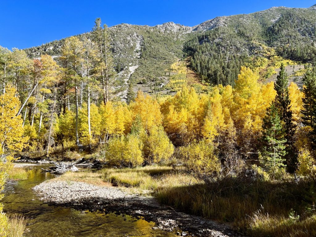
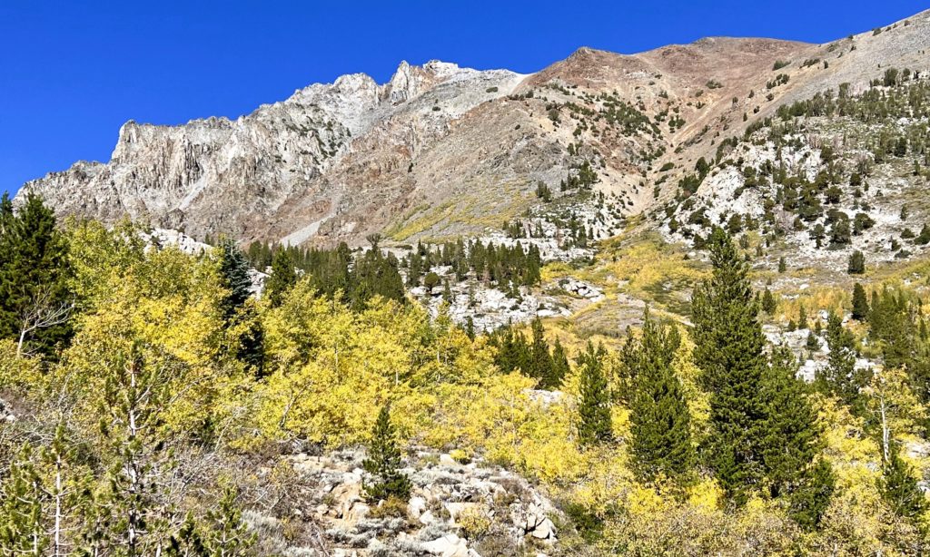
After a mile or so, we entered a large meadow with rugged snow-covered mountain peaks surrounding us on three side. There were a lot of aspens in this area and I found myself wishing we were doing this hike about a month later to catch the fall colors. Apparently fall colors hit later here than most other parts of the Hoover.
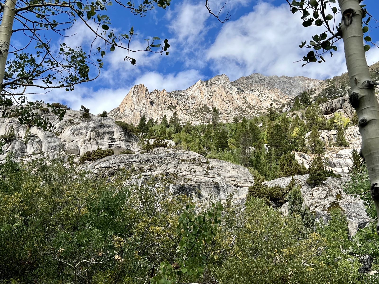
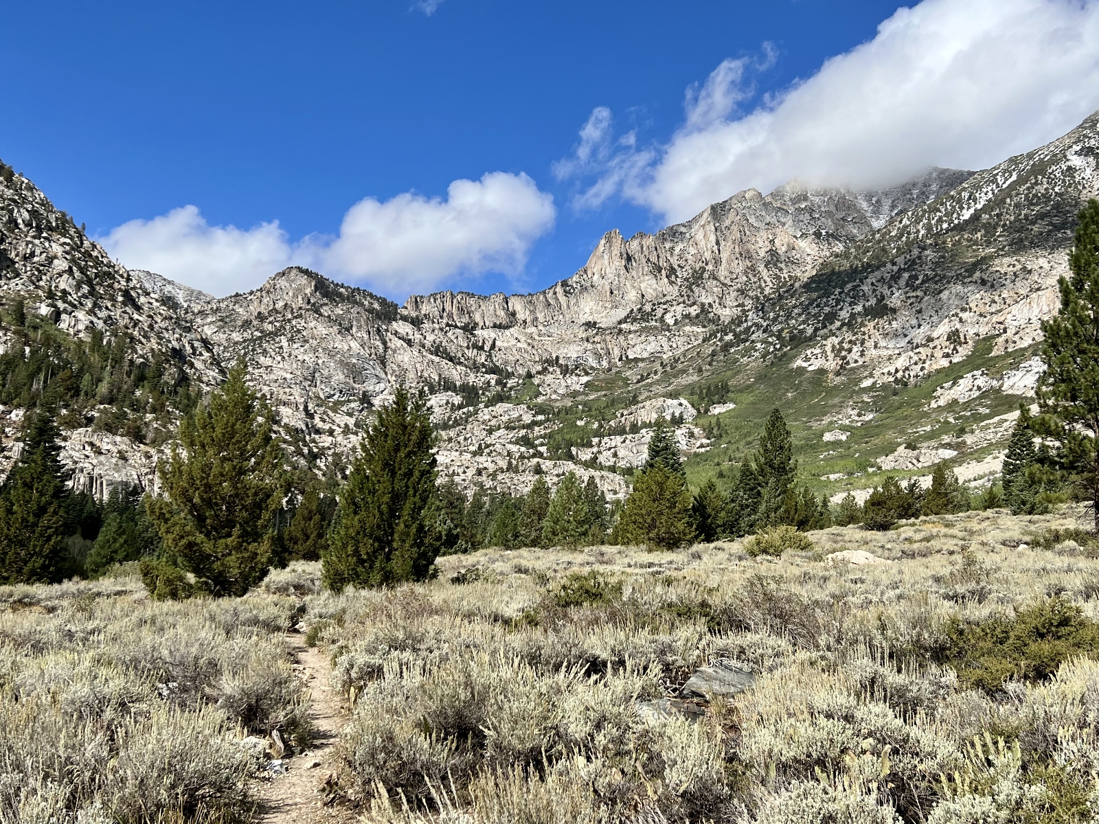
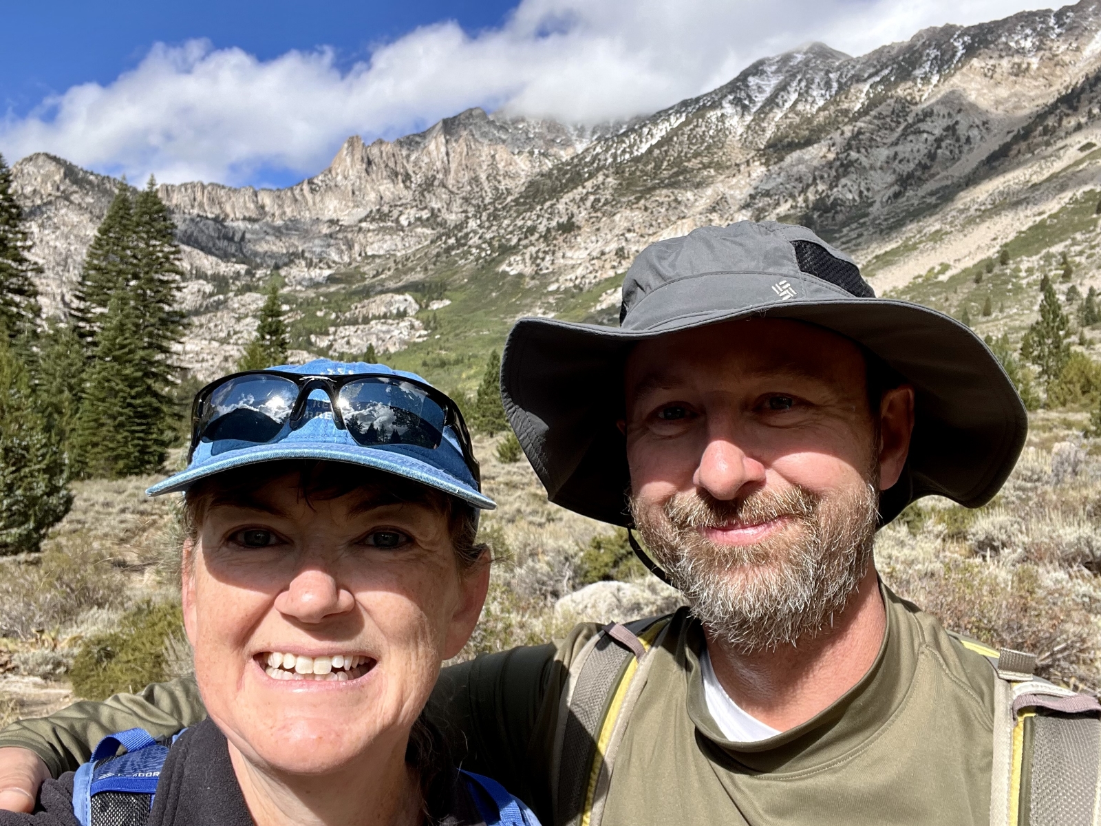
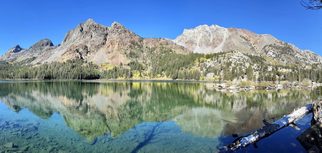
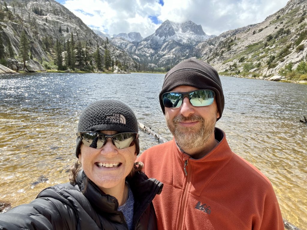
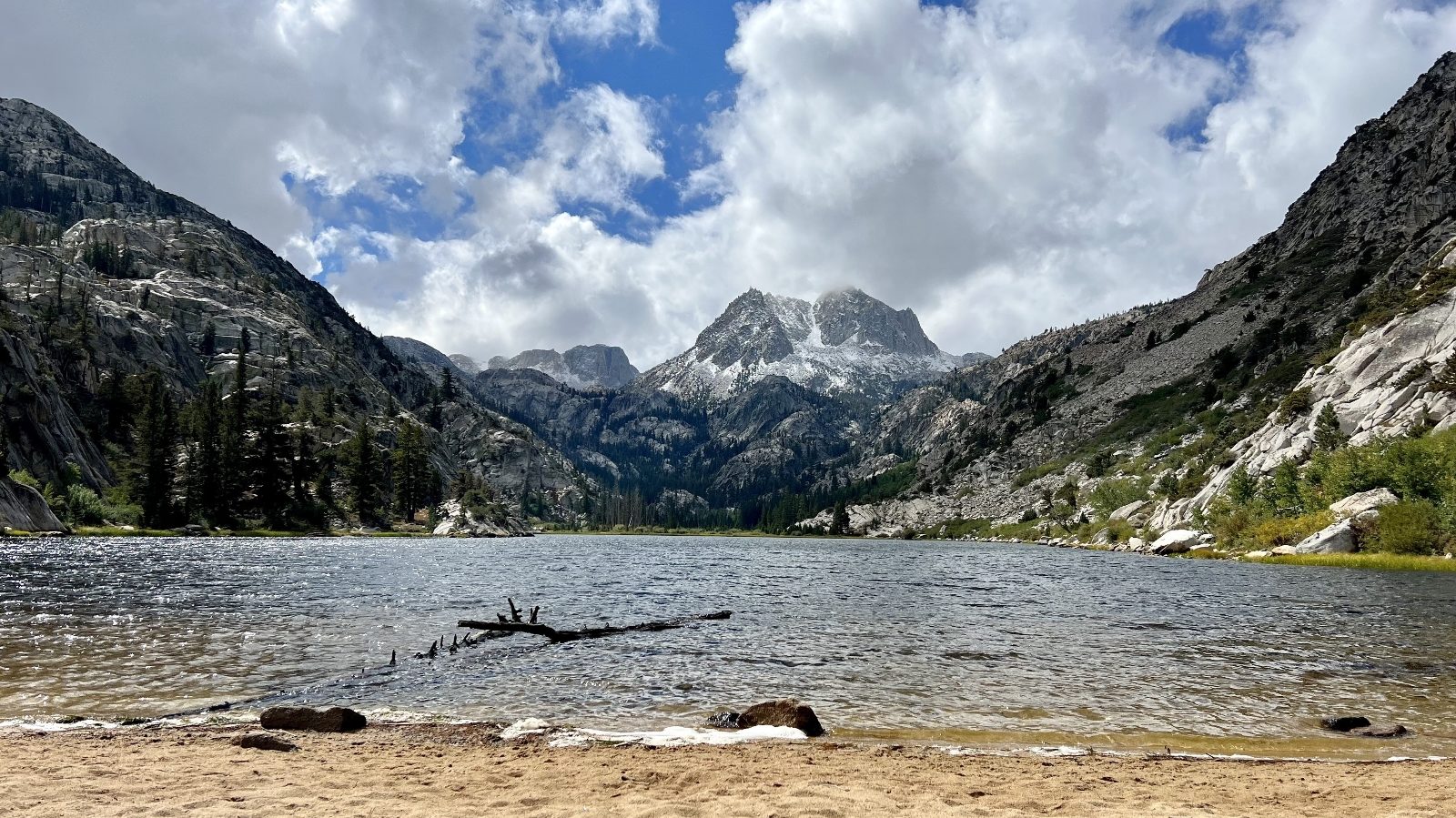
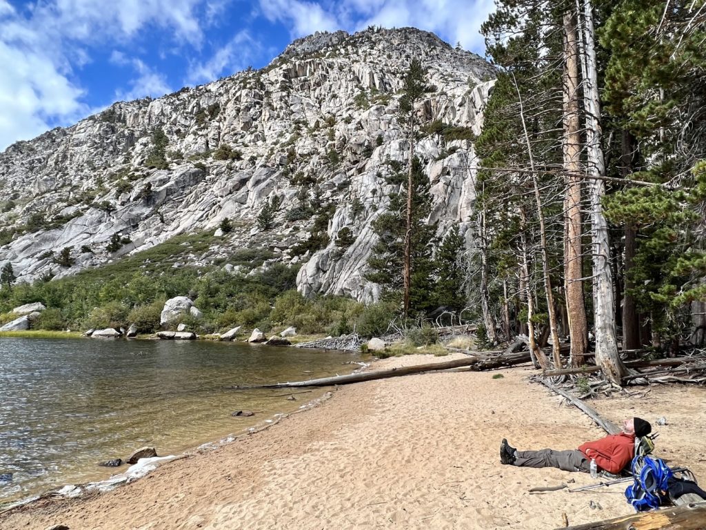
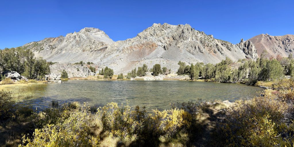
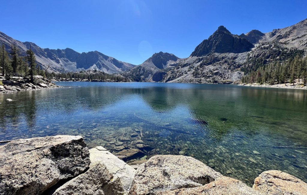
At a little over four miles in, we came to picturesque Barney Lake (elevation 8,300 feet) resting in the shadow of Crown Point. We found a lovely sandy beach at the lake’s outlet which made the perfect break spot. We enjoyed having the lake to ourselves and only saw a handful of people on our hike out. What an introduction to the Sierra Mountains! In all we hiked 8.9 miles with 1,300 feet elevation gain. It was a pretty easy start other than continuing to acclimate to the high elevation hiking.
Directions: The Robinson Creek Trail starts at Upper Twin Lake, 11 miles southwest of Bridgeport at the end of Twin Lakes Road. Follow the road around Twin Lakes to Mono Village, a private campground and marina. Head to the marina parking area to the left when you enter the resort. Day use is free, but backpackers must pay an overnight parking fee.
Virginia Lakes to Burro Pass
Next up was Virginia Lakes to Burro Pass. One website I saw said, “when ranking trails on the basis of scenery per mile, it is hard to beat the Virginia Lakes trail.” After Barney, we had high expectations.
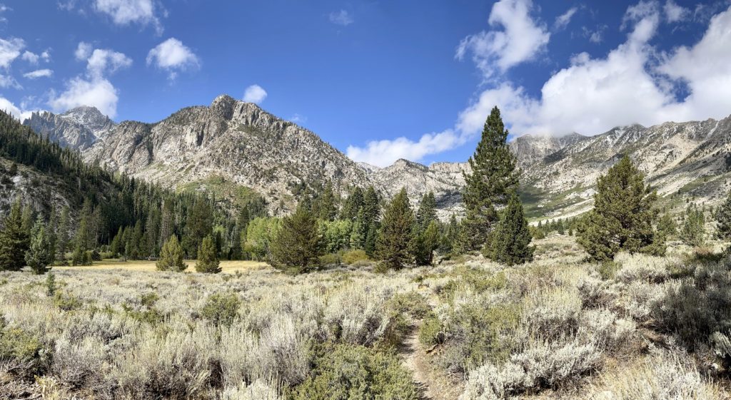
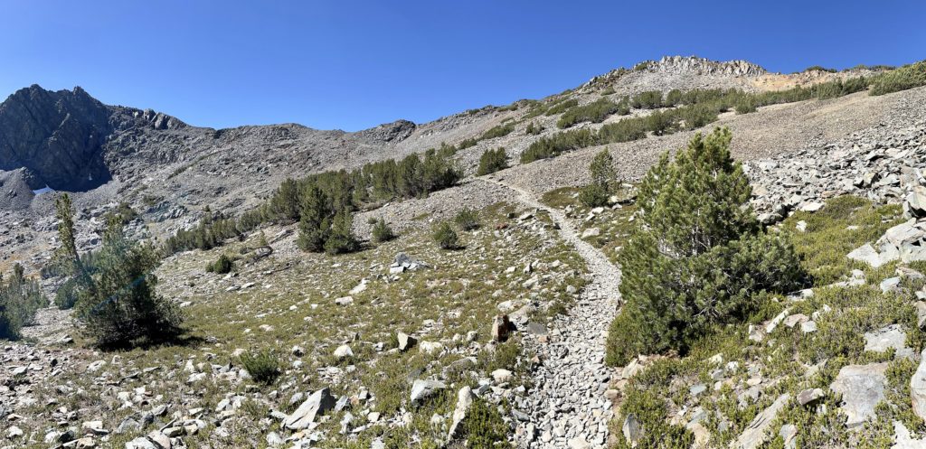
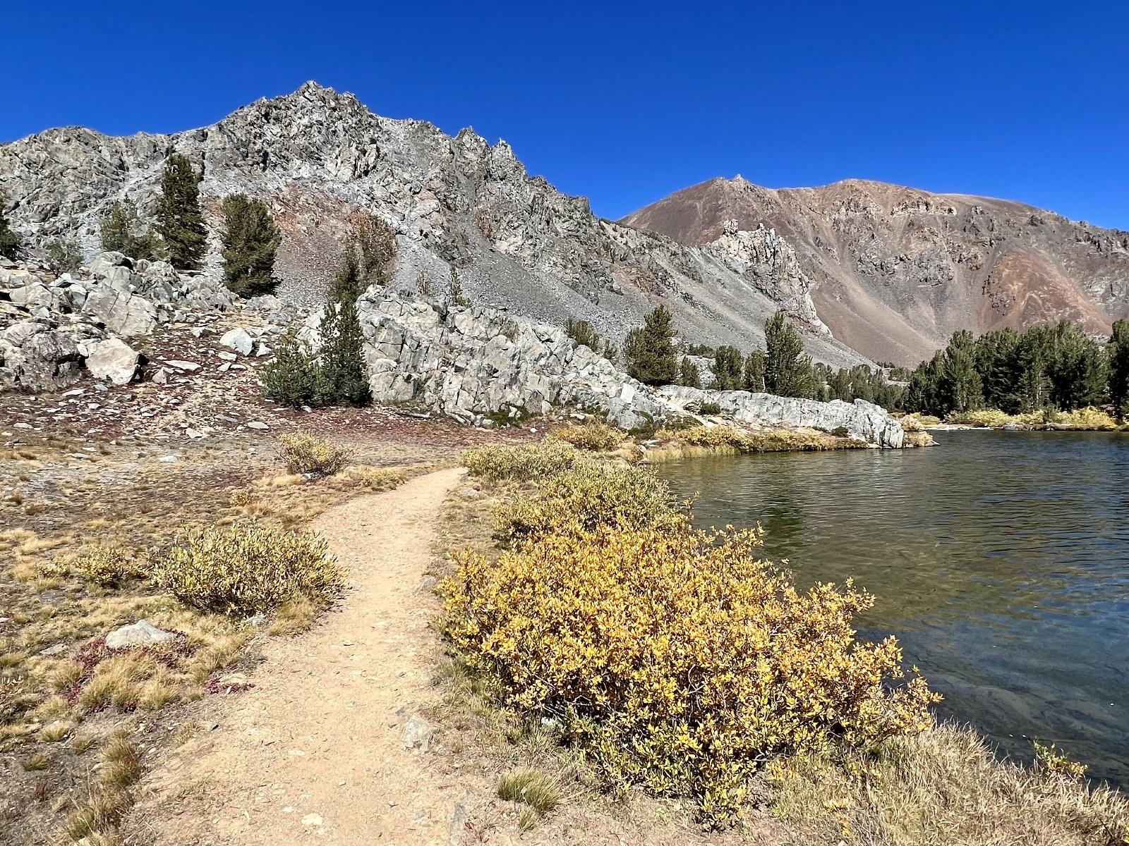
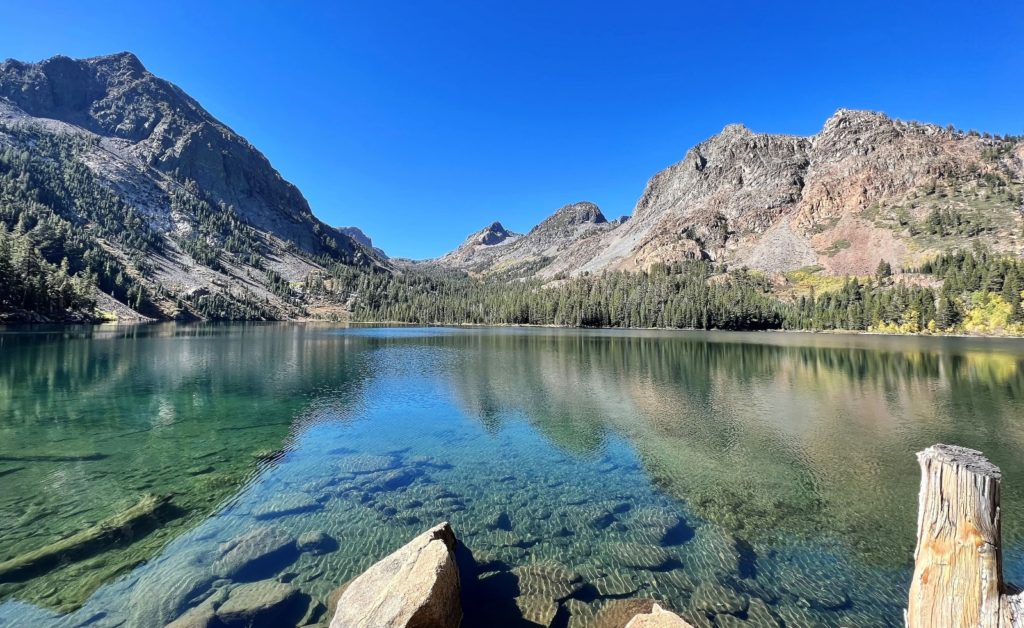
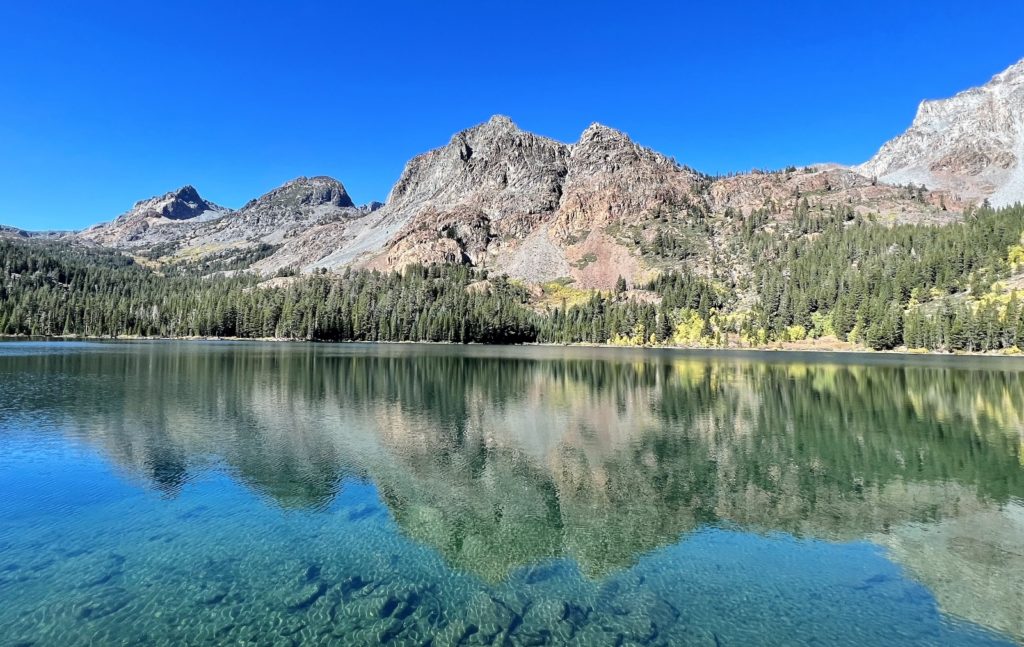
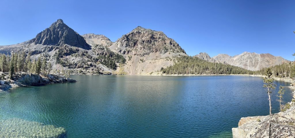
We started at the Virginia Lakes Trailhead just above Big Virginia Lake (elevation 9,875 feet). Over the first 1.6 miles, we wandered past five pretty lakes set amid a backdrop of colorful peaks. Blue Lake, Cooney Lake, then the three Frog Lakes—one by one they got more beautiful as we climbed.
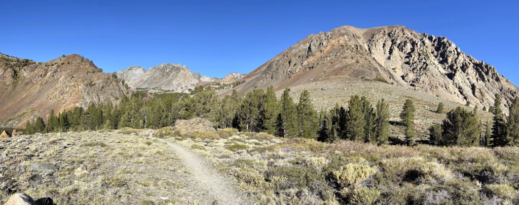
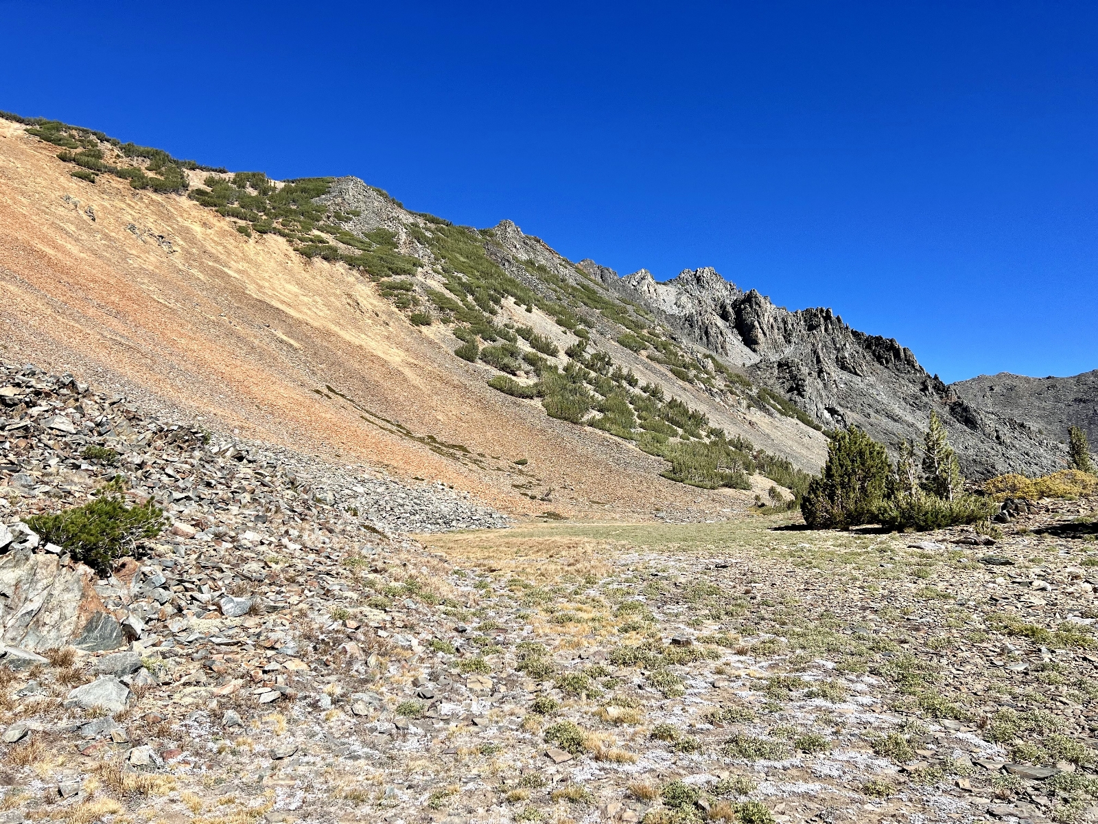
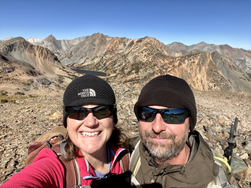
The next 1.2 mile stretch was a rocky climb to Burro Pass at 11,090 foot elevation. For our climb, we had gusting winds that turned the hikers ahead of us around before they reached the pass. We were undeterred and we kept climbing despite the gusts pushing me of course at times.
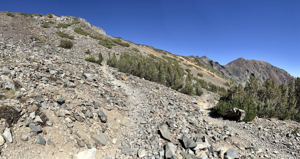
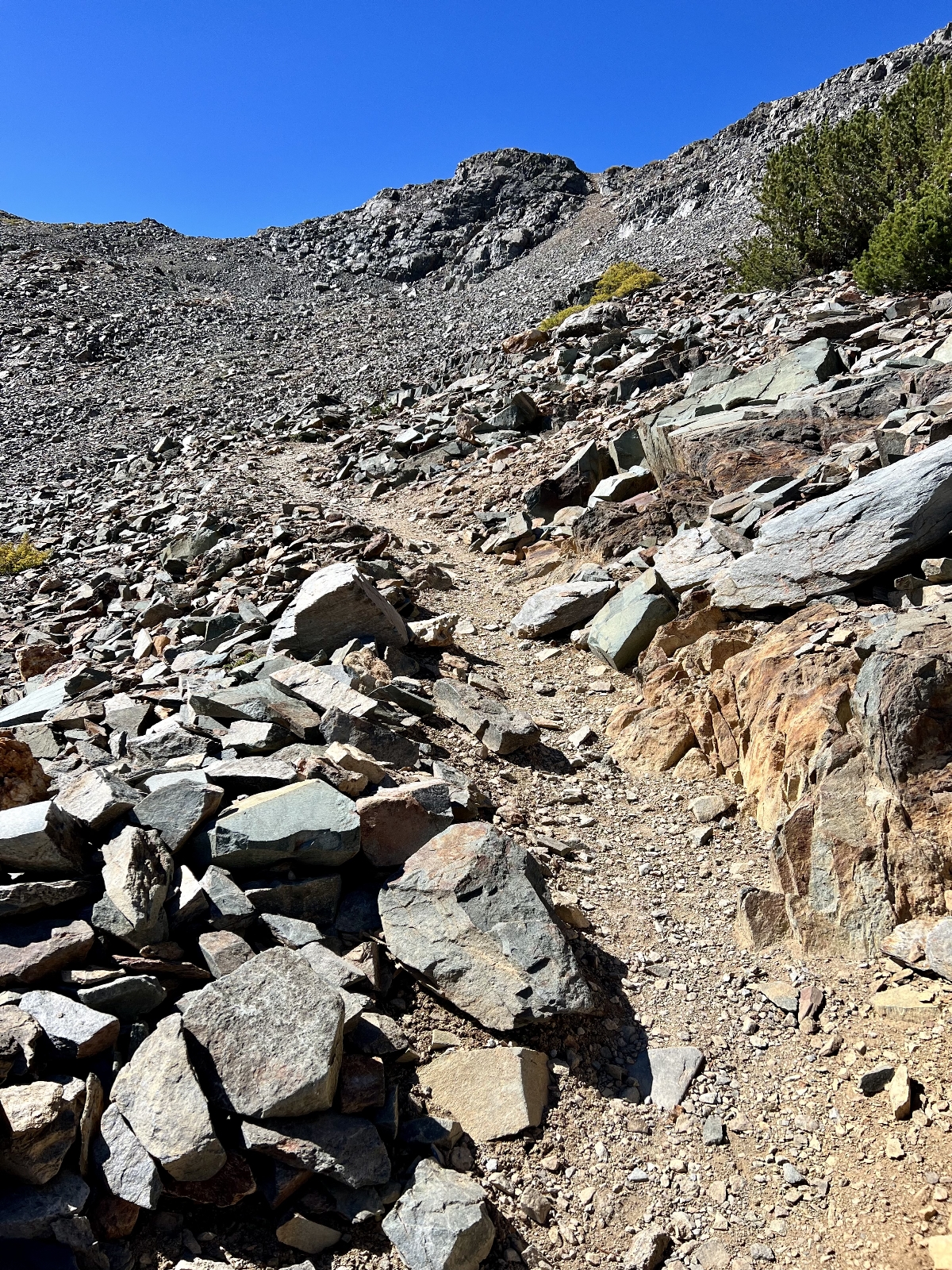
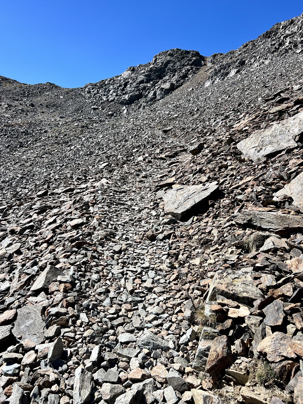
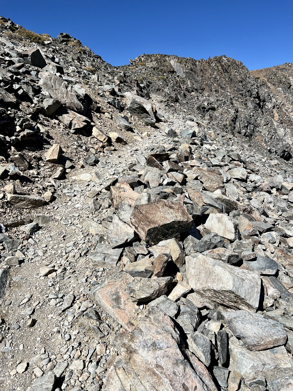
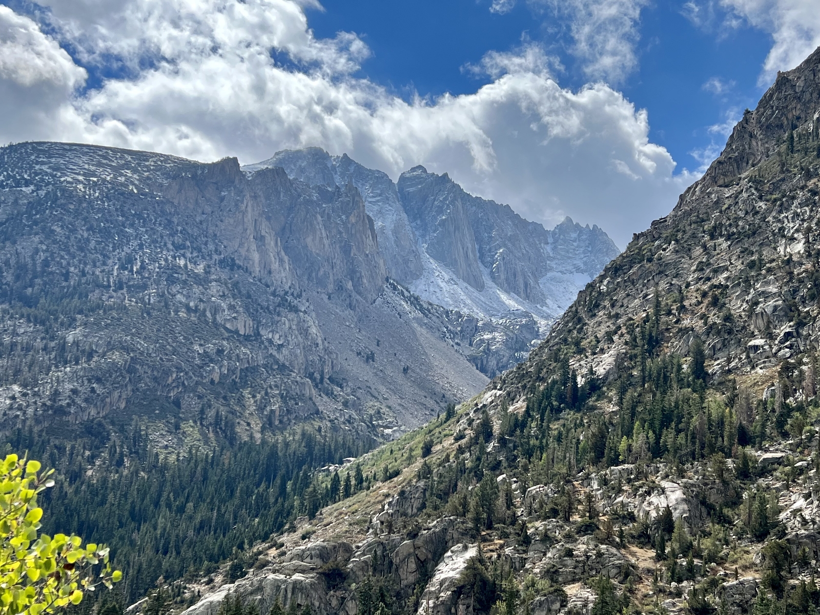
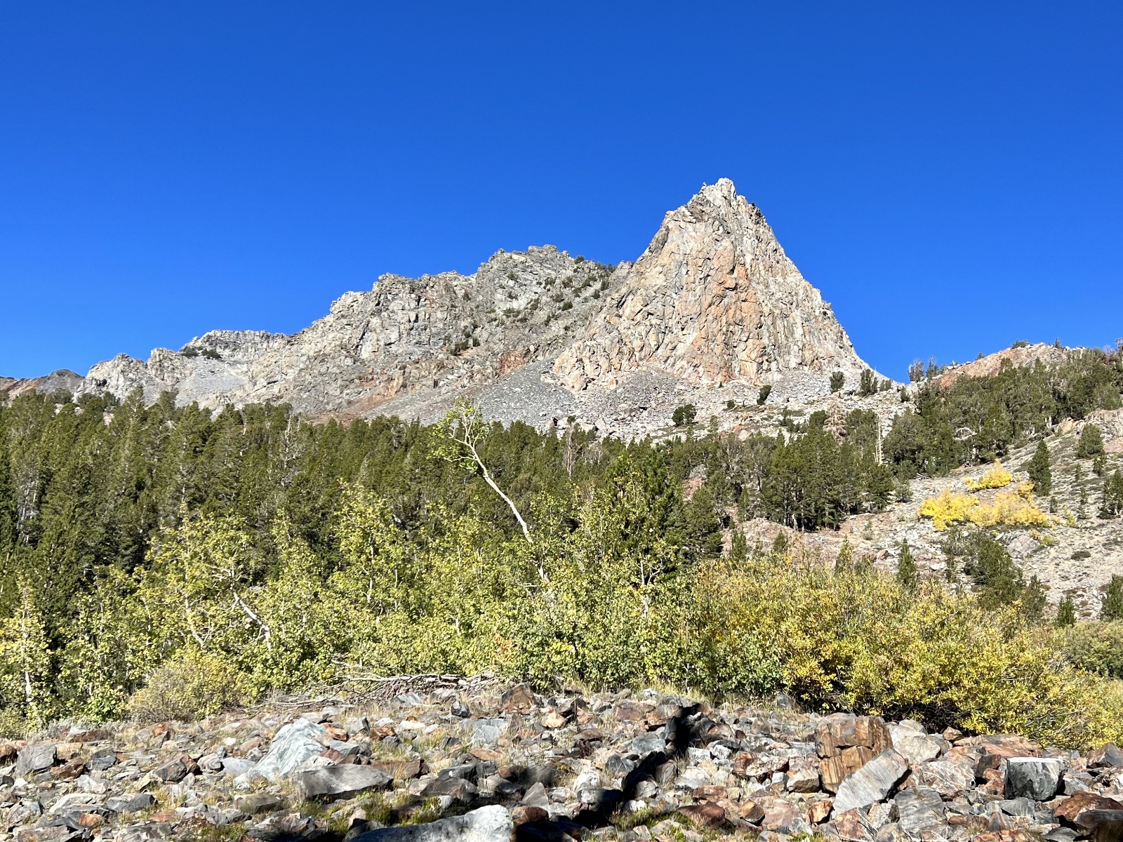
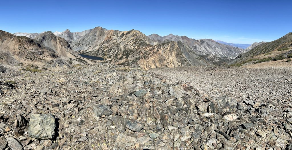
Views from Burro Pass were stunning and worth every step of the climb. Behind us we had great views down to the beautiful blue lakes we had just hiked past. We then walked a short distance along a faint use trail from the pass to a stunning viewpoint to the northwest. Summit Lake and Hoover Lakes were far below and a sea of Sierra peaks stretched out in front of us. It was one of the most spectacular pass views we had ever seen, although my photos don’t do it justice. This was the highest elevation we could recall ever hiking to at 11,125 feet. The air was definitely thin up there!
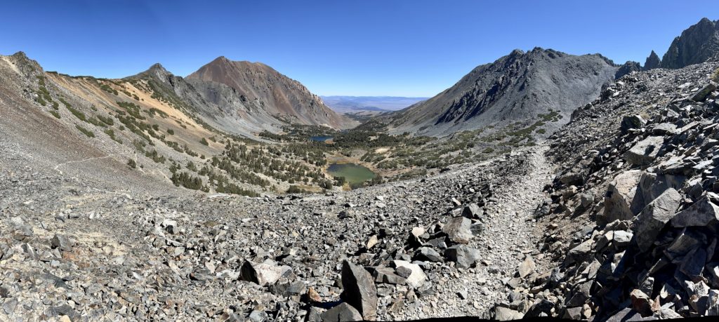
On our descent, we passed a few groups of hikers who asked if the views were worth continuing to fight the severe winds. We encouraged them all and one by one they continued on. Wind or no wind, this is a spectacular trail with beautiful lakes and stunning views from the pass. Best we could tell, most people do not continue past Frog Lakes. That’s ok, it is still a lovely hike. With our extra wandering around the pass and the lakes, we logged 6.6 miles roundtrip with around 1,400 feet total elevation gain.
Bonus: Virginia Lakes is one of Mono County’s prime fall color destinations. We enjoyed peak colors during our late September visit! The best colors were on the drive to the trailhead.
Directions: From Lee Vining, drive 12 miles north on Highway 395 and turn west on the Virginia Creek Road. Follow the road for 6.1 miles to the trailhead parking lot at the end of the road just above Big Virginia Lake. The last half mile or so transitions to gravel and it is a bit bumpy. But any car can make it to the trailhead.
Green Creek Trail
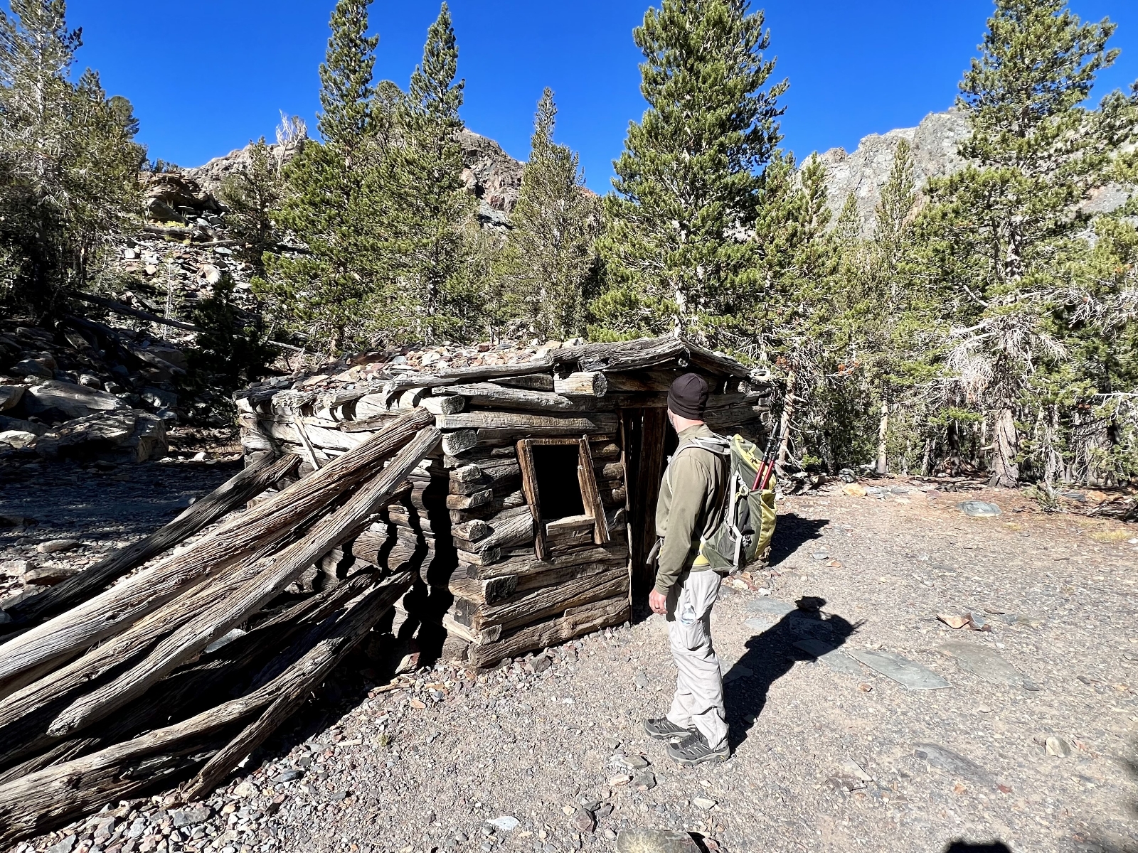
Our final hike into the Hoover was up the Green Creek Trail. This was a hike we hadn’t planned on, but we loved all our Hoover hikes so much that we wanted to grab one more before leaving the area.
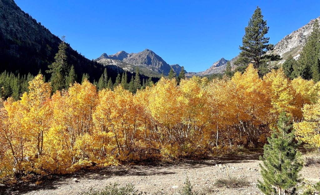
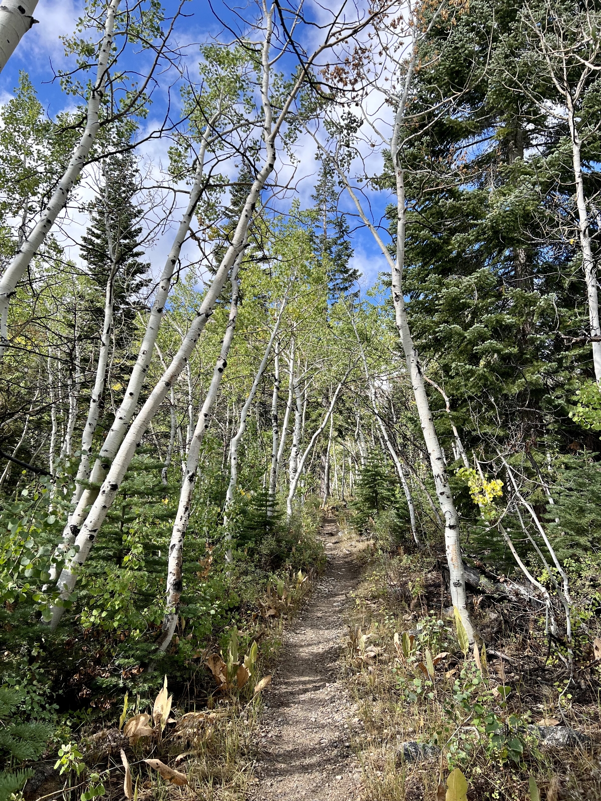
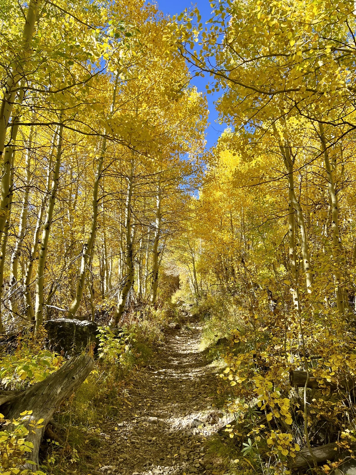
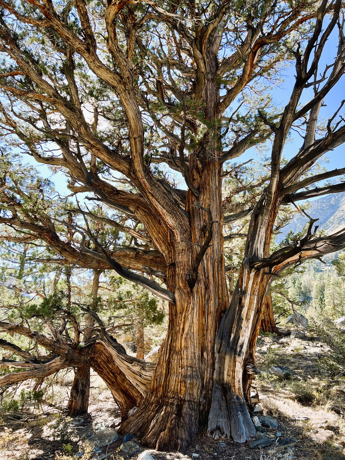
Our hike began at 8,000 feet elevation along the banks of lovely West Fork Green Creek. The aspens were thick along the creek and they were just reaching their peak colors. We hiked through tunnels of yellow interspersed with more of those beautiful Jeffrey pines and the most massive juniper trees we’d ever seen.
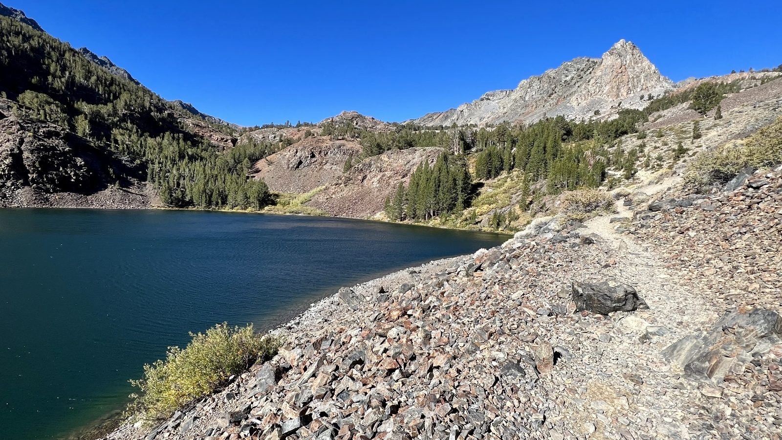
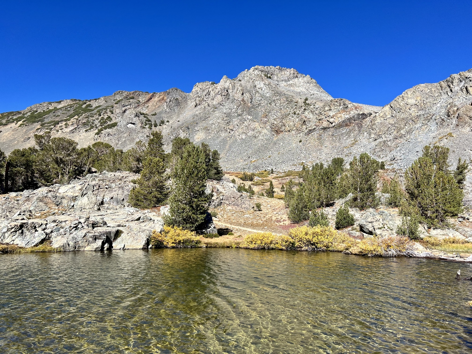
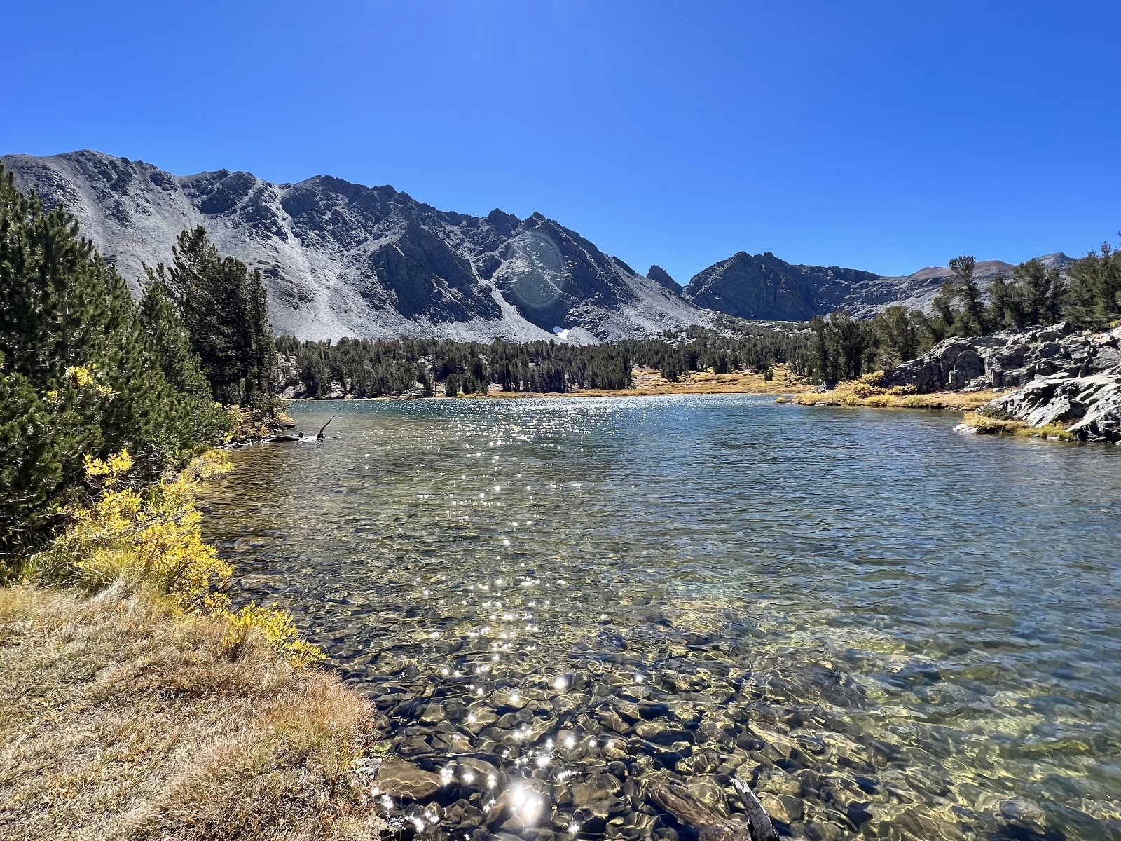
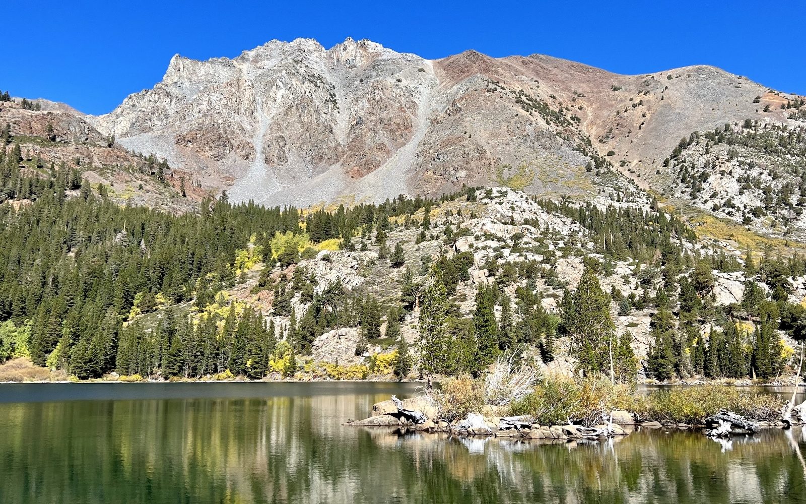
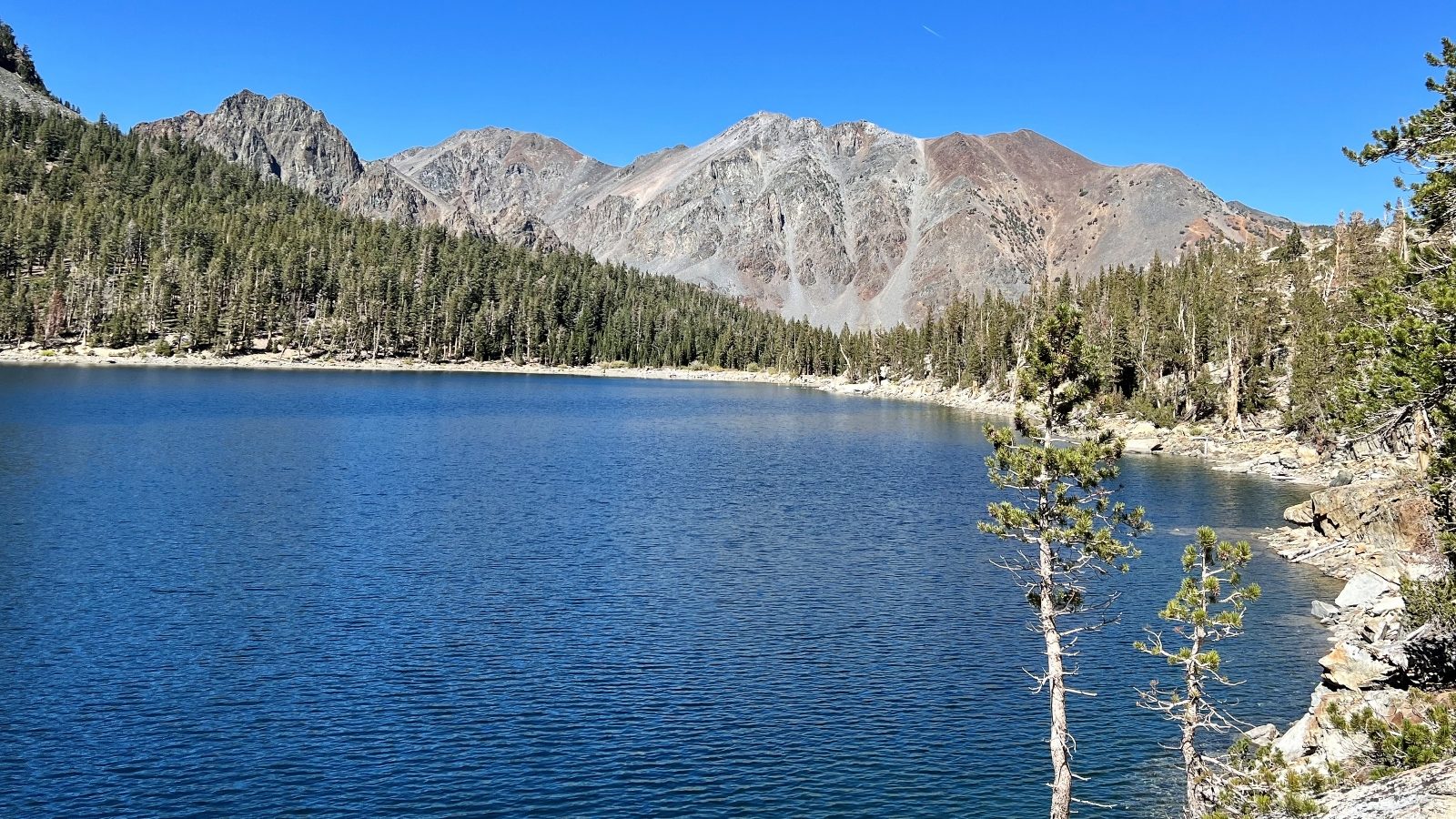
After a couple miles of climbing through the aspens and pines, we reached lovely Green Lake with its backdrop of stunning Sierra peaks. Usually lakes get more scenic the higher you climb, but I think Green proves that general rule wrong. This was my favorite lake of the day even though it was the lowest in elevation.
Continuing our climb, we came to massive East Lake. This was another impressive lake with stunning mountain peaks, it just didn’t strike me as much as Green did. We hiked the length of the massive lake and passed tiny Nutter Lake before topping out above Gillman Lake. Our goal had been Hoover Lakes (which we had seen from above at Burro Pass), but we started running tight on time and we still ended up with a 12.0 miles roundtrip hike with an elevation gain of 1,800 feet.
Directions: from Lee Vining, drive north on Highway 395 for 20.5 miles and turn southwest onto gravel Green Creek Road. Follow the road for 2.8 miles to the unsigned intersection with the Virginia Lakes Road. Take a sharp right here and continue along the road for 5.2 miles to the trailhead parking lot located on the right side of the road and just before the Green Creek Campground. This is a dusty and bumpy drive to the trailhead, but it was worth it and any car can make it.
The Adventure Continues
Please join us on our next adventure as we continue our Sierra Nevada adventures in the Hoover Wilderness. And don’t forget to check out our Amazon RV and Adventure Gear recommendations. We only post products that we use and that meet the Evans Outdoor Adventures seal of approval. By accessing Amazon through our links and making any purchase (even things as simple as toothpaste!), you get Amazon’s every day low pricing and they share a little with us. This helps us maintain this website and is much appreciated!
I love your pictures! YOU BOTH LOOK GREAT!!! 🙂 i LOVE YOU!
We love and miss you!
I loved the beautiful Autumn colors
What a grand time. Glad you were able to see those beautiful aspens! Keep on hikin’!